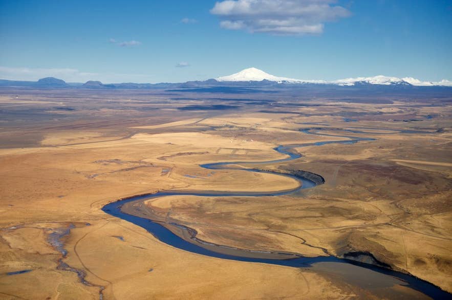
Ytri-Rangá with Hekla behind. Photo: Ulrich Latzenhofer, CC BY-SA 2.0
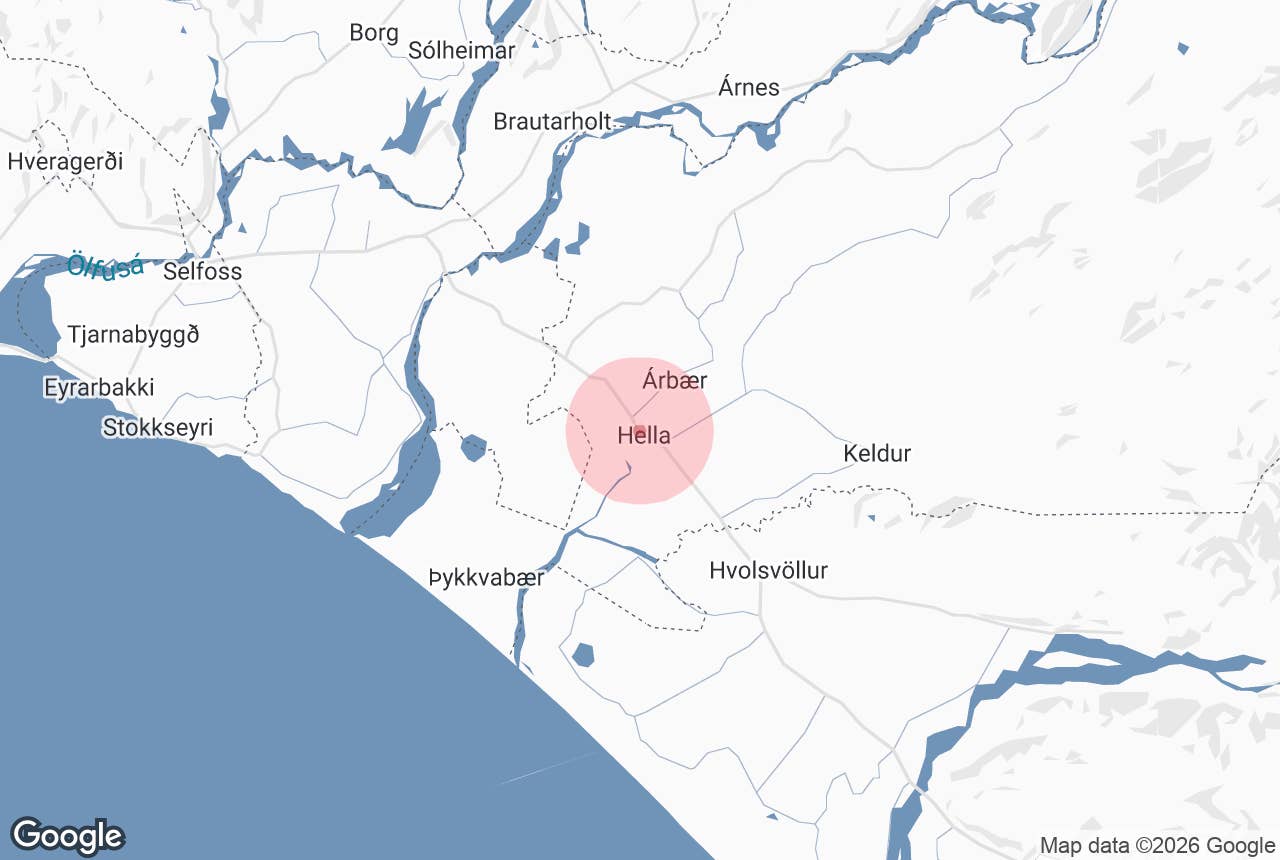
Ytri-Rangá ("the Outer Crooked River", also West Rangá) is a 55 km spring-fed river in South Iceland that rises north of Hekla and flows south-west past the town of Hella to the sea.
It is one of the country's most productive salmon rivers and, together with its sister river Eystri-Rangá (East Rangá), gives the Rangárvellir district and both local municipalities their name. Most visitors meet Ytri-Rangá where the Ring Road crosses it at Hella, about 93 km east of Reykjavík.
Key Takeaways About Ytri-Rangá
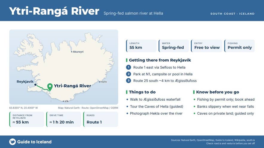
- 55 km spring-fed river rising at Rangárbotnar north of Hekla; clear water, not glacial
- Record salmon river (14,315 fish in 2008), fished on permit from around 20 June into the autumn
- Crossed by the Ring Road at Hella, 93 km from Reykjavík; Ægissíðufoss is 2 km downstream via Route 25
- Man-made caves at Ægissíða on the west bank (guided visits only); Hekla views from the river
Why visit Ytri-Rangá
Ytri-Rangá is not a glacial river. It surfaces from springs under the lava fields at Rangárbotnar in the highlands north-west of Hekla, just south of the Landmannaleið track, which is why its water runs clear and relatively steady while neighbouring glacial rivers turn grey and swell in summer.
On its way to the lowlands it drops over several waterfalls: Fossabrekkur in the upper reaches, Gutlfoss, Árbæjarfoss a few kilometres above Hella, and Ægissíðufoss about 2 km below the town, a wide, low fall over a lava ledge that is easy to reach from both banks.
About 10 km downstream of Hella the river is joined by Þverá, which carries the water of Eystri-Rangá, and the combined river runs to the sea as Hólsá.
The river's fame is its salmon. It has topped the Icelandic catch tables several times, with 14,315 salmon landed in 2008 and 10,749 in 2009, figures no other Icelandic river has matched.
The numbers rest on a long-running smolt-release programme by the river's fishing association, so this is a ranched rather than a purely wild fishery, but the fishing itself is real fly fishing on a big, open river with 12 to 18 rods and a lodge with 18 double rooms on the bank.
Sea trout and char are also fished, and the salmon season opens around 20 June.
For non-anglers the attraction is the setting. Hella grew up on the east bank around the bridge, and the river gives the small town its walks, campsite and café terraces.
Across the water at Ægissíða, on the west bank, twelve man-made caves are cut into soft sandstone; their age is unknown and one theory links them to Celtic people before the Norse settlement, which makes them one of Iceland's genuine historical puzzles.
In clear weather the whole valley is framed by Hekla to the north-east, and on still evenings the view of the volcano reflected in the river above Hella is one of the best on the south coast.
How to get to Ytri-Rangá
Hella is on Route 1, 93 km (about 1 hour 20 minutes) east of Reykjavík and 37 km east of Selfoss. The Ring Road crosses the river on the bridge at the western edge of town; there is parking at the N1 service station, at the Árhús campsite on the river bank and at the swimming pool.
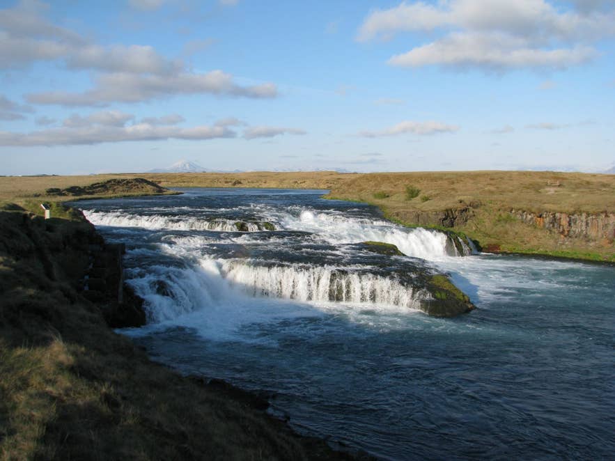
Ægissíðufoss on Ytri-Rangá, Hekla beyond. Photo: Bromr, CC BY-SA 3.0
For Ægissíðufoss, turn south off Route 1 onto Route 25 (Þykkvabæjarvegur) just west of the bridge, follow it along the west bank for about 3.5 km and turn left on the signed Ægissíðufoss track to a small car park, about 4 km from the bridge in all; the fall is a few minutes' walk away.
A riverside footpath also runs downstream from the Hella campsite to the fall, about an hour each way.
Árbæjarfoss lies a few kilometres upstream of Hella near the farm Árbær, a short detour on the local roads north of the town. Fossabrekkur and the sources at Rangárbotnar are in the highlands along the Landmannaleið route (F225) and need a 4x4, in summer only. The lower river is accessible all year on paved roads.
Best time to visit
June to September is the season for everything: the salmon run (opening around 20 June), long evenings, open highland tracks to the upper river, and green banks for walking.
The river is at its most photogenic on calm evenings in July and August. Winter visits to Hella and Ægissíðufoss are straightforward from the Ring Road, but the waterfall can ice over and the highland sources are closed.
Safety and practical tips
- Fishing requires a permit from the river's fishing association or its outfitter, booked well in advance; the river is divided into numbered beats and tackle must be disinfected before use in Iceland.
- Banks near the waterfalls are grassy and slippery when wet; keep children back from the edge at Ægissíðufoss.
- The caves at Ægissíða are on private land; visit with the farm's guided tour (Caves of Hella) rather than on your own.
- Hella has fuel, supermarkets, a swimming pool, hotels and a campsite. It is also one of the last service towns before the Landmannalaugar routes.
- Spring-fed does not mean warm: the water is cold year-round and swimming is not advised.
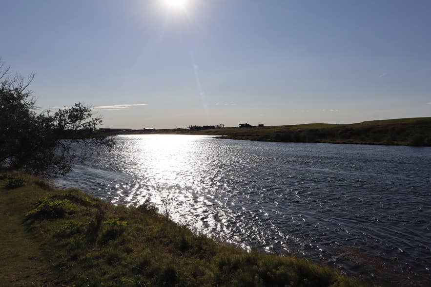
Evening light on Ytri-Rangá at Hella. Photo: Syrio, CC BY-SA 4.0
Is Ytri-Rangá the river you cross at Hella?
Can I fish Ytri-Rangá without a licence?
How high is Ægissíðufoss?
Does Ytri-Rangá flood?
Nearby attractions
- Hella, on the river bank: services, campsite and the Ring Road bridge.
- Caves of Hella, 0.5 km: guided visits to the man-made caves at Ægissíða.
- Ægissíðufoss Waterfall, 2 km downstream of the bridge.
- Gunnarsholt, 10 km: long the headquarters of the Soil Conservation Service, now a base of Land og skógur (Land and Forest Iceland), with an exhibition on land reclamation.
- Keldur, 16 km: turf farmhouse with roots in the saga age, on Rangárvellir east of the river.
- Hekla Center, 26 km: exhibition on the volcano at Leirubakki.
Tours that visit Ytri-Rangá
- Hiker-Friendly Bus Transfer from Landmannalaugar to Reykjavik stops for about 15 minutes in Hella, on the bank of Ytri-Rangá, on the way back from the highlands.
- Private South Coast Tour with Glacier Walk from Reykjavik passes the river at Hella on the drive east along the south coast.
