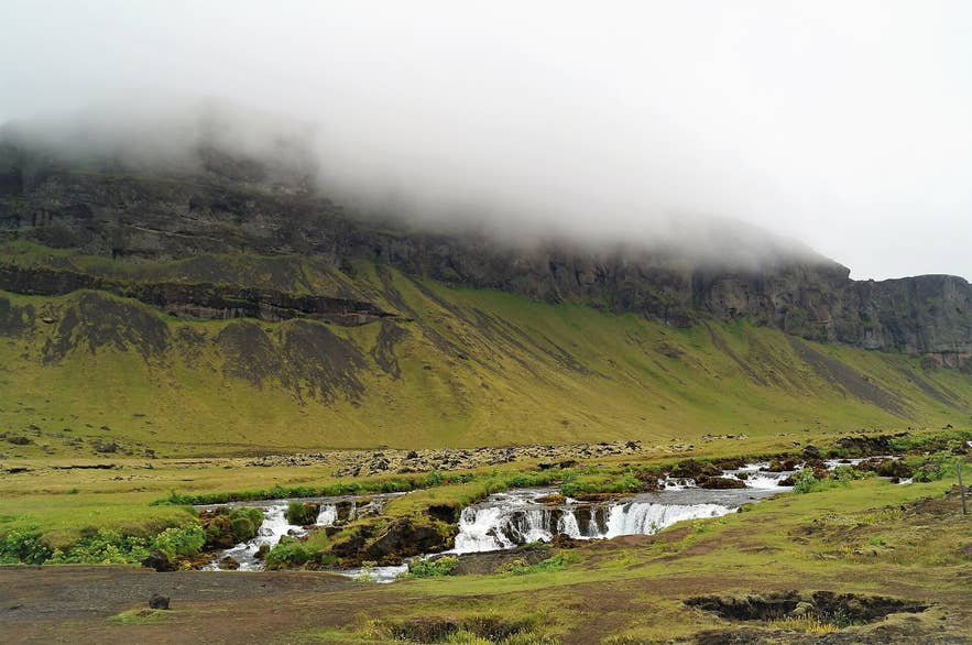
Fossálar cascades below the Síða cliffs. Photo: Alexander Grebenkov, CC BY 3.0
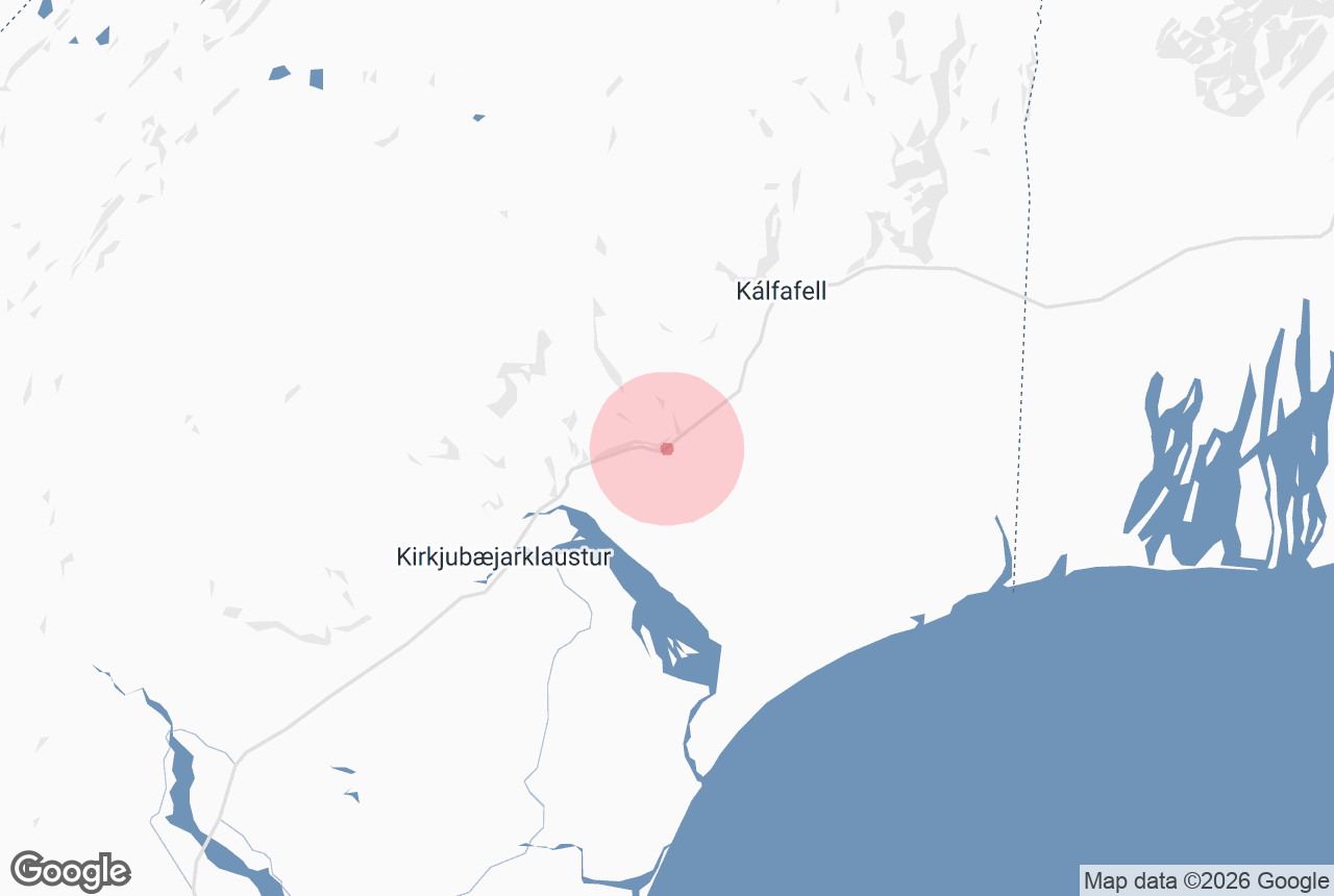
The Fossálar river (the name means "waterfall channels") is a spring-fed river that spills over a series of low, wide cascades right beside the Ring Road on Síða in South Iceland, about 15 km east of Kirkjubæjarklaustur.
The water breaks into many short drops over black basalt and mossy lava, with the cliffs of the Síða escarpment as a backdrop.
It is an easy waterfall stop on the south coast, a few metres from the road and visible from the car, and sits between two better-known neighbours, the columnar basalt of Dverghamrar and the tall thin waterfall Foss á Síðu.
Key Takeaways About Fossálar
- Spring-fed river with a line of low, wide cascades right beside Route 1 on Síða, about 15 km east of Kirkjubæjarklaustur
- Visible from the car; a small gravel pull-off (2023) on the north side of the road at the single-lane 1972 bridge, with Dverghamrar car park 1 km west as backup
- Any car, open all year, no fee and no facilities; nearest services in Kirkjubæjarklaustur
- A sea-trout river: fishing is permit-only, fly only and catch-and-release, 1 July to 20 October
- Pairs well with Dverghamrar (1 km) and Foss á Síðu (2 to 3 km) for a 30-minute three-stop break
Why visit Fossálar
Fossálar is not a single tall waterfall but a braided river that fans out across a shelf of lava and drops in a line of small falls and rapids.
The appeal is the setting: pale blue-green water over dark rock, bright green moss and lush bank vegetation, and the long wall of móberg (palagonite tuff) cliffs above the farms of Síða.
The whole scene fits in one frame from the roadside, and there are rarely crowds.
The river has an unusual course.
It rises south of the mountain Miklafell on the Austur-Síða highland pastures at roughly 550 to 600 m above sea level (sources differ).
It first flows as the Öðulbrúará river, widens into the lake Þverárvatn in the Þverárdalur valley, resumes its name near the hill Orrustuhóll and finally comes down to the lowland as Fossálar, where it "branches in channels through lava and sand" to join the glacial river Skaftá below its junction with Breiðbalakvísl.
Lower down, the river runs along the edge of the Brunahraun lava, the eastern branch of the Skaftáreldahraun (Eldhraun) laid down in the Laki eruption of 1783 to 1784, and there are deep pools along the lava edge; the leaseholder, Fish Partner, ranks Fossálar among the better sea-trout rivers in the country.
Sea trout are the main catch, with Arctic char early in the summer. Under the current lease the fishing is fly only and catch-and-release, with a season from 1 July to 20 October and four rods on the beat; check the leaseholder's page for the current rules.
The 36 m single-lane concrete bridge that carries Route 1 over the Fossálar river was built in 1972 and has a 4 m carriageway; the rapids just east of it have long been a popular stop.
In 2023 the Icelandic Road Administration (Vegagerðin), the municipality and the landowners laid a temporary gravel pull-off on the north side of the road and fenced off the south side.
Vegagerðin plans to realign the Ring Road here with a new 44 m two-lane bridge about 2.2 km downstream, so the roadside viewpoint may change in coming years.
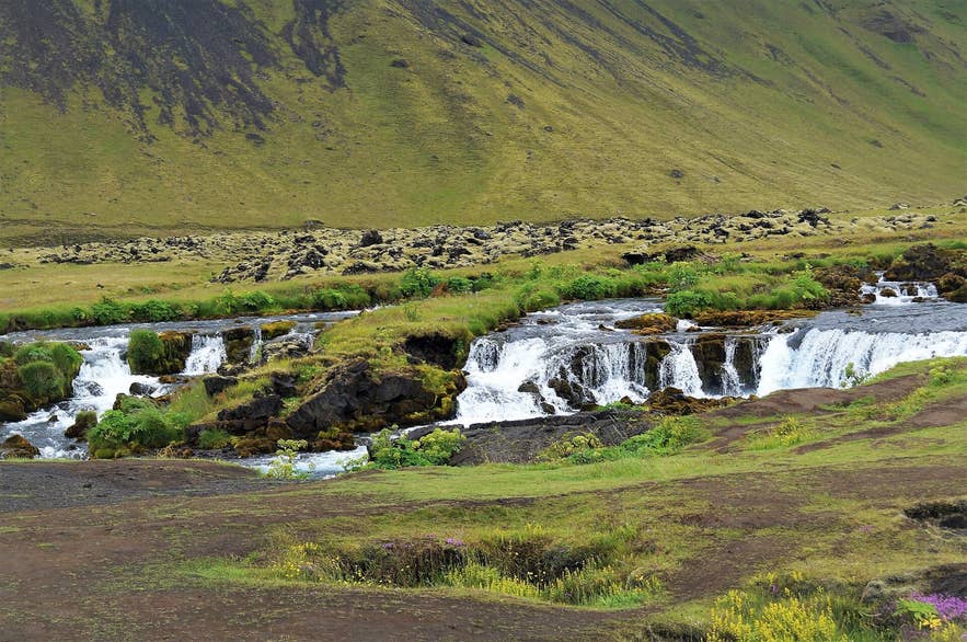
Braided Fossálar falls over lava. Photo: Alexander Grebenkov, CC BY 3.0
How to get to Fossálar
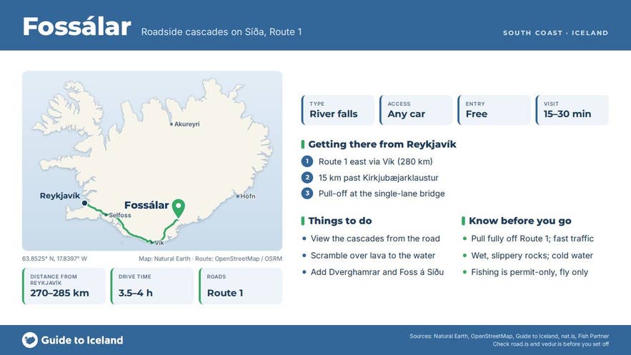
- From Reykjavík: about 270 to 285 km and 3.5 to 4 hours east along Route 1, past Vík and Kirkjubæjarklaustur.
- From Kirkjubæjarklaustur: continue east on Route 1 for roughly 14 to 15 km. You pass the farm and waterfall Foss á Síðu and then the Dverghamrar car park on the left; Fossálar is about 1 km further on, where the road crosses the river on a narrow bridge.
- From the east: Fossálar is about 55 km west of Skaftafell and 19 km west of Núpsstaður by road.
- Parking: there is a small gravel pull-off on the north side of Route 1 just east of the bridge, laid in 2023 as a temporary rest area, with room for a few cars; the south side is fenced off. Do not stop on the road or shoulder itself; the bridge is single-lane and approached on a bend from the west, and traffic arrives fast. If the pull-off is full, park at Dverghamrar and walk back along the road with care.
- Walking: none required. The cascades are a few metres from the parking area and can be seen from the car. A short scramble over uneven lava gets you closer to the water.
- Vehicle: any car; Route 1 is paved and open year-round.
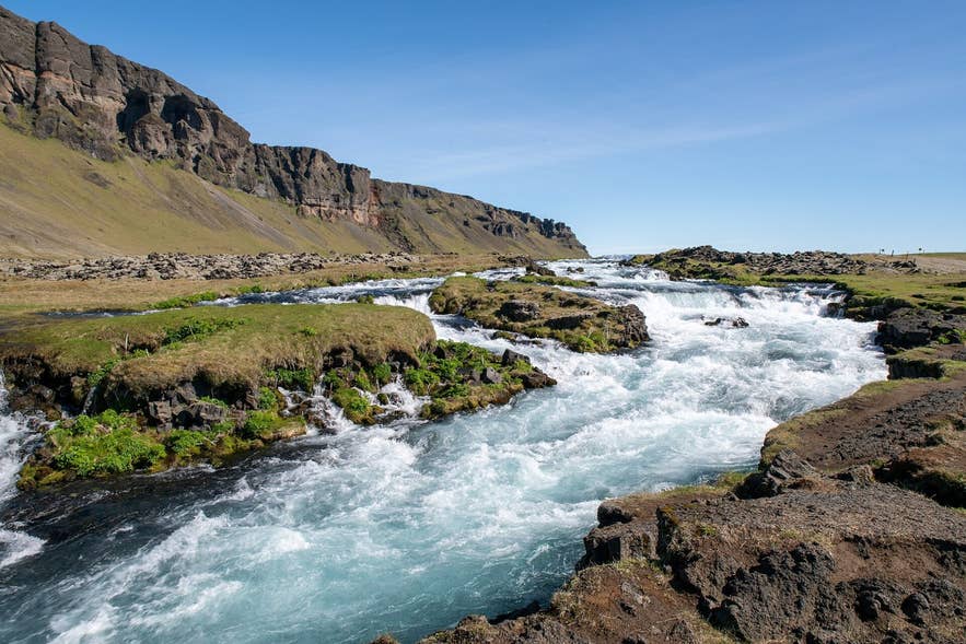
Fossálar cascades below the Síða escarpment. Photo: Hansueli Krapf, CC BY-SA 4.0
Best time to visit
Fossálar can be visited in any season. The river is spring-fed, so it keeps a steady flow, and the surrounding vegetation is at its greenest from June to August.
Autumn, from September to mid-October, is the peak of the sea-trout season. In winter the cascades are often edged with ice and the pull-off can be icy. Allow 15 to 30 minutes.
Safety and practical tips
- The main hazard is the road. Pull fully off Route 1, watch for traffic when crossing, and keep children close.
- Rocks beside the river are wet, mossy and slippery; the water is cold and fast. Stay back from the edge, especially with a tripod.
- Do not fish without a permit. The beat is privately let; under the current lease it is fly only and catch-and-release.
- There are no toilets, shop or café at Fossálar. The nearest services are at Kirkjubæjarklaustur (fuel, shops, restaurants, visitor centre) and at Hörgsland and Fosshotel Núpar along the road.
- No fee and no opening hours.
- Check road.is and the weather at vedur.is before driving in winter; this stretch of the south coast is exposed to strong wind and sandstorms.
- Respect the farmland on both banks and do not cross fences.
Is Fossálar the same as Foss á Síðu?
Do I have to hike to see Fossálar?
Why is the water so clear and steady?
Can I fish at Fossálar?
How far is Fossálar from Kirkjubæjarklaustur?
Nearby attractions
- Dverghamrar Cliffs, the protected "dwarf cliffs" of columnar basalt, about 1 km west.
- Foss a Síðu, the tall waterfall above the farm of the same name, about 2 to 3 km west.
- Brunahraun, the eastern arm of the Laki lava field, about 4 km east.
- Skaftareldahraun, the moss-covered 1783 lava, about 10 km away.
- Kirkjubæjarklaustur, the nearest village, with Kirkjugolf Stones and Systrafoss Waterfall, about 12 to 13 km west.
- Núpsstaður, the turf chapel beneath Lómagnúpur, about 17 km east.
Tours that visit Fossálar
- Private 3-Day Trip of Iceland with the Golden Circle, South Coast & Glacier Lagoon visits Fossálar on its second day, on the drive east along the south coast towards Orrustuhóll and Jökulsárlón glacier lagoon.