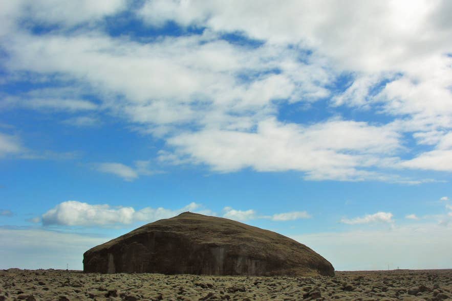
Orrustuhóll in mossy Brunahraun lava. Photo: Hansueli Krapf, CC BY-SA 3.0
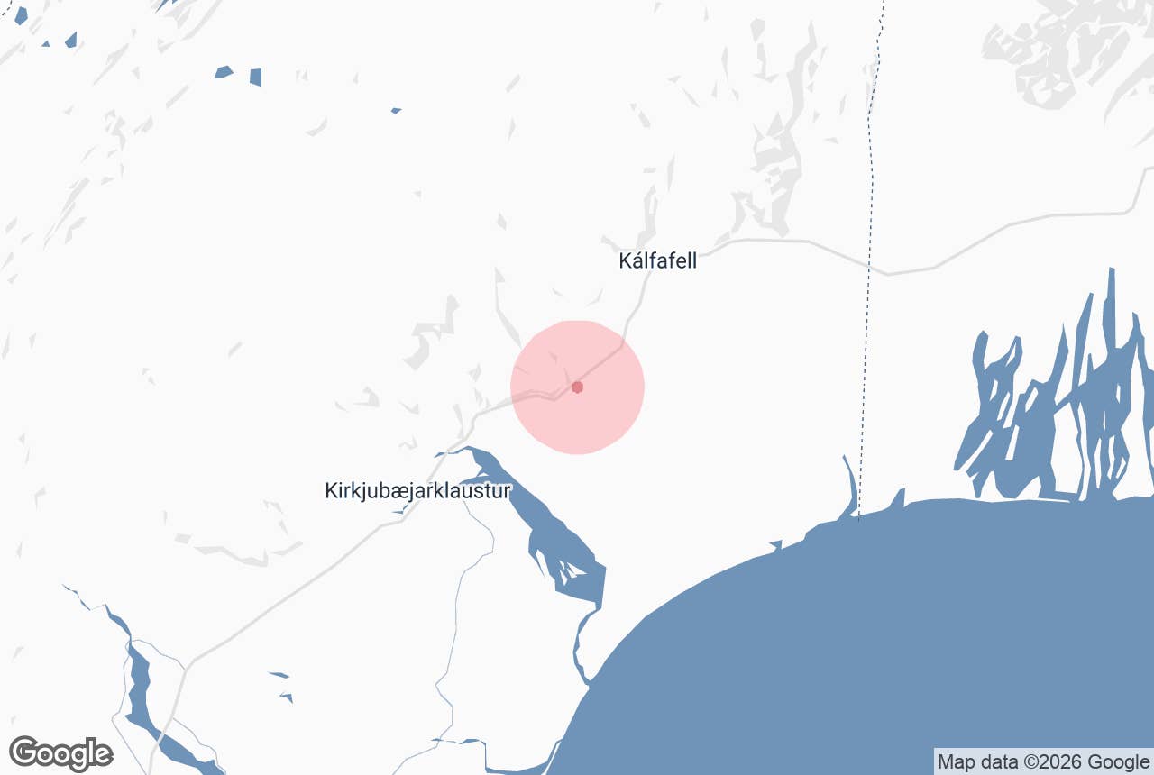
Orrustuholl (Orrustuhóll, "Battle Hill") is a flat-topped hill that stands alone in the Skaftáreldahraun lava field on the Síða district of South Iceland, just south of the Ring Road between Dverghamrar and the Hverfisfljót river. It is about 16 km east of Kirkjubæjarklaustur.
The hill is an óbrynnishólmi, an island of older rock that the 1783–84 Laki lava flowed around but did not cover, and it carries two old stories about fighting and quarrelling that gave it its name.
Key Takeaways About Orrustuhóll
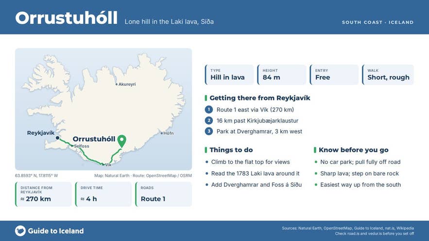
- Orrustuhóll is an óbrynnishólmi, a hill of older rock that the 1783–84 Laki lava (Brunahraun) flowed around, just south of Route 1.
- It is about 16 km east of Kirkjubæjarklaustur and 270 km (around 4 hours) from Reykjavík on the Ring Road.
- The name 'Battle Hill' comes from the legend of Hámundur halti avenging his father; two quarrelling farmers are said to be buried on top.
- There is no car park; the nearest formal parking is at Dverghamrar, 3 km west. Never stop on the carriageway.
- Visit May to September; the lava is sharp and moss-covered, so step on bare rock and wear boots.
Why visit Orrustuholl
Most people drive past Orrustuholl without noticing it, which is part of its appeal. From the road it looks like a dark, flat-topped mound rising out of a sea of moss-covered lava.
Its summit is marked at 84 m above sea level in Iceland's IS 50V map data.
Guide to Iceland's tour notes describe it as a tuff (móberg) hill with cliff sides.
Katla UNESCO Global Geopark, which lists it as a geosite, says it does not look high from its surroundings but that the view from the top is very good in all directions, over the eastern Skaftáreldahraun to the Síða cliffs in the north and, on a clear day, towards the glaciers in the east.
The lava around it is Brunahraun, the eastern of the two great tongues of Skaftáreldahraun that reached the lowlands during the Laki eruption of 1783–84.
Before the eruption the hill stood as an islet of sand and water in the floodplain of the Hverfisfljót river; the lava then flowed around it and left it as an island in the lava, which is what the Icelandic term óbrynnishólmi, roughly "unburnt islet", describes.
Standing on top you can read the eruption directly in the landscape.
The name comes from folklore recorded by Icelandic sources and summarised by the travel guide nat.is. One tradition says that Hámundur halti (Hámundur the Lame), a figure from the Saga Age, avenged the killing of his father, Hróar Tungugoði, here.
A second, more homely story tells of two elderly farmers from Síða who could never meet without bickering. They died within a short time of each other and were both buried on top of the hill, and people passing by afterwards claimed to hear the two still arguing inside it.
How to get to Orrustuholl
Orrustuholl lies beside Route 1 (the Ring Road) on the Síða district, east of Kirkjubæjarklaustur.
- From Reykjavík: about 270 km east along Route 1 (around 4 hours), past Vík and Kirkjubæjarklaustur.
- From Kirkjubæjarklaustur: about 16 km east on Route 1 (around 15 minutes). You pass Foss á Síðu and Dverghamrar first; the hill is on the right (south) side of the road about 2–3 km beyond Dverghamrar, before the Hverfisfljót bridge.
- From Jökulsárlón: about 107 km west on Route 1.
- Parking: there is no built car park or signed stop at the hill. The nearest formal parking is the Dverghamrar car park about 3 km west, or the car park at Foss á Síðu, which Katla Geopark recommends for this stop. If you stop nearer the hill, pull completely off the carriageway onto firm ground; never stop on Route 1 itself, which is a busy two-lane highway with no hard shoulder here.
- Walking: the Ring Road now runs some distance north of the hill, so you walk a few hundred metres across rough Brunahraun lava to reach it. Allow more time than the short distance suggests and expect uneven ground. Katla Geopark says the easiest way up is from the south, and a sheep path runs along the western side of the hill.
- The hill stands on the land of the farm Þverá. Keep to the lava and respect any fences.
Best time to visit
Summer, from May to September, when the lava is free of snow and the moss is at its greenest. The hill is a short stop, so it fits easily into a drive between Kirkjubæjarklaustur and Skaftafell. In winter the lava is treacherous under snow and the light is short; look at the hill from the road instead.
Safety and practical tips
- The lava is sharp, loose in places and covered in thick moss that hides holes. Wear boots with ankle support and step on bare rock, not on the moss, which is very slow to recover from footprints.
- If you climb, go up from the south, the gentlest side, and come down the same way; the rock can be loose when wet.
- There are no facilities at the site. The nearest services (fuel, food, toilets, information centre) are in Kirkjubæjarklaustur.
- There is no entrance fee and no opening hours.
- Weather on Síða can turn quickly and strong winds are common on this stretch of the south coast. Check vedur.is before you stop.
What does Orrustuhóll mean?
Is Orrustuholl a crater?
Can I see it from the Ring Road?
How long does a stop take?
Are there other places called Orrustuhóll in Iceland?
Nearby attractions
- Brunahraun – 2 km
- Dverghamrar Cliffs – 3 km
- Foss a Síðu – 3 km
- Kirkjubæjarklaustur – 13 km
- Núpsstaður – 16 km
- Fjaðrárgljúfur Canyon – 20 km
Tours that visit Orrustuholl
- Private 3-Day Trip of Iceland with the Golden Circle, South Coast & Glacier Lagoon – on Day 2 this private tour stops at the Fossálar waterfalls and then at Orrustuholl, described as a tuff cliff-sided hill with a wide view, before continuing east to Jökulsárlón.