
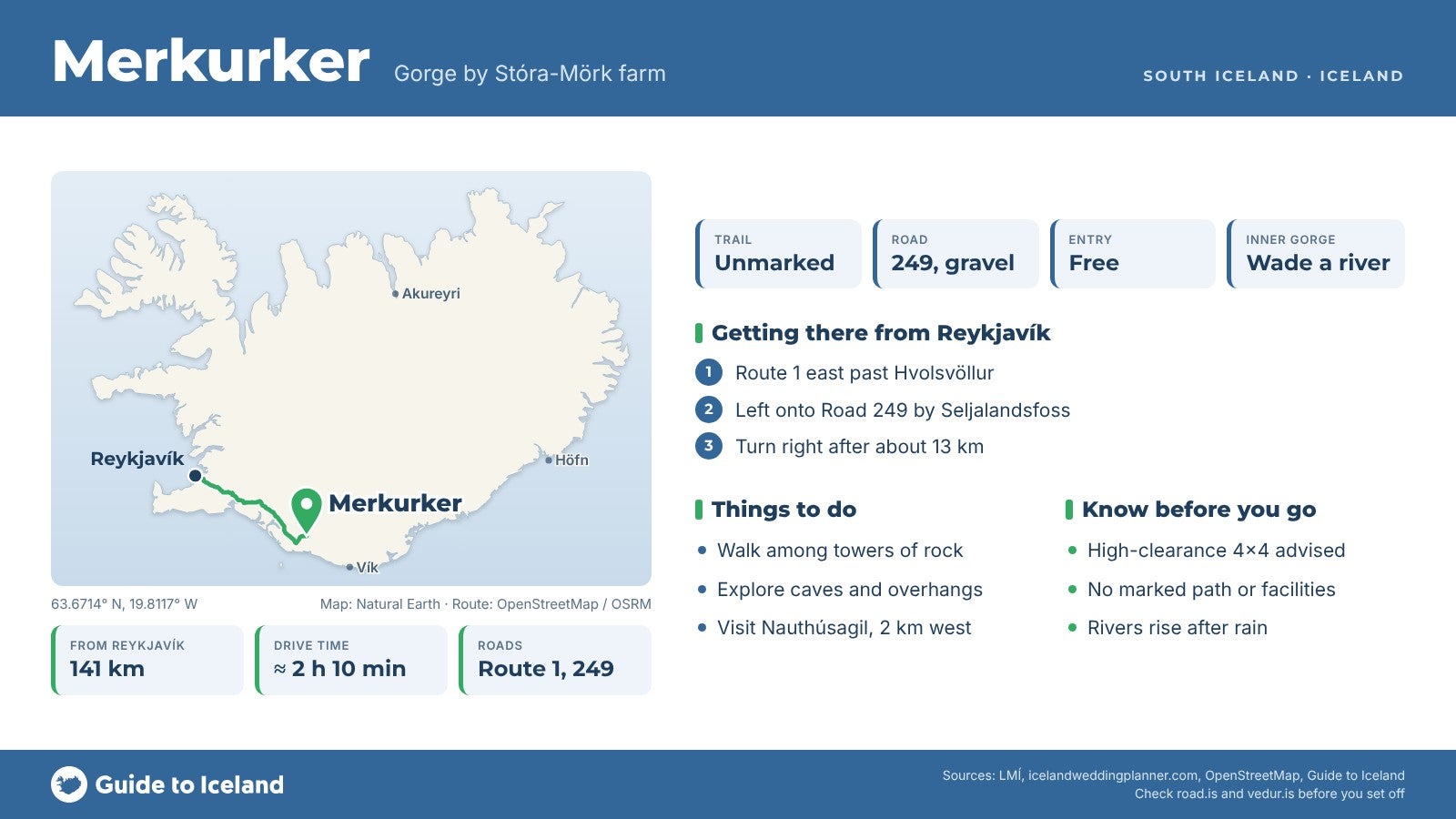
Merkurker is a small gorge in the foothills below Eyjafjallajökull in South Iceland, on the land of the farm Stóra-Mörk, a short detour off Road 249 on the way to Þórsmörk. Tall rock walls, moss, a winding riverbed and several caves and overhangs fill the gorge, and there's no marked trail.
To reach its finest inner part you wade a shallow river. It's about 2 km east of Nauthúsagil and 141 km from Reykjavík.
Key Takeaways About Merkurker
- Small gorge with rock towers, moss-covered cliffs, caves and a river cave, on Stóra-Mörk farmland below Eyjafjallajökull
- About 13 km along Road 249 from the Ring Road by Seljalandsfoss; 141 km (about 2 hours 10 minutes) from Reykjavík
- No marked trail or facilities; the inner gorge means wading a river that can be ankle to knee deep
- Gravel road that is often rutted; a high-clearance 4x4 is advised
- A stop on the Þórsmörk super jeep tour from Hvolsvöllur
Why visit Merkurker
Merkurker is a small gorge cut into the foothills below Eyjafjallajökull, on the land of the farm Stóra-Mörk. It sits a short way off Road 249, the road into Þórsmörk, about 2 km east of the better-known Nauthúsagil ravine.
Inside you'll find tall rock walls and towers, moss-covered cliffs, a winding riverbed and a scatter of caves and overhangs. One of them is a river cave you can step inside. Far fewer people come here than to the waterfalls on the Ring Road, and there's no marked trail, so it feels much wilder than its distance from the road suggests.
History and the name
Merkurker is an old farm place name. The national place-name register (LMÍ) lists it as a bowl-shaped hollow on Stóra-Mörk land, recorded in the farm's place-name description by the folklorist Þórður Tómasson.
According to that description, the gully is called Illagil higher up and Merkurker lower down, and in the part called Stóra-Merkurker stands a tall crag known as Burstin. The first part of the name, Merkur, is the genitive of Mörk, the same word as in Stóra-Mörk and Þórsmörk; ker means a tub or vat.
How to get to Merkurker
Merkurker is about 141 km from Reykjavík, roughly 2 hours 10 minutes' drive. Take the Ring Road (Route 1) east past Hvolsvöllur, then turn left onto Road 249 (Þórsmerkurvegur) by Seljalandsfoss. The road passes the waterfalls, then the pavement ends and it continues as gravel along the foot of the mountains.
About 13 km from the Ring Road, a turn-off on the right (GPS 63.6762, -19.8135) leads down a track of about 500 m to a small parking area by the gorge. The nearest town is Hvolsvöllur, about 34 km and 30 to 40 minutes away.
The gravel road is often rutted and potholed and can have several river crossings at any time of year, so a high-clearance 4x4 is the sensible choice.
Further on, the road becomes F249 into Þórsmörk, with unbridged rivers that grow larger the further you go, ending at the Krossá. Don't take a rental car beyond Merkurker unless you know how to judge a glacial river; read our guide to crossing rivers in Iceland first.
From the parking area there are two ways in. A path climbs a small hill into the middle part of the gorge. To reach the finer inner part, you cross the river on foot, in water that can be ankle to knee deep; tour operators sometimes leave small footbridges in summer, but don't count on them.
Beyond the crossing there's no marked path, but past the sand and rocks you'll pick up a small sheep track.
Best time to visit
Late spring to autumn is the practical window for a self-drive visit. The Iceland Wedding Planner guide suggests April to October, depending on weather and road conditions, and says that outside that period you'll probably need a super jeep and an experienced guide.
Even in summer the rivers can swell after heavy rain or on warm days, so be ready to turn back.
Guided super jeep tours from Hvolsvöllur that stop here run all year.
Safety and practical tips
- There are no facilities, signs or marked trails at Merkurker. Bring water and food, and wear waterproof boots or bring sandals for the river crossing.
- Only wade the river if it's calm and shallow. If it's high or murky, stay on the hill path.
- The river cave is a tight squeeze. Skip it if you don't like enclosed spaces.
- Watch for loose rock below the cliffs and don't climb the walls.
- The gorge is on the land of Stóra-Mörk farm, so treat it with care and take all litter home.
- Check road.is and vedur.is before setting out, and leave a travel plan at safetravel.is.
Where is Merkurker?
Do I need a 4x4 to get to Merkurker?
Do you have to cross a river?
Is Merkurker the same as Nauthúsagil?
Is there an entrance fee?
Is Merkurker the same as Merkurrani?
Nearby attractions
- Nauthúsagil, about 2.3 km: a narrow ravine known for its rowan trees, behind the farm Stóra-Mörk.
- Markarfljót River, about 4.7 km: the wide glacial river that flows past Þórsmörk to the sea.
- Gljúfrabúi, about 10.6 km: the waterfall hidden inside a narrow gorge.
- Seljalandsfoss, about 10.7 km: the waterfall you can walk behind.
- Gígjökull, about 10.7 km: the glacier tongue reshaped by the 2010 eruption.
- Stakkholtsgjá, about 12.5 km: a canyon walk on the way into Þórsmörk.
- Þórsmörk, about 16 km: the mountain valley at the end of the road.
Tours that visit Merkurker
This super jeep tour from Hvolsvöllur stops at the gorge on its way into Þórsmörk, before Gígjökull and Stakkholtsgjá. Its description calls the stop Merkurrani Canyon.
