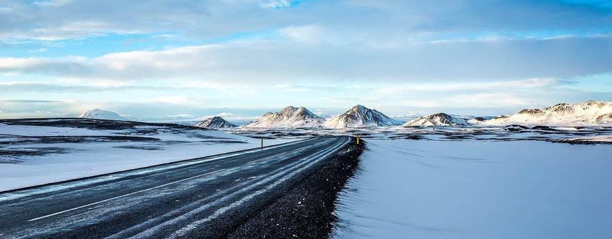
Route 1 across Möðrudalsöræfi in winter. Photo: sergejf, CC BY-SA 2.0
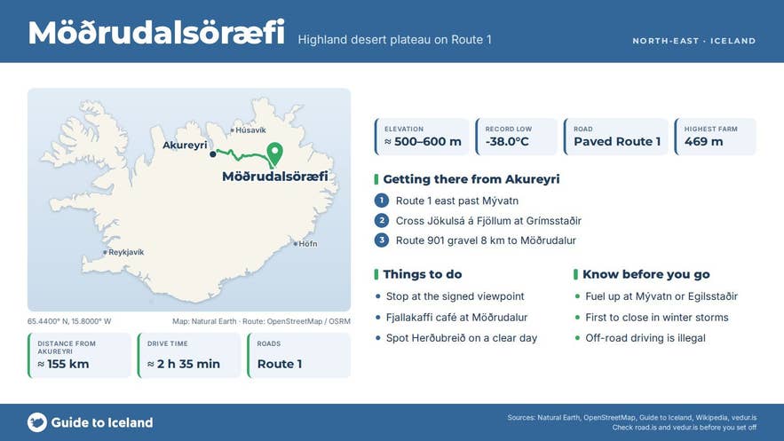
Möðrudalsöræfi is the high desert plateau in the north-east of Iceland that the Ring Road crosses between Lake Mývatn and Egilsstaðir. The name means "the wilderness of Möðrudalur", after the farm Möðrudalur, which at 469 metres above sea level is the highest inhabited place in Iceland.
For a long stretch of Route 1 you are at around 500 to 600 metres (the Ring Road's highest point, about 600 metres, is on this plateau), surrounded by gravel flats, black sand, old lava and rows of pale mountains, with the table mountain Herðubreið on the south-western horizon.
It is one of the emptiest stretches of the whole Ring Road.
Key Takeaways About Möðrudalsöræfi
- Desert plateau at around 500–600 m between the rivers Jökulsá á Fjöllum and Jökulsá á Dal, crossed by Route 1
- Named after Möðrudalur, at 469 m the highest inhabited farm in Iceland (café, church, campsite)
- Holds Iceland's record low temperature, -38.0°C, measured in January 1918
- Paved Ring Road in summer, no 4x4 needed; one of the first sections to close in winter storms
- Clear-day views of the table mountain Herðubreið to the south-west
Why visit Möðrudalsöræfi
This is the closest most Ring Road travellers get to Iceland's Highlands without leaving tarmac.
The plateau lies between the two great glacial rivers Jökulsá á Fjöllum to the west and Jökulsá á Dal to the east, and the land is mostly unvegetated gravel plains, sand and rough lava with pockets of green in sheltered hollows.
The Möðrudalsfjallgarðar mountain ranges run north–south across it, rising to just under 800 metres, and Route 1 crosses the western range through the pass of Vegaskarð (about 500 m) between Vegahnjúkur (783 m) and Sauðahnjúkur (641 m).
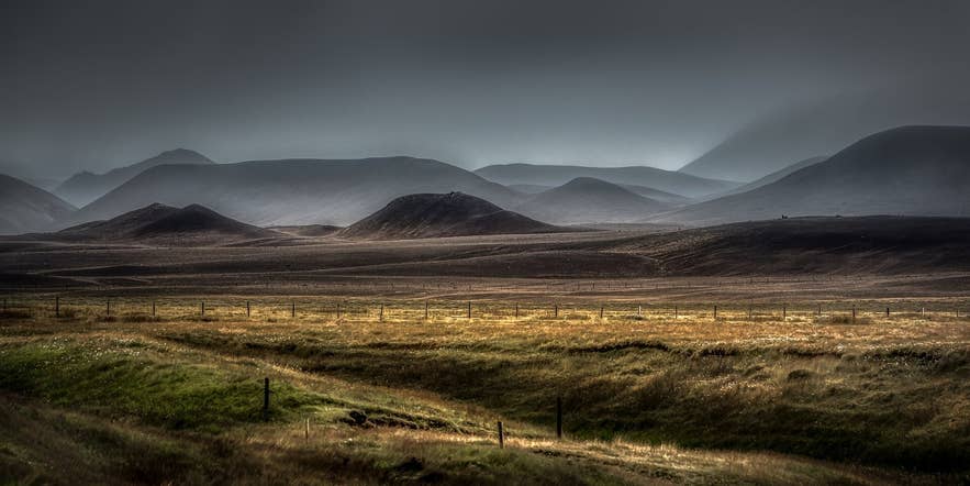
Gravel desert of Möðrudalsöræfi. Photo: Bernd Thaller, CC BY 2.0
The climate is as extreme as the scenery. Möðrudalur and neighbouring Grímsstaðir jointly hold Iceland's record low temperature, -38.0°C, measured on 21 January 1918.
Mean annual temperature at Möðrudalur is about 1°C and annual precipitation only around 334 millimetres, which is why the ground is desert rather than moss and grass.
The roadside weather station Möðrudalsöræfi II, shown on vedur.is and road.is, is one to check before a winter crossing.
People have farmed here for centuries. Möðrudalur's small church was built in 1949 by the farmer Jón A. Stefánsson, and the farm today runs guesthouse rooms, cafés (Fjallakaffi and Beitarhúsið) and a campsite under the name Fjalladýrð.
Between about 1840 and 1940 a scattering of highland farms existed on the heaths to the east, abandoned one by one; the reconstructed turf farm Sænautasel on Jökuldalsheiði is the best place to see how they lived.
On a clear day the flat-topped Herðubreið, often called the queen of Icelandic mountains, stands alone to the south-west, with the Dyngjufjöll and Askja beyond.
How to get to Möðrudalsöræfi
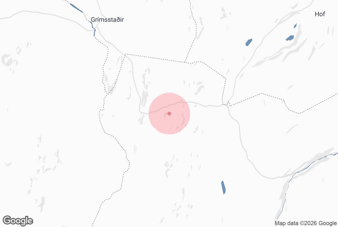
The Ring Road (Route 1) crosses the plateau through Vegaskarð and then on the Háreksstaðaleið alignment, a paved section north of Möðrudalur that replaced the older, snow-prone route through Möðrudalur and over the eastern Möðrudalsfjallgarður and Jökuldalsheiði.
Coming from the west, you climb onto the plateau after the bridge over Jökulsá á Fjöllum at Grímsstaðir; coming from Egilsstaðir you climb out of Jökuldalur. Reykjavík is a full day away: roughly 7 to 8 hours via Akureyri, so most people reach it on day 3 or 4 of a Ring Road trip.
The Mývatn area (Reykjahlíð) is about 75 kilometres or 1 to 1.5 hours' drive, and Egilsstaðir about 100 kilometres or 1.5 hours.
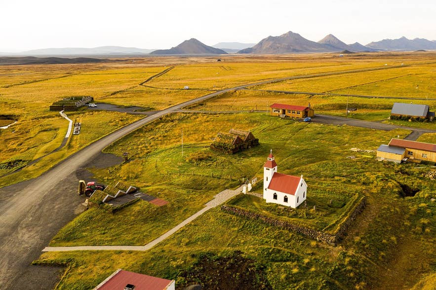
Möðrudalur farm and church. Photo: Kasa Fue, CC BY-SA 4.0
To visit the farm, turn south off Route 1 onto Route 901 (Möðrudalsleið), a gravel road that reaches Möðrudalur after about 8 kilometres. In summer a normal car manages it with care. Route 901 continues south-west to join the F-roads toward Askja (F905/F910); those are 4x4-only and open only in summer.
There is parking at Möðrudalur and at a signed viewpoint beside the Ring Road on the plateau. Elsewhere, pull fully off the road before stopping; the shoulders are soft gravel.
Best time to visit
June to September is the easiest: the road is clear, Möðrudalur's services are open and Route 901 is passable. Late August and September add autumn colour on the heaths and the first chance of northern lights.
In winter the Ring Road is kept open but this section is one of the first to close in storms; expect snow, drifting and poor visibility from October to April, and check road.is before setting out.
Safety and practical tips
- Weather changes fast at 500 metres. Even in July, bring a warm layer and windproof jacket for photo stops.
- Winter drivers should check road.is and vedur.is before crossing. Closures of this stretch are common in snowstorms, and there are no services on the Ring Road between Grímsstaðir and Jökuldalur apart from the turn-off to Möðrudalur.
- Fuel up at Mývatn or Egilsstaðir before crossing; do not count on buying fuel on the plateau.
- Fjallakaffi at Möðrudalur serves food and coffee and has toilets; check current opening hours on fjalladyrd.is before relying on it outside summer.
- Do not drive off the road onto the gravel. Tracks in this desert take decades to disappear and off-road driving is illegal.
Is Möðrudalsöræfi part of the Highlands?
Do I need a 4x4 to cross it?
How is Möðrudalsöræfi different from Mývatnsöræfi?
Is there anywhere to eat or sleep?
Can I see Herðubreið from the road?
Nearby attractions
- Útsýnisstaður – about 2 km. Signed viewpoint beside Route 1 over the plateau.
- Modhrudalur – about 8 km. Iceland's highest farm, with church, café and camping.
- Fjallakaffi – about 8 km. The café at Möðrudalur.
- Möðrudalsleið – about 13 km. The gravel Route 901 that leads toward Askja.
- Sænautasel – about 24 km. Reconstructed turf farm from the highland settlement era.
- Jokulsa a Fjollum – about 27 km. The glacial river that bounds the plateau to the west.
- Studlagil Canyon – about 38 km. Basalt-column canyon in Jökuldalur, the valley east of the plateau.
Tours that visit Möðrudalsöræfi
- 5-Day Ring Road of Iceland and Golden Circle Tour with Hotel Stays and Jokulsarlon Boat Ride – crosses the plateau between Mývatn and East Iceland.
- 7 Day Budget Self Drive Tour of the Complete Ring Road of Iceland with Waterfalls & Myvatn – the itinerary traverses Möðrudalsöræfi on the Ring Road.
- Ultimate 8-Day Self-Drive Tour of Iceland's Game of Thrones Shooting Locations – the itinerary crosses the plateau.
- Relaxed 13-Day Northern Lights Winter Self-Drive Tour of the Complete Ring Road & Snaefellsnes – the itinerary crosses the plateau in winter.
- Winter Wonderland 9-Day Northern Lights Adventure Tour Around Iceland from Reykjavik – crosses the plateau on the way around the island.
