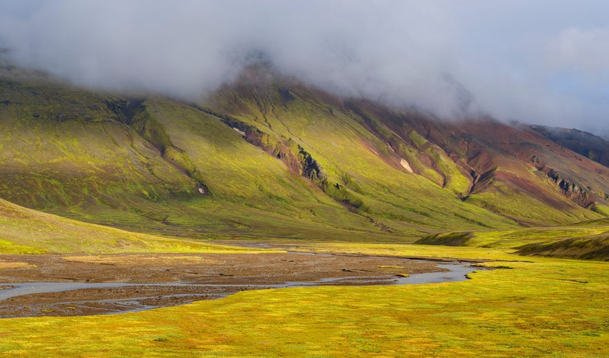
Information about Nýidalur/Jökuldalur
Nyidalur (a.k.a. Jokuldalur) is a valley in the Icelandic highlands, south of the glacier Tungnafellsjokull and north of Hofsjokull glacier. It is a frequent stop for travelers of the highlands, as huts of The Icelandic Touring Association are located there.
The huts are located around 800 m above sea level at the mouth of the valley. The older hut has two floors. They both have a kitchen, a warden’s room, and a sleeping hall, with further sleeping quarters on the above floor. They both accommodate 120 people in bunks or on matresses and their kitchens have oil-stoves, pots and pans, but no other utensils.
The valley itself is well vegetated and the Tungnafell glacier and Vonarskard pass, across the Mjohals mountain ridge, offer good opportunities for hiking.
Services near Nýidalur/Jökuldalur
Attractions nearby Nýidalur/Jökuldalur
Bárðarbunga
The stratovolcano Bardarbunga is Iceland’s second-highest mountain and lies under the icecap of Vatnajokull, Europe’s largest glacier. Ba...
Þjórsárver
Thjorsarver is a wetlands area and natural reserve in the mid higlands of Iceland and became listed as a RAMSAR site in 1990, mainly as it the wo...
Laugafell
Laugafell is a small mountain to the north-east of the glacier Hofsjokull, in the Icelandic mid-highlands. On the north-western slopes of La...
Hofsjökull
Hofsjokull is the third largest glacier in Iceland and is situated in the Mid-Higlands. Hofsjokull has an active subglacial caldera volcano which is...
Trölladyngja
Trölladyngja is Iceland's largest shield volcano, located in the north of Vatnajökull National Park in the highlands. At 1,468 metres (...
Sprengisandur
The Sprengisandur highland plateau stretches between the glaciers Hofsjokull and Vatnajokull (Europe’s largest glacier) and was the main route b...
Jökulheimar
At Jokulheimar, close to Tungnarjokull glacier in Vatnajokull National Park are two cabins run by the Icelandic Glacier Research Association. ...
Grímsvötn
Grimsvotn refers to subglacial lakes and a volcano of the same name that lie in the western part of Vatnajokull, Europe's largest glacier, ...
Odadahraun
Odadahraun is the most extensive lava field in Iceland, with a total area of around 4-6000 km² (definitions vary), consisting of relatively young...
Highlands
The Icelandic Highlands cover the majority of the country and many of Iceland’s impressive natural attractions can be found here. Away from cr...
Ofaerufoss
Ofaerufoss is a highly beautiful waterfall in the volcanic chasm Eldgja in Southeast Iceland. The Eldgja chasm, belongs to the same volcanic system as...
Langisjór
Langisjor is among the clearest highland lakes in the country. Its altitude is 670 meters and at its deepest it’s 75 meters. The l...
Kerlingarfjöll
Kerlingarfjoll is a beautiful and colourful mountain range in the Icelandic highlands that hosts the third largest geothermal area of the ...
Holuhraun
Holuhraun is an immense lava field north of Vatnajökull glacier in Iceland's Highlands. The most recent major eruption in Iceland occured h...
Hveradalir
Photo from Wikimedia, Creative Commons, by ezioman Hveradalir, ‘the Valley of the Hot Springs’, is exactly what its name suggests. It ca...
Breiðbakur
Breidbakur, in the Icelandic highlands, is a mountain west of Langisjor lake and near Vatnajokull glacier. The scenery in this area is magnificent. ...
Kverkfjöll
Credit: Wikimedia, Creative Commons. Photo by Pietro Kverkfjöll is a sub-glacial mountain range on the northern side of the Vatnajökul...
Vatnajökull
Vatnajökull glacier is the largest glacier in Europe, covering 8% of Iceland’s landmass. It is the central feature of the Vatnajök...
Kjölur/Kjalvegur
Kjolur/Kjalvegur is 600-700 m high mountain pass in the highlands, located east of Langjokull glacier and west of Hofsjokull. It starts by the popular...
Dyngjufjöll
Dyngjufjoll is a volcanic mountain range in the lava field Odadahraun in the Icelandic highlands. The Askja caldera is situated in this mountain rang...