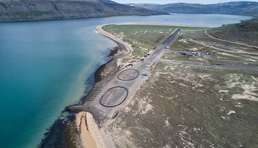
Sandoddi spit below Skersfjall, Patreksfjörður. Photo: Steinninn, CC BY 4.0
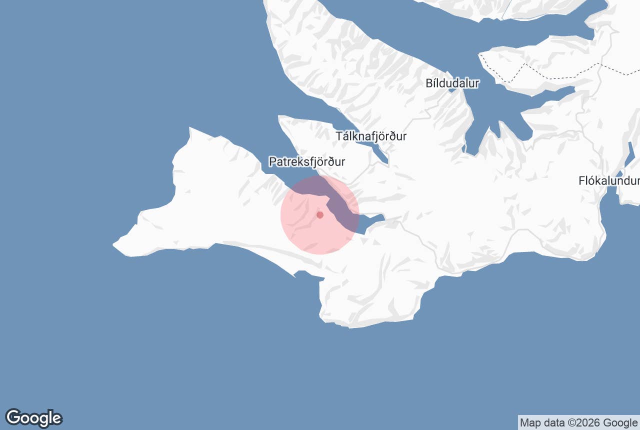
Skersfjall mountain is the flat-topped hill on the south side of Patreksfjörður in the southern Westfjords that separates the fjord from Rauðasandur, the red-gold beach on the coast to the south. It is not a dramatic peak: it rises to under 300 metres directly above the Patreksfjörður airstrip and the farm Hvalsker.
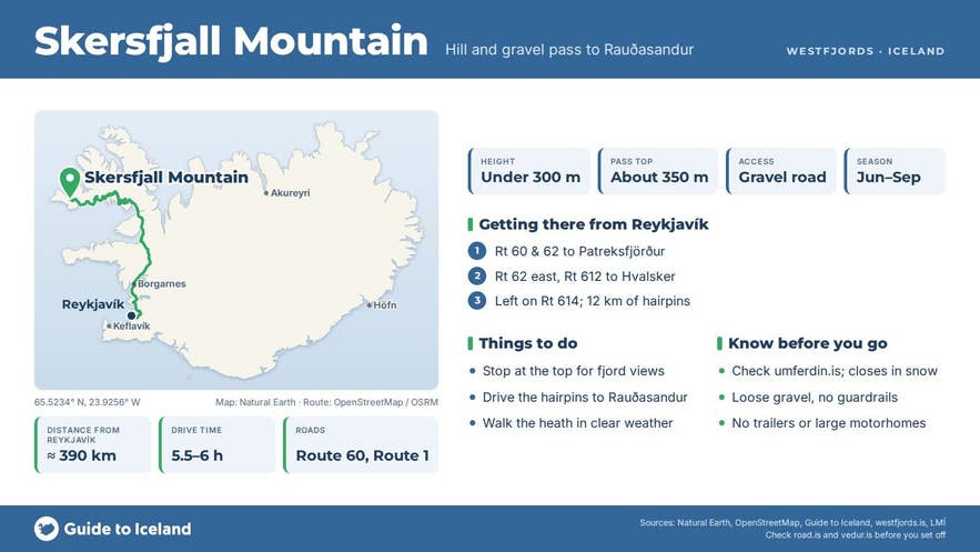
What makes it worth knowing is the road. Route 614, Rauðasandsvegur, leaves the fjord shore at Hvalsker, climbs onto the heath along the flank of Skersfjall, tops out at roughly 350 metres further south and then drops in a series of tight gravel hairpins to Rauðasandur.
The Icelandic road register describes the route exactly that way: "from Örlygshafnarvegur at Hvalsker over Skersfjall". The name shares the element sker, a skerry, with Hvalsker ("whale skerry"), the farm at its foot.
Key Takeaways About Skersfjall
- Flat-topped hill under 300 m on the south side of Patreksfjörður, above the airstrip and the farm Hvalsker
- Route 614 (Rauðasandsvegur) climbs past it from Hvalsker to about 350 m, then drops in gravel hairpins to Rauðasandur
- Gravel mountain road, not an F-road: ordinary cars manage it in summer; avoid with trailers and large motorhomes
- Often closed by snow in winter and spring; check umferdin.is
- Guided cycling tours from Patreksfjörður ride over it to Rauðasandur, with a vehicle ride back if wanted
Why visit Skersfjall
Skersfjall is the climb everyone makes on the way to Rauðasandur, and the crossing is half the experience.
From Hvalsker the gravel road climbs quickly away from the fjord, and within a few minutes you have Patreksfjörður spread out below you, with the Sandoddi spit and the airstrip at your feet, the town of Patreksfjörður across the water and the flat-topped mountains of the northern shore behind it.
On the top the land opens into a broad, stony heath with small lakes, Kjóavatn and Víðirvatn, before the ground falls away to the south.
The descent is the famous part.
The road drops more than 300 metres to the coast through steep switchbacks with no guardrails on some sections, and at each bend the view widens over Rauðasandur: roughly ten kilometres of sand whose colour runs from white through yellow to red depending on the light, ground from scallop shells rather than the black volcanic sand found on most Icelandic beaches.
Beyond it lies the ocean and, on a clear day, Snæfellsjökull across Breiðafjörður, about 75 kilometres south.
For cyclists the climb is a proper test, roughly 350 metres of ascent on loose gravel, which is why guided cycling tours from Patreksfjörður make a point of it. The reward is a long, freewheeling descent to a beach where seals haul out and where the church at Saurbær and a summer café sit at the foot of the hills.
How to get to Skersfjall
From Patreksfjörður town, drive east around the head of the fjord on Route 62 (Barðastrandarvegur), about 12 kilometres, then turn right onto Route 612 (Örlygshafnarvegur) along the southern shore.
Pass the Garðar BA 64 shipwreck at Skápadalur and continue about 9 kilometres to the farm Hvalsker, where Route 614 (Rauðasandsvegur) turns off to the left and starts climbing Skersfjall.
From the junction it is about 12 kilometres over the mountain to the church at Saurbær on Rauðasandur; allow 20 to 30 minutes for the drive, as the road is gravel, narrow and steep in places.
Patreksfjörður is roughly 390 kilometres from Reykjavík, around 5½ to 6 hours' drive, or less if you use the Baldur ferry from Stykkishólmur to Brjánslækur.
Route 614 is a normal mountain road, not an F-road, so a 4x4 is not legally required, but a car with reasonable clearance makes the hairpins more comfortable. Trailers and large motorhomes should not attempt it.
Where the road widens near the top you can stop for the view; park fully off the road, as traffic comes round the bends with little warning. There is no marked trail onto Skersfjall itself; the open heath can be walked from the road in clear, dry weather, but expect boggy patches.
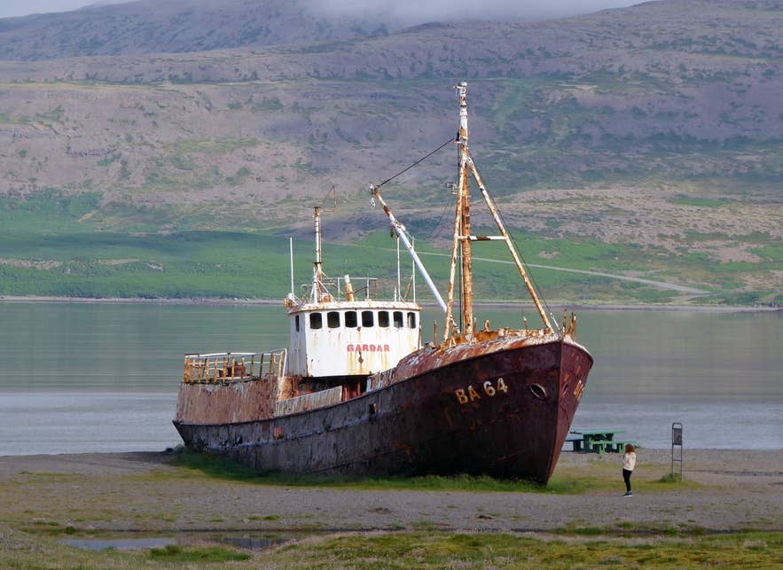
Garðar BA 64 shipwreck, Patreksfjörður. Photo: Wolfgang Fricke, CC BY 3.0
Best time to visit
June to September. Route 614 is a mountain road that is often closed by snow in winter and spring, so Rauðasandur and the Skersfjall crossing are effectively a summer destination.
Early morning and late evening light brings out the reds in the sand far more than midday sun. The local operator runs its cycling tour from May to the end of October.
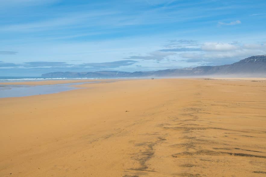
Rauðasandur beach below Skersfjall. Photo: Hansueli Krapf, CC BY-SA 4.0
Safety and practical tips
- Check umferdin.is for the current status of Route 614 before setting out; it closes in snow and after heavy rain.
- Drive slowly on the descent and keep right. Gravel on the bends is loose and the drop-offs are unprotected.
- In fog the top of Skersfjall is featureless. Do not wander away from the road without a GPS or map.
- There are no services on the mountain. Fuel, shops, a pool and restaurants are in Patreksfjörður; at Rauðasandur there is a campsite at Melanes and a seasonal café.
- Wind on the heath can be strong enough to be a problem for cyclists and for opening car doors.
- Tides at Rauðasandur come in fast across flat sand. Keep an eye on the water if you walk far out.
Do I need a 4x4 to cross Skersfjall?
How steep is the road down to Rauðasandur?
Is the road open in winter?
Can you hike Skersfjall?
How long does the Rauðasandur detour take from Patreksfjörður?
Nearby attractions
- Rauðasandur – the red-gold beach at the foot of the pass, 7 km
- Garðar BA 64 – steel ship built in 1912 and beached at Skápadalur on the way to the pass, often called Iceland's oldest steel ship, 6 km
- Patreksfjörður – the main town of the southern Westfjords, 7 km across the fjord
- Hnjótur – folk museum on Route 612, 11 km
- Tálknafjörður – village with pool and the Pollurinn hot pools, 11 km
- Látrabjarg – Europe's largest bird cliff and Iceland's westernmost point, 27 km
Tours that visit Skersfjall
- Scenic 4 Hour Cycling Tour of the Westfjords to Raudasandur Beach with Transfer from Patreksfjordur – a guided ride from Patreksfjörður past the Garðar shipwreck, uphill and over Skersfjall, then down the hairpins to Rauðasandur, with the option of a vehicle ride back to town.
