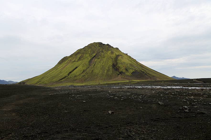
Mælifell from Mælifellssandur. Photo: PeterRYV, CC BY-SA 4.0
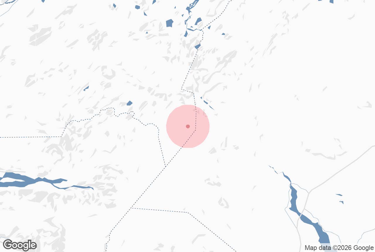
Vedurhals (Veðurháls, "Weather Ridge") is a low highland ridge on the northern edge of Mælifellssandur in Iceland's southern Highlands, immediately north-west of the green cone of Mælifell and about 3.5 km south of the Strútur mountain hut.
It is not a destination in its own right so much as a stage on the Strútsstígur trail: hikers cross it on the final day between Strútur and Hvanngil, with Mýrdalsjökull filling the view to the south.
Key Takeaways About Veðurháls
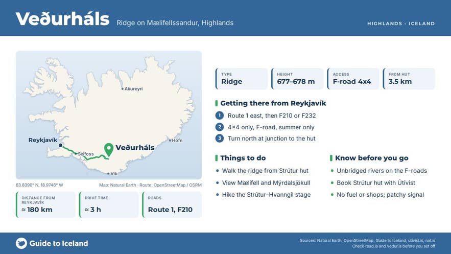
- Veðurháls is a low ridge (spot heights 677–678 m) immediately north-west of Mælifell on Mælifellssandur, about 3.5 km south of Strútur hut.
- It is crossed on the last Strútsstígur stage, Strútur hut to Hvanngil: about 18 km, around 7 hours, with Mýrdalsjökull in view.
- Vehicle access is by F210 or F232 to Strútur hut (about 180 km, 3 hours from Reykjavík); a proper 4x4 and river crossings are required.
- The F-roads usually open around the end of June or in July and close in autumn; check road.is.
- No facilities on the ridge; Strútur hut (Útivist, 26 beds) and Hvanngil hut (Ferðafélag Íslands) must be booked.
Why visit Vedurhals
The ridge sits between two very different landscapes. To the north lie the Hólmsá valley, Hólmsárlón lagoon and the rhyolite country around Torfajökull; to the south the black gravel plain of Mælifellssandur runs flat to the ice of Mýrdalsjökull, Iceland's fourth-largest ice cap.
Spot heights on the ridge in the national IS 50V map data are 677 and 678 m, while Mælifellssandur itself lies at roughly 600 m, so Vedurhals is a modest rise rather than a climb.
Its value is the view: from the top you look along the sands to Mælifell, the free-standing mountain that gave the plain its name, and across to the glacier edge.
The name tells you what to expect. Veður means weather and háls means a neck or ridge, and this is exposed, treeless ground where wind off the ice cap meets whatever comes in from the north. On a clear day it is one of the best vantage points on the whole Strútsstígur route.
The ridge is also part of a classic highland day.
Útivist, the Icelandic travel association that built the Strútur hut in 2002, describes the last stage of Strútsstígur as going "west over Veðurháls with Mýrdalsjökull on the left hand", then across Mælifellssandur past the Slysaalda sand ridge and over the Kaldaklofskvísl river to Hvanngil. That stage is about 18 km and takes around 7 hours.
How to get to Vedurhals
There is no road onto the ridge; you reach it on foot from Strútur hut or from the F-road network on Mælifellssandur.
- By vehicle: Strútur hut is reached from Fjallabaksleið syðri (F210) from the west, or Öldufellsleið (F232) from the east. At the junction at N63°48.023 W18°57.351 turn north onto the track to the hut. These are mountain roads with unbridged rivers, so a proper 4x4 with good ground clearance is required, and river crossings must be judged on the day.
- Driving distances (approximate): Reykjavík to Strútur hut about 180 km (around 3 hours), Vík to Strútur hut about 90 km. Hvanngil hut, at the western end of the Vedurhals stage, is about 170 km from Reykjavík.
- On foot: from Strútur hut the ridge is about 3.5 km to the south and is the first feature of the Strútur to Hvanngil stage. From Mælifell it is about 2 km to the north-west.
- Season: the F-roads across Mælifellssandur usually open around the end of June or in July and close again with the autumn snow; the exact dates change every year, so check the current status on road.is (umferdin.is) before you set out.
Best time to visit
July and August. Útivist has a warden at Strútur hut from early July to mid-August, the F-roads are open, and glacial rivers are generally lower in the morning than in the afternoon.
Early and late in the season Mælifellssandur can be partly under meltwater, and nat.is warns that travellers then have to be careful not to get bogged down in quagmires. Outside summer the whole area is closed to ordinary traffic and the ridge is snowbound.
Safety and practical tips
- Weather changes fast at 600–700 m with an ice cap next door. Carry windproof and waterproof layers, hat and gloves even in July.
- The Strútur to Hvanngil stage includes fording the branches of Kaldaklofskvísl. Cross early in the day, unbuckle your pack, and turn back if the water is above the knee and running hard.
- There is no marked path over much of the sands. Carry a map and GPS; Útivist publishes a hiking map of the Strútur area.
- Facilities: none on the ridge. Strútur hut sleeps 26 and must be booked through Útivist; Hvanngil hut belongs to Ferðafélag Íslands. There are no fuel stations in the area, so fill up on the Ring Road, and carry all your food.
- Mobile coverage is patchy. Leave a travel plan with safetravel.is.
- No fees apply to the ridge itself; hut nights and camping are paid to the operators.
How high is Vedurhals?
Can I drive to Vedurhals?
Do I have to cross rivers?
When is the area open?
Is this the same Veðurháls as the one near Veiðivötn?
Nearby attractions
- Maelifell – 2 km
- Strútur hut – 3.5 km
- Maelifellssandur – 4 km
- Hólmsárlón – 7 km
- Strútslaug – 8 km
- Hvanngil Hut – 12 km
Tours that visit Vedurhals
- Small-Group 7-Day Highlands Hiking Tour of the Eldgja and Strutur Trails with Reykjavik Transfers – Day 6 of this trek goes from Strútur hut along the Vedurhals ridge, across Mælifellssandur past Mælifell and Slysaalda, and into Hvanngil (about 18 km, 7 hours).
