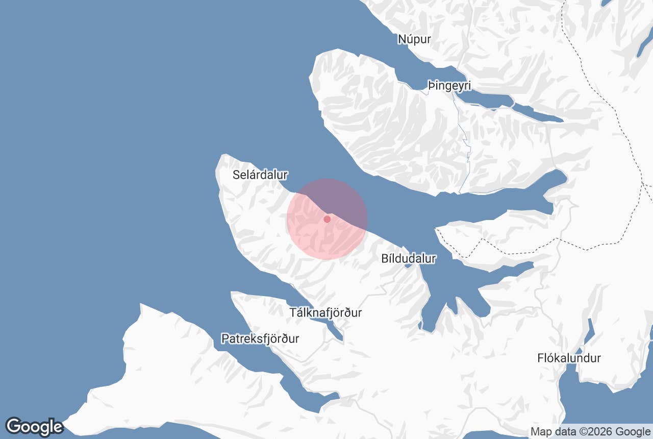
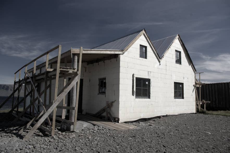
Selárdalur, westernmost of the Ketildalir. Photo: Anna Jonna Ármannsdóttir, CC BY-SA 3.0
Ketildalir ("Ketill's valleys") is a chain of short, steep-sided valleys on the south shore of Arnarfjörður in the southern Westfjords, stretching west from the village of Bíldudalur to the headland Kópanes at the mouth of the fjord. From east to west the valleys are Auðihrísdalur, Hvestudalur, Hringsdalur, Bakkadalur, Austmannsdalur, Fífustaðadalur and Selárdalur, with the uninhabited Verdalir beyond.
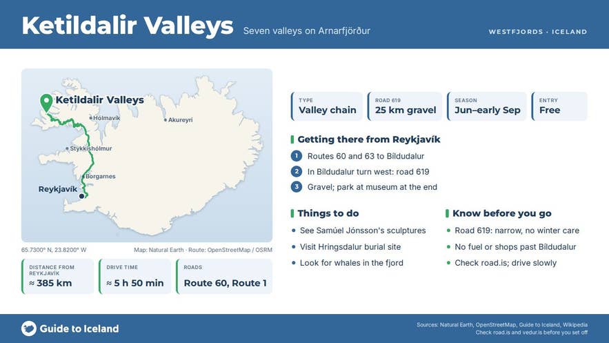
Gravel road 619 (Ketildalavegur) threads along the shore between them for about 25 kilometres and ends in Selárdalur at the sculpture farm of Samúel Jónsson. Landnámabók, the Book of Settlements, says the valleys take their name from the settler Ketill ilbreiður Þorbjarnarson, who claimed the land from Kópanes to Dufansdalur.
Key Takeaways About Ketildalir
- Seven short valleys along gravel road 619 on the south shore of Arnarfjörður, west of Bíldudalur
- About 25 km one way to Selárdalur; allow 45-60 minutes each way and 2-3 hours for the detour
- Samúel Jónsson's concrete sculptures and Alhambra lion fountain at Brautarholt, Selárdalur (museum open June to early September)
- Hringsdalur holds a 10th-century pagan burial ground excavated in 2006-2011
- Road 619 is narrow, steep in places and gets little or no winter service; drive slowly and check road.is
Why visit Ketildalir
The drive along road 619 through the Ketildalir valleys is itself the attraction. The mountains between the valleys rise to 500 to 600 metres straight out of the fjord, topped by cliff bands with long scree slopes running to the sea; the highest, Hringdalsnúpur, reaches 625 metres.
Across the water stands Kaldbakur mountain, at 998 metres the highest in the Westfjords. Between the headlands each valley opens as a green pocket with a stream, a beach and a scatter of old farm buildings.
The basalt layers in the mountainsides hold seams of lignite (surtarbrandur) and plant fossils from the Tertiary period, including beech, vine, redwood and elm, among the oldest evidence of Iceland's ancient vegetation.
Ketildalir was a populous district for centuries and formed its own municipality, Ketildalahreppur, until 1987. Today almost every farm is abandoned, which gives the valleys their quiet, slightly melancholy feel.
Selárdalur was a church site and parsonage for centuries; its wooden church was built in 1861, and the Selárdalur parish was merged into Bíldudalur's in 1907. The last farm in Selárdalur, Neðribær, was abandoned in 2010.
Two stories bring people here.
The first is Samúel Jónsson (1884 to 1969), "the artist with the child's heart", a farmer at Brautarholt in Selárdalur who, once he began drawing his old-age pension, spent his last years building concrete sculptures, a church, an art museum and a copy of the lion fountain from the Court of the Lions at the Alhambra in Spain.
A volunteer association founded in 1998 has restored the site, and it is open as an art museum from June to the start of September. The second is Hringsdalur, where a pagan burial ground was excavated between 2006 and 2011 after a human leg bone turned up on the headland Hreggnasi.
Archaeologists from the Institute of Archaeology found five graves from the 10th century, one of them a boat grave, with a sword, a knife, a shield boss and comb fragments.
Local tradition links the site to the settler Hringur, said to have fallen in a battle in the valley and to lie in the mound Hringshaugur, which was protected in 1930.
Arnarfjörður is also Iceland's sea-monster fjord, and some of the old sighting stories come from the Ketildalir shore; the Icelandic Sea Monster Museum in Bíldudalur tells them.
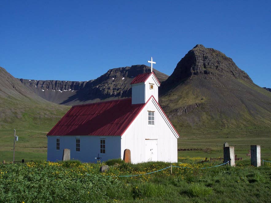
Selárdalur church, Ketildalir. Photo: Jóna Þórunn, CC BY-SA 3.0
How to get to Ketildalir
Bíldudalur is about 370 kilometres from Reykjavík, roughly five and a half hours' driving via Route 60 and Route 63, or via the Baldur car ferry from Stykkishólmur to Brjánslækur, which avoids much of the mountain driving but takes a similar total time.
From Patreksfjörður it is about 30 kilometres and 35 minutes over the mountain passes on Route 63; from Ísafjörður about 115 kilometres and two hours via Route 60 and the Dýrafjarðargöng tunnel.
In Bíldudalur turn west onto road 619. Beyond the village the road is gravel, narrow in places, with a rough surface, steep sections and drop-offs towards the sea, and it runs close to the shore.
A normal car can manage it in dry summer conditions if driven slowly, but a high-clearance vehicle is more comfortable, and the road gets little or no winter service. Allow 45 minutes to an hour one way to Selárdalur, and remember you drive the same road back.
There are small pull-offs at each valley; the main car park is at the Samúel Jónsson museum in Selárdalur, a few metres from the sculptures.
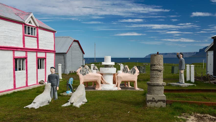
Samúel Jónsson's sculptures in Selárdalur. Photo: Rob Oo, CC BY 2.0
Best time to visit
June to early September. The Samúel Jónsson museum is open from 1 June to 1 September, the road is dry and the light on the fjord is at its best in the long evenings.
On a clear day the valleys are spectacular; in low cloud and rain they can feel bleak and the road becomes slippery. Whales are sometimes seen in the fjord in summer. From October to May the road can be impassable and services in Bíldudalur are limited.
Safety and practical tips
- Check road conditions on road.is before setting out; 619 is a minor road and is not maintained to Ring Road standards.
- Drive slowly, keep right on blind bends and use the pull-offs to let locals pass. Rockfall and loose scree are common beneath the cliffs.
- There are no shops, fuel or toilets beyond Bíldudalur; the museum in Selárdalur has basic facilities in season.
- The Hringsdalur burial site lies on a low headland by the shore and is a protected archaeological site. Look, but do not dig or disturb the ground.
- Mobile coverage is patchy in the outer valleys.
- Respect the abandoned farms; several are privately owned and used as summer houses.
Where exactly is Ketildalir?
Is road 619 suitable for a normal car?
How long does the detour take?
Can I visit Samúel Jónsson's sculptures year-round?
What is the connection to sea monsters?
Nearby attractions
- Hringsdalur – valley with the Viking-age burial site, in Ketildalir itself (about 4 km)
- Samúel Jónsson's Art Farm – the sculpture farm at the end of road 619, about 10 km
- Selárdalur – the westernmost inhabited valley, about 10 km
- Bíldudalur – the village where road 619 begins, about 11 km
- The Icelandic Sea Monster Museum – in Bíldudalur, about 11 km
- Arnarfjörður – the fjord the valleys open onto
- Kaldbakur – the Westfjords' highest mountain, seen across the fjord, about 13 km
Tours that visit Ketildalir
- Beautiful 9-Hour Westfjords Sightseeing and Culture Tour from Patreksfjordur – a jeep tour that drives through the Ketildalir valleys to Selárdalur.
- 4-Day Tour of the Westfjords with Transfer from Reykjavik Including Flights – the itinerary includes the drive through the Ketildalir valleys to Selárdalur.
