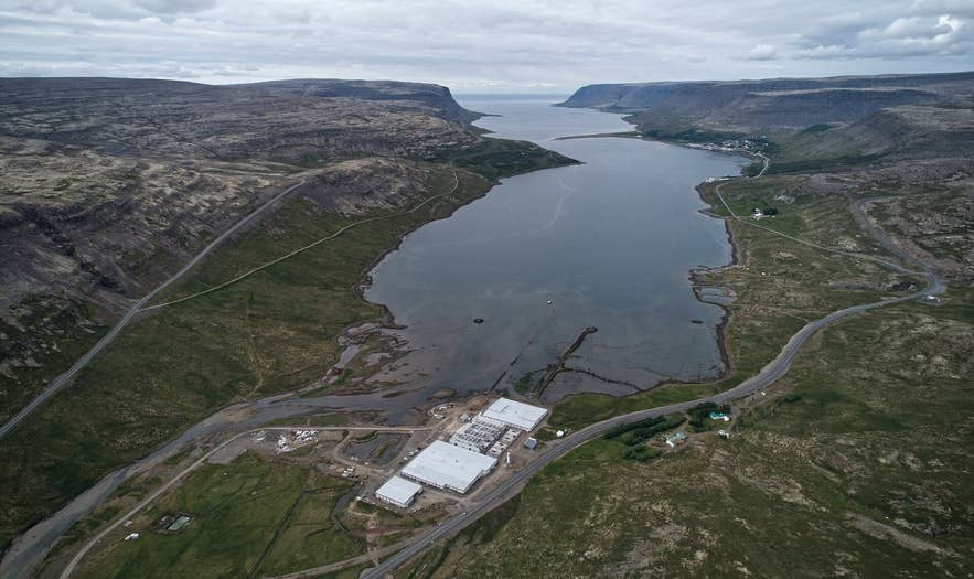
Tálknafjörður from the air. Photo: Eysteinn Guðni Guðnason, CC BY 4.0
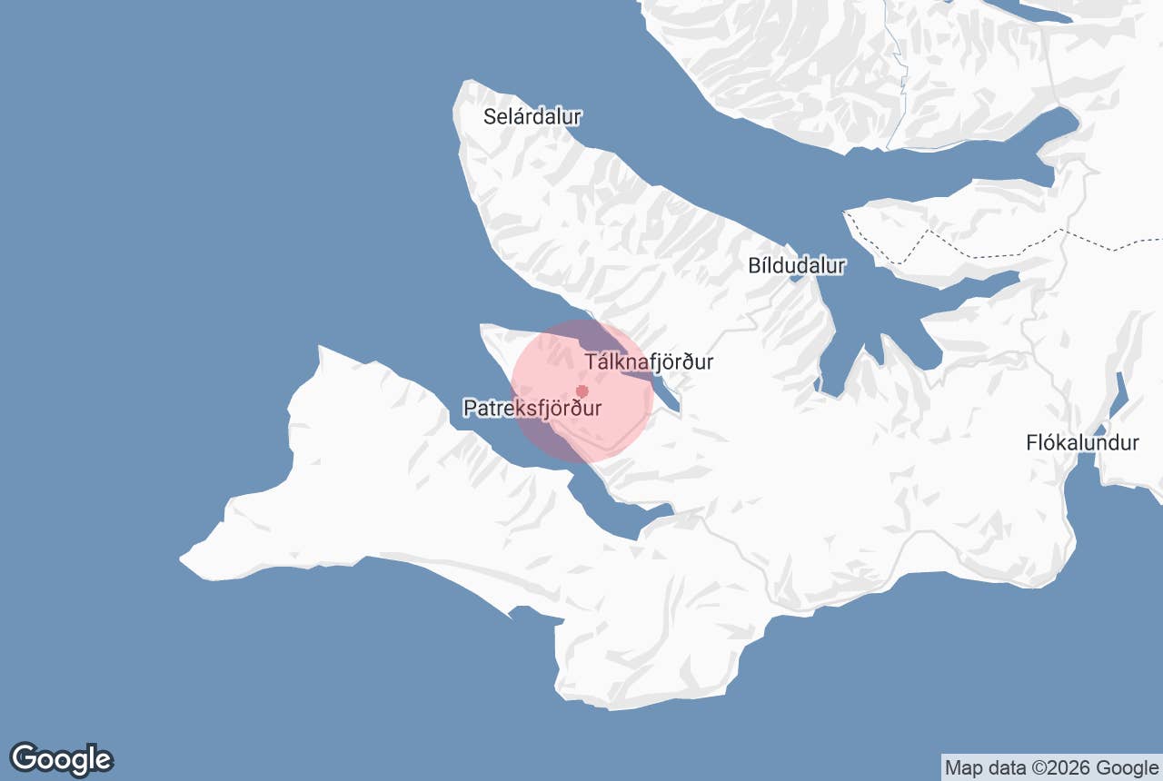
Lambeyrarháls is a 430-metre mountain pass in the southern Westfjords that carries an old walking route between the fishing town of Patreksfjörður and the farm Lambeyri on the south shore of Tálknafjörður.
The name means "Lambeyri ridge" (Lambeyri itself is "lamb sandbank" or "lamb spit", the low shore where the path comes down to the sea).
For centuries this was how people moved between the two fjords on foot; today it is a half-day hike along an old path that is still faintly visible in places.
Key Takeaways About Lambeyrarháls
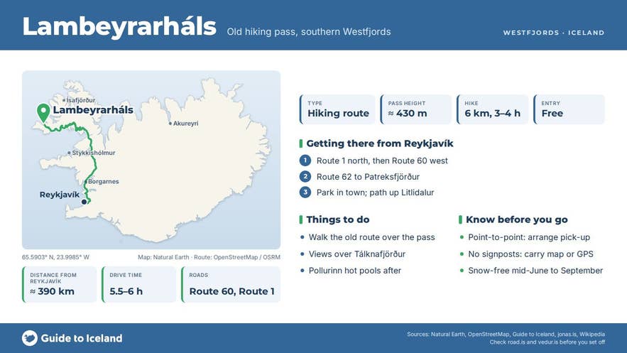
- Old walking route over a 430 m ridge from Patreksfjörður (via Litlidalur) to Lambeyri on the south shore of Tálknafjörður.
- About 6 km one way; allow 3-4 hours, or about 5 hours on the guided walk with transfers.
- Point-to-point: arrange a pick-up in Tálknafjörður or walk back over the pass.
- Season roughly mid-June to September; no signposts or waymarks, so carry a map or GPS track.
- No facilities on the route; shops, fuel and campsite in Patreksfjörður, pool and hot pools in Tálknafjörður.
Why visit Lambeyrarháls
In a few hours you walk out of one fjord, over a heath and down into the next, with the sea on both sides of the crossing. From the top, at about 430 metres, the view opens over the long, narrow Tálknafjörður and the flat-topped basalt mountains that wall in the southern Westfjords.
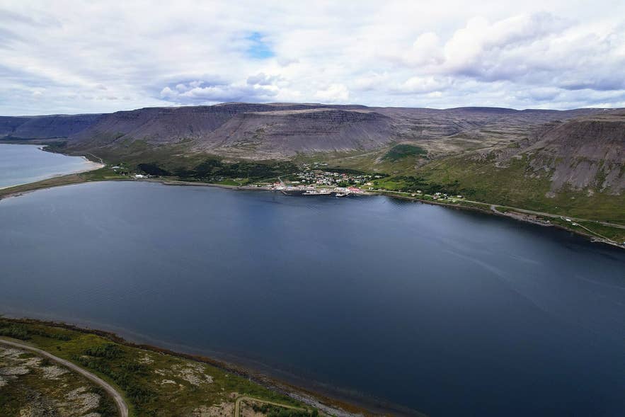
Tálknafjörður from near Lambeyri. Photo: Eysteinn Guðni Guðnason, CC BY 4.0
This is a genuine historic route, not a modern tourist path.
It is recorded in Jónas Kristjánsson's register of Icelandic þjóðleiðir (old national ways), based on the early Danish general-staff maps: from Patreksfjörður the path runs east-north-east up Litlidalur, passes north of the small lakes Kríuvötn, climbs onto Lambeyrarháls, then drops north-east down the heath, east of the rim of Smjörskál and Smælingjadalur, to Lambeyri.
The register notes that the old track can still be made out beyond the home field at Lambeyri.
The destination is worth the walk too. Lambeyri was once a ferry point: the crossing to Sveinseyri, where the village of Tálknafjörður now stands, is short.
Further out on the same shore lies Suðureyri, where, according to the tour operator, Norwegians ran a whaling station around 1900; Iceland's only licensed whaling station of the 1930s also operated in Tálknafjörður, from 1935 to 1939.
Tálknafjörður is also known for its birdlife, and the fjord's north shore has geothermal water, including the Pollurinn pools just outside the village.
How to get to Lambeyrarháls
Patreksfjörður is roughly 390 km from Reykjavík by road, about 5.5 to 6 hours via Route 60 and Route 62, or a shorter drive if you take the Baldur ferry from Stykkishólmur to Brjánslækur. The nearest airport is Bíldudalur, with scheduled flights from Reykjavík.
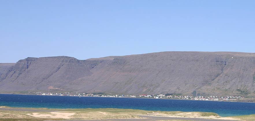
Patreksfjörður, start of the Lambeyrarháls hike. Photo: Brad Weber, CC BY-SA 3.0
The hike starts at the edge of Patreksfjörður town and ends at Lambeyri in Tálknafjörður.
The route is about 6 km one way, climbing from sea level to about 430 m, and most walkers should allow 3-4 hours including stops; the guided version allows about 5 hours with transfers.
Because it is point-to-point, you need either two cars (Lambeyri is reached on the gravel road along the south shore of Tálknafjörður), a pick-up arranged in Tálknafjörður, or to walk back over the pass. No 4x4 is needed to reach either end.
There is no formal car park at the trailhead; park considerately in town and ask locally for the start of the path up Litlidalur.
The pass is usually snow-free from about mid-June into September. Outside that window snow lingers on the heath and the old path can be hard to follow.
Best time to visit
Late June to early September is the reliable season: long daylight, snow-free ground and the most birdlife in Tálknafjörður. Mid-summer evenings are especially good, as the sun stays on the fjord late. In May and early October the walk may be possible but expect snow patches at the top and check conditions locally.
Safety and practical tips
- Weather in the Westfjords changes fast and the top of the pass is exposed. Bring windproof and waterproof layers even on a sunny morning in town, and turn back if cloud drops onto the heath.
- Footing is a mix of grassy valley floor, stony heath and some boggy ground after rain; sturdy boots are better than trail shoes.
- The path is an old route with no signposts or waymarks. Carry a map or GPS track and do not rely on mobile coverage over the pass.
- There are no facilities, toilets or water taps on the route. Fill up in Patreksfjörður, where there are shops, fuel, cafés and a campsite.
- Afterwards, the Tálknafjörður swimming pool has hot tubs, and the Pollurinn hot pools sit just outside the village.
- There is no fee and no opening hours; the land around Lambeyri is farmland, so keep to the path and close any gates.
How long is the hike over Lambeyrarháls?
Do I need a 4x4?
Is the trail marked?
Can I do it without a guide?
When is the pass open?
Nearby attractions
- Tálknafjörður - the fjord and village at the end of the hike, 5 km
- Pollurinn Hot Pool - geothermal pools on the hillside just outside Tálknafjörður village, 5 km
- Patreksfjörður - the start town, with services and a campsite, 6 km
- Örlygshöfn Beach - sandy bay on the south side of Patreksfjörður, 7 km
- Rauðisandur - the red-gold sand beach south of the fjord, 15 km in a straight line
- Látrabjarg - Europe's largest seabird cliff, 30 km
- Dynjandi - the Westfjords' best-known waterfall, 36 km
Tours that visit Lambeyrarháls
- Hiking Trip in the Westfjords with Transfer from Patreksfjordur - an easy-rated, roughly 5-hour guided walk over the old mountain route from Patreksfjörður via Lambeyrarháls to Tálknafjörður, continuing to the old whaling site at Suðureyri, with transport back.
