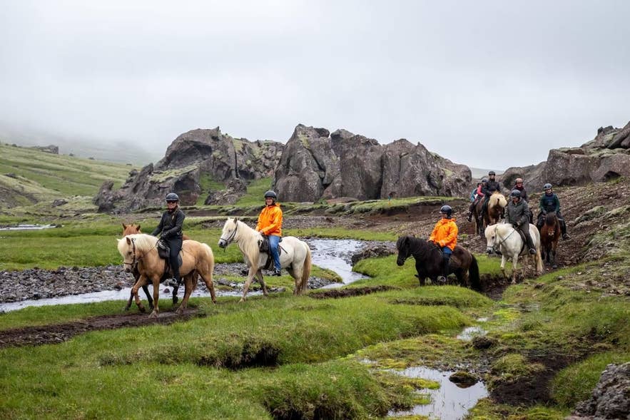
Horse riders near Marardalur
Marardalur is a small enclosed valley on the western side of Hengill, the volcanic massif between Reykjavík and Hveragerði in South Iceland. It is a sunken, oval-shaped depression beneath Skeggi (Vörðu-Skeggi, 803 m), the highest part of Hengill, walled in by cliffs on every side, with a flat grassy floor and a clear stream winding across it.
The only easy way in is a cleft in the south-western rim so narrow that people pass through in single file.
The name is usually read as "valley of the horses", from mar, an old word for horse, though a 2008 archaeological survey of the Hengill area notes that it may instead come from marflatur, "flat as the sea", a fair description of the valley floor.
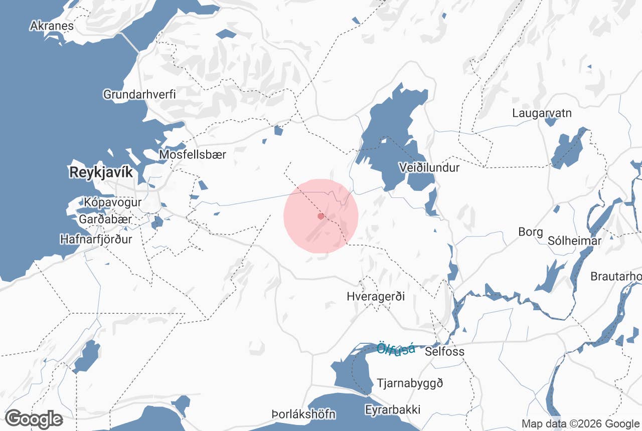
The trailhead is roughly 40 minutes' drive from Reykjavík, and Marardalur valley is one of the quieter corners of the Hengill hiking area and a favourite stop on horse-riding tours from Hveragerði.
Key Takeaways About Marardalur
- Enclosed graben valley beneath Skeggi on the western side of Hengill, 40 minutes from Reykjavík
- No road access: half-day hike from the Sleggjubeinsdalur or Kolviðarhóll car parks via Húsmúli and Engidalur, or a riding tour from Hveragerði
- Entered through a single-file cleft; former bull pen with the remains of a stone wall
- Best June to September; the approach is boggy and the stream must be crossed several times
- Free, no facilities; nearest services at the Hellisheiði geothermal exhibition and Hveragerði
Why visit Marardalur
The appeal of Marardalur valley is the sudden change of scene. You walk up a shallow gully beside a stream, through a gap in the rock, and the outside world disappears: dark cliffs on all sides, a level green floor close to a kilometre long, and the sky.
Streams from the mountain have filled the valley bottom with sediment over the centuries, which is why it is so flat and so green compared with the lava and scree around it.
Marardalur valley has been used for a long time. Farmers from Ölfus drove bulls and other non-milking cattle here for the summer and built a stone wall across the narrow entrance to keep them in; the remains of the wall can still be seen. These "nautaréttir" (bull pens) went out of use around 1860.
In the late 18th century reindeer were brought to Iceland from Finnmark and some were released on the Reykjanes peninsula; they lived wild in this area for more than a century, and the last one is said to have been killed in Marardalur valley.
In the 20th century, when Reykjavík residents began riding out to Kolviðarhóll for pleasure, the valley became a popular resting place on those trips, which kept the association with horses alive. At the inner end of the valley is a small cave that features in Icelandic outlaw tales.
Hengill itself is a hyaloclastite massif, 803 m at Vörðu-Skeggi, whose last eruption was about 2,000 years ago, before settlement; its heat now drives the Nesjavellir and Hellisheiði geothermal power stations. The enclosed shape of Marardalur valley is a graben, a block that dropped between faults, and the surrounding cliffs show the layered volcanic rock clearly.
How to get to Marardalur
Marardalur valley has no road access; it is reached on foot or on horseback.
The most common walking route starts at the mouth of Sleggjubeinsdalur, just past the Hellisheiði geothermal plant.
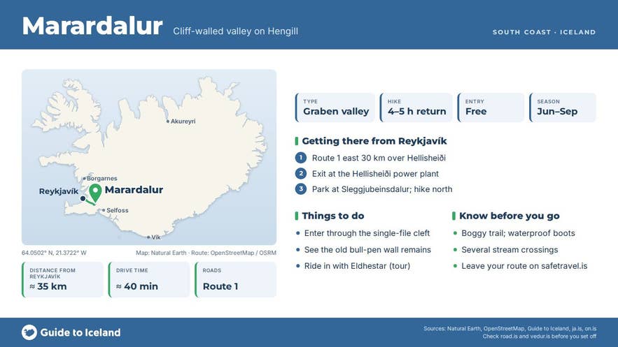
From Reykjavík take Route 1 (the Ring Road) east over Hellisheiði for about 30 km, turn off at the Hellisheiðarvirkjun exit and follow the signs past the plant to the car park at Sleggjubeinsdalur (there is also a car park at Kolviðarhóll, slightly further west).
From Hveragerði it is about 20 km back west on Route 1. The trailheads are at roughly 64.05 N, 21.37 W, about 5 km south of the valley.
From Sleggjubeinsdalur, follow the marked trail north over Húsmúli, the hill west of Hengill, and down into Engidalur, a grassy, marshy valley with a small stream, Engidalsá.
Follow the valley north and then the stream into a narrowing gorge; you will need to step across or wade the stream a few times before it opens into Marardalur valley.
Plan on a half-day round trip; a hiking group that combined Marardalur with Innstidalur and Engidalur recorded just under five hours of walking. A longer loop continues north out of the valley on an old path and returns via Þjófahlaup, the lowland west of Hengill.
Hiking maps and GPX files for the Hengill area are published by ON Power (on.is), which has maintained the roughly 130 km network of marked trails with Reykjavík Energy since 1991.
Best time to visit
June to September is the best period. The trail over Húsmúli and through Engidalur can be very wet in spring, and the stream through the entrance cleft runs high during snowmelt.
In winter and early spring snow lingers in the gullies and the stream crossings ice over; the valley is then a trip for experienced winter hikers only. Eldhestar's riding tours to Marardalur run from 1 June to 15 September.
Safety and practical tips
- Wear waterproof hiking boots; the entrance follows a stream bed and the Engidalur floor is boggy.
- The valley is sheltered but the approach over Húsmúli is exposed to wind and fog. Hengill weather changes quickly, so carry wind- and waterproof layers even on sunny days.
- Mobile coverage is patchy inside the valley. Tell someone your plan and leave your route on safetravel.is.
- There are no toilets, shelters or water taps on the trail. The nearest facilities are at the Hellisheiði geothermal exhibition and in Hveragerði.
- Stay on marked trails where they exist; the moss and wetland vegetation are slow to recover from trampling or horse traffic off the paths.
- Keep away from steaming ground and hot springs elsewhere in Hengill; the crust can be thin.
- There is no fee and no opening hours.
Why is Marardalur valley called the Valley of Horses?
How hard is the hike?
Can I ride a horse into the valley?
Do I need a 4x4?
Nearby attractions
- Hengill - the volcanic massif that encloses the valley, with hot springs and dozens of trails (the valley lies on its western flank).
- Nesjavellir - geothermal power station and viewing point above Þingvallavatn, about 4 km north-east.
- Dyrafjöll - the rocky ridge north of Hengill crossed by the old Dyravegur route, about 4 km away.
- Hellisheiðarvirkjun and The Geothermal Energy Exhibition - the power plant where the hike begins, about 7 km south.
- Reykjadalur Hot Spring River - the bathable warm river above Hveragerði, about 9 km south-east.
- Hveradalir geothermal area - steaming slopes beside Route 1 on Hellisheiði, about 9 km south.
- Hveragerdi - greenhouse town with hot springs and the base for Eldhestar riding tours, about 13 km away.
Tours that visit Marardalur
- Horse Riding Tour in the Valley of Horses with Optional Pickup from Reykjavik - a day tour for experienced riders from Eldhestar's farm at Vellir near Hveragerði, with 4 to 5 hours of riding (about 15 km) along Húsmúli and Hengill into Engidalur and on foot through the cleft into the flat, grassy floor of Marardalur, with a lunch box on the ride.
