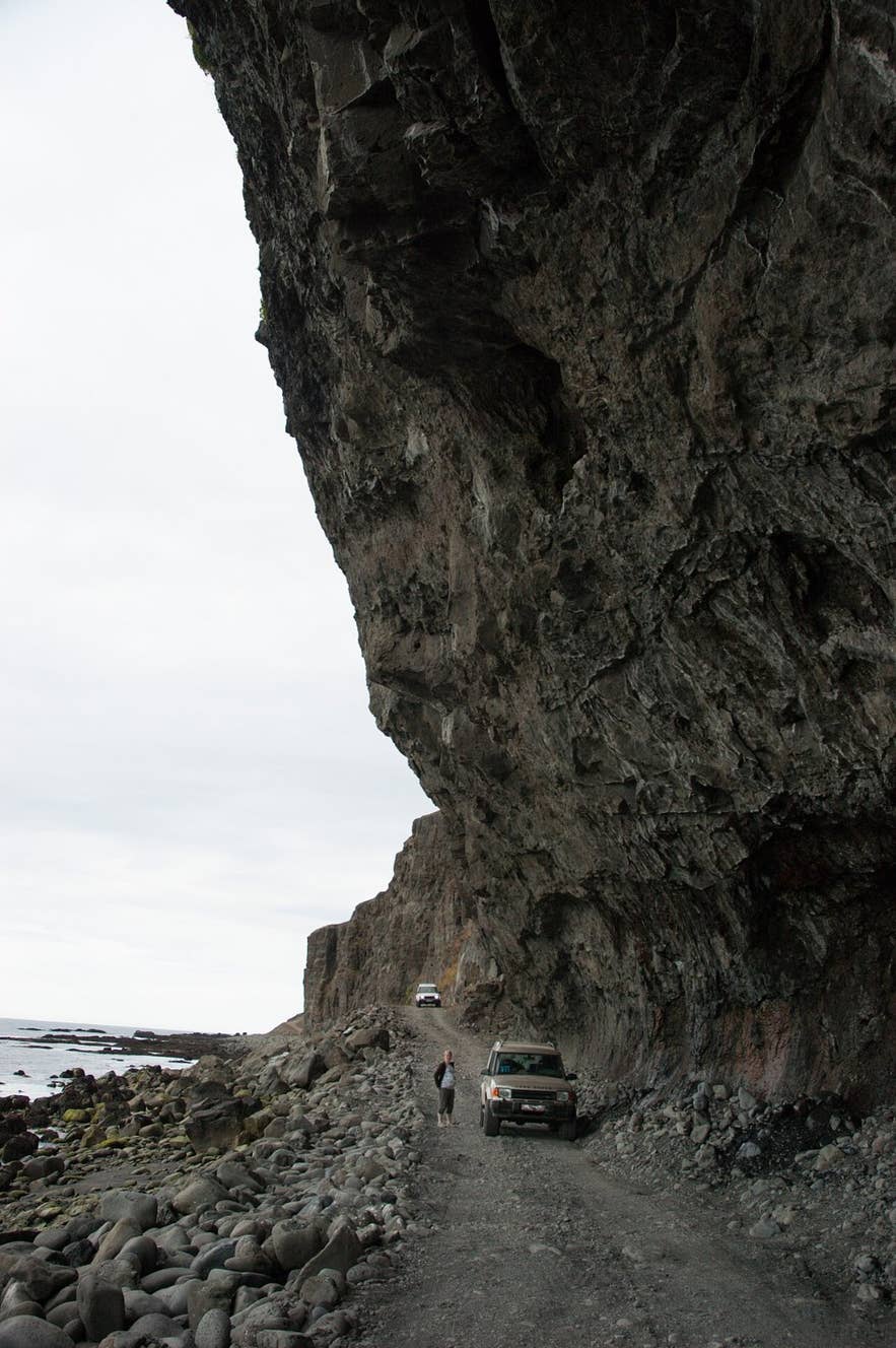
Boulder beach below Skútabjörg cliffs. Photo: Oliagust, CC BY-SA 4.0
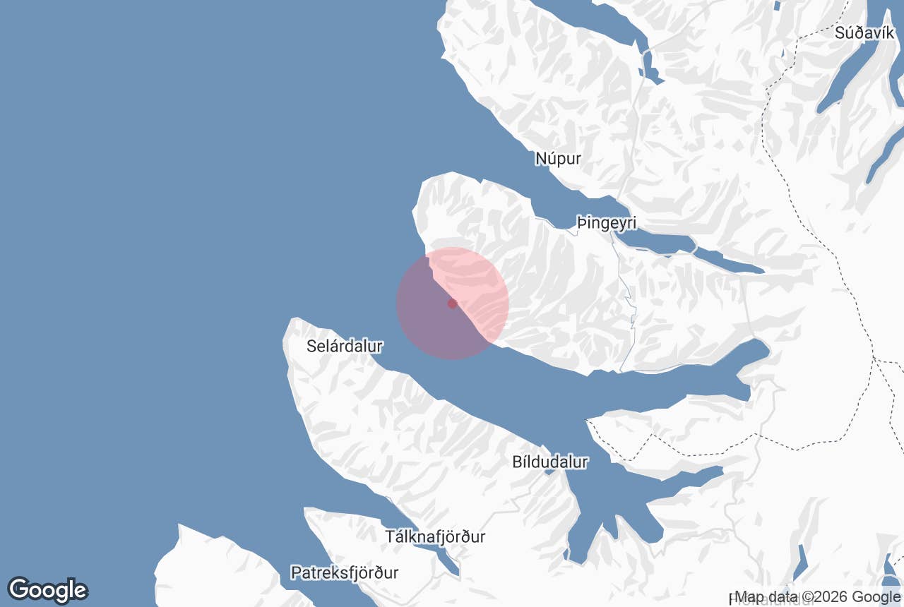
Skútabjörg cliffs (Icelandic: Skútabjörg, roughly "the overhang cliffs", from skúti, a rock shelter or overhang, and björg, cliffs) are a stretch of sea cliffs and stony beach on the north shore of Arnarfjörður in the Westfjords of Iceland.
They sit just west of the farm valley of Stapadalur, on the Arnarfjörður section of the one-lane jeep track known as Kjaransbraut or Svalvogavegur, the most difficult part of the route.
Here the track runs along the boulder beach at the foot of the cliffs, under overhanging rock, and at high tide the sea covers it completely. This is one of the most talked-about spots on a road sometimes described as one of the most dangerous in Iceland.
Key Takeaways About Skútabjörg
- Overhanging cliffs and boulder beach west of Stapadalur on the north shore of Arnarfjörður
- The Kjaransbraut / Svalvogavegur track runs along the shore here and is under water at high tide
- Named after Elís Kjaran Friðfinnsson, the local bulldozer operator who built and maintained the track; the road reached Lokinhamrar in 1974
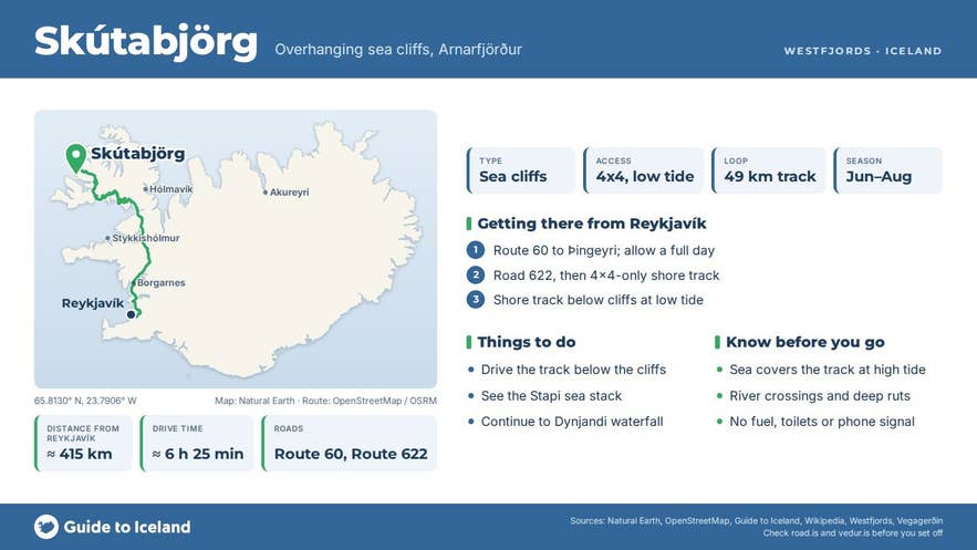
- High-clearance 4x4 only, summer only, low tide only; part of the 49 km Svalvogar loop from Þingeyri (not an F-road, but an unnumbered track beyond the end of road 622)
- No facilities, car park or phone signal; nearest services in Þingeyri
Why visit Skútabjörg cliffs
Skútabjörg is where Kjaransbraut stops being a road in any ordinary sense. On the Dýrafjörður side it is a narrow gravel road; on the Arnarfjörður side it crosses rivers, grows grass between the ruts and, at Skútabjörg, is simply a cleared line across the shore.
According to the Icelandic Wikipedia entry on Kjaransbraut, the beach section has to be rebuilt every spring and is often impassable again by late summer once the waves have done their work on it.
The road itself is the story. Elís Kjaran Friðfinnsson, a local bulldozer operator, built it with his own machine and kept it maintained for years, which is why it carries his name.
Before the road came from Dýrafjörður, the people of Lokinhamradalur had to time the tides to get round the headlands on either side of their valley to reach Stapadalur, the next farm along Arnarfjörður.
The road reached Lokinhamrar in 1974, and the shore stretch between Hrafnabjörg in Lokinhamradalur and Stapadalur, past Skútabjörg, closed the loop around the headland.
The setting matches the engineering. The mountains behind the cliffs are nicknamed the Westfjords Alps, and Kaldbakur, at 998 metres the highest in the Westfjords, stands a few kilometres inland. Just east of Skútabjörg the track passes Stapi, a free-standing sea stack on the shore below Stapadalur.
How to get to Skútabjörg cliffs
Skútabjörg is on the Svalvogar circuit, a 49-kilometre loop of track and gravel road between Dýrafjörður and Arnarfjörður that usually starts and ends in Þingeyri.
Road 622 (Svalvogavegur) is the numbered gravel road from Þingeyri out along Dýrafjörður to Keldudalur; beyond it, the track round the headland to Stapadalur, Kjaransbraut, is not part of the numbered road network and is not an F-road, although it needs a 4x4.
Þingeyri is reached from Reykjavík on the Westfjords road (route 60); allow a full day for the drive.
From Þingeyri the track follows the north side of the headland past Svalvogaviti lighthouse (built 1920), then turns into Lokinhamradalur and down to the Arnarfjörður shore, where Skútabjörg lies just before Stapadalur.
The alternative is to approach from the Arnarfjörður side: from route 60 near Dynjandi follow Hrafnseyrarvegur (road 626) along the north shore past Hrafnseyri and Auðkúla, then continue on the shore track to Stapadalur.
Visit Westfjords recommends driving the loop from Arnarfjörður towards Dýrafjörður if anyone in the car dislikes heights, because you then have the mountain rather than the drop on your side when passing.
Practicalities:
- A high-clearance 4x4 is essential. The Arnarfjörður section involves river crossings and deep ruts, and small cars are not suitable anywhere on the loop. Visit Westfjords describes the route as best enjoyed by mountain bike for those with the legs for it.
- The beach beneath Skútabjörg can only be driven at low tide. Check tide tables for the area before you set out and do not attempt the crossing on a rising tide.
- The route is open for a few summer months only; ask in Þingeyri about current conditions.
- There is no car park; vehicles simply stop on the track. Guided super-jeep tours from Patreksfjörður bring local knowledge of tides and road state.
Best time to visit
Roughly mid-June to August is the only realistic window. The beach section has to be rebuilt each spring and is often impassable again by late summer. Even in summer, pick a calm day with a daylight low tide and be prepared to turn back if the sea is up.
Safety and practical tips
- The main hazard is the tide. At high water the sea reaches the cliff and covers the road completely, so a vehicle caught below the cliffs has nowhere to go.
- Rockfall from the overhang is possible; do not linger directly beneath it.
- The track is single-lane with steep drops and no barriers; agree with oncoming traffic who reverses.
- There are no facilities of any kind on the loop: no fuel, shops, toilets or phone signal in many places. Fill up and stock up in Þingeyri.
- There is no fee or gate.
Can I visit Skútabjörg in a rental car?
How long does the Svalvogar loop take?
Is Skútabjörg the same as Svalvogar?
Why is the road called Kjaransbraut?
Nearby attractions
- Lokinhamradalur – 2.8 km. The farm valley the track crosses between Dýrafjörður and Arnarfjörður.
- Lokinhamrar – 3 km. Remote farm site on the Arnarfjörður shore.
- Kaldbakur – 6 km. The highest mountain in the Westfjords, 998 m.
- Svalvogar – 8.6 km. The headland at the tip of the peninsula.
- Phare de Svalvogar – 11 km. The 1920 lighthouse at Svalvogar.
- Hrafnseyri – 17 km. Birthplace of Jón Sigurðsson, with a museum, across Arnarfjörður.
- Dynjandi – 28 km. The great tiered waterfall at the head of the fjord.
Tours that visit Skútabjörg cliffs
- Crown Jewel Jeep Tour | Kjaran's Avenue & Dynjandi Waterfall – a nine-hour super-jeep day from Patreksfjörður that drives Kjaransbraut, stops on the stony beach at Skútabjörg, climbs Kaldbakur when the weather allows (or takes the Hrafnseyrarheiði pass instead), and finishes at Dynjandi waterfall.
