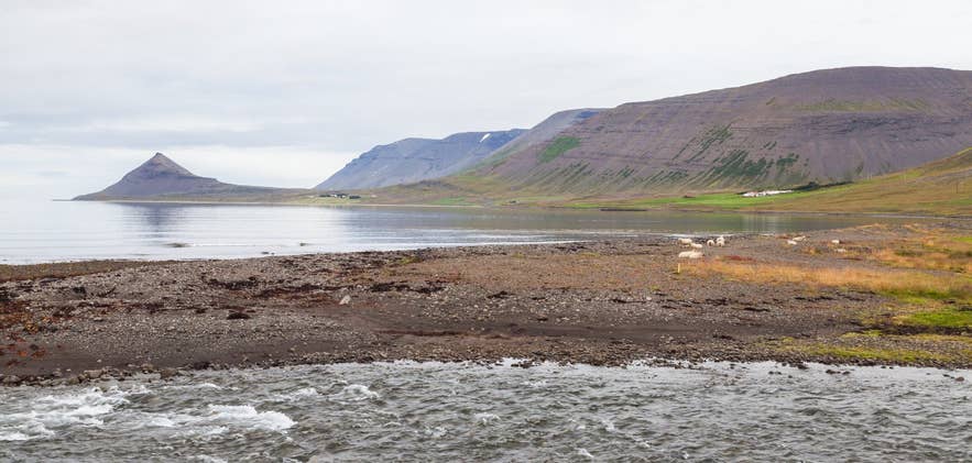
Shore of Dýrafjörður. Photo: Diego Delso, CC BY-SA 4.0
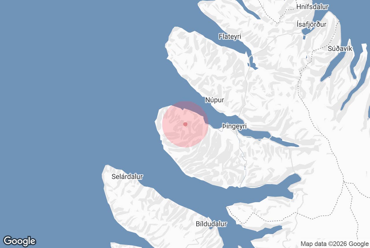
Keldudalur (Icelandic: Keldudalur, "valley of the springs" or "bog valley", from kelda, a spring or boggy pool) is an abandoned farming valley on the outer south shore of Dýrafjörður in the Westfjords, about 14–15 km west of the village of Þingeyri.
Cliff-walled mountains close Keldudalur valley in on three sides, small ponds and wet meadows fill its floor, and at the farm of Hraun stands a wooden church from 1885 that outlived the community it was built for.
The valley is the gateway to the Svalvogar circle, the rough coastal track around the peninsula between Dýrafjörður and Arnarfjörður, and a starting point for walks into the Westfjords Alps.
It is not the Keldudalur in Skagafjörður in North Iceland, where a Viking-age cemetery was excavated and where the Keldudalur farm cottages are.
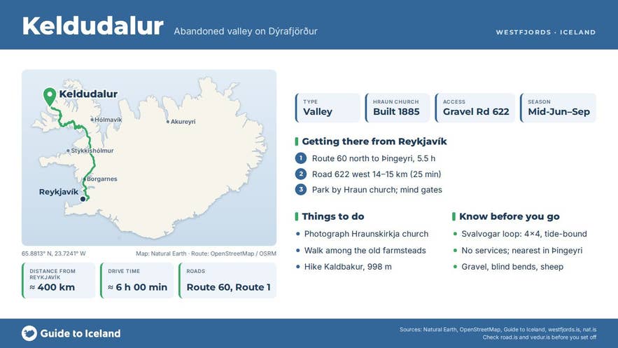
Key Takeaways About Keldudalur
- Abandoned farming valley on the outer south shore of Dýrafjörður, Westfjords; last farm left in 1987
- Hraunskirkja timber church of 1885, restored 1998–99, in the care of the National Museum
- 14–15 km / 25 min west of Þingeyri on gravel Road 622; normal car in summer as far as the valley
- Start of the 49 km Svalvogar circle — 4x4 only, tide-dependent, summer only
- Not the Keldudalur in Skagafjörður (Keldudalur Farm Cottages)
Why visit Keldudalur
Keldudalur has been settled since the earliest days of Iceland: Landnámabók names Eiríkur as the settler who took land here, one of four first settlers around Dýrafjörður, the fjord that figures so heavily in the saga of Gísli Súrsson. Farming continued for a thousand years and ended within living memory.
The parish church at Hraun was taken out of regular use in 1971 as the valley emptied, and the last farm was abandoned in 1987. Today the old homesteads stand weathered and silent against the slopes, which is exactly what draws photographers: grey timber and rusted iron, a white church, still water and the mountains behind.
The church, Hraunskirkja, was built and consecrated in 1885 by Aðalsteinn Pálsson, the farmer at Hraun, who gave it to the parish. It is a plain timber church of the oldest Icelandic wooden type, notable for its original roof shingles (soon covered with corrugated iron).
Demolition was being considered when the National Museum of Iceland stepped in; the parish restored it in 1998–99 and it was re-consecrated in 2000. Inside are a pulpit attributed to the painter-priest Hjalti Þorsteinsson (1692–1742) and two altar panels, one dated 1751.
The landscape around is as much the point as the buildings. Above the valley rises Strengbergshorn, whose cliffs are cut by near-vertical dykes of dark rock that locals call strengir, "strings".
Beyond the mouth of the valley the land runs out to Hafnarnes, where the Svalvogar lighthouse was built in 1920, and to Sléttanes, the outermost point between the two fjords. Kaldbakur, at 998 m the highest mountain in the Westfjords, stands on the ridge to the south.
Its two-metre summit cairn holds a visitor book and the view takes in the whole Westfjords Alps.
How to get to Keldudalur
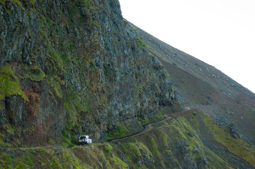
Svalvogavegur cliff road beyond Keldudalur. Photo: Oliagust, CC BY-SA 4.0
From Þingeyri, follow Road 622 (Svalvogavegur) west along the south shore of Dýrafjörður past Haukadalur. On the Dýrafjörður side it is an ordinary single-lane gravel road, and it reaches the farms in Keldudalur about 14–15 km (25 minutes) from the village. You can drive to Hraun and park by the church; please leave gates as you find them.
Þingeyri is about 385 km from Reykjavík by Route 60 and the Dýrafjörður tunnel (roughly 5.5 hours), and 49 km (about 50 minutes) from Ísafjörður over Gemlufallsheiði. Þingeyri has a shop, a campsite, a swimming pool and a golf course nearby, and it is the last place for supplies before the valley.
Beyond Keldudalur the track becomes the Svalvogar circle, a 49 km loop around the peninsula that continues past the lighthouse and along Kjaransbraut, a ledge bulldozed into the cliffs above Arnarfjörður by road-builder Elís Kjaran.
Visit Westfjords rates the loop unsuitable for small cars and recommends 4x4 or mountain bikes; a short stretch on the Arnarfjörður side runs along the shore under the Skútabjörg cliffs and floods at high tide, and it is repaired every spring and often cut by waves by late summer.
Drivers nervous about heights are advised to go in the opposite direction, from Arnarfjörður toward Dýrafjörður. The whole loop is a summer-only undertaking.
Best time to visit
Mid-June to early September. Snow can block the road into early summer, and the Svalvogar stretch is only passable once it has been reworked for the season.
Late June and July bring the midnight sun, which is when photographers favour the valley, with low golden light on the farmhouses and the ponds reflecting the cliffs. Autumn gives colour on the slopes but shorter, wetter days.
Safety and practical tips
- There are no services, toilets or shelter in Keldudalur. Bring food, water and warm layers even for a short walk.
- The old buildings are private property and some are unsafe; photograph them from outside.
- If continuing to Svalvogar, check the tide tables for Dýrafjörður and ask about conditions at the information office in Þingeyri or Ísafjörður; the shore section is impassable at high water.
- Hikers heading for Gjálpardalur or around the headland to Stapadalur should allow 7–9 hours for the latter and carry a map; the path is faint in places.
- The road is gravel with blind bends. Drive slowly and expect sheep.
- Mobile reception fades in the valley. Tell someone your plan and expected return time.
Can I drive to Keldudalur in a normal car?
Is the church open?
Does anyone live in Keldudalur?
Which Keldudalur is this?
Nearby attractions
- Svalvogar – lighthouse point at the end of the road, 6 km
- Lokinhamrar – abandoned farm on the Arnarfjörður side of the circle, 7 km
- Kaldbakur – highest peak in the Westfjords, 998 m, 7 km
- Sandafell Mountain – viewpoint above Þingeyri, 10 km
- Þingeyri – village with services and Viking festival ground, 10 km
- Dýrafjörður – the fjord itself, about 32 km long, 11 km
- Hrafnseyri – birthplace of Jón Sigurðsson, across the mountains, 19 km
- Dynjandi – the Westfjords' largest waterfall, 26 km
Tours that visit Keldudalur
- Guided 11 Day Midnight Sun Photography Workshop in Iceland's Westfjords – a package whose sixth day begins with an ascent of Kaldbakur, then photographs abandoned farmhouses on the way to Keldudalur valley with its glacial ponds and mountains, before returning to Þingeyri for the night.
