
Katla ist berühmt dafür, zwei der extremsten Naturkräfte Islands zu vereinen: Feuer und Eis. Viele Reisende besuchen Katla, um eine der beliebtesten Eishöhlen-Erlebnisse in Island zu genießen: die legendäre Katla-Eishöhlentour.
Darüber hinaus ist Katla ein faszinierender Ort, um mehr über einen der zerstörerischsten Vulkane Islands zu erfahren und Landschaften zu erkunden, die durch jahrhundertelange Ausbrüche unter dem Eis geformt wurden.
Warum du unseren Inhalten vertrauen kannst
Guide to Iceland ist die vertrauenswürdigste Reiseplattform Islands und hilft jedes Jahr Millionen von Besuchern. Alle unsere Inhalte werden von lokalen Experten verfasst und geprüft, die Island bestens kennen. Du kannst dich auf genaue, aktuelle und verlässliche Reisetipps verlassen.
Ganz gleich, ob du ein Auto in Island mietest, geführte Südküsten-Touren buchst oder einfach neugierig auf die vulkanischen Landschaften des Landes bist – ein Besuch am Katla bietet ein Erlebnis, das du sonst fast nirgendwo auf der Welt findest.
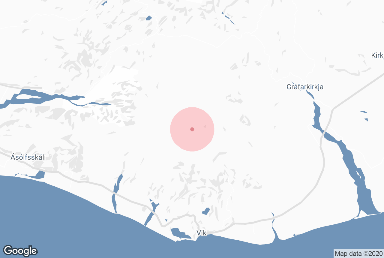
Katla-Vulkan auf einen Blick
-
Lage: An der Südküste unter dem Myrdalsjökull-Gletscher, nahe dem Ort Vik
-
Vulkantyp: Subglazialer Vulkan, bedeckt von einer mächtigen Eiskappe
-
Letzter großer Ausbruch: 1918
-
Ausbruchshäufigkeit: Historisch etwa alle 40 bis 80 Jahre
-
Höhe: Ungefähr 1.512 Meter
-
Kesselgröße: Rund 10 Kilometer Durchmesser
-
Bekannt für: Mächtige Ausbrüche, Gletscherfluten, schwarze Sandebenen und ganzjährige Eishöhlen-Touren
-
Bestes Erlebnis: Die berühmte Katla-Eishöhle auf einer geführten Superjeep-Tour erkunden
-
Beste Reisezeit: Ganzjährig zugänglich
-
Nächste Hauptstraße: Islands Ringstraße (Route 1)
-
Teil von: Katla-Geopark, ein UNESCO Global Geopark
Geschichte und Geologie des Katla-Vulkans
 Der Katla-Vulkan liegt nördlich des Küstenortes Vik an Islands Südküste. Der Vulkan befindet sich unter dem mächtigen Myrdalsjökull-Gletscher, dessen Eisschicht bis zu 700 Meter dick sein kann. Unter dieser gewaltigen Eiskappe verbirgt sich eine riesige Caldera mit einem Durchmesser von etwa 10 Kilometern.
Besonders faszinierend ist an Katla das Zusammenspiel von vulkanischer Aktivität und dem darüberliegenden Gletscher. Kleinere Ausbrüche bleiben manchmal unter dem Eis gefangen und dringen nicht bis an die Oberfläche vor.
Dennoch können auch diese Ausbrüche gefährlich sein. Die enorme Hitze unter Tage schmilzt große Mengen Gletschereis und löst plötzliche Flutwellen aus, sogenannte „Jökulhlaups“, die mit wenig Vorwarnung über die Südküste hinwegfegen.

Solheimasandur, eine riesige schwarze Sandebene, die über Jahrtausende von Vulkanausbrüchen und Schmelzwasser geformt wurde, ist einer der besten Orte, um die Folgen dieser Fluten zu sehen. Das Gebiet erstreckt sich bis zum Atlantik und beherbergt unter anderem das berühmte isländische DC3-Flugzeugwrack.
Die Ausbrüche des Vulkans Katla haben die Südküste Islands immer wieder neu geformt. Mächtige Gletscherfluten zerstörten dabei Bauernhöfe, ließen Siedlungen verschwinden und veränderten Flussläufe und Küstenlinien dauerhaft.
Besonders bedeutend war der Ausbruch von 1918: Er verursachte gewaltige Fluten und Lavaströme, sodass sich die Südküste Islands um mehrere Kilometer in den Atlantik ausdehnte.
Katla ist auch eng mit dem Eyjafjallajökull verbunden, jenem Vulkan, dessen Ausbruch im Jahr 2010 den europäischen Flugverkehr lahmlegte. Historisch betrachtet folgten auf Ausbrüche des Eyjafjallajökull oft wenige Jahre später Eruptionen des Katla.
Aufgrund dieses Musters wird Katla heute von Wissenschaftlern besonders aufmerksam auf Anzeichen erhöhter Aktivität überwacht.
Die Katla-Eishöhle
 Die Katla-Eishöhle zählt zu den außergewöhnlichsten Naturattraktionen Islands. Im Gegensatz zu vielen anderen Eishöhlen in Island, die nur im Winter entstehen, kann sie dank der stabilen Bedingungen durch Gletscher und Vulkanumgebung meist das ganze Jahr über besucht werden.
Was die Katla-Eishöhle besonders macht, ist ihr dramatisches Erscheinungsbild. Anstelle von nur leuchtend blauem Eis sieht man hier oft auch markante schwarze Streifen und Schichten im Gletscher. Diese dunklen Bänder sind vulkanische Ascheablagerungen vergangener Katla-Ausbrüche – ein seltenes Zusammenspiel von Feuer und Eis im Inneren der Höhle.
Gerade im Sommer wird die Katla-Eishöhle bei Reisenden immer beliebter. Sommertouren und -pakete in Island bieten leichtere Straßenverhältnisse, längere Tage und milderes Wetter und trotzdem die Möglichkeit, eine echte Gletscherhöhle zu betreten.
So kannst du den Katla in Island am besten besuchen

Es gibt verschiedene Möglichkeiten, den Katla zu erleben – je nach Reisestil, Route und Abenteuerlust. Da das Gelände rund um den Vulkan abgelegen und schwer zugänglich ist, sind geführte Touren für die meisten Besucher die sicherste und bequemste Wahl.
Hier findest du die besten Wege, um Katla in Island zu besuchen.
Mit dem Auto von Reykjavik zum Katla
Katla liegt etwa 2,5 bis 3 Autostunden von Reykjavik entfernt, je nach Straßen- und Wetterlage. Die Route folgt der Ringstraße (Route 1) Richtung Osten zur Südküste. Unterwegs passierst du einige der schönsten Sehenswürdigkeiten entlang der Ringstraße, darunter die Wasserfälle Seljalandsfoss und Skogafoss.
Weiter entlang der Strecke siehst du die dramatische Küste am Reynisfjara Black Sand Beach und die Dyrholaey-Klippen.
Es gibt keine direkte Straße zum Vulkan selbst. Du fährst von Reykjavik nach Vik, dem Hauptausgangspunkt für Katla-Touren und Gletschererlebnisse.
Auf der Fahrt von Vik Richtung Katla siehst du mehrere Gletscherzungen neben weiten schwarzen Sandebenen – eine typische Landschaft an der isländischen Südküste. Im Sommer leuchten entlang der Strecke violette Lupinenfelder.
Ein Besuch am Katla ist meist Teil einer größeren Südküsten-Route und lässt sich gut mit anderen Sehenswürdigkeiten in der Region kombinieren.
Teilnahme an einer Katla-Eishöhlen-Tour ab Vik
Die beliebteste Möglichkeit, den Katla-Vulkan zu erkunden, ist eine geführte Katla-Eishöhlentour ab Vik. Diese Touren führen dich sicher ins Gletschergebiet oberhalb des Myrdalsjökull und in die berühmte Katla-Eishöhle.
Da das Gelände rau ist und sich ständig verändert, ist der Zugang nur mit erfahrenen lokalen Guides und speziell ausgerüsteten Superjeeps möglich.
Gerade für Mietwagenreisen durch Island ist diese Option ideal. Die meisten Katla-Touren sind als Treffpunkt-Touren organisiert: Du fährst einfach nach Vik oder zu einem nahegelegenen Treffpunkt, triffst deinen Guide und startest von dort aus.
Die Touren beinhalten in der Regel den Gletscher-Transfer, Sicherheitsausrüstung und die geführte Erkundung der Eishöhle – eine der zugänglichsten und am besten organisierten Möglichkeiten, Katla in Island zu erleben.
Gletscherwanderung auf dem Myrdalsjökull-Gletscher
 Eine weitere spannende Möglichkeit, die Region zu erleben, sind geführte Gletscherwanderungen in Island auf dem Myrdalsjokull-Gletscher. Eine Gletscherwanderung ab Vik führt dich über die mächtige Eiskappe oberhalb des Katla und bietet dir aus nächster Nähe Einblicke in tiefe Gletscherspalten, beeindruckende Eisformationen und vulkanische Ascheschichten im Gletscher.
Diese geführten Wanderungen beinhalten meist Sicherheitsausrüstung wie Steigeisen und Helme und sind auch für Anfänger geeignet, die Islands Gletscherlandschaften hautnah erleben möchten.
Superjeep-Tour an der Südküste ab Reykjavik
 Du kannst Katla auch im Rahmen einer Südküsten-Superjeep-Tour ab Reykjavik besuchen. Diese Ganztagestouren verbinden landschaftliche Stopps entlang der Ringstraße mit Offroad-Zugang zum Gletschergebiet – ideal, wenn du dich nicht selbst um Anreise und Organisation kümmern möchtest.
Beste Reisezeit für den Katla-Vulkan
 Die beste Reisezeit für den Katla-Vulkan hängt davon ab, welches Erlebnis du suchst – denn die Bedingungen sind das ganze Jahr über sehr unterschiedlich. Dank seiner Lage unter dem Myrdalsjökull-Gletscher kann Katla sowohl im Sommer als auch im Winter auf geführten Touren besucht werden.
Katla-Besuch im Sommer (Juni bis August)
 Der Sommer in Island ist eine beliebte Reisezeit für den Katla, besonders für Reisende, die die Südküste Islands auf einer Mietwagenreise im Sommer erkunden. Das Wetter ist dann meist milder, die Straßen sind leichter befahrbar und es bleibt fast rund um die Uhr hell.
Gerade in dieser Zeit nehmen viele Besucher an einer Katla-Eishöhlentour teil, genießen den leichteren Zugang und das angenehmere Wetter – und betreten dennoch eine echte Gletscherwelt.
Katla-Besuch im Winter (November bis März)
 Der Winter in Island bietet ein noch dramatischeres und stimmungsvolleres Erlebnis. Der Gletscher ist von Schnee bedeckt und die Eisformationen in der Höhle wirken oft noch intensiver und eindrucksvoller.
Das ist auch die beste Zeit für alle, die ein echtes arktisches Abenteuer suchen – mit verschneiten Landschaften rund um den Katla-Vulkan und einer höheren Chance, die Eishöhle in ihrer spektakulärsten Form zu erleben.
Katla-Besuch im Frühling und Herbst (April bis Mai, September bis Oktober)
 Frühling und Herbst sind ruhigere Monate. Das Wetter ist wechselhafter, aber geführte Gletscher- und Eishöhlentouren werden weiterhin angeboten. Diese Jahreszeiten sind ideal für alle, die ein ruhigeres Erlebnis an der Südküste suchen.
Insgesamt ist Katla ein Ganzjahresziel – die „beste“ Reisezeit hängt davon ab, ob du lieber bei leichteren Bedingungen im Sommer oder bei winterlicher Gletscherstimmung unterwegs bist.
Sicherheitstipps für einen Besuch am Katla

Ein Besuch am Katla-Vulkan ist ein unvergessliches Erlebnis, doch das Gelände aus Gletscher und Vulkan ist unberechenbar. Deshalb wird die Sicherheit in dieser Region – besonders bei geführten Touren auf dem Myrdalsjökull-Gletscher und in den Eishöhlen – sehr ernst genommen.
Wenn du einige grundlegende Sicherheitshinweise beachtest, kannst du die Landschaft in vollen Zügen genießen und bist während deines Besuchs gut geschützt.
-
Besuche den Katla-Vulkan immer mit einem lizenzierten Guide, besonders im Gletscher- und Eishöhlengebiet.
-
Unternimm keine eigenständigen Touren auf den Gletscher oder in die Eishöhlen – die Bedingungen können sich schnell ändern.
-
Trage wasserdichte Kleidung und feste Wanderschuhe mit gutem Profil (Steigeisen werden auf Touren meist gestellt).
-
Packe wichtige Ausrüstung für Touren wie Handschuhe, Thermounterwäsche und wetterfeste Oberbekleidung ein – auch für kurze Ausflüge.
-
Folge allen Anweisungen der Guides, besonders beim Gehen auf Eis oder in der Nähe von Gletscherspalten auf dem Myrdalsjökull-Gletscher.
-
Halte Abstand zu instabilen Eiskanten, Schmelzwasserläufen und steilen Gletscherhängen.
-
Respektiere alle Absperrungen und gesperrten Bereiche rund um Vulkan und Gletscher.
-
Sei auf plötzliche Wetterumschwünge vorbereitet – auch im Sommer, denn an der Südküste kann sich das Wetter rasch ändern.
-
Informiere dich vorab über Straßenverhältnisse und Wetterlage, besonders in den Wintermonaten.
Top-Sehenswürdigkeiten in der Nähe des Katla
 Rund um den Katla-Vulkan findest du an der Südküste einige der ikonischsten Naturwunder Islands. Die meisten dieser Stopps lassen sich leicht in deine Sommer- oder Winterroute zwischen Reykjavik und Vik einbauen – die Region zählt zu den lohnendsten in ganz Island.
-
Seljalandsfoss-Wasserfall – Einer der ersten großen Stopps nach Reykjavik. Ein einzigartiger Wasserfall, hinter dessen Wasservorhang du entlanggehen und einen 360°-Blick genießen kannst.
-
Skogafoss-Wasserfall – Ein mächtiger, 60 Meter hoher Wasserfall, bekannt für seinen breiten Wasservorhang und häufige Regenbögen bei Sonnenschein.
-
Solheimasandur – Eine dramatische schwarze Sandwüste, geformt durch Vulkanausbrüche und Gletscherfluten, berühmt für das DC-3-Flugzeugwrack. Die Gegend lässt sich auch auf einer geführten ATV-Tour zum Flugzeugwrack erkunden.
-
Solheimajökull-Gletscher – Eine beeindruckende Gletscherzunge des Myrdalsjökull. Einer der am leichtesten zugänglichen Gletscher Islands, auf dem du eine anfängerfreundliche Gletscherwanderung unternehmen kannst.
-
Dyrholaey-Halbinsel – Ein Küstenkliff mit spektakulärem Blick auf schwarze Strände, Felsnadeln und tosende Wellen.
-
Schwarzer Sandstrand Reynisfjara – Einer der berühmtesten Strände Islands, bekannt für Basaltsäulen, tosende Wellen und eine spektakuläre Kulisse.
Die besten Unterkünfte in der Nähe des Katla
 Wenn du den Katla-Vulkan erkunden möchtest, solltest du dich an Islands Südküste einquartieren – so hast du leichten Zugang zu Eishöhlentouren, Gletscherwanderungen und Naturausflügen. Direkt am Gletscher gibt es keine Unterkünfte, daher übernachten die meisten Reisenden in nahe gelegenen Hotels und Gästehäusern in Südisland.
-
Vik – Der beliebteste Ausgangspunkt für Katla-Besucher. Vik ist der nächstgelegene Ort zum Vulkan und das Zentrum für Touren, darunter die Katla-Eishöhlentour. Hier findest du eine gute Auswahl an Hotels, Gästehäusern und Restaurants – ideal und praktisch für deinen Aufenthalt.
-
Hvolsvöllur – Hvolsvöllur liegt weiter westlich und eignet sich gut für Reisende, die Richtung Reykjavik weiterfahren. Hier ist es ruhiger und du hast schnellen Zugang zu Wasserfällen und anderen Highlights der Südküste entlang der Ringstraße.
-
Hella – Ebenfalls ein praktischer Ausgangspunkt mit Unterkünften und Services an der Route 1. Ideal als Zwischenstopp zwischen Reykjavik und Vik, besonders für Mietwagenreisen in Island.
-
Reykjavik – Auch von Reykjavik aus kannst du an einer geführten Tagestour zum Katla teilnehmen. Diese Touren beinhalten meist den Transport, sodass du dich um nichts kümmern musst.
Insgesamt bleibt Vik die beste und praktischste Basis für einen Besuch des Katla-Vulkans in Island – besonders, wenn du Gletschertouren machen oder die Südküste entspannt erkunden möchtest.
Plane deine Reise zum Katla-Vulkan in Island
 Ein Besuch des Katla-Vulkans zählt zu den eindrucksvollsten Erlebnissen an Islands Südküste. Dieses Naturwunder ermöglicht dir einen seltenen Einblick in die dramatische „Feuer und Eis“-Landschaft der Insel.
Für ein besonders entspanntes Erlebnis wählen viele Reisende eines der zahlreichen Island-Reisepakete, die Highlights der Südküste und Gletscheraktivitäten beinhalten.
Alternativ kannst du auch eine der vielen Touren in Island buchen, die die Katla-Eishöhle und weitere Highlights der Region beinhalten. So kannst du dich voll und ganz auf das Erlebnis konzentrieren, während sich lokale Experten um Transport, Sicherheit und Zeitplanung kümmern – so wird dein Besuch am Katla-Vulkan noch einfacher und unvergesslicher!


