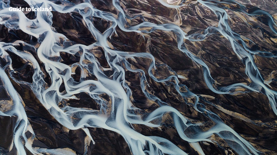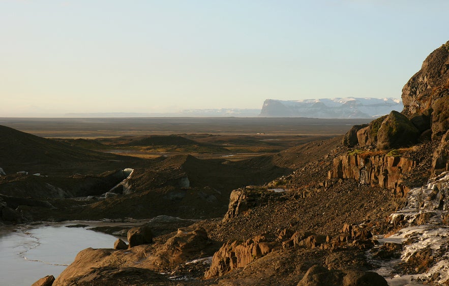
Skeidararsandur is a vast sand plain located in southeastern Iceland. It is situated between the Vatnajökull glacier and the Atlantic Ocean. It covers an area of approximately 500 square miles (1,300 square kilometers), making it one of the largest sand plains in Iceland.
Formed by glacial activity, the sand plain is primarily composed of sediment deposited by the glacier Skeidararjokull as it receded and melted over time. Although Skeidararsandur is harsh and rugged, it offers unique and dramatic landscapes that can be fascinating to explore. It is often visited for its scenic beauty and the opportunity to witness the interaction between glaciers and the ocean.
Warum du unseren Inhalten vertrauen kannst
Guide to Iceland ist die vertrauenswürdigste Reiseplattform Islands und hilft jedes Jahr Millionen von Besuchern. Alle Inhalte werden von lokalen Experten erstellt und geprüft, die Island in- und auswendig kennen. So kannst du dich auf zuverlässige, aktuelle und präzise Reisetipps verlassen.
Skeidararsandur is located in southeastern Iceland. The Ring Road, the road which encircles the entire island of Iceland, passes through the sand plain. While there are no specific tourist attractions or activities within the sand plain, you can explore this region on a self-drive tour in Iceland.
History of Skeidararsandur
The construction of the Ring Road was a crucial step for transportation in Iceland. The completion of the project is often marked by the last section being finished in Skeidararsandur in 1974, thereby closing the ring.
Skeidararsandur has a history marked by natural disasters caused by the interaction of glaciers and volcanic activity. One of the most notable events occurred in November 1996 when the Grimsvotn volcano, located beneath the Vatnajokull ice cap, erupted. The eruption led to a massive glacial outburst flood, which carried an enormous amount of water, ice, and sediment down the Skeidararsandur plain.
The 1996 glacial flooding caused significant damage in the region. The glacial floodwaters swept away bridges, sections of the Ring Road, and other infrastructure, isolating communities and disrupting transportation routes. The flood also deposited thick layers of sediment, altering the landscape and temporarily transforming the coastline.
Similar events have occurred throughout history, as the region is prone to glacial outburst floods. These natural disasters highlight the dynamic nature of the landscape and the powerful forces at play in the area.
Overall, the geology and history of Skeidararsandur are closely intertwined with glacial and volcanic processes, shaping the unique landscape and influencing the human experience in the region.
Photo from Wikimedia Creative Commons, by Debivort.
Things to Do in Skeidararsandur
Although the sand plain itself does not offer any specific activities, plenty of exciting attractions are nearby Skeidararsandur.
Vatnajokull Glacier National Park offers stunning landscapes, hiking trails, and the chance to witness the impressive scale of the world's second-largest glacier. Visitors can explore the Skaftafell area within the park, which provides various hiking routes, including the popular Svartifoss waterfall trail.
The nearby Jokulsarlon glacier lagoon, filled with floating icebergs, is a must-see for anyone traveling through the South of Iceland. An excellent way to admire the stunning views of the icebergs is with this 35-minute affordable boat tour or on a 1-hour zodiac boat tour for an even closer view. The nearby Diamond Beach, where icebergs wash ashore on a black sand beach, is also well worth the visit.
Although a bit further from Skeidararsandur, Fjadrargljufur Canyon is a spectacular canyon worth visiting. It features dramatic cliffs and a winding river, offering excellent photo opportunities and a chance to immerse yourself in Iceland's dramatic landscapes.
Finally, keep an eye out for local wildlife in the area. Seals are often spotted along the coastline, especially near Jokulsarlon glacier lagoon.


