Lakes in Iceland
- Veidivötn: The Volcanic Fishing Lakes
- Hraunsvatn: Where Poets are Born
- Saudlauksdalsvatn: White Sands and a Shipwreck
- Langisjor: Beauty and Love
- Ellidavatn: The Viking Governing Assembly
- Selvallavatn: The Lake in the Lava Field
- Kleifarvatn: The Draining Lake
- Arnarvatnsheidi: The Lakes of Outlaws
- Lagarfljót: The Monster Lake
- Laugarvatn: The Lake of Hot Springs
- Viti: The Lunar Crater Lake
- Kerid: The Volcanic Concert Hall
- Mývatn: The Lake of Natural Wonders
- Jokulsarlon: The Glacier Lagoon
- Thingvallavatn: The Lake Between Two Continents
Which lakes are the most beautiful in Iceland and where can you find them? Read on and discover all you need to know about the natural marvels that make up Iceland's water world.
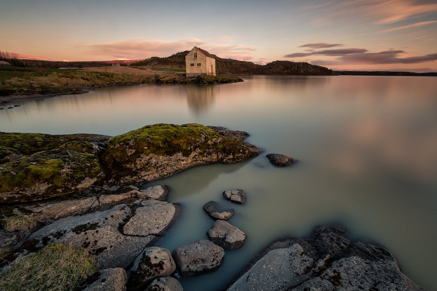
Iceland is dotted with hundreds of different lakes and lagoons that vary in size and geological composition.
Some were formed by glacial fluctuation, others by cataclysmic volcanic eruptions, and while many are ideal for fishing, others are perfect for bathing—each having a unique charm and offering a variety of opportunities for outdoor fun and adventure.
Icelandic lakes attract anglers and fishing enthusiasts from across the world, but it is not only the catch—the Atlantic salmon, the ice-age brown trout, or the Arctic char—that is alluring; being out in Iceland's untouched nature, surrounded by nothing but mountains and wildlife, is the perfect recipe for an unforgettable experience.
Following is our list of Iceland's most beautiful and interesting lakes.
Veidivötn: The Volcanic Fishing Lakes
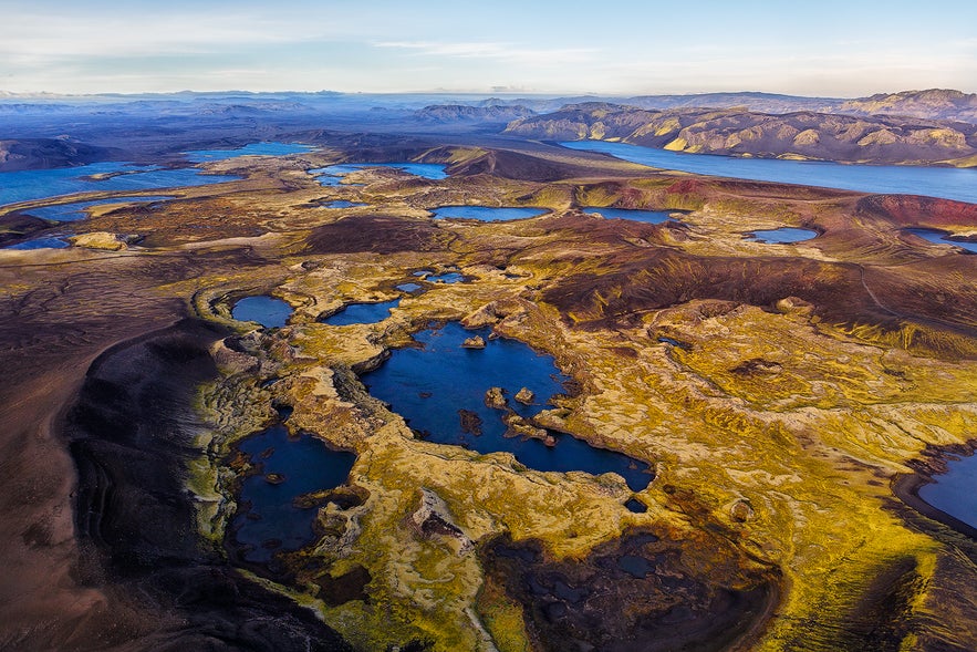
Starting off this list are the many lakes of Veiðivötn. Comprised of around fifty large and small lakes, the area of Veiðivötn is considered by many to be one of the most beautiful places in Iceland.
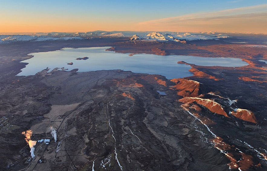
Located in the barren Icelandic highlands, these series of lakes are a short distance from the famed Landmannalaugar, a popular hiking and camping area. Many of the lakes are actually craters that were formed in the largest Icelandic eruption in recorded history.
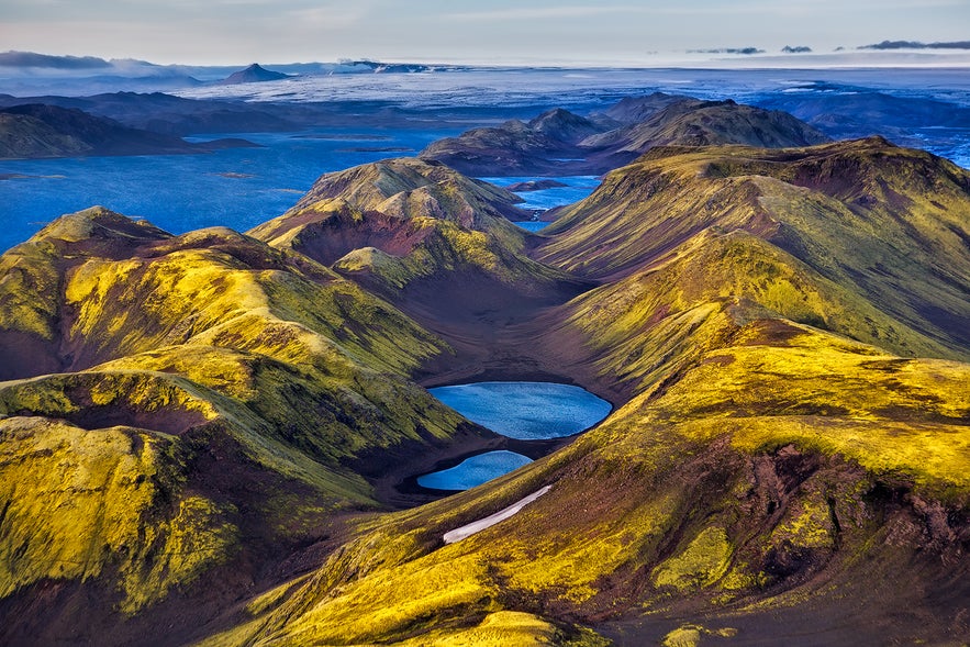
Today Veiðivötn is a popular fishing spot where you can try your luck at catching Arctic char or brown trout. But keep in mind that to protect the Icelandic environment, all fishing is regulated, so you’ll need a permit before you cast a line in the country’s lakes and rivers.
Hraunsvatn: Where Poets are Born
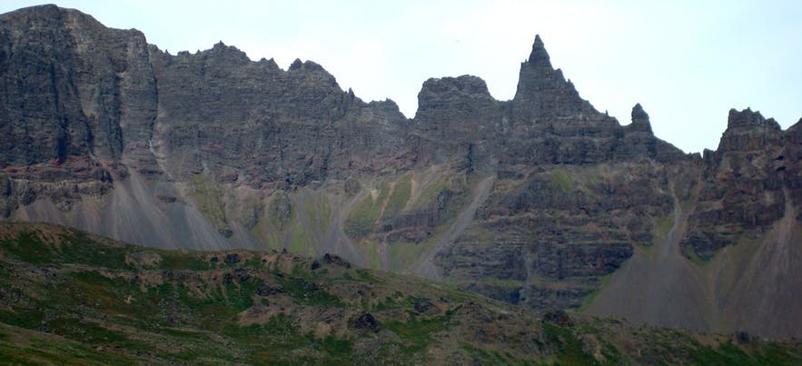
In the scenic Öxnadalur Valley is Lake Hraunsvatn. Along the valley’s northern side are jagged peaks, the remnants of the southeast face of Mt. Háafjall which sheared off in prehistoric times, creating a huge rockslide that formed the mountain lake.
According to legend, Hraunsvatn is filled with numerous mythical creatures, one of which is the Hrökkáll, an eel-like creature with scales as hard as iron and razor-sharp saw-toothed fins. The Hrökkáll lies in wait until someone steps into the river, then it slices their legs.
One of Iceland’s most beloved poets, Jónas Hallgrímsson (1807-1845), was born in Öxnadalur valley. After his father, a local curator, drowned in Hraunsvatn lake in 1816, Jónas was sent away to school where his interest in the natural sciences was sparked.
Jónas is considered to be one of the founding fathers of Icelandic Romanticism, his poetry reflecting his love of the country, and his imagery strongly influenced by the Icelandic landscape.
One of Jónas' most famous poems, the love poem Ferðalok ('Journey's End), talks about Hraundragi ('Steeple Rock'), Öxnadalur Valley's highest peak:
Journey's End
The star of love
over Steeple Rock
is cloaked in clouds of night.
It laughed, once, from heaven
on the lad grieving
deep in the dark valley.
— Translation from Dick Ringler
- Read more about Hraundrangi
Saudlauksdalsvatn: White Sands and a Shipwreck
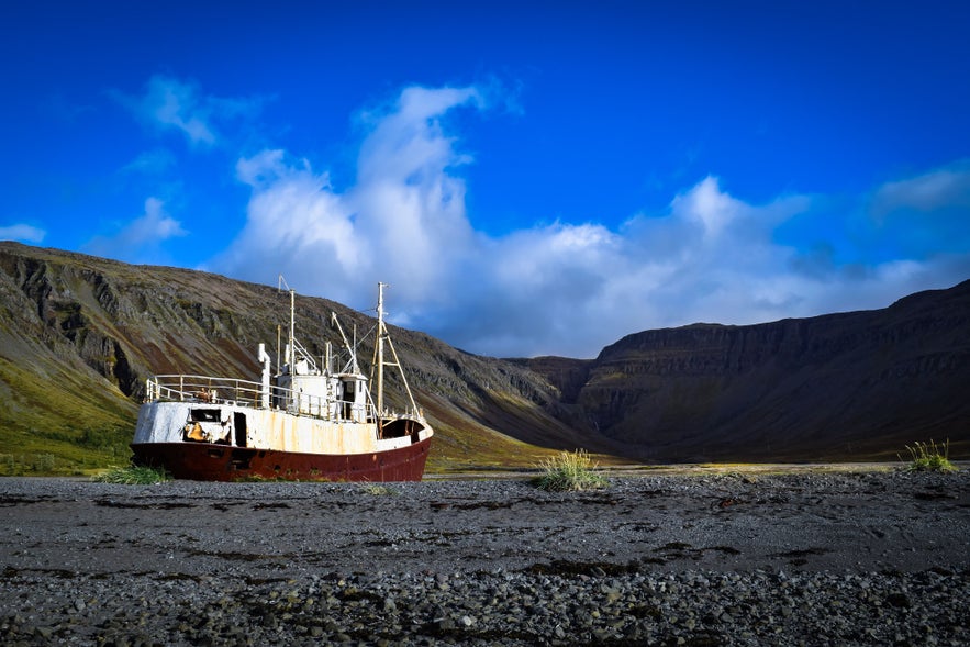 Photo from Wikimedia, Creative Commons, by Charlton. No edits made.
Lake Sauðlauksdalsvatn is located in the beautiful Westfjords, close to the town of Patreksfjörður. The lake differs from other Icelandic lakes as the sand surrounding it is not black, like the sands of Veiðivötn and Hraunsvatn, but white or yellow.
Try your luck fly fishing for trout at Sauðlauksdalsvatn. You can wade the yellow sand into the lake for a chance to catch both brown trout and sea trout. Arctic char can also be found there.
The Westfjords are one of Iceland's most beautiful but least visited places. Close to Lake Sauðlauksdalsvatn are numerous natural wonders such as Látrabjarg, Europe’s largest bird cliff, and Rauðisandur beach, known for its pale red, almost pink sand.
A short drive from the lake you’ll find Garðar BA 64, one of Iceland's oldest steel ships. The vessel was built over a hundred years ago in Norway, where it served as a whaler fit with a specially reinforced steel frame to sail the Antarctic Ocean.
When the ship came to Iceland, it was used for fishing herring and catching lobster before it was decommissioned. Now it sits on the shores of Skápadalur, rusting away and providing incredible photo opportunities for visitors.
Langisjor: Beauty and Love
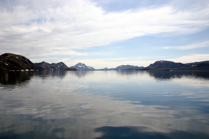
Iceland's Highlands make up one of Europe's last great wilderness expanses. They are composed of stark and barren areas which have never been inhabited or cultivated. Located in the highlands, by the roots of Vatnajökull glacier, lies a hidden treasure, known as Langisjór lake.
The lake is edged in by Tungnárfjöll mountains in the northeast and Fögrufjöll mountains in the south-east. Looming over is the scenic Sveinstindur peak.
Due to its isolation, the lake wasn’t discovered until the late 19th century.
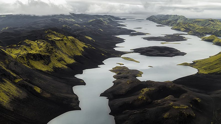 Photo by Ilya Grigorik
The area is extremely popular amongst mountaineers and backpackers who like to hike up Sveinstindur peak or Fögrufjöll mountains ('Beautiful Mountains’) for a great view of Langisjór lake, Vatnajökull glacier and the volcano Hekla.
There are numerous islands in the lake, and sometimes visitors bring rubber boats and sail around them. A popular trip is to sail around the island Ást ('Love') in Fagrifjörður (‘Beautiful Bay’).
Ellidavatn: The Viking Governing Assembly
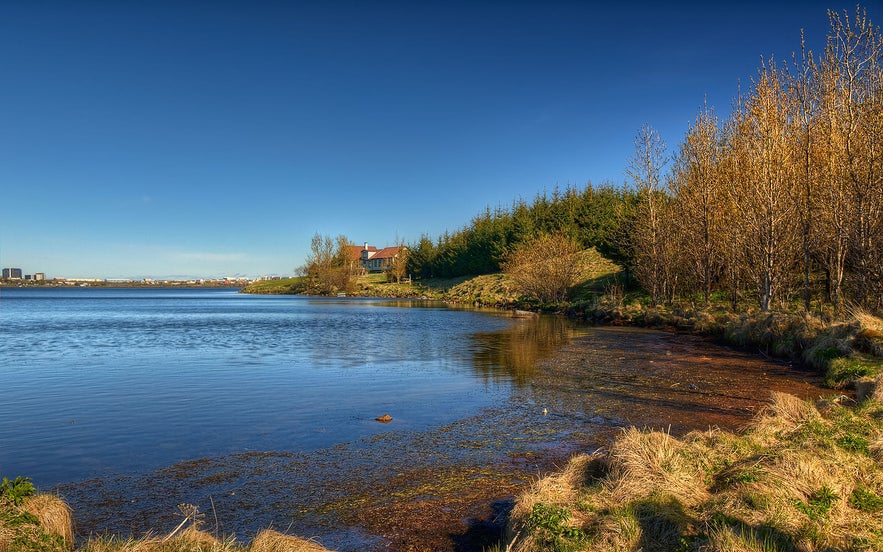 Photo by Axel Kristinsson, from Wiki Creative Commons. No edits made.
Langisjór might be isolated, but Lake Elliðavatn certainly is not. The lake is located on the outskirts of Iceland’s capital, Reykjavík, its outlets forming the rivers Elliðaár, which zig-zag through the city’s east side. The lake is very popular for fishing as it does not require long drives to get there.
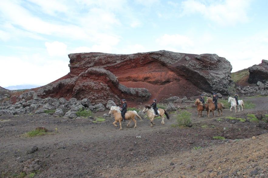
The eastern shores of the lake are a part of the Heiðmörk nature reserve, a favourite amongst locals. Heiðmörk's most notable features are Rauðhólar (‘Red Hills'), which are the remnants of a cluster of pseudocraters that were formed 5,000 years ago.
Another attraction is Þingnes promontory which reaches out into the lake. This now popular fishing and hiking spot is believed to have been home to a Viking governing assembly, known as Þing, around the year 900 AD.
Iceland’s parliament, Alþingi was founded in Þingvellir national park in the year 930. Before that, smaller assemblies, or Þings, were held across the country. There, people would gather, elect chieftains and settle disputes.
One of the first individuals to study the ruins of the Þing near Elliðavatn lake was the poet Jónas Hallgrímsson (Remember him?) who then gave the area its name.
Selvallavatn: The Lake in the Lava Field
The Snæfellsnes peninsula is famed for being like a miniature version of Iceland. It has everything: a glacier, a volcano, black sand beaches, white sand beaches, waterfalls and a lake in the middle of a lava field.
Like so many lakes in Iceland, Selvallavatn was created in a volcanic eruption. The lava field in which the lake lies is called Berserkjahraun and was formed around 4,000 years ago when four scoria craters erupted in short intervals. The lake itself was created when the lava flow of the crater Grákúla blocked the area's water outlets.
The name for Berserkjahraun lava field comes from one of the Viking Sagas called Eyrbyggja-Saga. According to the story, two berserkers from Sweden were hired to clear a path through the lava field (a feat considered impossible) and in exchange, one of them was promised a woman's hand in marriage. Upon finishing the task, the berserkers were swiftly killed and buried in the lava field.
The lake is quite scenic; it is bright blue with red mountains in the background, and eagles are known to nest in the surrounding lava field. A short walk from the lake is a delightful waterfall which drops over a multi-step cliff before it merges with Selvallavatn in the valley below.
Kleifarvatn: The Draining Lake
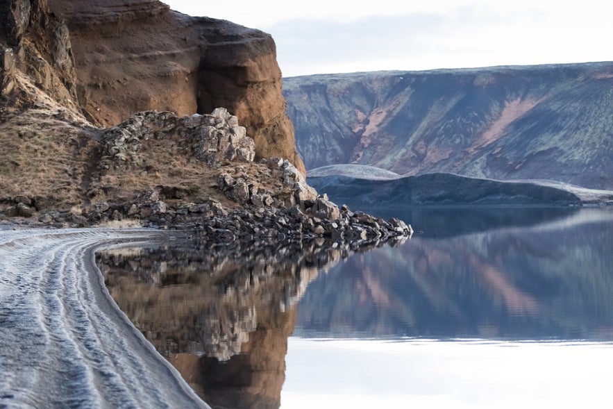 Photo by Einar Jónsson
To reach Reykjavík after landing at Keflavík airport, you will drive through the Reykjanes peninsula, past what seems to be an endless field of moss-covered lava. Nestled in between the peninsula's steep rocks and black sands is the geothermal lake of Kleifarvatn.
The lake is located near Seltún, a geothermal area on the Mid-Atlantic Ridge which separates the Eurasian and North American tectonic plates. These plates are drifting apart, creating tension that is relieved through measurable earthquakes in the area.
Kleifarvatn is about 8 km2 and 97 metres in-depth, making it one of Iceland’s deepest lakes. The water level solely depends on groundwater as there is no water flowing in or out of the lake.
In the year 2000 two earthquakes struck southern Iceland on June 17th and 21. During the tremor, a fissure opened on the bottom of Lake Kleifarvatn causing a 4-metre drop in water level.
The fissure has now filled up, and the lake is slowly returning to its former size. However, steam from hot springs, that were exposed during the earthquake can still sometimes be seen rising by the lake’s shores.
Kleifarvatn found fame through Nordic Crime Fiction, as it was the name of a murder mystery by Icelandic author Arnaldur Indriðason.
- Learn about Arnaldur Indriðason and Icelandic Literature
- Read more about Kleifarvatn and Seltún geothermal area
Arnarvatnsheidi: The Lakes of Outlaws
Like the mounds in the valley Vatnsdalur and the islands of Breiðafjörður Bay, the lakes at Arnarvatnsheiði Heath are considered innumerable.
Located in the northwestern part of Iceland’s highlands, the lakes of Arnarvatnsheiði Heath abound in lake char and brown trout. Some of the lakes are only accessible on foot or by 4WD vehicles, which only adds to their allure.
In the 10th century, outlaws and bandits would use Surtshellir, a nearby lava cave and its passages, as a hideout. As well as catching fish in the lake, the outlaws would travel to the town of Borgarnes to steal livestock from farmers and shepherds.
- See also: The Most Infamous Icelanders of History
Lagarfljót: The Monster Lake
Lagarfjót lake is situated in east Iceland, near the town of Egilsstaðir. It is the county's third-largest lake and one of the deepest. Perhaps the lake's enormity is the reason why nobody has ever managed to capture a good photo of its most famous resident, the cryptid serpent Lagarfljótsormurinn.
Similar to its cousin in Loch Ness, the Lagarfljótsormurinn worm is a mythical creature that is said to dwell on the bottom of the lake. This Icelandic monster is supposed to be longer than a bus, with some going so far as claiming it to be longer than a football field. It is reported to have many humps and has been seen coiled up on the river’s bank and slithering up trees.
Sightings have been logged since 1345 and have continued into the 21st century. In 2012 a video surfaced of this elusive creature which clearly shows it swimming in the murky waters. Book a hotel in East Iceland if you're planning to go serpent-spotting.
Monster or not, the lake and its surroundings are a favourite stop for those travelling the eastern fjords of Iceland. Close by is Hallormsstaðaskógur, Iceland’s largest forest, and the waterfall Hengifoss, one of the tallest cascades in the country.
Laugarvatn: The Lake of Hot Springs
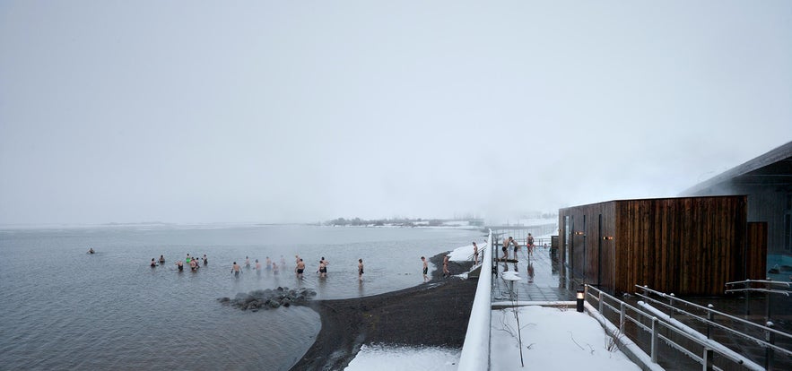 Photo from An Evening of Northern Lights at Laugarvatn Fontana
Laugarvatn is a lake and small charming town of the same name, located between Þingvellir National Park and the famous Gullfoss waterfall. Under the lake’s surface are geothermal springs which create warm patches along the lake's shores, making it a favourite swimming spot for locals and tourists alike.
A forest has been planted at Laugarvatn and brooks and streams further contribute to the pleasant scenery. The beautiful and shallow lake is rich with fish like Arctic char and trout, and it is a popular fishing spot as the char is said to like the warmer waters.
On the north shore of the lake, a geothermal spa has been built that utilises the earth's natural heat. Visitors can enjoy the hot healing steam that comes directly from the ground and take a relaxing dip in the naturally heated hot tubs.
To cool down, adventurous bathers can walk straight into the cold lake from a pier or on the warm black sand beach for a refreshing dip.
- Check out this tour of the Golden Circle and Fontana Geothermal Spa
Viti: The Lunar Crater Lake
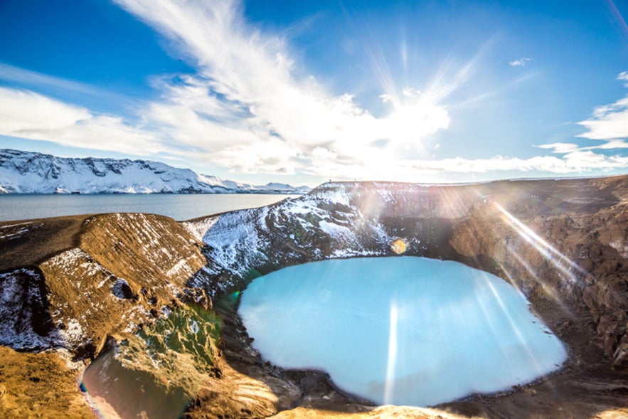 Photo from Askja Caldera & Holuhraun Lava Field | Super Jeep Day Tour
Buried deep in the isolated regions of Iceland's Dyngjufjöll mountain range, lies a collection of beautifully formed lake-calderas under the name of Askja.
The lakes formed gradually during multiple volcanic eruptions in which magma chambers collapsed, and filled with water.
Filling up most of the smaller calderas is lake Öskjuvatn, and although it is the country’s second deepest lake (with a depth of 220 metres), it does not make this list of the most interesting lakes in Iceland. What does make the list, however, is a geothermal lake on the shores of Öskjuvatn, called Víti, or ‘Hell’.
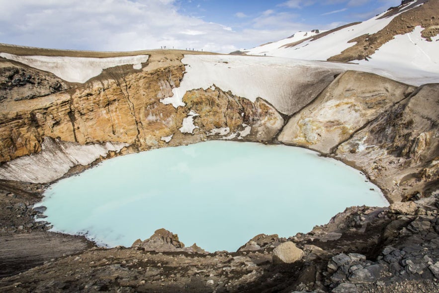 Photo from Askja Caldera & Holuhraun Lava Field | Super Jeep Day Tour
Víti is a caldera that contains a mineral-rich lake of warm, sulphurous, opaque blue water. The temperature of the water differs but it is generally around 22-30°C. Bathing is permitted in Víti, but getting there is quite a challenge and visitors should be aware of slippery pathways and hot mud along the way.
Due to its remote location and challenging roads, this surreal landscape can only be accessed using 4x4's in favourable weather conditions.
Askja's stark, barren wilderness makes for lunar landscapes, which is why groups of Apollo astronauts travelled to the Icelandic highlands to prepare for their moon mission in the 1960’s. You can learn more about the astronaut's visit to Iceland in the Exploration Museum in Húsavík.
- See also: The 30 Best Hot Springs in Iceland
Kerid: The Volcanic Concert Hall
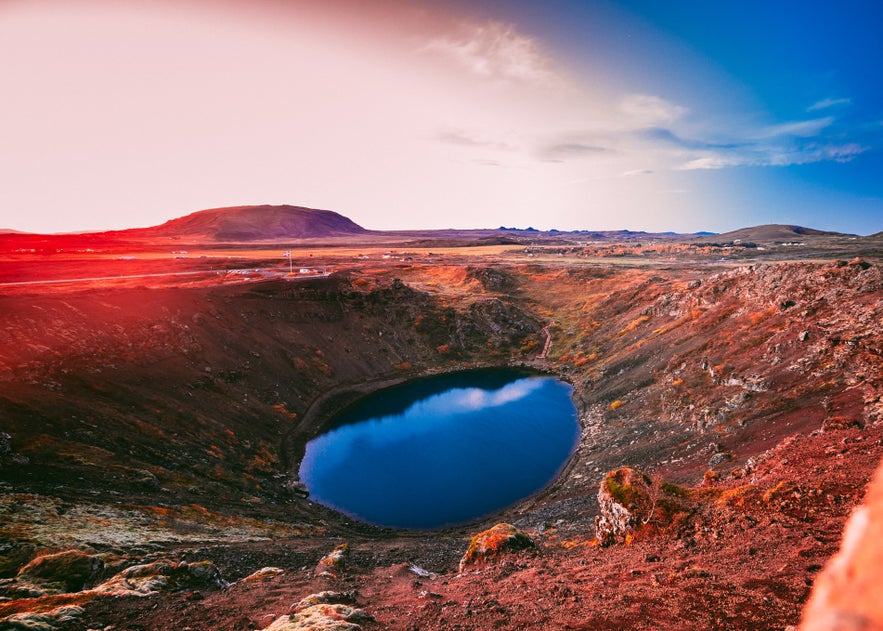 Photo by Vivek Kumar
Kerið is an equally mesmerising crater-lake you can visit without a 4x4 or the assistance of NASA. Those travelling the Golden Circle route should take a short detour to this beautiful lake which is located just off the ring road in southwest Iceland.
Around 6,000 years ago, a series of volcanic cones erupted and created the Grímshraun lava field. One of them completely emptied its magma chamber during the eruption, and once the magma was depleted, the cone collapsed. Later, the empty magma chamber filled with groundwater and became Kerið lake.
Kerið’s steep walls of dark red volcanic rock surrounding the aquamarine water give it a truly otherworldly appearance. The walls also create great acoustics and on a number of occasions, musicians have been taken onto the lake on boats, where they’ve performed for audiences.
- See also: How to Drive the Golden Circle
Mývatn: The Lake of Natural Wonders
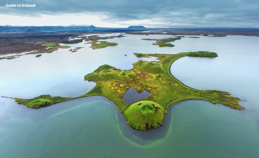
Located in an active volcanic area, Lake Mývatn in northern Iceland is considered to be one of Iceland’s most spectacular locations. You can stay there by booking accommodations at Myvatn.
The lake and its surroundings were formed in a massive volcanic eruption some 2,300 years ago. Evidence of this eruption can be seen in the enormous free-standing lava pillars and pseudocraters which dominate the lake’s landscape.
The lake and surrounding wetlands are exceptionally rich with bird species, especially ducks. Most of the ducks are migratory, arriving late in April or early May and visitors should be able to spot at least thirteen different species of ducks.
- See Also: The Ultimate Guide to Lake Myvatn
The area surrounding Lake Mývatn is nothing short of amazing. Close to the lake is Dimmuborgir, an area of dark and dramatic rock formations which, according to legend, were formed when Lucifer landed on earth after being banished from heaven.
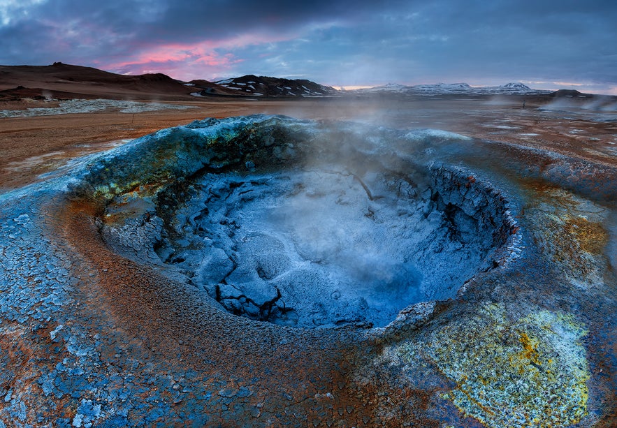
In the Mývatn area, you’ll also find Námafjall, a high-temperature geothermal area of bubbling mud pools and steaming fumaroles. You can also explore the active volcano Krafla, and tours to this caldera often include a visit to Dettifoss, Europe’s most powerful waterfall.
Those visiting Mývatn lake and its surrounding area would also be well advised to visit the Mývatn Nature Baths, the North’s answer to the Blue Lagoon.
- Learn about Movie Locations in Iceland here
Jokulsarlon: The Glacier Lagoon
In the realm of Europe’s largest glacier, Vatnajökull, lies the glacier lagoon Jökulsárlón. This lagoon has become one of Iceland’s most popular attractions, due to its immense beauty. You can stay in this beautiful part of Iceland by booking accommodation at the Jokulsarlon glacial lagoon.
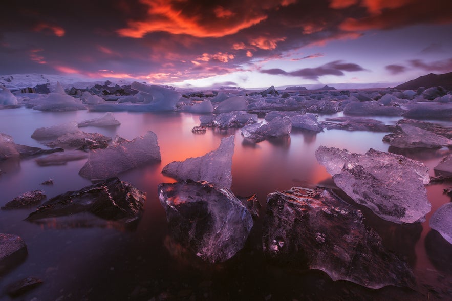
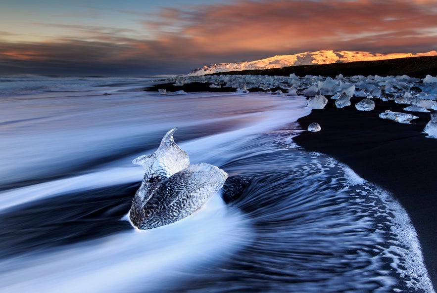
The lagoon is filled with enormous blue and white icebergs that have broken off the Breiðamerkurjökull glacier tongue. Close by is a black sand beach covered in translucent, compact ice that has washed up onshore. As the ice glistens in the sun, it is reminiscent of precious stones on black satin, which is why the beach is nicknamed ‘The Diamond Beach’.
Making your way to the lagoon from Reykjavík is an experience in itself, as you’ll travel along Iceland’s south coast, past the gorgeous waterfalls Seljalandsfoss and Skógafoss, the black sand beach of Reynisfjara, Mýrdalsjökull glacier and Eyjafjallajökull volcano.
In 1985, boat tours began operating on the lagoon. Now you can sail on the lagoon and get a dramatic view of the titanic icebergs on the icy water with the glacier tall and mighty in the background.
The lagoon is Iceland’s deepest lake, with a depth of 240 metres. It was formed from melted glacial water, and it is getting bigger each year as the glacier decreases, visibly demonstrating the effects of global warming.
Thingvallavatn: The Lake Between Two Continents
Last but certainly not least is the biggest natural lake in Iceland, Þingvallavatn. This lake has everything; it was formed by a unique natural occurrence, it has a historical connection, great fishing and amazing sights just a short drive away.
Surrounding the lake is the famed Þingvellir National Park, one part of the famous Golden Circle sightseeing route. On the lake’s northern shores is where Iceland’s parliament, Alþingi, was founded over a thousand years ago. It is also the site where Icelanders declared independence from Denmark in 1944.
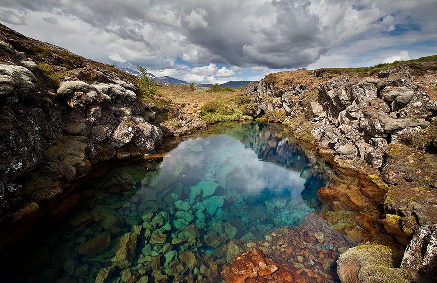
Both the park and the lake lie in a rift valley where two tectonic plates are drifting apart, tearing up the landscape around in the process. Throughout the region are cracks, faults and canyons: a direct result of this continental drift. One of those canyons, Silfra fissure, lies on the bottom of Þingvallavatn lake. You can stay near this beautiful lake by booking a hotel in the Golden Circle.
Silfra’s crystal clear water and its geological significance attract scuba divers and snorkellers from all over the world. There, they get the rare opportunity to swim between two continents in water with up to 100-meter visibility.
Þingvallavatn is also noted for fantastic fishing. Not only do fishers routinely get a good haul, but the brown trout caught there is among the biggest in Iceland. There are also four separate varieties of Arctic char found in the lake.
What are some of your favorite lakes in Iceland? Do you have any great stories about your fishing holiday in Iceland? Tell us in the comments.
Inne interesujące artykuły
Kompletny przewodnik po Islandii w marcu
Dowiedz się wszystkiego, co musisz wiedzieć o wizycie na Islandii w marcu. Przeczytaj o najlepszych aktywnościach dostępnych w tym czasie, takich jak jaskinie lodowcowe i oglądanie zorzy polarnej. U...Czytaj więcejZwiedzanie Islandii w maju | Co warto zobaczyć i zrobić
Jakie są najpopularniejsze miejsca do zobaczenia na Islandii? Co można wtedy robić na wyspie? Jaka jest średnia temperatura i czy goście mogą spodziewać się deszczu, śniegu lub słońca? Na ile godzin...Czytaj więcej
Kompletny przewodnik po erupcji wulkanu Fagradalsfjall w 2022 r.
Dowiedz się wszystkiego o erupcji wulkanu Fagradalsfjall na Islandii w 2022 roku! Jak silna była erupcja? Czy można już odwiedzić wulkan? Jak się tam dostać? Czy erupcja była niebezpieczna? Jak dług...Czytaj więcej

Pobierz największą platformę turystyczną na Islandii na telefon i zarządzaj wszystkimi elementami swojej podróży w jednym miejscu
Zeskanuj ten kod QR za pomocą aparatu w telefonie i naciśnij wyświetlony link, aby uzyskać dostęp do największej platformy turystycznej na Islandii. Wprowadź swój numer telefonu lub adres e-mail, aby otrzymać wiadomość SMS lub e-mail z linkiem do pobrania.

