
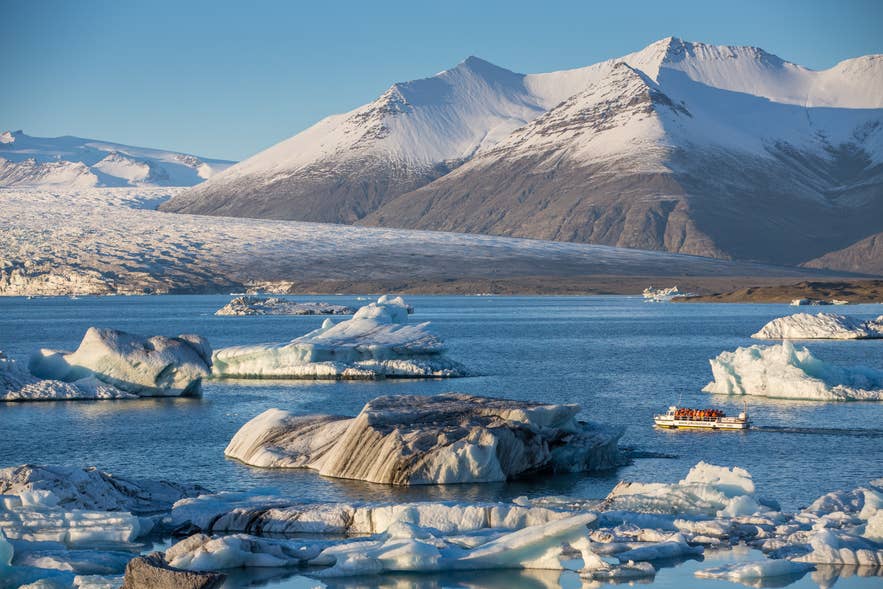
Breidamerkurjokull is a large outlet glacier flowing from the southeastern edge of the Vatnajokull Ice Cap. Its retreat formed Jokulsarlon Glacier Lagoon, where icebergs break away from the glacier and drift toward the Atlantic. Some fragments later wash ashore at nearby Diamond Beach.
These interconnected landscapes lie on Breidamerkursandur, a broad glacial outwash plain in Southeast Iceland. Together with Breidamerkurjokull, they are protected within Vatnajokull National Park, which manages conservation and visitor access.
Breidamerkurjokull is also part of Iceland’s wider record of glacial change. Our study of glacier melting rates in Iceland traces 135 years of change, placing the formation of the lagoon and surrounding landscape within the longer story of how glaciers shape Iceland.
Why You Can Trust Our Content
Guide to Iceland is the most trusted travel platform in Iceland, helping millions of visitors each year. All our content is written and reviewed by local experts who are deeply familiar with Iceland. You can count on us for accurate, up-to-date, and trustworthy travel advice.
For most travelers, Jokulsarlon Glacier Lagoon, across the road from Diamond Beach, provides the main gateway to this protected landscape and the easiest place to admire Breidamerkurjokull from a distance. Those wanting a closer look can join guided glacier hikes or seasonal ice cave tours.
Reaching this gateway requires a journey of about 236 miles (380 kilometers) from Reykjavik. You can drive there in rental cars or visit on South Coast tours that follow the Ring Road.
Keep reading to learn about the glacier’s history and retreat, how to get there, seasonal activities, nearby attractions, and essential safety advice.
Key Takeaways About Breidamerkurjokull
-
Location: Breidamerkurjokull is an outlet glacier on the southeast edge of the Vatnajokull Ice Cap.
-
Icebergs: Huge blocks of ice break away from Breidamerkurjokull and drift through Jokulsarlon, Iceland’s deepest lake, measured at more than 814 feet (248 meters).
-
Distance: Jokulsarlon, the main access point for views and tours connected to Breidamerkurjokull, is about 236 miles (380 kilometers) from Reykjavik, roughly five hours by car without extended stops.
-
Activities: Depending on the season, travelers can join guided glacier hikes and natural ice cave tours on Breidamerkurjokull or take boat tours among its icebergs on Jokulsarlon.
-
Nearby attractions: Diamond Beach is directly linked to the glacier through ice carried from Jokulsarlon, while Fjallsarlon Glacier Lagoon and Skaftafell are worthwhile stops nearby.
-
Safety: Visit Breidamerkurjokull only with the necessary glacier equipment and a qualified guide. Never step onto ice floating in Jokulsarlon.
The Changing Landscape of Breidamerkurjokull
The landscape around Breidamerkurjokull has changed as the glacier has retreated inland and Jokulsarlon Glacier Lagoon has expanded. According to NASA Earth Observatory, the glacier began retreating from the Atlantic coast during the 1920s, and the lagoon started forming around 1935 as water filled the space left by the ice.
Satellite observations show that this transformation is continuing. A Copernicus Sentinel-2 comparison published in 2025 shows the position of the glacier’s edge in 1990, 2016, and 2025, recording a retreat of approximately 3.7 miles (6 kilometers).
As Breidamerkurjokull has moved inland, Jokulsarlon has grown deeper and wider. NASA measured the lagoon at 814 feet (248 meters) deep, making it the deepest lake in Iceland. Its expanding waters and changing shoreline provide visible evidence of how the glacier continues to reshape the surrounding landscape.
How To Get to Breidamerkurjokull
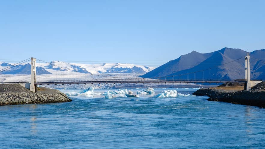
Breidamerkurjokull lies on the southeast edge of the Vatnajokull Ice Cap, within the municipality of Hornafjordur. It extends south toward Breidamerkursandur, west of Hofn and east of the Skaftafell area.
Most travelers access Breidamerkurjokull through Jokulsarlon Glacier Lagoon, about 236 miles (380 kilometers) from Reykjavik. The drive east along Route 1, the Ring Road, takes approximately five hours without long stops.
The route passes many of the South Coast's major attractions. Stops at waterfalls, black sand beaches, and viewpoints can turn the journey into a full day, so many travelers stay overnight along the South Coast instead of driving from Reykjavik and back in one day.
Rental cars provide the most flexibility, while multi-day self-drive tours can include the car, accommodation, and a planned itinerary. Travelers who prefer not to drive can join South Coast tours that include Jokulsarlon, although not every tour travels this far east.
On arrival, paid parking is available at Jokulsarlon, and one payment covers parking until midnight that day. A 50% discount applies if you paid the full parking fee at another fee-based area of Vatnajokull National Park earlier that day using the same payment method. Check current rates on the official Parka page.
Jokulsarlon serves as the departure point for several guided trips onto Breidamerkurjokull. Depending on the season, these include glacier hikes and tours of the glacier's natural ice cave.
Top Things To Do Near Breidamerkurjokull
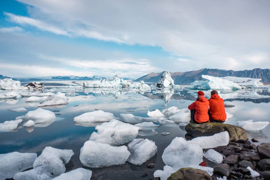
The best things to do near Breidamerkurjokull include guided hikes, ice cave tours, and boat trips. These experiences offer different perspectives on the glacier and the landscape shaped by its retreat. Availability and participation requirements vary by season, age, and fitness level.
See Icebergs at Fjallsarlon Glacier Lagoon
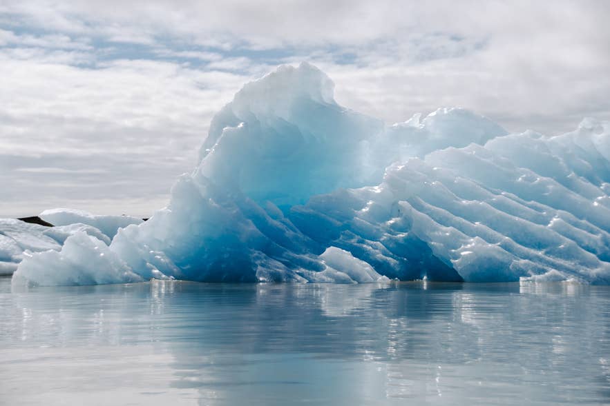
Fjallsarlon, about 6 miles (10 kilometers) west of Jokulsarlon, offers views of floating icebergs and Fjallsjokull descending toward the water. The lagoon is fed by Fjallsjokull, another outlet glacier of Vatnajokull.
You can take a 45-minute Fjallsarlon boat tour, available from June to November, which accepts children aged five and older. Travelers seeking a more active experience can choose a 1.5-hour guided Fjallsarlon kayaking tour, available from June to September.
The kayaking tour has a minimum age of 10 and requires moderate fitness. Participants must carry their equipment about 984 feet (300 meters) to and from the water, so the boat tour is the more accessible option for families and travelers who prefer a gentler experience.
Explore the Hiking Trails of Skaftafell
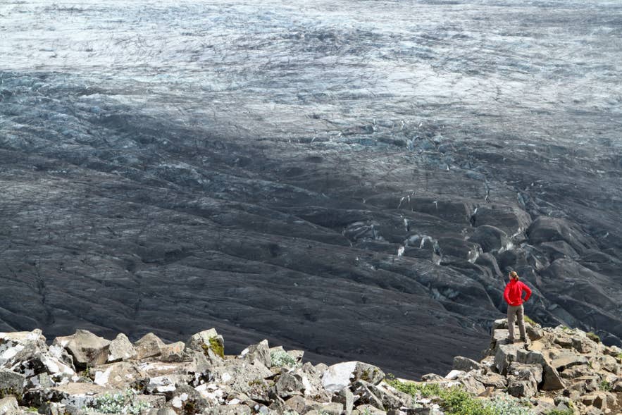
Skaftafell, west of Breidamerkurjokull, has several clearly marked trails beginning near its visitor center. The easy Skaftafellsjokull loop covers 2.5 miles (4.1 kilometers) and takes about 1 to 1.5 hours, while the 3.6-mile (5.8-kilometer) Svartifoss Waterfall, Sjonarsker Viewpoint, and Sel Farm Loop takes approximately two hours.
Skaftafell is also a departure point for guided glacier walks. For example, this five-hour glacier hike from Skaftafell operates year-round and is open to participants aged 14 and older. Tours starting here generally visit Falljokull or another nearby glacier rather than Breidamerkurjokull.
Hike Across Breidamerkurjokull
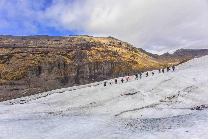
A guided glacier hike on Breidamerkurjokull lets you explore the glacier beyond the views available from Jokulsarlon. The excursion begins at the lagoon and uses a super jeep to cross the glacial landscape before participants continue on foot.
This 4.5-hour tour is available from June to September and includes about two hours on the glacier. It is rated moderately difficult and requires participants to cover approximately 2.5 to 3.5 miles (4 to 6 kilometers) on the ice. Glacier equipment is provided, but warm waterproof clothing and sturdy hiking boots are still required.
Explore a Natural Ice Cave in Breidamerkurjokull
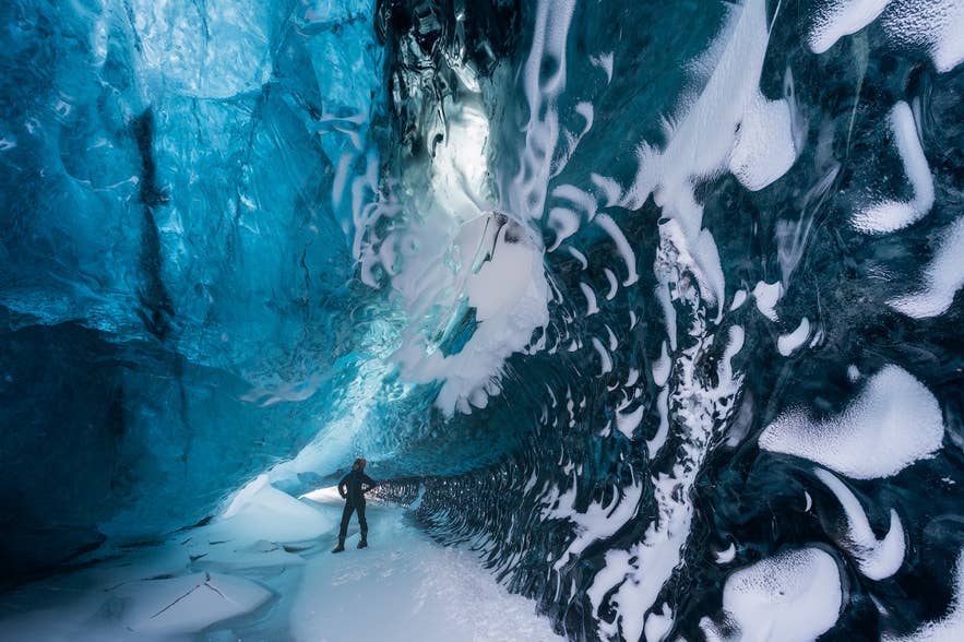
A guided ice cave tour lets you enter one of the natural caverns within Breidamerkurjokull. The caves form and change as meltwater passes through the glacier, so their location, shape, color, and accessibility differ each winter.
This ice cave tour from Jokulsarlon operates from October to April and travels to the glacier by super jeep. The experience lasts approximately 3.5 hours and is open to participants aged seven and older.
The walking distance can range from approximately 0.6 to 2.5 miles (1 to 4 kilometers), sometimes across glacier ice. The exact route and cave visited depend on current conditions.
See Glacial Ice at Diamond Beach
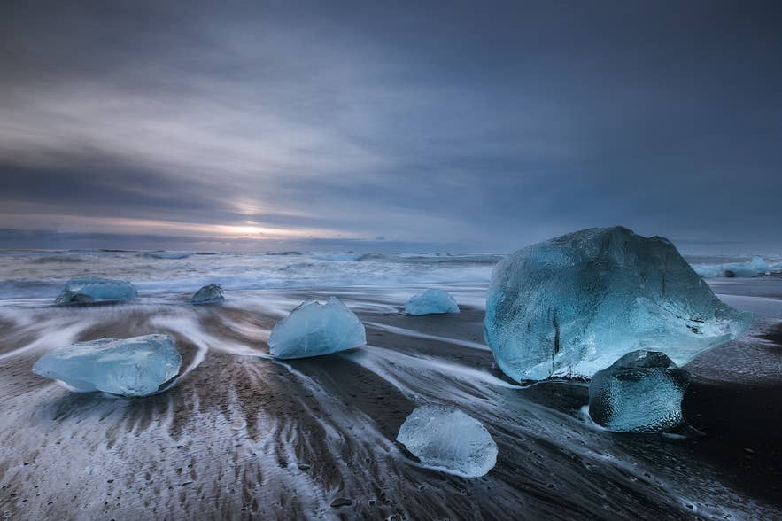
Diamond Beach lies south of Route 1 across from Jokulsarlon. After breaking away from Breidamerkurjokull, icebergs drift through the lagoon and Jokulsa River before some fragments wash onto the black sand.
From the parking area, an easy 0.6-mile (1-kilometer) trail leads past an outdoor photography exhibition and down to the beach. It then follows the Jokulsa River beneath the Route 1 bridge to Jokulsarlon, with signs explaining local wildlife and the retreat of Breidamerkurjokull.
Do not walk across the road bridge between the beach and lagoon. Vatnajokull National Park directs pedestrians to use the path beneath it instead. The amount and position of ice on the beach change naturally, so the scenery differs from day to day.
Cruise Among Icebergs on Jokulsarlon
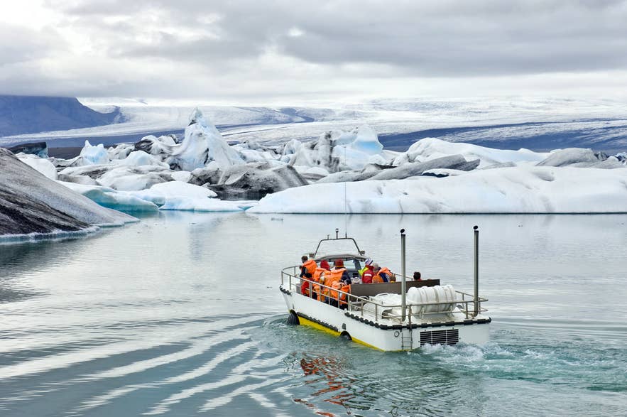
A lagoon boat tour provides a closer view of the icebergs originating from Breidamerkurjokull. Travelers can choose between amphibian and Zodiac boats, which offer different experiences.
The Jokulsarlon amphibian boat tour is available from June to November. It lasts approximately 30 to 40 minutes and accepts travelers of all ages, which makes it a more suitable option for families traveling to Iceland with kids.
The Jokulsarlon Zodiac tour is also available from June to November. The smaller, faster vessel covers more of the lagoon while maintaining a safe distance from the icebergs. The tour lasts approximately 75 minutes and is open to participants aged 10 and older who are at least 4 feet 3 inches (130 centimeters) tall.
Travelers seeking a quieter, more active experience can also join a guided kayaking tour on Jokulsarlon. The 1.5-hour tour operates from May to September and is open to participants aged 14 and older.
Best Time To Visit Breidamerkurjokull
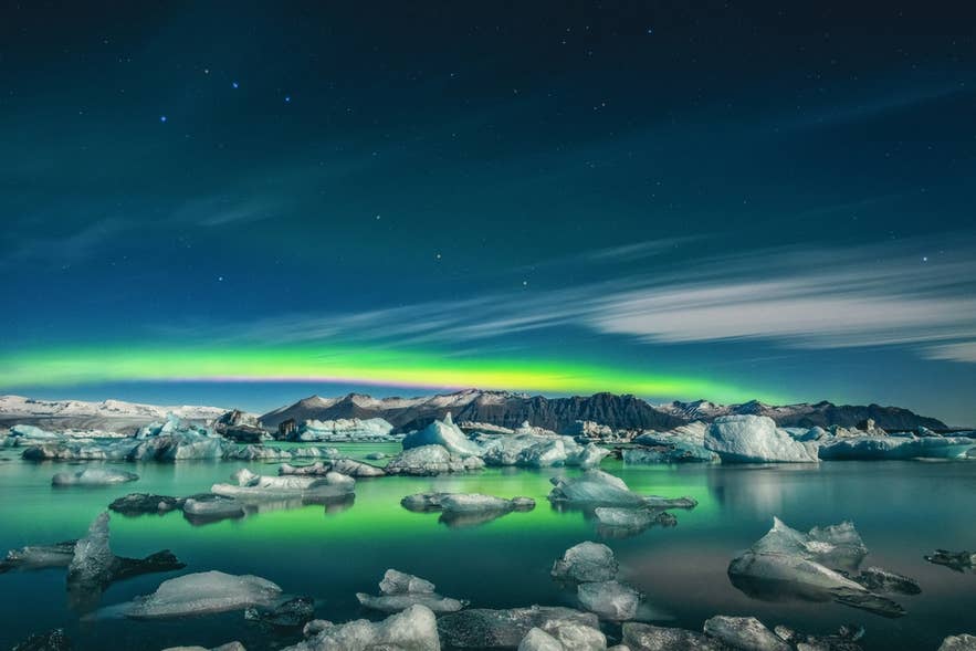
Breidamerkurjokull and Jokulsarlon are rewarding to visit year-round. Summer brings long daylight, easier driving, and the widest range of activities, while winter offers natural ice cave tours and snowy scenery but requires more planning around weather, road conditions, and limited daylight.
If seeing plenty of floating ice is your priority, our study of the best time to visit Jokulsarlon and Diamond Beach points to February and March. April offers a balance of ice, longer daylight hours, and milder weather, with considerably more floating ice remaining in the lagoon than in summer.
Glacier hikes typically operate from June to September. Depending on the operator, boat tours on Jokulsarlon run from May or June through November, while kayaking is generally available from May to September. Natural ice cave tours usually operate from October to April.
The Icelandic Tourist Board's 2018–2022 data show that visitor numbers generally rose from winter through spring. Monthly visitation remained above 100,000 from June to September 2022 and peaked in July and August. Similar seasonal patterns appeared in 2018 and 2019.
During the busiest summer months, visit before 9 AM or after 8 PM for a quieter experience. Hourly data show that arrivals generally peaked between 3 PM and 5 PM, while differences between weekdays were relatively small. Long summer daylight makes early and late visits practical, although tours may not operate at those times.
Spring and autumn are not always quiet. Vatnajokull National Park recorded approximately 100,513 visitors in October 2024, setting a record for that month.
Safety at Breidamerkurjokull and Jokulsarlon
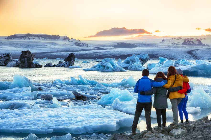
Travelers should only go onto Breidamerkurjokull with a certified glacier guide. The glacier constantly moves, crevasses can appear with limited warning, and weather on the ice can be harsher than in the surrounding lowlands. Guides provide the necessary glacier equipment and assess the route according to current conditions.
Never step onto an iceberg floating in Jokulsarlon, even if it looks stable or lies close to shore, as floating ice can break apart or roll without warning. Before traveling, check SafeTravel, the weather forecast, and current road conditions. Conditions in Southeast Iceland can change quickly, particularly in winter. Call 112 in an emergency.
Plan Your Visit to Breidamerkurjokull
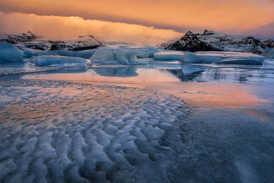
Breidamerkurjokull shapes some of Southeast Iceland's most remarkable scenery, from the icebergs of Jokulsarlon to the glacial fragments scattered across Diamond Beach. Seeing these connected landscapes makes the glacier more than a distant backdrop.
Plan activities around the season you visit, as glacier hikes, ice cave tours, and lagoon boat trips operate at different times of year. Check each tour's age and fitness requirements, then visit on South Coast tours or arrange rental cars and explore Southeast Iceland at your own pace.
