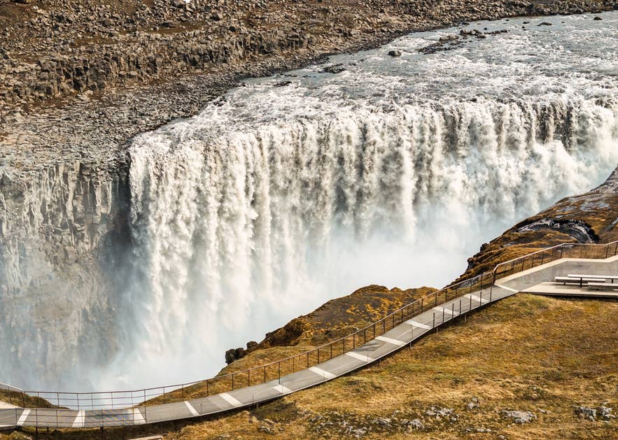
Discover Dettifoss, the most powerful waterfall in Europe by volume and one of North Iceland's great natural sights. This guide covers how to get there, which side to visit, how the canyon formed, and the best stops nearby. Read on to plan your trip.
Dettifoss is a regular feature on Diamond Circle tours, which explore North Iceland's dramatic landscapes. It’s often paired with canyons, geothermal areas, and wildlife-viewing sites that show the variety of the region.
Why You Can Trust Our Content
Guide to Iceland is the most trusted travel platform in Iceland, helping millions of visitors each year. All our content is written and reviewed by local experts who are deeply familiar with Iceland. You can count on us for accurate, up-to-date, and trustworthy travel advice.
You'll also find Dettifoss on broader waterfall tours or Myvatn tours that reach the northeastern interior. Some Akureyri tours stop here too, including a 4x4 tour of North Iceland that suits travelers based in the region.
For this guide, we consulted Dr. Greta H. Wells, a geoscientist who studied glacial outburst floods at the University of Iceland. Her insights on how Dettifoss and its canyon formed appear in quotes throughout.
Key Takeaways
-
Dettifoss is Europe's most powerful waterfall by volume. Located in Vatnajokull National Park, the falls drop 144 feet (44 meters) into Jokulsargljufur Canyon.
-
The canyon was carved by catastrophic glacial floods, not slow erosion. Jokulsargljufur was cut by sudden glacial outburst floods (jokulhlaups), which gave it its box shape.
-
There are two sides, and road conditions differ. Route 862 (west) is paved and open to all cars. Route 864 (east) is closer but needs a 4x4 and is often closed in winter.
-
Nearby attractions make Dettifoss easy to combine into a day. Godafoss Waterfall, Lake Myvatn, Akureyri, and Husavik are all within reach.
-
The best time to visit is summer, June to September. Roads and trails are more accessible then. Winter brings icy scenery but harder access.
The Geography of Dettifoss Waterfall

The Jokulsa a Fjollum River feeds Dettifoss Waterfall. The water originates from the Vatnajokull Glacier. The sediment-rich runoff gives the water its grayish-white color. It flows over the falls at around 6,800 cubic feet per second (193 cubic meters per second).
This is why Dettifoss is often called Europe's most powerful waterfall by volume. Some sources give that title to Switzerland's Rhine Falls, which has a higher average flow in summer.
Dettifoss is 330 feet (100 meters) wide, and the water drops 144 feet (44 meters) into Jokulsargljufur Canyon. The canyon lies in the northern part of Vatnajokull National Park, so it’s protected for future generations.
The Selfoss Waterfall and Hafragilsfoss Waterfall are close by. Selfoss can be reached on the same hiking trail, covered below.
How Dettifoss and Its Canyon Were Formed
 A lot of guides say Jokulsargljufur was carved slowly over a very long time. The evidence points to something more dramatic: sudden, massive glacial outburst floods, known in Icelandic as jokulhlaups.
The main lines of flood evidence at Jokulsargljufur are the box-shaped canyon, waterfalls, and terraces.
Wells explains that the rock here is mostly columnar basalt, which has natural weak points. The floodwaters were powerful enough to topple and carry away entire columns at once.
Much of the erosion happened at knickpoints, which are steps in the riverbed, often marked by waterfalls. During each flood, the knickpoint cut backward and deeper into the rock, forming the canyon downstream. Dettifoss now stands where that flood erosion last stopped, though the modern river has continued to gradually erode the canyon at a much slower rate.
Dettifoss is an example of a knickpoint where erosion stopped after a period of flood activity.
Later floods deepened the canyon further, leaving behind the resistant bedrock terraces still visible at Dettifoss and Hafragilsfoss.
Dating of the bedrock terraces shows the canyon was cut during three main flood periods, roughly 9,000, 5,000, and 2,000 years ago. In some periods, the erosion fronts retreated more than 1.2 miles (2 kilometers), far faster than a river could erode.
The floods were at least tens to hundreds of times greater than the river's flow today. Most were fed by eruptions beneath the Vatnajokull Ice Cap.
Traces of those floods are still visible on the ground today. On the west side, the path to the falls runs right through one of the old flood channels.
As visitors walk from the parking lot to Dettifoss, they will pass through a flood-eroded channel.
How To Get To Dettifoss Waterfall
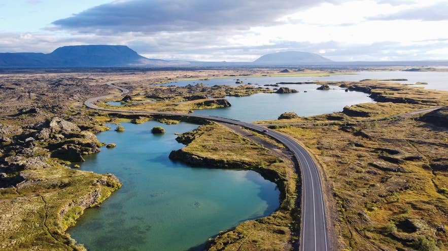 Although remote, Dettifoss isn't hard to reach if you know the route. For those using car rentals, Route 862 is the best option from the west. The road is paved and suitable for all vehicles.
Route 864 takes you to the east side of the falls. It gives a closer view, but you'll need a four-wheel drive for the gravel road. This route is usually closed in winter.
Driving times are manageable from the main bases in the North:
-
From Akureyri: around 1 hour and 45 minutes (83 miles / 133 kilometers) via Route 1.
-
From Lake Myvatn: about 50 minutes (40 miles / 60 kilometers).
-
From Husavik: about 1 hour and 10 minutes (57 miles / 91 kilometers).
Dettifoss sits within the region's Diamond Circle and pairs well with a tour that includes Lake Myvatn and Asbyrgi Canyon. The Diamond Circle connects to the Ring Road, which circles the island.
Snow and ice make these routes harder in winter. In the colder months, guided Ring Road tours are often the easier choice. Alternatively, consider a self-drive tour of the Ring Road to explore Dettifoss and the unforgettable sights in North Iceland.
Dettifoss East Side or West Side: Which to Choose
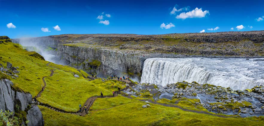 Dettifoss has a viewing area on each side of the canyon, and they offer different experiences. Here is how they compare.
| West side (Route 862) | East side (Route 864) | |
|---|---|---|
| Road | Paved | Gravel |
| Vehicle needed | Any car | 4x4 recommended |
| Walk from car park | About 15 minutes | About 10 minutes |
| View | Wide, elevated view of the falls | Closer to the edge, more dramatic |
| Facilities | Toilets, marked paths, larger car park | Minimal |
| Season | Open most of the year | Usually closed in winter |
A few other things can tip the decision. The west side has the toilets, marked paths, and the larger car park. It’s also where the trail to Selfoss begins, so it suits families and anyone who wants a longer hike.
The east side is quieter and puts you nearer the thundering edge, but the gravel road is slow, and the viewpoints are more exposed to spray and wind. Photographers often prefer the east for the raw angle, while the west is the safer bet for comfort and year-round access.
In short: choose the west side for easy access, facilities, and the Selfoss walk, especially outside summer. Choose the east side in summer if you have a 4x4 and want the closest, most powerful view.
Visiting Dettifoss, Selfoss and Hafragilsfoss Together
Three waterfalls sit within a short distance of each other on the Jokulsa a Fjollum River. Many visitors see all of them in a single stop, since Selfoss and Hafragilsfoss each have a very different character from Dettifoss.
Selfoss Waterfall
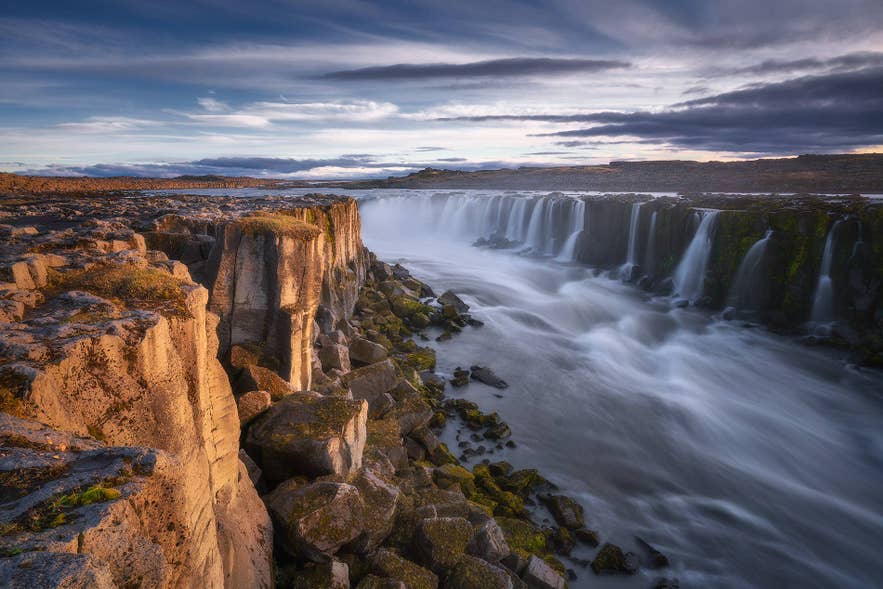 Selfoss lies about 0.6 miles (1 kilometer) upstream of Dettifoss. It’s reached on foot from the same trail, usually a 30-minute walk each way.
Although only about 33 feet (10 meters) high, it’s far wider than Dettifoss. The water spills over a broad horseshoe of basalt ledges that stretch across the river. The path is easiest from the west side via Route 862, and is mostly flat but uneven, so sturdy shoes help.
Hafragilsfoss Waterfall
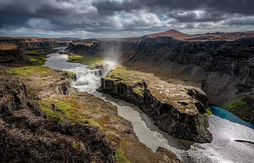 Hafragilsfoss sits about 1.4 miles (2.3 kilometers) downstream of Dettifoss. It drops around 89 feet (27 meters), making it the tallest of the three.
It’s best viewed from the east side via Route 864, where a viewpoint looks down into the deep canyon. The surrounding cliffs show layered basalt and reddish crater rock that record the area's volcanic and flood history.
Seeing all three comfortably takes around three to four hours, so allow roughly half a day if you want to enjoy them without rushing.
Attractions Near Dettifoss
The area around Dettifoss is full of variety, making it one of the most interesting parts of North Iceland. Travelers can extend the visit with nearby towns, natural landmarks, and cultural sites.
Each stop below offers something different, and all are within driving distance.
Akureyri
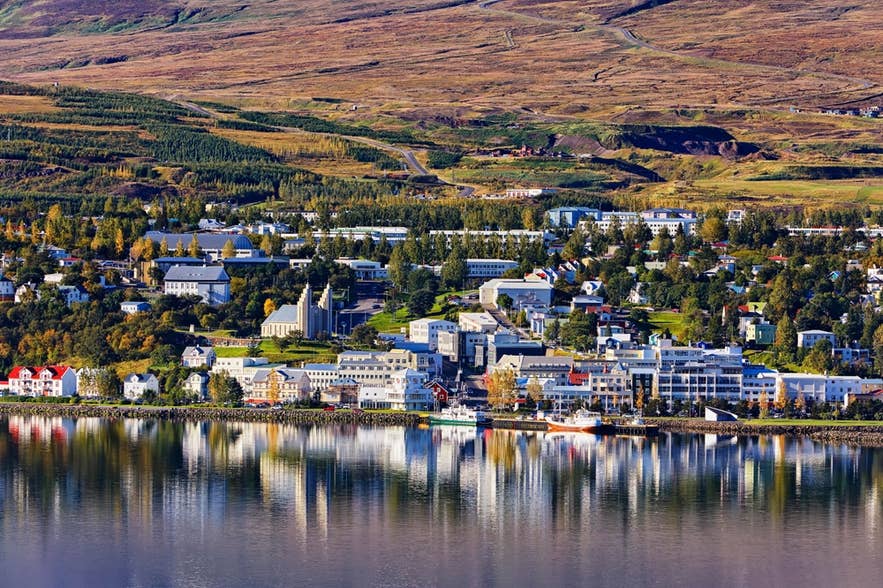 The most prominent town near Dettifoss is Akureyri, also called "the capital of the North." With a population close to 20,000, it’s the largest Icelandic town outside Reykjavik and the capital area.
There is plenty to do here, like taking in the mountains, spotting puffins, or eating at one of the best restaurants in North Iceland.
Lake Myvatn
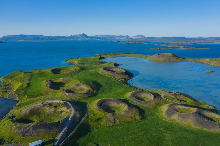 Between Akureyri and Dettifoss is beautiful Lake Myvatn, where you can see Iceland’s diverse wildlife up close. The lake is spotted with small islands and is perfect if you’re in the mood for birdwatching. Lake Myvatn is also known for its unique geologic features, like pseudocraters and basalt pillars.
Between Akureyri and Dettifoss is Lake Myvatn, where you can see Iceland's wildlife up close. The lake is dotted with small islands and is good for birdwatching. It’s also known for pseudocraters and basalt pillars.
Godafoss Waterfall
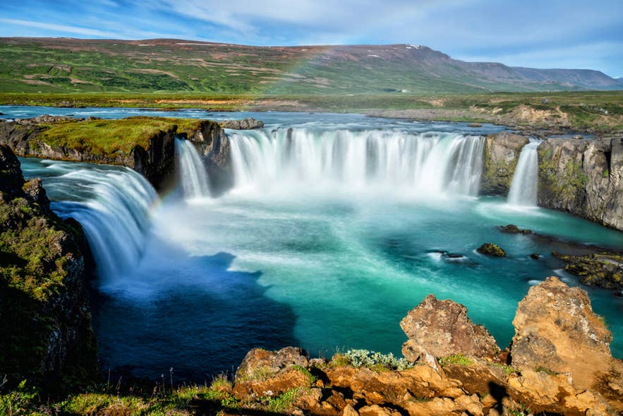 Visit Godafoss Waterfall between Akureyri and Myvatn for a piece of Icelandic history. According to legend, in 1000 A.D., Iceland's lawspeaker marked the shift from the Old Norse gods to Christianity by throwing idols into the falls.
Husavik
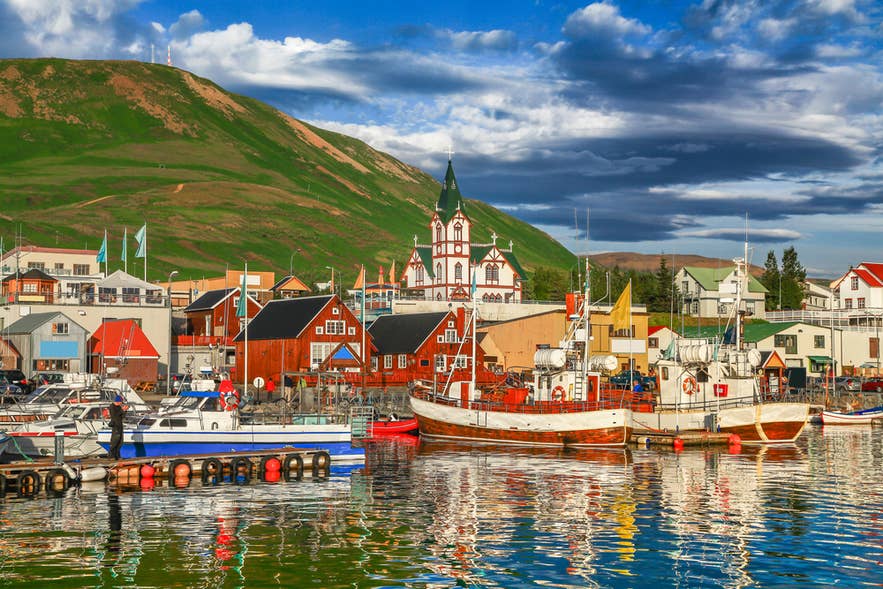 If you want to add whale-watching tours to your Dettifoss trip, Husavik is the place to go. This coastal village has some of the best whale-watching in Europe, with a near 100 percent success rate in summer. Common species include humpback and minke whales.
Before or after your tour, walk around the harbor and visit Husavikurkirkja, the town's wooden church built in 1907. Overlooking the bay, it’s one of Husavik's most recognizable landmarks.
Plan Your Visit: An Ideal Dettifoss Itinerary
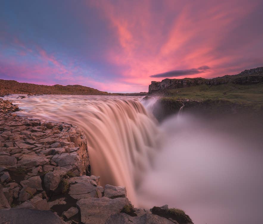 A visit to Dettifoss can be as short as a quick stop or part of a full day around the Diamond Circle. Most visitors approach from the west side via Route 862, where there is parking, toilets, and marked walking paths.
Start with the walk to Dettifoss, then continue to nearby Selfoss if time allows. Along the way, Dr. Wells suggests looking for signs of past floods in the landscape, including scoured bedrock, potholes, rippled rock, and exposed basalt columns.
For a full-day trip, start from Akureyri or Lake Myvatn and visit Dettifoss and Selfoss before continuing to Asbyrgi Canyon or other Diamond Circle stops.
Travelers looking for a longer hike can take the Asbyrgi to Dettifoss Trail, which runs about 20 miles (32 kilometers) and can be completed as a long day hike or over multiple days.
If you'd rather leave the driving and route-planning to someone else, several guided tours cover this itinerary:
-
9-Hour Diamond Circle Tour: Explore the entire Diamond Circle in one day, with a transfer from Akureyri.
-
Lake Myvatn Tours: A geothermal area with hot springs, lava formations, and bubbling mud pools.
-
One-Week Circle of Iceland Self-Drive Tour: See Iceland's major attractions, including glaciers and geysers, in one week.
-
8-Hour 4x4 Tour of the North Coast to Dettifoss and Lake Myvatn: Explore the lesser-known North Coast.
If you're staying in Reykjavik, browse this selection of self-drive tours, these vacation packages, and bundle trips for any season.
See the Power of Dettifoss Waterfall for Yourself
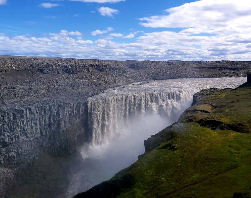 Dettifoss rewards the effort it takes to reach it. Self-drive travelers get a dramatic detour off the Ring Road, and guided-tour visitors get the story and the safety of a local driver. Either way, it pairs naturally with the wider attractions of North Iceland, such as Lake Myvatn and Husavik.
It’s also a place to see how the island itself is still being shaped. As Dr. Greta Wells puts it:
Glaciers and rivers are actively sculpting the landscape, not just flowing passively across it.
When is the best time to visit Dettifoss Waterfall?
How long does a visit to Dettifoss take?
Is Dettifoss safe to visit?
Is there an entrance fee for Dettifoss?
Can I swim at Dettifoss?
How far is the walk from the parking lot to Dettifoss?
What wildlife can I see near Dettifoss?
How big and powerful is Dettifoss?
Which side of Dettifoss should I visit, east or west?
Is Dettifoss wheelchair accessible?
What is the best time of day to visit Dettifoss?
Can I fly a drone at Dettifoss?
What does Dettifoss mean in English?
How was Jokulsargljufur Canyon formed?
Is Dettifoss or Godafoss better to visit?
How do I get to Dettifoss from Akureyri?
Can I see Dettifoss, Selfoss and Hafragilsfoss together?
Was Dettifoss Waterfall in a movie?
Popular Tours to Dettifoss

 103 reviews
Diamond Circle Tour from Akureyri
Tour startsHotel pick-up or Hof Cultural Centre, Strandgata 12, AkureyriDuration8 hours - 8.3 hoursFrom 321USD
Diamond Circle Minibus Tour in North Iceland with Transfer from Akureyri
Tour startsAkureyri, IcelandDuration9 hoursFrom 313USD
 Save 254 USD9.4166 reviews9% discount
8-Day Guided Tour of the Complete Ring Road of Iceland & Snaefellsnes Peninsula
Tour startsReykjavík, IcelandEnding placeReykjavík, IcelandFrom 2,567USD