If you're planning on driving from Akureyri to Snaefellsnes, or vice versa, make sure to stop by the following sights along the way, which include natural wonders and historical curiosities.
Iceland is so full of fascinating locations that many visitors choose to explore it by renting a car or taking a self-drive tour and driving the Ring Road around the island to see as many as possible. With so many attractions to choose from, it can be hard to decide where to stop to take in the best the country has to offer.
Why You Can Trust Our Content
Guide to Iceland is the most trusted travel platform in Iceland, helping millions of visitors each year. All our content is written and reviewed by local experts who are deeply familiar with Iceland. You can count on us for accurate, up-to-date, and trustworthy travel advice.
Snaefellsnes Peninsula is a growingly popular region, often nicknamed "Iceland in miniature," as it offers a diverse landscape of glaciers, lava fields, volcanic craters, and black sand beaches. With stunning attractions such as the iconic arrowhead-shaped mountain of Kirkjufell, Snaefellsnes provides a compact yet diverse experience of Iceland's nature.
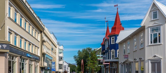
Another popular stop in Iceland is the town of Akureyri, unofficially known as the "Capital of North Iceland." The town is renowned for its scenery, culture, and proximity to many of the wonders in the region, prompting many to choose an accommodation in Akureyri to serve as a home base in their explorations of North Iceland.
As these two regions are so popular when driving in Iceland, we've compiled a list of our favorite things to see on the way from Snaefellsnes to Akureyri. Whether you're looking for gorgeous and unusual natural formations or wish to retrace the steps of Viking settlers - there's something for everyone!
- Discover the Best Attractions by the Ring Road of Iceland
- Learn about the 13 Best Things to Do in Akureyri
- Find the Top 16 Things to Do on the Snaefellsnes Peninsula
Top Things to See From Akureyri to Snaefellsnes
Here are some of the best things you can see when driving between Akureyri and Snaefellsnes. Most of these will be found close to the road, while some might require a little detour to get to. At the end of the article, you'll find a map detailing where to find each wonder.
Hvitserkur Rock
 Hvitserkur is a basalt rock stack located off the eastern shore of the Vatnsnes Peninsula in North Iceland. This monolithic rock rises 50 feet above the seas (15 meters) and is renowned for its unique and somewhat surreal shape, which has been compared to various forms. Hvitserkur translates to "white shirt," inspired by the droppings of seabirds that frequent the rock.
The formation of Hvitserkur was caused by relentless sea erosion, which carved three large holes, granting it its iconic shape. The base of the stack has been reinforced with concrete to protect its foundations from the sea, prolonging the life of this remarkable formation.

Understandably, Hvitserkur features prominently in folklore, with some tales saying Hvitserkur was originally a troll from the peninsula, determined to rip the bells down from a nearby convent before being petrified by the rays of the sun on its way there.
With its distinct shape, which has been compared to a troll, elephant, rhino, and even a dragon, we encourage you to visit Hvitserkur and interpret its form for yourself. It's one of the better photo spots in North Iceland.
1238 The Battle of Iceland Exhibition

1238 The Battle of Iceland is an interactive and immersive exhibition in the town of Saudarkrokur where visitors can step back in time and experience a Viking battle using virtual reality. The name of the exhibition is drawn from the largest battle in Iceland's history, the Battle of Orlygsstadir, which took place nearby in 1238.
The exhibition stages the most famous Viking battles and events of the Age of the Sturlungs (1220-1262), a time of civil war and conflict in Icelandic history. The cutting-edge virtual reality technology allows visitors who buy a ticket to the 1238 Battle of Iceland exhibition to take part and experience the Battle of Orlygsstadir.
 The exhibition also features numerous historical tidbits presented using modern technology and replicas of weapons and clothing worn by Icelandic people of the age. Guests can dress up in Viking clothing and take pictures for a memento to take back home.
If you're feeling hungry after the battle, the fantastic Grána Bistro is located at the exhibition, where visitors can enjoy food and beverages made from local ingredients. Stopping by 1238, The Battle for Iceland is highly recommended if you want to experience Iceland's Viking Age for yourself.
- Skim across the Complete History of Iceland
- Also, check out the Top 12 Restaurants in North Iceland
Kolugljufur Canyon

Kolugljufur is a spectacular canyon located in the Vididalur Valley in North Iceland. The gorge, carved by the river Vididalsa, sports multiple waterfalls that cascade through the canyon, creating a beautiful natural display. The most notable of these waterfalls is Kolufossar, a stunning series of waterfalls that plunge into the gorge, creating a gorgeous display of water and mist.
Kolugljufur cannot be seen from the road, but there is a parking lot right by the main road, and the canyon can be reached by crossing a nearby footbridge. Two observation platforms have been set up by the canyon, allowing visitors to enjoy the scenic beauty from the best vantage points.

The canyon is also steeped in local folklore. According to legend, the gorge is named after Kola, a giantess who is said to have lived in the area. A nearby hole in the ground is rumored to have been the bed of Kola.
The combination of the powerful waterfalls and a lovely natural backdrop make Kolugljufur a nice place to visit and take some photos if you're passing by the area.
Glaumbaer Farm
 Glaumbaer is an open-air museum in the Skagafjordur fjord of North Iceland. It features a traditional turf farm and timber buildings, providing visitors with a fascinating glimpse into rural life in Iceland from the 18th to the early 20th centuries.
The Glaumbaer turf houses are constructed using a technique that involves layering turf and stone to create thick, insulating walls. The roofs are also covered with turf, providing excellent protection against the harsh Icelandic weather. This construction method was essential for survival in Iceland's challenging environment and is a distinctive feature of the country's architectural history.
 Visitors to Glaumbaer can wander around the farm area and explore the interiors of the buildings, which have been furnished with period-appropriate artifacts and household items, giving a vivid impression of daily life in a traditional Icelandic household. Various rooms may be explored, including the kitchen, living quarters, and storage areas.
Visiting Glaumbaer is an excellent way to learn about the ingenuity and resilience of the Icelandic people in days past. The surrounding region of Skagafjordur is both picturesque and historically significant, making it a worthwhile stop on any journey in North Iceland.
Borgarvirki
 Borgarvirki is a fascinating historical site in the Vatnsnes Peninsula in North Iceland. This natural fortress is a volcanic plug that has been fortified by early inhabitants of Iceland.
The natural part of the fort is constructed from basalt columns, and the walls reach up to 30-50 feet in height (10-15 meters), creating a naturally defensible position. The strategic location would have provided a significant advantage, allowing those within to survey the surrounding region and control access routes.
 Visitors to Borgarvirki can explore the remains of the walls and structures within the fortress. Informative signs provide historical context, detailing the site's significance and the methods used in its construction. Although a battle here would have been a sight to behold, no historical evidence supports that one ever occurred at Borgarvirki.
The views from Borgarvirki are breathtaking, with expansive vistas over the Húnaflói Bay and the Vatnsnes Peninsula. On clear days, the sight extends to distant mountains and vast stretches of the Icelandic countryside, making the climb to the top a rewarding experience.
Grabrok Volcano Crater
 Grabrok is a volcanic crater in West Iceland, close to Snaefellsnes. It is part of the larger Grabrokarhraun lava field which was formed during a volcanic eruption approximately 3,400 years ago. The crater rises about 550 feet (170 meters) above the surrounding landscape, providing an excellent opportunity to witness the raw power of Icelandic volcanic activity up close.
A wooden staircase leads to the top of Grabrok, making it accessible to most visitors. The hike to the summit is relatively short, taking about 20-30 minutes, but it offers great views of the surrounding area and the crater itself.
 The lava field around Grabrok is a stark yet fascinating landscape, with patches of moss and lichen adding a touch of green to the otherwise black and gray terrain. This contrast creates a visually striking scene, especially on clear days when the sunlight enhances the vibrant colors.
Grabrok is a lesser-known attraction in Iceland, making it a great stop if you wish to take in a unique natural formation without encountering huge crowds. It is a bit of a detour when driving between Snaefellsnes and Akureyri, but well worth the trip if you have the time.
Eiriksstadir Viking Longhouse
 Eiriksstadir is an archaeological site in Haukadalur valley in West Iceland, believed to be the homestead of Erik the Red, the famous Norse explorer who founded the first Norse settlements in Greenland. It is also considered the birthplace of Erik's son, Leif Erikson, the first European to reach North America, long before Christopher Columbus.
The Eiriksstadir site features a reconstructed longhouse based on the remains of the original Viking structure discovered during archaeological excavations. Built using traditional methods and materials, such as turf, timber, and stones, it provides visitors with a vivid insight into the daily life of a Viking family in the 10th century.
 Inside the longhouse, costumed guides provide informative tours, sharing stories and historical facts about the Viking Age. They demonstrate various aspects of Viking life, including craftsmanship, cooking, and farming practices. This interactive experience allows visitors to immerse themselves in the rich history and culture of the Vikings.
The surrounding landscape of Eiriksstadir is also quite scenic, making it a perfect place for a short stop with a lot of history on your road trip in Iceland.
Map of The Top Things to See from Akureyri to Snaefellsnes
Here's a map of where to find the aforementioned sights on the way from Akureyri to Snaefellsnes.
Have you seen any of the sights we mentioned on the road from Snaefellsnes to Akureyri? What was your experience? Did we miss your favorites? Let us know in the comments below!

Hi, I’m Arnar Tómas, a storyteller with a background in journalism and content creation. I’ve worked with top Icelandic media and travel organizations, and I’m into fantasy football, pro wrestling, and travel.