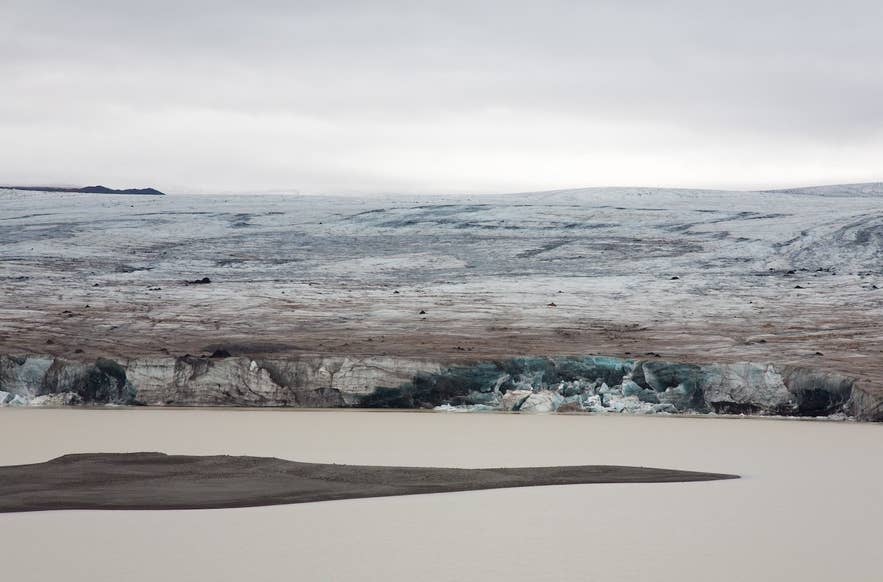
Eystri-Hagafellsjökull at Hagavatn. Photo: Polarlys, CC BY 2.5
Eystri-Hagafellsjökull is the eastern of two outlet glaciers that flow south out of Langjökull, Iceland's second-largest ice cap, into the highlands north of the Golden Circle. The Icelandic name means "the eastern Hagafell glacier": Hagafell ("pasture mountain") is the low mountain that splits the ice into an eastern (eystri) and a western (vestari) tongue.
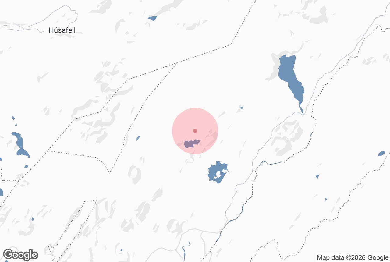
Eystri-Hagafellsjökull ends at the glacial lake Hagavatn, hemmed in on its eastern side by the dark ridge of Jarlhettur. It is a surge-type glacier that has lurched forward three times in living memory, and the lake, the lava and the ridges around it make this one of the more dramatic corners of the southern highlands.
Key Takeaways About Eystri-Hagafellsjökull
- Eastern of the two Hagafellsjökull outlet glaciers flowing south from Langjökull; it ends in the glacial lake Hagavatn beside the Jarlhettur ridge.
- A surge-type glacier: documented surges in 1974, 1980 and 1999, the last destroying the footbridge over Farið.
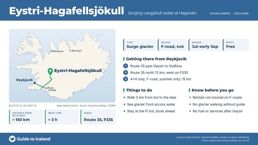
- Reached from the Kjölur road (Route 35) north of Gullfoss via the rough 15 km Hagavatn track (F335); 4x4 only, July to early September.
- Ferðafélag Íslands hut at Hagavatn (12 beds, normally unstaffed) about 2 km from the lake.
- Hagavatn drains via Farið and Sandvatn towards Hvítá, so part of its water eventually goes over Gullfoss.
Why visit Eystri-Hagafellsjökull
Langjökull covered about 810 km² in 2025 and is still shrinking; its ice is up to about 580 m thick. Eystri-Hagafellsjökull is one of its southern tongues, and unlike most Icelandic outlets it is a surging glacier. Instead of creeping steadily, it stores ice for years and then advances fast for a few months.
Documented surges happened in 1974, 1980 and 1999; the last one pushed the snout out into Hagavatn and destroyed the footbridge over Farið, the lake's outlet river. In the scientific literature and the Icelandic Met Office's glacier records the glacier appears as Hagafellsjökull eystri.
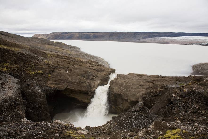
Hagavatn and Eystri-Hagafellsjökull. Photo: Polarlys, CC BY 2.5
Hagavatn itself owes its existence to the glacier. Meltwater was trapped behind the prehistoric Lambahraun lava field, and the lake has repeatedly burst out through gaps in the Jarlhettur ridge.
The outlet has shifted north over the centuries, from Mosaskarð to Fagridalur, and in 1939 a glacier-dam burst (jökulhlaup) lowered the lake dramatically.
Today it drains through Farið into Sandvatn and on via Sandá to Hvítá, with part of the flow going to Tungufljót, so some of the water you see here eventually goes over Gullfoss.
Jarlhettur, the jagged ridge east of the glacier, is a móberg (palagonite) range built by a fissure eruption under Ice Age glaciers.
From the Hagavatn area you look across milky water to the glacier front with the ridge rising behind it.
Like Langjökull's other outlets, the glacier has been thinning and retreating in recent decades, so the view changes year by year.
How to get to Eystri-Hagafellsjökull
The glacier is reached from the Kjölur highland road (Route 35, Kjalvegur, long signed F35; it is gravel beyond Gullfoss and closed in winter), which starts at Gullfoss, about 115 km east of Reykjavík on the Golden Circle.
From Gullfoss, follow Route 35 north for about 12 km, then turn west onto the signed Hagavatn track (F335, Hagavatnsvegur), a rough 4x4 route of about 15 km that ends at the Hagavatn mountain hut.
The hut, run by the Icelandic Touring Association (Ferðafélag Íslands), was first built in 1942, rebuilt in 1986 and sleeps twelve.
From the hut it is about 2 km on foot to the lake shore, and the glacier front is visible across the water; a footbridge over Farið below Einifell, opened in July 2006, lets walkers cross the outlet.
The whole route beyond Gullfoss is gravel and the Hagavatn track is only suitable for high-clearance 4x4 vehicles. Rental cars that are not 4x4 are not insured on F-roads.
Route 35 over Kjölur normally opens in June and closes with the first snows in September or October; the F335 side track to Hagavatn is often open for a shorter period.
Allow about 3 hours each way from Reykjavík including the track, and do not count on fuel or services after Geysir.
Best time to visit
July to early September is the only practical season for driving in. The tracks are then open, the days are long and the lake is at its most colourful. In June snowpatches can still block the Hagavatn track.
Winter visits are only possible on guided super-jeep or snowmobile trips that operate on Langjökull. The buggy tour listed below runs on highland tracks south of the glacier from May to November, with the view north to Vestari- and Eystri-Hagafellsjökull on a clear day.
Safety and practical tips
- Never walk onto the glacier without a guide, crampons and rope. Surging glaciers are heavily crevassed, and the snout above Hagavatn is unstable.
- The lake shore is loose sand and glacial silt. Wind-blown dust is a known problem here because the wind picks up fine sediment from the old lake bed, so protect your eyes and camera on windy days.
- There are no facilities apart from the Hagavatn hut, which has no warden; book through Ferðafélag Íslands if you want to stay. Bring all water, food and fuel.
- Weather changes fast up here, at over 400 m. Check vedur.is and road.is before leaving Gullfoss.
- Off-road driving is illegal and damages the fragile moss and sand; stay on the marked track.
Where is Eystri-Hagafellsjökull?
What does "surge-type glacier" mean?
Can I walk on the glacier?
Do I need a 4x4?
Is there a hut?
Nearby attractions
- Hagavatn – the glacial lake at the glacier's snout, 3 km
- Nýifoss – the waterfall on Farið, the lake's outlet river, 3 km
- Jarlhettur – the palagonite ridge east of the glacier, 8 km
- Sandvatn – the lake Hagavatn drains into, 10 km
- Hlöðufell – a table mountain west of the glacier, 16 km
- Langjokull – the ice cap itself, 17 km
Tours that visit Eystri-Hagafellsjökull
- Golden Circle Buggy Tour from Reykjavik – a 10-hour buggy day from Reykjavík over Mosfellsheiði to Þingvellir, Gullfoss and Geysir; on the highland section it passes Mosaskarð and overlooks Hagavatn and Sandvatn with Vestari- and Eystri-Hagafellsjökull in sight.
Popular Tours to Eystri-Hagafellsjokull Glacier
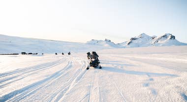

 9.4336 reviews
Snowmobile Tour on Langjokull Glacier from Gullfoss Waterfall
Tour startsGullfossDuration4 hoursFrom 268USD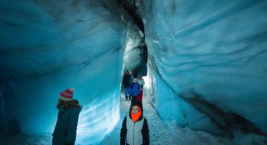
 9.274 reviews
Into the Glacier Ice Tunnel Tour in Langjokull from Base Camp
Tour startsLangjökull, IcelandDuration2.5 hoursFrom 204USD
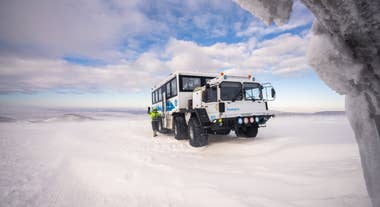
 8.696 reviews
Incredible 10-Hour Super Jeep Tour of Langjokull with Snowmobiling & Secret Lagoon
Tour startsReykjavíkDuration10 hoursFrom 424USD