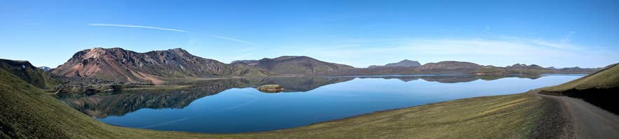
Frostastaðavatn below Frostastaðaháls. Photo: Gestumblindi, CC BY 3.0
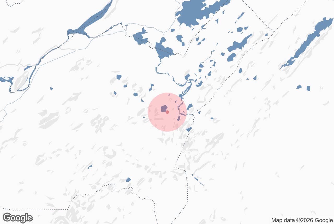
Frostastaðaháls is a low ridge in the Fjallabak Nature Reserve in Iceland's southern Highlands, between the lake Frostastaðavatn and the hot-spring oasis of Landmannalaugar.
The mountain road F208 (Fjallabaksleið nyrðri) climbs over it on the final approach to Landmannalaugar from the north, and the crest is one of the best-known viewpoints in the area: in one direction the dark blue lake with the Námshraun lava flow pushing into it and the rhyolite mountains behind, in the other the first sight of the Landmannalaugar valley.
The name joins háls, a ridge (literally "neck"), to Frostastaða-, "of the frosty place", the element that also names the lake.
Key Takeaways About Frostastaðaháls
- Frostastaðaháls is the low ridge F208 crosses between Frostastaðavatn and the Landmannalaugar junction, about 3 km by road from the camp.
- From the crest you look over Frostastaðavatn (573 m), the Námshraun lava and the rhyolite mountains of the Torfajökull area.
- F208 is a mountain road: 4x4 only, open roughly June to mid September; the northern approach from Hrauneyjar has no major fords.
- Walks start here: up Suðurnámur or around the lake to Norðurnámur, Tjörvafell and Ljótipollur.
- No facilities or fees on the ridge; the nearest services are at Landmannalaugar.
Why visit Frostastaðaháls
The ridge is a natural grandstand. From the road on Frostastaðaháls you look north over Frostastaðavatn, a lake of about 2.5 km² at 573 metres above sea level, rich in trout and ringed by black lava and the ochre, pink and green slopes of the Torfajökull volcanic area.
The lava on the shore is Námshraun, part of the mixed basalt-and-rhyolite flows from the 1477 eruption on the Veiðivötn fissure, when the Bárðarbunga and Torfajökull systems erupted together. To the west rises Suðurnámur, and beyond the ridge the ground drops to the Laugahraun lava field and the Landmannalaugar camp.
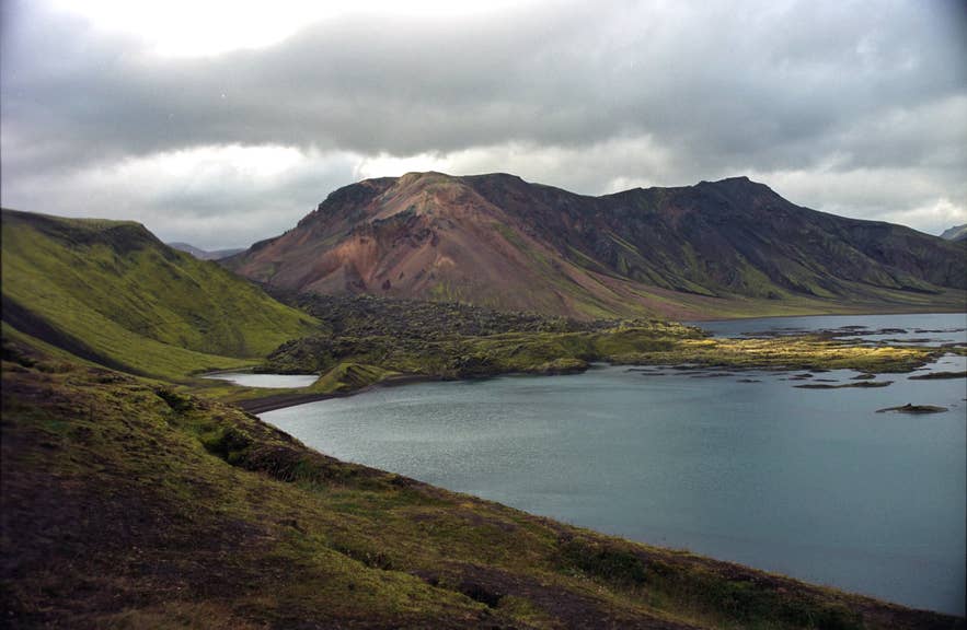
Frostastaðavatn and the Námshraun lava. Photo: Jerzy Strzelecki, CC BY 3.0
The Landmannalaugar valley comes into view all at once from the junction just south of Frostastaðaháls.
Because the ridge is on the drive in, almost everyone sees it; because few stop for more than a photograph, a short walk along the crest away from the road gives you the panorama to yourself.
Photographers favour it for the way the lake mirrors the mountains on still mornings and evenings, and Ragnar Axelsson's 2008 photograph "Mountain herders on Frostastaðaháls" was taken here during the autumn sheep round-up.
The ridge also marks the start of several walks.
The circuit of Frostastaðavatn, which can take in the peaks of Norðurnámur and Suðurnámur, Tjörvafell and the crater lake Ljótipollur, uses the ridge and the lake's parking area as its base, and the summit of Suðurnámur, across the lake's southern end, is a popular half-day hike from Landmannalaugar with the lake laid out below.
How to get to Frostastaðaháls
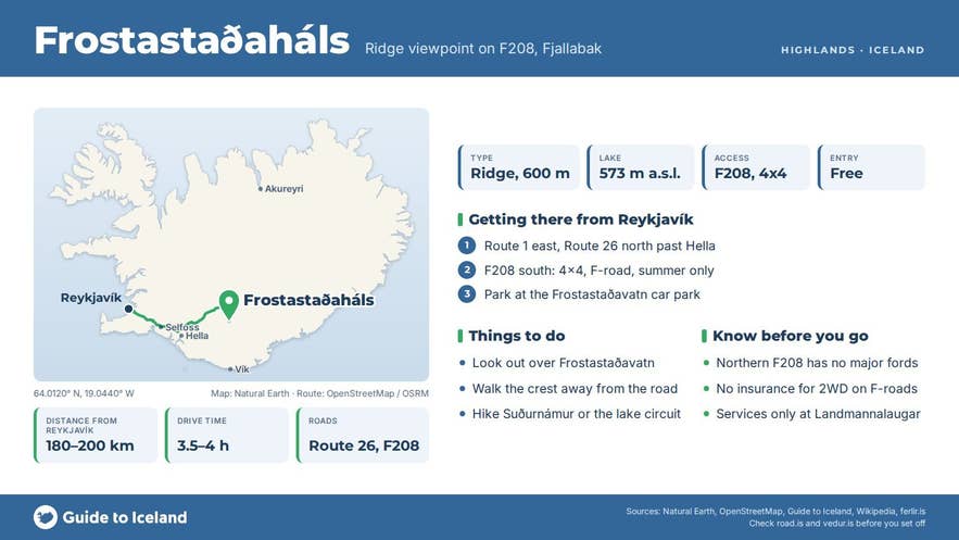
Frostastaðaháls is on F208 north, the main summer route into Landmannalaugar. From Reykjavík take Route 1 east, then Route 26 (Landvegur) north past Hella towards Hrauneyjar, then F208 south past Sigöldugljúfur and Ljótipollur.
The ridge is the last rise before the Landmannalaugar turn-off, roughly 180 to 200 km and 3.5 to 4 hours from the capital and roughly 3 km by road from the Landmannalaugar camp; the final stretch into the camp from the junction is numbered F224.
The alternative F225 (Landmannaleið) from Route 26 joins F208 at Frostastaðavatn, so travellers on either road cross the ridge.
All F-roads require a 4x4 with good clearance, and rental cars that are not 4x4 are neither permitted nor insured on them. The northern F208 has no major river fords, which is why it is the recommended route for first-time Highland drivers; F225 and the southern F208 from Skaftártunga, near Kirkjubæjarklaustur, involve river crossings.
The only fords near the ridge are the two small ones on the short F224 spur into the Landmannalaugar camp, which you can avoid by parking at the northern car park (P1).
The roads open when the snow clears: in 2021 to 2025 the Sigalda to Landmannalaugar section of F208 opened between 23 May and 23 June, and the roads close again in September or early October depending on snow; check road.is before you go.
Highland buses from Reykjavík to Landmannalaugar run in summer and pass over the ridge.
There is no formal car park on the ridge. Use the parking area by the lake, which hikers use as the base for the Frostastaðavatn circuit, or stop only where the track is wide enough to pull fully off it.
Everything is visible from the road, so the walk from the car can be as short as 50 metres or as long as you like along the crest.
Best time to visit
June to mid September, while the F-roads are open; the exact opening date depends on snow. Early morning and late evening give the calmest water and the softest light on the rhyolite; midday light flattens the colours.
September adds autumn tones to the moss and the possibility of fresh snow on the peaks, but also the first road closures. In winter the whole area is closed to ordinary traffic and reached only by specially equipped vehicles.
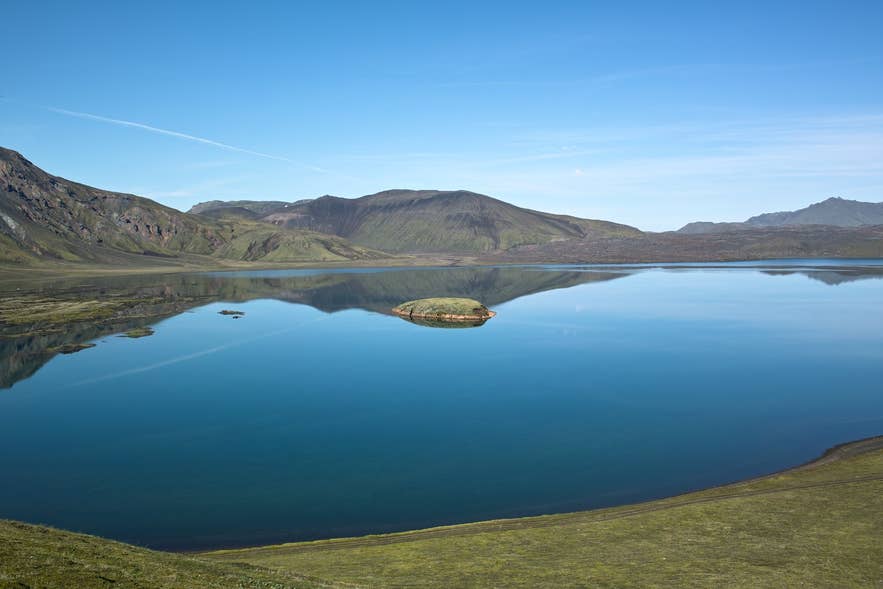
Frostastaðavatn below Frostastaðaháls. Photo: Gestumblindi, CC BY 3.0
Safety and practical tips
- Weather at nearly 600 metres is colder and windier than in the lowlands, and cloud can roll in within minutes. Carry warm layers even on a sunny day.
- Stay on the marked track. Fjallabak is a nature reserve and the moss and vegetation here take decades to recover from tyre marks and footprints; off-road driving is illegal.
- The crest is grassy and uneven with loose gravel in places; good footwear is enough, but watch your footing near the drop to the lake.
- There are no facilities at the ridge. The nearest toilets, shop, hut and campsite are at Landmannalaugar; the nearest fuel is at Hrauneyjar.
- Mobile coverage is patchy. Tell someone your plans if you walk the lake circuit.
- No fees or opening hours on the ridge. Landmannalaugar itself has required a Parka parking reservation and service fee for private cars arriving between 9:00 and 16:00 in high summer (20 June to 14 September in 2025); check ust.is for current rules and follow the rangers' instructions.
Do I need a 4x4 to reach Frostastaðaháls?
How far is it from Landmannalaugar?
Can I hike from the ridge?
When is the road open?
Is there a fee?
Nearby attractions
- Frostastaðavatn, the lake directly below the ridge, 1.4 km.
- Námshraun, the lava flow on the lake shore, 0.7 km.
- Suðurnámur, the mountain west of the ridge, 3 km.
- Landmannalaugar, 2.6 km.
- Bláhnjúkur, 4 km.
- Ljótipollur, the red crater lake north along F208, 3.5 km.
- Bláhylur (Hnausapollur), 4.5 km.
Tours that visit Frostastaðaháls
- Extreme 13 Day Photography Workshop in the Highlands of Iceland travels the ridge of Frostastaðaháls as part of its Landmannalaugar itinerary.
- Scenic 3 Day Photography Workshop in the Icelandic Highlands with Waterfalls & Crater Lakes includes the Frostastaðaháls ridge among its Landmannalaugar locations.
