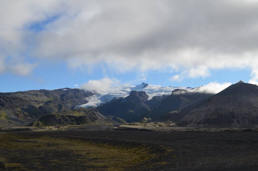
Kotárjökull descending from Öræfajökull. Photo: Steinninn, CC BY 4.0
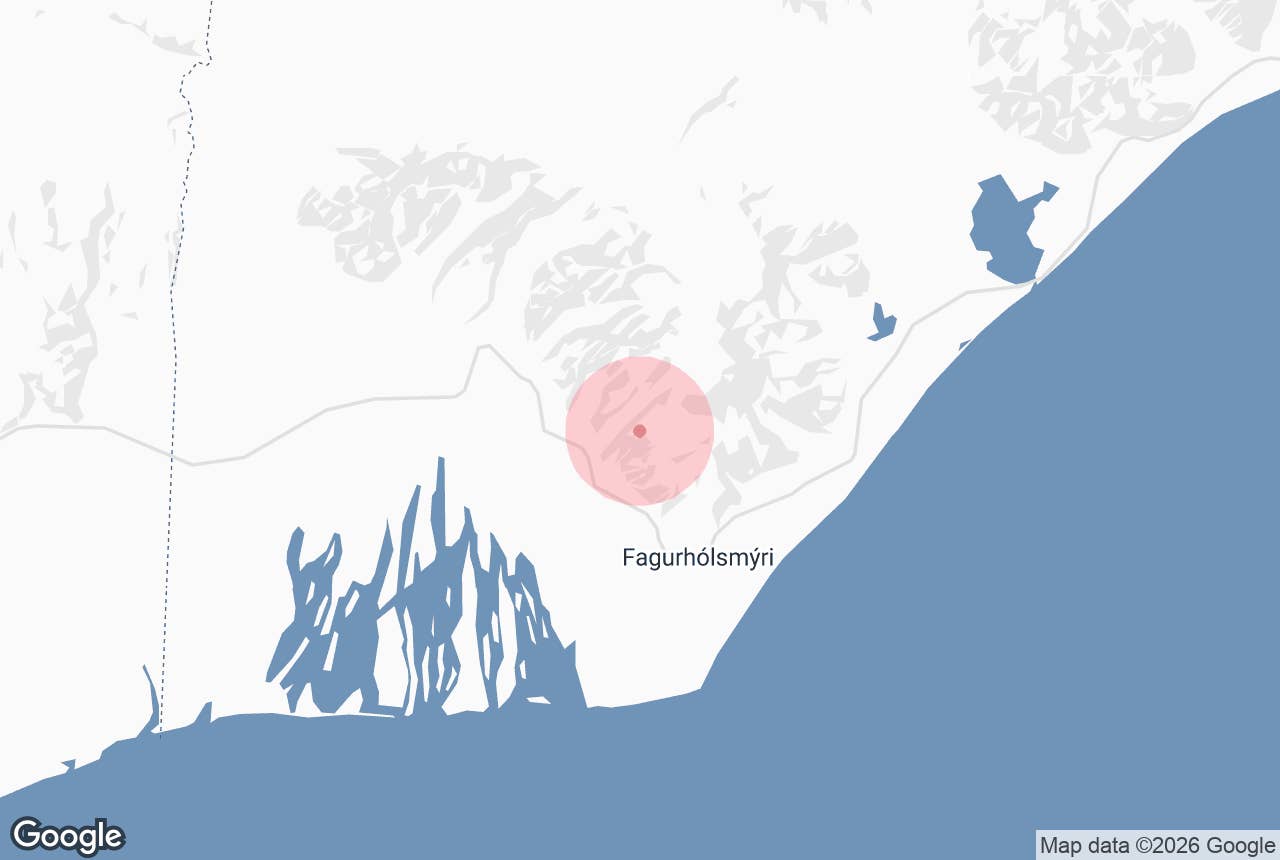
Kotarjokull (Kotárjökull, "Kotá river glacier") is an outlet glacier on the southwest side of Öræfajökull, the ice-covered volcano in Vatnajökull National Park that carries Iceland's highest peak.
It flows out of the summit caldera at about 1,800 m, drops steeply down the mountainside between the farms of Sandfell and Hof in Öræfi, Southeast Iceland, and ends in a narrow gorge, Kotárgil, at around 350 m above sea level.
It is the steep, crevassed glacier just east of Sandfell, split by the dark rock of Rótarfjall into two tongues.
Key Takeaways About Kotárjökull
- Outlet glacier of Öræfajökull, about 11.5 km², falling from 1,800 m to 350 m
- Photographed in 1891 by Frederick W. W. Howell; repeat photos show 1.3–2 km of retreat and about 30% volume loss
- The 1727 Öræfajökull eruption flood burst out mainly through Kotárjökull and killed three people
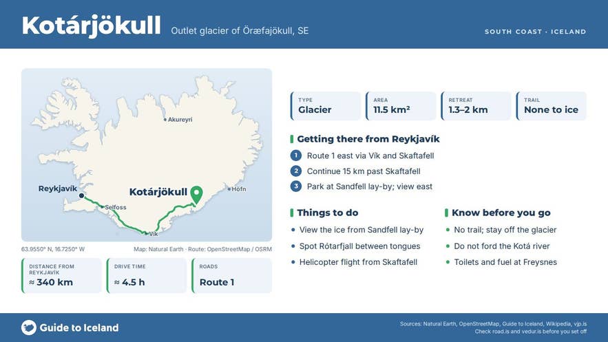
- Best viewed from the Sandfell car park on Route 1, about 340 km from Reykjavík; no trail to the ice
- Not a glacier-hike glacier: guided walks use Falljökull and Svínafellsjökull nearby
Why visit Kotarjokull
Kotárjökull is one of the best places in Iceland to see how fast glaciers have changed. In August 1891 the English traveller Frederick W. W. Howell made the first ascent of Hvannadalshnúkur with two men from Svínafell, and on the way up he photographed Kotárjökull from the slopes of Sandfell.
Those photographs are among the earliest of any Icelandic glacier and were taken at the glacier's Little Ice Age maximum. In 2011 glaciologists repeated them from the same spots and worked out the difference: the glacier had retreated 1.3 to 2 km, lost 2.7 km², about a fifth of its area, and lost roughly 30 percent of its volume.
Near the snout the ice surface is now about 180 m lower than in Howell's day. At the end of the 19th century the two tongues, Kotárjökull proper and its eastern branch Rótarfjallsjökull, still joined in front of Rótarfjall and flowed together into Kotárgil; today they end separately.
The glacier today covers about 11.5 km², with an average slope of around 20 degrees and ice roughly 100 m thick.
Its upper basin, inside the caldera rim, receives more precipitation than anywhere else in Iceland, 5,700 to 7,800 mm a year, almost all of it as snow.
Rótarfjallshnúkur, a 1,833 m nunatak, stands above the glacier's accumulation area, and Rótarfjall (946 m) divides the two tongues lower down.
Kotárjökull also has a violent history. When Öræfajökull erupted in August 1727, the meltwater flood, or jökulhlaup, that burst out on the morning of 4 August came mainly through Kotárjökull. It swept down the Kotá valley between the mountains Slaga and Goðafjall, killed three people and drowned sheep, cattle and horses grazing in its path.
Its peak discharge is estimated at around 40,000 cubic metres per second. The flood dumped ice blocks and debris across the lowland below, where they melted over decades and left the hummocky, kettle-holed ground east of the Kotá, near Goðafjall, known locally as Svartijökull, "black glacier".
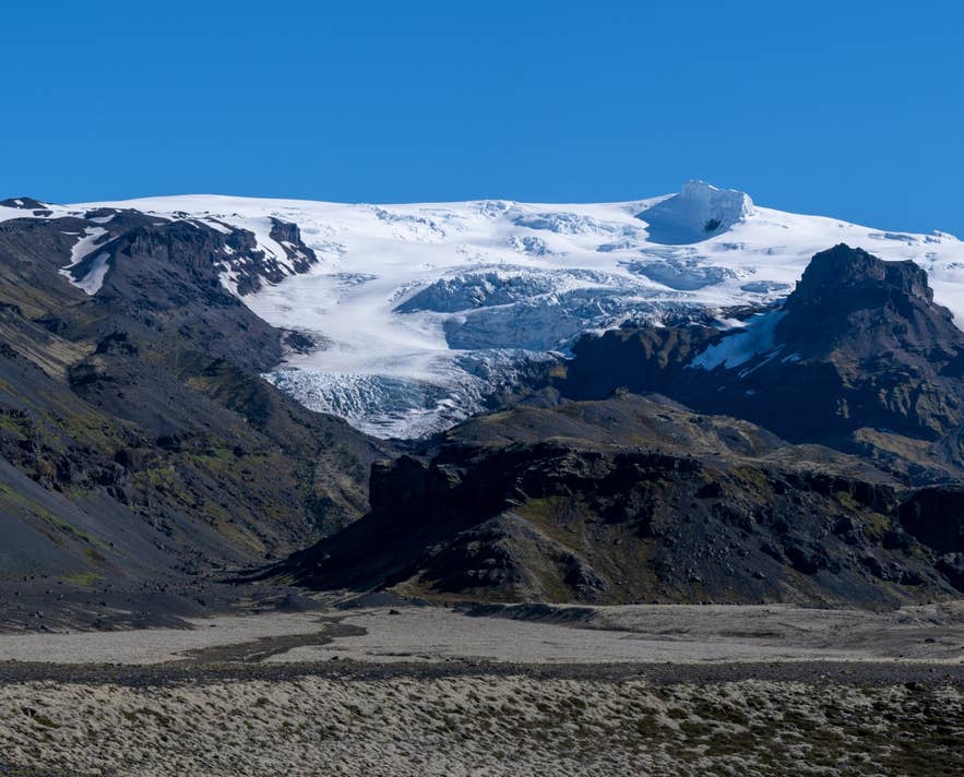
Kotárjökull from Route 1. Photo: Hansueli Krapf, CC BY-SA 4.0
How to get to Kotarjokull
Kotárjökull is in Öræfi, Southeast Iceland, on the Ring Road (Route 1) about 340 km east of Reykjavík, roughly four and a half hours' drive. Skaftafell visitor centre is about 15 km to the west and Hof, with its turf church, about 5 km to the east. From Höfn it is about 110 km west.
The glacier is best seen from the road and from the Sandfell car park, a gravel car park beside Route 1 at the abandoned farm and church site of Sandfell. From here the view east takes in Kotárjökull, Rótarfjall and Rótarfjallshnúkur.
The Sandfell car park is also the start of the standard mountaineering route to Hvannadalshnúkur, Sandfellsleið, which climbs Sandfellsheiði west of Kotárgil; guided ascents start here very early in the morning, mostly in spring and early summer.
There is no marked trail to the glacier snout. The lower gorge of Kotárgil lies beyond farmland, river gravels and unstable moraine, and the Kotá has to be crossed.
Treat Kotárjökull as a view-from-the-road glacier, or see it from the air: helicopter flights from the Skaftafell terminal fly along this side of Öræfajökull. No 4x4 or F-road is involved; the Ring Road here is paved and open all year.
Best time to visit
The glacier is visible year round whenever the cloud lifts off Öræfajökull.
May to September gives the best chance of a clear view of the full height of the ice from caldera to gorge, and the long evening light picks out the crevasses.
Winter brings the clearest air and snow down to the road, but Öræfajökull is often in cloud, and Route 1 can be icy.
Safety and practical tips
- Do not walk onto any part of the glacier without a guide and equipment. Kotárjökull is steep, heavily crevassed and not a guided-hike glacier; the nearby guided walks use Falljökull and Svínafellsjökull.
- The Kotá and other rivers from Öræfajökull can rise quickly in warm weather or rain. Do not try to ford them.
- Öræfajökull is an active volcano. Earthquake activity in 2017–2018 led the Met Office to raise the aviation colour code to yellow for several months. Follow any instructions from the national park and vedur.is.
- The Sandfell car park has no facilities. The nearest toilets, fuel and food are at Freysnes (Hotel Skaftafell) and Skaftafell visitor centre.
Can I hike on Kotárjökull?
Where is the best view of Kotárjökull?
How much has Kotárjökull shrunk?
What does the name Kotárjökull mean?
Nearby attractions
- Virkisjökull Glacier – the next outlet glacier to the west, about 3 km.
- Falljökull Glacier – steep icefall glacier used for guided glacier hikes, about 3 km.
- Sandfell Carpark – viewpoint and start of the Hvannadalshnúkur route, about 3.5 km.
- Hofskirkja Turf Church – 1884 turf church at Hof, about 5 km.
- Hvannadalshnúkur Mountain – Iceland's highest peak, 2,110 m, about 7 km.
- Svínafellsjökull – glacier tongue with a short walk to a viewpoint, about 8.5 km.
- Skaftafell – the national park's main visitor area, about 14 km.
Tours that visit Kotarjokull
- Wild 1-Hour Helicopter Tour Over Vatnajokull Glacier with Landing from Skaftafell Terminal – flies from Skaftafell over Skaftafellsjökull, Svínafellsjökull, Virkisjökull, Falljökull and Kotárjökull on the flank of Öræfajökull, with a landing at a moss-covered spot.
