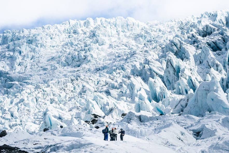
Falljokull Glacier is one of the most popular locations for guided glacier hikes in Iceland. Its heavily crevassed surface, blue ice walls, and cascading icefall make it a favorite for travelers on the South Coast.
Why You Can Trust Our Content
Guide to Iceland is the most trusted travel platform in Iceland, helping millions of visitors each year. All our content is written and reviewed by local experts who are deeply familiar with Iceland. You can count on us for accurate, up-to-date, and trustworthy travel advice.
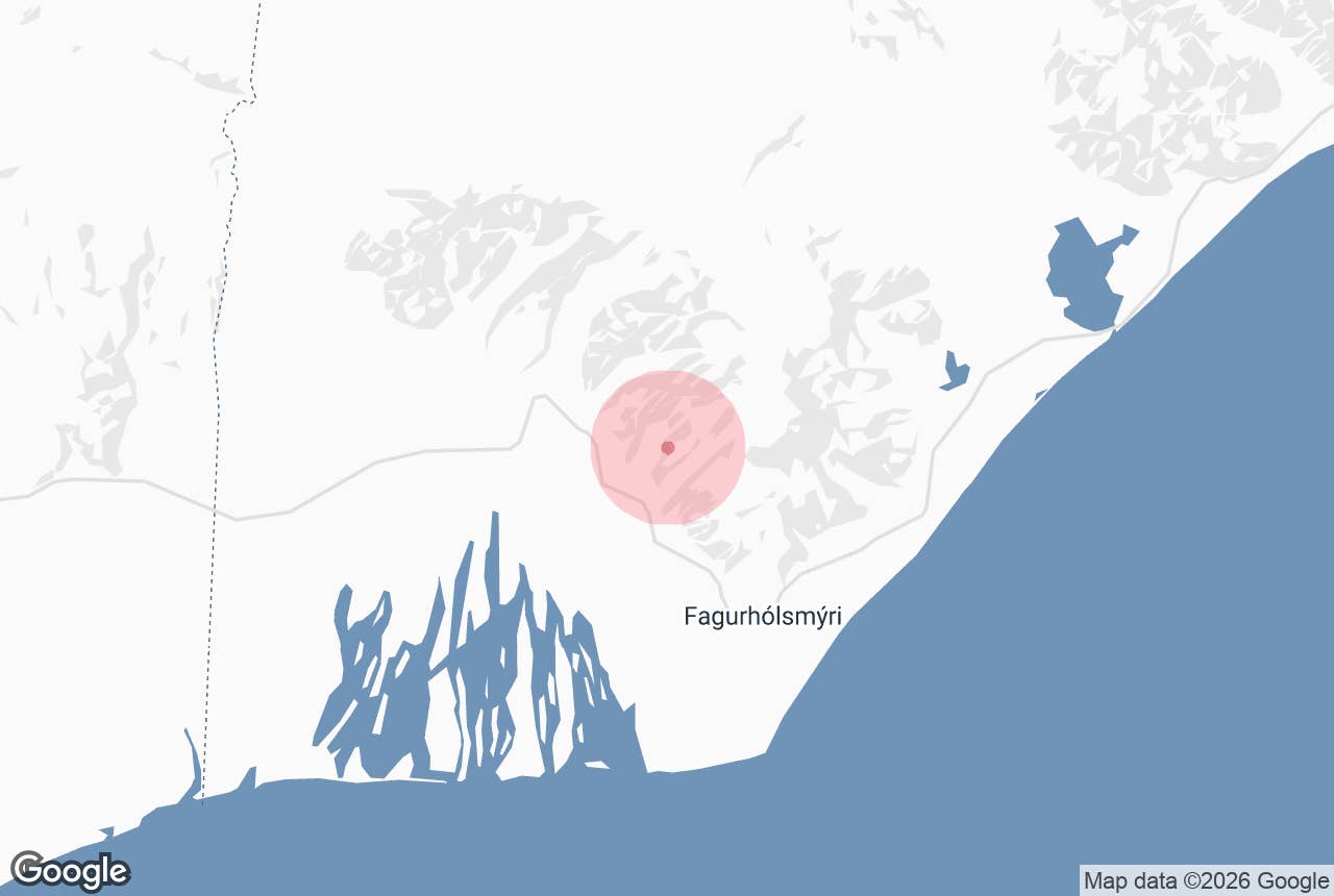
The glacier sits inside Vatnajokull National Park, just off the Ring Road and a short drive east of the Skaftafell Nature Reserve. Most visitors reach it on self-drive tours or on Skaftafell tours that depart just minutes from the glacier.
The name Falljokull means "Falling Glacier," and one look at its frozen cascade of ice tells you why. This guide covers how to get there, which tours to choose, and what else to see nearby, so keep reading to plan your visit.
Falljokull at a Glance
-
Location: Oraefi district of Vatnajokull National Park in Southeast Iceland, just off the Ring Road (Route 1) between Skaftafell and Hof.
-
Distance from Reykjavik: About 220 miles (353 kilometers), a drive of roughly 4.5 to 5 hours without major stops.
-
Type: A steep, fast-moving outlet glacier flowing from the Oraefajokull Volcano, famous for its dramatic icefall.
-
Activities: Guided glacier hikes, ice climbing, and seasonal ice cave tours. Walking on the ice without a certified guide is never safe.
-
Getting on the ice: Tours depart from the Skaftafell Terminal or the nearby Freysnes Area, with an approach by trail or operator super jeep.
-
Best time to visit: Tours run year-round. Summer offers long daylight and easier conditions, while winter brings blue ice and possible ice caves.
-
Nearest services: Freysnes (fuel and food) is minutes away, and the Skaftafell Visitor Center has restrooms and travel information.
Why Visit Falljokull Glacier
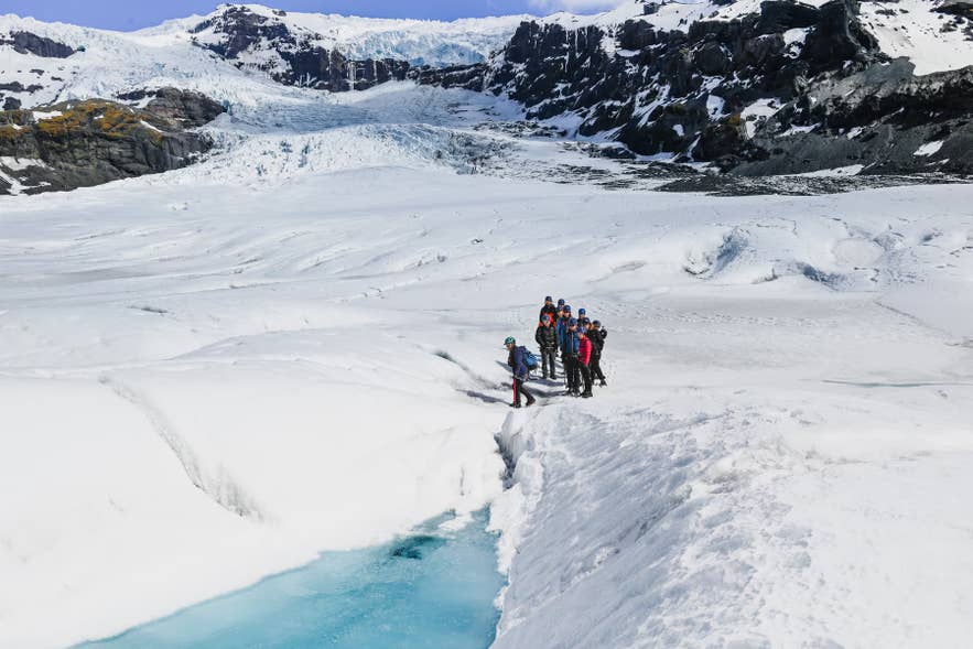
Falljokull is best known for its icefall, a frozen cascade where the glacier pours over a steep rock threshold on its way down from the mountains. The ice fractures into towering seracs (towering blocks of glacial ice) and deep crevasses as it descends, creating one of the most photogenic glaciers in Iceland.
The glacier is also a place of striking contrasts. Streaks of black volcanic ash from past Oraefajokull eruptions cut across white and blue ice, while meltwater streams and deep moulins (vertical shafts drilled into the ice by running water) carve the surface into constantly changing shapes.
Falljokull has been the main glacier for guided hikes in the Skaftafell area since 2018, when most tours moved here from neighboring Svinafellsjokull Glacier. Because the ice moves quickly, crevasses, ridges, and ice walls shift from week to week, so even repeat visitors find something new.
Look out for one of Iceland's most delicate natural curiosities on the flatter lower ice: glacier mice. These fuzzy green moss balls, called jokla-mys in Icelandic, form around small stones and creep across the ice at about an inch (2.5 centimeters) per day, surviving on the glacier for years.
Geography of Falljokull
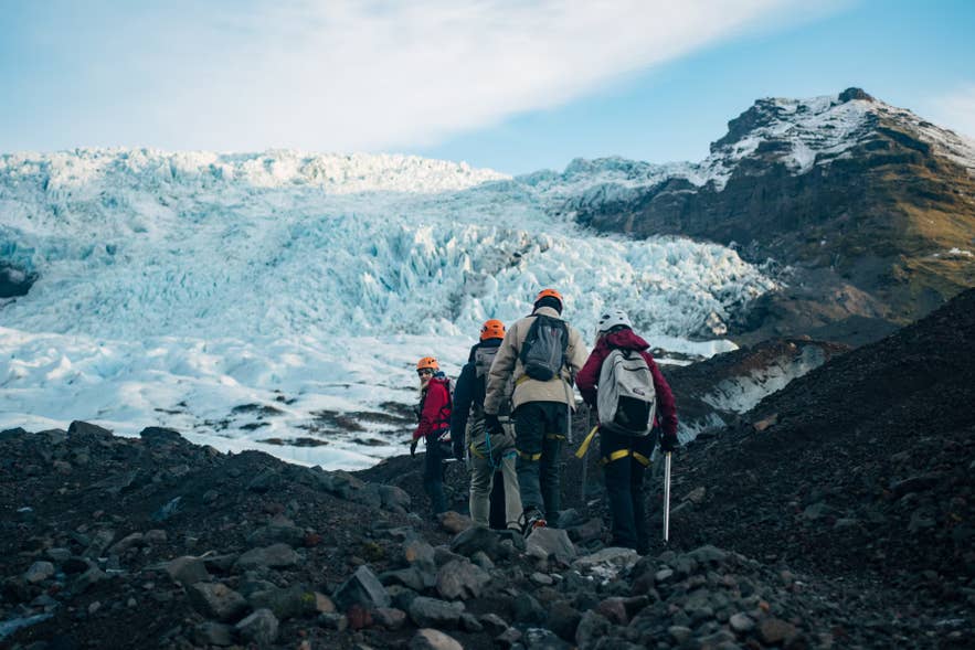
Falljokull flows down from Oraefajokull, the massive ice-covered volcano that forms the southern edge of the Vatnajokull ice cap, Iceland's largest glacier and one of the biggest in Europe. Several outlet glaciers creep down from the volcano's caldera rim, which stands around 5,900 feet (1,800 meters) high.
The glacier splits into two tongues around a rocky ridge called Raudikambur. The northern tongue is known as Virkisjokull, and the two names are often used together for the same ice stream. Adventurous travelers can even cross Falljokull and Virkisjokull glaciers on a single guided hike, a demanding 5.5-hour summer route from Skaftafell.
Above the glacier rises Hvannadalshnukur, the highest peak in Iceland at 6,922 feet (2,110 meters). Its summit crowns the rim of Oraefajokull and towers over the valley on clear days. Experienced hikers can climb to Iceland's highest summit on a demanding 12 to 15-hour guided ascent offered in spring and early summer.
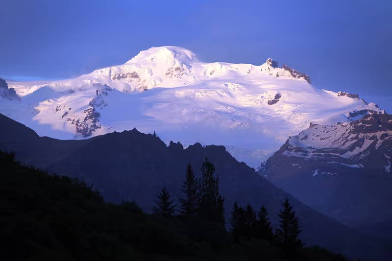
The ice itself began as snowfall high on the volcano centuries ago, compressed over time into dense glacial ice. Some of the ice you walk on during a tour is estimated to be hundreds of years old, with the oldest layers possibly reaching 1,000 years.
Meltwater from the glacier feeds a small brook called Fallsjokulskvisl. Two canyons near the glacier tongue, Graenafjallsgljufur and Storalekjargljufur, are also worth a look if you have extra time in the valley.
How To Get to Falljokull Glacier
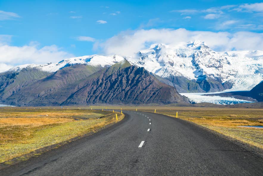 Falljokull sits just off Route 1, about 220 miles (353 kilometers) east of Reykjavik. You can reach the area by rental car or join guided tours that handle the driving for you.
Reaching Falljokull by Car
Driving is the most flexible option, and travelers on self-drive tours often visit Falljokull between Skaftafell and the Jokulsarlon Glacier Lagoon. The drive from Reykjavik takes around 4.5 to 5 hours in good conditions.
A short gravel access road branches off Route 1 toward the glacier near Svinafell, a few minutes east of the Skaftafell turnoff. From the small parking area, a footpath leads about 0.6 miles (1 kilometer) to the glacier snout, a walk of roughly 20 minutes each way. The path crosses old moraines, the ridges of rock and gravel the glacier piled up and left behind as it retreated.
If you would rather skip the gravel road, park at Skaftafell instead and join a guided tour, since operators include the transfer to the glacier from their meeting points.
The route is manageable for standard rental cars in summer, but conditions change fast in this region. Always check the weather forecast and road conditions before setting out, especially between October and April.
If you need fuel, food, or restrooms, the Freysnes service station sits just minutes from the glacier, and the Skaftafell Visitor Center is a short drive west.
Parking at the Falljokull access road lot is currently free, with no fee zone registered on the Parka app.
Falljokull Tours From Skaftafell
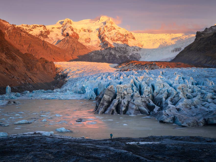 Most glacier hikes on Falljokull depart from the Skaftafell terminal or nearby Freysnes, a 5-minute drive from the glacier parking area. Certified guides provide crampons, helmets, and ice axes, so you only need warm layers and sturdy hiking boots.
Skaftafell makes an ideal meeting point because it sits right on the Ring Road at the heart of the region, within minutes of several outlet glaciers. Operators based here can choose the best ice conditions each day, and the visitor center offers parking, restrooms, a cafe, and travel information while you wait for departure.
The area rewards travelers who arrive early or linger afterward. Waymarked hiking trails lead to waterfalls and glacier viewpoints, and a year-round campsite sits beside the visitor center, so a glacier hike combines easily with a half day of exploring on foot.
Some operators shorten the approach by driving super jeeps up an old sheep track into the Falljokull valley, a route local farmers still use for the annual sheep round-up during fall in Iceland.
Falljokull Glacier Hikes and Ice Climbing Tours
A Falljokull glacier hike is one of the most rewarding adventures on the South Coast, and tours run at several difficulty levels. Introductory hikes last around 3 hours in total and explore the flatter lower glacier, with views of the icefall from below. Many guides pause at a meltwater stream along the way, so bring a bottle and taste the freshest water of your trip.
Longer discovery-style hikes climb higher toward the base of the icefall, weaving between crevasses, moulins, and ice ridges. Half-day technical tours add ice climbing, where you ascend vertical ice walls with axes and ropes under the supervision of your guide.
Falljokull suits travelers who want to go further. Across more than 10,000 verified reviews of glacier hikes in Iceland, the standard three-hour hike is the most booked and most consistently well-reviewed introduction to the ice, and the longer discovery routes edge slightly ahead among hikers who already know what to expect. Our ranking of Iceland's glacier hiking tours by rating, price, and reliability shows which format fits which traveler.
Here are the best glacier hiking options to choose from:
-
The Skaftafell Glacier Hiking Tour: A beginner-friendly 3.5-hour hike on a Vatnajokull outlet from the Skaftafell terminal, suitable for ages 8 and up. Between October and April, you can add an ice cave visit.
-
Vatnajokull Ice Climbing and Glacier Hiking Tour from Skaftafell: A 4-hour moderate tour on the neighboring Skaftafellsjokull glacier tongue that adds ice climbing on vertical walls. Ages 12 and up, running May through December.
-
Small Group 3-Hour Guided Glacier Hike on Falljokull Glacier: A year-round, easy-rated hike in a group of eight people maximum, with a 4x4 transfer from the Skaftafell terminal and 1.5 to 2 hours on the ice. Ages 8 and up.
-
4-Hour Super Jeep and Glacier Hiking Tour at Falljokull: A moderate half-day adventure from the Freysnes gas station, combining a super jeep ride into the Falljokull valley with 3 hours of hiking. Runs April through October for ages 14 and up.
Never walk onto Falljokull without a certified guide. The glacier moves quickly, crevasses open without warning, and the ice is unstable at the terminus (the front edge where the glacier ends), so all visitors should stay off the ice unless roped into a guided group.
Ice Caves on Falljokull
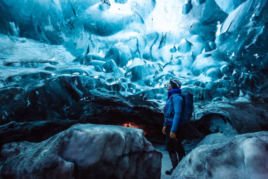
In winter, natural ice caves sometimes form beneath Falljokull and the neighboring outlet glaciers as meltwater channels freeze and empty. These caves glow deep blue inside and rank among the most sought-after sights in Iceland.
Ice caves are never guaranteed, since they form, collapse, and change from year to year. Guides scout safe caves each season, and visits are only possible on guided ice cave tours, typically between October and March.
On Falljokull itself, you can combine a glacier hike with an ice cave visit on an easy 4-hour tour from Skaftafell, available October through March. If no cave is accessible on Falljokull during your visit, operators in the region usually run tours to caves under other Vatnajokull outlets, so you rarely miss out entirely.
What To Wear on Falljokull Glacier
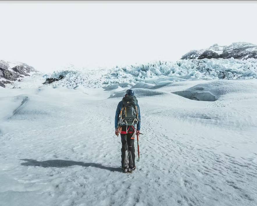 Waterproof outer layers, warm mid-layers, gloves, a hat, and sturdy hiking boots that support your ankles are glacier hiking essentials. Avoid jeans and cotton, which stay cold and wet once soaked.
Tour operators provide the technical gear, including crampons, helmets, harnesses, and ice axes, and most rent hiking boots on-site if you need them. Sunglasses and sunscreen are worth packing too, since glare off the ice is strong even on overcast days.
If your visit includes a winter cave tour, our guide on what to wear for ice caving in Iceland covers the extra details.
Best Time To Visit Falljokull Glacier
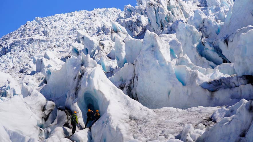
Falljokull can be visited year-round, and guided hikes on the glacier itself run in every season. The right time depends on what you want from the trip, so here is how the seasons compare in practice.
Summer, from May through September, is the easiest season to plan around. Daylight stretches up to 20 hours or more in June and July, roads stay clear, and departures run several times a day. Tours in this area sell out in July and August, so book at least a few days ahead.
Winter, from November through March, brings the most vivid blue ice and the ice cave season. Daylight drops to around 4 to 5 hours in December, so book a midday departure and plan to drive in daylight. Storms can close Route 1 with little warning, so build a buffer day into your itinerary and check safetravel.is before setting out.
The shoulder months of April, May, September, and October offer fewer crowds and lower accommodation prices in the Oraefi area. The northern lights are visible on clear, dark nights from late August through mid-April, and the glacier valley's dark skies make it a good hunting ground.
Attractions Near Falljokull Glacier
 Falljokull sits in one of the densest stretches of natural attractions in Iceland, so it pairs easily with other South Coast highlights and hidden gems. Here is what to combine with your visit, and how to reach each spot from the glacier.
Svinafellsjokull Glacier
Svinafellsjokull is another dramatic outlet glacier about 10 minutes west of Falljokull by car, reached via a short gravel road off Route 1. It is one of the most recognizable filming locations in Iceland, with scenes from Game of Thrones and Interstellar shot on its ice. Viewing the glacier from the moraine is free, but walking on the ice requires a certified guide.
Svartifoss Waterfall
Svartifoss, the waterfall framed by hexagonal basalt columns, is reached on foot from the Skaftafell Visitor Center. The columns are so striking that they inspired the design of Hallgrimskirkja, Reykjavik's landmark church.
The trail climbs 0.9 miles (1.5 kilometers) one way and takes about 45 minutes each way. The hike is free and open year-round, though the path can be icy in winter, so bring shoe spikes.
Morsarfoss Waterfall
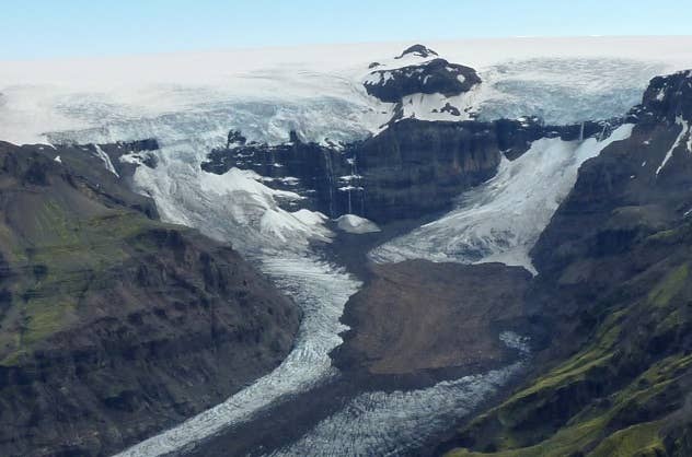 Morsarfoss is the tallest waterfall in Iceland at 748 feet (228 meters), tumbling from the Morsarjokull Glacier northwest of Falljokull. It only became visible in 2007 as the glacier retreated, and it was officially measured in 2011. There is no trail to its base, so hikers admire it from a distance on clear days from Skaftafell's longer trails.
Jokulsarlon Glacier Lagoon
The Jokulsarlon Glacier Lagoon sits east of Falljokull along Route 1, a drive of roughly 40 minutes. Icebergs calve from the glacier and drift across the lagoon, where seals often swim between them.
Entry is free, parking costs 1,110 ISK per standard car through the Parka app, and you get 50 percent off if you paid for parking at Skaftafell the same day. Boat tours run on the lagoon in summer.
Diamond Beach
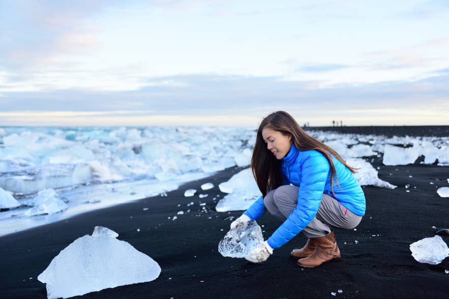
Diamond Beach lies directly across the road from Jokulsarlon, where icebergs from the lagoon wash ashore and glitter against the black sand. It is free to visit and open year-round, and your Jokulsarlon parking ticket covers the beach lots too. The ice is most plentiful after windy days, and mornings offer the best light for photos.
Hofskirkja Turf Church
Hofskirkja, one of the last turf churches in Iceland, stands about 7 miles (11 kilometers) east of Falljokull in the hamlet of Hof. It is free to visit from the outside year-round and makes a quick, atmospheric stop on the drive toward Jokulsarlon.
Vik Village
Vik is the largest town on this stretch of coast, about 96 miles (155 kilometers) west of Falljokull, a drive of roughly 2 hours. With plenty of things to see and do in Vik, the town is a destination in itself. The wide selection of hotels in Vik also makes it a practical overnight base for travelers heading back toward Reykjavik.
Make the Most of Your Falljokull Glacier Visit
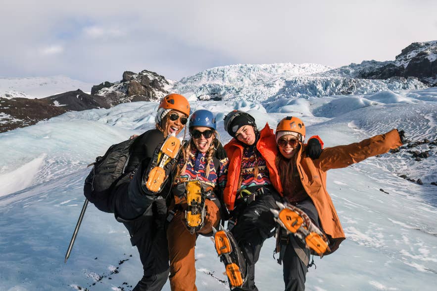
Falljokull condenses everything dramatic about Icelandic glaciers into one accessible place: a tumbling icefall, deep crevasses, ash-streaked blue ice, and Iceland's highest peak rising overhead. Its location just off the Ring Road makes it an easy addition to any South Coast itinerary.
To experience the glacier properly, book one of the glacier hiking tours led by certified guides, and consider staying nearby to combine it with Skaftafell and Jokulsarlon. Travelers exploring at their own pace can build the stop into one of the many self-drive tours in Iceland.
However you plan it, leave room in your schedule for the unexpected. The weather shifts fast in the Oraefi region, and the glacier itself changes constantly, which is exactly what makes visiting Falljokull so memorable.
