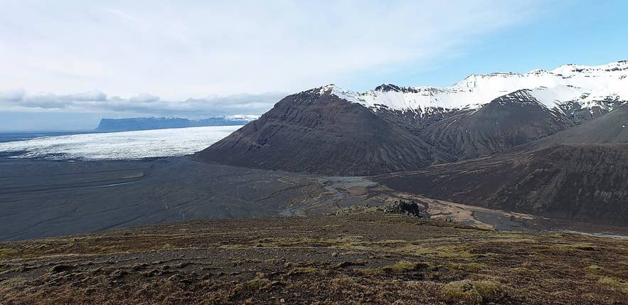
Braided Morsá in Morsárdalur. Photo: Óðinn, CC BY-SA 2.5 CA
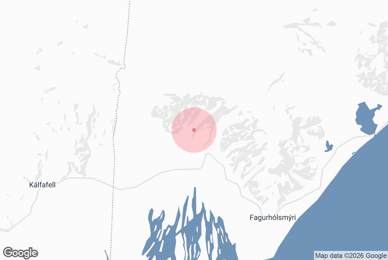
Morsá is the glacial river that drains Morsárjökull, an outlet glacier of Vatnajökull, down the length of Morsárdalur valley on the western side of Skaftafell in Vatnajökull National Park, Southeast Iceland. The river gives its name to the valley (Morsárdalur) and the glacier (Morsárjökull).
From the glacier lake at the head of the valley the Morsá river braids across a wide gravel floor for roughly 7 km, passes below the birch woods of Bæjarstaðarskógur and the cliffs of Skaftafellsheiði, and spreads out onto Skeiðarársandur, where it meets the waters of Skeiðará.
It is the river that hikers cross on footbridges on the way into Morsárdalur, and the one ATV riders splash through on the sands below Skaftafell.
Key Takeaways About Morsá
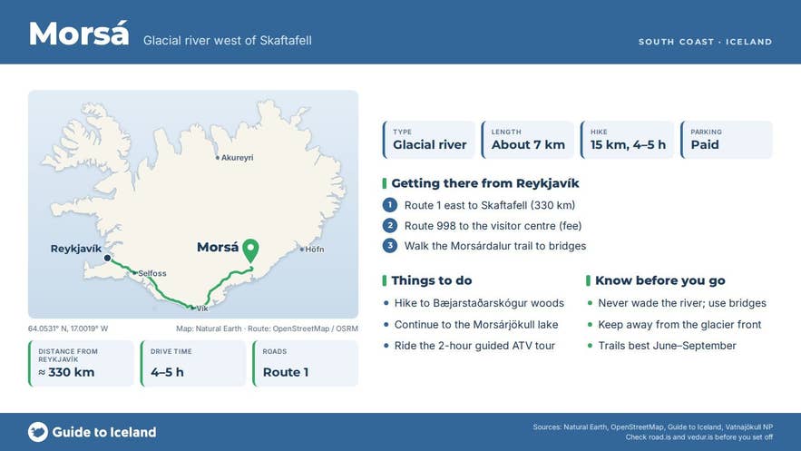
- Glacial river from Morsárjökull running roughly 7 km down Morsárdalur onto Skeiðarársandur, west of Skaftafell
- Crossed on footbridges on the marked Morsárdalur trail: Bæjarstaðarskógur loop 15.3 km (4–5 h), glacier lake 19.5 km (6–7 h)
- Skaftafell is on paved Route 1, about 330 km from Reykjavík; parking fee at the visitor centre, no national park entrance fee
- The lower river on the sands is ridden through on a 2-hour guided ATV tour from Skaftafell Terminal; no private vehicles in the valley
- Best June–September; never wade the river, and keep away from the glacier front where ice and rock fall
Why visit Morsá
Morsá is the thread that ties together the quieter, western half of Skaftafell. At its source lies Morsárjökull, a steep glacier tongue below the cliffs of Kristínartindar and Þumall; ice regularly calves off the headwall, and in 2007 a large rock avalanche fell onto the glacier and still sits on its surface.
Also around 2007, as the ice thinned, Iceland's tallest waterfall, Morsárfoss, appeared on the cliff above the glacier; its main fall has been measured at about 227 m, some 30 m higher than Glymur. Its meltwater joins the lake at the glacier front and feeds the river.
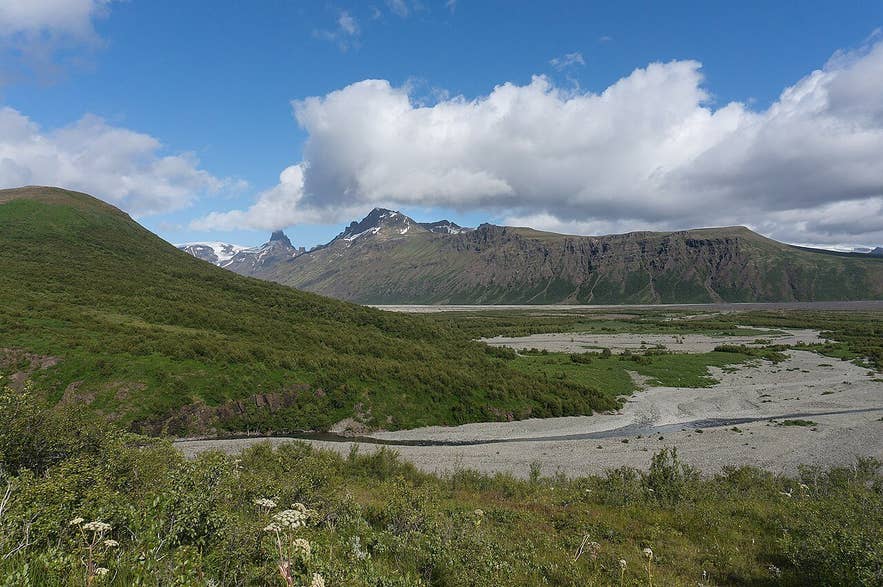
Morsá river in Morsárdalur. Photo: Denis DespaiR, CC BY 3.0
Downstream, the valley holds Bæjarstaðarskógur, a natural birch wood with the tallest birch trees in Iceland (up to about 12 m) and unusually straight trunks for Icelandic birch, and, further in, the side valley Kjós at the end of a long day hike (30 km, 8–10 hours).
The river itself is a classic braided glacial river: milky grey with rock flour, constantly shifting its channels across the gravel, and lined in summer with arctic riverbeauty (Chamerion latifolium), the pink flower that colonises fresh glacial sands.
The valley has a long human history too. Skaftafell was a major farm in the Middle Ages before the 1362 Öræfajökull eruption buried the district, and the Morsárdalur woods were long used for grazing, which had badly damaged Bæjarstaðarskógur before it was fenced off in 1935.
How to get to Morsá
Skaftafell lies on Route 1 about 330 km east of Reykjavík, a drive of four to five hours, 70 km east of Kirkjubæjarklaustur and about 130 km west of Höfn. Turn north onto Skaftafellsvegur (Route 998) for 2 km to the visitor centre, campsite and car park; a parking fee is charged and paid online or at the machines.
The river is reached on foot.
The marked trail into Morsárdalur leaves the visitor centre westward, climbs gently onto the heath and descends to footbridges over Morsá before continuing to Bæjarstaðarskógur (15.3 km round trip, 4–5 hours, easy) or on to the Morsárjökull glacier lake (19.5 km round trip, 6–7 hours, 350 m ascent, challenging).
The lower reaches of the river on the sands below Skaftafell are visited on the guided ATV tour that leaves from the Skaftafell Terminal tour centre at Flugvallarvegur 5, just off Route 1 near the Skaftafell turn-off.
There is no vehicle access into Morsárdalur itself, and it is not permitted to ford the river in a car.
Best time to visit
Skaftafell is open all year, but the Morsárdalur trails are best from June to September, when the footbridges are in place, the birch is in leaf and daylight is long.
In July and August the river is usually at its highest from glacier melt, so stay on the bridges rather than attempting to wade channels. The ATV tour operates year-round, conditions permitting, but the valley hikes are not recommended in snow and short daylight.
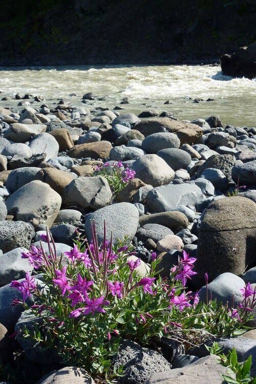
Arctic riverbeauty beside the Morsá. Photo: Gudmundur Ogmundsson, CC BY-SA 3.0
Safety and practical tips
- Never wade Morsá or its channels. Glacial rivers are cold, fast and opaque, and the bed shifts; use the footbridges.
- Do not approach the glacier front or the lake edge at Morsárjökull: ice falls from the headwall, and the rock avalanche debris is unstable.
- The valley is long and exposed; bring food, water, rain gear and warm layers even in summer, and check the forecast at the visitor centre.
- Facilities (toilets, café, information desk) are at the Skaftafell visitor centre only. The campsite is open year-round.
- A parking fee applies at Skaftafell. There is no separate entrance fee to the national park.
- Drones are restricted in Vatnajökull National Park; ask at the visitor centre.
Where does Morsá come from and where does it go?
Can I cross Morsá on foot?
Is Morsárfoss on the river Morsá?
Do I need a 4x4 to reach the river?
How long is the hike to the river?
Nearby attractions
- Bæjarstaðarskógur, the birch wood with Iceland's tallest birch trees, 1.5 km
- Morsárdalur, the valley the river runs through, 2 km
- Kristínartindar, the twin peaks above Morsárdalur with the best view of the glacier and river, 4 km
- Skaftafell, the visitor centre and trailheads, 4.5 km
- Svartifoss, the basalt-column waterfall, 4.5 km
- Skaftafellsjökull, the accessible glacier tongue east of Skaftafell, 7 km
- Skeiðará Bridge Monument, girders twisted by the 1996 glacial flood, 8 km
- Morsárjökull, the glacier at the river's source, 8 km
- Morsárfoss, Iceland's tallest waterfall, revealed in 2007, 9 km
Tours that visit Morsá
- Small Group 2-Hour ATV Tour in Skaftafell with Glacier Views and River Crossings: a two-hour guided ATV ride from the Skaftafell Terminal across black-sand tracks and riverbeds on Skeiðarársandur, splashing through the shallow channels of Morsá and passing the old Skeiðará bridge, with views of Skaftafellsjökull and Vatnajökull throughout.
