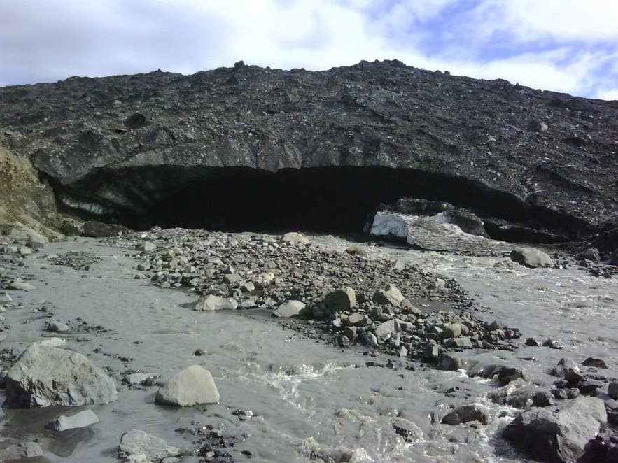
Volga flowing from the Kverkjökull ice cave. Photo: Pietro Valocchi, CC BY-SA 2.0
The Volga is a short glacial river in the Kverkfjöll mountains on the northern edge of Vatnajökull, in the Highlands of north-east Iceland.
It pours out of the mouth of an ice cave at the snout of Kverkjökull, the outlet glacier that flows down through the Kverk, the wide pass that splits the mountains, and runs north a few kilometres before joining Jökulsá á Fjöllum, one of Iceland's longest rivers.
The name is the same as the great Russian river, almost certainly given tongue in cheek; the Icelandic form is simply Volga.
Key Takeaways About Volga
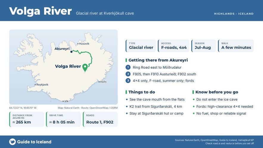
- A short glacial river that leaves the Kverkjökull ice cave and joins Jökulsá á Fjöllum a few kilometres north.
- Reached only in summer by 4x4 on F905, F910 and F902 from Möðrudalur; about 105 km of highland track to the Sigurðarskáli hut.
- A few minutes' walk from the car park at the glacier snout, or the 4.1 km K2 trail from Sigurðarskáli.
- Do not enter the ice cave: the roof sheds blocks of ice. View the mouth from the gravel flats.
- July and August, when the rangers are at the hut and the fords are lowest.
Why visit the Volga river
The Volga river is where the Kverkfjöll glacier cave begins. The river is fed partly by the geothermal field high up in the western Kverkfjöll, which drains ice-dammed lakes called Gengissig and Galtarlón, so warm water has melted a tunnel through the base of Kverkjökull.
The cave mouth it leaves behind is a wide, dark arch in dirty grey ice with the milky river sliding out beneath it over a bed of boulders and silt.
For decades the cave was one of the best-known sights in the Icelandic interior, and people used to walk and even bathe inside it.
Today the cave is unstable and the national park tells visitors not to enter, but the mouth itself, the river and the glacier front are easy to see from a safe distance.
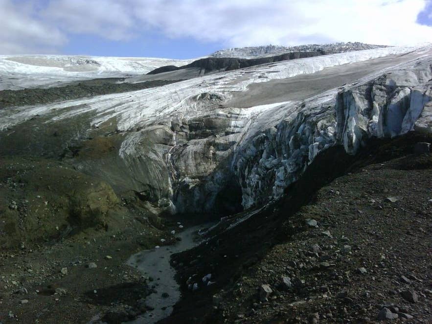
Kverkjökull and the Volga outflow. Photo: Pietro Valocchi, CC BY-SA 2.0
The setting adds to it. Kverkfjöll is Iceland's third-highest mountain group, with Skarphéðinstindur rising to about 1,935 m (the national park gives 1,936 m, a 2019 survey 1,933 m), and it sits over an active central volcano. Kverkjökull flows down between steep rock walls from two ice-filled calderas whose rims lie at about 1,800 m.
Just west of the glacier lies one of the most powerful high-temperature geothermal areas in the country, around 3 km long and lying at 1,500 to 1,800 m, centred on the valley of Hveradalur.
The oldest rocks here are about 780,000 years old, and tephra studies have counted up to 70 eruptions from Kverkfjöll in the last 6,500 years, though there has been no confirmed eruption for about a thousand years; small steam explosions and floods from the geothermal lakes have happened as recently as 2013.
How to get to the Volga river
This is remote highland country inside Vatnajökull National Park, reachable only in summer, by 4x4, on F-roads. From the Ring Road at Möðrudalur in north-east Iceland take F905 and then F910 (Austurleið, the East Route), which crosses Jökulsá á Fjöllum on a bridge near Upptyppingar.
The Kverkfjöll track, F902, then branches south to the Sigurðarskáli hut below Mt Virkisfell, where the national park has rangers in summer. It is roughly 105 km of highland track from Möðrudalur to the hut (about 115 km from the Ring Road); allow four hours or more.
These are F-roads with unbridged streams to cross, so a high-clearance 4x4 is a must, and in recent years they have opened between mid-June and mid-July (F902 on average around 25 June). Check road.is.
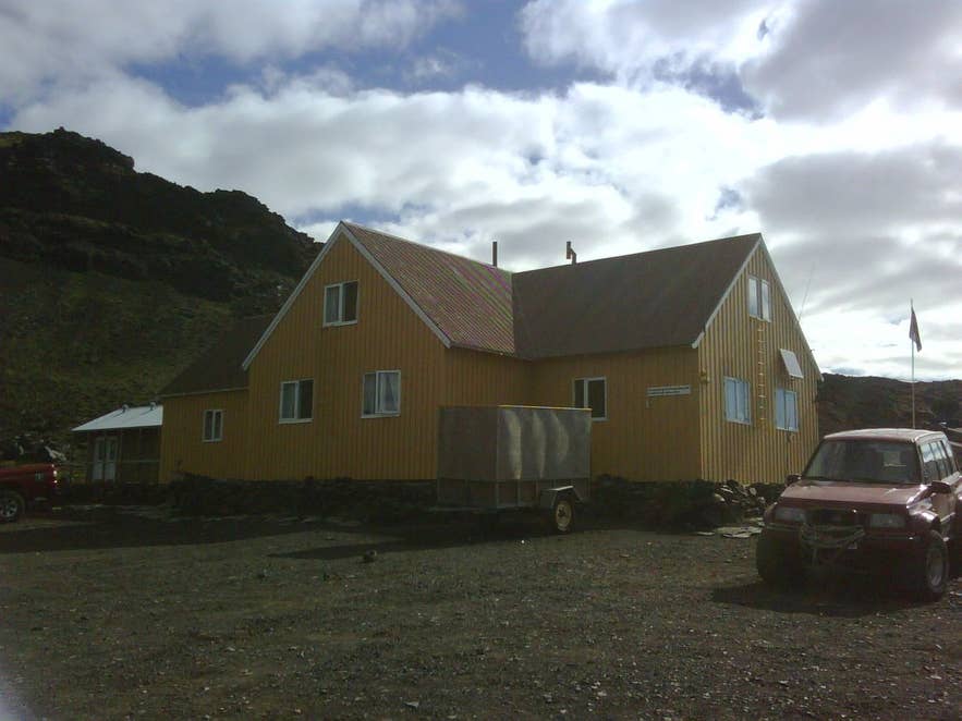
Sigurðarskáli hut below Virkisfell. Photo: Pietro Valocchi, CC BY-SA 2.0
From Sigurðarskáli a track continues a few kilometres south to a car park beside the Kverkjökull snout. From there it is a walk of a few minutes over gravel and moraine to the river and the mouth of the ice cave.
You can also walk from the hut along the marked trail K2 (4.1 km one way, 2 to 3 hours, with about 200 m of climbing). Kverkfjöll is not a day trip from Reykjavík; Egilsstaðir and Mývatn are the usual starting points, and most people stay a night or two at the hut.
Best time to visit
July and August, when the tracks are open and the rangers are at Sigurðarskáli. Early in the season the fords can be deep; the rangers leave at the end of summer and from September snow can shut the roads. Long daylight in June and July helps, but the weather at 900 m is cold and changeable at any time.
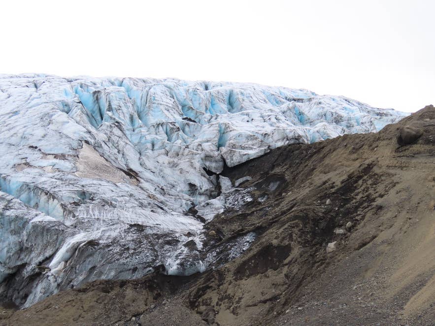
Crevassed front of Kverkjökull. Photo: Rémih, CC BY-SA 4.0
Safety and practical tips
- Do not enter the ice cave. The glacier front changes constantly and blocks of ice fall from the roof, especially in warm weather. Admire it from the gravel flats.
- The Volga is glacial meltwater: cold, silty and fast after warm days or rain. Do not try to wade it.
- Dust storms of fine glacial clay are common on the sands north of Kverkfjöll and can cut visibility to almost nothing.
- Sigurðarskáli sleeps 75 in sleeping-bag accommodation and has a campsite, flush toilets and showers; book ahead through the touring clubs of Fljótsdalshérað and Húsavík, which run it. There is no fuel, shop or restaurant, and do not count on mobile coverage.
- Hut and camping fees at Sigurðarskáli are set by the touring clubs that run it; check their current prices. Stay on marked tracks; off-road driving is illegal in Iceland.
- Hiking up to Hveradalur is a full-day glacier walk and should only be done with a guide and glacier equipment.
Can you still go into the Kverkfjöll ice cave?
Why is the river called Volga?
Do I need a 4x4 to reach the Volga?
Is the water warm?
How long is the walk from the car park?
Nearby attractions
- Kverkjökull, the glacier the river flows from (about 3 km)
- Virkisfell, the hill above the hut with a 2.1 km trail and views over the glacier (about 3 km)
- Sigurðarskáli, the mountain hut and ranger station (about 3 km)
- Hveragil, a geothermal gorge east of the glacier (about 7 km)
- Kverkfjöll, the mountain range and volcano itself (about 8 km)
- Hvannalindir, a spring-fed oasis with 18th-century outlaw ruins on F903 (about 25 km)
Tours that visit the Volga river
- Challenging 3 Day Glacier Hiking Tour of Kverkfjoll in North Iceland includes a short walk to the remains of the ice cave and the river Volga on day one, a full-day glacier hike to Hveradalur on day two, and a stop at Hvannalindir on the way back on day three.
Popular Tours to Volga River

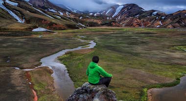 9.2136 reviews
Landmannalaugar Super Jeep Tour From Reykjavik
Tour startsReykjavíkDuration11 hoursFrom 380USD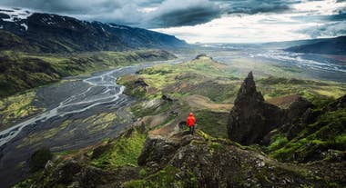
 9.645 reviews
Best Thorsmork Super Jeep Tour
Tour startsBrú Base Camp, road 249, Hvolsvöllur, IcelandDuration6 hoursFrom 329USD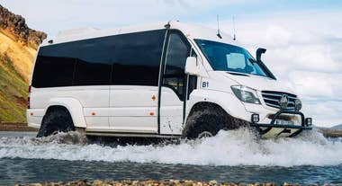
 9.410 reviews
Landmannalaugar & Hekla Volcano Super Jeep Tour
Tour startsReykjavík, IcelandDuration12 hoursFrom 280USD