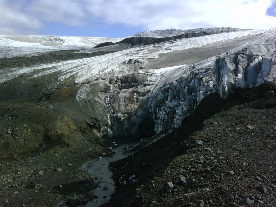
Kverkjökull snout and the Volga river. Photo: Pietro Valocchi, CC BY-SA 2.0
Hveradalur (Icelandic: Hveradalur, "hot-spring valley") is the main geothermal area of Kverkfjöll, the volcanic mountain massif on the northern edge of Vatnajökull in Iceland's central highlands.
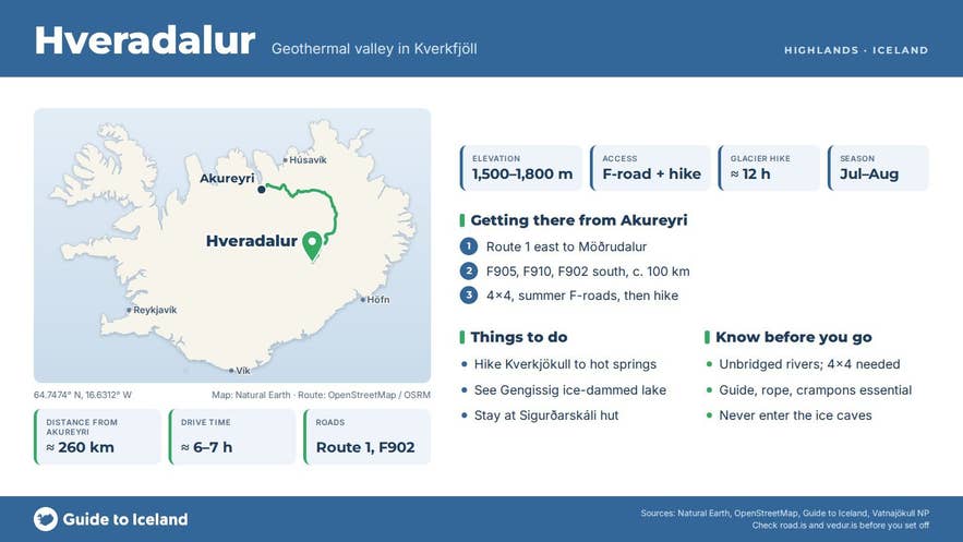
Hveradalur valley lies high in the western part of the massif at 1,500–1,800 m above sea level and runs for roughly 3 km, which makes it one of the largest and highest-lying high-temperature areas in Iceland.
It is not a roadside stop: reaching it means a full day on the glacier from the Sigurðarskáli hut, and most visitors only see it on a guided trip.
It is a different place from the two Hveradalir geothermal areas at Kerlingarfjöll and Hengill in the south of the country.
Key Takeaways About Hveradalur
- One of Iceland's largest and highest geothermal areas, at 1,500–1,800 m in the Kverkfjöll massif on the north edge of Vatnajökull
- Reached only on foot across Kverkjökull glacier from Sigurðarskáli hut: c. 18 km, 1,000 m ascent, about 12 hours, guide and rope needed
- Sigurðarskáli is roughly 100 km of F-road (F905, F910, F902) south of the Ring Road at Möðrudalur; 4x4 with river crossings, open roughly July–early September (check road.is)
- Ice-dammed lakes Gengissig and Galtarlón drain in sudden jökulhlaups; never enter the Kverkjökull ice caves
- Not the same as Hveradalir at Kerlingarfjöll or Hengill
Why visit Hveradalur
Kverkfjöll is a central volcano with two adjoining calderas and a highest point, Skarphéðinstindur, of about 1,933–1,936 m, which puts the massif among the three highest in Iceland.
Its heat comes from a magma body a few kilometres below the surface, and nowhere is that heat more visible than in Hveradalur valley, where steam rises from hot springs and boiling pools between snowfields and the ice of Vatnajökull.
Icelandic sources describe the geothermal field here as covering around 10 km².
Water melted by the heat collects in ice-dammed lakes just beyond the western rim of the northern caldera, the best known being Gengissig and Galtarlón. These lakes drain through the glacier into the Volga river, which emerges from the ice cave at the snout of Kverkjökull below.
The system is restless: Gengissig has emptied in sudden floods (jökulhlaups) in 1985, 1987, 1993, 1997, 2002 and 2013, and the 2013 drainage was followed by hydrothermal explosions in the exposed lake bed. A hydrothermal eruption was also recorded about 500 m west of Gengissig in 1968.
On the ridge east of the geothermal area, at 1,718 m, stands Kverkfjallaskáli, a small hut built in 1977 by the Icelandic Glaciological Society (JÖRFÍ) with room for 6–12 people.
It marks the usual turning point of the day hike, and the view from this height takes in Vatnajökull to the south and the black desert of Krepputunga and the Dyngjufjöll mountains to the north.
How to get to Hveradalur
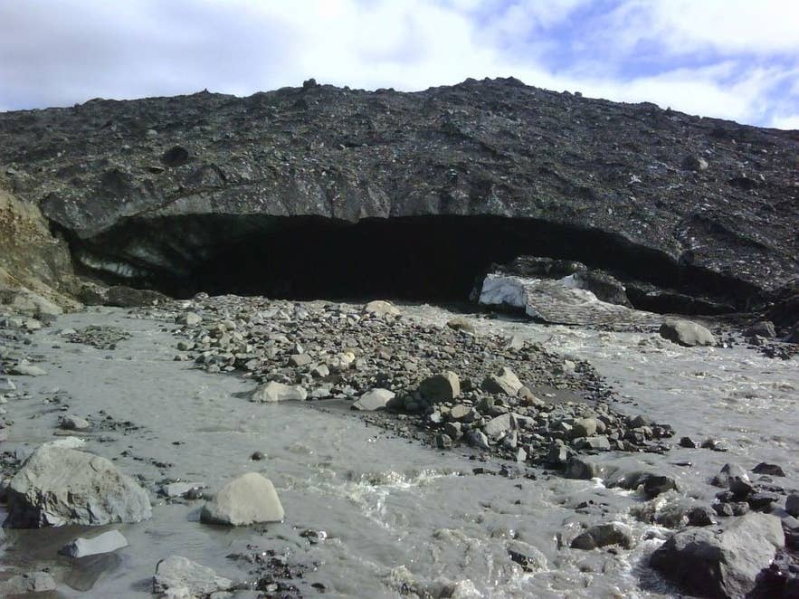
Ice cave at Kverkjökull. Photo: Pietro Valocchi, CC BY-SA 2.0
Hveradalur is reached on foot from Sigurðarskáli, the mountain hut under Virkisfell at the foot of Kverkfjöll.
The hut is roughly 100 km south of the Ring Road via Möðrudalur on mountain tracks (F905 and F910, then F902 Kverkfjallaleið for the final stretch; the F903 spur passes Hvannalindir), and it is among the most remote places in Iceland that can be reached by vehicle.
A 4x4 with good clearance is required, there are unbridged river crossings, and the tracks only open in summer, typically from around late June or July until early September depending on snow (check road.is for current openings).
From Egilsstaðir the drive is a long day; from Reykjavík it is roughly 540 km by the Ring Road via Akureyri just to Möðrudalur, so most people approach from the north or east.
From Sigurðarskáli it is about 3 km on a marked trail to the edge of Kverkjökull and the ice cave where the Volga river leaves the glacier.
The route to Hveradalur then climbs onto the glacier itself, up the long, steep snow slope known as Langafönn, through the Hveratagl gully and on to the JÖRFÍ hut at about 1,700 m.
The round trip is rated difficult and takes a full day; the GTI tour below covers about 18 km with 1,000 m of ascent in around 12 hours. Crevasses, soft snow and fog make a guide, rope, crampons and GPS essential.
In summer, rangers and hut wardens may offer guided walks; ask at Sigurðarskáli.
Best time to visit
The season is short: July and August, with early September possible in a good year. Before the tracks open the area is unreachable except by expedition, and by September snow can close the glacier route. Long daylight in July helps with the roughly 12-hour day.
Weather at 1,700 m changes fast, and fog, storms and sandstorms from the glacial silt plains below can arrive with little notice, so build a spare day into any plan.
Safety and practical tips
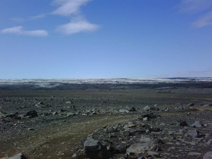
Outwash plain below Kverkjökull. Photo: Pietro Valocchi, CC BY 3.0
- Do not enter the ice caves at Kverkjökull. The park warns of collapse and toxic gases, and the caves change constantly.
- Hot pools in Hveradalur can drain suddenly, and the ground around springs may be a thin crust over boiling water. Stay on firm ground and follow your guide.
- Glacier travel on Langafönn involves crevasses. Go roped with an experienced guide.
- Sigurðarskáli has 75 sleeping-bag places, water toilets, a shower, gas cooking rings and a campsite, and it is staffed in summer. There is no shop, restaurant or fuel anywhere in Kverkfjöll, so bring everything from Egilsstaðir, Mývatn or Möðrudalur.
- A ranger station operates at Kverkfjöll in summer. Hut and campsite fees apply; check the Ferðafélag Fljótsdalshéraðs website (ferdaf.is) for bookings.
- Jökulhlaups from Bárðarbunga or Kverkfjöll can affect Jökulsá á Fjöllum and its tributaries without warning; heed any ranger advice about river crossings.
Can I visit Hveradalur without a guide?
Can I bathe in the hot springs?
How long is the hike?
Is Hveradalur the same as Hveradalir at Kerlingarfjöll?
Nearby attractions
- Kverkfjöll – the massif itself, 3.5 km
- Kverkjökull – the outlet glacier and ice cave at the start of the route, 3.6 km
- Hveragil – a second thermal ravine beyond the eastern rim of the northern caldera, 6.4 km
- Virkisfell – 1,108 m viewpoint above the hut, 7.2 km
- Sigurðarskáli – the mountain hut and trailhead, 7.8 km
- Holuhraun – the 2014–15 lava field, 20 km
- Hvannalindir – spring-fed oasis with outlaw ruins on the way in, 29 km
Tours that visit Hveradalur
- Challenging 3 Day Glacier Hiking Tour of Kverkfjoll in North Iceland – a package from Egilsstaðir with two nights in the Kverkfjöll hut (Sigurðarskáli); day two is the full glacier day (18 km, 1,000 m ascent, about 12 hours) past the geothermal features of Hveradalur valley to a high point at around 1,800 m.