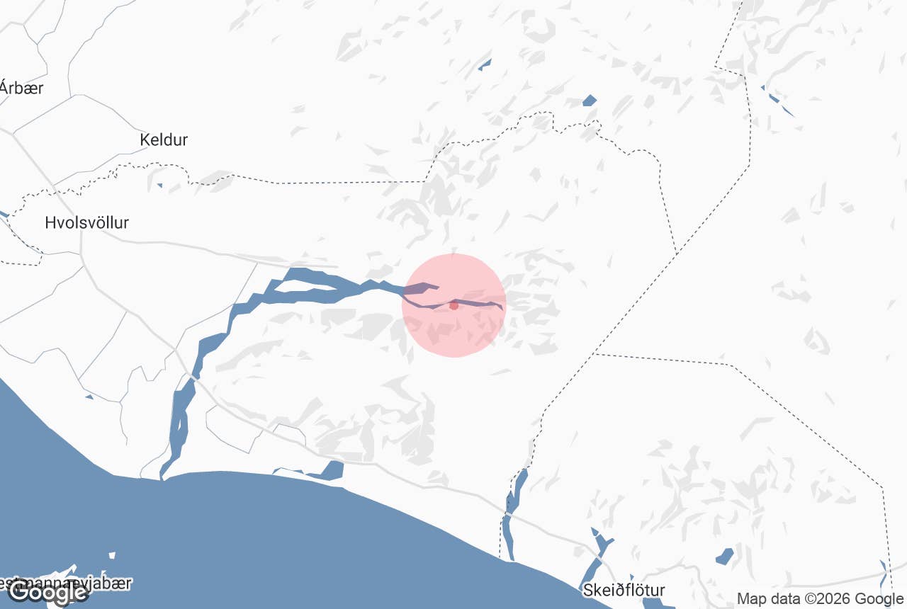
Álfakirkja ("Elf Church") is a church-shaped rock formation on Goðaland, the southern half of the Þórsmörk area in South Iceland.
It stands on the south bank of the glacial river Krossá, about 1.5 km west of the Básar huts, where the F249 track runs in towards Þórsmörk.
In Icelandic folklore it is a church of the huldufólk, the hidden people, and tours into Þórsmörk often stop here for photos and a short walk.
Key Takeaways About Álfakirkja
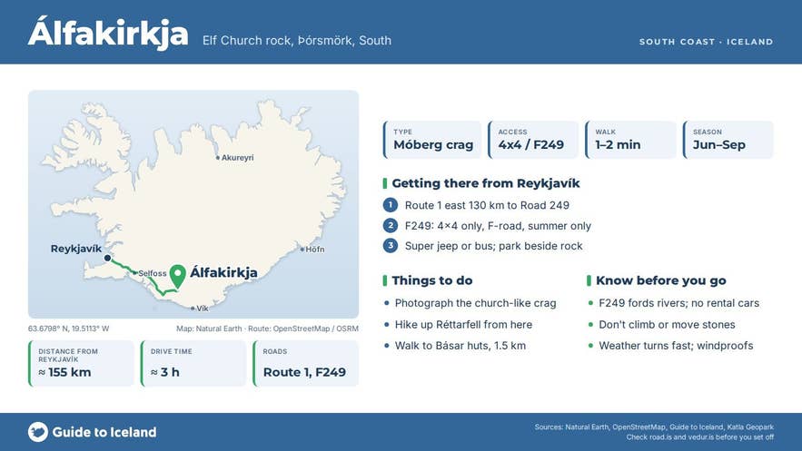
- Church-shaped crag of palagonite tuff (móberg) at the foot of Réttarfell on Goðaland
- Beside the F249 track on the south (Básar) side of Krossá; a minute's walk from a parked vehicle
- Reach it by super jeep tour or highland bus; F249 fords glacial rivers and is banned for rental cars
- Season June to September, when F249 is open and the Básar huts and campsite are running
- Several other rocks in Iceland are called Álfakirkja; this is the Þórsmörk one
Why visit Álfakirkja
Álfakirkja is a crag of palagonite tuff, móberg in Icelandic, the brownish rock that makes up most of the Þórsmörk and Goðaland hills, and it stands at the foot of Réttarfell (503 m), opposite the mouth of Langidalur across the river.
Móberg forms when eruptions happen under ice, and the Eyjafjallajökull volcano, on whose northern flank Goðaland lies, is about 800,000 years old.
Wind and water have carved the soft rock into gullies, caves and spires, and here they left a dark, tower-like crag with a large hollow eroded into its base, so that from the track it looks like a small church with its doors open. The name is simply álfa (of elves) and kirkja (church).
The setting is as much of the attraction as the rock. Álfakirkja sits on the open gravel flats of Goðaland, with the braided channels of Krossá on one side and the móberg peaks of Réttarfell and Útigönguhöfði (805 m) rising directly behind it.
Across the river are Valahnúkur and the birch woods of Þórsmörk proper. The area is part of Katla UNESCO Global Geopark, which lists Álfakirkja among the curious natural rock formations of Þórsmörk, alongside Snorraríki, Sóttarhellir cave and Stakkholtsgjá gorge.
Álfakirkja is also a trailhead. Hikers taking the western route up Réttarfell, or on to Útigönguhöfði via Vestrihattur and the Hvannárgil gorge, park beside the rock and start from here.
The slope soon steepens into scree and scrambling, so this is a route for experienced walkers in good weather; the easier, more used path up Réttarfell, with built steps, starts at Básar.
How to get to Álfakirkja
Álfakirkja lies on the Goðaland side of Krossá, so you reach it from the F249 Þórsmerkurvegur, not from the Húsadalur and Langidalur side.
- From Reykjavík, drive the Ring Road (Route 1) east for about 130 km to the junction with Road 249, just east of the Markarfljót bridge and next to Seljalandsfoss. Hvolsvöllur, the nearest town, is about 25 km before the junction, roughly 1.5 hours from Reykjavík.
- Road 249 is paved for its first stretch, then becomes gravel F249. The route from the Ring Road to the Þórsmörk huts is about 30 km and takes 1 to 1.5 hours.
- F249 crosses several unbridged glacial rivers, including Steinsholtsá and Hvanná. Básar and Álfakirkja are reached without fording Krossá itself, which is the most dangerous river on the route and the reason most people do not drive here themselves.
- Only large, high-clearance 4x4s and modified super jeeps should attempt F249. Most rental agreements exclude F249 outright. River depth changes by the hour with rain and glacier melt.
- Scheduled highland buses run from Reykjavík and Hvolsvöllur to Básar in summer, and super jeep day tours leave from Hvolsvöllur and Reykjavík. Álfakirkja stands right beside the track, so the walk from a parked vehicle is a minute or two on flat gravel.
F249 normally opens in late May or early June and closes in the autumn; dates depend on snow and river conditions and are posted on road.is.
Best time to visit
June to September is the season. The track is open, the huts and campsite at Básar are staffed, and the long daylight leaves time for a hike up Réttarfell after the drive in.
July and August have the warmest weather and the fullest birch foliage; September brings autumn colour and fewer people. Outside summer the rivers are often impassable or frozen and only guided winter super jeep trips go in.
Safety and practical tips
- Do not attempt to ford Krossá or the other rivers in a standard car. If you are unsure, take a bus or a guided tour.
- Weather in Þórsmörk changes quickly even in summer. Bring a windproof shell, warm layers and proper footwear; the gravel flats are exposed and the slopes above are loose móberg scree.
- The rock stands in a protected area within Katla UNESCO Global Geopark. Do not climb on it or move stones, and stay on existing paths on the vegetated areas.
- There are no facilities at the rock itself. Toilets, showers, drinking water, a campsite and two huts with 75 beds (run by the touring club Útivist) are at Básar, 1.5 km away. Huts should be booked in advance; the campsite does not need booking.
- There is no fee to visit Álfakirkja. Mobile coverage is patchy on Goðaland.
- Check road.is for F249 status and safetravel.is for conditions before you set off.
Is Álfakirkja a real church?
Can I drive to Álfakirkja in a normal car?
How far is Álfakirkja from Básar?
Are there other places in Iceland called Álfakirkja?
When is the best time to visit Álfakirkja?
Nearby attractions
- Valahnúkur – 1 km across Krossá, the classic Þórsmörk viewpoint hike
- Thorsmork (Þórsmörk) – 1.3 km
- Básar Hut – 1.5 km, the huts and campsite on Goðaland
- Stakkholtsgjá – 2.3 km, a narrow gorge with a waterfall at its end
- Fimmvörðuháls – 5 km, the pass between Eyjafjallajökull and Mýrdalsjökull that the trail from Básar climbs to
- Gígjökull – 7 km, the outlet glacier of Eyjafjallajökull passed on the way in
Tours that visit Álfakirkja
- Southern Highlands & Thorsmork Super Jeep Tour from Hvolsvollur – a roughly 6-hour super jeep day tour from the LAVA Centre in Hvolsvöllur that stops at Seljalandsfoss, Gígjökull and Stakkholtsgjá, pauses for lunch at Básar (a lunch box is an optional extra), includes a short guided hike in Þórsmörk and visits Álfakirkja before heading back.
