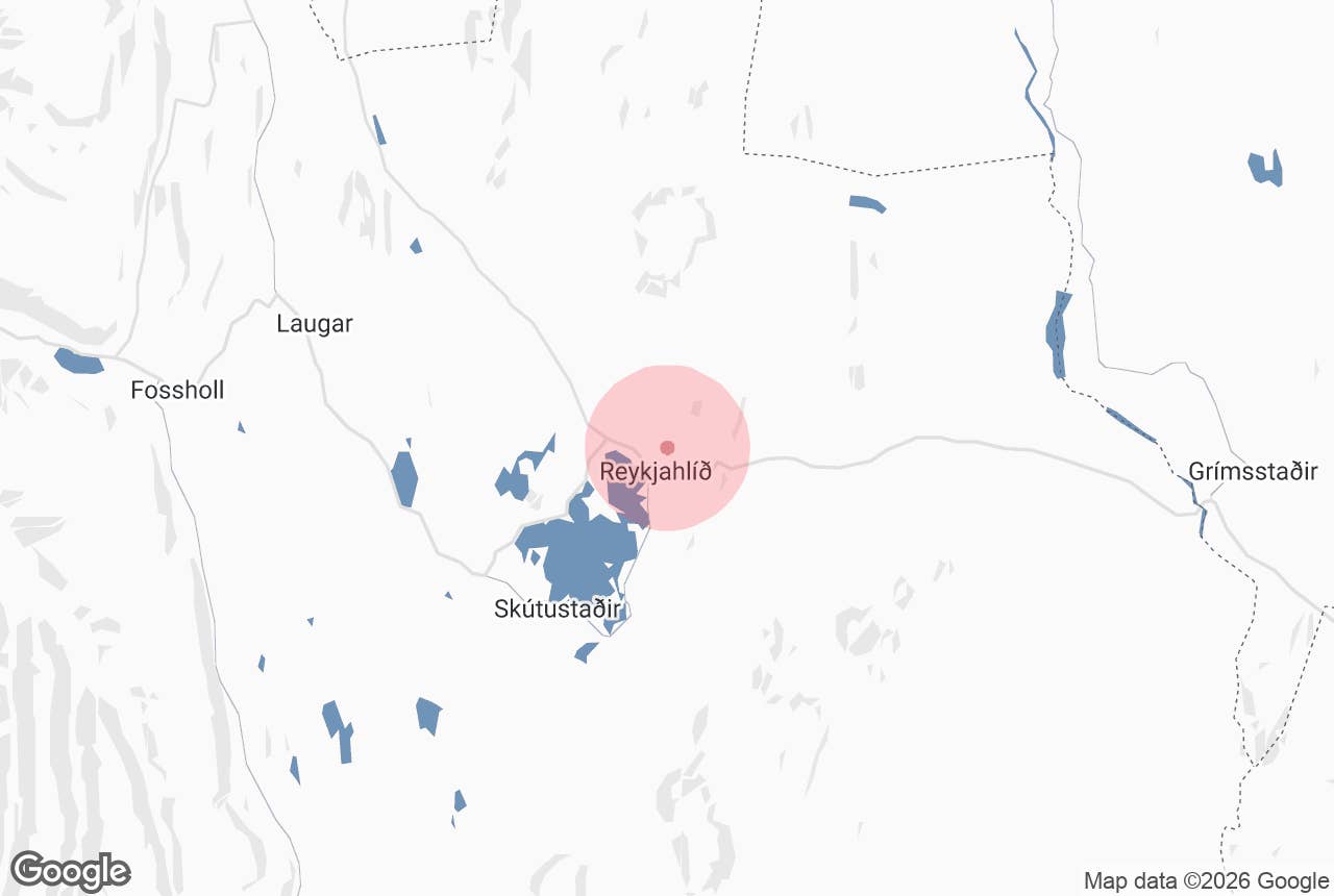
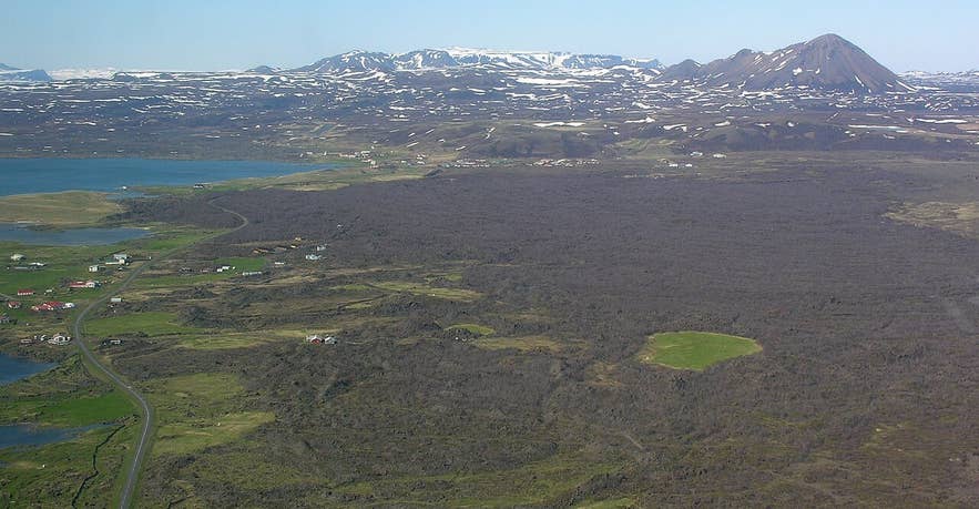
Reykjahlíð and the Eldá lava flow. Photo: Hansueli Krapf, CC BY-SA 3.0
Eldá lava channel (Icelandic: Eldá, "fire river") is the narrow lava channel that carried molten rock down from the Krafla fissures to the village of Reykjahlíð and into Lake Mývatn during the Mývatn Fires of 1724–1729.
It is not a river of water but a river-shaped ribbon of solidified lava, a few kilometres long, running from the slopes below Hlíðarfjall down onto the flat ground north of the village. The lava field it fed around Reykjahlíð is called Eldhraun ("fire lava").
Together they are the most visible legacy of the eruptions that destroyed three farms, buried the old village and famously stopped at the church.
Key Takeaways About Eldá
- A river-shaped channel of solidified lava, not water, from the 1724–1729 Mývatn Fires; the main flow ran down it in 1729
- An old glacier-cut gully filled by more than one lava flow, with lava "waterfalls" and lava tubes (Environment Agency of Iceland)
- Fed the Eldhraun lava plain that destroyed the farms at Reykjahlíð and stopped in front of the church
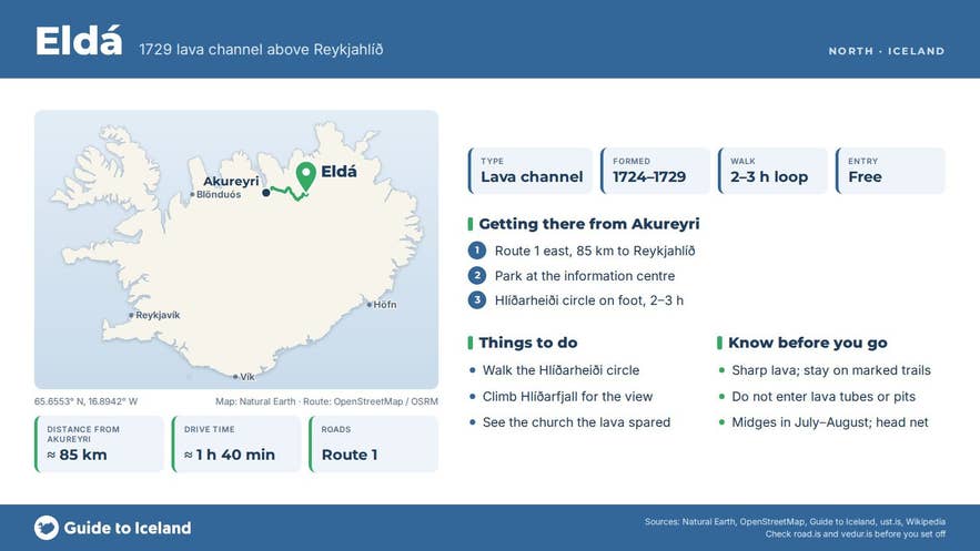
- Reached on foot or by fat bike from Reykjahlíð on the Hlíðarheiði circle (2–3 h) or the Krafla route (3–4 h); no 4x4 needed
- Listed in conservation class 2 since 1987; proposed for protection with Leirhnjúkur and Hverir
Why visit the Eldá lava channel
The Mývatn Fires were a five-year episode of rifting and eruption at Krafla, starting with the explosion that created the Víti crater on 17 May 1724.
Lava eruptions began in August 1727 and came in pulses until June 1729, and in 1729 lava from Leirhnjúkur followed the lowest ground towards the lake. Over a few kilometres from Hlíðarfjall down to the lowland it flowed in a narrow tongue, and that tongue is Eldá.
According to the Environment Agency of Iceland, the Eldá channel is an old glacier-carved gully that has since been filled by more than one lava flow; within it are unusual lava formations, lava "waterfalls" where the flow dropped over steps in the gully, and lava tubes.
Eldhraun itself, the lava plain the channel spilled out onto, is varied and largely unvegetated except in the cracks, with ropy pahoehoe surfaces, collapse pits and split lava blisters.
In 1729 the flow destroyed the farms around Reykjahlíð but halted in front of the church, which stood on slightly higher ground; the present church stands on the same spot.
In 1987 the Nature Conservation Council listed Eldá and Eldhraun in conservation class 2, and the Environment Agency has since proposed protecting the whole Leirhnjúkur–Hverir–Eldá area for its geology and rifting features.
From the ridge of Hlíðarfjall you can look down the channel and see how the 1729 lava got from the fissure to the lake. It is also quiet: most visitors go to Hverir, Dimmuborgir and the Nature Baths, and the Eldá lava channel is in plain sight but rarely walked.
How to get to the Eldá lava channel
The Eldá lava channel lies immediately north-east of Reykjahlíð, the main village on Lake Mývatn in North Iceland. Reykjahlíð is on the Ring Road (route 1) about 85 km east of Akureyri, and roughly a seven-hour drive (about 470 km) from Reykjavík. There is no car park at Eldá itself; park in Reykjahlíð and walk.
Two marked walking routes follow the channel:
- Hlíðarheiði circle. Starts at the Hlíð campsite on the north edge of the village, leads north to Eldá, then up Hlíðarfjall on a fairly steep marked path (30–40 minutes each way), east to the Brunaborgir craters and back over the hills to the information centre. Allow two to three hours.
- Krafla route. A longer trail between the Reykjahlíð information centre and Leirhnjúkur that crosses the 1724–1729 lava, passes Hlíðarfjall and then follows the bank of Eldá back down to the village. Three to four hours one way, fairly easy going.
Both are on foot or by fat bike over lava and gravel; no F-road or 4x4 is involved.
Best time to visit
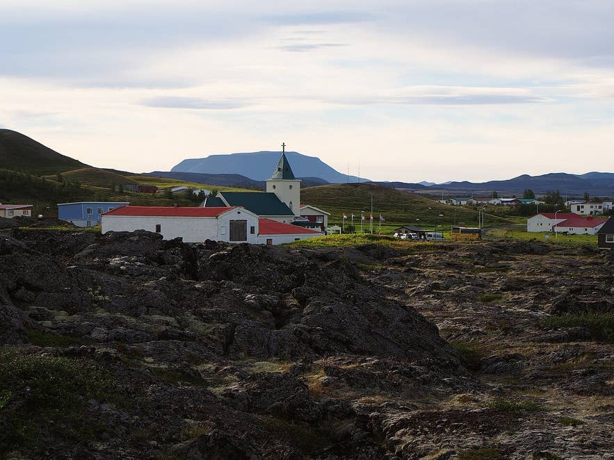
1729 lava at Reykjahlíð church. Photo: rheins, CC BY 3.0
June to September, when the trails are snow-free and the days are long. The midges that give the lake its name can be dense on still days in July and August; a head net helps. In winter the channel is under snow and the paths are not maintained.
Safety and practical tips
- The lava surface is sharp and uneven, with hidden cracks and loose blocks. Wear boots with ankle support and stay on the marked trail.
- Lava tubes and collapse pits in the channel are not developed for visitors; do not enter them.
- There are no facilities on the route. Toilets, shops, fuel and the information centre are all in Reykjahlíð.
- Weather on Hlíðarfjall can be much windier than in the village. Take a windproof layer even on a warm day.
- There is no entrance fee and the area is open at all times.
Is Eldá a real river?
When did the lava flow down Eldá?
Can I drive to Eldá?
Is Eldá the same as Eldhraun in South Iceland?
Nearby attractions
- Church of Reykjahlíð – 1.5 km. The church the 1729 lava stopped in front of.
- Reykjahlíð – 1.6 km. The village on the north-east shore of Lake Mývatn, with shops, fuel and the information centre.
- Grjotagja – 3.3 km. Lava-cave with a hot spring, south-east of the village.
- Namafjall Geothermal Area – 4.3 km. Hot springs and mud pots at Hverir, east of Námaskarð.
- Hverfjall – 5.3 km. The 2,500-year-old tephra ring south of the village.
- Dimmuborgir – 6.8 km. The "dark castles" of collapsed lava pillars.
- Myvatn – 7.4 km. The shallow, bird-rich lake the lava flowed into.
- Krafla Lava Fields – 8.9 km. The 1975–1984 Krafla Fires lava at Leirhnjúkur.
- Krafla – 9.4 km. The volcano whose fissures fed the Mývatn Fires.
- Viti in Krafla – 10.0 km. The explosion crater formed on 17 May 1724 at the start of the Mývatn Fires.
Tours that visit the Eldá lava channel
- Exhilarating 3-Hour Fat Bike Lake Myvatn Tour – a guided fat-bike ride from Reykjahlíð over single tracks, gravel and lava near the Krafla area, following the Eldá lava river to see where the lava ran down the hillside in the Mývatn Fires, and finishing along the continental rift. (The tour text dates the flow to 1724; the lava that ran down Eldá is from 1729.)
