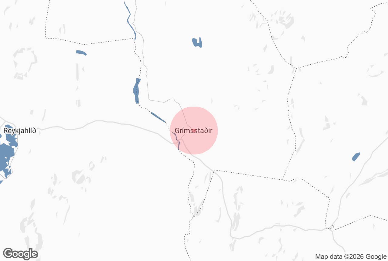
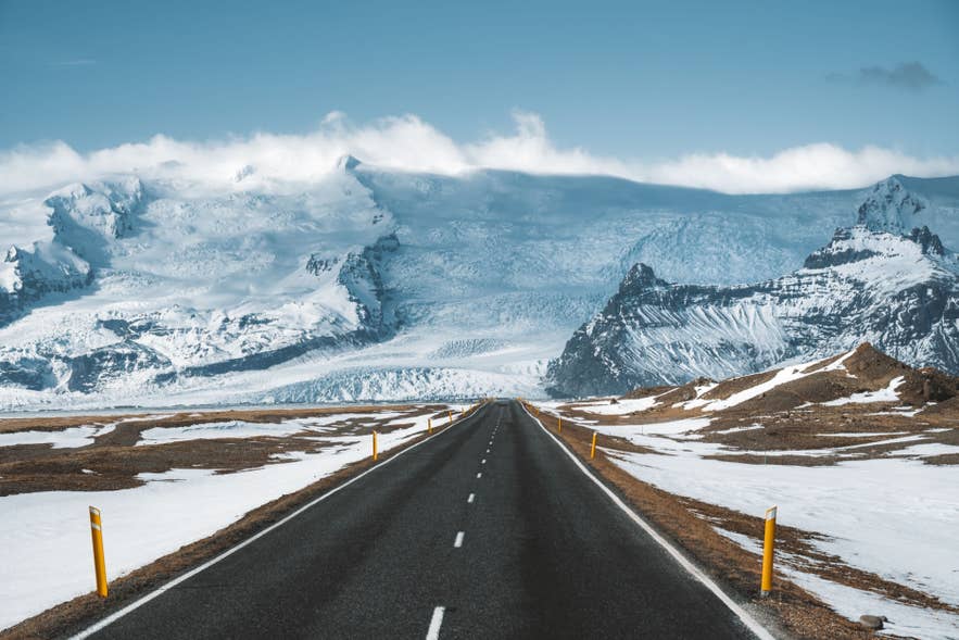
Grimsstadir is a working farm and Ring Road stop in Northeast Iceland, at the point where Route 1 crosses the Jokulsa a Fjollum river and the gravel road to Dettifoss turns north. It shares Iceland's all-time cold record. Read on to plan your visit.
Grimsstadir Farm sits in Northeast Iceland, on the long empty stretch of the Ring Road between Lake Myvatn and Egilsstadir. Most drive straight past. That is a miss, because this is the junction where the road to the east bank of Dettifoss Waterfall leaves Route 1.
Why You Can Trust Our Content
Guide to Iceland is the most trusted travel platform in Iceland, helping millions of visitors each year. All our content is written and reviewed by local experts who are deeply familiar with Iceland. You can count on us for accurate, up-to-date, and trustworthy travel advice.
The farm is 77 miles (124 kilometers) east of Akureyri and 23 miles (37 kilometers) east of Reykjahlid on Lake Myvatn. From Reykjavik it is 320 miles (516 kilometers) by the northern Ring Road.
Nearly everyone arrives in a rental car, and a 4x4 is sensible for the gravel road north. The year-round Akureyri to Egilsstadir bus passes this way, and guided Diamond Circle tours and Ring Road day tours cover the same waterfalls without the gravel.
Iceland's lowest temperature was recorded here, the farmers once ferried travelers across the river, and in 2011 this land sat at the center of an international sale dispute. Read on for the distances, the road choices, and what to check before you turn north.
Key Takeaways
-
Grimsstadir Farm sits at the Route 1 and Route 864 junction in Northeast Iceland, 23 miles (37 kilometers) east of Lake Myvatn.
-
It is the closest Ring Road turnoff for the east bank of Dettifoss Waterfall, 17 miles (28 kilometers) north on unpaved Route 864.
-
Iceland's lowest recorded temperature, -36 F (-38 C), was measured at Grimsstadir and neighboring Modrudalur on 21 January 1918.
-
Route 864 is rough gravel, normally passable only in summer. Paved Route 862 on the west bank is the year-round option.
-
The farmers here ferried travelers across the river for a fee until the bridge opened in 1947.
-
The farm runs a guesthouse and campsite, and Fjalladyrd Hotel at Modrudalur is the nearest hotel.
What Is Grimsstadir Farm
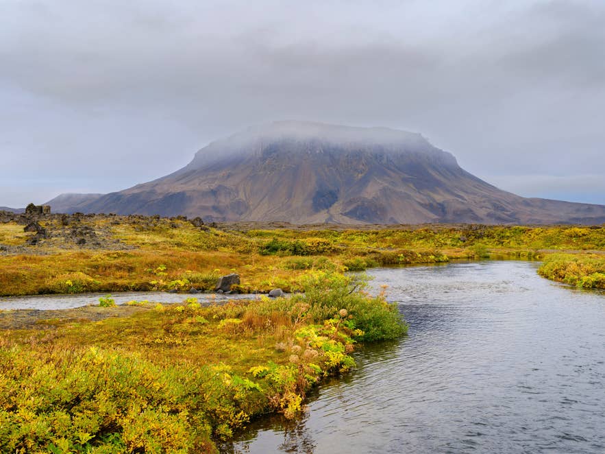
Grimsstadir is a working farm in Northeast Iceland, about 1,300 feet (400 meters) above sea level, where the Ring Road crosses the glacial river Jokulsa a Fjollum. Its full name, Grimsstadir a Fjollum, places it in the sparsely settled Holsfjoll district.
The buildings you see today are not on the original site. The farm once stood about 4 miles (7 kilometers) further north and was moved because of soil erosion and sandstorms blowing off the plateau.
Grimsstadir has long served as a weather observation point, which is how it entered Iceland's record books. Its guesthouse and campsite, roughly 2 miles (3 kilometers) off Route 1, are among very few places to sleep here.
The name reached international news in August 2011. Chinese businessman Huang Nubo offered around 8.8 million US dollars for about 116 square miles (300 square kilometers) of land here for a 200 million dollar resort.
The Icelandic government rejected the sale that November on foreign-ownership grounds, and a later attempt to lease the land also failed.
The land did sell in the end. British businessman Jim Ratcliffe bought about 70 percent of Grimsstadir in 2016 for its salmon-river headwaters. As an EEA national he fell outside the law that blocked Huang.
Where Grimsstadir Sits on the Ring Road
Grimsstadir sits on Route 1 at the bridge over Jokulsa a Fjollum, 77 miles (124 kilometers) east of Akureyri and 23 miles (37 kilometers) east of Reykjahlid. It is the last junction before the Ring Road climbs east toward Modrudalur Farm and the Eastfjords.
| From | Distance | Driving time |
|---|---|---|
| Reykjahlid, Lake Myvatn | 23 miles (37 kilometers) | 30 minutes |
| Akureyri | 77 miles (124 kilometers) | 1 hour 30 minutes |
| Reykjavik, via Akureyri | 320 miles (516 kilometers) | 6 hours 30 minutes |
| Dettifoss east bank, via Route 864 | 17 miles (28 kilometers) | 45 minutes |
Both the 7-day and 9-day circle-of-Iceland self-drive routes pass through Grimsstadir, halfway along the Akureyri to Egilsstadir leg.
How To Get to Dettifoss From Grimsstadir
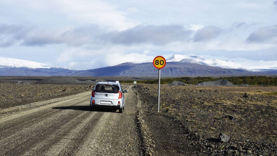
From Grimsstadir, the east bank of Dettifoss Waterfall is 17 miles (28 kilometers) north on Route 864, an unpaved gravel road normally passable only in summer.
Route 864, also called Holsfjallavegur, runs 35 miles (56 kilometers) from the Ring Road north to Route 85, unsealed the whole way. The surface is corrugated and pitted, so it is slow going and best in a high-clearance vehicle.
| Route 864, east bank | Route 862, west bank | |
|---|---|---|
| Surface | Gravel, unsealed | Paved |
| Season | Summer only | Year-round |
| Facilities | Minimal | Marked paths and parking |
| Turnoff from Route 1 | At Grimsstadir | West of Grimsstadir |
Two more waterfalls sit on the same river within walking distance of Dettifoss: Selfoss upstream and Hafragilsfoss downstream inside Jokulsargljufur Canyon. To skip the gravel, Lake Myvatn and Dettifoss day tours run from Myvatn in summer.
The Coldest Place in Iceland
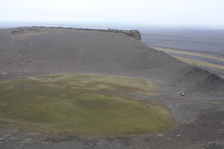
Iceland's lowest recorded temperature, -36 F (-38 C), was measured at Grimsstadir and neighboring Modrudalur on 21 January 1918. Icelanders call that winter Frostaveturinn mikli, the Great Frost Winter.
Both farms read the figure the same morning, so the Met Office treats the record as shared. The reason is geography.
Grimsstadir sits inland at about 1,300 feet (400 meters), ringed by higher ground and far from the sea that keeps coastal Iceland mild. On clear, still winter nights, cold air sinks off the uplands and pools here.
Check the Icelandic Met Office forecast before you drive this stretch in any season, and read up on Iceland's climate if you are planning a winter trip.
The River Crossing and the 1947 Bridge at Grimsstadir
Before the suspension bridge opened in 1947, the farmers at Grimsstadir were obliged to ferry travelers across Jokulsa a Fjollum for a fee. It was the only practical crossing for a very long way.
A stone-and-concrete travelers' retreat was built at the ferry point in 1880, with a stable downstairs and a stove and beds above.
The 1947 bridge is still the one you drive over. It is a single-span suspension bridge on concrete towers, narrow enough that traffic crosses one vehicle at a time.
Corrosion has developed in its cables and its load capacity has fallen. The road authority has run maintenance closures here in recent summers, opening the deck only in short windows during the working day.
A replacement two-lane bridge is under consideration in Iceland's transport plan, which targets removing single-lane bridges from the Ring Road.
If a closure would wreck your day, check the Icelandic Road and Coastal Administration's road conditions map before you set out.
What To See and Where To Stay Near Grimsstadir
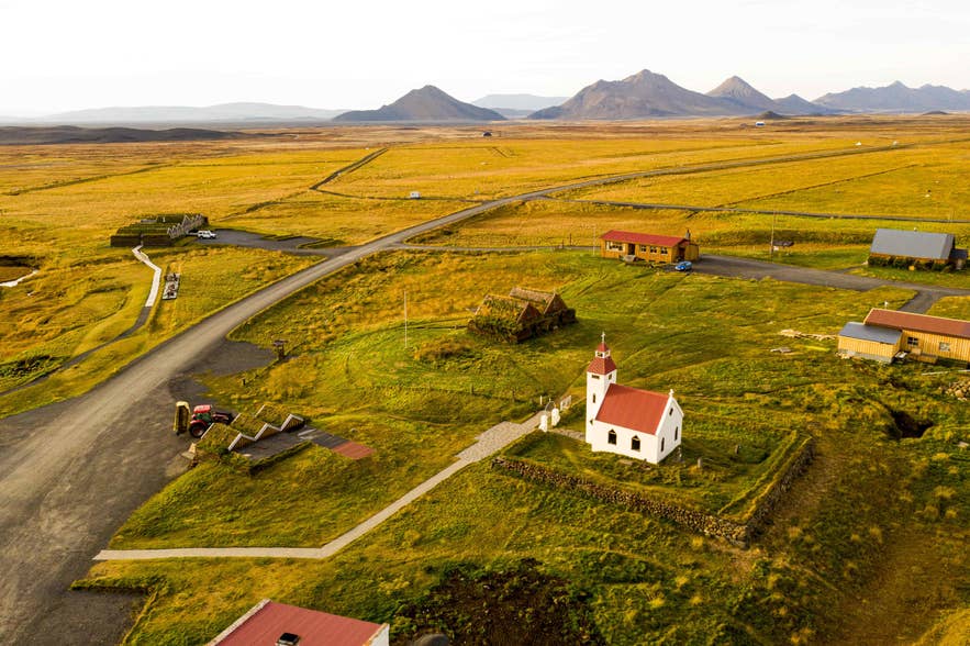
The closest sights to Grimsstadir are the three waterfalls on Jokulsa a Fjollum and Modrudalur Farm, 20 minutes east on the Ring Road. This is the eastern edge of the Diamond Circle.
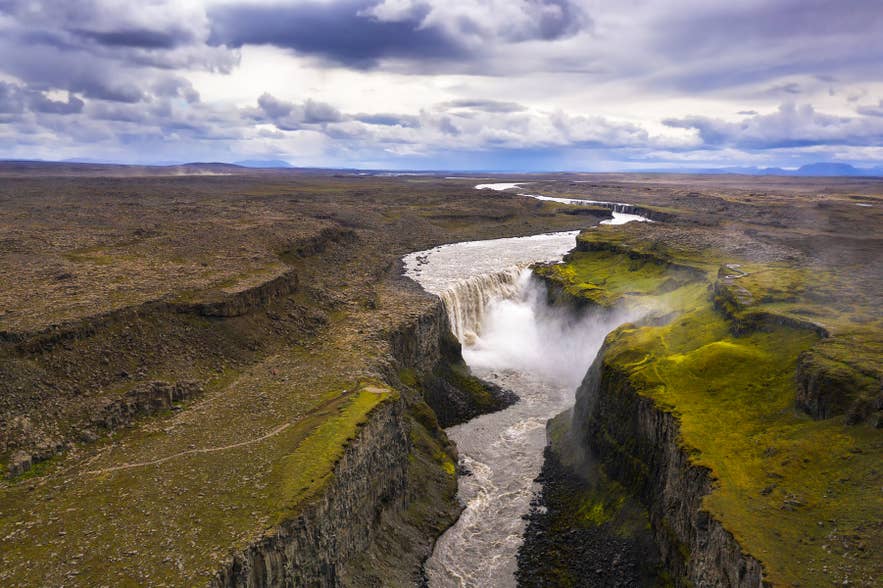
- Dettifoss Waterfall: one of Europe's most powerful waterfalls by volume, averaging about 6,800 cubic feet (193 cubic meters) per second, 17 miles (28 kilometers) north on Route 864.
- Selfoss Waterfall: a broad, low fall a short walk upstream from Dettifoss.
- Hafragilsfoss Waterfall: downstream of Dettifoss, deep inside Jokulsargljufur Canyon.
- Asbyrgi Canyon: the horseshoe-shaped canyon at the north end of Route 864.
- Hljodaklettar: twisted basalt formations in the same canyon system.
- Modrudalur Farm: Iceland's highest inhabited farm at 1,539 feet (469 meters), with a small turf-roofed church.
- Herdubreid: the flat-topped table mountain south of the Ring Road, deep in the Highlands.
For a bed, the farm's own guesthouse and campsite are nearest, and Fjalladyrd Hotel at Modrudalur is the closest hotel.
For more choice, see hotels near Lake Myvatn to the west or hotels in East Iceland to the east. Campers should read our guide to camping in Iceland first.
Driving Safety and Weather at Grimsstadir
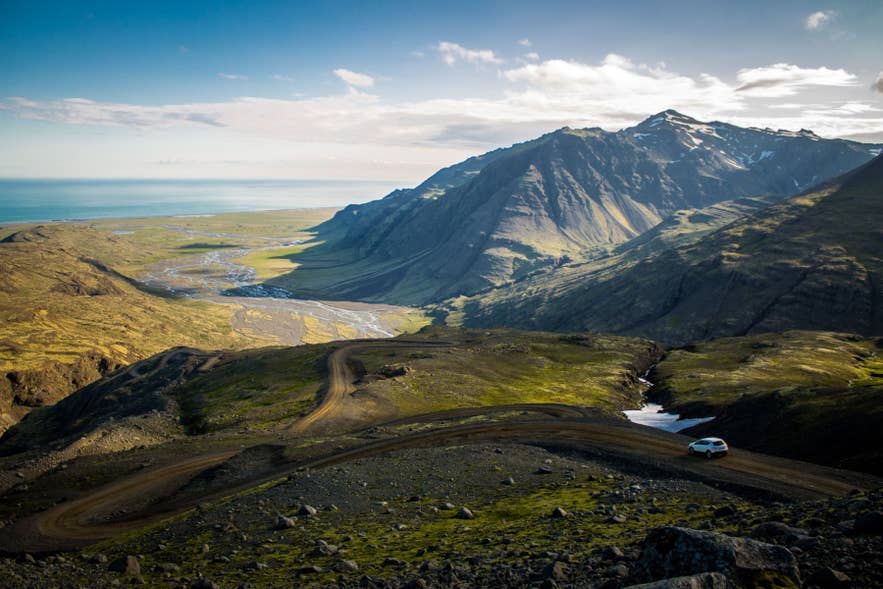
Grimsstadir sits on an exposed inland plateau where snow, ice, and high winds can close the Ring Road in winter, so check road conditions and the forecast before you set out. There is little shelter and little passing traffic.
- Wind and snow: watch the Met Office's weather warnings and the road conditions map. Winter closures on the Myvatn to Egilsstadir leg are routine.
- The bridge: it carries one vehicle at a time, so slow down, look across, and yield.
- Route 864: gravel demands lower speeds than it looks, and loose surfaces cause most rental-car damage in Iceland. Read our notes on driving in Iceland first.
- Going south: the tracks toward Herdubreid and Askja are F-roads, summer-only, and need a genuine 4x4. File a travel plan with SafeTravel.is, Iceland's official travel safety service first.
Plan Your Visit to Grimsstadir Farm
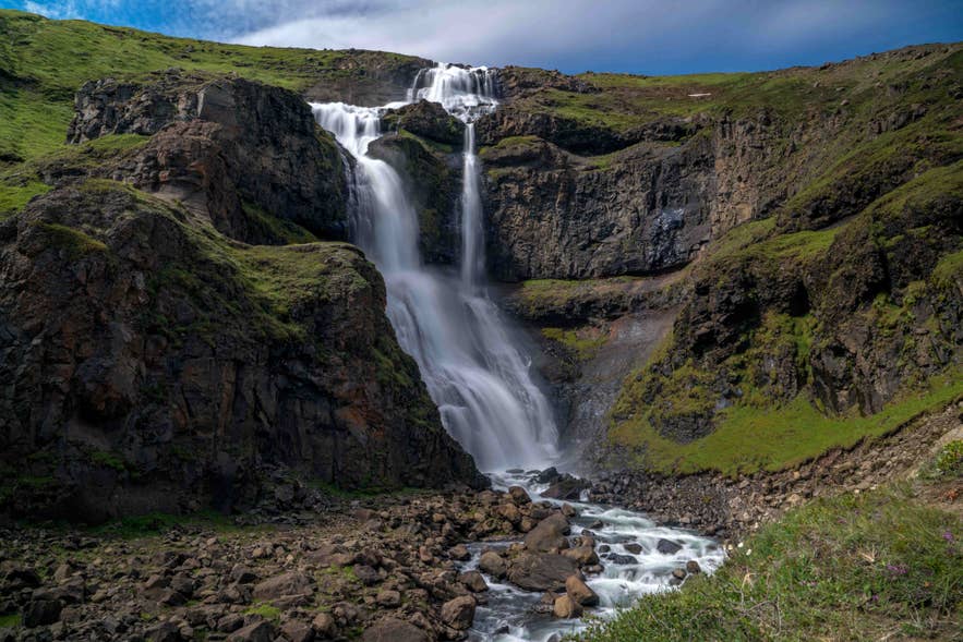
Grimsstadir rewards travelers who know what it is for. It is the turnoff for the wild side of Dettifoss, a rare bed on an empty road, and a piece of Icelandic history beside a glacial river.
Build it into a North Iceland itinerary alongside the Diamond Circle, and pick a rental car with the clearance for Route 864.
For the rest of the route, see the best attractions along the Ring Road and 8 must-see places in North Iceland.
Frequently Asked Questions About Grimsstadir
Is Grimsstadir worth stopping at?
Yes, if you are driving between Lake Myvatn and Egilsstadir and want to see the east bank of Dettifoss, or you need a bed or a campsite on a stretch of the Ring Road that has almost none. It is a practical stop and a historic river crossing rather than a sightseeing attraction in itself.
Can you drive to Grimsstadir in winter?
Yes. Grimsstadir sits directly on Route 1, which is maintained year-round, but this exposed inland section closes in bad weather more often than the coast. Check the road conditions map and the forecast the morning you travel.
Do you need a 4x4 to drive Route 864 from Grimsstadir?
No, not strictly, but a high-clearance vehicle is strongly advised. Route 864 is unsealed for its full 35 miles (56 kilometers), with a corrugated surface and potholes. A 4x4 rides it far more comfortably and is less likely to pick up damage.
Is Route 864 open all year?
No. Route 864 is normally passable only in summer. For year-round access to Dettifoss, use paved Route 862 on the west bank, which leaves Route 1 west of Grimsstadir.
Can you camp at Grimsstadir?
Yes. The farm operates a campsite alongside its guesthouse, about 2 miles (3 kilometers) off Route 1. It is the only campsite on this part of the Ring Road, so it fills up in high summer.
Is there public transport to Grimsstadir?
Yes, but barely. Straeto route 56 runs along this stretch of Route 1 between Akureyri and Egilsstadir, daily in summer and three to five times a week in winter, and drivers will drop off on request. No bus goes north to Dettifoss from here, so you would still need a car.
Is Grimsstadir the same place as Modrudalur?
No. They are two separate farms about 20 minutes apart on the Ring Road. Both recorded Iceland's lowest temperature on the same day in 1918, which is why the names often appear together, and Modrudalur is the higher of the two at 1,539 feet (469 meters).
Was Grimsstadir nearly sold to a foreign investor?
Yes, twice over. In 2011 Chinese businessman Huang Nubo offered about 8.8 million US dollars for around 116 square miles (300 square kilometers) of land at Grimsstadir for a resort development. The Icelandic government blocked that sale and a later lease attempt. Most of the land was bought in 2016 by British businessman Jim Ratcliffe, who as an EEA national was not covered by the same restriction.
Is the suspension bridge at Grimsstadir safe to cross?
Yes, it is an open public road bridge, but it is narrow and takes one vehicle at a time. Corrosion in the cables has reduced its load capacity. The road authority has closed it for maintenance during working hours in recent summers, so check road conditions before you rely on it.
Can you see the northern lights at Grimsstadir?
Yes, between roughly September and April. There is effectively no light pollution here, which makes it a strong spot on a clear night, though you still need the aurora forecast and a cloud-free sky. Guided northern lights tours run from Myvatn and Akureyri.
