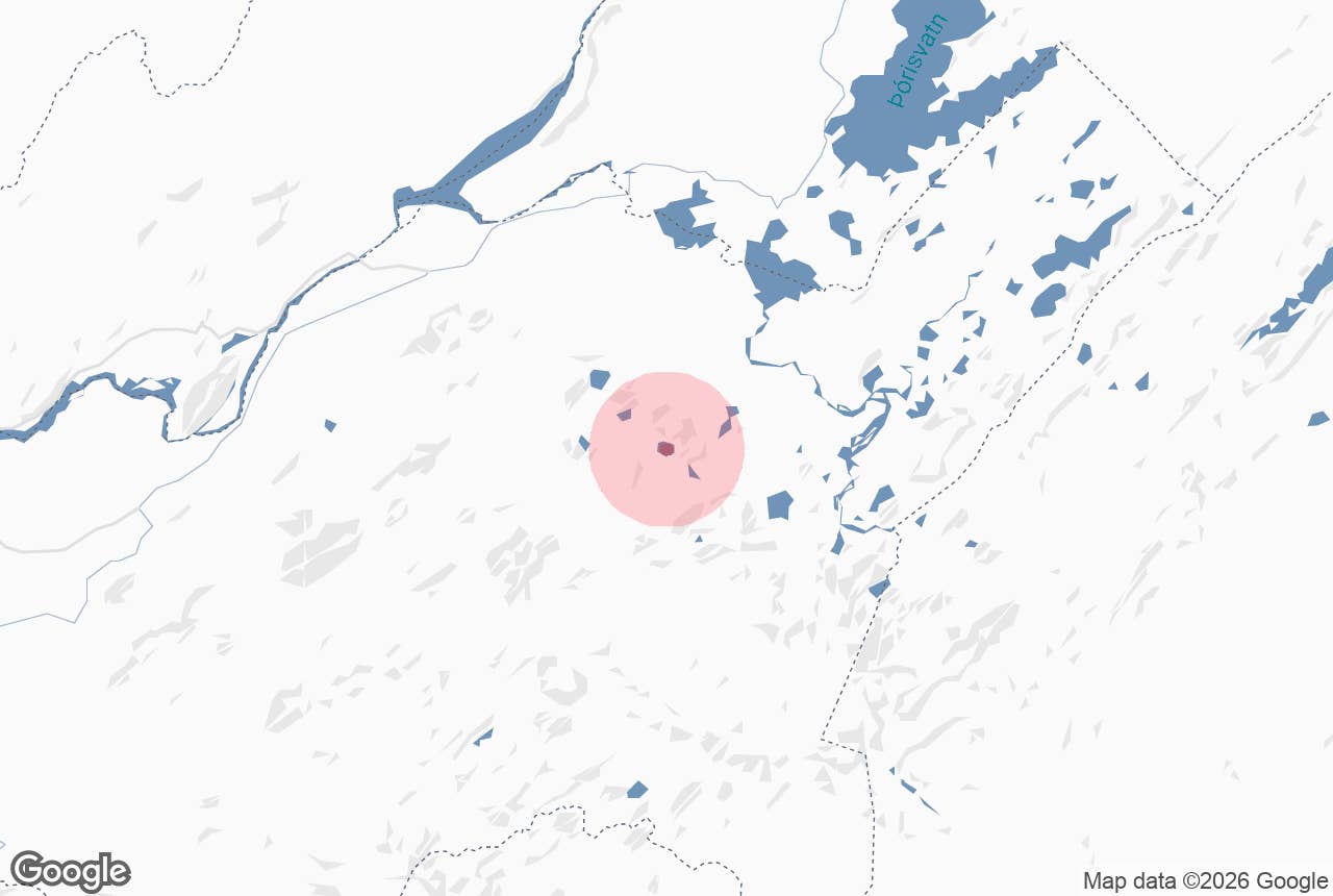
Löðmundarvatn lake, named after the mountain Löðmundur, is a small highland lake at the foot of the mountain Löðmundur in the Fjallabak Nature Reserve, in the southern highlands of Iceland.
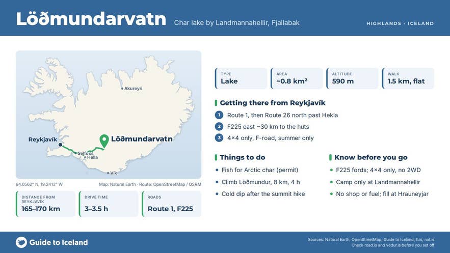
It lies at about 590 m above sea level, just east of the Landmannahellir huts and campsite, on the Landmannaleið track (F225) that runs from Route 26 towards Landmannalaugar.
The lake is known as a quiet Arctic char fishing water and as the finish of the popular Löðmundur summit hike, where walkers on the GTI Fjallabak tour cool off with a dip after coming down off the mountain.
Key Takeaways About Löðmundarvatn
- Groundwater-fed highland lake (about 0.8 km², 590 m a.s.l.) just east of the Landmannahellir huts in Fjallabak Nature Reserve
- Arctic char fishing 1 June–31 August with permits from Landmannahellir; fly, worm and spinner allowed
- Finish of the Löðmundur summit hike (1,077–1,079 m; ~8 km, 4 h from the Landmannahellir car park), where hikers take a cold dip
- Reached by F225 (Landmannaleið) from Route 26 — 4x4 only, usually open from mid-June to September
- Camp only at Landmannahellir; no shop or fuel (nearest fuel at Hrauneyjar)
Why visit Löðmundarvatn
Löðmundarvatn covers roughly 0.75 to 0.9 km² (the current LMÍ map polygon measures about 0.85 km²) and sits in a bowl of moss-covered hyaloclastite hills, with the sharp ridge of Löðmundur rising about 490 m above it to the north-east.
Löðmundur itself is 1,077 to 1,079 m high (sources differ by a couple of metres), and Ferðafélag Íslands describes its sharp-edged ridge as recognisable from far away. The lake has almost no surface inflow. Its outlet, the Helliskvísl stream, flows west past Landmannahellir and soon sinks into the porous lava, so the lake is fed mainly by groundwater.
The water is clear and cold.
Löðmundarvatn holds Arctic char.
Permits are sold by the hut warden at Landmannahellir (and at the summer shop in Landmannalaugar), and fishing is allowed across the whole lake with fly, worm or spinner, with no limit on the number of rods and 24-hour access during the season from 1 June to 31 August. Catches are reported to the hut warden at Landmannahellir.
For hikers, Löðmundarvatn is the reward at the end of the Löðmundur route. The marked trail starts at the Landmannahellir car park, curves up to the western end of the mountain, climbs steeply onto the summit ridge and follows it east to the highest point.
Ferðafélag Íslands gives the round trip as about 8 km, 400 m of ascent and 4 hours. From the top, in clear weather, you see Hekla, the Rauðufossafjöll range, the peaks Krakatindur and Þóristindur, and the hills around Landmannalaugar, and on the clearest days the big ice caps of the interior.
Landmannahellir itself, about 1.5 km west of the lake, is a small cave in Hellisfjall, about 14 m deep, 8 m wide and 4 m high, which sheltered travellers and round-up men (and, according to the site's own history, their horses) during the autumn sheep round-ups before the first hut was built there in 1907.
Today the Landmannahellir site has heated huts sleeping around 100 people, a campsite for tents and campervans with toilets and a shower, cooking facilities and horse paddocks, open from about mid-June into September.
How to get to Löðmundarvatn
- From Reykjavík: about 165 to 170 km and 3 to 3.5 hours. Take Route 1 east to Selfoss, then Route 30 and Route 32 past Árnes, or Route 26 from Hella, to the junction of Route 26 and F225 (Landmannaleið, also called Dómadalsleið) north of Hekla. Follow F225 east for roughly 30 km to the signed turning for Landmannahellir.
- Vehicle: F225 is a highland F-road, open in summer only and legal only for 4x4 vehicles. It has fords, but the rivers on the Landmannahellir section are usually small. Do not attempt it in a two-wheel-drive car.
- Alternative: from Landmannalaugar, F208 and F225 lead west for roughly 20 km to Landmannahellir.
- Parking and walking: park at the Landmannahellir car park (N 64°03.369' W 19°14.477', the Ferðafélag Íslands trailhead). The lake is a short, mostly flat walk of about 1.5 km east. The Löðmundur summit trail starts at the same car park.
Best time to visit
Mid-June to early September, when F225 is open and the Landmannahellir huts are staffed. Vegagerðin has opened F225 between 9 and 24 June in recent years (mid-June on average); check road.is for the current year, as the date varies with snowmelt.
July and August are warmest and have the longest days; the fishing season runs 1 June to 31 August. The Löðmundur trail is exposed on the ridge, so pick a clear, calm day for the summit and the swim in Löðmundarvatn.
Safety and practical tips
- The lake water is cold even in August. Swim only close to shore, never alone, and get out as soon as you feel chilled.
- The moss on the slopes of Löðmundur is fragile and takes decades to recover; stay on the marked trail and do not cut corners on the descent to the lake.
- The summit ridge has steep drops and is often very windy. Turn back in low cloud.
- Löðmundarvatn lies inside the Fjallabak Nature Reserve, where camping is allowed only at marked campsites (Landmannahellir) and along recognised hiking routes, not freely by the lake.
- Buy fishing permits before you fish (Landmannahellir, or by phone from Skarð in Landsveit). Report your catch.
- Facilities at Landmannahellir: huts, campsite, shower, toilets, cooking areas, permit sales (about ISK 6,000 per rod per day in 2026). There is no shop or fuel; the nearest fuel is at Hrauneyjar on Route 26.
Can you swim in Löðmundarvatn?
Can I fish in Löðmundarvatn?
How high is Löðmundur?
Do I need a 4x4?
Is this the same Löðmundur as in Kerlingarfjöll?
Nearby attractions
- Landmannahellir Cave – about 1.4 km, the cave the lake area is named with
- Landmannahellir – about 4.2 km, the hut and campsite area
- Dómadalur – about 4.1 km, the valley the F225 track follows
- Rauðufossar – about 7.1 km, the red waterfalls
- Frostastaðavatn – about 8.0 km, another fishing lake on the way to Landmannalaugar
- Bláhylur – about 8.7 km, the blue crater lake
- Landmannalaugar – about 10.2 km, the rhyolite mountains and hot spring
- Ljótipollur – about 10.4 km, the red crater lake
Tours that visit Löðmundarvatn
- Thrilling 4-Day Hiking Tour in Fjallabak Nature Reserve from Reykjavik is based at the Landmannahellir hut for three nights; on day three the group climbs Löðmundur and descends to Löðmundarvatn for a dip before returning to the hut.
