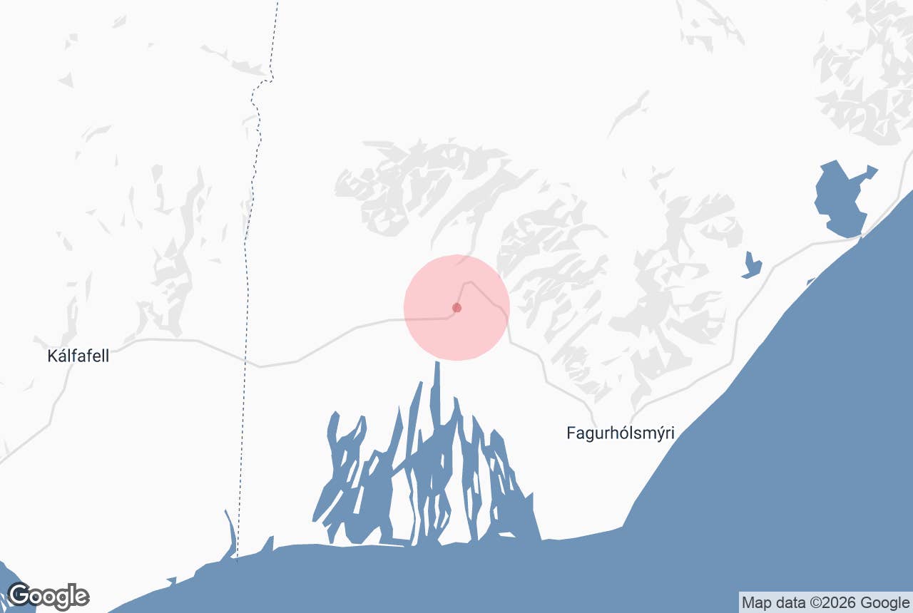
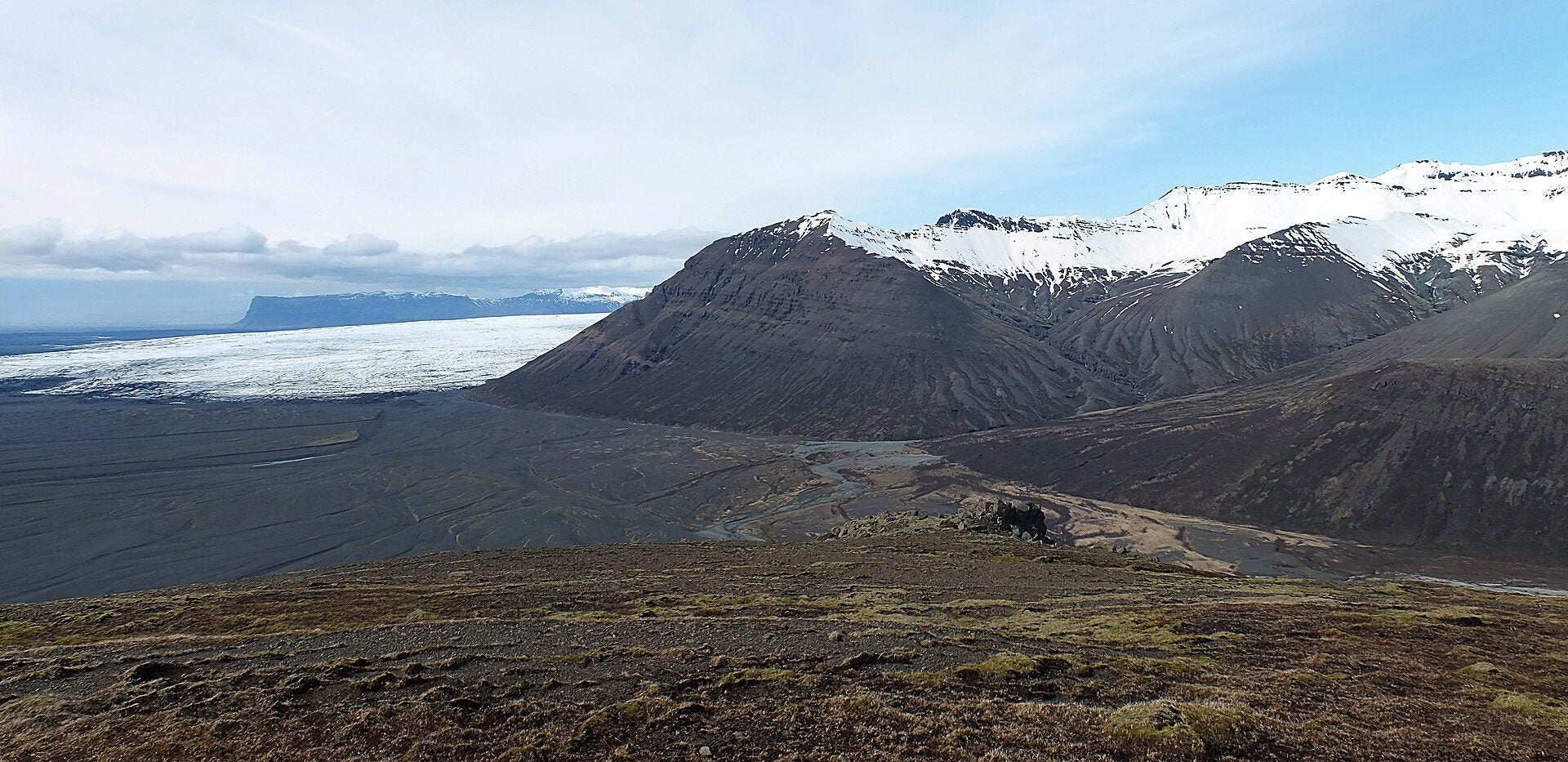
Skeiðarárjökull (left) and the Morsárdalur valley. Photo: Óðinn, CC BY-SA 2.5
Skeiðarárjökull (Icelandic: Skeiðarárjökull, "the glacier of the Skeiðará river") is the largest outlet glacier on the south side of the Vatnajökull ice cap. Its wide front rises above the black sands of Skeiðarársandur just west of Skaftafell, in full view of the Ring Road.
It is known for glacial floods, including the 1996 flood that wrecked bridges on the Ring Road. Two twisted bridge girders by the road mark it.
Key Takeaways About Skeiðarárjökull
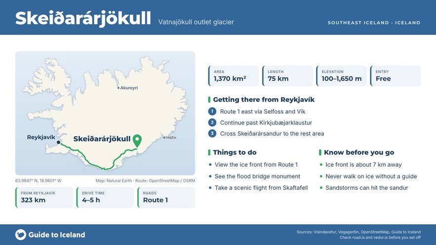
- Largest outlet glacier on the south side of Vatnajökull: about 1,370 km² and 75 km long
- Best seen from Route 1 at the bridge monument rest area, about 4 km from the Skaftafell visitor centre
- Its November 1996 glacial flood wrecked Ring Road bridges; two twisted girders by Route 1 mark it
- Retreating 50 to 100 m a year; the ice front is about 7 km from the road with no marked trail
- Scenic airplane and helicopter flights from Skaftafell fly over it
Why visit Skeiðarárjökull
Skeiðarárjökull is the largest outlet glacier on the south side of Vatnajökull, Iceland's biggest ice cap. It flows down west of Skaftafell and spreads out as a broad lobe of ice, about 28 km wide at its front, above the black sands of Skeiðarársandur.
You don't need to hike to see it. The ice front fills the northern horizon as you drive Route 1 across the sands, and the best roadside stop is the rest area by the twisted steel girders left over from the 1996 flood, a few kilometres southwest of the Skaftafell turn-off and about 4 km from the visitor centre.
Several scenic flights and helicopter tours from Skaftafell fly over it, with views of its crevasses, meltwater channels and the ice-dammed lake Grænalón on its western edge.
Size and geology
Glaciologist Helgi Björnsson puts its area at 1,370 km² and its length at about 75 km from source to snout. The ice falls from around 1,650 m at the ice divide with Dyngjujökull to about 100 m at the front. Part of the glacier bed lies below sea level, in a trough that reaches 270 m below sea level.
Two big glacial rivers, the Skeiðará and the Gígjukvísl, have drained the glacier across the sands. Their sediment built Skeiðarársandur, a black outwash plain of about 1,300 km² between the ice and the sea.
Skeiðarárjökull is a surging glacier. It advanced by about 1 km in 1991, and records suggest several earlier surges since the late 1700s. It is now in steady retreat: the Icelandic Met Office says the ice front moves back 50 to 100 m a year, sometimes more.
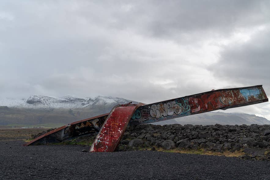
The 1996 flood bridge monument. Photo: Eric Kilby, CC BY-SA 2.0
The 1996 flood and the bridge monument
Glacial floods (jökulhlaups) from Grímsvötn, a subglacial lake and volcano in Vatnajökull, drain under Skeiðarárjökull. The best known came on 5 November 1996, weeks after the Gjálp eruption under Vatnajökull, when floodwater burst out from under the glacier and spread across the sands.
The U.S. Geological Survey records peak flows of about 33,000 m³ per second in the Gígjukvísl and 22,000 m³ per second in the Skeiðará. House-sized icebergs carried by the flood wrecked sections of the Ring Road, destroyed the Gígjukvísl bridge and damaged the 880 m Skeiðará bridge, which opened in 1974 as the last link of Route 1.
Two twisted steel girders from the flood now stand by the road as a monument, with information boards at the parking area.
In summer 2009 the Skeiðará shifted west into the Gígjukvísl channel and left the long bridge mostly over dry land. Since 2017, traffic has used a much smaller bridge beside it, which only spans the Morsá.
How to get to Skeiðarárjökull
The glacier viewpoint on Route 1 is about 323 km from Reykjavík, a drive of roughly 4 to 5 hours on a paved road. Drive east on Route 1 through Selfoss, Hvolsvöllur and Vík, continue past Kirkjubæjarklaustur, and cross Skeiðarársandur. The monument rest area is on the south side of the road, a few kilometres before the Skaftafell turn-off.
The nearest village is Kirkjubæjarklaustur, about 65 km west (around an hour). Höfn is about 120 km east. The Skaftafell visitor centre, 4 km away, has a campsite and a car park.
For a view from above the sands, walk the trails from Skaftafell onto Skaftafellsheiði; the heath near the Sjónarnípa viewpoint looks west over the glacier and the Morsárdalur valley. The ice front itself is about 7 km from the road, and there is no marked trail to it.
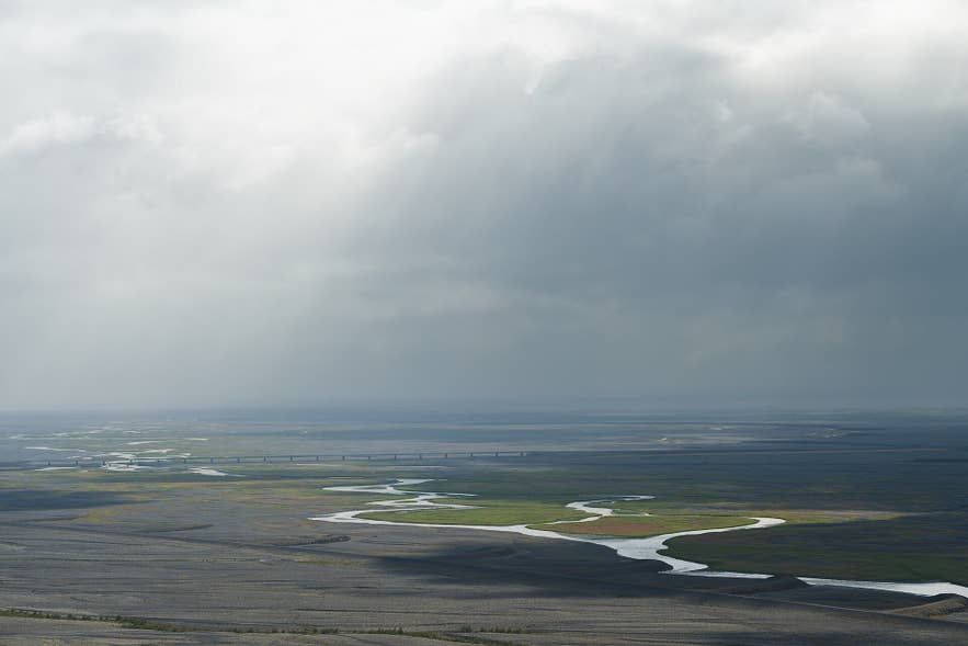
Skeiðarársandur, seen from Skaftafell. Photo: ThibautRe, CC BY-SA 4.0
When to visit
Route 1 is paved and open all year, so you can see the glacier in any season. Summer gives long days, green moss on the sands and the best flying weather; scenic flights from Skaftafell run when weather allows. In winter, daylight is short and the ice is often under fresh snow.
The sands are exposed to strong winds. Sandstorms and dust storms do happen here, so check the forecast on vedur.is and road conditions on road.is before you set off.
Safety tips
- Never walk onto glacier ice without a certified guide; crevasses and meltwater channels are hidden under snow.
- Don't try to reach the ice front on foot or by car across the sands. The unbridged meltwater channels on the sands shift and can be deep.
- Park only in the marked rest area, not on the road shoulder.
- For a guided walk on the ice, join one of the tours from Skaftafell.
Where can I see Skeiðarárjökull?
How far is Skeiðarárjökull from Reykjavík?
Can I walk on Skeiðarárjökull?
How big is Skeiðarárjökull?
What is the twisted bridge monument on Skeiðarársandur?
Is Skeiðarárjökull retreating?
Does it cost anything to visit?
Nearby attractions
- Skaftafell: about 3.5 km
- Svartifoss Waterfall: about 3.5 km
- Sjónarnípa Viewing Point: about 5 km
- Skeiðarársandur Sand Plain: about 6 km
- Svínafellsjökull: about 8 km
- Morsá River: about 8 km
- Skaftafellsjökull: about 10 km
- Grænalón Glacier Lagoon: about 29 km
Read more in our guides to glaciers in Iceland, glacier melting rates in Iceland and sightseeing flights in Iceland.
Tours that visit Skeiðarárjökull
These flights from Skaftafell pass over the glacier:
- Scenic 45 Minute Airplane Tour over Skeidararjokull Glacier & the Black Sands of Skeidararsandur
- Incredible 30-Minute Airplane Tour of Vatnajokull National Park
- Ice Cave Tour with Helicopter from Skaftafell
- Exciting 1-Hour Helicopter Tour of Laki Craters and Surroundings from Skaftafell
- Landmannalaugar & Icelandic Highlands Helicopter Tour from Skaftafell