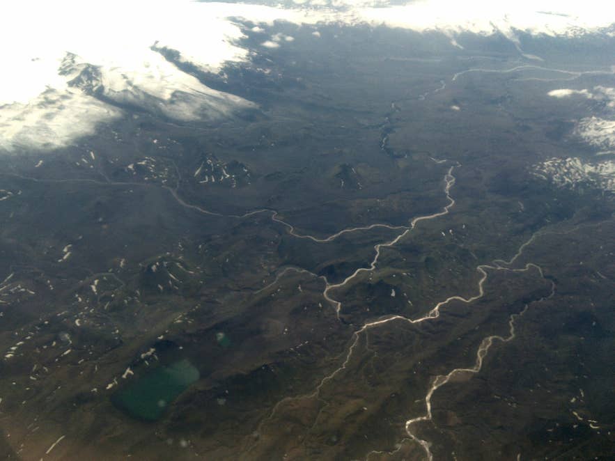
Markarfljót river from the air. Photo: Bjoertvedt, CC BY-SA 3.0
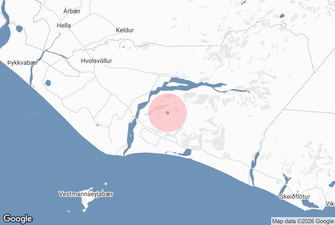
Markarfljót river is one of the big glacial rivers of South Iceland, running roughly 100 kilometres (62 miles) from the ice caps of the southern highlands to the Atlantic, reaching the sea on the Landeyjar coast just east of the Vestmannaeyjar ferry harbour at Landeyjahöfn.
The second part of the name, *fljót*, is the Icelandic word for a large river. The river separates Fljótshlíð and the Landeyjar lowlands on its west bank from the Eyjafjöll district on the east. Most travellers meet it as the braided grey river under the Ring Road bridge just before Seljalandsfoss, or along the F249 into Þórsmörk.
Key Takeaways About Markarfljót
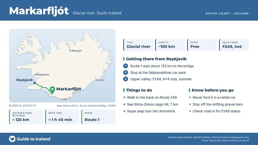
- About 100 km long, fed by Mýrdalsjökull, Eyjafjallajökull, Tindfjallajökull and Torfajökull; reaches the sea east of Landeyjahöfn
- Easiest to see from the Ring Road bridge about 125 km / 1 h 45 min from Reykjavík, next to Seljalandsfoss
- F249 follows the river into Þórsmörk; 4x4 only, open roughly June–September, with unbridged fords
- Record floods of about 2,100 m³/s (1967) and 2,640 m³/s (2010, Eyjafjallajökull eruption)
- Upper canyon Markarfljótsgljúfur is up to 200 m deep and has its own GTI page
Why visit Markarfljót
Markarfljót collects meltwater from four glaciers. Its main sources are Mýrdalsjökull (through the Entujökull and Sléttjökull outlets) and Eyjafjallajökull (through Gígjökull and Steinsholtsjökull), with smaller contributions from Tindfjallajökull and Torfajökull. Published figures for the catchment range from about 830 to 1,200 square kilometres, and the river is counted among Iceland's longest.
The upper river runs through Markarfljótsgljúfur canyon, about 10 kilometres long and up to 200 metres deep, cut by a series of glacial outburst floods (jökulhlaups) between roughly 7,500 and 2,000 years ago. Katla Geopark lists at least ten major floods down the Markarfljót from the west side of Mýrdalsjökull in the last 8,000 years.
The two largest in modern times measured about 2,100 cubic metres per second in 1967 and about 2,640 cubic metres per second during the Eyjafjallajökull eruption in April 2010, when meltwater poured out of Gígjökull and the Ring Road was cut to protect the bridge.
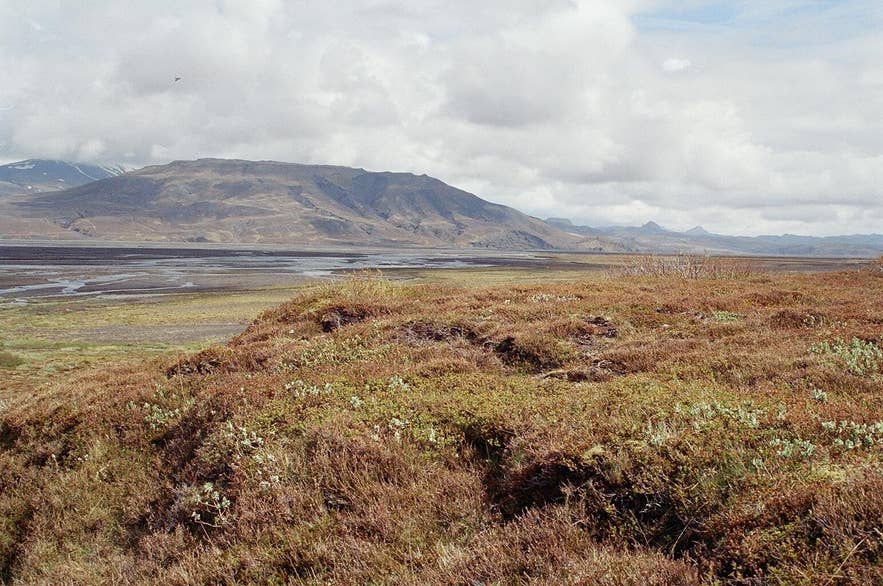
Markarfljót valley near Þórsmörk. Photo: Reykholt, CC BY-SA 3.0
Below Þórsmörk the river spreads across Markarfljótsaurar, a flat outwash plain several kilometres wide. Before the flood defences were built the river wandered freely across the lowlands and destroyed farmland.
The first embankment went up at Seljalandsmúli in 1910 and was about 700 metres long; most of the other walls were built between 1930 and 1950, and today around 40 structures hold the river in its channel.
The river also appears in Njáls saga, which places the ambush of Þráinn Sigfússon by the sons of Njáll on the ice of Markarfljót near the hill Stóra-Dímon.
Markarfljót has three bridges. The first, near Litla-Dímon, opened in 1934 and was 242 metres long, the longest in Iceland at the time. A second bridge, built in 1978, crosses the highland river at Emstrur on the F261 Emstruleið track, and the present Ring Road bridge was opened in 1992 when the highway was moved closer to the coast.
How to get to Markarfljót
The easiest place to see the river is the Ring Road (Route 1) bridge about 125 kilometres (78 miles) east of Reykjavík, a drive of around 1 hour 45 minutes. Hvolsvöllur, the nearest town with shops and fuel, is about 23 kilometres to the west by road.
There is no formal viewpoint at the bridge. The Seljalandsfoss car park, a few minutes further east, is a safe place to stop, and the riverbank can be reached on foot from there along Route 249.
For the upper river, Route 249 and then the F249 mountain road (Þórsmerkurvegur) run along the north edge of Eyjafjallajökull for about 30 kilometres to Þórsmörk, crossing several unbridged tributaries.
F249 is a 4x4-only F-road, normally open from June until September, and the last ford, Krossá, should only be attempted by modified super jeeps and the scheduled highland buses.
Most visitors reach the inner Markarfljót valley on a guided super jeep tour or the summer highland bus, which stops at the N1 station in Hvolsvöllur.
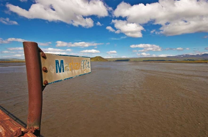
Markarfljót river in summer. Photo: Hrafnhildur Árnadóttir, CC BY 2.0
The canyon, Markarfljótsgljúfur, is in the highlands between Emstrur and Fljótshlíð and is reached by F-roads (F261 Emstruleið from Fljótshlíð) with a suitable 4x4; F261 normally opens in late June or early July and closes in September.
Hikers on the Laugavegur trail can make a short detour from the Emstrur huts to the canyon rim, and on the last day they follow the river down its east side to Þórsmörk.
Best time to visit
Summer, from June to September, is the only season when the valley roads to Þórsmörk and the canyon are open, and the river is at its fullest and widest with glacial melt in July and August. The Ring Road crossing can be seen all year.
Safety and practical tips
- Never try to ford Markarfljót or its tributaries in a rental car. Water levels change within hours as the glaciers melt or rain falls, and rental insurance does not cover river damage.
- The outwash plain is soft, wet and criss-crossed by shifting channels. Stay on marked tracks and do not walk onto the gravel bars.
- There are no facilities at the river itself. Toilets, food and fuel are available at Hvolsvöllur, and there are toilets and paid parking (about 1,000 ISK per car) at Seljalandsfoss.
- Check road.is for the status of F249 and other mountain roads before setting out, and safetravel.is for weather alerts.
Nearby attractions
- Seljalandsfoss Waterfall – 7 km from the central plain, right beside the Ring Road crossing.
- Gljúfrabúi – 7 km, the waterfall tucked into a canyon just north of Seljalandsfoss.
- Stóra-Dímon – 7 km, the lone hill on the plain, the setting for the Njáls saga ambush.
- Nauthúsagil – 4 km, a narrow ravine with a waterfall on the north side of Eyjafjallajökull.
- Gígjökull – 12 km, the Eyjafjallajökull outlet glacier that fed the 2010 floods.
- Þórsmörk – about 19 km up the valley (straight line), reached by F249.
- Markarfljótsgljúfur Canyon – the 200-metre-deep upper canyon of the same river.
Tours that visit Markarfljót
- Guided 7-Day Laugavegur Trail Tour with Solheimajokull Glacier Hike from Reykjavik – the trail follows the Markarfljót valley on its last stage into Þórsmörk.
- Private 8-Hour Super Jeep Tour of Hekla and Maelifell Volcano – the route passes within sight of the Markarfljót in the highlands.
- Luxury Full-Day Jeep Adventure to Thorsmork, Valley of Thor, From Reykjavik – drives the F249 along the river to Þórsmörk, which sits between Markarfljót, Krossá and Þröngá.
