Volcanic Eruptions on the Reykjanes Peninsula in Iceland - A Complete Timeline (2021-2024)

- History of Volcanic Activity on the Reykjanes Peninsula
- Timeline of Eruptions in Reykjanes (2021-2024)
- Fagradalsfjall (March 19th, 2021)
- Fagradalsfjall (August 3rd, 2022)
- Litli-Hrutur (July 10th, 2023)
- Sundhnukagigar (December 18th, 2023)
- Hagafell (January 14th, 2024)
- Sundhnukagigar (February 8th, 2024)
- Sundhnukagigar (March 16th, 2024)
- Sundhnukagigar (May 29th, 2024)
- Sundhnukagigar (August 22nd, 2024)
- Sundhnukagigar (November 20th, 2024)
- FAQs about the Recent Eruptions in the Reykjanes Peninsula

With a series of ten volcanic eruptions in just four years, Iceland has once again drawn attention to its fiery nature! When did it all start? When will it end? Discover all there is to know about the recent eruptions on Iceland's Reykjanes peninsula!
Staying true to its nickname as the land of ice and fire, Iceland boasts some of the earth's most active volcanoes, with a landscape to match the powerful eruptions that have formed the country. In the last four years, the Reykjanes peninsula has been host to a large number of eruptions that range from tourist-friendly spectacles to major challenges.
It's little wonder that many people travel to Iceland to see the volcanoes for themselves, either by renting a car and taking on the Ring Road or by taking one of many available self-drive tours. You might even be able to spot a volcano from the window of your accommodation in Iceland!
A natural question that comes up for many travelers when it comes to the subject of an active volcanic event is: "Is it safe to travel to Iceland?" The answer is yes! The eruptions have not impacted flights to Iceland. When conditions allow, you might even be able to see an active eruption from a birdseye view on a helicopter tour of the volcano area!
Read on to learn all about the current volcanic activity in Iceland, how it began, and how it might pan out in the future!
- Learn all about the Volcanoes of Iceland
- Find the Best Volcano Experiences in Iceland
History of Volcanic Activity on the Reykjanes Peninsula
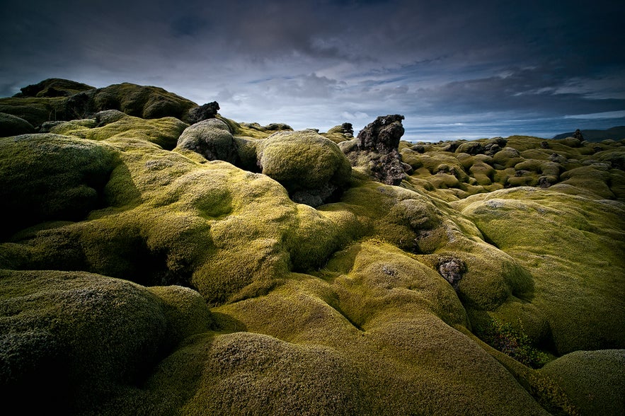 The Reykjanes peninsula is the region encountered by most visitors to Iceland as it is home to Keflavik International Airport. There's a 40-minute drive from the airport to Iceland's capital city of Reykjavik through a rugged landscape of vast lava fields that many have described as "otherworldly." This is the result of past eruptions in the region, but until the eruption of 2021, there had been no eruptions in Reykjanes for 800 years.
"The Reykjanes Fires" is the name given to a series of eruptions that began beneath the ocean off the southwestern tip of the peninsula in 1211 that would until 1240. The eruptions happened once every few years, with the most powerful one in 1226 spewing ash and lava all over the peninsula. These were, quite literally, dark times for the inhabitants of Reykjanes, and written records describe conditions such as "darkness during daytime." The following winter was called a "sand winter," describing the devastating effects of the volcanic ash on livestock and farming.
Many of the lava fields that can be found on the Reykjanes peninsula were created during the Reykjanes Fires. But what is it about the region that makes it such a volcanic hot spot? The answer lies in Iceland's unique geographical position in relation to the tectonic plates.
- What are the 22 Best Things to Do in the Reykjanes Peninsula?
 The Reykjanes Peninsula, as well as Iceland as a whole, lies atop the Mid-Atlantic Ridge - a massive underwater mountain range that marks the rift between the North American and Eurasian tectonic plates. As these plates slowly separate, magma (molten rock deep inside the Earth) fills the gap, becoming a new oceanic crust and sometimes causing eruptions on the surface.
Iceland is uniquely positioned as the only landmass on Earth sitting on the Mid-Atlantic Ridge. As a result, there are many volcanoes in Iceland, roughly 130 in total, although 18 of which have erupted during the country's recorded history since settlement in the late 9th century.
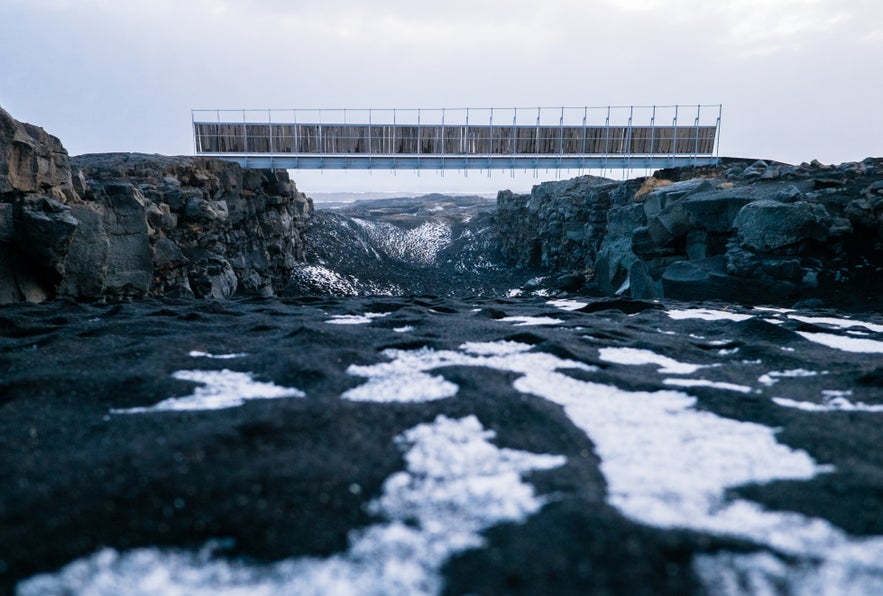
As a symbol of Iceland's location on the Mid-Atlantic Ridge, you can find a structure in Reykjanes called The Bridge Between Continents that represents the meeting point of the two tectonic plates. The bridge spans a small fissure, which has been widening as the plates slowly move apart. You can see this fascinating structure and many other fascinating attractions on one of many fantastic day tours of Reykjanes.
- See more: Tectonic Plates in Iceland and Where to Find Them
- See also: Earthquakes in Iceland: The Ultimate Guide
Timeline of Eruptions in Reykjanes (2021-2024)
Learn all about the recent eruptions that began in Reykjanes in 2021 and are ongoing to this day. If you want to see them for yourself, take a look at the live webcams from the volcano area.
Fagradalsfjall (March 19th, 2021)
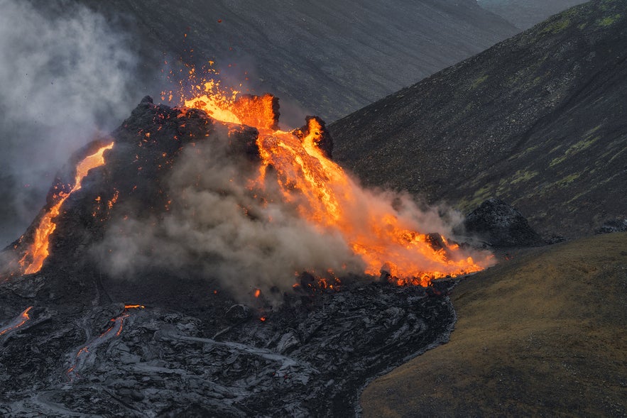 Although it had been over 800 years since the last eruption in Reykjanes, the eruption that began by Fagradalsfjall on March 19th did not come as a surprise to the people of Iceland. Over 53,000 tremors had shaken the southwestern part of the island in the weeks leading up to the eruption, signaling that something was brewing beneath the surface.
The lava burst to the surface around 9:30 PM with an initial fissure about half a mile long (700 meters). The nation breathed a collective sigh of relief as the eruption site was in the secluded valley of Geldingadalur and posed no threat to the livelihood of people in the region.
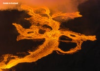
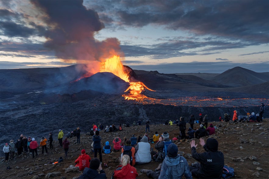
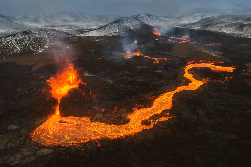 In the following weeks, people began flocking in the thousands to see the volcano for themselves. The spectacle was very visitor-friendly as it was located within a reasonable hiking distance and offered dramatic displays of Mother Earth's molten artistry in action.
The eruption wasn't very powerful but lasted for months, giving people ample time to come and see the Mordor-like landscape for themselves. Over time, the eruption fizzled out and was declared over on December 18th. The eruption at Fagradalsfjall would only be the first in a long series of eruptions in the area over the coming years.
Fagradalsfjall (August 3rd, 2022)
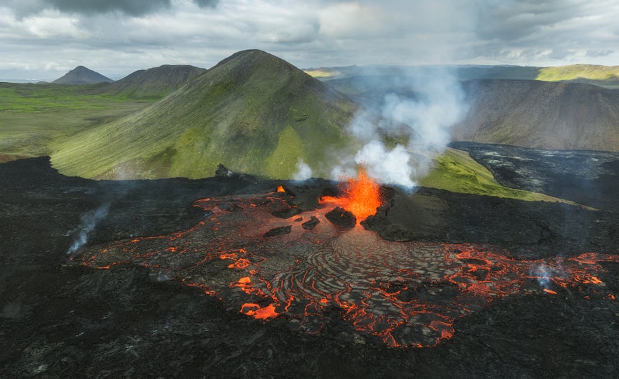
A few months after the eruption by Fagradalsfjall ceased, a series of tremors began a new that lasted for a few weeks. While the tremors did no major damage to homes or infrastructure, scientists figured a new eruption was only a matter of time. They were right, as on August 3rd, 2022, a new fissure opened up by Fagradalsfjall.
The eruption site was only about 0.6 miles (1 kilometer) away from the previous eruption, with a fissure that reached 300 meters in length. The eruption was more powerful than the previous eruption, with a lava flow of 20-50 square meters per second.
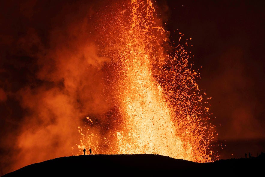 The location and nature of this new eruption attracted thousands of visitors to hike there to see the volcanic display with their own eyes. Witnessing a volcanic eruption with your own eyes is not a chance that comes around on a regular basis, so visitors from all over the world flew to Iceland to use this opportunity.
The eruption was not nearly as long-lived as the last one, as the lava flow decreased around August 17th and stopped on 21 August 2022. Overall, the 2022 eruption by Fagradalsfjall was about 5-10 times bigger than the eruption in the year before.
Litli-Hrutur (July 10th, 2023)
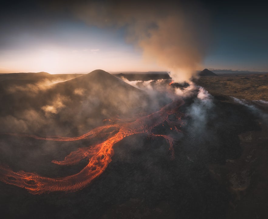 On July 10th, 2023, a volcanic eruption began by the mountain Litli-Hrutur, close to the site of the Fagradalsfjall's eruptions. Like before, thousands of tremors had hit the region in the weeks before.
The fissure of the new eruption was roughly half a mile wide (900 meters), with an initial lava flow that was much higher than the previous eruptions. This new eruption was up to ten times bigger than the eruption of Fagradalsfjall Volcano in 2021 and three times bigger than the eruption in 2022.
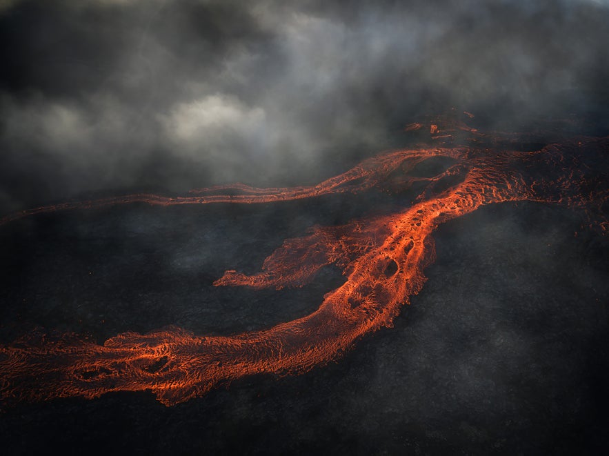 Although the hiking distance to this eruption was longer than on the paths to the previous eruptions, locals and visitors alike trekked across the harsh landscape to see it. While Litli-Hrutur's eruption might not have been quite as photogenic as the ones at Fagradalsfjall, it was still a sight to behold.
The eruption at Litli-Hrutur lasted just under a month and was declared over on August 5th. Up to this point, the volcanic activity in the Reykjanes peninsula had been relatively tame and tourist-friendly, but that was about to change.
Sundhnukagigar (December 18th, 2023)
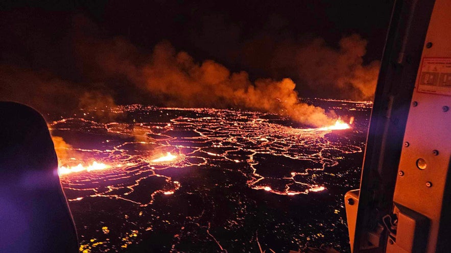 In late 2023, Reykjanes was hit by yet another increase in earthquake activity, but this particular event sparked genuine worries for the people of Iceland. The stream of magma flowing beneath the surface was close to the town of Grindavik as well as the Svartsengi Power Station, which supplies all of Reykjanes with hot water and electricity, as well as the Blue Lagoon, Iceland's biggest tourist attraction.
The people of Grindavik were forced to evacuate the town a few weeks before the eruption as magma was discovered flowing only a few hundred feet below the surface of the town. Thankfully, all inhabitants and animals were safely evacuated, and over the next weeks, many valuables were salvaged from homes.
Before the eruption even started, the seismic activity in the area caused massive damage to the down as a gigantic crack appeared, running through the town. The eruption began on December 18th by the crater row Sundhnukagigar and was described as a "best-case scenario" as the lava flowed away from Grindavik and infrastructure in the area.
The 2023 eruption at Sundhnukagigar had a lava flow up to ten times more powerful than the eruptions in the peninsula in previous years and created a lava field of roughly 1.4 square miles (3.7 square kilometers). The eruption was short-lived and stopped on December 21st.
Hagafell (January 14th, 2024)
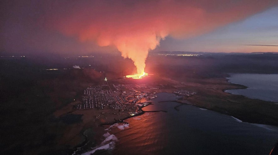
Just weeks after the eruption in Sundhnukagigar, a new series of tremors signaled that another eruption was around the corner. On January 14th, 2024, two separate fissures opened up within a short distance of each other, close to the mountain Hagafell. The southern fissure was located a few hundred meters near Grindavik.
The eruption was relatively small compared to the last eruption, but its proximity to Grindavik was a cause for great concern. The inhabitants of the town had been evacuated in the night but had to watch in horror as the flow of lava approached the town.
The lava kept creeping towards Grindavik until it ultimately reached the town limits, and a house on the edge of town caught fire. Shortly thereafter, two more homes were destroyed by the volcanic stream, but at that point, the lava flow from the southern fissure slowed down and stopped before more homes were claimed.
The flow of the lava in the northern fissure stopped shortly after, and the eruption was declared over.
Sundhnukagigar (February 8th, 2024)
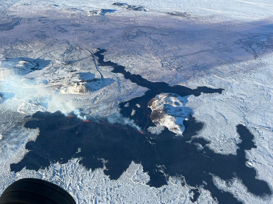
Sundhnukagigar became the site of a new eruption on February 8th as a fissure emerged, spanning approximately 1.8 miles (3 kilometers) in length. The eruption took place further north than the Hagafell eruption event, with the lava primarily flowing westward.
Although the lava thankfully did not pose a danger to Grindavik, the flow of the lava meant it endangered nearby infrastructure. The flowing lava ended up bursting a hot-water pipe, leaving the inhabitants of Reykjanes without hot water for four cold winter days before a replacement pipeline could be built.
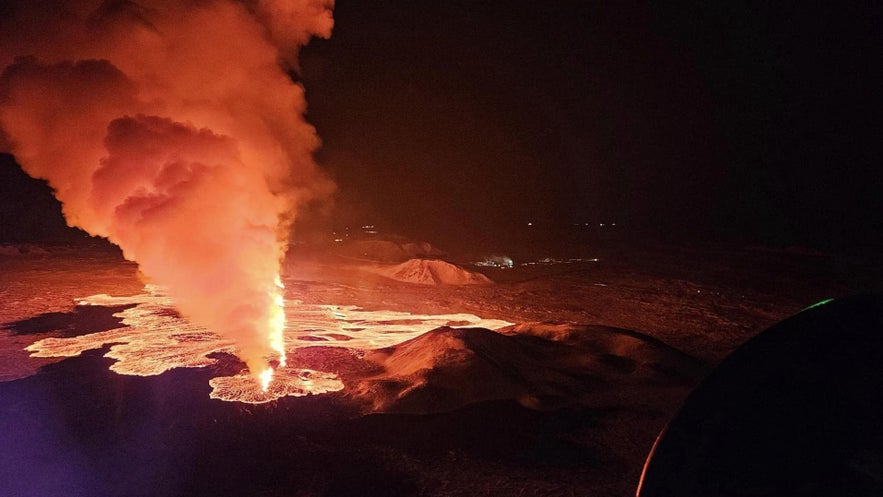
In contrast to past eruptions on the peninsula, the eruption on February 8th generated significant amounts of black ash mixed with steam. It is likely that this phenomenon arose from the boiling of groundwater, which then mixed with magma, leading to the formation of ash.
The eruption lasted for only three days before dying down on February 10th. The relatively short duration of the event was little cause for celebration as experts warned that the seismic activity in the area was far from dying down.
Sundhnukagigar (March 16th, 2024)
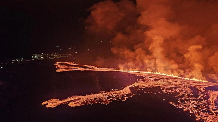 Another eruption began in Sundhnukagigar on March 16th, and after a huge fissure measuring roughly 2 miles long (3.5 kilometers) opened up, it was obvious that this eruption would be more powerful than the last one.
The lava initially moved rapidly, spreading in two directions: southward and westward. Fortunately, the precautionary strategy of constructing barriers using earth mounds initially diverted the lava away from vital infrastructure but did end up flooding into a mine, rendering it unusable.
The eruption petered down but kept going at a steady but low power level and was over on May 8th.
Sundhnukagigar (May 29th, 2024)
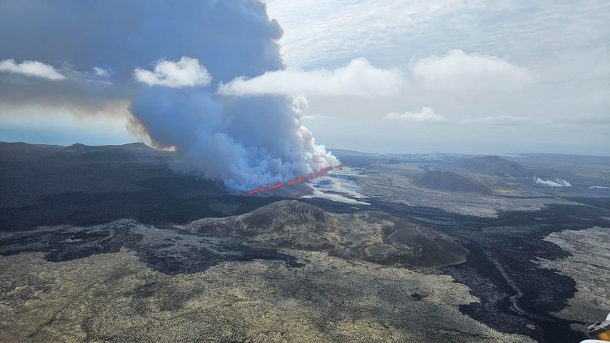 Yet another eruption took place on the Reykjanes peninsula on May 29th, once again in the Sundhnukagigar crater row. The fissure was initially just under a mile long (1 kilometer) but gradually widened to roughly 2 miles (3.4 kilometers), with lava plumes reaching 150 feet tall (50 meters).
By June 4th, the volcanic activity in the crater had decreased significantly, and on June 22nd, the eruption was officially declared to have ended.
Sundhnukagigar (August 22nd, 2024)
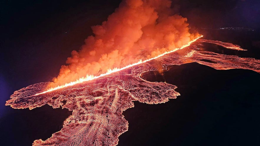
Just two months later, the Sundhnukagigar volcanic row erupted again. On August 22nd, around 9 PM, a sudden surge in earthquakes near the craters started, and the earth opened up for the ninth time in four years. One quake, measuring 4.1 in magnitude, was even felt in the Capital Area.
The fissure quickly stretched 2.5 miles (4 kilometers), and hours later, a smaller fissure opened to the north, about 0.6 miles (1 kilometer) long. As the earth released pressure, the quakes subsided. Initially, lava flowed at 1.2 miles (2 kilometers) per hour but soon slowed.
The activity shifted north of previous eruptions, a more manageable location for infrastructure protection, but still posed new risks. This area was actually used as a practice site by the United States military in the 1950s, and there is a risk of landmine remains in the area.
Fortunately, most people respected the safety closures and didn't hike to the area, and the eruption was officially declared over on September 5th.
Sundhnukagigar (November 20th, 2024)
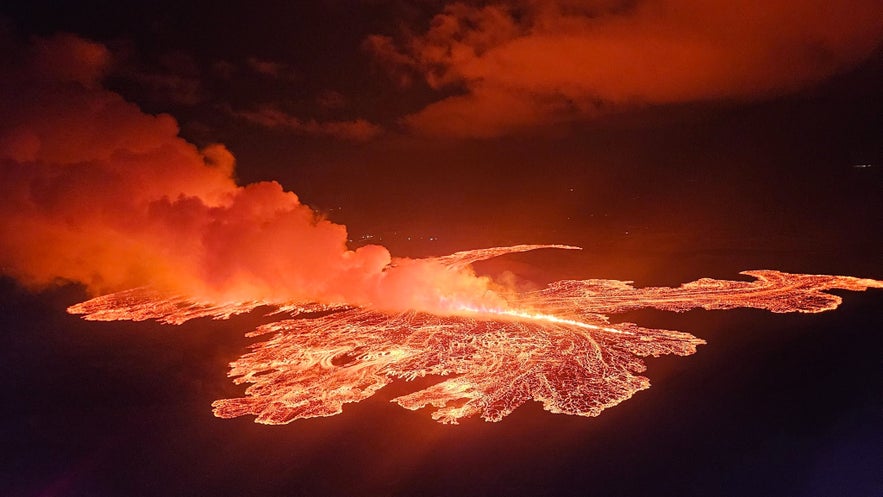
After the August eruption, activity around Sundhnukagigar seemed to settle, and experts predicted that another eruption wouldn’t occur until at least December. Previous eruptions had been preceded by a series of small earthquakes lasting up to a week, so it was a surprise when a new fissure opened just before midnight on November 20th with little warning.
While lava had been steadily accumulating beneath the surface, the only indication of the impending eruption was a change in pressure readings at boreholes in the Svartsengi power plant. Shortly after, the lava broke through to the surface.
Fortunately, the Svartsengi power plant, Blue Lagoon, Grindavik, and the surrounding areas were swiftly evacuated. However, the eruption proved relatively small. Overnight, the fissure reached a maximum length of about 3 kilometers (1.8 miles) but quickly decreased activity, forming craters.
As with previous Sundhnukagigar eruptions, it did not impact travel in Iceland, and flights continued to operate as usual. It lasted for 18 days before coming to a close on December 9th.
It remains uncertain when the next eruption will occur, but the area remains closed to the public. Helicopter tours are the only way to witness the eruption site by Grindavik.
FAQs about the Recent Eruptions in the Reykjanes Peninsula
 Here are the answers to some of the most asked questions about the recent eruptions in Reykjanes.
Is it safe to visit Iceland because of the eruptions? Yes, the eruptions do not impact flights to Iceland, and most of the country is still accessible. Depending on the situation, access to the Blue Lagoon might be unavailable due to its proximity to the volcanic area.
How many eruptions have there been so far? Since 2021, there have been ten eruptions in Reykjanes. Two were by Fagradalsfjall, one by Litli-Hrutur, one by Hagafell, and the rest by Sundhnukagigar.
Can I visit the eruption? The volcano area and the town of Grindavik are currently closed. You can visit the volcano area on a helicopter tour from Reykjavik.
This article will be updated as the situation in Reykjanes develops. Would you like to see an eruption with your own eyes? Have you seen a volcanic eruption? What was your experience? Let us know in the comments!
더 많은 흥미로운 게시글
아이슬란드의 하이랜드 고원지대 | 상세 가이드
현지인과 관광객 모두를 매료시키는 아이슬란드 내륙 고원지대의 매력은 무엇일까요? 고원지대의 주요 관광 명소는 어떤 곳이 있으며 어떤 액티비티가 가능할까요? 고원지대로의 접근은 왜 여름에만 허용되는 걸까요? 여러분이 궁금해 하는 아이슬란드 고원지대에 대한 모든 것, 지금부터 자세하게 설명해 드릴게요! 더 보기: 하이랜드 투어 목차 ...더 보기아이슬란드 밴드 및 음악 소개
불과 얼음의 나라 아이슬란드의 음악과 밴드를 소개하고자 합니다. 가장 유명한 아이슬란드 음악 그룹, 아이슬란드 록이나 포크 등 장르별 최고 인기 밴드, 아이슬란드의 최고 인기 팝 스타부터 아이슬란드 음악이 세계 음악 시장에 어떤 영향을 주었는지까지, 아이슬란드의 음악과 밴드에 대한 모든 내용을 총망라해두었습니다. 아이슬란드는 시 문학에 대한 유구...더 보기아이슬란드 도로 표지판 완벽 가이드
아이슬란드의 도로 표지판에 대한 완벽 가이드로 아이슬란드의 도로를 안전하게 여행하세요! 링로드를 완전일주하는 렌트카 여행 패키지든 레이캬비크 주변의 간단한 시내 드라이브든, 아이슬란드 운전 시 꼭 알아야할 정보를 알려드립니다. 아이슬란드에서 운전할 때는 이 지역에 익숙하지 않은 운전자가 인지하지 못할 수 있는 독특한 조건과 위험이 존재합니다. 도로 표...더 보기

아이슬란드 최대의 여행 마켓플레이스를 전화에 다운로드하여 전체 여행을 한 곳에서 관리하세요
전화 카메라로 이 QR 코드를 스캔하고 표시되는 링크를 누르면 아이슬란드 최대의 여행 마켓플레이스를 주머니에 넣을 수 있답니다. 다운로드 링크가 포함된 SMS 또는 이메일을 받으려면 전화번호 또는 이메일 주소를 추가하세요.

