Discover all you need to know about earthquakes in Iceland. Learn about what causes earthquakes, their magnitude and frequency, and how they've shaped the country's landscapes and history. Dive into the geological forces of the land of ice and fire!
Iceland, a land of vast glaciers and volcanic activity, is also frequently shaken by earthquakes. The country is located right along the Mid-Atlantic Ridge, a tectonic plate boundary where the Eurasian and North American plates are pulling apart. This constant geological movement makes Iceland one of the most seismically active regions in the world!
Why You Can Trust Our Content
Guide to Iceland is the most trusted travel platform in Iceland, helping millions of visitors each year. All our content is written and reviewed by local experts who are deeply familiar with Iceland. You can count on us for accurate, up-to-date, and trustworthy travel advice.
There's no need to worry, though, as most earthquakes are very minor and usually go unnoticed by residents. It's unlikely that you'll feel a quake during a visit, but you can still witness Earth's power firsthand as you travel around Iceland.
You can see the separation between the tectonic plates at Thingvellir National Park, a main stop on Golden Circle tours, and you can even swim between them in the Silfra Fissure with snorkeling or diving tours!
Delve into the intriguing world of seismic activity in Iceland and learn everything you need to know about earthquakes. Explore their causes, how they've shaped the otherworldly Icelandic landscape, and what visitors can expect regarding tremors.
You'll also find information on the biggest earthquakes in Iceland's history and how to react to earthquakes safely.
Whether you're staying in comfortable Reykjavik accommodation or embarking on thrilling self-drive tours with your trusty rental car, you can experience Iceland's magic with peace of mind. Here's all you need to know about earthquakes in Iceland.
- Learn more about Tectonic Plates in Iceland and Where to Find Them
- See also: Geothermal Power in Iceland
The Mid-Atlantic Ridge in Iceland

Photo from Wikimedia, Creative Commons, by M. Bitton.
Iceland straddles the Mid-Atlantic Ridge, a vast underwater mountain range where the North American and Eurasian plates meet.
This is why Iceland is so volcanically active, as the movement of these plates creates a divergent boundary, where magma wells up from the Earth's mantle, forming a new crust and causing the island to expand over time.
As the North American and Eurasian plates pull apart, they generate immense geological stress. This stress manifests as earthquakes when the built-up tension is suddenly released along faults and fractures in the Earth's crust. These earthquakes can vary in magnitude, from minor tremors to rare larger events.
- Check out Iceland's Volcanoes: The Complete Guide
- See also: Top 7 Volcanic Experiences in Iceland
The Earthquake Magnitudes in Iceland

Photo from Wikimedia, Creative Commons, by ChaseKiwi. The North American plate moves 0.72 - 0.74 inches per year (18.34 - 18.82 millimeters).
Thankfully, earthquakes in Iceland rarely reach great magnitudes. The country's location on the Mid-Atlantic Ridge means it's undergoing constant movement, and as the plates pull apart, the stress release is more gradual, leading to frequent, smaller earthquakes.
Iceland is constantly experiencing quakes under 1 and 2 in magnitude, but the largest known earthquake in Iceland is estimated at 7.1 on the Richter Scale. Large earthquakes like that are very uncommon, and they're not believed to be able to exceed a 7 in magnitude.
The Icelandic building code is designed to withstand regular seismic activity, and as most tremors are minor, they're unlikely to disrupt your exploration of this geologically fascinating island.
- Learn about the Top 12 Best Things To Do and See in Iceland
Main Causes of Earthquakes in Iceland

You can walk between the Eurasian and North American tectonic plates at the Bridge Between the Continents on the Reykjanes Peninsula.
The Eurasian and North American plates are slowly pulling apart at a rate of roughly 0.78 inches (2 centimeters) per year. The divergence of the plates can be seen around Iceland, such as at Thingvellir National Park and at the Bridge Between the Continents on the Reykjanes Peninsula!
This movement causes stress to build up along fault lines in the Earth's crust. When this stress reaches a breaking point, the rock fractures, releasing energy that travels as seismic waves, causing the ground to shake with tectonic earthquakes. This relentless movement is the primary cause of earthquakes in Iceland.
However, Iceland can also experience volcanic earthquakes. With 32 active volcanic systems, the movement of magma (molten rock) beneath the surface can cause tremors.
These earthquakes tend to be smaller and more localized than tectonic earthquakes and occur in clusters around active volcanic sites. While they can be a precursor to an eruption, they don't guarantee one.
To learn more about the effects of volcanic activity in Iceland, visit the Perlan Wonders of Iceland exhibition in Reykjavik.
If you have an affordable rental car during your visit, you can also book entry to the LAVA Centre volcano and earthquake exhibition in Hvolsvollur, an hour and a half's drive from the Capital Region.
Understanding these different earthquake types is crucial for monitoring seismic activity in Iceland. Sophisticated equipment is used to track tremors, helping to assess potential risks and ensure public safety.
- See more: National Parks in Iceland
- See also: 22 Best Things to Do on the Reykjanes Peninsula
Earthquake Measurements in Iceland

Photo from Regína Hrönn Ragnarsdóttir. A seismometer at the Earthquake Center in Kopasker.
In Iceland, earthquakes are commonly measured using the Local Magnitude Scale (ML). It's an updated version of the Richter Scale, and it measures the size of an earthquake based on the total energy released by the seismic event. This provides a quick and informative estimate of earthquake strength. However, both ML and Richter Scale have limitations, and they work best for smaller earthquakes.
Scientists increasingly use the Moment Magnitude Scale (Mw) for more precise measurements. This is because it provides a more reliable measure of earthquake size, especially for larger events.
Another scale that you may encounter is the Modified Mercalli Intensity Scale (MMI). It measures the intensity of shaking experienced during an earthquake, focusing on its effects on people, buildings, and the environment rather than its magnitude.
Frequency of Earthquakes in Iceland

Photo from Felir/Icelandic Met Office. Yellow marks volcanic zones and red dots are earthquakes in Iceland between 1994 and 2012.
The largest earthquakes in Iceland originate in Southwest Iceland, in an area known as the South Iceland Seismic Zone, and in North Iceland, in the Tjornes Fracture Zone. These occur every few decades but don't exceed a 7 in magnitude.
These larger earthquakes are little cause for worry for visitors. They are rare, and Iceland has stringent building codes and emergency response measures in place to mitigate the impact of earthquakes.
The South Iceland Seismic Zone

The beautiful Geysir Geothermal Area is fueled by the volcanic heat under the island.
Activity in the South Iceland Seismic Zone (SISZ) causes most of the largest earthquakes in Iceland. These are referred to as South Iceland earthquakes or "Suðurlandsskjálftar" in Icelandic and are characterized by a magnitude of 6 and above.
They are not able to far exceed a magnitude of 7, with the largest ever earthquake in Iceland's history being estimated at a 7.1 on the Richter Scale.
The South Iceland Seismic Zone lies between the Helka and the Hengill mountains, stretching over a length of 43.5 miles (70 kilometers) and a width of 6.2 - 9.3 miles (10 - 15 kilometers). In this area, the Earth's crust is weaker and more flexible. As it strains against the sturdier crust to the north and south, tension builds, eventually releasing in the form of strong earthquakes.
- Plan your trip with the Ultimate Guide to Iceland's South Coast
- See also: The Ultimate Guide to Iceland's Golden Circle
Tjornes Fracture Zone in North Iceland

Grimsey Island in North Iceland experiences frequent earthquakes because it lies along the Tjornes Fracture Zone.
Larger earthquakes can also occur in North Iceland. This is because of the Tjornes Fracture Zone, which is approximately 74.5 miles long (120 kilometers) and 43.5 miles wide (70 kilometers).
Unlike the South Iceland Seismic Zone, where tension builds up from plates diverging, the Tjornes Fracture Zone is a transform zone where plates slide horizontally, causing stress buildup along faults. This means the area can also experience larger earthquakes, though they won't exceed a 7 in magnitude.
While the zone covers a large region, it draws its name from the Tjornes Peninsula, which is just outside the town of Husavik, the best place for whale-watching in Iceland.
Tjornes also happens to be great for spotting puffins in Iceland, so make sure to stop by when traveling around the North.
- Check out Where to See Puffins in Iceland and the Best Guide to Whale Watching in Iceland
The Biggest Earthquakes in Iceland's History
| Year | Magnitude | Location | Region | Notable Impact |
|---|---|---|---|---|
| 1784 | ~7.1 | South Iceland Seismic Zone | South Iceland | Coincided with the Laki eruption; widespread destruction of farms and landslides |
| 1896 | 6.9 | South Iceland Seismic Zone | South Iceland | Part of a major earthquake sequence; significant damage to farms and buildings |
| 1912 | 7.0 | South Iceland Seismic Zone | South Iceland | One of the largest recorded earthquakes in Iceland; felt across the entire country |
| 1934 | 6.3 | Dalvík, North Iceland | North Iceland | Severely damaged the town of Dalvík; over 200 buildings damaged, dozens injured |
| 1963 | 7.0 | Skagafjörður fjord | North Iceland | Epicenter in Skagafjörður; felt as far as Reykjavík and detected on seismometers in Svalbard; no injuries reported |
| 1976 | 6.3 | Kópasker, Öxarfjörður | North Iceland | Series of tremors from December 1975 culminating in a major quake on January 13th, 1976; significant building damage in Kópasker |
| 2000 | 6.5 | South Iceland Seismic Zone | South Iceland | Part of a June 2000 double earthquake sequence; extensive road and infrastructure damage |
| 2000 | 6.5 | South Iceland Seismic Zone (Holt) | South Iceland | Second major quake of the June 2000 sequence, occurring four days after the first |
| 2008 | 6.3 | Ölfus, South Iceland | South Iceland | Struck on 29 May 2008; damaged hundreds of homes and buildings in the Ölfus and Hveragerði area |
While most earthquakes in Iceland are minor, a handful of powerful earthquakes have left their mark on the island's history, especially in Southwest and North Iceland. Let's delve into some of the biggest earthquakes recorded in Iceland.
South Iceland Earthquake of 1784

Artwork depicting the 1783-1784 Lakagigar eruption by Ásgrímur Jónsson (1876-1958).
The largest earthquake in Iceland's history is believed to have occurred on August 14th, 1784. It coincided with the infamous Lakagigar eruption between 1783 and 1784, one of the biggest natural disasters in Iceland's history.
The earthquake's size has been estimated at around 7.1 on the Richter Scale based on detailed descriptions of the event's effects. The tremors caused widespread damage and landslides, adding to the devastation of the eruption.
- Learn more: Volcanic Eruptions in Iceland: A History of Fire
Biggest South Iceland Earthquakes
 The Southwest is especially prone to large earthquakes, thanks to the South Iceland Seismic Zone. According to written records, there have at least been 37 South Iceland earthquakes or "Suðurlandsskjálftar" since the year 1013, but their number is likely higher. Here are some of the most recent South Iceland earthquakes in Iceland's history.
The 1896 South Iceland Earthquakes

Photo from Ferlir/The National Museum of Iceland, by Sigfús Eymundsson. The Arnarbæli turf farm in South Iceland collapsed in the 1896 earthquakes.
A series of five powerful earthquakes rocked South Iceland in 1896, ranging in size from 6.5 to 7.0 on the Richter scale and VIII-X on the Mercalli Scale. These seismic events caused destruction or great damage to over 3000 buildings, and four people lost their lives.
It's important to note that such extensive damage would not happen in a similar earthquake today. Up until the early 20th century, most Icelanders resided in traditional Icelandic turf houses, which were nowhere near as structurally stable as modern buildings.
The 1912 South Iceland Earthquake

An Icelandic family in front of a traditional turf house in South Iceland. Photo taken around 1900, from Wikimedia, Creative Commons.
Another significant earthquake struck South Iceland in 1912, with an estimated size of 7.0. The quake caused extensive damage to buildings, with a few farms collapsing and cracks forming in the Earth. Three people lost their lives in the event.
Descriptions of damage from the 1912 earthquake resembled those of earthquakes estimated to be around 7.0 on the Richter Scale at the time. This provided a basis for estimating the magnitude of all previous earthquakes in Iceland based on written records.
The 2000 South Iceland Earthquakes

Photo taken from DV, June 19th, 2000. Kitchen cabinets ripped from the wall in the town of Hella during the June 17th earthquake of 2000.
In the year 2000, Iceland experienced two notable South Iceland earthquakes on the 17th and 21st of June, measuring 6.5 and 6.6 in magnitude.
This seismic event shook the region, causing damage to buildings and infrastructure and forming cracks in the ground. In a stroke of luck, the earlier earthquake took place on Iceland's Independence Day, meaning most locals were outside participating in the celebration.
With such a short time between them, authorities were quicker to respond to the second earthquake. It affected a smaller area, but both quakes caused damage to buildings and infrastructure. Thankfully, nobody was harmed.
The 2008 South Iceland Earthquake
On May 29th, 2008, South Iceland was struck by two significant earthquakes simultaneously. Together, they had a magnitude of 6.3. The earthquake's epicenter was by Ingolfsfjall mountain, which is just outside the towns of Selfoss and Hveragerdi.
The earthquake was felt all over South Iceland, but towns near Ingolfsfjall were hit hard. There was damage to infrastructure, buildings, and roads. Some minor injuries were reported, and landslides and ground deformation were also observed. The security footage in the video above showcases the moment it occurred and gives an idea of its strength.
- See also: Top 8 Things to Do in Selfoss
Biggest Earthquakes in North Iceland
 There have also been strong earthquakes in North Iceland, which occur because of tension build up in the Tjornes Fracture Zone. These are the most recent large earthquakes in the region.
The 1934 Dalvik Earthquake

Broken house in Dalvik, from the 1934 earthquake.
On June 2nd, 1934, the town of Dalvik in North Iceland experienced a large earthquake. Known locally as "Dalvíkurskjálftinn," the quake originated at sea, just off the coast of Dalvik, and could be felt all over North Iceland. It measured 6.3 on the Richter Scale.
Most buildings in Dalvik were damaged, and some were destroyed, but thankfully, nobody was harmed in the event. Throughout the following summer, many locals lived in tents as Dalvik was repaired and rebuilt. Today, there's an exhibition dedicated to the earthquake at the local Hvoll Folk Museum, which is worth a visit when exploring the area.
The 1963 Skagafjordur Earthquake

Photo from Morgunblaðið, March 29th, 1963, by Björn Bergmann. A store in the town of Blondos after the 1963 earthquake.
One of the largest known earthquakes in North Iceland occurred on the evening of March 27th, 1963. Its epicenter was in the Skagafjordur fjord, around an hour's drive from Akureyri. The earthquake is known as "Skagafjarðarskjálftinn" in Icelandic.
The Skagafjordur earthquake measured a 7 on the Richter Scale. Houses were damaged in the event, some outhouses were destroyed, but no injuries were reported. A natural hot spring by Reykjarholl hill in Varmahlid disappeared, electricity was cut out momentarily, and the force of the quake made church bells ring by themselves in the town of Siglufjordur.
The Skagafjordur quake was felt in Reykjavik, approximately 155 miles (250 kilometers) away from the earthquake epicenter, where a resident reported seeing the lights in their dining room swinging. It was even detected on seismometers in Svalbard, a distance of around 1205 miles (1.940 kilometers)!
The 1976 Kopasker Earthquake
The video above shows footage of the 1976 earthquake aftermath, along with interviews with locals in Icelandic.
The quiet village of Kopasker in the Oxarfjordur fjord witnessed a series of tremors that began in December 1975 and culminated in a major earthquake on January 13th, 1976. This Kopasker earthquake, known locally as "Kópaskersskjálftinn," measured 6.3 on the Richter scale.
Houses were badly damaged, with examples of buildings having moved around 3.5 inches (9 centimeters). Infrastructure was also damaged, including waterpipes, plumbing, and the town harbor. A new lake was formed south of the town, which gained the name "Skjálftavatnið" or Lake Earthquake.
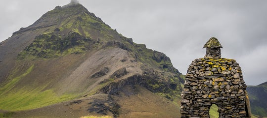
Today, there is an Earthquake Center in Kopasker. It's a must-visit when in the area, as you can learn about the earthquake, hear first-hand accounts, and even try an earthquake simulator. It's about an hour's drive from the Arctic Henge artwork in Raufarhofn and a two-hour drive from Akureyri.
- Learn about Kópasker Village on Melrakkaslétta Plain in North-East Iceland
- See also: Raufarhofn - the Arctic Circle Village in NE-Iceland
Recent Grindavik Earthquakes
The recent earthquakes on the Reykjanes peninsula have gained a lot of international attention for how they've affected the town of Grindavik. However, these are not caused by seismic activity.
Even though they are caused by movement in the Earth's crust, this movement is directly linked to the ongoing volcanic activity in the Reykjanes peninsula. The magma pushing upwards creates stresses and fractures in the rock, resulting in waves of tremors.
Since 2021, the Reykjanes peninsula has experienced regular volcanic eruptions, first in Mt. Fagradalsfjall, and Mt. Litli-Hrutur, and then by Mt. Hagafjall, and the Sundhnukagigar crater row, which are very close to Grindavik.
Magma moving under the Earth's surface during the most recent volcanic activity has greatly damaged the town, leading to the evacuation of Grindavik in November 2023. The video above showcases a crack in the Earth that runs through the town, which was formed by underground lava movement.
It's worth noting that while the Reykjanes peninsula is a part of Southwest Iceland, it's not part of the South Iceland Seismic Zone. Reykjanes has its own seismic zone, which sees more activity and much smaller earthquakes. Their size does not come close to the magnitude of the South Iceland ones.
The volcanic activity by Grindavik is very centralized and does not affect the rest of the Reykjanes peninsula. This means travelers have no need to worry about traveling to Iceland.
Safety Tips For Earthquakes in Iceland
 Earthquakes can happen unexpectedly in Iceland. Here are some safety tips from the Department of Civil Protection and Emergency Management on how to react to an earthquake:
If you're indoors:
-
Drop, Cover, and Hold: This is the golden rule! Don't try to run out. Immediately drop to the ground, take cover under a sturdy desk or your bed, and hold on until the shaking stops.
-
Move away from windows, mirrors, and furniture that could fall and injure you.
-
If you know which walls are load-bearing walls, you can also kneel in a corner or stand in a doorway in a load-bearing wall. Regular interior walls will not provide added safety as they're not as strong.
-
Be prepared for smaller tremors following the main earthquake. Remain under cover until the shaking stops completely.
If you're outdoors:
-
The biggest danger outdoors comes from falling debris. Move away from buildings, power lines, trees, and anything else that could fall.
-
Seek open ground where there are no overhead hazards. Strong earthquakes can trigger rockfalls and avalanches.
-
Once in a safe spot, drop to the ground and cover your head and neck with your arms.
If you're driving:
-
Pull over in a safe spot and stop the car. Keep your seatbelt on and stay in the vehicle until the earthquake has stopped. Be aware that roads and bridges can be damaged in earthquakes.
After an earthquake, be prepared for aftershocks, which can occur in the hours or days following the initial quake. Stay alert and continue to follow safety procedures until the risk of further shaking has passed.
You can find the newest information through official channels such as RÚV, the national broadcasting service. Also, keep an eye on the SafeTravel website or mobile app. To find information about the estimated size of an earthquake, check out the Icelandic Met Office webpage. Information is updated every few minutes.
Should I be concerned about earthquakes when visiting Iceland?
How does Iceland prepare for earthquakes?
How long do earthquakes typically last in Iceland?
Are earthquakes in Iceland dangerous?
Have you experienced an earthquake before? Will you visit the division of the tectonic plates in Iceland? Are there any topics we missed in our guide that deserve a mention? Share your thoughts and experience in the comment section below!

I'm an Icelandic folklorist writing about Icelandic nature and culture for travelers. I share practical guides, cultural insights, and tips on hidden spots, helping you experience the best of Iceland and maybe come to love it as much as I do!