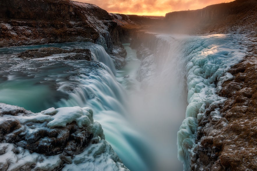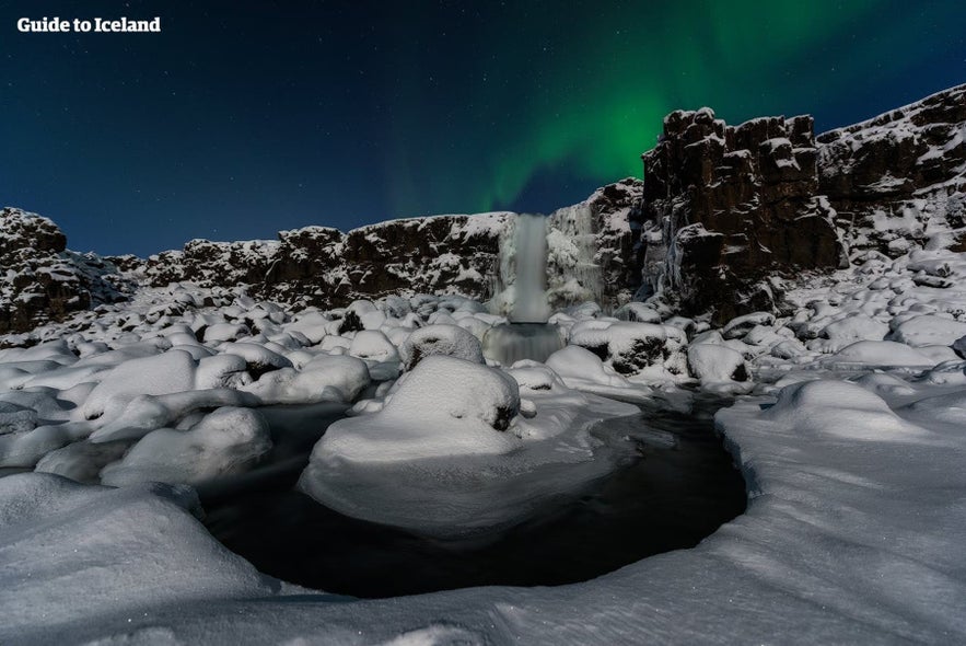
Iceland is a land of staggering physical beauty; from mist-wreathed mountains to ancient glaciers, it is impossible to escape the sheer, breathtaking gorgeousness of one’s surroundings. Just as sublime, and yet perhaps less widely written about, are Iceland’s river systems.
If there is to be a recurring motif to your holiday in Iceland, more often than not, you’ll find it is the reliable presence of water. Be it the island’s notoriously damp weather, the omnipresent Atlantic, the frozen and bejewelled glaciers, the cascading waterfalls or the mystic lakes, water is in no short supply here.
Why You Can Trust Our Content
Guide to Iceland is the most trusted travel platform in Iceland, helping millions of visitors each year. All our content is written and reviewed by local experts who are deeply familiar with Iceland. You can count on us for accurate, up-to-date, and trustworthy travel advice.
The water cycle in Iceland is about as eclectic and enjoyable as a scientific process can get. Whether the water is frozen into intricate ice sculptures, cascading over the lip of Dettifoss waterfall or simply pummeling you from the heavens, you can be guaranteed this is nature in action.
The vast majority of rivers in Iceland originate from the country's most famous longtime residents; glaciers. For centuries, the runoff has carved itself through the young landscape, sculpting valleys and cliffsides and mountain ridges on its journey toward the Atlantic.
Today, Iceland's river systems bless visitors with the opportunity to see this natural process still occurring, offering a deeper insight into both the country's natural history and its geological future.
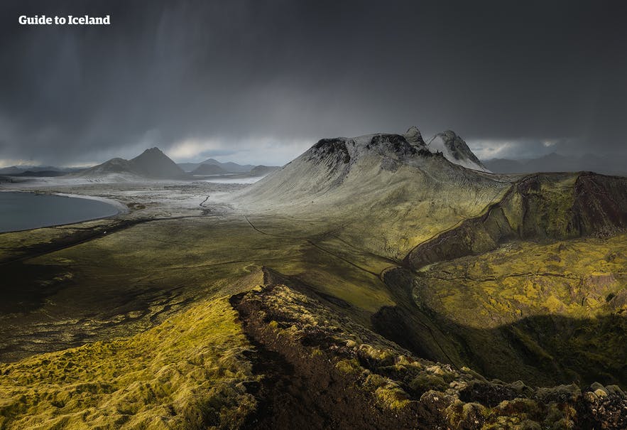
As is often the case with burgeoning island societies, it is considered unlikely that rivers were used for navigation by Iceland’s earliest inhabitants. Despite their years of maritime experience, the Norsemen would have found the rivers either too short for long distance travel or simply too hazardous, flowing dangerously into rapids and waterfalls.
This is only strengthened with the foreknowledge of the river’s origins in the treacherous Icelandic highlands—a terrain almost impossible to traverse with heavy boats.
Saying that, rivers still make an appearance in the Icelandic 'Book of Settlements', the Landnámabók, indicating they were an important tool for orientation and a source for food. Iceland's first settler, Ingólfur Arnarson, once claimed the land west of the rivers of Ölfusá, Öxará and Brynjudalsá, to which his slave coyly replied, "How ill that we should pass good land, to settle in this remote peninsula."
As ancient as the Book of Settlement is the Icelandic practice of fishing, an activity that is highly popular in Iceland today. What was once considered a necessary skill for survival is now perceived by millions as a way to relax, connect with nature and, most importantly, as a means of obtaining one’s dinner.
Thankfully, Iceland’s rivers are teeming with fish, with species including Arctic Char, Atlantic Salmon, Brown Trout, Sticklebacks and Eels.
- See also: River Rafting in Iceland
Though they are not known to breed in Iceland, anglers will also sometimes catch Rainbowfish and Humpback Salmon, the latter of which are thought to have migrated here from either Russia or Canada. By and large, however, it is Atlantic Salmon and Arctic Char that are most common, both of which are commonly found in rocky, fast-paced rivers, rich in nutrients.
Naturally, Iceland has hundreds of rivers of varying sizes—this is why, in this article, we have included only the largest rivers in Iceland.
- See also: The 5 Best Hot Springs in Iceland.
Thjorsa River
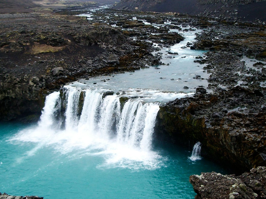 Photo by Grunkhead, from Wikimedia, Creative Commons. No edits made.
Iceland’s longest and second most voluminous river can be found in the south of Iceland, originating from the glacier Hofsjökull. Running at an incredible 230 km, the majestic Þjórsá ('The River of Bulls') acts as a dividing line between two of the country’s chartered counties; Rangárvallasýsla and Árnessýsla.
Passing through the narrow crags of the highlands, this river’s flow toward the ocean is strengthened as another river, Tungnaá, joins it downstream in the lowlands. The river continues its journey through the staggeringly beautiful Þjórsárdalur valley, passing the historical farmstead Stöng, before flowing along the eastern side of the Þjórsá lava field.
- See also: Volcanoes in Iceland and Waterfalls in Iceland
Þjórsá is notable for a number of islets found along it, the largest of which are Hagaey and Árnes. On the latter, there historically stood a Þing, a governing assembly that presided over by the region’s law speakers. Visitors to the island can still see the circular ruins of this assembly, though they are now declared to be inviolable and protected.
The Þing’s presence has lent topographical names to the island’s features; here, one can find Parliament Hill and Gallows Rock (this was the location for numerous executions.) Naturally, the county Árnessýsla is named after this island.
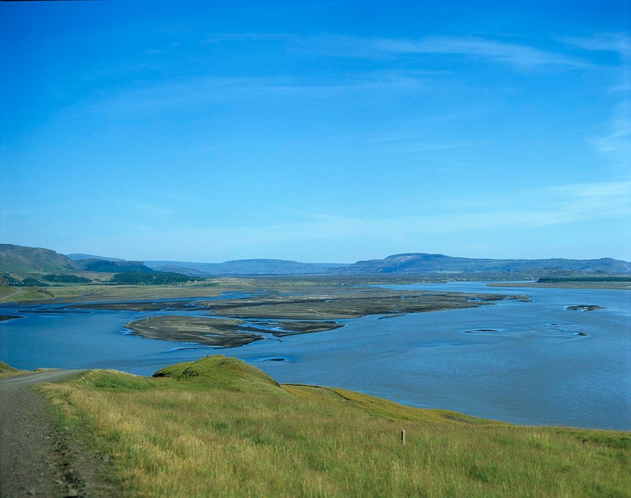 Photo by Christian Bicket, from Wikimedia Creative Commons. No edits made.
Historically, getting across the river was something of an obstacle. The first bridge was photographed above in 1900 by the writer Frederick W. W. Howell, a man famous for his illustrations and photography documenting the 19th century in Iceland.
The above bridge was later removed, given the threat of magnitude 7 earthquakes in the area, and replaced downstream by a 1950's construction. Again, the bridge was renovated in 1991 in order to increase safety. As anyone who has crossed an Icelandic river knows, seeing parts of a bridge floating below is not an uncommon sight.
Thjórsá is also an important source of energy for the Icelandic people. There are five power stations situated along the river; Búrfellsstöð, Hrauneyjafossastöð, Sultartangastöð, Vatnsfellstöð and Sigöldustöð, all of which were constructed by Landsvirkjun. There are future ambitions to build three more power stations along the lowland stretch of the river.
Jokulsa a Fjollum
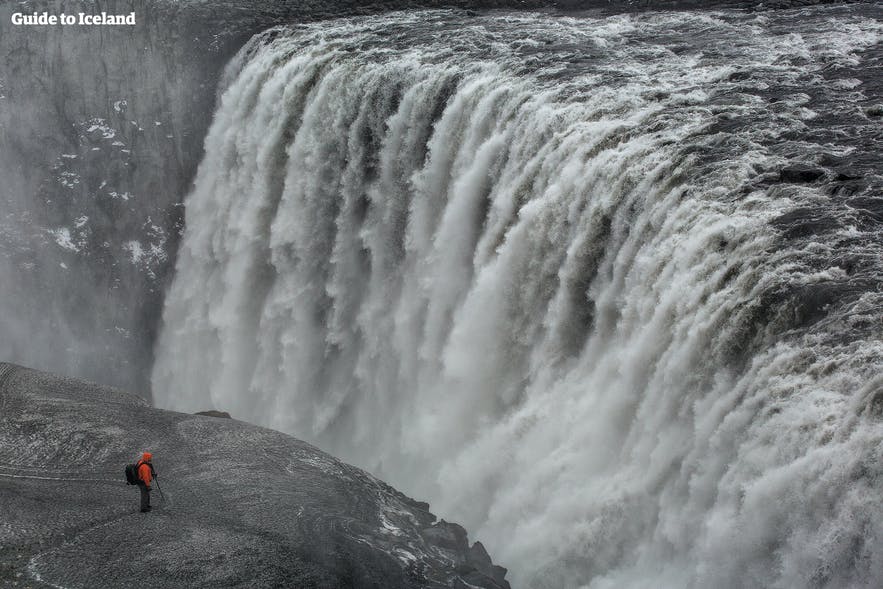
Flowing from the mighty glacier Vatnajökull, Jökulsá á Fjöllum ('The Glacial Mountain River') is celebrated as Iceland’s second largest river and the source of many of the country’s most visited cascades, including Dettifoss, Europe's most powerful waterfall.
Jökulsá á Fjöllum is found in the northeastern region of the country, acting as an eastern border to the open lava field, Ódáðahraun, before flowing into the Greenland Sea. Jökulsá á Fjöllum has a catchment basin of 7,380km, one of the many reasons why the river has been prone to dramatic glacial flooding (“jökulhlaups”) throughout history.
- See also: Glaciers in Iceland and Fjords in Iceland
The largest glacial floods that Iceland has experienced occurred along Jökulsá á Fjöllum, between 7000 to 2000 BC during the Holocene period. These floods would have occurred following an eruption under Vatnajökull glacier. The subsequent discharge is thought to have been around 900,000 cubic metres of water a second—the Amazon River boasts a discharge just a fifth of this.
The relationship between Iceland’s volcanoes and river systems is clearly indicative of the landscape’s current form. For instance, the Jökulsá á Fjöllum passes through the Jökulsárgljúfur canyon and Ásbyrgi gorge, both of which are now known to have been formed from glacial flooding.
This flooding likely occurred from an eruption at Bárðarbunga, a volcano that, to this day, threatens the very same event. It should also be made poignantly clear however that eruptions such as these are interspersed with millennia of relative stability.
Hvita River
Hvítá River ('White River') is one of the river’s you will most likely see during your time in Iceland because its course is interrupted by one of Iceland's most iconic attractions, Gullfoss waterfall, one of the three stops on the highly appraised Golden Circle sightseeing route.
The river’s source can be found at Langjökull glacier in the highlands, particularly the Hvítárvatn glacier lake. Covering an impressive 185 km in total, Hvítá begins with a 40 km journey to Gullfoss where it drops off into a narrow gorge. From there, it proceeds to directly cut between the districts of Biskupstungur and Hrunamannahreppur.
The volume of the river is doubled as its course joins with three others; the Tungufljót, the Brúará and the Stóra-Laxá. From this meeting point, the river runs steadily through the lowlands beside Grímsness, passing Ingólfsfjall mountain before it finally meets the Sogið River at Selfoss.
Here, the two rivers conjoin to become the Ölfusá, which finishes the course toward the Atlantic Ocean.
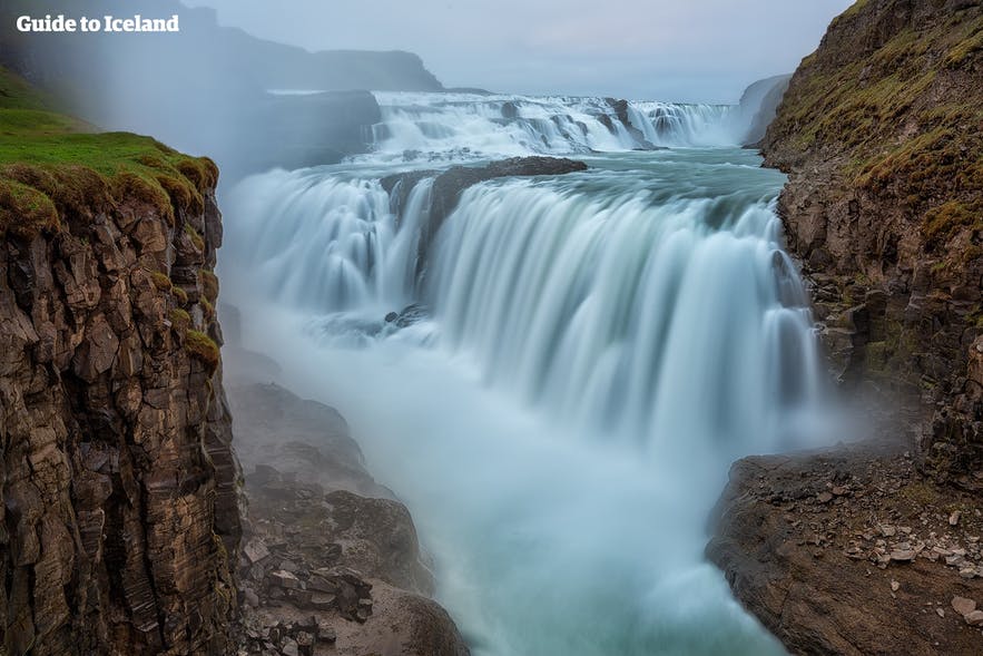
Hvítá river is highly popular amongst river rafters and kayakers. The river is classified Class 2, in accordance with the International Scale of River Difficulty, meaning it boasts moderate drops, rocks and rapid flow and requires manoeuvrability and skill on part of the rafter.
Taking to the river by boat allows you the opportunity to see Brúarhlöð canyon up close, a relic of the glacial flooding that occurred in the area centuries ago.
Despite the river’s potential for fun and adventurous activity, the Hvítá river has a reputation as the most dangerous river in Iceland. This is due to historical flooding, made all the worse by Iceland’s relatively heavy rainfall.
- See also: Weather in Iceland
Skjalfandafljot River
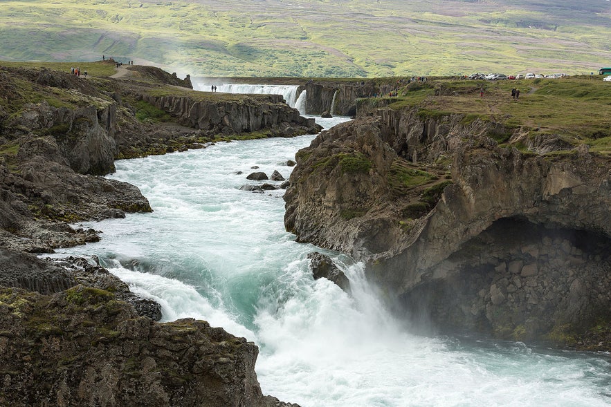 Photo by Villy Fink Isaksen, from Wiki Creative Commons. No edits made.
Skjálfandafljót ('The River of Tremble') is 178km long, making it Iceland’s fourth largest river. As with Hvítá, Skjálfandafljót’s source is the northwestern border of Vatnajökull glacier. From Vatnajökull, the river flows in a northerly direction parallel to the Sprengisandur black sand expanses, out into Skjálfandi bay. At the northern end of Sprengisandur, the river drops 10m over Aldeyjarfoss waterfall.
- See also: National Parks in Iceland
Those visitors who decide to follow the river’s course will be privy to a wide variety of beautiful waterfalls, including the sublime Goðafoss, Hrafnabjargafoss, Aldeyjarfoss, Barnafoss and Ullarfoss. Goðafoss is widely considered to be one of the most majestic waterfalls in Europe.
The first sportsman to conquer the river was a kayaking team from the University of Sheffield. They descended the river rapids in 1989. You can watch this feat on the video above:
Jokulsa a Dal
Jökulsá á Dal ('Glacial River of the Vale') is a 150km long river found in the northeastern region of Iceland. Otherwise known as Jökulsá á Brú or Jökla, this river is well known in Iceland due to its history and it’s utilisation for energy
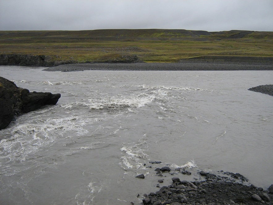 Photo by Friðrik Bragi Dýrfjörð, from Wiki Creative Commons. No edits made.
Due to the river's ferocious currents, it is not possible to ford it. The first bridge over the Jökulsá á Dal was built as early as 1625. The bridge along Route 1 was constructed in 1994, though the original bridge can still be seen downstream. In the below picture, one can see another photograph by Frederick W.W. Howell showing a rope bridge built over the river.
Over recent years, the river has been at the centre of national polarisation and controversy because of the construction of the Kárahnjúkar Hydropower Plant, the largest of its type in Europe.
In one camp stand environmentalists, who have rightfully claimed the plant not only to severely damage the untouched, eastern ecosystem but also to be indicative of persistent attempts to sell the country for heavy industry.
On the other side, a small but politically powerful minority has argued that the hydropower plant is an excellent source of employment and energy—the region's youth being presented with the bright future of slaving their lives away in a scorching aluminium smelter owned by a multinational corporation with a long criminal history—and is thus a crucial aspect of the 'modernisation' of the long modernised Iceland.
Out of the river’s original 150km, 25km of it is now comprised of the artificial lake, Hálslón, a byproduct of the dam itself.
- See also: Top 10 Worst Things About Iceland
What is clear is that no one truly knows the impact the Kárahnjúkar Hydropower Plant will have on the environment in centuries to come. Already, the natural flow of the river has been irreversibly changed; whereas once the river discharged 205 m³/s, it is now reduced to 95 m³/s, no longer travelling down to the Atlantic Ocean but instead flowing from the dam's artificial lake into Lagarfljót.
Lagarfljót, which used to be teaming with life, has now been declared 'dead' by biologists and local residents alike; the river’s ecosystem has literally been obliterated, a 'necessary' side effect of the gigantic Kárahnjúkar Dam.
- See also: Iceland's Troubled Environment
Kudafljot River
One of the largest glacial rivers found in Iceland, the 115km Kúðafljót can be found in the south of Iceland. Originating in Mýrdalsjökull, the river pours through both the Skaftátunga district and the black sand desert of Mýrdalssandur on its journey towards the Atlantic.
According to The Book of Settlements, the river takes its name from some of the earliest settlers to Skaftátunga, who arrived at the area in a ship Kúði. Throughout history, we know that the river was widely regarded to be dangerous, with strong currents and concealed quicksand.
Even so, travellers would risk their lives, again and again, crossing the river, often using the strength and willpower of their horse to cross the shallowest areas. Because of stories like this, we are aware that Kúðafljót differed from the majority of rivers in Iceland in so much as it was navigable.
- See also: Where Did Icelanders Come From?
That’s not to say navigation was easy. Until the 1950s, the south-east coast of Iceland was well known to be a ship cemetery, made up of numerous French fishing vessels. Between 1850 and 1914, up to 5000 men would sail from Brittany in order to harvest the Icelandic coastal waters, setting their seasonal base in Fáskrúðsfjörður.
Because of the sheer amount of men involved, the French government also saw to it that hospital ships accompanied them. The Saint Paul was a French hospital ship that stranded by the mouth of the Kúðafljót river on the 4th April 1899. All crew members survived, though they were unhappy to see the local population auction off the entirety of the boat’s cargo, including 900 bottles of wine.
Blanda River
Blanda ('Mixture') is the largest river in north-west Iceland, following a 125 km course from its source, Hofsjökull glacier, all the way down to Húnaflói bay, by the village of Blönduós.
Blanda is particularly known as a salmon fishing river; one year, the catch almost exceeded 3000 fish! Fishing season along Blanda river is between June and September, and guests can expect to catch a fish weighing between 10 and 18 lbs. That being said, it is not uncommon to catch fish weighing over 20 lbs, adding a certain thrill and challenge to fishing in these waters.
The fish are thought to be larger than average in Blanda because the rapids require more strength from the fish. On average, the river is between 30m and 50m wide, and between 1m and 2m deep, making it the perfect conditions to fish with a double handed rod. The river’s drainage basin is estimated to be 2370 km².
Fnjoska River
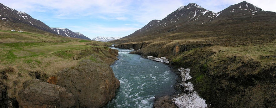 Photo by Hansueli Krapf, from Wiki Creative Commons. No edits made.
Running a full length of 117 km, Fnjóská ('The River of Dry Wood') is considered to be the ninth largest river in Iceland. It can be found approximately 10 km east of Akureyri, flowing down Fnjóskardalur valley, which runs parallel to Eyjafjörður.
The course of the river runs through Vaglaskógur, the second largest forest in Iceland (300 acres), only strengthening the river's reputation for beauty. Even the river's estuaries are well known to Icelanders, famous for their aesthetic beauty and chattering birdlife.
- See also: Wildlife and Animals in Iceland
Fnjóská is a fast-running, rocky river that requires fishermen to wade up to their waist in order to grab the best spot for angling. The river is relatively cold, meaning the Atlantic Salmon can be a tad elusive, but Arctic Char are plentiful in the water, weighing in between 2 lbs to 10 lbs.
Once again, this is the perfect type of river to use a double-handed rod. Because of all these reasons, this river is considered one of the best in Iceland for fly fishing.
What is your favourite river in Iceland? What was your favourite water-based activity whilst you were here, or what are you looking forward to the most? Do you have any outstanding questions about Iceland's river systems? Make sure to ask in the comments' box below and we'll get back to you as fast as we can!
Written by Mike Chapman

