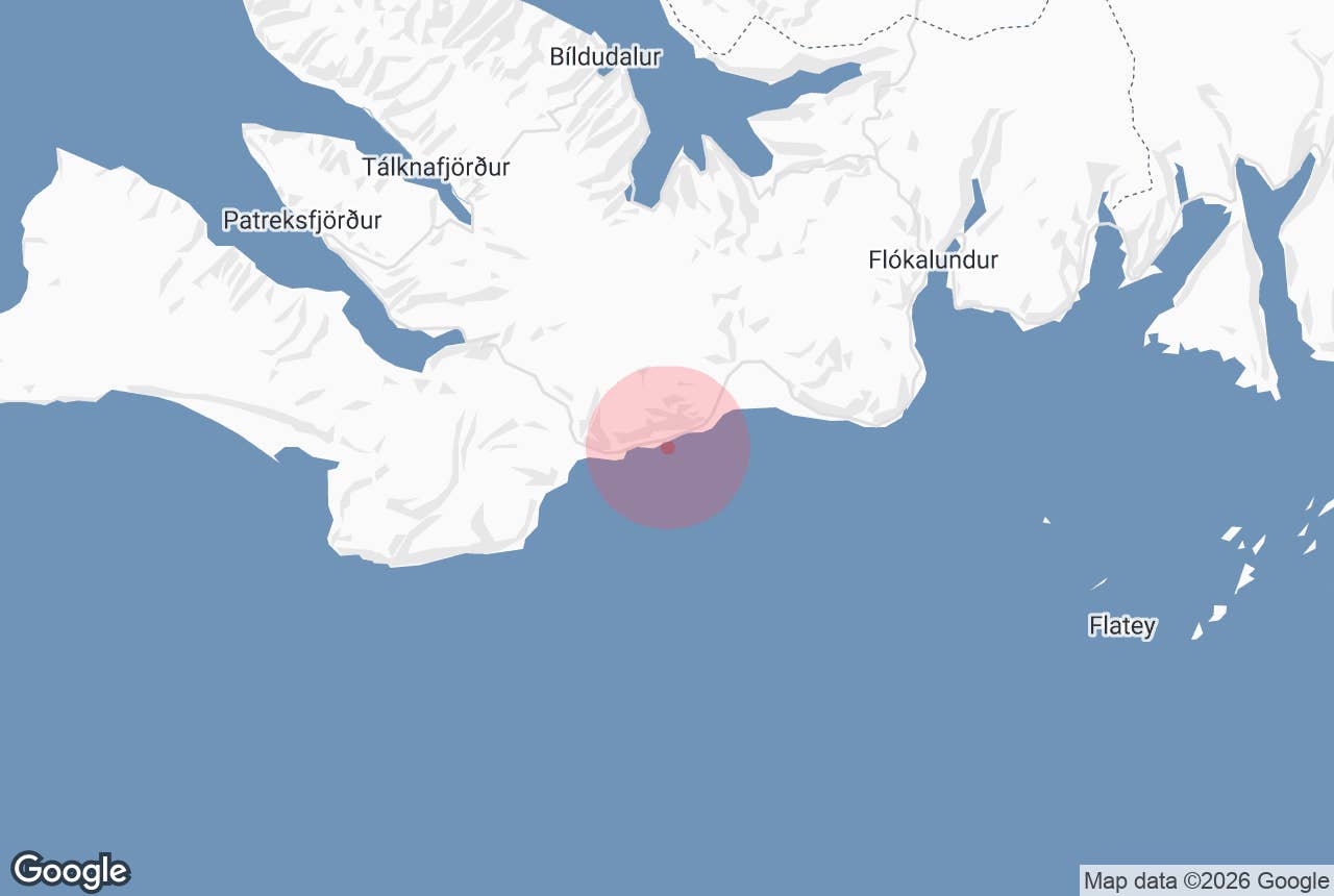
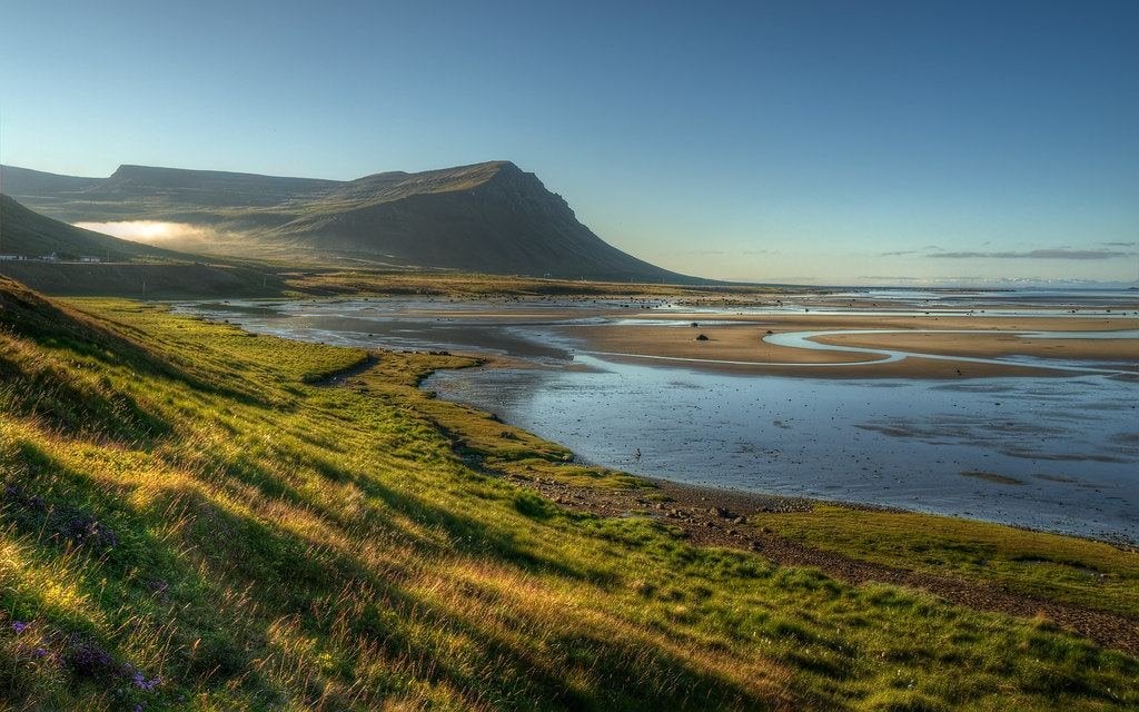
Hamarshyrna above Hagavaðall, Barðaströnd. Photo: Axel Kristinsson, CC BY 2.0
Barðaströnd (Icelandic: Barðaströnd) is the long south-facing coast of the southern Westfjords, running along the north shore of Breiðafjörður bay between Vatnsfjörður in the east and the steep slopes of Sigluneshlíðar in the west.
The Barðaströnd coast is farmland and sandy shore backed by a wall of flat-topped mountains, threaded by Road 62 (Barðastrandarvegur), and it is the first stretch of the Westfjords most people see after arriving on the Baldur ferry at Brjánslækur.
The name is old and its exact origin is not certain; strönd simply means "shore". Barðaströnd also gave its name to the former Barðastrandarsýsla county, which is why you will see the word on signs far from this coast.
Key Takeaways About Barðaströnd
- South-facing coast of the southern Westfjords on Breiðafjörður, between Vatnsfjörður/Flókalundur and Sigluneshlíðar, followed by Road 62
- Hrafna-Flóki wintered at Vatnsfjörður and named the country Ísland; nature reserve since 1975
- Hagi church (1899) and Brjánslækur church (1908); Surtarbrandsgil fossil gully is protected
- Two bathing spots: Hellulaug shore pool (c. 38°C) and Krosslaug/Birkimelur at Krossholt (c. 37°C)
- 330–360 km from Reykjavík by road, or the Baldur ferry Stykkishólmur–Brjánslækur; no 4x4 needed
Why visit Barðaströnd
This is where Iceland got its name. According to Landnámabók, the Norwegian Flóki Vilgerðarson (Hrafna-Flóki) landed at Vatnsfjörður and spent a winter there.
His party fished and hunted but failed to make hay, so their livestock died, and in the cold spring that followed Flóki climbed a mountain, probably Lónfell (752 m), saw a fjord to the north choked with drift ice and called the country Ísland.
A memorial to him stands at Flókalundur, and Vatnsfjörður has been a nature reserve since 1975, covering about 20,000 hectares of birch and rowan woodland, wetland and rocky upland, with Arctic foxes, seals, around twenty resident bird species, salmon in Vatnsdalsá and trout in Vatnsdalsvatn.
West of Vatnsfjörður the coast opens out. Breiðafjörður, with its roughly 3,000 islands and skerries, fills the view to the south, and on a clear day the mountains of Snæfellsnes show across the water.
Wide tidal flats and lagoons such as Hagavaðall draw waders and Arctic terns in summer, and long sandy beaches (Barðastrandarsandur) line the shore below the farms. The land here is some of the gentlest in the Westfjords, which is why it was settled early.
Hagi, the old manor farm in the middle of the coast, has a wooden church built in 1897–99 and consecrated on 12 November 1899, replacing an 1892 church destroyed by winter storms. It holds a pulpit from 1745 and altar cloths dated 1649.
A Catholic church dedicated to St Nicholas stood here before the Reformation. At Brjánslækur, by the ferry landing, the current church dates from 1908 and contains an altarpiece painted in 1912 by Þórarinn B. Þorláksson and a chalice from 1804.
Nearby, Surtarbrandsgil, a protected gully, holds fossil leaves, insects and lignite from the Miocene, about 12 million years ago; entering the gully is only allowed with a ranger, so ask locally about the scheduled guided walks.
The coast also has two of the Westfjords' best-loved bathing spots.
Hellulaug is a stone-lined natural pool at about 38°C right by the shore in Vatnsfjörður, a short walk from Hótel Flókalundur, about 60 cm deep and out of sight of the road, with a small parking area by the path.
Further west at Krossholt, the Birkimelur swimming pool (built in 1948) and the adjoining natural pool Krosslaug sit above the beach at around 37°C.
How to get to Barðaströnd
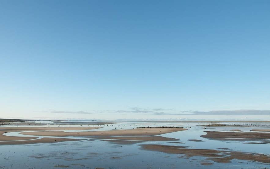
Low tide on Hagavaðall, Barðaströnd. Photo: Axel Kristinsson, CC BY 2.0
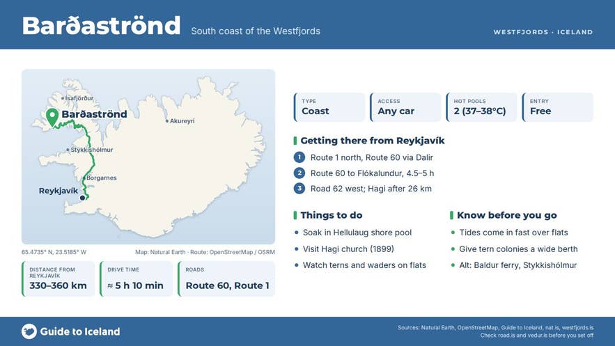
Barðaströnd is about 330–360 km from Reykjavík by road: take Route 1 north, Route 60 through Dalir and over the mountain roads to Flókalundur (around 4.5–5 hours), then Road 62 west along the coast. From Flókalundur it is about 6 km to Brjánslækur, 26 km to Hagi and 62 km to Patreksfjörður over Kleifaheiði.
The shorter alternative is the ferry Baldur from Stykkishólmur on Snæfellsnes to Brjánslækur, which calls at Flatey and saves about 155 km of driving; book ahead and check the current timetable and operator, as the service has changed in recent years.
Road 62 is a normal highway with some gravel sections; in winter check the road status, because the Kleifaheiði pass at its western end can close in storms. Parking is limited to the small car park at Hellulaug and pull-offs at the pools at Krossholt and the churches; please keep off farm tracks. Nothing on Barðaströnd needs a 4x4.
Best time to visit
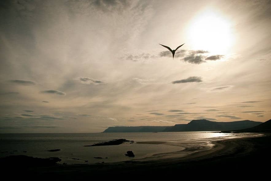
Arctic tern over Barðaströnd. Photo: Didier Baertschiger, CC BY-SA 2.0
June to August gives the best chance of calm weather, long evenings over Breiðafjörður and busy birdlife on the tidal flats, and the ferry runs most often in summer. May and September are quieter and still practical.
In winter the coast is passable but Flókalundur is closed (open May–September), the ferry runs less often, and the mountain roads in and out may close.
Safety and practical tips
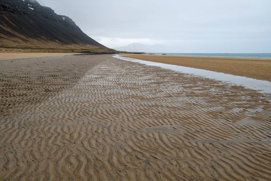
Barðaströnd near Grjótnes. Photo: Hansueli Krapf, CC BY-SA 4.0
- Tern colonies on the flats and beaches defend their nests fiercely in June and July; walk around them, not through them.
- Tides over Hagavaðall and the other lagoons come in quickly across flat sand. Do not wander far out at low water.
- Hellulaug has no changing facilities; Krosslaug/Birkimelur charges a small fee and has changing rooms and showers.
- Food and accommodation are at Flókalundur (May–September) and, with fuel and shops, at Patreksfjörður. Carry what you need in the off-season.
- Surtarbrandsgil is a protected natural monument; collecting fossils there is illegal.
- Mobile coverage is patchy under the mountains; check the road status on umferdin.is before crossing Kleifaheiði in bad weather.
Is Barðaströnd a town?
Where exactly did Flóki name Iceland?
Can I drive Barðaströnd in a normal car?
How long should I allow?
Nearby attractions
- Hagi – historic farm and 1899 church, 3 km
- Barðastrandarsandur – the long beach below the coast, 4 km
- Krosslaug Hot Springs – pool and natural hot spring at Krossholt, 7 km
- Sigluneshlíðar – the steep slopes at the coast's western end, 12 km
- Brjánslækur ferry – landing for Baldur from Stykkishólmur, 16 km
- Vatnsfjörður – nature reserve where Flóki wintered, 18 km
- Hellulaug Hot Spring – shoreline pool by Flókalundur, 20 km
- Rauðisandur – red-sand beach over the mountains to the west, 22 km
Tours that visit Barðaströnd
- Thrilling 7 Day Iceland Motorcycle Adventure Tour in the Westfjords with Waterfalls & Glaciers – a package whose second day (Bjarkalundur to Patreksfjörður, 188 km) rides along the Barðaströnd coast before continuing to Látrabjarg and Patreksfjörður.
