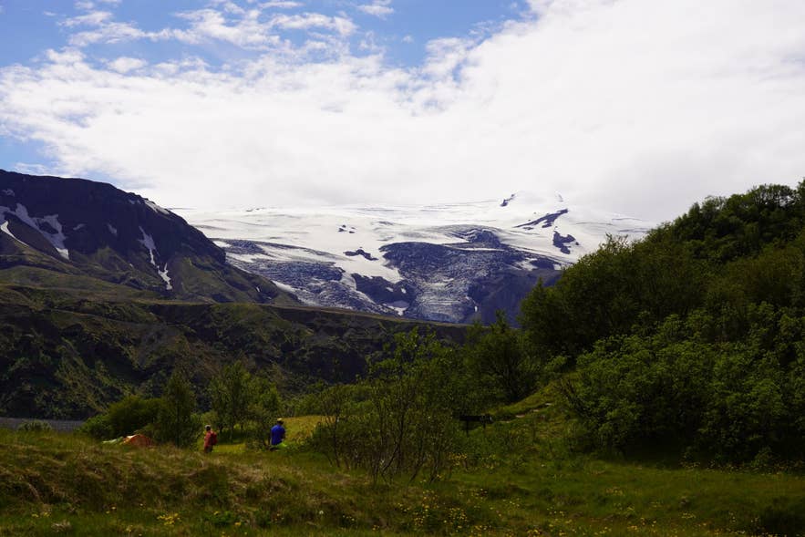
Langidalur, Þórsmörk, below Eyjafjallajökull. Photo: Ray Swi-hymn, CC BY-SA 2.0
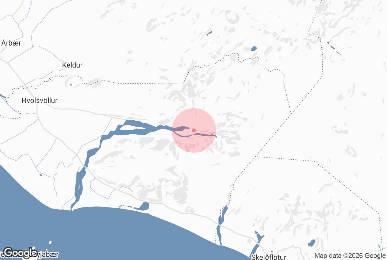
Snorrariki Cave (Icelandic: Snorraríki, "Snorri's realm") is a small cave in the palagonite tuff of Þórsmörk, the birch-wooded valley between the glaciers Eyjafjallajökull and Mýrdalsjökull in South Iceland. It sits in Langidalur, a few hundred meters from the Skagfjörðsskáli mountain hut, beside the marked path that climbs from the hut toward the viewpoint of Valahnúkur and on to Húsadalur.
It is the kind of place you visit on a short walk from the hut rather than a destination in itself, and that is exactly how most people see it: a shaded hollow in the rock, a good story from the guide, and then on up the hill.
Key Takeaways About Snorraríki
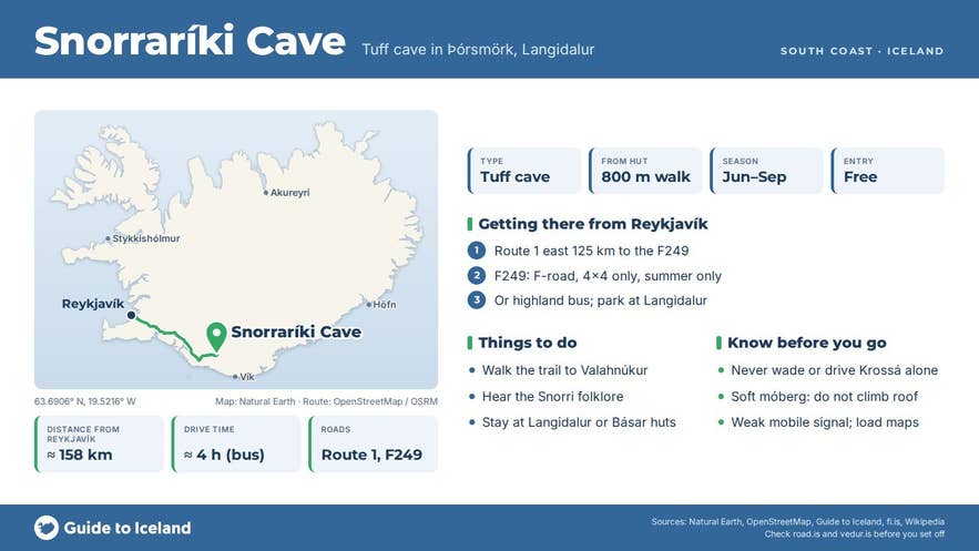
- A small cave in soft palagonite tuff about 800 m north-west of the Skagfjörðsskáli hut, on the marked trail to Valahnúkur and Húsadalur.
- The name means 'Snorri's realm'; the story attached to it is local folklore with no written source.
- Easiest access is the summer highland bus from Reykjavík (BSÍ) to Langidalur; the F249 fords the Krossá and is for large 4x4s only.
- Combine it with the 4 km, 1 to 2 hour Valahnúkur viewpoint loop.
- No fee; huts and camping at Langidalur, Básar and Húsadalur, open June to September.
Why visit Snorrariki Cave
Þórsmörk is built of hyaloclastite, or móberg, the soft brown rock formed when lava erupts under ice. Water and wind carve it into ribs, pinnacles and overhangs, and the whole valley is dotted with small caves. Snorraríki is one of the better known, along with Sönghellir ("song cave") and Sóttarhellir to the west towards Húsadalur.
The name means Snorri's realm or kingdom; the cave is traditionally linked to a man called Snorri said to have lived or hidden here, and guides tell their own versions of the tale. No written account of the story has been traced, so treat the details as folklore rather than history.
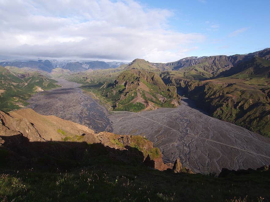
Þórsmörk from Valahnúkur above Snorraríki. Photo: rheins, CC BY 3.0
The real reward is the surroundings. Þórsmörk is named after the god Þór; the Book of Settlements says the settler Ásbjörn Reyrketilsson dedicated his land claim to him. Glacial rivers and ice walled the area off from grazing sheep, so birch, ferns and leafy mosses thrive here in unusual variety.
After the Katla eruption of 1918 the valley was fenced off from grazing and handed to the Forestry Service, and the woods have been spreading back ever since. The climate is noticeably milder than on the coast because the surrounding mountains hold off the rain clouds.
From the cave the path continues to Valahnúkur, a steep little mountain of about 460 m with a summit view over all of Þórsmörk: the braided Krossá, the Markarfljót plain, the Tindfjöll ridge, Eyjafjallajökull and the twin craters of Magni and Móði from the 2010 eruption.
How to get to Snorrariki Cave
Snorraríki is reached from the Langidalur hut area in Þórsmörk.
- By highland bus (recommended): in summer buses leave Reykjavík's BSÍ terminal around 07:00 and reach Langidalur around 11:00, with pick-ups in Selfoss, Hella and Hvolsvöllur. Return departures from Langidalur are mid-afternoon. The season runs roughly from the start of June to late September.
- By car: take Route 1 east for about 125 km to the F249 (Þórsmerkurvegur) junction near Seljalandsfoss, then roughly 30 km of mountain road to Langidalur. The F249 fords many streams and finally the glacial river Krossá, which is cold, shifts its channels and has claimed lives. Only large, high-clearance 4x4s should attempt it, and most rental agreements forbid it. In summer a movable footbridge spans the Krossá, so a common plan is to park on the south bank near Básar and walk the last stretch to Langidalur.
- On foot: from Skagfjörðsskáli in Langidalur, follow the marked trail toward Valahnúkur and Húsadalur. The cave is about 800 m from the hut along this path, roughly 10 to 15 minutes of easy walking. From the Volcano Huts in Húsadalur the walk is a little longer, about 2 km over the low pass.
- Parking is at the huts. There is no fee to visit the cave.
Best time to visit
June to September, when the F249 and the huts are open and the birch is in leaf. July and August give the warmest, driest conditions and the fullest bus schedule.
June has the longest days and fewer people; September brings autumn colour in the birch and a real chance of early snow on the passes. The cave itself is accessible whenever Þórsmörk is, but winter visits need a super-jeep tour.
Safety and practical tips
- Rivers are the main danger in Þórsmörk, not the cave. Never try to wade or drive the Krossá on your own judgement; use the footbridge and ask the hut wardens about conditions.
- The móberg is soft and crumbly. Do not climb on the cave roof or pull at the rock, and keep children close near drop-offs.
- Weather changes quickly even in this sheltered valley. Carry a waterproof shell, a warm layer, water and a snack for the Valahnúkur climb.
- Stay on marked paths; the thin soils and moss regrow slowly.
- Facilities: Skagfjörðsskáli in Langidalur sleeps 73 and has a kitchen, dining room, showers and a campsite; wardens sell maps. Básar (Útivist) and the Volcano Huts in Húsadalur also offer beds, camping and, in Húsadalur, meals. Book ahead in July and August.
- Mobile coverage is weak in the valley. Download maps before you arrive.
Where is Snorrariki Cave?
Do I need a guide or special gear?
Who was Snorri?
Can I drive to Þórsmörk in a normal car?
How long does the Valahnúkur walk take from the cave?
Nearby attractions
- Skagfjörðsskáli, the Langidalur hut, 0.8 km
- Valahnúkur, the viewpoint above the cave, 0.9 km
- Réttarfell, across the Krossá in Goðaland, 2.2 km
- Básar, Þórsmörk, the Útivist hut area, 2.5 km
- Stakkholtsgjá, the canyon with a hidden waterfall, 2.5 km
- Rjúpnafell, 5.6 km
- Fimmvörðuháls, 6.6 km
- Gígjökull, 7.4 km
Tours that visit Snorrariki Cave
- Women-Focused 3-Day Thorsmork Hiking Tour with Meals and Mountain Huts: on day one, after climbing Valahnúkur and dropping into Húsadalur, the group walks toward Langidalur and stops to explore Snorraríki, with the guide sharing the stories attached to it.
