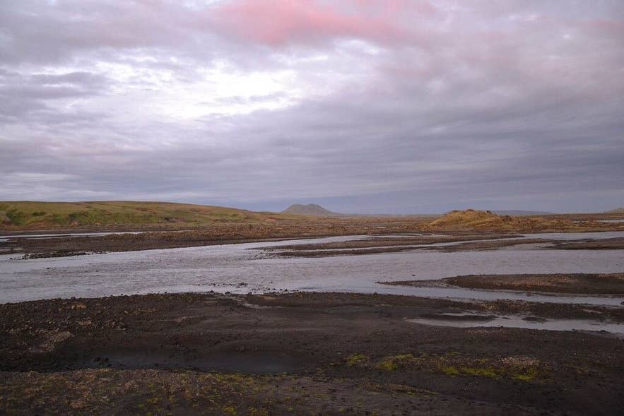
Braided Syðri-Ófæra at dusk. Photo: Janko Hoener, CC BY-SA 4.0
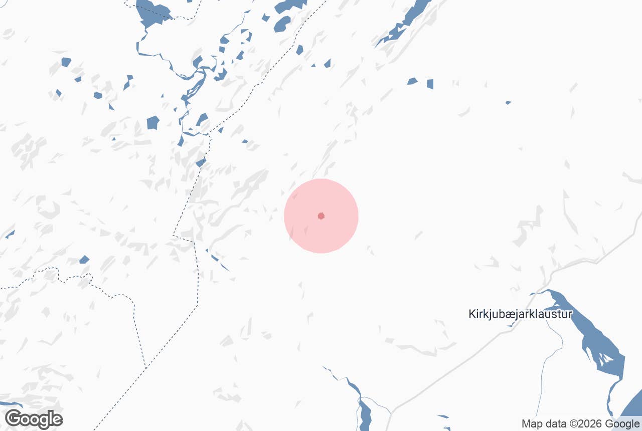
Syðri-Ófæra ("the southern impassable one") is a cold highland river in the Fjallabak area of South Iceland, on the eastern side of the Eldgjá volcanic fissure.
It rises in the hills east of the Torfajökull glacier, gathers the spring-fed lakes of Álftavötn, runs east through the southern part of Eldgjá and past the Hólaskjól highland centre, and joins the glacial river Skaftá in Skaftártunga.
Its name pairs it with Nyrðri-Ófæra, "the northern impassable one", which is the river that drops into Eldgjá at the famous Ófærufoss waterfall a few kilometres to the north. Both names are a warning: these rivers could not be crossed on the old routes without difficulty.
For walkers on the Strútsstígur and Eldgjá treks, Syðri-Ófæra is the river they follow, ford and camp beside.
Key Takeaways About Syðri-Ófæra
- The southern of the two Ófæra rivers at Eldgjá; it runs past Hólaskjól to the Skaftá
- Silfurfoss waterfall drops through a basalt-columned fissure a few hundred metres from the Hólaskjól car park
- Followed and forded by the Strútsstígur and Eldgjá treks between Hólaskjól and Álftavötn
- Reached by 4x4 on F208 from Route 208, about 60 km from Kirkjubæjarklaustur; the road opens around mid-June and closes in late September
- Hikers report hip-deep fords in places; cross early in the day with poles and river shoes
Why visit Syðri-Ófæra
Hikers describe Syðri-Ófæra as clearer and colder than the silt-laden glacial rivers Skaftá and Hólmsá, since much of its water comes from springs and snowmelt in the Álftavötn basin, though after rain or in the lower reaches it can run grey and braided.
Along its course the river has cut narrow gorges into the Eldgjá lavas and tuff, and it drops over a string of waterfalls. The best known is Silfurfoss, "silver falls", directly at Hólaskjól, where the river squeezes through a small fissure lined with basalt columns.
A short marked loop from the campsite follows the gorge and the lava field and takes well under an hour. Further upstream, towards Álftavötn, there are more falls and a natural stone bridge over the river.
Above the gorges the river opens into the Álftavötn basin, the "swan lakes", where springs well up out of the lava field and whooper swans and other waterfowl nest. The Álftavötn hut, a rebuilt shepherds' hut run by the hiking association Útivist, and the trail lead on towards Strútslaug, a natural hot spring south of Torfajökull, and the Strútur hut.
The area lies at the edge of the Eldgjá section of Vatnajökull National Park, in the Fjallabak region, surrounded by the moss-covered lava of the Eldgjá eruption of around 939 CE, the largest lava (effusive) eruption on Earth in the last few millennia.
For most visitors Syðri-Ófæra is experienced in two ways: as the setting of Hólaskjól, the only serviced base in this corner of the Highlands, and as the companion on the Strútsstígur trail stage between Hólaskjól and Álftavötn, 6 to 7 kilometres where the path runs along the river through moss-grown lava.
How to get to Syðri-Ófæra
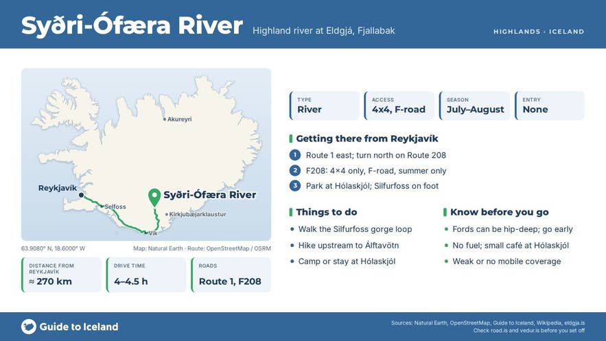
The practical access point is Hólaskjól. From Kirkjubæjarklaustur drive 23 kilometres west on the Ring Road, turn north onto Route 208, follow it for about 16 kilometres, and continue roughly 20 kilometres on F208 (Fjallabaksleið nyrðri) to Hólaskjól, about 60 kilometres in total.
Coming from Reykjavík you turn off the Ring Road before reaching Kirkjubæjarklaustur, so the full drive from the capital is about 270 kilometres and four to four and a half hours. A shorter but rougher approach is F208 from the north via Landmannalaugar, which involves several unbridged river crossings.
F208 is a mountain road. The southern approach from Route 208 to Hólaskjól is the gentlest section and has no rivers to ford, but a 4x4 with good clearance is still required by the road authority and by rental agreements on any F-road.
North of Hólaskjól towards Eldgjá and Landmannalaugar the road crosses several unbridged rivers, and F233 (Álftavatnskrókur), which branches off north of Hólaskjól towards Álftavötn, crosses the unbridged Syðri-Ófæra itself; Útivist advises asking the Hólaskjól warden about the safest crossing point.
The southern F208 (Skaftártunga to Eldgjá) normally opens in mid-June (Vegagerðin lists openings between 10 and 26 June in recent years) and closes with the first autumn snow, usually in late September; check road.is before you go.
From the Hólaskjól car park the Silfurfoss gorge is a few hundred metres on foot. Reaching the upper river at Álftavötn is a walk of six to seven kilometres each way, about two hours, or part of the multi-day Strútsstígur route.
Best time to visit
July and August. The F-roads are open, the river is at its usual summer level and Hólaskjól is staffed.
Early in the season, in June, snowmelt raises the river and makes fords deeper and colder; in late August and September water levels are generally lower and the moss and birch scrub turn colour, but weather closes in fast and services wind down. Útivist's guided Strútsstígur treks run in July and early August.
Safety and practical tips
- Fording Syðri-Ófæra on foot is the trickiest crossing on the Strútsstígur. Hikers report hip-deep water in places even when the current is slow, and the vehicle ford is not the best place to wade. Use a trekking pole, unbuckle your pack, cross in a group and do not cross after heavy rain or on warm afternoons when the flow is highest.
- The water is cold all summer. Wear proper river shoes, not bare feet.
- Hólaskjól has a lodge, cabins, a campsite and a small café selling snacks, and is owned and run by the Skaftártunga angling association (Veiðifélag Skaftártungu); services run from early June to late September, so book ahead in high season. There is no fuel or proper shop; the nearest are at Kirkjubæjarklaustur.
- Mobile coverage around Hólaskjól and Álftavötn is weak or absent. Carry a map and GPS; the Strútsstígur is only lightly marked.
- Stay on tracks. The Eldgjá moss is slow-growing and tyre and foot damage lasts for decades.
- Fishing in the mountain lakes of Skaftártunga is controlled by the same angling association; ask at Hólaskjól.
Is Syðri-Ófæra the river at Ófærufoss?
Can I drive to the river?
Do I have to wade across it?
Can I swim in it?
When is the road open?
Nearby attractions
- Hólaskjól Highland Center – huts and campsite on the river bank, 0.2 km
- Silfurfoss Waterfall – the river's basalt-lined falls at Hólaskjól, under 1 km
- Álftavötn – the spring-fed lakes at the head of the river, about 4 km
- Eldgjá – the volcanic fissure the river runs through, about 6 km
- Ófærufoss – the twin falls of the northern Ófæra, about 6 km
- Strútslaug – natural hot spring reached on foot from the upper river, about 17 km
- Langisjór Lake – highland lake north of Eldgjá, about 40 km by track
Tours that visit Syðri-Ófæra
- 12-Day Small-Group Highlands Hiking Tour with Transfer – the itinerary reaches the cold waters of the Syðri-Ófæra river on its Fjallabak section.
- Small-Group 7-Day Highlands Hiking Tour of the Eldgja and Strutur Trails with Reykjavik Transfers – the Strútur trek section runs from Hólaskjól along the Syðri-Ófæra towards the Álftavötn hut.
