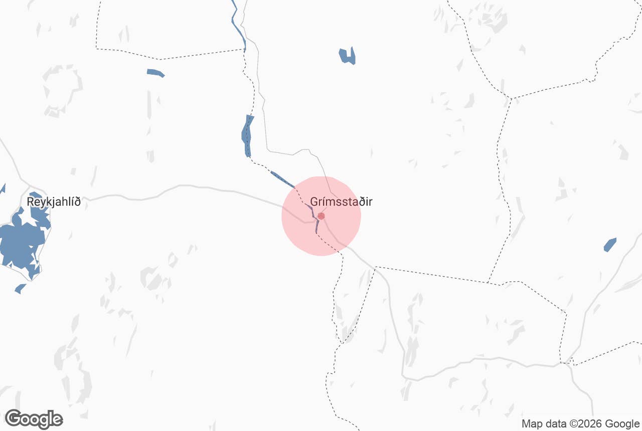
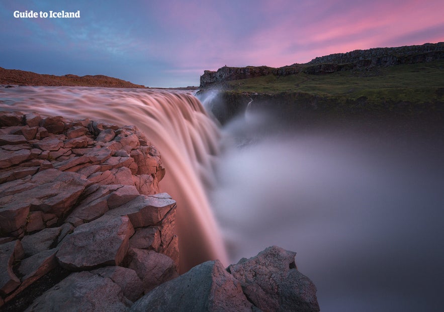
Jokulsa a Fjollum is Iceland's second-longest river. Known for its immense glacial power, it has carved dramatic canyons and feeds some of the country's most iconic waterfalls. Learn what to see, when to visit, and how to make the most of your trip to this spectacular natural wonder.
Stretching 128 miles (206 kilometers) from the Vatnajokull Glacier to Oxarfjordur Bay on the north coast, Jokulsa a Fjollum is one of the most powerful glacial rivers in Iceland. Along its course, the river has carved deep canyons and created some of Iceland's most iconic waterfalls, including Dettifoss and Selfoss.
Many of the river's highlights are part of the Diamond Circle sightseeing route, making them easy to explore on self-drive adventures or guided Diamond Circle trips. If you're planning to explore North Iceland at your own pace, booking a car rental gives you the flexibility to visit the river's viewpoints, hiking trails, and nearby attractions.
Why You Can Trust Our Content
Guide to Iceland is the most trusted travel platform in Iceland, helping millions of visitors each year. All our content is written and reviewed by local experts who are deeply familiar with Iceland. You can count on us for accurate, up-to-date, and trustworthy travel advice.
To better understand how this remarkable river continues to shape Iceland's landscape, we spoke with Dr. Greta Wells, a geoscientist specializing in glacial hazards and Arctic environmental change. Throughout this guide, she shares expert insights into the powerful geological processes that have formed and continue to transform Jokulsa a Fjollum.
Read on to know more about Jokulsa a Fjollum, from its geology and famous waterfalls to the best time to visit, top things to do, and practical travel tips.
Jokulsa a Fjollum at a Glance
-
Region: North Iceland
-
Length: 128 miles (206 kilometers)
-
National Park: Vatnajokull National Park
-
Source: Dyngjujokull, an outlet glacier of Vatnajokull Glacier
-
Mouth: Oxarfjordur Bay on Iceland's north coast
-
Best-Known Waterfalls: Dettifoss, Selfoss, and Hafragilsfoss
-
Best Time To Visit: June to September for the best road access, hiking conditions, and sightseeing
Geology and Formation of Jokulsa a Fjollum
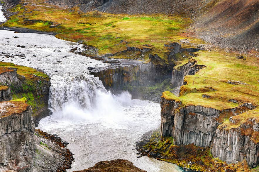 The name “Jokulsa a Fjollum” (pronounced YOH-kul-sow ah FYOT-lum) means “glacial river in the mountains.” The river begins at Dyngjujokull, an outlet glacier of Vatnajokull Glacier, Iceland's largest glacier.
From there, the river flows 128 miles (206 kilometers) north through volcanic landscapes before emptying into Oxarfjordur Bay on Iceland's northern coast.
Jokulsa a Fjollum is fed by glacial meltwater, carrying vast amounts of water, volcanic sediment, and rock downstream each year. Its flow is also influenced by volcanic activity beneath Vatnajokull, where eruptions can trigger sudden glacial outburst floods known as jokulhlaups. These powerful floods have repeatedly reshaped the landscape, eroding bedrock and carving deep canyons over thousands of years.
The river's dramatic scenery is the result of both fire and ice working together. Ancient lava fields, layers of basalt, and repeated glacial floods have created the rugged volcanic landscapes seen today.
These geological processes are still shaping the landscape today.
Iceland's glaciers and rivers are actively sculpting the landscape, not just flowing passively across it. Some processes occur slowly; for example, centuries for a river to erode a valley or a glacier to push sediment into a moraine. Others operate on shorter time scales—seconds for glacial ice to calve into a lake or days for a subglacial lake to drain.
As Iceland's second-longest and one of its most powerful glacial rivers, Jokulsa a Fjollum remains one of the defining natural features of North Iceland and a highlight of the Diamond Circle.
What Makes Jokulsa a Fjollum Famous
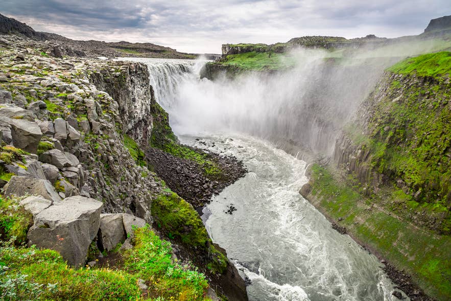 Jokulsa a Fjollum is best known for shaping some of Iceland's most dramatic landscapes. Many of its most famous natural attractions lie within Vatnajokull National Park, making the river one of the best places to visit in North Iceland.
Home to Iceland's Largest Canyon System
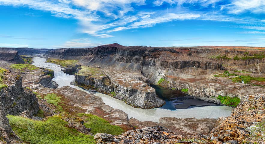 The immense power of Jokulsa a Fjollum is most evident in Jokulsargljufur Canyon, Iceland's largest canyon system. The canyon stretches for about 15.5 miles (25 kilometers) and features towering basalt cliffs, unusual rock formations, and lush pockets of vegetation.
Rather than being worn away gradually, the canyon was excavated in sudden bursts. Dr. Wells discusses how the process works:
Glacial outburst floods, known as jokulhlaups, create unique landforms because of their high-powered flow and short duration of days to weeks, which sounds long but is an instant in geology. Much of the geology here is columnar basalt, which forms structural weaknesses in the rock, and the floodwaters carry enough power to ‘topple’ and remove the columns. That erosion is active at knickpoints (the waterfalls) which retreat upstream, excavating the canyon.
She further states that this “sudden floods” explanation is now widely accepted among scientists.
By dating the canyon's bedrock terraces, researchers have identified three main periods of canyon-cutting, roughly 9,000, 5,000, and 2,000 years ago. During these periods, some waterfalls retreated more than 1.2 miles (2 kilometers) upstream, far faster than gradual river erosion could achieve.
These floods are estimated to have been at least tens to hundreds of times greater than the river's flow today, fed mainly by volcanic eruptions beneath the Vatnajokull ice cap.
Today, it forms the northern section of Vatnajokull National Park and is home to popular attractions such as Asbyrgi Canyon and Hljodaklettar Rock Formations.
Home to Some of Iceland's Most Powerful Waterfalls
As Jokulsa a Fjollum makes its way to the sea, it plunges over several dramatic waterfalls shaped by volcanic rock and centuries of erosion. These include Europe's most powerful waterfall, Dettifoss, the horseshoe-shaped Selfoss, the scenic Hafragilsfoss, and the lesser-known Rettarfoss.
Together, they are among the biggest highlights of the Diamond Circle and showcase the incredible force of Iceland's glacial rivers.
Best Waterfalls In Jokulsa a Fjollum
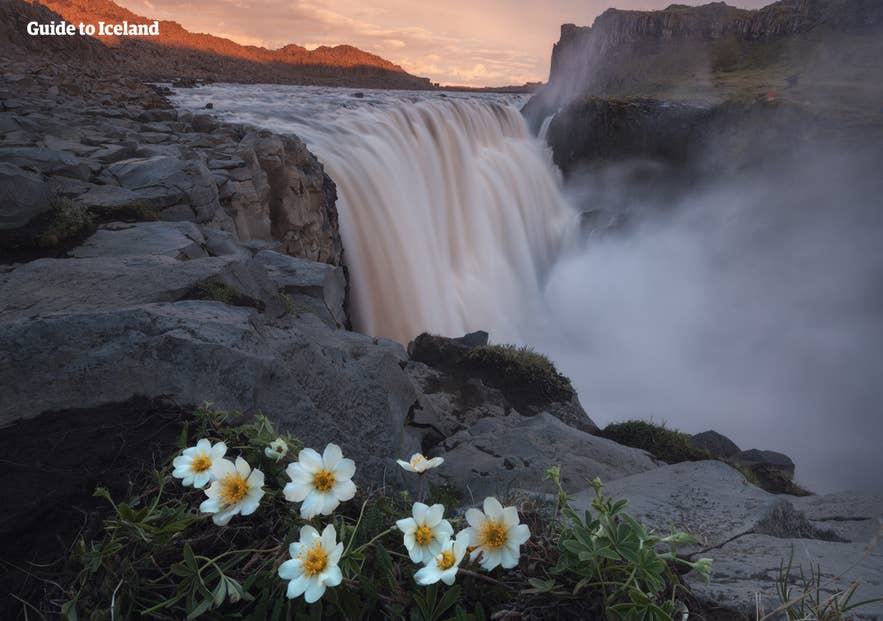
Jokulsa a Fjollum feeds some of the best waterfalls in Iceland, creating a series of dramatic cascades that draw visitors from around the world. Whether you're driving the Diamond Circle or joining one of Iceland's top waterfall tours, these waterfalls offer unforgettable views of the country's volcanic landscapes and powerful glacial rivers.
Dettifoss Waterfall
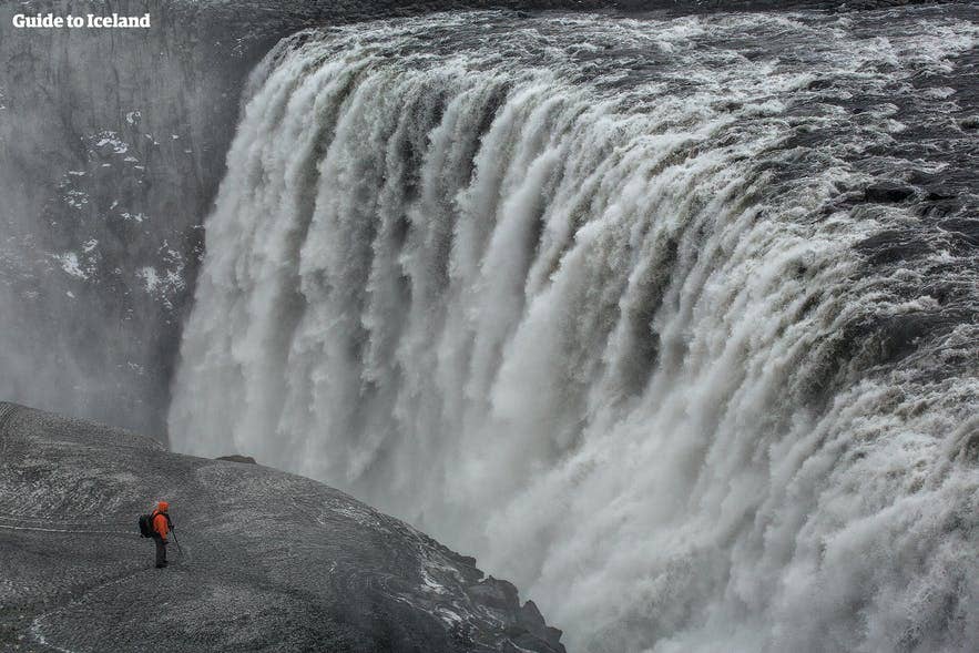 Dettifoss is the crown jewel of Jokulsa a Fjollum and is widely recognized as Europe's most powerful waterfall. Measuring about 144 feet (44 meters) high and 330 feet (100 meters) wide, it sends enormous volumes of glacial water crashing into Jokulsargljufur Canyon.
Even at a distance, you can hear the thunderous roar of the falls and see the mist rising high above the canyon. Prepare for slippery paths and drifting spray, particularly during peak summer flow.
Dettifoss is described as a knickpoint, a point where flood erosion stalled after a period of activity. The walk to the falls is itself a lesson in how the landscape formed.
Dr. Wells points to details most visitors walk straight past:
As visitors walk from the parking lot to Dettifoss on the western side, they pass through a flood-eroded channel. They can see bedrock that was scoured by the floods, or potholes and rock that looks ‘rippled.’ Watch for basalt columns along the trail, as they give a close-up view of the structure and show the flood power required to excavate these large blocks.
You can reach Dettifoss from either side of the river.
-
West side: Accessible via Road 862, which is paved and generally easier to drive, making it the more popular option. This side also features maintained walking paths and panoramic views.
-
East side: Reached via Road 864, which offers a closer, more dramatic view of the falls. However, the way is typically a rougher gravel road and may not always be open, especially outside summer.
Tips for Visiting Dettifoss Waterfall:
-
Check current road conditions on road.is before your visit, especially in winter or during the shoulder seasons, as weather can affect access to both roads.
-
Plan which side of Dettifoss you want to visit before you go. There is no bridge across the river at the waterfall, so switching between the east and west viewpoints requires about a 50-mile (80-kilometer) drive around the canyon.
-
Join one of the guided Dettifoss tours if you don't plan to drive. One popular option is the 4x4 Tour to Dettifoss Waterfall & Lake Myvatn from Akureyri, combining Dettifoss with other highlights of North Iceland.
Selfoss Waterfall
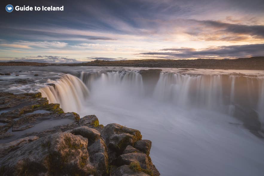
Just upstream from Dettifoss lies Selfoss, a beautiful waterfall known for its wide, horseshoe-shaped cascade. While it isn't as powerful as its famous neighbor, many travelers consider it one of the top waterfalls to see in Iceland during winter, thanks to its elegant appearance and surrounding basalt cliffs.
A well-marked walking trail connects Dettifoss and Selfoss, with the journey taking around 10 to 15 minutes each way. Visiting both waterfalls together is highly recommended, as they offer two very different perspectives on the same glacial river.
The trail is also a good place to spot the canyon's geological history: the resistant bedrock terraces visible here and at Dettifoss mark former canyon floors, left behind as successive floods cut the gorge ever deeper. Dr. Wells points to these terraces as some of the clearest evidence of the canyon's flood-carved past.
Tips for Visiting Selfoss Waterfall:
-
Visit the east bank for the best photos. It offers an excellent vantage point to capture the full horseshoe shape of Selfoss and its many cascading streams.
-
Wear sturdy footwear. The trail is generally easy, but it can become muddy or slippery after rain or during periods of heavy glacial melt.
-
Consider joining a Diamond Circle tour from Akureyri if you want to visit Selfoss, along with other North Iceland attractions, without driving.
Hafragilsfoss Waterfall
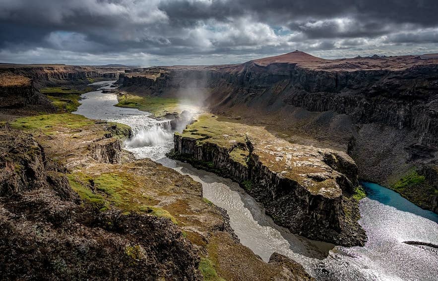
Located about 1.6 miles (2.5 kilometers) downstream from Dettifoss, Hafragilsfoss is another impressive waterfall along Jokulsa a Fjollum. Although smaller than Dettifoss at about 89 feet (27 meters) high, its setting within the steep walls of Jokulsargljufur Canyon creates one of the river's most dramatic viewpoints.
Hafragilsfoss receives far fewer visitors than Dettifoss, making it an excellent stop for those looking to escape the crowds. A designated viewing platform overlooks the waterfall and the canyon below, offering spectacular views that are especially striking in the early morning or late afternoon.
The elevated perspective also makes Hafragilsfoss a favorite among landscape photographers.
Tips for Visiting Hafragilsfoss Waterfall:
-
Bring a zoom lens or binoculars. The designated viewing platform sits above the canyon, so a zoom lens helps capture the waterfall's details and the rugged basalt cliffs below.
-
Stay on the marked paths. The canyon edges are steep and can be unstable in places.
-
Book a summer package to North Iceland if you want to see Hafragilsfoss alongside other top attractions in the region. It's a convenient way to experience North Iceland with transportation and an itinerary already arranged.
Rettarfoss Waterfall
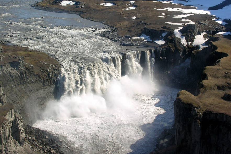
Photo from Wikimedia, Creative Commons, by Hansueli Krapf. No edits made.
Often overlooked by visitors, Rettarfoss is a smaller waterfall along Jokulsa a Fjollum. It drops only about 39 feet (12 meters) over a broad basalt ledge, creating a series of gentle rapids rather than a single dramatic plunge.
Although it's often overlooked by visitors, Rettarfoss is worth a stop if you're exploring the wider Jokulsargljufur area. The short walk to the waterfall is easy and rewards visitors with peaceful scenery, fewer crowds, and excellent views of the river.
Tips for Visiting Rettarfoss Waterfall:
-
Combine your visit with Hljodaklettar Rock Formations, which is only a short walk from the falls.
-
Bring a wide-angle lens. The waterfall is best photographed together with the surrounding basalt formations and river, rather than as a close-up of the cascade itself.
Top Things To Do Along Jokulsa a Fjollum
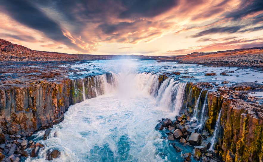 While the waterfalls are the river's biggest draw, there's much more to see and do along Jokulsa a Fjollum. Along the river, you'll find dramatic canyons, unique basalt formations, scenic hiking trails, and peaceful viewpoints shaped by thousands of years of glacial floods and volcanic activity.
These are some of the best things to do along Jokulsa a Fjollum.
Explore Jokulsargljufur Canyon
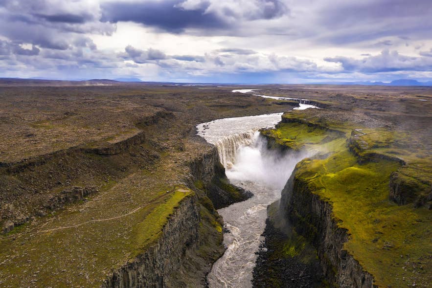 As the country's largest canyon system, Jokulsargljufur Canyon is one of the most amazing canyons in Iceland. While many visitors come for the famous waterfalls, those who venture farther into the canyon are rewarded with quiet hiking trails, spectacular viewpoints, and some of North Iceland's most diverse landscapes.
The canyon is easy to explore by car, with several parking areas providing access to short walks and longer hiking routes. Whether you're looking for panoramic views, unique rock formations, or a peaceful place to enjoy nature, Jokulsargljufur offers something beyond the river's famous cascades.
Hike Among the Echo Rocks at Hljodaklettar
Hljodaklettar, or the Echo Rocks, is famous for its unusual basalt formations and remarkable acoustics. The area's name comes from the echoes created when sounds bounce off the surrounding rock walls.
Several well-marked hiking trails wind through Hljodaklettar, ranging from short walks to longer loops. Along the way, you'll see striking volcanic formations, including basalt columns, caves, and cliffs shaped by ancient eruptions and glacial floods.
The trails are generally easy to moderate, making Hljodaklettar a rewarding stop for most visitors.
Visit Asbyrgi Canyon
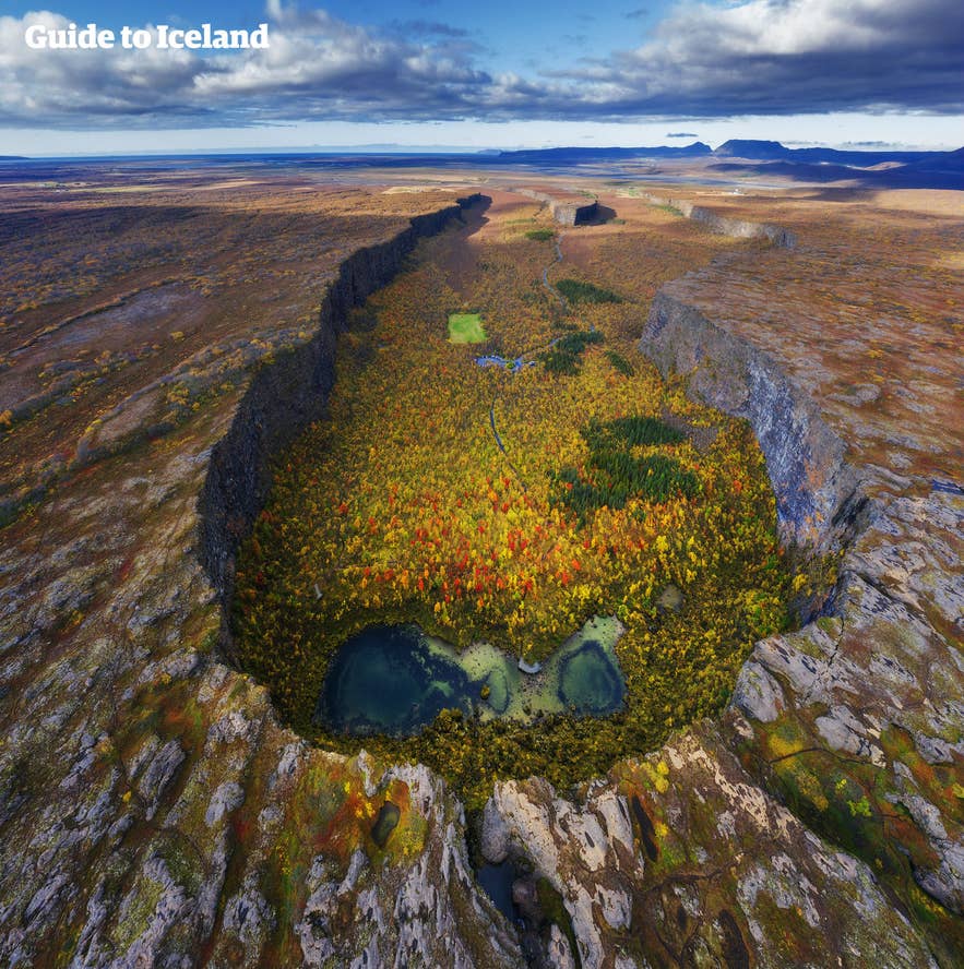
Asbyrgi Canyon is one of North Iceland's most unique natural attractions. Shaped like a giant horseshoe, the canyon measures about 2.2 miles (3.5 kilometers) long and 0.7 miles (1.1 kilometers) wide, with cliffs rising up to 330 feet (100 meters) above the valley floor.
According to Icelandic legend, Asbyrgi was formed when Odin's eight-legged horse, Sleipnir, left a hoofprint on the earth. Geologists, however, believe it was created by powerful glacial floods from Jokulsa a Fjollum.
Today, visitors can enjoy peaceful walking trails, scenic viewpoints, picnic areas, and a small visitor center.
Walk Through Holmatungur Oasis
Hidden within Jokulsargljufur Canyon, Holmatungur is a lush oasis that contrasts beautifully with the surrounding volcanic landscape. Fed by numerous freshwater springs, the area is covered with green vegetation, wildflowers, and birch trees, creating one of the most fertile spots in North Iceland.
Several hiking trails pass through Holmatungur, leading to small waterfalls, viewpoints, and quiet picnic spots. It's an excellent place to slow down and experience a different side of Jokulsa a Fjollum, especially during summer when the vegetation is at its greenest.
Spot Wildlife Along the River
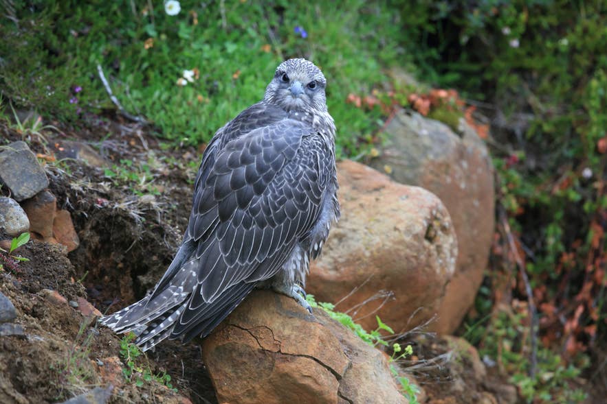 Jokulsa a Fjollum isn't just known for its dramatic landscapes; it's also an excellent place to observe Iceland's wildlife.
During the summer months, the riverbanks and surrounding cliffs become home to a variety of nesting birds, including Arctic terns, pink-footed geese, ravens, and gyrfalcons, Iceland's national bird of prey. You may also spot ptarmigans and other native bird species while hiking through the area.
The varied habitats around Jokulsargljufur Canyon, Asbyrgi, and Holmatungur also support Arctic foxes, though sightings are uncommon due to their shy nature.
If you're visiting during the warmer months, keep an eye out for birds soaring above the canyon or resting along the river. Remember to observe wildlife from a respectful distance, especially during nesting season.
How To Visit Jokulsa a Fjollum
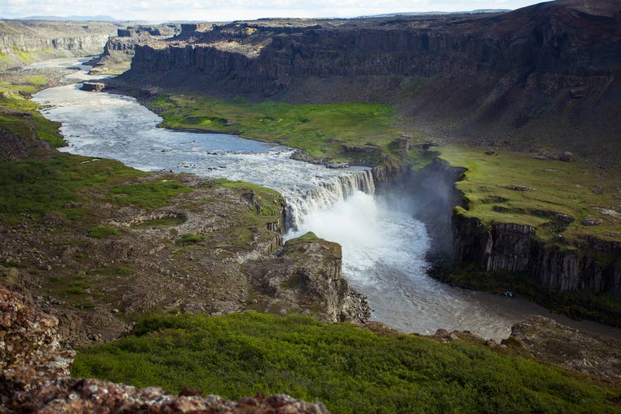 Jokulsa a Fjollum is easy to visit as part of a North Iceland itinerary. Whether you choose to drive the Diamond Circle or join a guided tour, there are several ways to experience the river's waterfalls, canyons, and volcanic landscapes.
Drive to Jokulsa a Fjollum
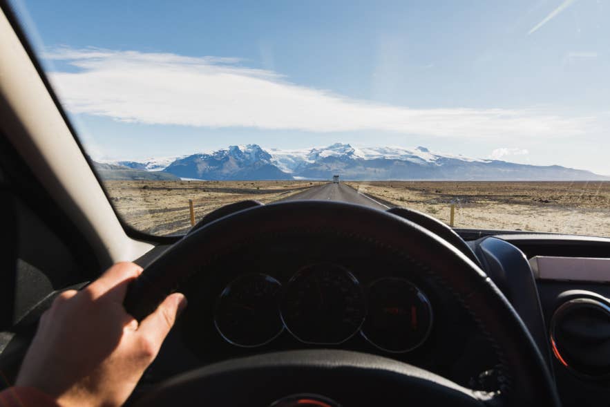 Driving is the best way to explore Jokulsa a Fjollum at your own pace, with the river's main attractions all accessible along the Diamond Circle route.
Most visitors start their journey from Akureyri, Lake Myvatn, or Husavik. If you're taking a flight from Reykjavik to Akureyri, booking one of the available Akureyri rental cars makes it easy to explore the region on your own schedule.
Road conditions vary depending on the season. During summer, both Road 862 (west side) and Road 864 (east side) are generally open. Road 862 is paved and suitable for most standard vehicles in good conditions, while Road 864 is an unpaved gravel road where a 4x4 car rental is recommended for a more comfortable drive.
In winter, snow and ice can affect both roads, making a 4x4 the recommended choice regardless of which side you plan to visit. Always check current road conditions before setting out, as weather can cause temporary closures or restricted access.
Join a Guided Tour to Jokulsa a Fjollum
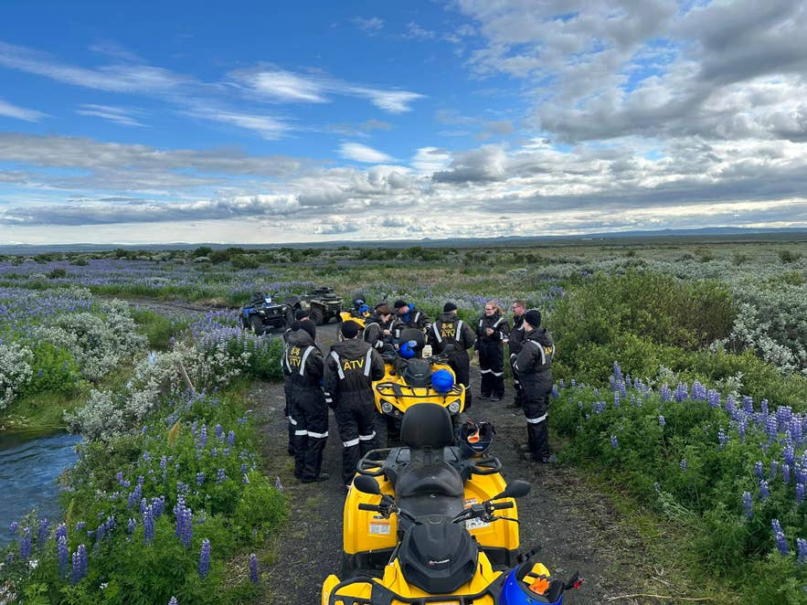 A guided tour is a great option if you want to experience Jokulsa a Fjollum without driving or planning your own itinerary.
Many Diamond Circle tours, Lake Myvatn trips, and North Iceland adventures include stops at the river's most famous attractions, such as Dettifoss, Selfoss, Hafragilsfoss, and Asbyrgi Canyon, along with other highlights in the region.
Joining a guided tour also gives you the benefit of local knowledge, convenient transportation, and a well-planned route, allowing you to spend more time enjoying the scenery. It's an especially good choice during winter, when changing weather and road conditions can make driving more challenging.
Here are some of the best guided tours that explore the top attractions of Jokulsa a Fjollum:
-
North Iceland 4x4 Tour from Akureyri – Travel in a 4x4 vehicle to explore Dettifoss, Asbyrgi Canyon, Lake Myvatn, and other spectacular natural attractions across North Iceland.
-
Diamond Circle Tour from Akureyri – Visit the highlights of the Diamond Circle, including Dettifoss, Selfoss, Asbyrgi Canyon, and Lake Myvatn, on a full-day guided sightseeing tour.
-
7-Day Tour Around Iceland's Ring Road – Discover Jokulsa a Fjollum as part of a week-long journey around Iceland, with visits to the most famous attractions along the Ring Road.
Best Time To Visit Jokulsa a Fjollum
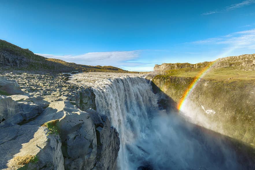 You can experience Jokulsa a Fjollum year-round, but the best time to visit is from June to September, when road conditions are most reliable, and all of the river's major attractions are typically accessible.
Summer is the ideal season for hiking, sightseeing, and photography, with long daylight hours making it easy to visit Dettifoss, Selfoss, Hafragilsfoss, Asbyrgi Canyon, Hljodaklettar, and other Diamond Circle highlights in a single day. It's also the best time to explore lesser-known trails and viewpoints that may be inaccessible during the colder months.
Winter in Iceland offers a completely different experience, transforming the river's waterfalls and canyons into a dramatic landscape of snow and ice. While the scenery is spectacular and crowds are generally smaller, weather can affect access to certain areas, particularly the east side of Dettifoss via Road 864 and other gravel roads.
Before setting out, always check current road conditions and weather forecasts, and allow extra travel time if you're driving in winter.
Safety Tips for Visiting Jokulsa a Fjollum
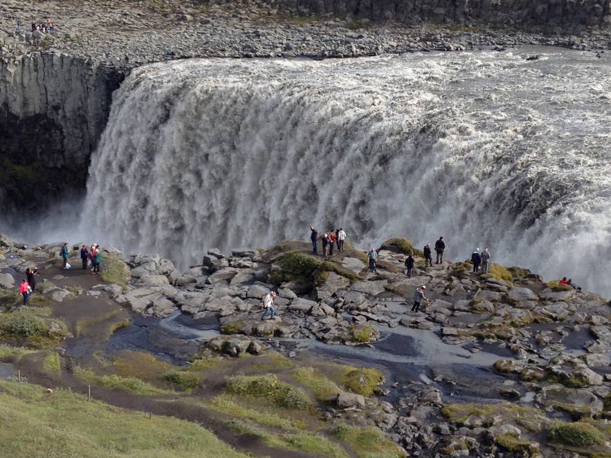 Jokulsa a Fjollum is one of Iceland's most powerful glacial rivers, and its waterfalls and canyon edges demand extra caution. Follow these tips to stay safe while exploring the area's viewpoints, hiking trails, and scenic stops.
-
Dress for rapidly changing weather. Weather conditions in Iceland can change quickly, so bring waterproof layers and warm clothing, even during summer.
-
Wear sturdy, non-slip footwear. Trails and viewing areas can become wet, muddy, or slippery from waterfall spray, particularly around Dettifoss.
-
Choose the right vehicle for the season. Standard rental cars are generally suitable for the paved Road 862 in summer, while a 4x4 car rental is recommended for the gravel Road 864 and for winter driving.
-
Stay behind safety barriers. The viewpoints at Dettifoss, Selfoss, and Hafragilsfoss overlook powerful waterfalls with steep drop-offs and fast-moving water.
-
Keep a safe distance from the river. The current is extremely strong, and the riverbanks can be unstable, especially after heavy rain or during peak glacial melt in summer.
-
Check road conditions before you leave. Roads 862 and 864 may close due to snow, ice, flooding, or maintenance. Always check road conditions and weather updates before driving.
-
Stay on marked trails. Shortcuts can damage fragile vegetation and may lead to unstable cliff edges or uneven volcanic terrain.
-
Allow extra care in winter. Ice and snow can make parking areas, walkways, and viewpoints slippery, so take your time and use traction aids if needed.
-
Stay nearby if you're exploring the full Diamond Circle. Booking accommodations near Dettifoss Waterfall lets you spread your sightseeing over two or more days, giving you more flexibility if weather or road conditions change and reducing the need to rush between attractions.
Ready to Explore Jokulsa a Fjollum?
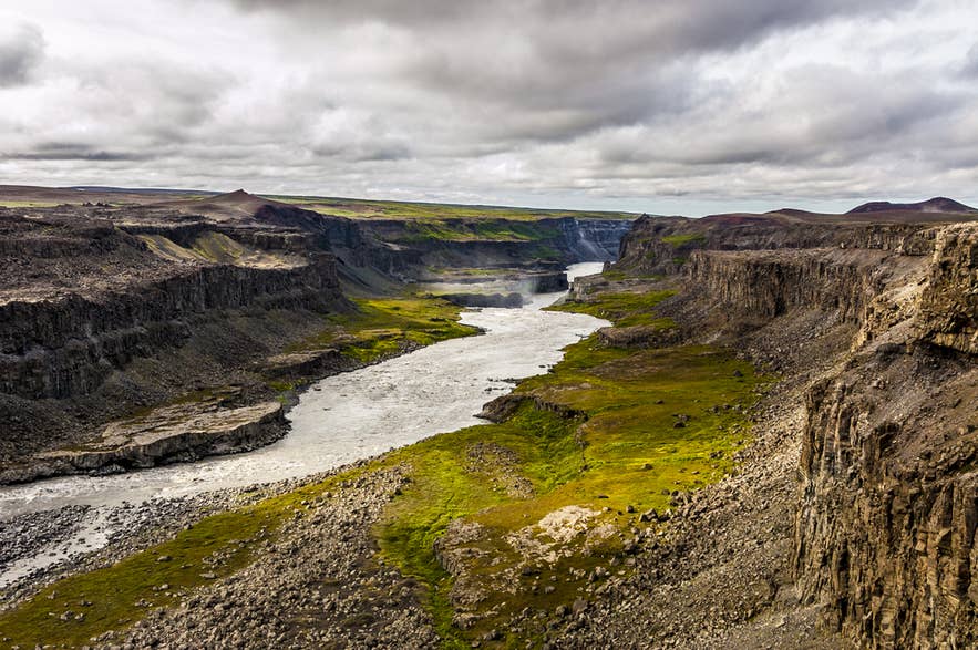 Jokulsa a Fjollum offers much more than a stop at Dettifoss. Follow the river, and you'll discover dramatic canyons, unique rock formations, scenic hiking trails, and some of North Iceland's most memorable attractions, including Dettifoss and Selfoss waterfalls.
If your itinerary allows, slow down and explore beyond the main viewpoints. Renting a car in Iceland gives you the flexibility to visit places like Hljodaklettar, Holmatungur, and Asbyrgi Canyon at your own pace, making it easier to experience one of the country's most remarkable river systems.
Where is Jokulsa a Fjollum?
What is Jokulsa a Fjollum famous for?
Is Jokulsa a Fjollum part of the Diamond Circle?
Is Jokulsa a Fjollum worth visiting?
How long should I spend at Jokulsa a Fjollum?
Can I see Dettifoss and Selfoss in one visit?
Which side of Dettifoss Waterfall is better?
Can I visit Jokulsa a Fjollum in winter?
Do I need a 4x4 to visit Jokulsa a Fjollum?
How far is Jokulsa a Fjollum from Akureyri?
What is the best time to visit Jokulsa a Fjollum?
Winter offers dramatic snowy scenery, but road access may be limited, especially on the east side of the river.
What wildlife can I see along Jokulsa a Fjollum?
