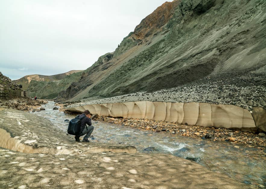
Stream and green rhyolite walls in Grænagil. Photo: Jerzy Strzelecki, CC BY-SA 4.0
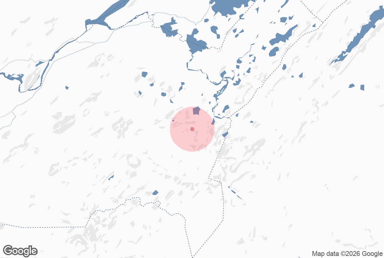
Grænagil (Icelandic: Grænagil, "the green ravine") is a short, narrow gorge at Landmannalaugar in Iceland's southern highlands. It lies a short walk south-west of the Landmannalaugar hut, beyond the hot-spring brook, and separates the mountain Bláhnúkur from the Laugahraun lava field.
One wall is green-tinted rhyolite, the other is the moss-covered edge of the 1477 lava flow, and a small stream runs down the middle. It is a popular photo stop in the Fjallabak Nature Reserve, and walking through it takes under an hour.
Key Takeaways About Grænagil
- Short ravine a short walk from the Landmannalaugar hut, between Bláhnúkur mountain and the 1477 Laugahraun lava
- Named for the green-tinted rhyolite on the Bláhnúkur side; black moss-patched lava on the other
- Easiest landscape walk at Landmannalaugar: under an hour from the hut, little climbing, several stream crossings
- Usual descent route from the Bláhnúkur mountain summit and part of the 2–3 hour Laugahraun loop
- Only reachable in summer (roughly late June to mid-September) via F-roads (4x4) or highland bus
Why visit Grænagil
The colour. Landmannalaugar's mountains are made of rhyolite, a silica-rich volcanic rock that weathers into pinks, yellows, reds and greys; in Grænagil, the rock on the Bláhnúkur side of the gorge is tinted a distinct green, which gives the ravine its name.
Facing it across the streambed is the black, moss-patched Laugahraun lava. Few places in Iceland put two such different volcanic surfaces side by side within a few metres.
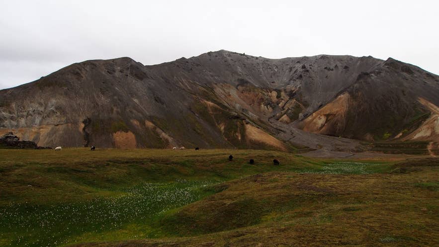
Grænagil ravine in Bláhnúkur, Landmannalaugar. Photo: rheins, CC BY 3.0
It is also the easiest "real" landscape walk at Landmannalaugar. The marked path through the gorge is short, with little height gain, so it suits people who do not want to climb Bláhnúkur (945 m) or Brennisteinsalda but still want to get in among the coloured rock.
Because the ravine links directly to the Laugahraun trail, most walkers combine the two into a loop of roughly two to three hours: out across the lava to the foot of Brennisteinsalda, back down through Grænagil to the hut.
For hikers doing the Bláhnúkur summit, Grænagil is the usual descent. From the top a steep marked path drops into the head of the ravine, and you follow the stream out to the campsite. Laugavegur trekkers sometimes fit it in as a short side trip before setting out.
How to get to Grænagil
Grænagil is reached on foot from the Landmannalaugar hut: follow the trail past the hot-spring brook and across the Brennisteinsöldukvísl stream, which flows out of the ravine, to the foot of Bláhnúkur about a kilometre from the hut. Getting to Landmannalaugar itself requires a 4x4 on summer-only F-roads.
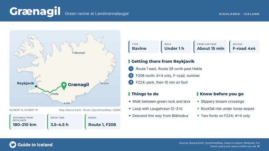
- From Reykjavík (about 3.5–4.5 hours, roughly 180–210 km): Route 1 east, Route 26 north past Hekla volcano, then F208 (Fjallabaksleið nyrðri) from the north via the Sigalda power station, and finally F224 into Landmannalaugar. On this route the only unbridged rivers are the two fords at the end of F224. The Environment Agency recommends that smaller SUVs and inexperienced drivers park in the northern car park (P1) before the fords and walk across the footbridge.
- F225 (Landmannaleið) from the Hekla volcano area is the western alternative and includes several fords.
- F208 from the south, past the Eldgjá fissure, is the roughest route and has multiple unbridged rivers; it is for experienced drivers in capable 4x4 vehicles only.
- By bus: scheduled highland buses run in summer from Reykjavík, Selfoss and Hella to Landmannalaugar, including the Landhotel Hella transfer listed below.
The nearest towns are Hella and Hvolsvöllur, each roughly 2 to 3 hours away depending on the route. From the car park, allow about 15 minutes on foot to the mouth of the ravine.
Parking: Landmannalaugar has used a paid parking and reservation system through the Parka app since 2024.
In 2025, private and rental cars arriving between 9 AM and 4 PM from 20 June to 14 September needed a reservation and paid a service fee per vehicle, and the Iceland Touring Association says the same applies in summer 2026.
Dates, hours and fees change, so check ust.is or parka.is before you drive up.
Best time to visit
The F-roads normally open in June (the Iceland Touring Association advises assuming 20 June) and close again around mid-September, depending on snow. July and August are the most reliable months; early in the season there can be snow in the gorge and the stream runs high with meltwater.
Grænagil is a good choice on a windy or showery day because the ravine walls give some shelter. For photographs, visit after rain or in soft morning or evening light, when the green rock is darkest and the contrast with the black lava is strongest.
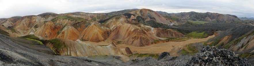
Grænagil and Laugahraun from Bláhnúkur. Photo: Pintafontes Senapelio, CC BY-SA 3.0
Safety and practical tips
- You will have to step across the stream several times. The stones are slippery; walking poles help, and waterproof boots are worth having early in summer.
- Rockfall from the rhyolite walls is possible, so do not linger directly under loose slopes or climb on them. Rhyolite scree is fragile and footprints on it last for years.
- Stay on the marked path. The reserve is protected and off-trail walking damages moss and soil that take decades to recover.
- The weather at about 550–600 m is colder and windier than in the lowlands. Carry a warm layer and check vedur.is and safetravel.is.
- There are no facilities in the gorge. Toilets, showers, a hut and a small summer shop are at Landmannalaugar; there is a fee for campsite and facility use. The natural bathing brook is at the edge of the lava; use the boardwalk and do not use soap in the water.
- Mobile coverage is weak. Carry an offline map.
What does Grænagil mean?
How long does the Grænagil walk take?
Is Grænagil hard to hike?
Can I visit Grænagil without a 4x4?
When is Grænagil accessible?
Nearby attractions
- Landmannalaugar – about 1.3 km
- Bláhnjúkur – about 0.9 km
- Brennisteinsalda – about 0.7 km
- Frostastaðavatn – about 4.2 km
- Storihver – about 4.2 km
- Ljótipollur – about 7.1 km
Tours that visit Grænagil
- All-Women Laugavegur Trail Hiking Tour for Six Days with Meals and Mountain Huts
- Highland Bus Transfer from Landhotel Hella to Landmannalaugar in Iceland
- 8-Day Laugavegur Trail Tour with Glacier Hike, Golden Circle, and South Coast from Reykjavik
- Action-Packed 5-Hour Hiking and Hot Springs Tour of Landmannalaugar
- Guided 4-Day Highland Hiking Tour of the Laugavegur Trail from Reykjavik
- Small-Group 7-Day Highlands Hiking Tour of the Eldgja and Strutur Trails with Reykjavik Transfers
- Adventure-Packed 4-Day Eldgja Trek Expedition through Iceland's Highlands from Reykjavik
- 4-Day Laugavegur Hiking & Camping Tour from Reykjavik
