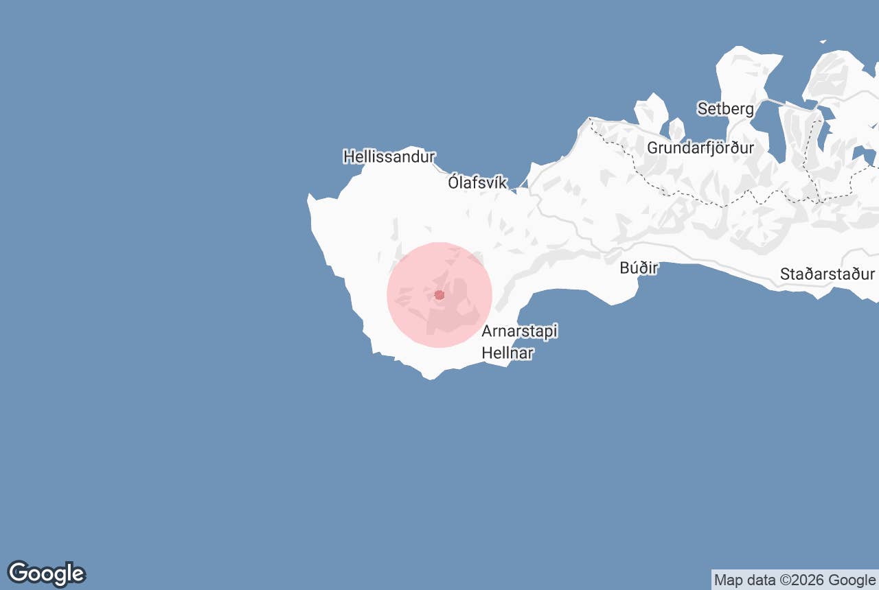
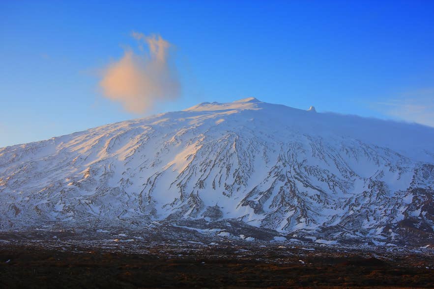
Snaefellsjokull is a glacier-capped volcano at the tip of the Snaefellsnes Peninsula in West Iceland, about a three-hour drive from Reykjavik. Learn how to visit the famous glacier and discover its history, folklore, and literary fame below.
Snaefellsjokull is the crown of Snaefellsjokull National Park, one of only three national parks in Iceland. The glacier rises 4,744 feet (1,446 meters) above the westernmost point of the Snaefellsnes Peninsula, and on clear days, it is visible across the Faxafloi Bay from Reykjavik.
Snaefellsjokull brings together two forces that shape Iceland: glaciers and volcanoes. Our studies of glacier melting rates in Iceland and how often volcanoes erupt in Iceland explore the country’s changing ice and eruption history, adding context to the landscapes you can discover on the peninsula.
Why You Can Trust Our Content
Guide to Iceland is the most trusted travel platform in Iceland, helping millions of visitors each year. All our content is written and reviewed by local experts who are deeply familiar with Iceland. You can count on us for accurate, up-to-date, and trustworthy travel advice.
The easiest ways to visit are on guided Snaefellsnes tours from Reykjavik or by renting a car and driving the peninsula at your own pace. Many travelers also see the glacier on multi-day tours and combo tours.
The drive from Reykjavik takes around three hours via Route 1 and Route 54, covering roughly 120 miles (190 kilometers). Read on to learn what makes Snaefellsjokull one of the most storied mountains in Iceland.
What to Know About Snaefellsjokull Glacier
-
Snaefellsjokull is a 4,744-foot (1,446-meter) glacier-capped stratovolcano in West Iceland.
-
It sits inside Snaefellsjokull National Park, established in 2001.
-
The volcano is classified as active but dormant; its last eruption was around 1,800 years ago.
-
The ice cap has lost more than a third of its area since the 1940s and may largely disappear within decades.
-
The glacier is the setting of Jules Verne’s novel Journey to the Center of the Earth.
-
You can walk near the glacier’s base on your own, but reaching the top requires a certified guide.
-
The drive from Reykjavik takes around three hours via Routes 1 and 54.
Snaefellsjokull Glacier and Volcano Facts
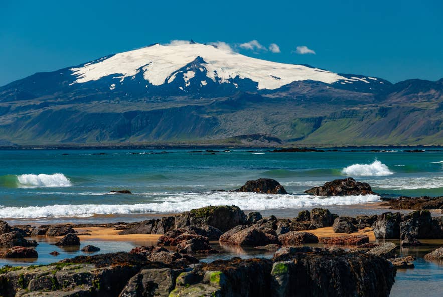
Snaefellsjokull is a stratovolcano, a steep cone built up in layers by its own repeated eruptions. The volcano has been erupting and growing this way for roughly 700,000 years, and an ice cap has crowned its summit since the last Ice Age.
That ice cap explains the name. The mountain itself is called ‘Snæfell’ (Snowy Mountain), and ‘jökull’ (glacier) was added to distinguish it from other Icelandic mountains of the same name.
The volcano is currently dormant, meaning it shows no signs of erupting. Scientists still classify it as active because it has erupted in the geologically recent past and is expected to erupt again someday. Its last eruption happened around 1,800 years ago, and the Icelandic Meteorological Office watches the volcano with seismic stations on the peninsula.
The glacier on its summit is shrinking fast. In August 2012, the peak was free of snow and ice for the first time in recorded history. Measurements by the Icelandic Meteorological Office show the ice cap has lost more than a third of its area since the 1940s, and researchers warn that most of the ice could disappear within decades if Iceland’s climate keeps warming.
Hiking Snaefellsjokull Glacier
 Arnar Haukur Rúnarsson of Ferðafélag Íslands (the Iceland Touring Association), a former guide on the Laugavegur Trail and hut warden in Thorsmork, picks Snaefellsjokull as the one place on the peninsula where he would spend a full day.
You definitely need a guide, but a hike to the top of the glacier is amazing.
The guide requirement is a matter of safety, not formality. The glacier is crevassed, and reaching the true summit involves technical climbing that should never be attempted alone. Guided glacier hikes keep you clear of hazards that are invisible from the surface.
Tours meet in the village of Arnarstapi on the mountain’s south side. Going on a glacier hiking tour on Snaefellsjokull typically takes around five to six hours, with roughly 2,500 feet (760 meters) of climbing. You need a reasonable level of fitness and sturdy hiking boots, but guides provide the crampons, harnesses, and ice axes.
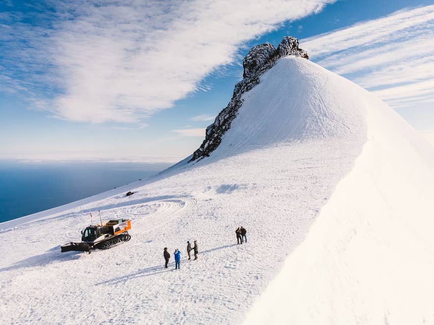
For travelers who would rather skip the climb, a snowcat tour on Snaefellsjokull Glacier reaches the top of the ice in a purpose-built vehicle and suits most ages and fitness levels.
Weather on the glacier changes quickly, and either option can be canceled on short notice, so build some flexibility into your plans. The walk near the glacier’s base is free to do on your own.
Summit trips on Snaefellsjokull depend on the weather more than most glacier hikes do. Across the country, glacier hiking operators run the large majority of their departures, with most calling off fewer than 5% and several under 2%, so it is a dependable activity to build a day around, just one worth giving some slack on an exposed summit. Our study of how glacier hiking tours in Iceland compare on reliability covers more than 10,000 verified reviews.
How to Get to Snaefellsjokull Glacier
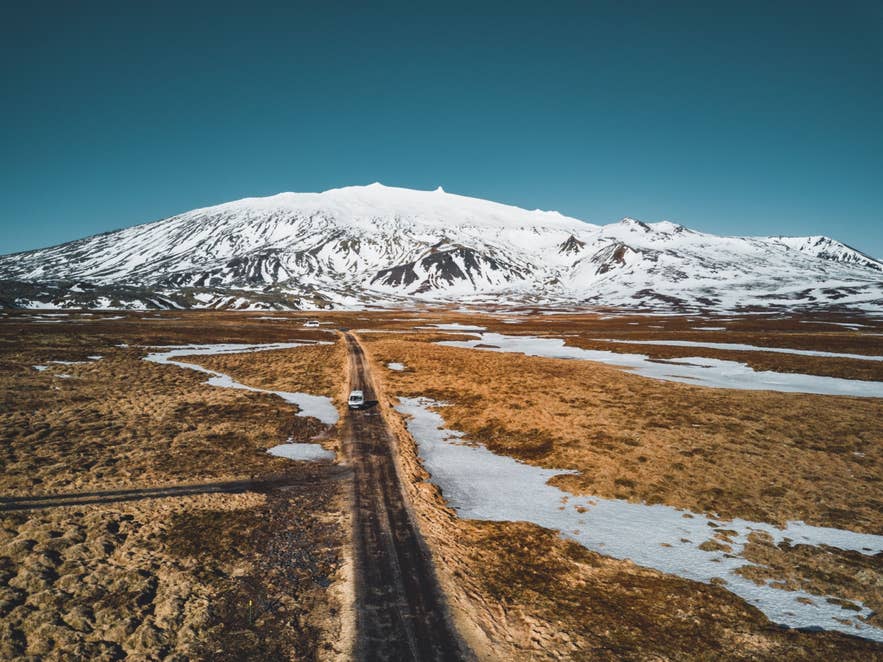
Snaefellsjokull stands at the far western tip of the Snaefellsnes Peninsula. You can reach it in two main ways: driving yourself or joining guided day trips from Reykjavik. Both work year-round, and the better choice mostly comes down to the season and your comfort behind the wheel.
Driving to Snaefellsjokull From Reykjavik
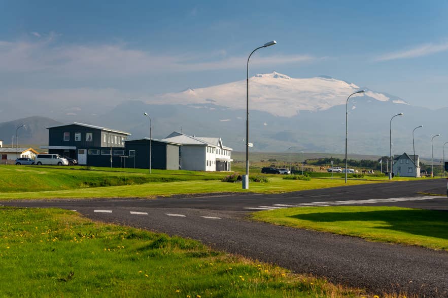 Snaefellsjokull is around a three-hour drive from Reykjavik. Follow Route 1 north to the town of Borgarnes, then take Route 54 west onto the Snaefellsnes Peninsula.
Route 574 loops around the tip of the peninsula and circles the glacier, passing the Snaefellsjokull National Park’s main attractions. The mountain road F570 climbs closest to the glacier itself, but it is gravel, steep, and open only to 4x4 vehicles in summer.
Many drivers make the glacier one stop on a longer road trip, which means planning accommodation for each night along the way. Self-drive tours handle that by bundling the rental car, hotels, and a planned itinerary into one booking.
These routes all stop at Snaefellsjokull:
-
10-Day Self-Drive Tour of the Complete Ring Road: Circle the whole country and visit the Snaefellsnes Peninsula alongside Iceland’s other highlights.
-
9-Day Northern Lights Winter Self-Drive Tour of Snaefellsnes and the South Coast: Drive the peninsula in winter with nightly chances to catch the northern lights.
-
7-Day Budget Self-Drive Tour of Snaefellsnes and the South Coast: See the glacier and Iceland’s southwest at a lower cost.
The national park is free to enter, and visitor centers at Malarrif and Hellissandur provide maps and information in season. In winter, always check road conditions before setting out.
Visiting Snaefellsjokull on a Guided Day Tour
 If you would rather not drive, guided day tours circle the peninsula from Reykjavik year-round, with hotel pickup and stops at the park’s main attractions:
-
Snaefellsnes Peninsula Bus Tour from Reykjavik: An affordable way to see the glacier and its surroundings in a day.
-
Small-Group Snaefellsnes Peninsula Day Tour from Reykjavik: Loops the peninsula counterclockwise to avoid the crowds at each stop.
-
Sightseeing Tour of Snaefellsnes with Homecooked Meal: Adds a traditional Icelandic dinner to the day for a more local experience.
Guided tours are the simplest option in winter, when the weather can turn quickly.
History of Snaefellsjokull’s Fishing Villages
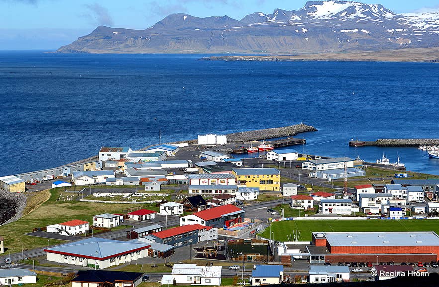
Snaefellsjokull is ringed by small villages, including Hellissandur, Rif, and Olafsvik, which ranked among Iceland’s busiest fishing hubs for much of the last millennium.
Fishing took off in the 13th century, when stations were built wherever boats had easy access to the open ocean. The peninsula’s north coast thrived on the fertile waters of Breidafjordur Bay, while stations on the south and west faced the open Atlantic.
No station shows this history better than Dritvik Cove on the peninsula’s western tip. The tiny cove is deserted today, but at its peak, around 60 fishing boats and up to 400 seasonal workers filled it every spring.
Fishing in the region declined during the 19th century as Iceland’s industry and fish stocks changed, though it remains an important livelihood on the peninsula. Snaefellsjokull National Park was established in 2001, and tourism is now reshaping the local economy.
Snaefellsjokull in Icelandic Folklore
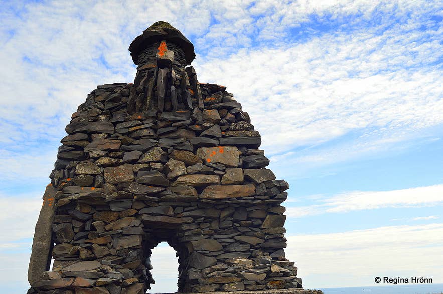 Snaefellsjokull has been considered one of the world’s great power sites, a source of energy and mystery for the people of the peninsula for generations.
The mountain takes a central role in Bardar saga Snaefellsass, a late 14th-century saga about Bárður, a half-human, half-troll settler who vanished into the glacier and became its guardian spirit. Many rock formations around the mountain are said to be trolls petrified by sunlight or homes of the hidden people, elf-like beings who appear throughout folklore in Iceland.
The mountain’s strange reputation persists into modern times. On November 5, 1993, hundreds of people, along with a CNN camera crew, gathered at Snaefellsjokull after paranormal enthusiasts announced that aliens would land on the glacier that evening. No spacecraft appeared, and the night ended with a party and fireworks.
Locals still tell the story with a wink.
Some people say that all the people, lights and reporters in the area caused them to abort their landing.
Snaefellsjokull in Literature
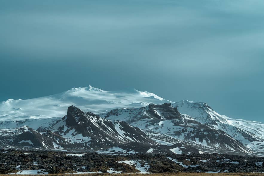 Snaefellsjokull is the entrance to a fantastical subterranean world in Jules Verne’s classic 1864 novel Journey to the Center of the Earth. In the story, explorers descend through the volcano’s crater to reach a hidden world below, and the book has drawn travelers to the glacier ever since.
The mountain later appeared in the Blind Birds trilogy by Czech science fiction writer Ludvík Souček, partly inspired by Verne’s work, and in Under the Glacier by Halldór Laxness, Iceland’s only Nobel laureate.
Attractions Near Snaefellsjokull
 The glacier anchors a dense cluster of natural attractions, and most sit right along the Route 574 loop. These are the closest stops to the ice, though they are only a sample of the many things to do on the Snaefellsnes Peninsula.
Volcanic Sites Near Snaefellsjokull Glacier
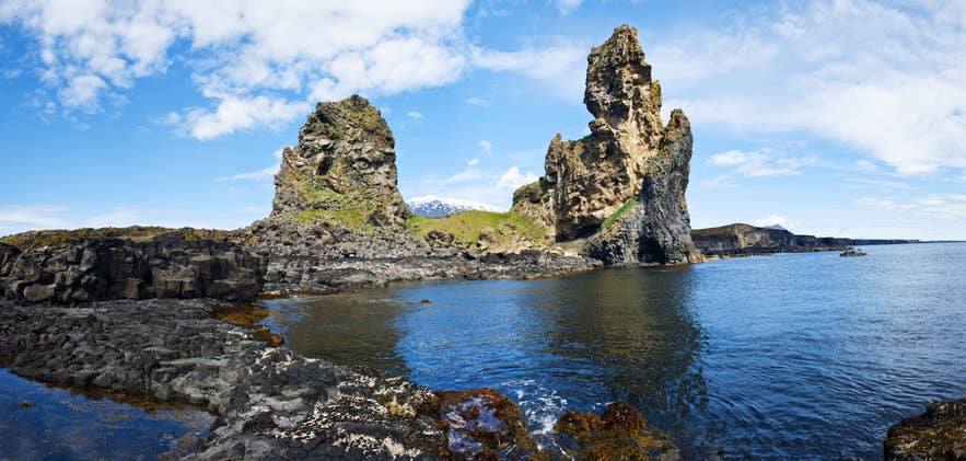
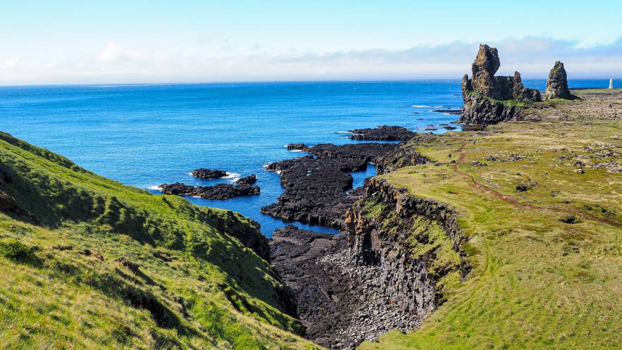
 The basalt sea stacks of Londrangar rise from the coast just south of the mountain, the remains of an ancient crater eaten away by the sea.
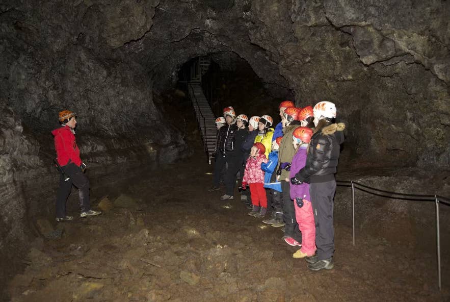
Nearby, Vatnshellir Cave offers guided tours into an 8,000-year-old lava tube, a fitting stop given the area’s Journey to the Center of the Earth fame. You can also climb the staircase up Saxholl Crater for views over the lava fields.
Fishing and Folklore Sites Near Snaefellsjokull
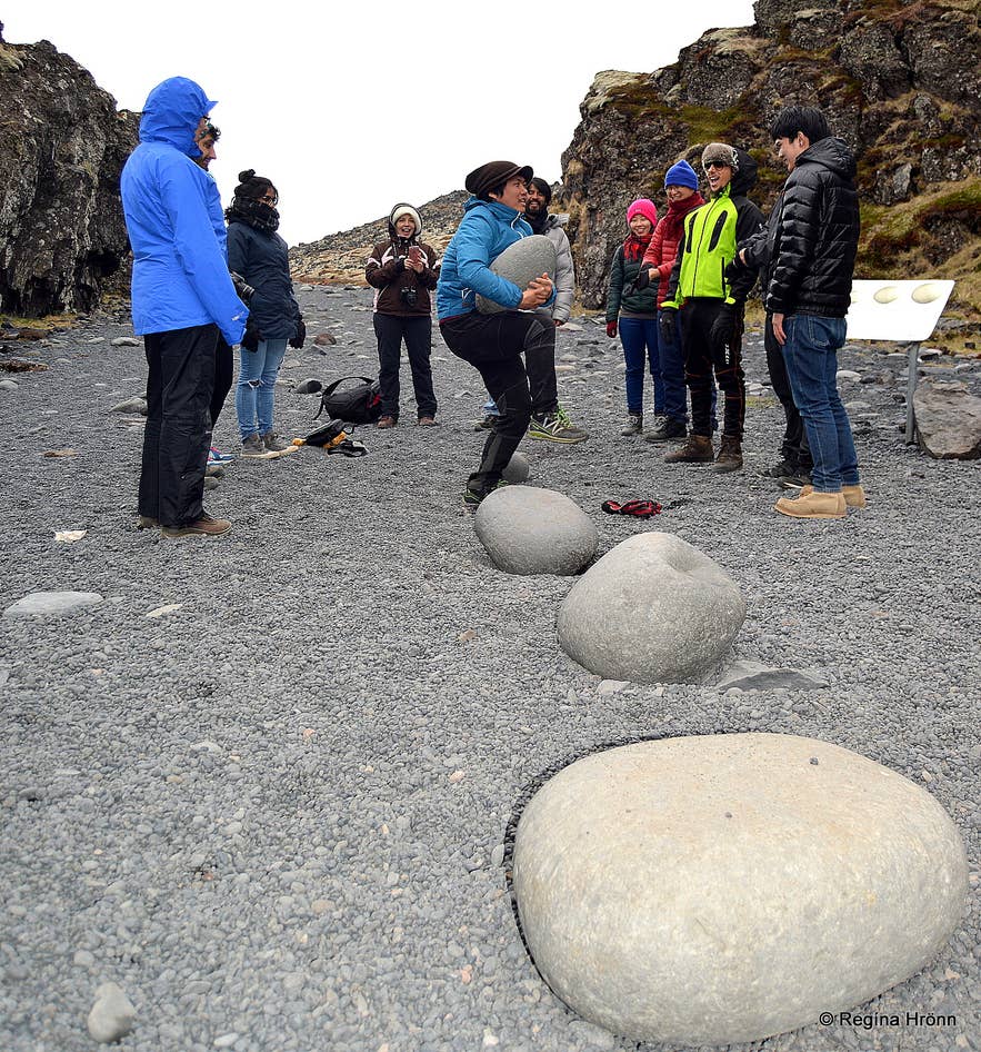 At Djupalonssandur Beach, you can test your strength on the four lifting stones once used to rank fishermen: Amlóði (‘Useless’), Hálfdrættingur (‘Weakling’), Hálfsterkur (‘Half Strength’), and Fullsterkur (‘Full Strength’). A short coastal trail leads from the beach to the ruins at Dritvik Cove.
On the south coast, the fishing village of Arnarstapi is home to the famous Gatklettur Arch Rock and a scenic coastal walk to Hellnar. Songhellir, ‘the singing cave,’ is named for its loud echoes and is tied to the Bárður saga.
Visit Snaefellsjokull Glacier on Your Trip to Iceland
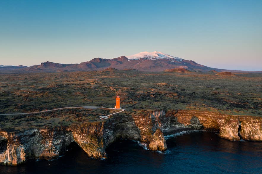 Snaefellsjokull rewards any amount of time you give it. You can admire the glacier from Reykjavik on a clear day, circle it on a drive around the Snaefellsnes Peninsula, or stand on its summit with a guide.
The mountain has stood over western Iceland for 700,000 years, but the ice that gave it its name is not so permanent. With the glacier expected to shrink dramatically within decades, there has never been a better reason to see the white crown of Snaefellsjokull National Park for yourself.
