Hornstrandir is a remote nature reserve in the Westfjords, known for its untouched landscapes, long hiking routes, and complete lack of roads and services. Learn how to get there, when to visit, where to hike and camp, and how to prepare for exploring the area safely and confidently.
Hornstrandir Nature Reserve is one of the best places to experience peace, quiet, and silence in Iceland. There are no roads, towns, or permanent residents, and access is only possible by boat from Isafjordur and Bolungarvik during the summer. A common entry route is the ferry from Isafjordur to Hornvik, which serves as a main starting point for hikes into the reserve. Hiking tours are also available for those who prefer guided routes and pre-arranged logistics.
Once you arrive, it quickly becomes clear how different Hornstrandir feels from the rest of Iceland. The last people left the area in the mid-20th century, and nature has been in control ever since. Mountains rise straight from the sea, valleys feel endless, and there are almost no signs of modern life. As a result, Hornstrandir feels timeless and far removed from the world you came from.
Why You Can Trust Our Content
Guide to Iceland is the most trusted travel platform in Iceland, helping millions of visitors each year. All our content is written and reviewed by local experts who are deeply familiar with Iceland. You can count on us for accurate, up-to-date, and trustworthy travel advice.
Because of this isolation, Hornstrandir holds a special place in Icelandic culture. The region is often linked to old stories, ghost tales, and modern crime fiction, including the well-known crime novel "I Remember You" by Yrsa Sigurðardóttir. Empty houses, shifting light, and sudden weather changes give the area a strange and uneasy mood. It is easy to see why Hornstrandir is often described as mysterious or even spooky.
Hornstrandir is very different from most hiking in Iceland. Trails are rarely marked and often follow natural terrain rather than clear paths. You are unlikely to meet many other hikers, which adds to the feeling of space and quiet. However, this isolation also means help is far away, so careful planning, self-reliance, and respect for nature are essential.
Hornstrandir Map and Location
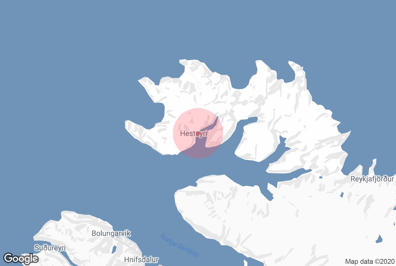
Hornstrandir Nature Reserve is located at the very northern tip of Iceland’s Westfjords, between the Greenland Sea and the Denmark Strait. It is one of the most remote regions in the country.
The reserve covers about 224 square miles (580 square kilometers) and forms a rugged peninsula deeply cut by fjords and valleys. The nearest town is Isafjordur, about 30 kilometers (19 miles) to the south across the fjords.
Steep sea cliffs, wide fjords, river plains, and mountain passes shape the landscape. Elevation ranges from sea level up to roughly 1,300 to 2,000 feet (400 to 600 meters). Several major fjords, including Hornvik in the north, Adalvik and Hesteyri in the southwest, and Veidileysufjordur and Fljotavik along the eastern and southern edges, border the peninsula.
How To Get to Hornstrandir Nature Reserve
 To reach Hornstrandir, you first need to get to Isafjordur or nearby Bolungarvik in the Westfjords. Isafjordur is the main transport hub for the area, while Bolungarvik is about 3 miles (5 kilometers) north and is sometimes used as an alternative departure point for ferries.
If your trip focuses only on hiking in Hornstrandir, flying to Isafjordur Airport from Reykjavik Airport is the most practical option. Domestic flights run regularly during the summer and are the fastest and least tiring way to reach the region.
You can also rent a car and drive to Isafjordur if you plan to explore the Westfjords before or after your Hornstrandir hike. The drive from Reykjavík follows Route 1 and Route 60, covering about 280 miles (450 kilometers) and taking six to seven hours in good summer conditions. Road conditions can change, so extra time is always wise.
Access to Hornstrandir is only possible by boat during the summer season. Ferries drop hikers at coastal landing points such as Hornvik, Hesteyri, Adalvik, Grunnavik, and Veidileysufjordur. Your drop-off location determines which hiking routes you can reach, and once you arrive, all movement within the reserve is done on foot.
Ferry to Hornstrandir
From Isafjordur or Bolungarvik, ferries operate to several drop-off points along the coast of Hornstrandir during the summer season (usually early June to early September).
The main ferry stops in Hornstrandir are Hornvik, Hesteyri, Adalvik, Grunnavik, and Veidileysufjordur. Some schedules may also include less frequent stops such as Hloduvik, Lonafjordur, Hrafnfjordur, Sletta, and Flaedareyri, depending on the operator and day of the week.
Some ferry routes to Hornstrandir include the Isafjordur to Hornvik boat ride, the Isafjordur to Hesteyri boat transfer, and the Isafjordur to Adalvik boat ride.
Some return ferry routes from Hornstrandir include the Hornvik to Isafjordur boat ride, the Hesteyri to Isafjordur boat transfer, the Adalvik to Isafjordur boat transfer, the Grunnavik to Isafjordur boat transfer, and the Veidileysufjordur to Isafjordur boat ride.
Because ferry services in Hornstrandir are limited and weather-dependent, some arrival and departure points should be planned in advance. Not all ferries stop at every location, and some landing points are mainly used for pickups rather than drop-offs.
Guided Tours in Hornstrandir
 Guided tours are one way to experience Hornstrandir if you prefer not to manage ferry schedules, route planning, and daily logistics yourself. Because there are no roads into the reserve, guided trips start in Isafjordur and include boat transport to landing points such as Hornvik, Veidileysufjordur, or Hesteyri. Tours vary in length, effort, and focus, from short visits and day hikes to multi-day hiking and kayaking trips.
A practical short introduction to Hornstrandir is the 2-day guided hiking and camping tour in Hornvik. This trip includes boat transport, guided coastal hiking, and one overnight stay at the Hornvik campsite. It gives you a first experience of the reserve’s landscape and wildlife without the time commitment of a longer multi-day hike.
If you only have one day available, the guided day hike from Veidileysufjordur to Kviar farmhouse offers a full Hornstrandir experience in a single outing. The trip includes a boat crossing, a moderate hike with elevation gain, views toward Drangajokull Glacier, and a stop for warm soup at Kviar before returning to Isafjordur.
 For visitors interested mainly in history, the guided visit to the abandoned village of Hesteyri focuses on settlement life in Hornstrandir before the area was abandoned. You walk through the village with a guide and finish at the old doctor's house, where refreshments are served.
Hikers looking for a structured multi-day route may consider the 3-day Hornstrandir Traverse with base camp glamping. This guided hike covers about 21.7 miles (35 km) and includes major landmarks such as Hornbjarg cliffs, mountain passes, waterfalls, and the Latravik lighthouse. Nights are spent at a fixed base camp in furnished tents, allowing you to hike mostly with a daypack.
For a longer and more remote experience, the 6-day guided hiking expedition through the Lost Fjords of Hornstrandir explores less-visited areas of the reserve. This tour involves extended hiking days, camping, and travel through uninhabited terrain, with guides managing navigation, meals, and equipment.
 Hornstrandir can also be explored from the water on the 4-day guided kayaking tour through Hornstrandir fjords, which focuses on slow-paced travel along the coastline. You kayak during the day and stay each night in a farmhouse with a sauna, rather than camping, with all kayaking equipment provided.
If wildlife observation is your main goal, the 3-day Arctic fox and midnight sun tour in Hornstrandir is designed around spotting foxes, seabirds, and marine life. The tour is based near the remote Kviar farmhouse, with daily guided outings and luggage transport so you carry only a light daypack.
Best Time to Visit Hornstrandir
 You can visit Hornstrandir only in summer, when ferries operate, and hiking routes are accessible. The season typically runs from early June through early September, but the best time to visit is mid-July to late August. During this window, most trails are snow-free, river crossings are easier, and the weather is generally more stable.
June and early July still count as early season. Snow often remains on mountain passes, trails can be wet and muddy, and some routes may be more challenging to follow. River levels are usually higher due to snowmelt, which can slow progress.
Late August and early September mark the end of the season. Trails remain accessible, but storms become more frequent, daylight shortens, and ferry schedules are more limited.
Throughout the summer, the weather in Hornstrandir remains unpredictable. Daytime temperatures typically range from 41 to 54 F (5 to 12 C), but strong winds can make it feel significantly colder, especially along the coast and on exposed ridges.
Fog and low cloud are common and can reduce visibility quickly, while rain may last for hours or even days. Although daylight is nearly continuous in late June and early July, darker nights gradually return by August, making weather awareness and timing an important part of any trip.
Where to Stay in Hornstrandir
Accommodation in Hornstrandir is extremely limited and very basic. There are only three places with indoor accommodation, and everything else is camping.
There are no hotels, shops, or regular services anywhere in the reserve, so where you stay will directly affect your hiking routes, ferry drop-off points, and overall itinerary.
The three guesthouses in Hornstrandir all offer sleeping bag accommodation, meaning you get a bed or mattress but must bring your own sleeping bag and personal items.
-
Læknishúsið (Doctor’s House), Hesteyri: Located in the abandoned village of Hesteyri, this is the most well-known and most commonly used guesthouse in Hornstrandir. It also operates as a small cafe during the summer and is a popular base for both day hikes and longer routes in the southern part of the reserve.
-
Hornbjargsviti Lighthouse: Simple accommodation near the lighthouse on the northeastern edge of Hornstrandir. This is one of the most remote places to stay in the reserve and is mainly used by hikers exploring the Hornbjarg cliffs.
-
Kvíar Lodge: A small, privately run lodge in the southern part of Hornstrandir. Capacity is very limited, and access is usually by boat. It is not a campsite and should be treated separately from the camping system.
Because space in all three guesthouses is extremely limited, most visitors camp, even on short trips, following standard practices for camping in Iceland. You can rent camping equipment, so you don’t have to bring your own gear on your flight.
Campsites in Hornstrandir
Hornstrandir has 14 official campsites, along with a small number of privately operated or lesser-used camping areas connected to old farmsteads or landing points. Camping is only allowed at designated sites, and hikers are expected to use them whenever a campsite is available nearby.
Below is a complete list of all known campsites in Hornstrandir, including both official and privately operated ones:
-
Hornvik (Hofn) Campsite
-
Hesteyri Campsite
-
Hornbjargsviti Campsite
-
Latrar Campsite
-
Saebol Campsite
-
Smidjuvik Campsite
-
Bjarnanes Campsite
-
Hrafnfjordur Campsite
-
Furufjordur Campsite
-
Lonhorn Campsite
-
Veidileysufjordur Campsite
-
Vid Hloduvikuros Campsite
-
Horn / Hornsa Campsite
-
Glumstadir (Fljotsvatn) Campsite
-
Atlastadir (Fljotavik) Campsite
-
Flaedareyri Campsite
Facilities vary widely between campsites. Most provide basic toilets and access to water, but nothing more. Some campsites also include emergency shelters, intended strictly for use in severe weather or emergencies, not as planned accommodation. You should always carry a proper tent and be fully self-sufficient.
The largest and best-equipped campsite is Hornvik, which usually has ranger presence during the summer and slightly more developed facilities than other sites.
What To Pack for Hornstrandir
 Hornstrandir is completely self-supported. Everything you need must be carried with you, including extra supplies in case of delays.
Bring all food from outside the reserve and plan for at least one extra day. Lightweight, high-calorie meals work best, and it is important to include food that can be eaten without cooking. You will need a stove, fuel, cookware, and a reliable lighter or matches. Campfires are not allowed anywhere in Hornstrandir.
Hiking conditions are often wet, windy, and uneven. Gear should focus on staying dry, warm, and stable rather than comfort extras or ultralight setups. Even in summer, temperatures can drop quickly, and the weather can change within hours.
Essential Gear
-
Wind-resistant tent with strong guylines and extra stakes
-
Warm sleeping bag and insulated sleeping pad
-
Waterproof hiking boots with good ankle support
-
Neoprene socks or water shoes for river crossings
-
Trekking poles
-
Waterproof jacket and pants
-
Warm layers, hat, gloves, and extra socks
-
Gaiters for wet and boggy terrain
-
Paper map, compass, and GPS device or satellite communicator
-
Headlamp with spare batteries or power bank
-
First-aid kit and personal medication
-
Water bottles and a water purification method
-
Toilet paper, hand sanitizer, and trash bags
Navigation tools are essential, as trails can be faint or disappear in fog. Carry both paper and digital navigation for backup. Packing a small buffer of food, fuel, and dry clothing helps you stay flexible if weather or ferry schedules change.
Hornstrandir Hiking Trails

Main hiking routes and campsites in Hornstrandir Nature Reserve. Source: Umhverfisstofnun
Hornstrandir offers some of the most remote and demanding hiking in Iceland. The trails listed below are the main hiking routes used to travel between fjords, campsites, and key areas of the nature reserve.
Be aware that these are not casual walks. Even the shorter routes require good preparation, basic navigation skills, and an understanding that weather and trail conditions can change quickly.
Each main trail is described in detail, including distance, difficulty, key hazards, and practical warnings, to help you plan your hikes safely and realistically.
Hesteyri to Adalvik (Saebol) via Slettuheidi
Distance: 8.4 to 8.5 mi (13.5 to 13.7 km)
Time: 4 to 6 hours (add 1 to 2 hours if you walk to Sletta)
Difficulty: Moderate
Elevation Gain: about 920 to 1,310 ft (280 to 400 m)
This hike is one of the easier routes in Hornstrandir, but it is still remote. There are no services on the trail. You need to be ready for changing weather and rough ground.
The Trail:
The hike starts in Hesteyri. The trail climbs out of Hesteyrarfjordur and goes up toward Nongilsfjall. From there, it crosses the open highland of Slettuheidi. This part of the trail is easy to follow and marked with cairns.
Near Sletta, you must cross the Slettua River. There is no bridge. Water levels change with rain and snowmelt, so check conditions before crossing.
After the river, the trail goes down through Fannadalur toward Stadur Church. This section can be wet and muddy. The path is faint in places, but navigation is still simple if you stay to the right of the lake. From Stadur, the trail continues to Saebol in Adalvik.
Trail Map: https://www.wikiloc.com/hiking-trails/iceland-j5-boat-124098641
What To Watch Out For:
-
River crossing with no bridge
-
Wet and muddy ground
-
Faint trail near Stadur
-
Optional walk to Sletta adds 1 to 2 hours
-
No services along the trail itself
-
Campsites and toilets are available in Hesteyri and in Saebol
Saebol to Darri and Back
Distance: about 5 mi (8 km)
Time: about 3 hours
Difficulty: Moderate
Elevation Gain: about 1,600 ft (500 m)
This is a popular half-day hike from Saebol in Adalvik. The goal is Mount Darri, where you can visit the ruins of a British military radar station. The hike is short, but the climb is steep, so it can feel tougher than the distance suggests.
The Trail:
The hike begins at the campsite in Saebol. A clear path leads you to the Tradara River, which you must cross. There is no bridge, so always check water levels before crossing.
Once across the river, the trail is easy to follow as it climbs into the Gardadalur Valley. The path continues uphill and soon becomes steeper. This is the hardest part of the hike and requires steady effort, especially if the ground is wet.
Near the top, the slope eases, and the trail turns into an old road. This road leads directly to the ruins of the British military base on Mount Darri, at about 1,610 ft (490 m). After exploring the site and enjoying the views, you return to Saebol the same way.
Trail Map: https://www.wikiloc.com/hiking-trails/darri-107666880
What To Watch Out For:
-
River crossing at Tradara with no bridge
-
Steep and tiring climb, especially on the way up
-
Wind and low visibility near the summit
-
No services on the trail
Hesteyri to Latrar in Adalvik via Hesteyrarskard
Distance: about 6 to 7 mi (10 to 11 km)
Time: 3 to 4 hours
Difficulty: Easy to moderate
Elevation Gain: about 1,000 ft (300 m)
This is one of the easiest main routes in Hornstrandir and a common way to travel between Hesteyri and Latrar. The trail is well used, mostly clear, and a good choice if you want a straightforward hike without technical difficulty.
The Trail:
The hike starts in Hesteyri Village and follows an old road uphill to the Hesteyrarskard Pass at about 890 ft (270 m). This section is easy to follow and gently climbs out of the valley.
From the pass, the trail continues toward Stakkadalur. Cairns mark the route, though the path itself sometimes runs a short distance away from them. As you descend into the valley, you reach the Stakkadalsos River, which you must cross. There is no bridge, but the riverbed is mostly sand and usually easy to cross in good conditions.
After the river crossing, a clear path leads directly to the campsite at Latrar. One of the highlights of this hike is the view down toward Latravik and a small waterfall along the way.
Trail Map: https://www.wikiloc.com/hiking-trails/hesteyri-adalvik-latrar-10077499
What To Watch Out For:
-
River crossing at Stakkadalsos with no bridge
-
Wet ground in the valley
-
Snow can remain until early summer
-
No services along the trail itself
-
Campsites and toilets are available in Hesteyri and in Latrar
Latrar to Straumnesfjall to Rekavik and back to Latrar
Distance: about 10.5 to 13.5 mi (17 to 22 km)
Time: 6 to 8 hours
Difficulty: Moderate
Elevation Gain: about 1,600 ft (500 m)
This is a long but rewarding loop hike from Latrar. The main highlights are wide views over Adalvik and the ruins of a former US military radar station on Straumnesfjall. The hike includes both easy road walking and sections with little or no visible trail.
The Trail:
The hike starts at Latrar and follows a road inland along Latrafjall. This road was built by the US military in the 1950s and leads all the way up to the ruins on Straumnesfjall. This part of the hike is steady and easy to follow.
From Straumnesfjall, the route goes down toward Oldudalur Valley in Rekavik. There is no clear trail here. You may see a few cairns or broken cairns, but navigation requires care. Some hikers continue down to the old farmhouse in Rekavik and then walk along the lake.
When hiking toward the Grasadalsa River, it is best to stay a little higher up, about 200 to 260 ft (60 to 80 m) above the cliffs. After crossing the river, you will find a clear road on the other side that leads back to Latrar.
Trail Map: https://www.wikiloc.com/hiking-trails/hornstrandir-straumnesfjall-78884503
What To Watch Out For:
-
Long distance and full-day effort
-
Very faint or no trail between Straumnesfjall and Rekavik
-
River crossing at Grasadalsa with no bridge
-
Careful navigation needed near cliffs
-
No services along the trail itself
-
Campsites and toilets are available in Latrar only
Latrar to Fljotavik via Tunguheidi
Distance: about 6 to 7.5 mi (10 to 12.5 km)
Time: 4 to 5 hours
Difficulty: Moderate
Elevation Gain: about 1,600 ft (500 m)
This is a scenic but more demanding hike between Latrar and Fljotavik. The route includes a steep climb, a steep descent, and a serious river crossing near the end. Good conditions are important for this hike.
The Trail:
From Latrar, the trail goes east along the mountain Latrafjall. Just above Rekavik, the main path turns west toward Straumnesfjall. Here, look for a smaller trail marked with cairns that leads east toward Tunguheidi.
The climb up to the Tunguheidi pass is steady, and the path is marked. After the pass, the trail drops steeply down into Tungudalur. Take care on the descent, especially in wet weather.
You pass the old farm at Tunga and continue inward toward the lake. The ford near Fljotavatn lake is marked across from Langanes. This is the hardest part of the hike. The water can be deep and may reach upper hip or groin height in high water.
After crossing, the trail continues into Fljotavik.
Trail Map: https://www.wikiloc.com/hiking-trails/hornstrandir-d1-adalvik-latrar-fljotavik-168113169
What To Watch Out For:
-
Very deep river crossing at Fljotavatn
-
Steep descent into Tungudalur
-
Slippery ground after rain
-
No services along the trail itself
-
Campsites and toilets are available in Latrar and in Fljotavik
Fljotavik to Kjaransvik via Thorleifsskard
Distance: about 7.5 to 9.5 mi (12 to 15 km)
Time: 7 to 8 hours
Difficulty: Moderate to demanding
Elevation Gain: about 1,800 ft (550 m)
This is a long and demanding hike with steep terrain and slow progress. It includes boulder fields, rockslides, and exposed areas. Good navigation skills are important, especially in poor visibility.
The Trail:
From Fljotavik, the trail follows moorland along Fljotavatn Lake and continues up Thorleifsdalur Valley. From the valley, the route climbs steeply toward the Thorleifsskard Pass at about 1,180 ft (360 m). The climb is hard work but offers wide views back toward the lake.
From the edge of the pass, the trail drops into Almenningar. This section is steep and rough, with loose rocks and large boulders.
The boulder fields continue through Almenningaskard at about 1,410 ft (430 m) and all the way down toward Kjaransvik. Progress here is slow, and careful foot placement is needed.
Parts of the route are marked with wooden sticks, but the trail is still hard to follow in fog. From Kjaransvik, it is a short walk along the coast to the campsite in Hloduvik.
Trail Map: https://www.wikiloc.com/hiking-trails/fljotavik-reida-hloduvik-budir-1120730
What To Watch Out For:
-
Long and slow hike with rough terrain
-
Steep rockslides and large boulders
-
The trail can be hard to follow in fog
-
Strong winds on the passes
-
No services along the trail itself
-
Campsite and toilets are available in Hloduvik
Hesteyri to Kjaransvik to Hloduvik via Kjaransvikurskard
Distance: about 9.5 to 10 mi (15 to 16 km)
Time: 6 to 7 hours
Difficulty: Moderate to difficult (Level 3)
Elevation Gain: about 2,000 ft (600 m)
This is one of the shortest routes between southern and northern Hornstrandir, which makes it popular. At the same time, it is more challenging than many other trails due to snowfields, wind, and rough ground.
The Trail:
The hike starts in Hesteyri and follows a well-marked path uphill toward Hesteyrarbrunir. From there, the trail climbs to the Kjaransvikurskard Pass at about 1,400 ft (426 m). This is the hardest part of the hike and often the most scenic, with wide views back over Hesteyrarfjordur.
From the pass, cairns mark the way down toward Hloduvik. The path can disappear at times due to rocks or snow, even though cairns are present. Navigation can be slow in these sections.
Near the coast, you must cross the Kjaransvikura River, usually best done close to the shore. After the crossing, the trail continues east along the coastline. Once you pass Alsfell, you reach the campsite in Hloduvik.
Trail Map: https://www.wikiloc.com/hiking-trails/d3-hloduvik-hesteyri-52917311
What To Watch Out For:
-
Snowfields where the path may be hidden
-
Strong wind gusts on the pass
-
Rockfall in steep areas
-
Boggy and rocky ground
-
River crossing at Kjaransvikura with no bridge
-
No services along the trail itself
-
Campsite and toilets available in Hesteyri and in Hloduvik
Hloduvik to Hornvik via Atlaskard
Distance: about 6.5 mi (10.5 km)
Time: 4 to 5 hours
Difficulty: Moderate to difficult (Level 3)
Elevation Gain: about 1,250 ft (380 m)
This hike connects Hloduvik and Hornvik and includes steep climbs, exposed sections, and strong winds. It is well marked, but some parts are narrow and require careful footing.
The Trail:
The hike starts in Hloduvik and passes the old farm at Budir. From there, the trail climbs on the north side of the Skalakambur Ridge. This section is narrow and steep, but it is clearly marked.
The route continues up to the Atlaskard Pass, which is marked with cairns. From the pass, the trail follows the slopes above Haelavik Valley and then descends toward Rekavik. The path is easy to see all the way down to the shore.
Near the coast, you cross the Rekavikura River. After the crossing, the trail follows the coastline, goes over the cliffs of Trollakambur, and continues to the campsite at Hofn in Hornvik. In places, the ground can be smooth and slippery, and there is a rope to help in one exposed section.
Trail Map: https://www.wikiloc.com/hiking-trails/hloduvik-to-hornvik-107093344
What To Watch Out For:
-
Narrow and steep trail sections
-
Exposed cliffs at Trollakambur
-
Rockfall in steep areas
-
River crossing at Rekavikura with no bridge
-
Strong wind gusts on ridges and passes
-
No services along the trail itself
-
Campsite available in Hornvik
Veidileysufjordur to Hornvik via Hafnarskard
Distance: about 6.5 to 7 mi (10 to 11 km)
Time: 4 to 5 hours
Difficulty: Moderate to difficult (Level 3)
Elevation Gain: about 1,600 ft (550 m)
This is a popular entry route into Hornvik and is often used by hikers starting a longer trip. It is not very long, but it includes a steep mountain pass and can be demanding in poor conditions.
The Trail:
The hike starts at the bottom of Veidileysufjordur. The trail follows the Veidileysua River uphill and is well marked with large cairns. The ground here can be wet and swampy at first, but it usually becomes drier as you gain height.
The route climbs steadily to the Hafnarskard Pass at about 1,700 ft (519 m). This is the hardest part of the hike. The slope is steep, and snow can remain on the pass, making progress slower.
From the pass, the trail descends toward Hornvik and the campsite at Hofn. The way down is also marked with cairns. Along this section, you cross many small streams. In wet conditions, some of them can be difficult to step over.
Trail Map: https://www.wikiloc.com/hiking-trails/hornvik-hafnarskard-veidileysufjordur-5199072
What To Watch Out For:
-
Steep climb to Hafnarskard
-
Snow on the pass, even later in the year
-
Wet and swampy ground near Veidileysufjordur
-
Many small stream crossings
-
Strong wind gusts on the pass
-
Rockfall in steep areas
-
No services along the trail itself
-
Campsite and toilets available at the start and in Hornvik
Hrafnfjordur to Furufjordur via Skorarheidi
Distance: about 4.3 mi (7 km)
Time: about 3 hours
Difficulty: Moderate
Elevation Gain: about 660 ft (200 m)
This is a short hike, but it feels very remote. It is often used as part of a longer route through the northern fjords of Hornstrandir rather than as a stand-alone hike.
The Trail:
The hike starts at the bottom of Hrafnfjordur. The trail follows the west side of the Skorara River for about 0.6 mi (1 km). You then reach a bridge, which makes this one of the few routes in Hornstrandir without a river ford.
After crossing the bridge, a clear path leads uphill onto Skorarheidi. The trail passes Skorarvatn Lake and is easy to follow up to this point. About 0.6 mi (1 km) after the lake, the path splits.
Here, it is best to leave the main path and walk along the northern hillside of Furufjordur. This helps you avoid wet and boggy ground lower down. East of the lake, the trail can be very faint, and you may need to rely on cairns rather than a visible path.
Trail Map: https://www.wikiloc.com/hiking-trails/hrafnfjordur-skorarheidi-furufjordur-178777905
What To Watch Out For:
-
Very isolated route with little foot traffic
-
Faint or almost invisible trail east of Skorarvatn
-
Navigation relies heavily on cairns
-
Wet and boggy ground if you stay low
-
GPS may be unreliable in this area
-
No services along the trail itself
Furufjordur to Hornvik
Distance: Multi-day route
Time: 2 to 3 days (can be extended)
Difficulty: Difficult
Elevation Gain: Varies by route
This is a very long, remote wilderness route through the northern part of Hornstrandir. It is only suitable for experienced hikers with strong navigation skills. Most of the route is unmarked, and some sections depend on tide timing.
The Trail:
From Furufjordur, the route follows the northern shoreline of the fjord. One key section, Bolungarvikurofaera, can only be passed at low tide. If the tide is high, you may not be able to continue.
From Bolungarvik, the route climbs over the Gongumannaskord Pass at about 1,200 ft (366 m) and drops into Bardsvik. From there, the trail continues toward Smidjuvik, crossing open terrain along Almenningar and near Axarfjall. Most of this section has no clear trail, with only occasional wooden sticks or cairns.
From Axarfjall, you have two main options. One route goes down toward Hornbjargsviti Lighthouse in Latravik. The more direct route to Hornvik stays high and crosses Kyrskard Pass at about 1,030 ft (315 m), then descends into Hornvik.
A major highlight along the wider route is Drifandisfoss, the largest and most impressive waterfall in Hornstrandir. It lies between Bjarnanes and Smidjuvik, falling from high cliffs.
This route can also connect south from Furufjordur over Svartaskard toward Tharlatursfjordur, Reykjafjordur, Ofeigsfjordur, and Ingolfsfjordur, turning the hike into a 4- to 5-day traverse.
Trail Maps:
-
Furufjordur to Smidjuvik route: https://www.wikiloc.com/hiking-trails/furufjordur-to-smidjuvik-140422221
-
Bardsvik to Hornvik route: https://www.wikiloc.com/hiking-trails/horn-i-hornvik-bardsvik-09-08-18-28278945
What To Watch Out For:
-
Multi-day commitment in very remote terrain
-
Long sections with no marked trail
-
Navigation relies heavily on GPS and map skills
-
The coastal section is only passable at low tide
-
River crossing at Bolungarvikurofaera
-
Long, rocky shoreline walking
-
Strong winds and exposure on passes
-
No services anywhere along the route
Hofn in Hornvik to Hornbjarg Cliff
Distance: about 10 mi (16 km)
Time: 6 to 8 hours (allow up to 10 hours if conditions are slow)
Difficulty: Moderate
Elevation Gain: about 2,500 ft (600 m)
This is the most popular hike in Hornstrandir. The main reason is the dramatic scenery at Horn and Hornbjarg, where massive sea cliffs rise straight out of the ocean. The trail is demanding but manageable for experienced hikers, and it starts right from the large campsite in Hofn.
The Trail:
The hike starts at the campsite in Hofn and heads toward the Hafnaros River. You must cross the river to continue. The official crossing point is higher up the river and marked with yellow markers, but many hikers look for shallower crossings closer to the shore, especially at low tide. Water is often knee deep, but the depth depends on conditions.
After crossing, the trail follows the river to the shore and then continues east along the beach toward Horn in Ystidalur. From here, the views begin to open up, and the cliffs become more dramatic.
From Horn, you can continue as a loop around the cliffs. The route climbs over Midfell at about 1,200 ft (366 m). This section is steep and can be hard to walk, especially when wet. The trail then returns to Hofn, completing the loop.
Trail Map: https://www.wikiloc.com/hiking-trails/hornvik-midfell-hornbjarg-140087904
What To Watch Out For:
-
River crossing at Hafnaros
-
Strong winds near the cliffs
-
Steep and exposed trail sections
-
Sheer drops close to the path
-
Slippery ground in wet weather
-
No services along the trail itself
-
Campsite and toilets available in Hofn
Hornbjarg to Innstidalur to Hornbjargsviti Lighthouse
This route begins in the Horn area and climbs inland through the open landscape of Innstidalur. As you gain height, the route leads up to Almenningaskard at 310 m (about 1,020 ft), where the terrain opens up, and different options become available.
From the pass, you can choose between staying near the cliff edge toward Kalfatindar or heading toward the Hornbjargsviti Lighthouse on the plateau. From the lighthouse, the route continues up to Kyrskard at 326 m (about 1,070 ft), from where the hike can be linked back down into Hornvik.
What To Watch Out For:
-
Exposed terrain near cliff edges
-
Route choices with no single fixed path
-
No services along the route
Scenery and Natural Highlights in Hornstrandir

Clifftop view above the clouds at Hornvik. By Rob Oo from NL - Above the clouds, CC BY 2.0, Source. No edits made.
Hornstrandir does not have marked viewpoints, official attractions, or developed sightseeing stops. Instead, its highlights are natural areas you experience while hiking through the reserve. Cliffs, fjords, mountain passes, lakes, and coastal valleys reveal themselves along the trails, and what you see depends on where you enter Hornstrandir and how far you hike.
These are some of the most well-known scenery areas and natural features visitors encounter in Hornstrandir.
Hornbjarg Cliffs
 Hornbjarg is the most striking landscape feature in Hornstrandir. These vast sea cliffs rise straight from the ocean and stretch along the northern edge of the reserve. From above, the views run along the coastline and out toward the open sea. In summer, the cliffs are filled with nesting seabirds, and the scale of the drop is hard to grasp until you stand near the edge.
Hornbjargsviti Lighthouse

Hornbjargsviti Lighthouse above sea cliffs and a coastal waterfall. Photo by RagnarHeidar - Own work, CC BY 4.0. Source. No edits made.
Hornbjargsviti Lighthouse stands near the cliffs on the northeastern tip of the peninsula. The area around the lighthouse offers wide, uninterrupted views over the surrounding cliffs and the ocean beyond. Its remote location and exposed setting make it one of the most isolated places hikers reach in Hornstrandir.
Skalarkambur Pass

View of Hloduvik from Skalarkambur Pass. Photo by Aronlh, CC BY-SA 3.0, Source. No edits made.
Skalarkambur is a high mountain pass overlooking Hloduvik fjord. From the top, the view opens across the wide valley below, framed by steep slopes and the sea at the far end. This viewpoint is reached as part of longer hiking routes and is often remembered for how suddenly the landscape opens up.
Hafnarskard Pass

View from Hafnarskard Pass over a fjord and snow-patched plateaus in Hornstrandir Nature Reserve. Source: Umhverfisstofnun
Hafnarskard connects Veidileysufjordur and Hornvik and offers views into both fjords. Standing at the pass gives a clear sense of Hornstrandir’s rugged shape, with deep valleys dropping away on either side. It is one of the most commonly crossed passes in the reserve.
Fljotsvatn Lake
 Fljotsvatn is the largest lake in Hornstrandir and sits in a broad inland basin. Views around the lake look out over wetlands, open water, and surrounding ridges. Compared to the coastal cliffs, this area feels wider and calmer, offering a different perspective on the reserve’s interior.
Adalvik Fjord
 Adalvik is a wide fjord with long beaches and open valleys. Viewpoints along the surrounding hills look down over the bay and old farm sites. The landscape here is less steep than in northern Hornstrandir and gives a sense of how people once lived in the area.
Hloduvik
 Hloduvik is known for its wide valley and exposed coastline. Views from nearby slopes look over the river delta, beach, and surrounding mountains. The area feels open and remote, especially in changing weather.
Veidileysufjordur
 Veidileysufjordur offers classic fjord scenery, with steep valley sides and layered mountain ridges. Viewpoints along nearby trails provide long views toward both the sea and inland passes, making it a common introduction to Hornstrandir’s terrain.
Wildlife and Nature in Hornstrandir
 Hornstrandir is one of the most important wildlife areas in Iceland and has been protected for decades. Because there is no hunting, farming, or permanent settlement, animals behave more naturally here than in most other parts of the country.
The area is especially known for its Arctic foxes. Hornstrandir is one of their main strongholds in Iceland, and foxes are often seen near trails, campsites, and coastal plains. They may appear calm or curious, but they are wild animals. Feeding or approaching them is not allowed and can harm their natural behavior.
Hornstrandir is also a major bird nesting area. High sea cliffs, especially around Hornbjarg and Hornvik, are home to large seabird colonies. Puffins, guillemots, kittiwakes, and other species nest on narrow ledges and grassy slopes above the cliffs. During the nesting season, birds can be very close to hiking routes, and extra care is needed near cliff edges to avoid disturbing nests or burrows.
The entire area is a protected nature reserve, and conservation rules are taken seriously. Staying on established paths where possible, camping only in designated areas, and leaving no trace are essential to protect wildlife and fragile vegetation.
Respect for these rules helps ensure that Hornstrandir remains one of Iceland’s most pristine and wildlife-rich regions.
Hornstrandir Safety and Hiking Tips
 Hornstrandir is remote and quiet, but it is not forgiving. Once you arrive, there are no shops, no roads, and usually no phone signal. Good planning before you go is what makes the experience manageable rather than stressful.
-
Check the weather forecast before departure and reassess it every day, as wind, fog, and rain can escalate quickly in Hornstrandir.
-
Carry a detailed map and a compass or GPS at all times, since trails may be faint, snow-covered, or completely invisible in fog.
-
Follow visible paths whenever they exist, and rely on cairns and navigation tools when the trail fades or disappears.
-
Prepare for wet and boggy ground on most routes, as marshes, soaked grass, and muddy sections are common across the reserve.
-
Plan river crossings and beach sections around tides, rainfall, and snowmelt, since conditions can change daily.
-
Use brief mobile signal on ridges or passes to update weather information or send essential messages only.
-
Arrive early for ferry pickups, as boats operate on fixed schedules and will not wait for late hikers.
-
Train for multi-day hiking with a heavy pack and poor weather, including setting up a tent in strong wind and rain.
-
Stay on main hiking routes unless you have strong experience in Hornstrandir, as secondary trails can be poorly marked and dangerous.
Emergency and Safety Information
In Hornstrandir, rescue can take time, so preparation matters.
-
Register your route with SafeTravel.is before entering the reserve and update it if plans change.
-
Share your itinerary with ferry companies, as they coordinate closely with rescue teams.
-
Call 112 for emergencies when a signal is available, and install the 112 Iceland app in advance, which allows emergency services to receive your location even with limited connectivity.
-
Visit Hornstrandastofa Visitor Centre in Isafjordur for local guidance before departure.
-
Speak with park rangers in Hornvik or Hesteyri when present for current trail and weather conditions.
Hornstrandir Rules and Responsible Travel
 Hornstrandir is a protected nature reserve with very limited facilities. Visitors are expected to minimize impact and follow strict rules to protect the landscape, wildlife, and sense of isolation.
-
Camp only at designated campsites and use the toilets provided at each site.
-
Move or remove your tent after one week to prevent damage to vegetation.
-
Carry out all rubbish and food waste, and leave no trace of your visit.
-
Do not move stones, driftwood, or build cairns.
-
Follow existing paths whenever possible and step carefully when leaving them.
-
Use stoves for cooking, as campfires are not allowed anywhere in the reserve.
-
Keep a safe distance from wildlife, especially Arctic foxes and nesting birds, and never feed animals.
-
Pass fox dens quietly and quickly, keeping at least 130 feet (40 meters) away at all times.
-
Respect private property by staying away from houses and not entering buildings.
-
Observe group size limits and follow any guidance given by rangers.
-
Leave bicycles and dogs outside the reserve unless you have special permission.
-
Flying drones is not allowed in Hornstrandir without a special permit, especially during the summer when wildlife is most sensitive.
These rules help keep Hornstrandir wild, quiet, and intact for future visitors.
Hornstrandir Travel Guide FAQs
 These FAQs cover the most common practical questions travelers have when planning a visit to Hornstrandir.
Is Hornstrandir safe to visit?
Yes, but only with proper planning. There are no dangerous animals, but weather, terrain, river crossings, and remoteness make it risky if you are unprepared.
Do you need a guide to visit Hornstrandir?
No, experienced hikers can go independently. Guided tours are strongly recommended for first-time visitors or those without strong navigation and wilderness experience.
How difficult is hiking in Hornstrandir?
Most routes are moderate to demanding. Trails can be faint, wet, steep, and exposed, and conditions change quickly due to the weather.
When is the best time to visit Hornstrandir?
Mid-July to late August offers the most reliable conditions. Early summer may still have snow and high rivers, while late summer brings more storms and limited ferry schedules.
How many days do you need in Hornstrandir?
A day trip is possible, but 3 to 5 days allows for a more complete experience. Longer multi-day routes require careful logistics and weather flexibility.
Can you see Arctic foxes in Hornstrandir?
Yes. Hornstrandir is one of the best places in Iceland to see Arctic foxes, often near campsites and coastal areas. They must not be approached or fed.
Are there roads, shops, or services in Hornstrandir?
No. There are no roads, shops, fuel, or regular services. Everything you need must be brought with you.
Is camping allowed anywhere in Hornstrandir?
No. Camping is only allowed at designated campsites, and tents may stay in one spot for a maximum of 7 days.
Is there a mobile signal or internet in Hornstrandir?
Usually no. Occasional weak signals may appear on ridges or passes, but it cannot be relied on for navigation or emergencies.
What is the emergency number in Hornstrandir?
Call 112 in case of emergency when a signal is available. Travel plans should also be registered with SafeTravel.is before arrival.
Experiencing Hornstrandir as It Is
 Hornstrandir is one of the few places in Iceland where nature still sets the pace.
The lack of roads, services, and crowds is exactly what makes the experience so memorable, but it also means that every visit depends on careful planning and respect for the environment. Whether you spend a single day exploring a fjord or several days hiking between campsites, the experience is shaped as much by preparation as by the landscape itself.
Approached with realistic expectations, the right gear, and an understanding of the conditions, Hornstrandir offers a rare chance to experience true remoteness in Iceland. Taking the time to plan well, follow the rules of the reserve, and travel responsibly helps ensure that this unique wilderness remains unchanged for future visitors.


