The Complete Guide to the 2023 Sundhnukagigar Volcanic Eruption

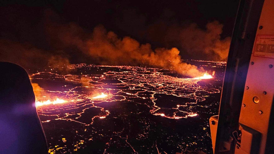
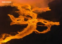
On December 18th, 2023, the ground in the Reykjanes peninsula began rumbling once more. At 10:17 PM local time, the night sky near the town of Grindavik lit up as the magma that had been circulating below ground for weeks found its way to the surface by the Sundhnukagigar crater volcano. Iceland was experiencing yet another eruption, the fourth in three years. It would then be followed by a fifth eruption in January 2024, this time at Hagafell, even closer to Grindavik, and even more eruptions, again in Sundhnukagigar, in February, March, May, August, and November of 2024.
This fourth Reykjanes eruption, while powerful at first, quickly petered out. While scientists were concerned that new fissures might suddenly open, the volcanic activity lessened steadily until, on December 21st, the eruption was declared officially over.
If you want to see the aftermath of the eruption, as well as the aftermath of the eruptions in previous years, check out the available volcano tours. The best way to see the scope of the eruptions is with a birdseye view on a helicopter tour of the eruption area.
- See more about the 2024 Sundhnukagigar Volcanic Eruptions
- Learn about the 2024 Hagafell Volcanic Eruption Near Grindavik
- For more: The Complete Guide to the 2023 Eruption by Litli-Hrutur Volcano
- See also: The Complete Guide to the 2021 Volcanic Eruption by Fagradalsfjall Volcano and the 2022 Fagradalsfjall Volcano Eruption
The Leadup to the Eruption by Grindavik
Just as before the eruptions in Fagradalsfjall in 2021 and 2022 and Litli-Hrutur in 2023, the Reykjanes region had been experiencing an increase in earthquake activity for weeks before but had since quieted down. The seismic activity was caused by a stream of magma flowing beneath the surface, but unlike eruptions in previous years, this one caused real concerns for inhabitants in the area.
Weeks before the eruption, the inhabitants of Grindavik were forced to evacuate the town as magma was discovered flowing only a few hundred feet below the surface of the town. All inhabitants and animals were safely evacuated, and over the next weeks, many valuables were salvaged from homes. Even though the eruption hadn't started, the seismic activity caused a great deal of damage to the town as cracks formed in the earth, as can be seen in the video above.
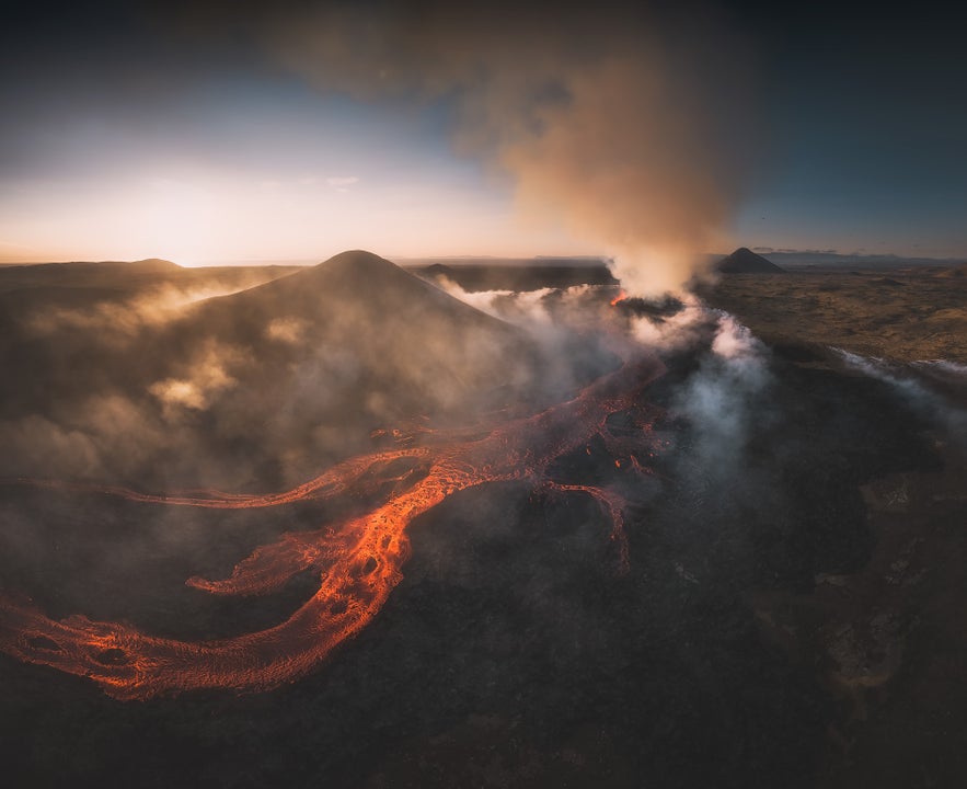
The 2023 eruption by Litli-Hrutur
The possibility of an eruption also caused concern for nearby infrastructure. The Svartsengi Power Plant, which provides both power and heat to the entire region, was under threat, as well as Iceland's largest tourist attraction, the Blue Lagoon, which had been closed down as well. Authorities took preventative measures to create defenses for Svartsengi (and, by extension, the Blue Lagoon) by erecting mounds of earth against possible eruption sites to serve as a wall against the flowing lava.
The 2023 Eruption by Grindavik
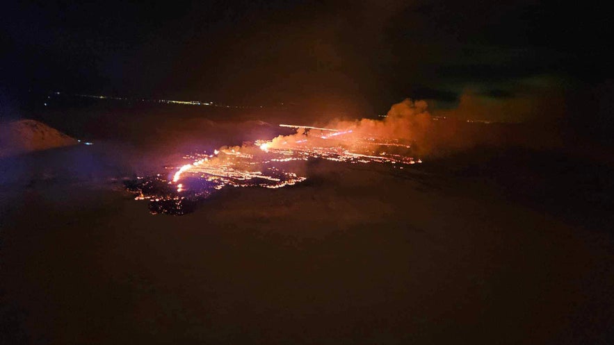 As the eruption began, all thoughts were with the people of Grindavik. The lava flow of the eruption was significantly higher than the eruptions of recent years in Reykjanes, and the fissure created reached a length of upwards of 2.5 miles (4 kilometers). A Civil Defence emergency level was declared, and police closed down nearby roads.
Thankfully, the eruption turned out to be what experts call a "best-case scenario," as the lava flowed away from the town, the Svartsengi power station, and the Blue Lagoon. Scientists closely monitored the situation to see if the fissure extended further south or if new fissures might open up, but thankfully, the eruption ended, and the people of Grindavik could breathe a sigh of relief.
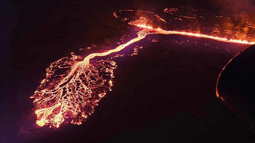 The eruption began with a bang, with a lava flow ten times more powerful than the eruptions in the peninsula in previous years. The lava field created covered an area of roughly 1.4 square miles (3.7 square kilometers).
The following Sundhnukagigar eruptions were located further away from Grindavik than the Hagafell eruption, but they did manage to damage some infrastructure before dying down.
How long will the Sundhnukagigar craters continue erupting? It's impossible to say, but the Reykjanes peninsula has been very active in recent years, so the Icelandic people and geologists everywhere will be keeping a close eye on the region!
That's it about the relatively short 2023 eruption of Sundhnukagigar! Let us know in the comments below if you have questions, and we will do our best to answer them.
関連記事
アイスランドのハイランド地方【完全ガイド】
アイスランド人も観光客も惹きつけてやまない、ハイランドの魅力とは?ハイランド人気の見どころやお勧めのアクティビティは?夏季しか訪れることができないのはなぜ?そんな疑問に全部答える、アイスランド島内陸部の高原地帯、ハイランドの丸わかりガイドです! ハイランドを楽しむ各種のツアー 目次 1 - アイスランドのハイランド地方とは? 2 - ランドマンナロイガ...もっと読むアークレイリのおすすめアクティビティ13選(周辺エリアも)
アークレイリとその周辺エリアのおすすめ観光名所やアクティビティ13選をご紹介します。アイスランドの「北の都」と呼ばれるこの街では、ホエールウォッチングやスキーといったアクティビティや、ビールスパのようなちょっと変わった体験まで、様々な遊び方ができます。アークレイリから日帰りで行ける観光地や、夏・冬それぞれの人気アクティビティをまとめました。 アークレイリ(Akureyri)は首都レイキャビク...もっと読むロマンチック・アイスランド
アイスランドで、特別な時間を過ごせる場所をお求めですか?プロポーズにぴったりな場所をお探しですか?この記事では、アイスランドで最もロマンチックで美しい場所をご紹介します。 アイスランドには魅力的な絶景スポットが点在していますが、ロマンチックな雰囲気の場所もたくさんあるんです。実際、多くのカップルがアイスランドを結婚式の場所として選んでいます。Guide to Icelandでは、アイス...もっと読む

アイスランド最大の旅行アプリをスマートフォンにダウンロード。旅のすべてを1か所で管理できます。
アイスランド最大の旅行マーケットプレイスをポケットに。スマートフォンのカメラでQRコードを読み取り、表示されるリンクをクリックしてください。電話番号またはメールアドレスを入力すれば、SMSやEメールでもダウンロードリンクを受け取ることができます。


