최고의 아이슬란드 관광 투어
아이슬란드에서 가장 다양한 관광 투어 중에서 선택하세요. 지식이 풍부한 가이드와 함께 장엄한 풍경과 사람의 손길이 닿지 않은 자연을 만나보세요.
특별한 체험 찾기
시작 위치 선택
날짜 선택
시작일종료일
여행자 추가
1명
관광 투어
필터를 사용해 더 정확한 결과를 얻으세요
정렬: 인기 순


4.8
후기 949개
3일 겨울 투어 | 골든 서클, 남부 해안, 빙하 하이킹과 얼음 동굴 그리고 오로라
투어 출발지
레이캬비크
출발 시간
오전 08:00
소요 시간
3 일
마지막 종착지
레이캬비크


4.8
후기 347개
겨울 아이슬란드에서 8일간 가이드와 함께 오로라를 찾아 여행하는 링로드 일주 패키지
투어 출발지
레이캬비크
출발 시간
오전 08:00
소요 시간
8 일
마지막 종착지
레이캬비크


더 많은 것을 준비했어요
타의 추종을 불허하는 수많은 투어와 패키지 상품들을 살펴보세요
자주 묻는 말
골든써클 관광 투어에서 들르는 곳은 어디인가요?
골든써클 관광에 참여하시면, 세 군데의 명소에 들르게 될 예정이며, 역사 및 지질학적 유적지인 씽벨리어 국립공원 (Thingvellir National Park), 숨막히는 굴포스(Gullfoss) 폭포, 그리고 마지막으로 모든 간헐천의 이름이 유래한 게이시르 (Geysir) 지열 지역 입니다. 모든 골든 서클(Golden Circle) 투어는 이 세 곳으로 안내하지만 대부분은 도중에 잘 알려지지 않은 명소도 소개합니다.
남부해안 투어에서 들르는 명소는 어디인가요?
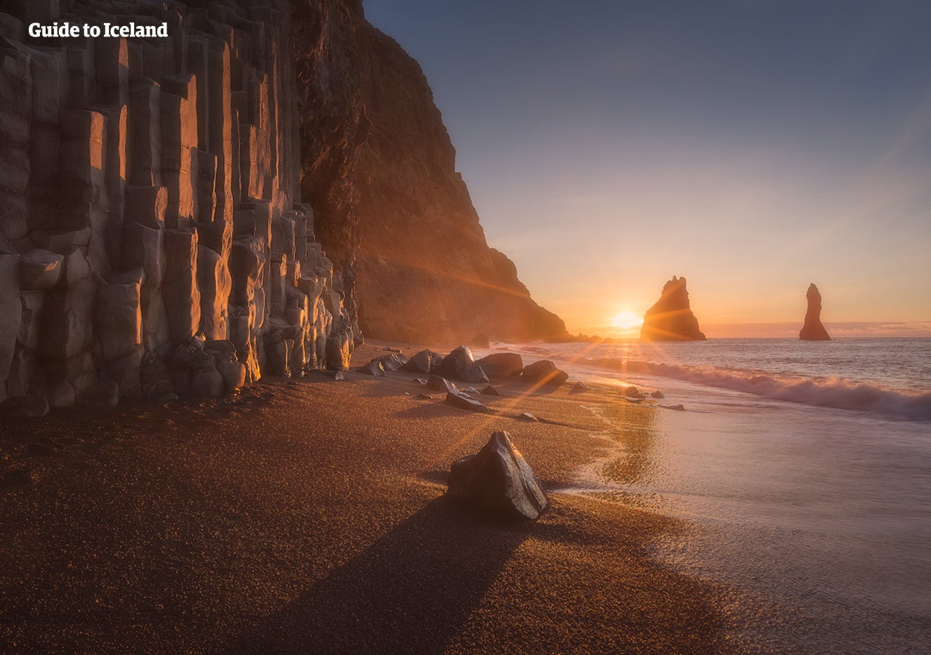
남부해안을 투어에서는 셀랴란드스포스, 스코가포스 폭포에 기본적으로 들르며 검은 모래 해변인 레이니스퍄라, 스카프타펠 자연보호구역과 아이슬란드의 왕관이라 불리는 요쿨살론 빙하호수에 방문합니다. 각각의 투어마다 상세 일정은 상이합니다.
다이아몬드 써클에서 들르는 명소들에는 어떤 곳이 있나요?
다이아몬드 서클(Diamond Circle) 관광 투어의 주요 4곳은 매력적인 도시 후사빅 (Husavik), 신화 속의 아스비르지 협곡 (Asbyrgi canyon), 아름다운 미바튼 호수 (Lake Myvatn), 유럽에서 가장 강력한 폭포인 데티포스 (Dettifoss) 입니다. 이 다양한 명소는 모두 아이슬란드 북부에 위치해 있습니다. 다이아몬드 서클 관광 투어는 북쪽에서 가장 큰 마을인 아쿠레이리 (Akureyri)에서 출발 합니다.
각각의 장소에 얼마나 오랜 시간 머무르나요?
각 명소에서 사진을 찍고 아이슬란드의 아름다운 풍경을 감상하는데 보통 최소 10분부터 60분정도 소요되며 볼 거리에 따라 다르지만 많은 여행객이 평균적으로 원하는 시간만큼 정차합니다.
점심식사는 포함되어 있나요?
투어 포함사항에 제시되지 않은 이상, 특별히 제공되지는 않습니다. 보통 휴게소에 들러 식사시간을 갖습니다.
관광 투어는 언제 이용이 가능한가요?
전 시즌 동안 신청하고 참여가 가능한 것이 관광투어입니다. 단, 오로라투어는 겨울에만 참여가 가능합니다. 여름에는 백야현상으로 인해 밤하늘이 어둡지 않아 오로라 관측이 불가능하기 때문입니다.
투어가이드는 어떤 언어를 쓰나요?
전 투어는 영어로 진행됩니다. 한국어로 진행되는 투어는 음성가이드 투어 외에는 없습니다.
내가 머무는 숙소에서 픽업되어서 복귀도 시켜주나요?
일반적으로 레이캬비크 시내에 있는 주요 숙소에서 픽업과 복귀가 가능합니다. 단, 에어비앤비 또는 개인 주거지역과 같은 곳에서는 픽업이 지원되지 않으며, 직접 가장 가까운 픽업장소로 나와 대기하셔야 합니다.
혼자서 여행하더라도 당일투어나 관광투어 신청이 가능한가요?
물론입니다!
투어에 이용되는 차량은 어떤 차량이지요?
사용하는 차량 유형은 각 관광 투어에 따라 다릅니다. 미니버스, 고급 버스 또는 4x4 전용 지프에서 진행되며 명소를 볼 수 있습니다.


아이슬란드 최대 규모의 여행 앱 설치
아이슬란드 최대의 여행 마켓플레이스를 전화에 다운로드하여 전체 여행을 한 곳에서 관리하세요
전화 카메라로 이 QR 코드를 스캔하고 표시되는 링크를 누르면 아이슬란드 최대의 여행 마켓플레이스를 주머니에 넣을 수 있답니다. 다운로드 링크가 포함된 SMS 또는 이메일을 받으려면 전화번호 또는 이메일 주소를 추가하세요.