Jokulsargljufur Canyon is a vast glacial gorge in North Iceland, part of Vatnajokull National Park and a highlight of the Diamond Circle route. It holds Dettifoss, one of the most powerful waterfalls in Europe, the horseshoe canyon of Asbyrgi, and miles of hiking trails. Read on to plan your visit.
Jokulsargljufur Canyon in North Iceland is protected within Vatnajokull National Park. It was its own national park from 1973 until 2008, when it became the park’s northern section.
The canyon is part of the Diamond Circle, about 37 miles (60 kilometers) east of Husavik and 81 miles (130 kilometers) from Akureyri. While most visitors come to see the powerful Dettifoss Waterfall, the canyon is also home to the Asbyrgi Canyon. Most travelers see it as part of Diamond Circle tours or on self-drive adventures.
Why You Can Trust Our Content
Guide to Iceland is the most trusted travel platform in Iceland, helping millions of visitors each year. All our content is written and reviewed by local experts who are deeply familiar with Iceland. You can count on us for accurate, up-to-date, and trustworthy travel advice.
To understand how Jokulsargljufur formed, we asked Dr. Greta Wells, a geoscientist who studies glacial outburst floods, to walk us through it. She earned her Ph.D. at the University of Texas at Austin and spent a year at the University of Iceland as a Fulbright-NSF Arctic Research Fellow.
Keep reading to know what to do, how to get there, where to stay, and when to go to Jokulsargljufur Canyon.
Key Takeaways
-
Jokulsargljufur is a 15.5-mile (25-kilometer) glacial canyon in North Iceland, forming the northern section of Vatnajokull National Park.
-
Its highlights are Dettifoss, Selfoss, Hafragilsfoss, and the Asbyrgi Canyon.
-
Entry and parking are free in Jokulsargljufur Canyon.
-
Summer (June to September) is the best time to visit Jokulsargljufur Canyon, when Route 864, the hiking trails, and the campsites are all open.
-
Route 85 reaches Asbyrgi in the north; Route 862 (paved) or Route 864 (gravel, 4x4 recommended) reaches Dettifoss in the south.
-
The canyon is open year-round, but winter access is limited and depends on road and weather conditions.
-
The Gljufrastofa Visitor Center at Asbyrgi Canyon is the main hub for trail maps and current road conditions.
Why Visit Jokulsargljufur
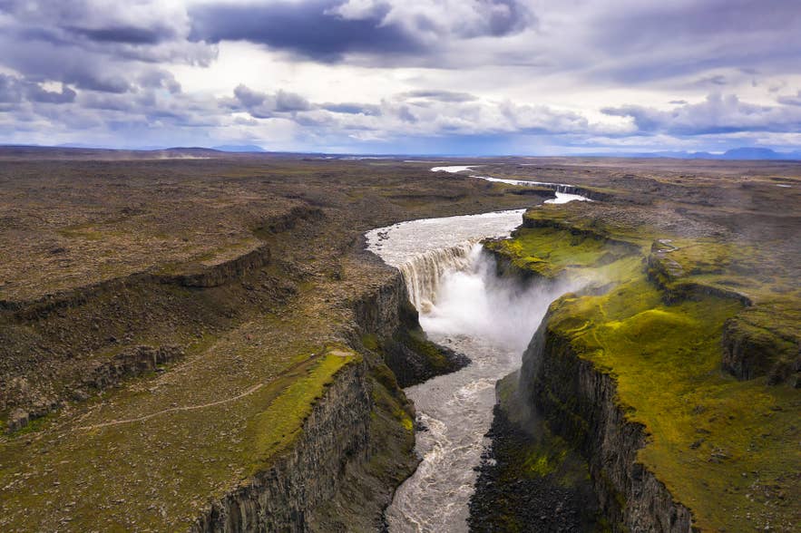
Jokulsargljufur Canyon is known for its mix of waterfalls, volcanic rock formations, and lush landscapes, all within a 15.5-mile (25-kilometer) stretch. As one of the highlights of the Diamond Circle, it’s home to some of North Iceland’s most iconic sights. Enjoy accessible viewpoints, scenic hiking trails, and sheltered woodlands where Arctic plants and birdlife thrive throughout summer.
History and Geography of Jokulsargljufur Canyon
Jokulsargljufur is a canyon, cut by the glacial river Jokulsa a Fjollum, the country’s second-longest. Once its own national park, it now forms part of Vatnajokull National Park and holds some of Iceland’s most powerful waterfalls, including Dettifoss, Selfoss, and Hafragilsfoss.
The canyon was not carved slowly. Dr. Greta Wells, a geoscientist who studies glacial outburst floods, explains that sudden, massive floods carved Jokulsargljufur, an explanation now widely accepted.
Glacial outburst floods, jökulhlaups in Icelandic, create unique landforms due to their high-powered flow and short duration, days to weeks. This sounds long but is an instant in geology.
The evidence is written into the landscape: a box-shaped canyon, waterfalls, and terraces. Much of the rock is columnar basalt, and its structural weaknesses let floodwaters topple and remove whole columns at once.
This erosion is strongest at knickpoints, the waterfalls, which retreat upstream and deepen the canyon. Dettifoss marks a knickpoint where erosion paused after a period of flood activity, while resistant bedrock terraces at Dettifoss and Hafragilsfoss mark former positions of the canyon floor.
Where Is Jokulsargljufur Located
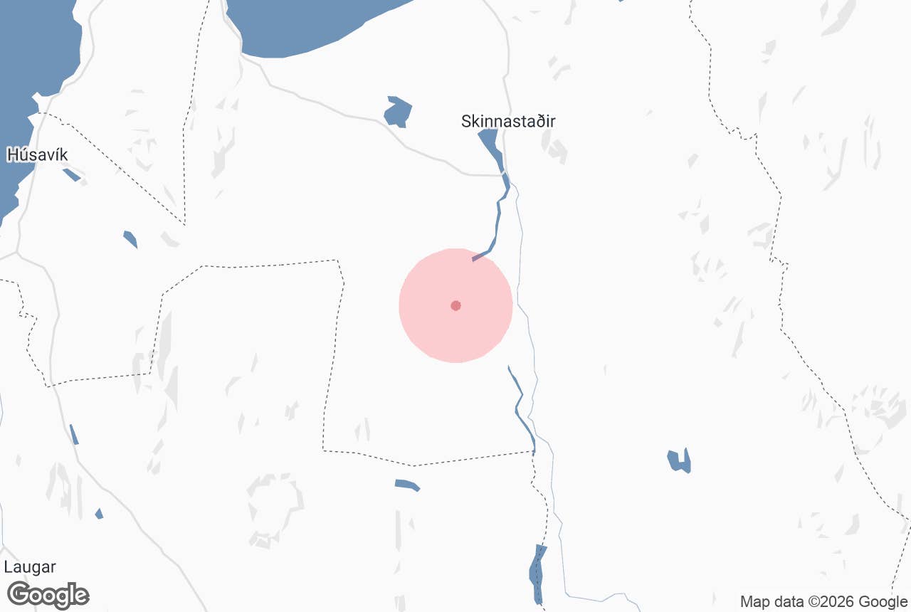
Jokulsargljufur Canyon is located in Northeast Iceland within Vatnajokull National Park. It is about 81 miles (130 kilometers) from Akureyri and 37 miles (60 kilometers) from Husavik, making it an easy stop on any North Iceland itinerary.
The canyon follows the Jokulsa a Fjollum River and is accessible from the north via Route 85 or Route 862. Most visitors reach Jokulsargljufur by driving the Diamond Circle route, with Dettifoss Waterfall serving as the most popular access point.
Note: This is a remote stretch of North Iceland with few services along the way. Fill up your fuel tank in Husavik or Kopasker before you head out.
How To Get to Jokulsargljufur Canyon
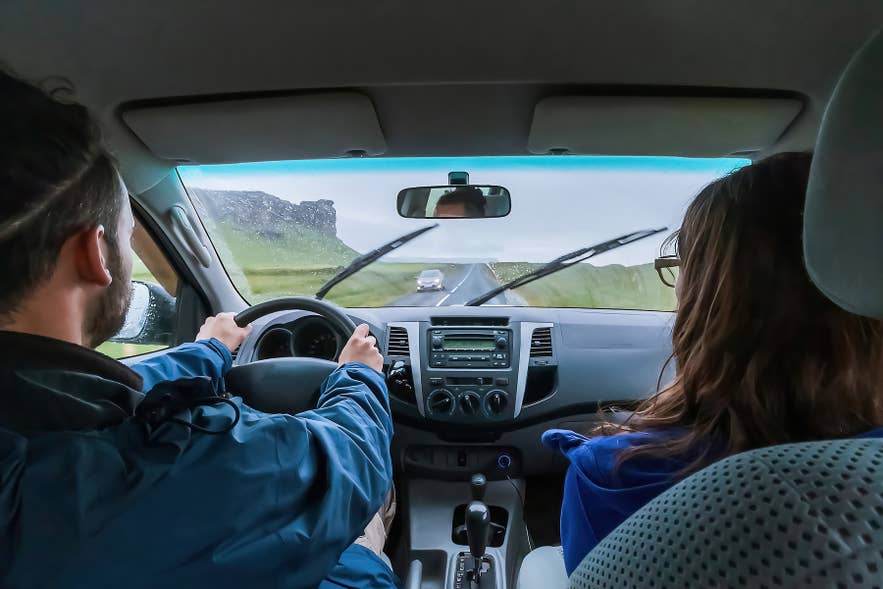
The best way to reach Jokulsargljufur Canyon is by rental car or guided Diamond Circle tours, as there is no public bus to the canyon. Most visitors travel here between June and September, when the access roads are typically open for summer road trips.
-
From Reykjavik: Jokulsargljufur Canyon is about 336 miles (540 kilometers) from Reykjavik, around a 7.5 to 8-hour drive. Because of the distance, it’s best visited as part of multi-day Ring Road tours or vacation packages.
-
From Husavik: Follow Route 85 east to Asbyrgi. The drive is about 37 miles (60 kilometers) and takes 50 minutes.
-
From Akureyri: Take Route 1, then Route 85 east through Husavik to Asbyrgi. The journey is about 93 miles (150 kilometers) and takes around 2 hours. To reach Dettifoss at the southern end instead, follow Route 1 east and turn north onto Route 862, about 84 miles (135 kilometers) and 1 hour 45 minutes. Travelers who prefer not to drive can join a Diamond Circle tour from Akureyri.
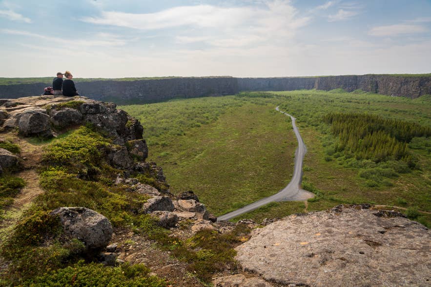
Once you are near the canyon, you choose the west or east side of the Jokulsa a Fjollum River. There are no bridges connecting the two routes, so decide which viewpoints you want before setting out.
-
Route 862 (west bank): The easiest way to reach Jokulsargljufur. In summer, this paved road is suitable for all car types, including 2WD rental cars, and reaches the Dettifoss parking area, trails, and facilities. It continues north past Holmatungur and Vesturdalur to meet Route 85 near Asbyrgi Canyon.
-
Route 864 (east bank): A rough gravel road that leads directly to Dettifoss and Hafragilsfoss. A 4x4 is recommended, and the road often closes in winter.
Tip: Roads and trails can be completely closed or impassable due to snow, ice, and severe weather in Iceland. Before leaving the Ring Road, check the latest road conditions in Iceland and the weather forecast, as both can change quickly.
What To See in Jokulsargljufur Canyon
One of the best ways to explore Jokulsargljufur Canyon is to begin near Dettifoss and continue north along the Jokulsa a Fjollum River toward Asbyrgi Canyon. This route passes some of the area’s most impressive waterfalls, volcanic formations, and hiking trails.
Jokulsargljufur Waterfalls
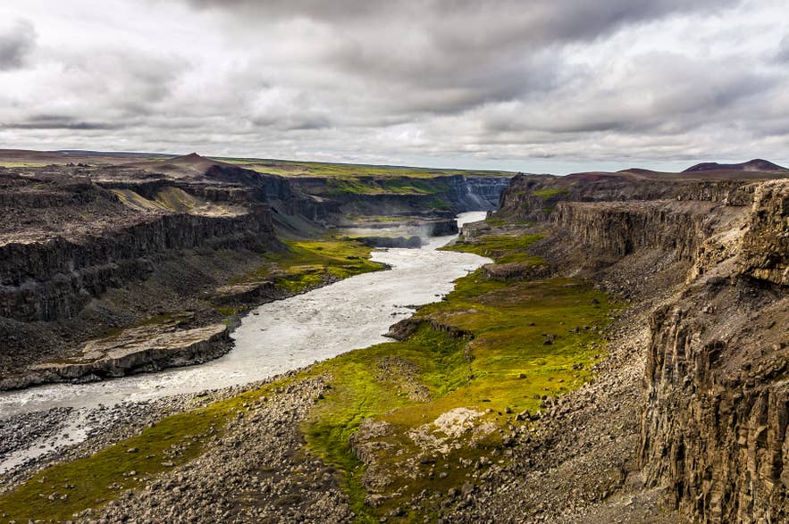
Three of North Iceland’s most impressive waterfalls, Dettifoss, Selfoss, and Hafragilsfoss, are found along the Jokulsa a Fjollum River in Jokulsargljufur Canyon.
If you plan to visit all three waterfalls, many travelers begin at Selfoss, continue to Dettifoss, and finish at Hafragilsfoss. Marked trails on both the east and west sides of the canyon connect the viewpoints. Allow around 1 to 2 hours to visit Dettifoss, or 3 to 4 hours if you also plan to explore Selfoss and Hafragilsfoss.
Selfoss Waterfall
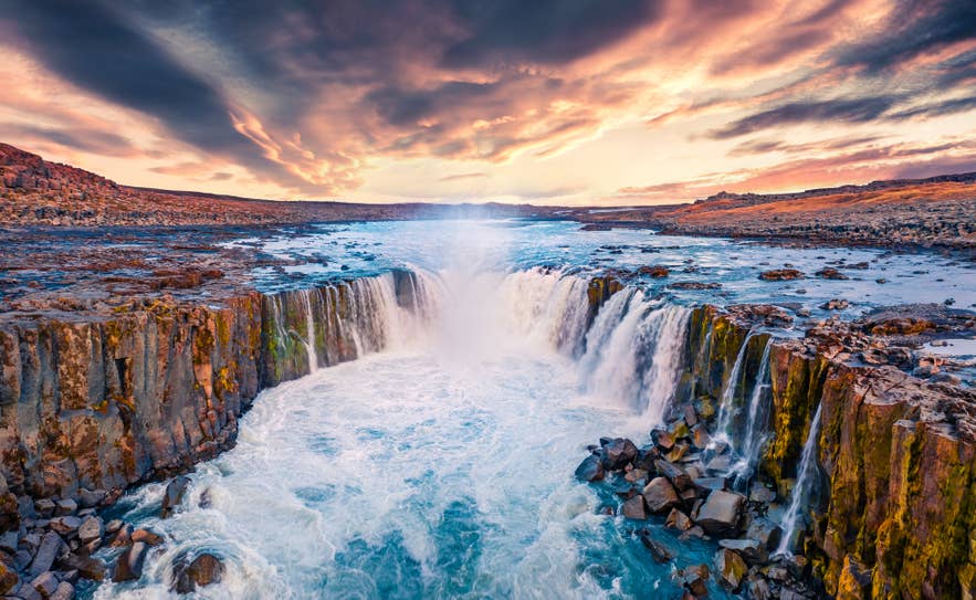
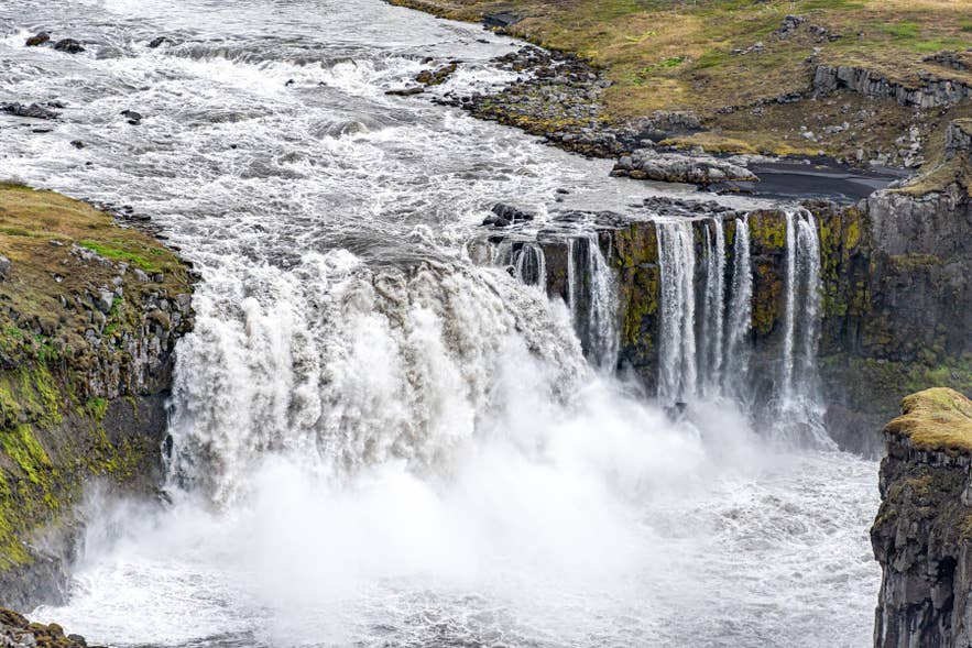
Located about 0.6 miles (1 kilometer) upstream from Dettifoss, Selfoss Waterfall is a wide, horseshoe-shaped cascade of dozens of streams flowing over basalt cliffs. Not to be confused with the town of Selfoss in South Iceland, this waterfall in Jokulsargljufur spans about 330 feet (100 meters) across and drops 36 feet (11 meters).
You can reach Selfoss around 30 minutes from the parking area, with trails on both the west side (Route 862) and east side (Route 864). Because of its close proximity, many visitors combine both waterfalls in a single visit.
Tip: Selfoss is far wider than it is tall, so the wide views from the marked viewpoints on either side work better than trying to get close. Stay behind the barriers, as the rock near the edge stays wet and slippery.
Dettifoss Waterfall
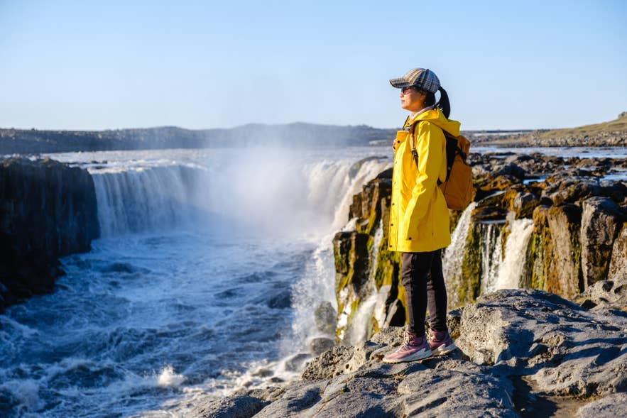
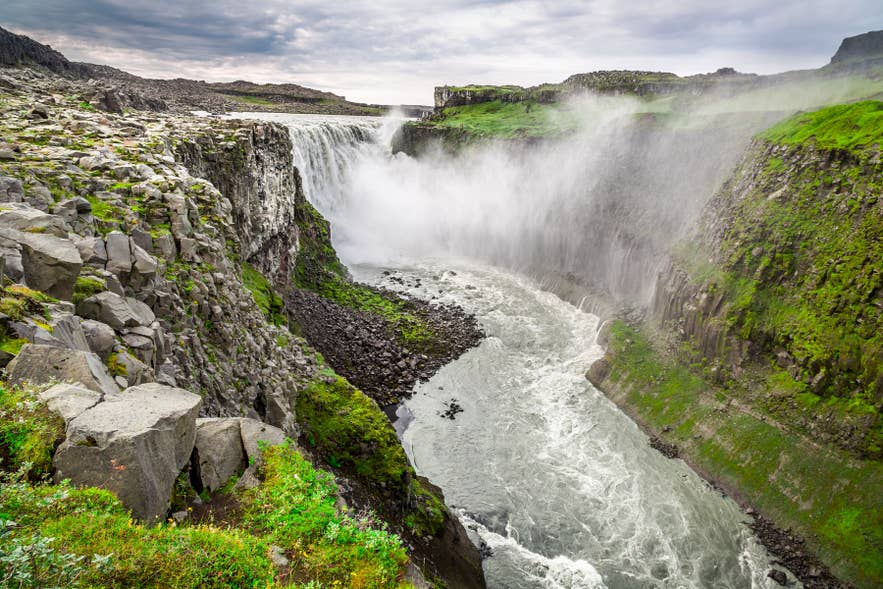
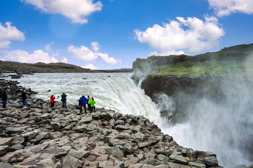
A short, flat walk downstream leads to Dettifoss, where immense volumes of glacial water plunge 144 feet (44 meters) over a 330-foot-wide (100-meter) cliff. The waterfall averages 6,800 cubic feet (193 cubic meters) per second, rising to between 14,000 and 17,700 cubic feet (400 to 500 cubic meters) during summer melt.
Dettifoss is also one of Iceland’s most recognizable filming locations. Fans of Ridley Scott’s Prometheus may recognize the waterfall from the movie’s opening scene, where its glacial landscape stood in for an alien world.
You can visit Dettifoss from either side of the Jokulsa a Fjollum River. The west side (Route 862) has the main parking area and paved trails, while the east side (Route 864) offers a closer viewpoint. Expect heavy mist near the viewpoints, so wear waterproof clothing.
Note: Access on the west side is changing. Following a rockfall in 2025, Vatnajokull National Park found extensive cracking beneath Fosshvammur, the lower area beside the falls, and has closed it permanently. Trails are being rerouted through the 2026 season, and new viewing platforms are planned north of the waterfall. Viewpoints remain open, but check the park’s notices before you travel.
Tip: If you don’t want to drive, many guided Dettifoss tours include Jokulsargljufur Canyon along with other North Iceland attractions. You can also consider staying at one of the hotels near Dettifoss to make the most of your time.
Hafragilsfoss Waterfall
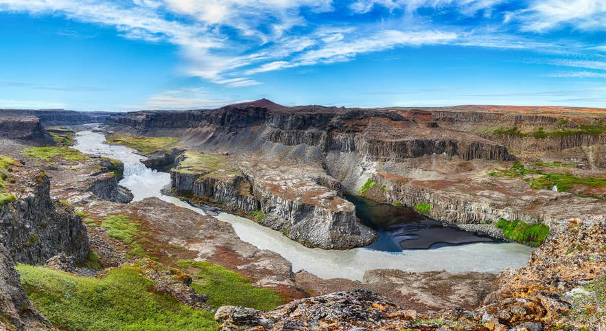
About 1.2 miles (2 kilometers) downstream from Dettifoss, Hafragilsfoss is a worthwhile stop if you’re exploring Jokulsargljufur Canyon. The waterfall plunges into a narrow gorge surrounded by towering basalt cliffs, showing the full scale of the canyon.
The east side gives the closest and most dramatic views of Hafragilsfoss Waterfall. Because fewer visitors continue beyond Dettifoss, Hafragilsfoss is often quieter, making it a rewarding stop for photographers and anyone seeking a more peaceful viewpoint.
See the Volcanic Formations of Jokulsargljufur
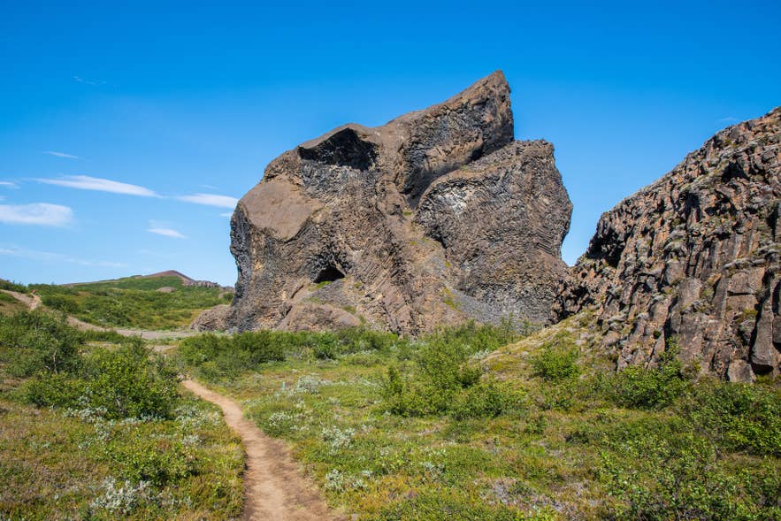
Moving north, the canyon shifts from massive waterfalls to unusual volcanic formations. Here you’ll find the unique rock formations of Hljodaklettar, the red hills of Raudholar, and the green oasis of Holmatungur.
Hljodaklettar (The Echo Rocks)
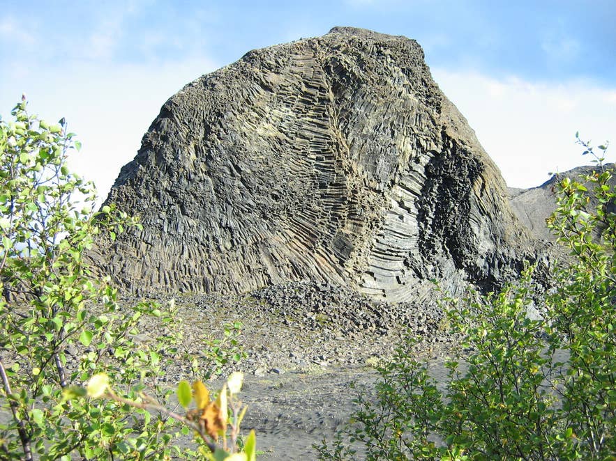
Photo from Wikimedia, Creative Commons, by Bernello. No edits made.
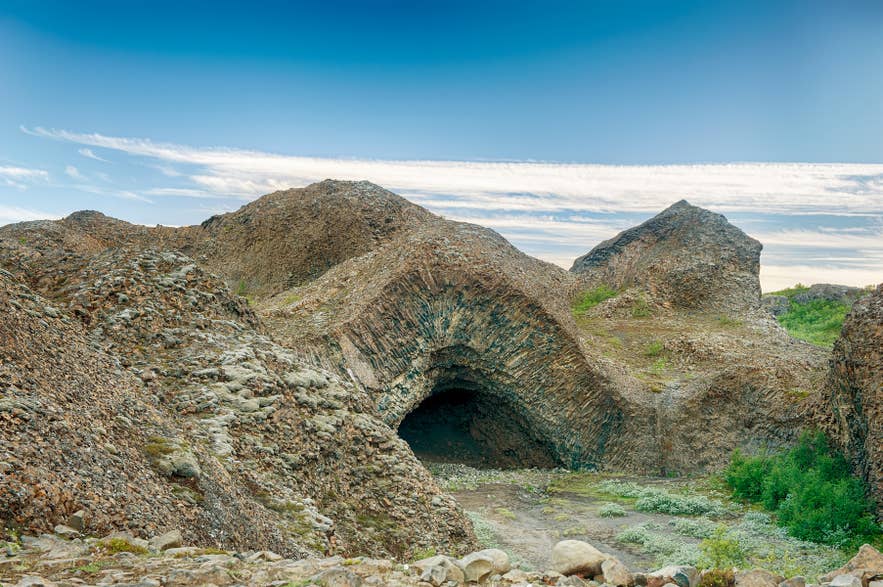
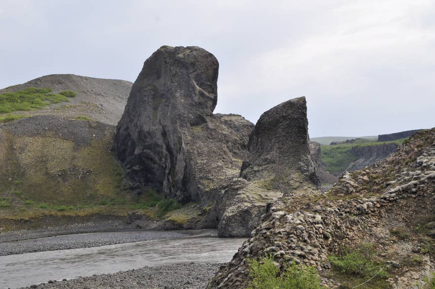
Hljodaklettar is one of Jokulsargljufur Canyon’s most unusual geological sites, and the reason it looks so strange is that you are standing inside old volcanoes rather than beside them.
Hljodaklettar and the nearby Raudholar form part of a crater row about 3.7 miles (6 kilometers) long that erupted around 8,000 to 9,000 years ago. Every crater once looked much like Raudholar does today.
Glacial outburst floods then stripped the loose material away from most of them, exposing the magma that had solidified inside the volcanic conduits. The result is basalt columns that fan, twist, and radiate instead of standing in the neat vertical rows found elsewhere in Iceland.
Hljodaklettar gets its name, “The Echo Rocks,” from the acoustics created by the curved rock walls beside the river. Marked trails lead to formations including Kirkjan (the Church), a domed cave, and Karl og Kerling.
Tip: The full Hljodaklettar circle is 1.9 miles (3 kilometers) and takes one to one and a half hours. The park rates it as challenging. For an easier option, the 0.7-mile (1.2-kilometer) walk to Trollid takes about 30 minutes. Stay on the marked paths, as walking off-trail here damages the vegetation and is not permitted.
Raudholar (Red Hills)
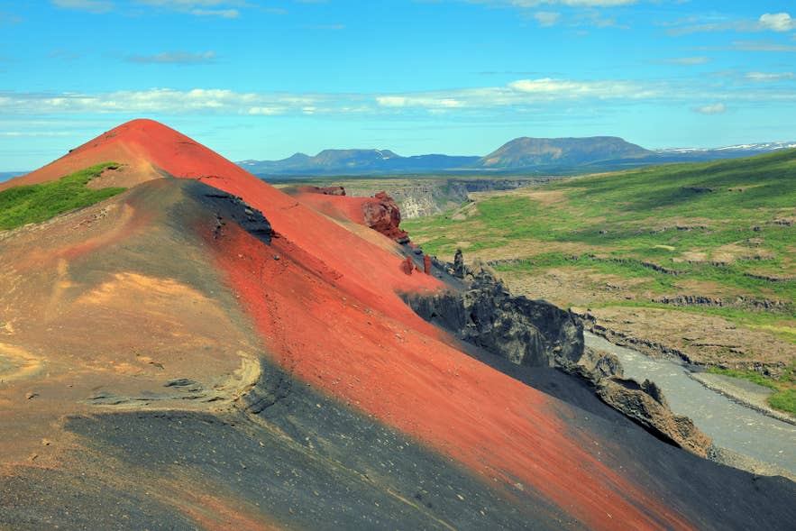
Just north of Hljodaklettar, Raudholar stands out with deep red volcanic cinder cones that contrast sharply with the surrounding black lava fields. Most visitors explore it on the 3-mile (5-kilometer) Raudholar Loop, a moderately challenging hike of 1.5 to 2 hours that starts near the Vesturdalur campsite.
Holmatungur
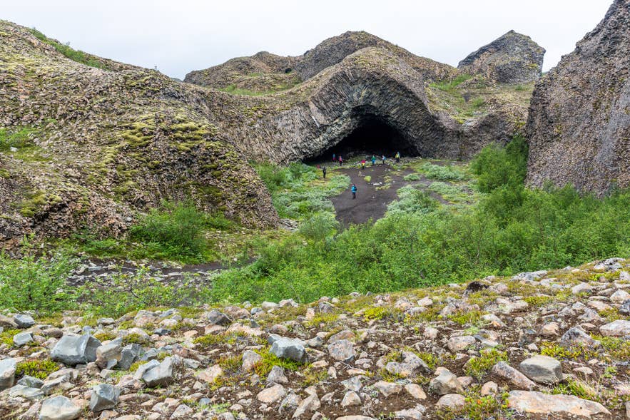
Holmatungur shows a completely different side of Jokulsargljufur Canyon. Unlike the canyon’s rugged lava fields, this peaceful oasis is filled with lush vegetation, spring-fed streams, and small waterfalls that flow into the glacial Jokulsa a Fjollum River.
Easy hiking trails lead past the Holmafossar Waterfalls and the Katlar Rock Formations, where the river narrows into a dramatic channel. Holmatungur also connects with trails to Hljodaklettar and Dettifoss, making it a great stop for hikers exploring more of the canyon.
Walk Through Asbyrgi Canyon
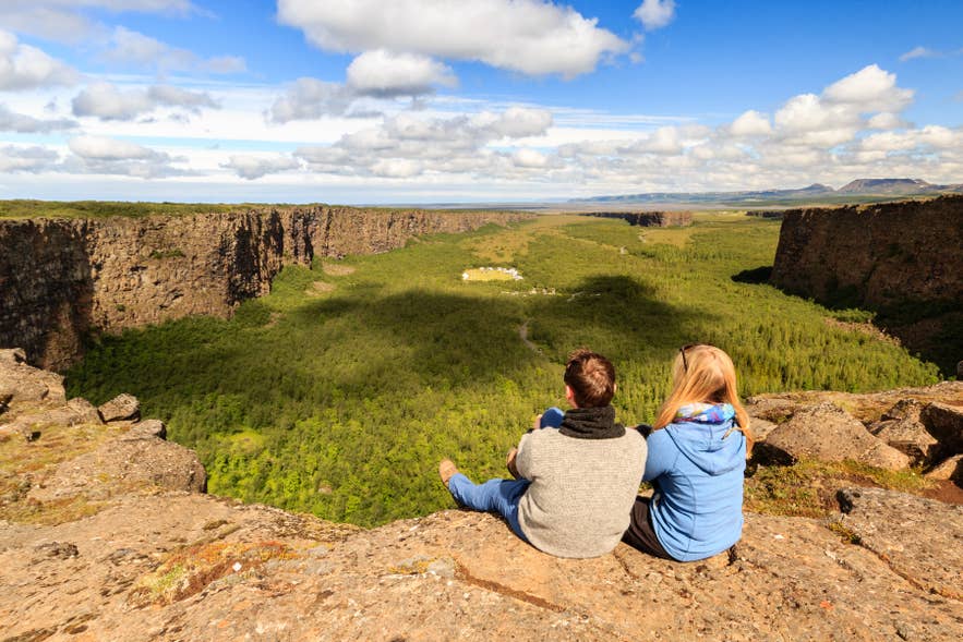
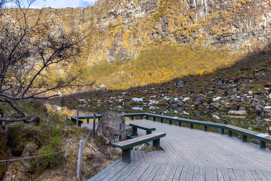
Asbyrgi marks the northern end of Jokulsargljufur Canyon and is one of North Iceland’s most remarkable natural attractions. This wide horseshoe-shaped canyon is a peaceful oasis of birch forest, wildflowers, and the Botnstjorn pond.
Local Icelandic folklore adds to the area’s appeal. According to Norse mythology, Asbyrgi Canyon was formed when Sleipnir, the eight-legged horse of the god Odin, struck the ground with one of its hooves.
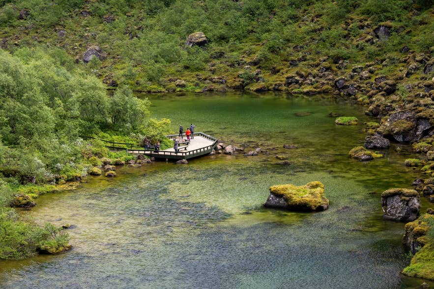
The canyon is enclosed by cliffs rising up to 330 feet (100 meters), while the Eyjan (the Island) rock formation divides much of its floor. It is a favorite for hiking and birdwatching, with trails from easy 30-minute loops to longer routes.
Asbyrgi is one of the main highlights of the Diamond Circle and is easily reached via Route 85. If you’re exploring North Iceland by rental car or joining a Diamond Circle tour, it’s the perfect place to end your journey through Jokulsargljufur Canyon.
The Best Hiking Trails in Jokulsargljufur Canyon
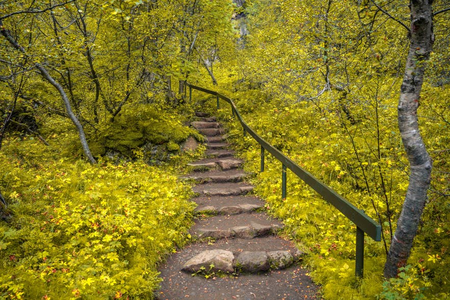
Jokulsargljufur Canyon is one of Iceland’s best hiking destinations, with trails from easy walks to the multi-day Canyon Trail connecting Asbyrgi to Dettifoss Waterfall. Most trails are best explored between mid-May and the end of September, when access roads and hiking paths are typically open.
Even in summer, Iceland’s weather can change quickly, so pack waterproof clothing, sturdy hiking boots, and warm layers before setting out.
Easy Jokulsargljufur Canyon Hikes (30 Minutes to 3 Hours)
-
Dettifoss to Selfoss: This 1.6-mile (2.5-kilometer) easy trail connects the canyon’s two best-known waterfalls and takes about an hour each way.
-
Botnstjorn Pond Loop: A gentle 0.6-mile (1-kilometer) walk through the birch forest of Asbyrgi Canyon, passing the Botnstjorn Pond. The trail takes about 30 minutes to complete and is suitable for visitors with limited mobility.
-
Holmatungur Trails: Popular routes include the 2.8-mile (4.5-kilometer) Holmatungur Circle Trail and the more challenging 5-mile (8-kilometer) one-way Vesturdalur to Holmatungur Trail, which requires wading across the shallow Stalla River.
Longer Jokulsargljufur Canyon Day Hikes (3 to 6 Hours)
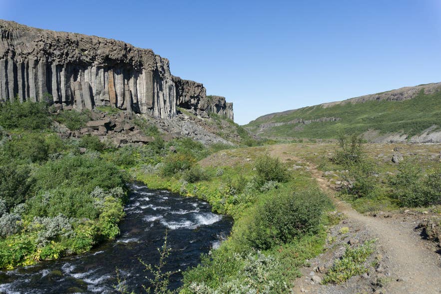
Photo from Wikimedia, Creative Commons, by Michal Klajban. No edits made.
-
Vesturdalur to Botnstjorn: This 7.8-mile (12.5-kilometer) trail connects Asbyrgi Canyon with Vesturdalur. This challenging hike starts from the Gljufrastofa Visitor Center and takes about 4 to 5 hours to complete.
-
Holmatungur to Dettifoss: This 7-mile (11.5-kilometer) challenging trail follows the Jokulsa a Fjollum River from Holmatungur to Dettifoss. It takes about 3 hours and passes waterfalls, lush vegetation, and canyon viewpoints.
-
Hljodaklettar Loop: A 1.9-mile (3-kilometer) trail through the echo rocks, where basalt columns, caves, and arches form one of Iceland’s most unique volcanic landscapes. The hike takes about 1 to 1.5 hours and is considered challenging.
Multi-Day Jokulsargljufur Canyon Hike
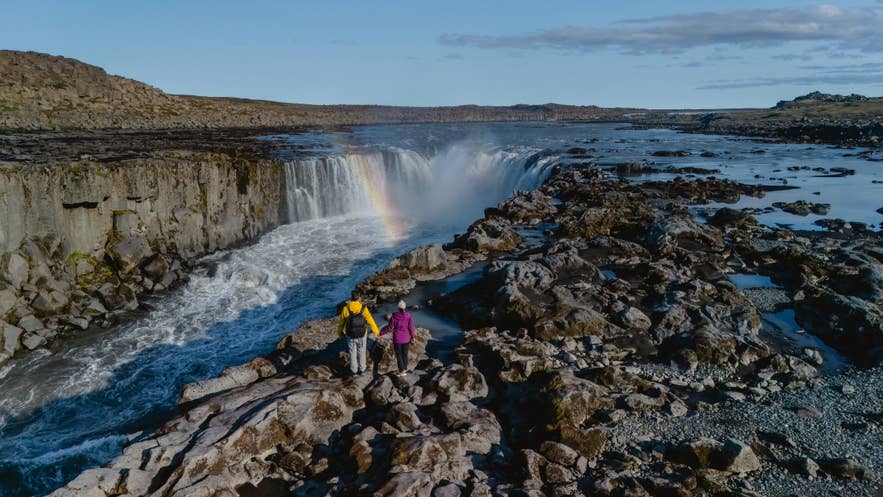
The Canyon Trail is Jokulsargljufur’s premier long-distance hike, stretching 20 miles (32 kilometers) from Asbyrgi to Dettifoss. Most hikers complete the trail over two days, camping overnight at Vesturdalur.
-
Day 1: Start in Asbyrgi and hike through birch woodland and dramatic canyon scenery. You can choose the clifftop route for panoramic views or the lower riverside trail before reaching the Vesturdalur campsite.
-
Day 2: Continue through Hljodaklettar’s unusual basalt formations and the lush Holmatungur oasis before finishing at the powerful Dettifoss Waterfall, the dramatic finale of the trek.
This is a demanding hike with steep climbs, uneven trails, and a river crossing near Holmatungur. Good fitness, sturdy hiking boots, and preparation for rapidly changing weather are essential.
Tip: The trail is one way, so plan your transportation before setting out. Arrange a pickup at Dettifoss or leave a vehicle there in advance, as you’ll finish about 20 miles (32 kilometers) from where you started.
Camping in Jokulsargljufur Canyon
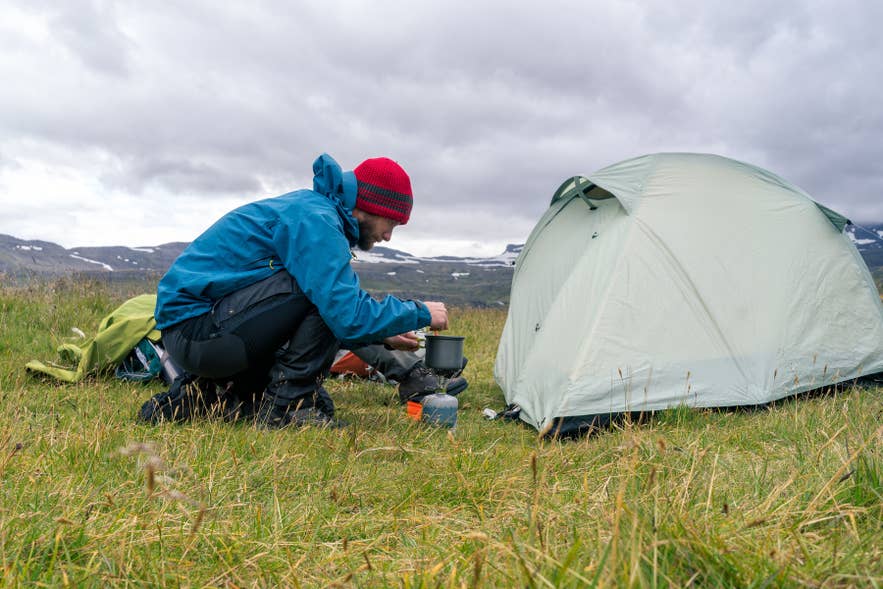
Camping in Jokulsargljufur is only permitted at designated campsites. Wild camping and pitching a tent outside these areas is prohibited.
-
Asbyrgi Campsite: Open from May 15 to the end of October, this full-service campsite at the park’s northern entrance takes tents, campervans, and motorhomes. Facilities include toilets, hot showers, cooking and dining areas, washing machines, and electrical hook-ups in selected zones. The park advises booking ahead, especially for a pitch with electricity.
-
Vesturdalur Campsite: Open from early June to mid-September, this small tent-only campsite is midway along the canyon near Hljodaklettar. There is no electricity or hot water and phone coverage is patchy. Reservations are not available, and rangers collect fees on site.
Hikers on the multi-day Canyon Trail can also camp at Dettifoss. Opening dates and services shift with weather and park conditions, so confirm with Gljufrastofa before relying on either of the smaller sites.
When To Visit Jokulsargljufur Canyon
The best time to visit Jokulsargljufur Canyon is from June through September, when most roads, hiking trails, and campsites are open. This is also the easiest season for a road trip, with long daylight hours and mild weather.
You can still visit in winter, but expect more limited access. Route 864 is usually closed, some hiking trails become inaccessible, and snow and ice can affect driving conditions. If you’re planning a winter visit, allow extra travel time and check for road closures before you leave.
Whatever the season, check the latest road conditions in Iceland and safety alerts on SafeTravel Iceland before setting out. Stay on marked trails and behind safety barriers, as canyon edges and waterfall viewpoints can be slippery, unfenced, and dangerous.
Where to Stay Near Jokulsargljufur Canyon
Jokulsargljufur Canyon sits in a remote corner of North Iceland, with no large town at its edge. Most travelers base themselves in one of four nearby areas, each a short drive from the trails. Asbyrgi Canyon puts you on the trails first, Husavik covers services and whale watching, and Lake Myvatn suits the south end of the park and its baths.
-
Asbyrgi and the National Park: Asbyrgi marks the park’s north entrance. Hotel Skulagardur is one of the closest options, about a 12-minute drive from Asbyrgi. You can also camp at the official site by the visitor center or book a cottage like Loulundur Asbyrgi.
-
Husavik: Husavik is the main town near the canyon, about 37 miles (60 kilometers) from Asbyrgi, or roughly an hour by car. Husavik hotels, guesthouses, and cottages make a natural base for the wider Diamond Circle route.
-
Lake Myvatn: The lake lies south of the canyon, near Dettifoss and about an hour’s drive away. You can find everything from farm stays to full-service hotels near Lake Myvatn, and its geothermal baths are a welcome reward after a day on the trail.
-
Akureyri: The largest town in North Iceland is about 2 hours from Jokulsargljufur Canyon. Accommodations in Akureyri are ideal for travelers who don’t mind the longer drive.
Top Things To Do Near Jokulsargljufur Canyon
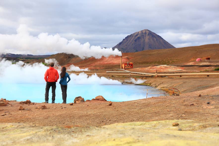
Jokulsargljufur Canyon lies along the Diamond Circle, so most travelers combine it with other top attractions in North Iceland rather than visiting it on its own. Most of the region’s best sights are within about one to two hours’ drive and fit easily into a self-drive trip around North Iceland.
Explore Krafla and the Viti Crater
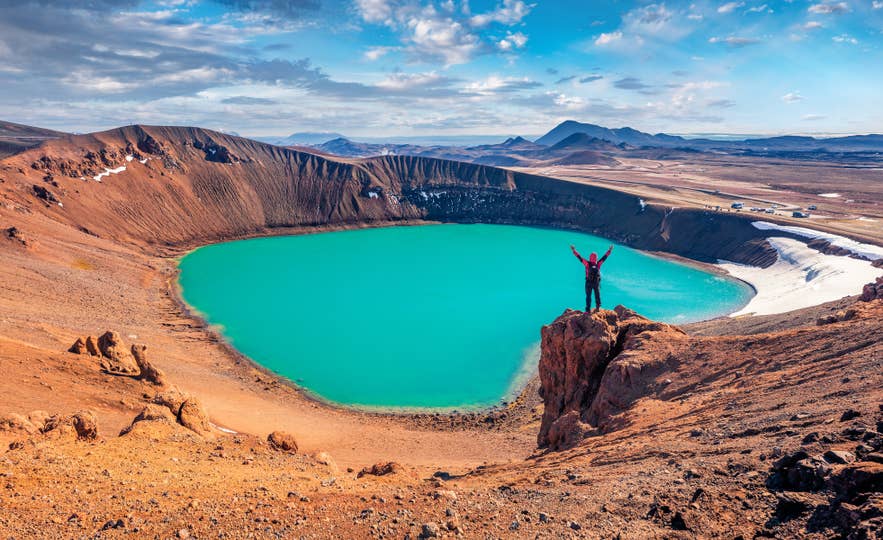
About 43 miles (70 kilometers) from Jokulsargljufur Canyon, the Krafla volcanic region is one of Iceland’s most active geothermal zones. The main highlight is Viti Crater in Krafla, a bright turquoise lake set inside a crater.
Nearby, you can also visit Leirhnjukur Volcano, where steaming fumaroles, colorful sulfur deposits, and fresh lava fields reveal the area’s active volcanic landscape. If you want to go deeper into the volcanic interior, you can reach Askja Caldera on a Super Jeep tour from the Myvatn area.
Spend Time in Akureyri
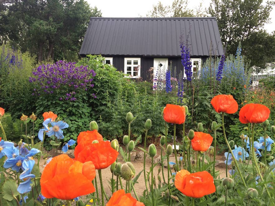
Located about 2 hours from Jokulsargljufur Canyon, Akureyri works as a convenient base for exploring North Iceland. As the largest town in North Iceland, there are plenty of activities in Akureyri. Enjoy everything from whale watching tours and relaxing at the Forest Lagoon to exploring the town center with its cafes, restaurants, and local art galleries.
You can also visit the iconic Akureyri Church, stroll through the Akureyri Botanical Garden, or use the town as a starting point for exploring the Diamond Circle and other nearby attractions.
Relax at the Earth Lagoon
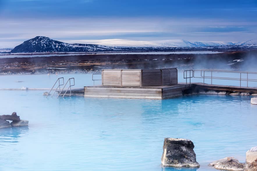
The newly renovated Earth Lagoon, formerly known as the Myvatn Nature Baths, is a geothermal lagoon near Lake Myvatn. Its warm, mineral-rich water makes it a natural stop after a day of hiking or driving in the Jokulsargljufur area.
You can book admission to the Earth Lagoon in advance, which is recommended in summer. If you prefer not to drive, you can pair Jokulsargljufur with Earth Lagoon on a guided tour from Akureyri.
Go Whale Watching in Husavik
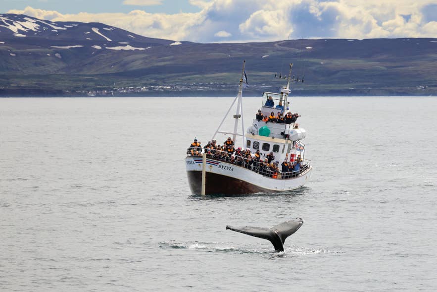
Husavik, the main base for the northern end of the canyon, is one of Iceland’s leading whale-watching towns. From June to November, you can join a Husavik whale watching tour to see humpback and minke whales on the shores of Skjalfandi Bay.
Visit Godafoss Waterfall

Godafoss Waterfall is worth a stop for its horseshoe shape and the Viking history behind its name. This wide waterfall drops across the Skjalfandafljot River, about 47 miles (75 kilometers) southwest of Asbyrgi on the way toward Akureyri.
You reach Godafoss Waterfall straight from the Ring Road, so it takes little time to visit. It also features on most Diamond Circle tours alongside Jokulsargljufur Canyon. You can also see it on many Godafoss tours, which usually start from Akureyri.
Tip: Viewpoints sit on both sides of the river and are connected by a short bridge, so it’s easy to see the falls from multiple angles in under 30 minutes.
Explore Lake Myvatn’s Geothermal Sites
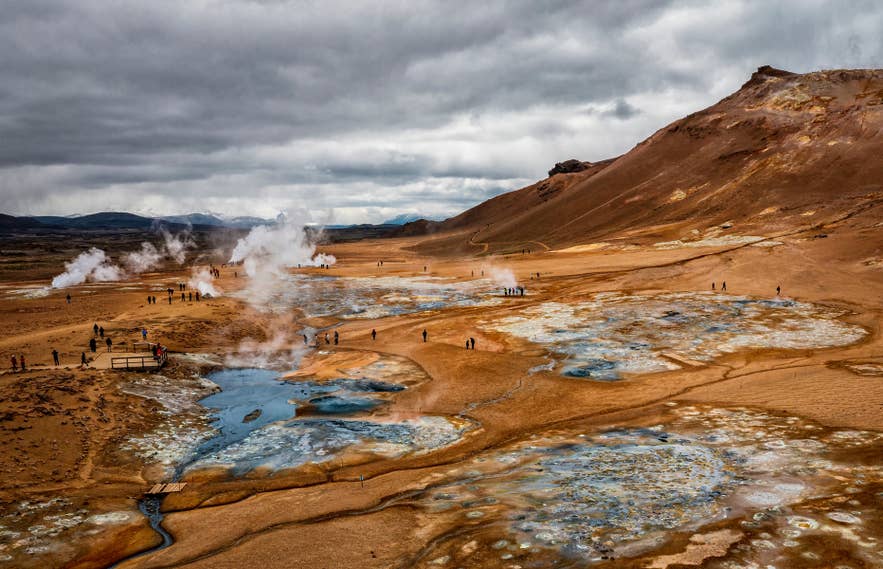
About 47 miles (76 kilometers) south of Jokulsargljufur Canyon, the Lake Myvatn area packs several short stops close together: the Namafjall Geothermal Area, the twisted lava formations at Dimmuborgir, and the Skutustadagigar Pseudocraters. Most sights are just a 10 to 20-minute walk from the parking areas, making them easy to combine with a visit to Dettifoss or Asbyrgi Canyon.
You can cover the highlights on a Lake Myvatn sightseeing and hot springs tour from Akureyri or browse all Lake Myvatn tours. If you visit in winter, a dog sledding tour in Myvatn is a popular activity in the Lake Myvatn area from November to April.
Plan Your Visit to Jokulsargljufur Canyon
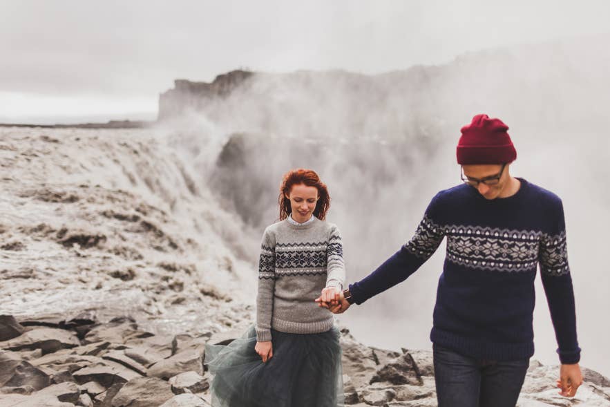
Jokulsargljufur Canyon packs Europe’s most powerful waterfall, a legendary horseshoe canyon, and long hiking trails into one stretch of North Iceland. It is an easy addition to any Diamond Circle itinerary, especially for travelers already exploring Lake Myvatn and Akureyri.
To build it into a longer trip, browse self-drive tours in Iceland or the other national parks in Iceland worth pairing with a northern route.
What does Jokulsargljufur mean?
Is Jokulsargljufur Canyon worth visiting?
Do you need a 4x4 to visit Jokulsargljufur?
Always check for the latest road conditions before you travel.
Which side of Dettifoss is better, east or west?
Is there an entrance fee for Jokulsargljufur Canyon?
How long do you need at Jokulsargljufur?
For hikers tackling the Canyon Trail between Asbyrgi and Dettifoss, allow two days. Most hikers camp overnight at Vesturdalur before completing the trek on the second day.
Can you visit Jokulsargljufur in winter?
With fewer daylight hours, plan a shorter itinerary or join a guided tour. Always check the latest road and safety conditions before setting out.
