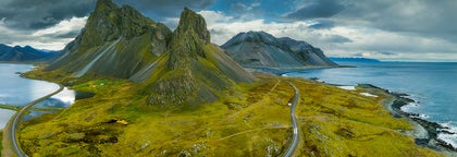
The flat-topped mountain Esja, often called Esjan, is Iceland’s most popular destination for day hiking. It is situated in Kjalarnes in the south-west corner of Iceland.
Only 10 kilometres (6 miles) from the city of Reykjavík across Faxaflói Bay, the mountain is a dominant feature of the capital’s skyline. In reality, Esja is not a true mountain in itself, but a volcanic range, the highest peak of which reaches 914 metres (2,999 feet) tall.
Geology and History
Esja's formation dates back to the beginning of the last Ice Age. Magma rising from eruptions formed layers of lava beneath a glacier, and when the ice retreated, it ground much of it away and left the mountain in its current form.
The volcano is no longer active, so it has little changed since.
Since Iceland is situated on the boundary between two tectonic plates, Eurasia and North America, the continuous tension pushes the sedimentary soil to the west. This makes the western part of the range the oldest (at about 3.2 million years) and the eastern part the youngest (at about 1.8 million years).
Esja is composed of basalt and tuff rock. It has quite a lot of vegetation for an Icelandic peak, with many lupin and wildflower fields across it in summer.
Recently, Esja has been the site of several concerts, with helicopters taking music-lovers up to the peak for a great show beneath the midnight sun.
Hiking and precautionary measures
Because of the mountain's proximity to the capital city (less than an hour by car, or accessible by taking two regular buses), Esja is an extremely popular hiking destination for locals and visitors alike. The path up the mountain is divided into different sections, with signs indicating the difficulty of each route.
The most well-known paths lead to the separate summits of Þverfellshorn (780 metres or 2,560 feet) and Kerhólakambur (851 metres or 2,790 feet).
The highest point is called Hábunga and requires an additional three-kilometre trek northeast from Þverfellshorn. Approximately 200 metres (656 ft) from the top, hikers find themselves at a large rock named Steinn where they are faced with three options: continuing on the marked trail, climbing directly to the peak, or simply enjoying the great views before descending.
When hiking Esja, it is important to be equipped with proper hiking gear, with a good knowledge of your capabilities. Amateur hikers should only take a simple route, and only expert climbers should try to scale Steinn.
It is also imperative that you get the weather forecast ahead of arrival, so you know what precautions to take.
Avalanches and accidents can and do claim lives; in fact, according to the Iceland Touring Association, Esja holds the record for the most accidents in Icelandic nature. There are several incidents here a year, especially through winter with ice, rain and heavy fog, several of which have resulted in death.
This is largely due to its popularity, as if you take necessary precautions and do not push your limits, however, you minimise the risk to yourself dramatically.
If you take a path you know you can do in clear weather, at your own pace and in appropriate clothing, then you can hike confidently

Móskarðshnjúkar is a mountain and popular hiking route, situated in the south-west corner of Iceland next to Mt. Esja.
The mountain can be seen from Reykjavík City and is celebrated both as a hiking trail and venue for backcountry skiing. Móskarðshnjúkar sits right next to Mt. Esja, but is more challenging to get to and therefore much less crowded. Making your way here is very awarding, where avid treckers are greeted with sweeping rhyolite landscapes and challenging trails for hiking or mountain biking.
How to Get There
To get to Móskarðshnjúkar, you drive Road 36 to Þingvellir and turn left after the farm Gljúfrasteinn, famed home of Iceland’s Nobel Laureate Halldór Laxness. Following a gravel road, you cross a bridge and then drive by the riverside, before turning right through a gate. At the end of that road, you’ll find a parking lot, from where you will have to continue on foot.