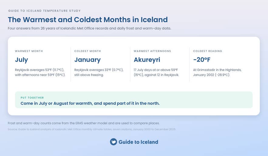
We analyzed 26 years of Icelandic Met Office temperature records and daily frost and warm-day data to find the warmest and coldest months in Iceland. The warmest summer days are not on the coast most visitors drive, and the coldest month is milder than the name Iceland suggests.
The story of why Iceland is called Iceland begins with a settler who climbed a mountain and saw a fjord packed with drift ice. The name has oversold the cold ever since.
Winter tours are far from the only way to see Iceland, and the months in this study show why. In July, the warmest month, we recommend camping in Iceland and self-drive tours through the north, where the warm afternoons are. January is the coldest month in Iceland, and it falls in the heart of the northern lights season.
Why You Can Trust Our Content
Guide to Iceland is the most trusted travel platform in Iceland, helping millions of visitors each year. All our content is written and reviewed by local experts who are deeply familiar with Iceland. You can count on us for accurate, up-to-date, and trustworthy travel advice.
The temperatures in this study come from the seven Icelandic Met Office weather stations. Each one records the average, the daily high, and the daily low for every month. Their readings decide the warmest and coldest months and places.
The seven stations are Reykjavik, Keflavik, Stykkisholmur, Akureyri, Grimsstadir, Dalatangi, and Vatnsskardsholar on the South Coast near Vik. An eighth station, Storhofdi in the Westman Islands, is included for the years it published, 2000 to 2013.
To determine how many nights froze or how many afternoons turned warm, we used a weather model called ERA5. It rebuilds past weather day by day from satellite and station data. From this, we counted two kinds of day at eleven locations.
A frost day drops to 32°F (0°C) or below. A warm day reaches 59°F (15°C) or above. The model smooths out fjords and headlands, so we used it only to count days and to compare places.
Key Findings
-
July is the warmest month in Iceland. Reykjavik averaged 53°F (11.7°C) in July from 2000 to 2025, with afternoons at 59°F (15.0°C) and nights near 49°F (9.3°C). August followed at 52°F (11.3°C). Dalatangi on the East Coast is the one station where August is warmer than July.
-
Iceland has four different coldest months. January is the coldest month in Reykjavik and along the south and west coasts. December is the coldest in Akureyri and the Highlands. February is the coldest in the Westman Islands, and March is the coldest at Dalatangi in the east.
-
Reykjavik's coldest month averages above freezing. January in the capital runs at 33°F (0.7°C), and the South Coast station near Vik averages 36°F (2.0°C) in its coldest month. Inland, Grimsstadir in the Northeast Highlands falls to 25°F (-3.9°C) in December.
-
Akureyri has Iceland's warmest summer afternoons. The northern town's average July high is 60°F (15.5°C) against 59°F (15.0°C) in Reykjavik. Akureyri reaches 59°F (15°C) on about 17 days in an average July. Reykjavik reaches it on about 12 days, and the South Coast near Vik reaches it on fewer than one.
-
The Northeast Highlands hold both ends of Iceland's thermometer. Grimsstadir, a highland weather station east of Lake Myvatn, recorded the study's lowest reading, -20°F (-28.9°C) in January 2002, and its second-highest, 81°F (27.4°C) in August 2021. The highest, 81.5°F (27.5°C), came from Akureyri in July 2021.
-
July is the only month with no frost anywhere in Iceland. Every one of the eleven locations stayed above 32°F (0°C) on every July night from 2000 to 2025. August came close, with four frost nights at Grimsstadir across the 26 years and none anywhere else.
-
Reykjavik freezes on about half of its January nights. The capital averages 17 frost nights in January. Akureyri in the north and Egilsstadir in the east average about 23. Grimsstadir in the Highlands averages 27, and the South Coast near Vik averages 11.
Cite This Study
The charts and data in this study are free to use under CC BY 4.0. Credit Guide to Iceland and link to this page. Every chart has an Embed button underneath it with ready-to-paste code.
July Is the Warmest Month in Iceland
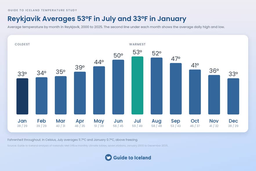
July is the warmest month in Iceland at seven of the eight weather stations in this study. Reykjavik averaged 53°F (11.7°C) in July between 2000 and 2025. A typical July afternoon reached 59°F (15.0°C), and a typical night fell to 49°F (9.3°C).
August comes a close second to July in Iceland. Reykjavik averaged 52°F (11.3°C) in August, just behind July. Together the two months make up Iceland's summer as the thermometer sees it.
The exception is Dalatangi on the east coast, where August is the warmest month at 49°F (9.4°C). The sea around the eastern headland warms slowly, so the peak arrives a month late. The same lag pushes its coldest month back to March.
The table below shows average temperatures in Reykjavik for every month of the year, based on the 26 years from 2000 to 2025.
| Month | Average | Average high | Average low |
|---|---|---|---|
| January | 33°F (0.7°C) | 38°F (3.2°C) | 29°F (-1.8°C) |
| February | 34°F (0.9°C) | 39°F (3.7°C) | 29°F (-1.5°C) |
| March | 35°F (1.6°C) | 40°F (4.7°C) | 31°F (-0.8°C) |
| April | 39°F (4.1°C) | 46°F (7.5°C) | 35°F (1.5°C) |
| May | 44°F (6.9°C) | 51°F (10.4°C) | 39°F (4.1°C) |
| June | 50°F (10.0°C) | 56°F (13.2°C) | 45°F (7.4°C) |
| July | 53°F (11.7°C) | 59°F (15.0°C) | 49°F (9.3°C) |
| August | 52°F (11.3°C) | 58°F (14.5°C) | 48°F (8.8°C) |
| September | 47°F (8.6°C) | 53°F (11.6°C) | 43°F (6.3°C) |
| October | 41°F (5.0°C) | 46°F (7.8°C) | 37°F (2.8°C) |
| November | 37°F (2.5°C) | 41°F (5.0°C) | 32°F (0.2°C) |
| December | 33°F (0.8°C) | 38°F (3.4°C) | 29°F (-1.6°C) |
July 2019 was the warmest single month in Reykjavik's record, at 56°F (13.4°C). The hottest reading in the capital across the 26 years was 78°F (25.7°C), on July 30, 2008.
July pairs the warmth with the last of the midnight sun and every road in the country open. Nights stay near 49°F (9.3°C), which makes July and August the most comfortable months for camper van rentals and hiking in Iceland. August tours in Iceland run in nearly all of July's warmth, at 52°F (11.3°C) in the capital.
January Is Iceland's Coldest Month on the Coast, and December Is Coldest Inland
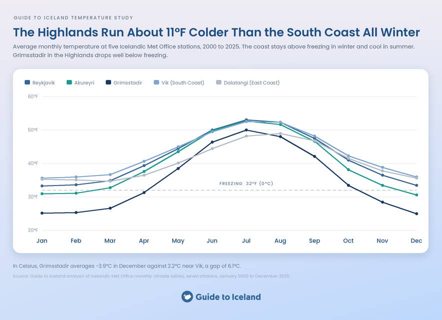
January is the coldest month along Iceland's south and west coasts, and December takes the title inland. Reykjavik averaged 33°F (0.7°C) in January between 2000 and 2025. Keflavik averaged 34°F (1.0°C), Stykkisholmur averaged 32°F (0.2°C), and the South Coast station near Vik averaged 36°F (2.0°C).
In the north and the Highlands, December edges out January by a fraction of a degree. Akureyri bottomed out at 31°F (-0.8°C) in December, and Grimsstadir fell to 25°F (-3.9°C). January followed within two tenths of a degree at both.
The east and the islands break the pattern again. Dalatangi on the east coast is coldest in March, at 35°F (1.5°C), because the sea around it cools slowly through the winter. Storhofdi in the Westman Islands is coldest in February, at 36°F (2.4°C).
Four different coldest months in one small country sounds dramatic, and the numbers say otherwise. From December to March, Reykjavik's monthly averages sit within 2 degrees Fahrenheit (1°C) of each other. Winter in Iceland is one long, flat cold season rather than a single cold month.
For travelers, that flatness means daylight decides the winter month more than the cold does. December has the longest nights for the northern lights. February has the same temperatures, and its days are several hours longer.
Iceland's Winter Is Milder Than Its Latitude Suggests
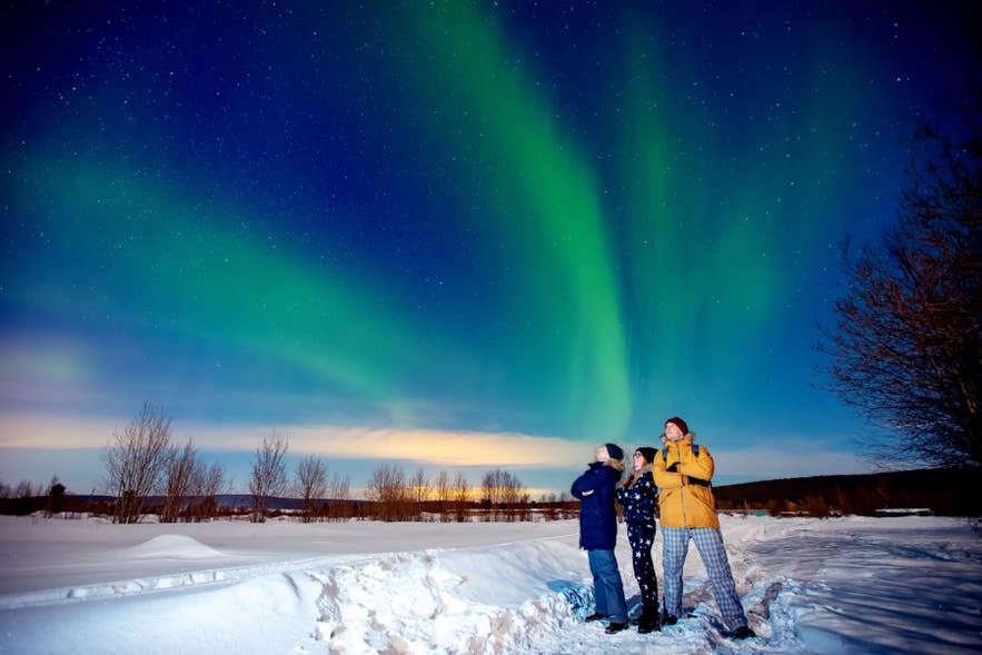 Iceland's winter is milder than its latitude suggests because the sea around the island stays warm. Reykjavik sits at 64 degrees north, the latitude of central Alaska. Its coldest month still averages 33°F (0.7°C), just above freezing. An average January night brings a light frost of 29°F (-1.8°C).
The reason is the warm North Atlantic Current, the tail end of the Gulf Stream. It flows past the south and west coasts and keeps the sea, and the air over it, from freezing in winter. The Westman Islands and the South Coast near Vik average 36°F (2.4°C and 2.0°C) in their coldest months, the mildest winters in the study.
The mildness is a coastal effect. Grimsstadir, inland in the Northeast Highlands, averages 25°F (-3.9°C) in December, about 11 degrees Fahrenheit (6°C) below the South Coast.
What makes an Icelandic winter feel cold is the wind on that mild air. A 33°F (0.7°C) afternoon in a 30 mph (48 km/h) gust feels far colder than the thermometer says. Our study of the windiest and least windy months in Iceland measures how often that happens.
That is why dressing for an Icelandic winter starts with a windproof shell rather than heavy insulation. Iceland in January asks for layers, a hat, and gloves, and rarely for anything an Alaskan would call cold-weather gear.
Short days, storms, and ice make December the worst month to visit Iceland, according to our study of Iceland's weather. December gives 3.9 hours of daylight a day and brings 12.5 storm days a month that can close roads. Plan a winter trip around fewer driving hours and a spare day for storms.
North Iceland Gets the Country's Warmest Summer Afternoons
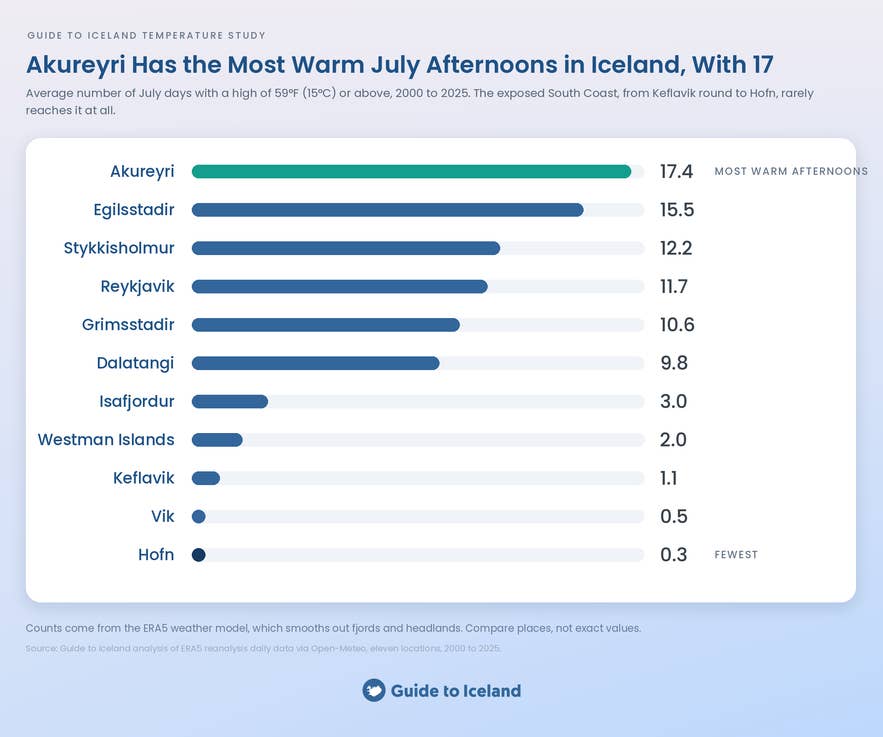
North Iceland has the country's warmest summer afternoons, measured by how often the thermometer reaches 59°F (15°C). Akureyri reached that mark on about 17 days in an average July between 2000 and 2025. Egilsstadir in the east reached it on about 16 days.
Reykjavik managed about 12 such days in an average July. The South Coast near Vik managed fewer than one.
The table below ranks the eleven locations by July days at or above 59°F (15°C), averaged over 2000 to 2025.
| Location | July days at or above 59°F (15°C) |
|---|---|
| Akureyri | 17.4 |
| Egilsstadir | 15.5 |
| Stykkisholmur | 12.2 |
| Reykjavik | 11.7 |
| Grimsstadir | 10.6 |
| Dalatangi | 9.8 |
| Isafjordur | 3.0 |
| Westman Islands | 2.0 |
| Keflavik | 1.1 |
| Vik | 0.5 |
| Hofn | 0.3 |
The exposed south barely registers. Keflavik counts about one warm day in an average July, Vik counts half a day, and Hofn counts a third of one. The Westman Islands reach 59°F (15°C) on about two July days.
Inland and northern places fill the top of the table. Stykkisholmur and Grimsstadir both beat Reykjavik. Grimsstadir's 11 warm July days come at a station whose December averages 25°F (-3.9°C).
The average July high tells the same story. Akureyri's afternoons average 60°F (15.5°C). Reykjavik's average 59°F (15.0°C), the South Coast near Vik averages 57°F (14.0°C), and Dalatangi on the east coast averages 53°F (11.4°C).
The sea that keeps the south mild in winter keeps it cool in summer. The northern valleys sit behind the Highlands, sheltered from the ocean, and warm up when the sun stays high. The warm afternoons come with cooler nights, since Akureyri's July nights average 48°F (8.8°C) against 49°F (9.3°C) in Reykjavik.
For a warm-weather trip, that argues for spending the summer days around Akureyri, Lake Myvatn, and the Eastfjords. A self-drive tour of the complete Ring Road passes through the warm north in the middle of the loop.
Our study of the sunniest month in Iceland found the north out-suns Reykjavik in June. June and July in the north therefore pair warmth with sun.
The Highlands Are a Different Climate From the Coast
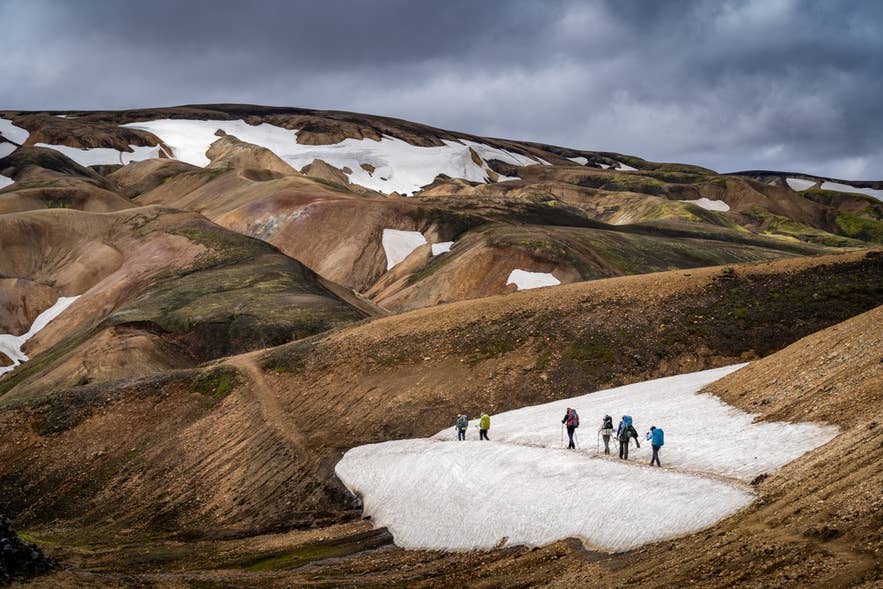
The Highlands are a different climate from the coast, colder in every month and more extreme at both ends. Grimsstadir, the highland weather station east of Lake Myvatn, recorded the lowest temperature in this study, -20°F (-28.9°C), on January 26, 2002. It also recorded the second-highest, 81°F (27.4°C), on August 25, 2021.
The hottest reading of all came from Akureyri five weeks earlier. The town reached 81.5°F (27.5°C) on July 20, 2021, a tenth of a degree above Grimsstadir. Both records belong to the northeast.
Winter in the Highlands runs about 10 to 11 degrees Fahrenheit (5.6 to 6.1°C) colder than the South Coast from December through March. Grimsstadir averages between 25 and 27°F (-3.9 and -3.0°C) across those four months. Its average January night falls to 18°F (-7.8°C).
Frost reaches into the Highlands' summer. Grimsstadir averages about two frost nights in June and about five in September. It is the only place in the study with any August frost, four nights across the 26 years, the coldest at 30°F (-1.2°C).
The coast sees nothing like it. Reykjavik and the South Coast near Vik average no frost nights at all from June through August.
The Highlands' winter matters most to anyone driving the Ring Road between the north and the east. The Highland roads themselves close for the season, but Route 1 crosses the plateau's northeastern edge at Grimsstadir. That stretch runs about 10 degrees Fahrenheit (-12°C) colder than the coast all winter, which is worth knowing before driving in Iceland in the dark months.
Frost Nights Decide Iceland's Winter Driving Season
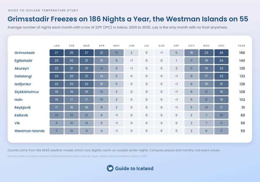
Frost nights decide when Iceland's roads turn icy, and the count differs sharply from coast to interior. Reykjavik averages 17 frost nights in January, a little over half the month. Keflavik averages 14, and the South Coast near Vik averages 11.
Inland and in the north, frost is close to nightly. Akureyri averages 22 or 23 frost nights in January, Egilsstadir averages 23, and Grimsstadir averages 27. The Westfjords around Isafjordur average 21 or 22.
Over a full year, Reykjavik freezes on about 91 nights and Akureyri on about 139. Grimsstadir freezes on about 186 nights, more than half the year. Vik freezes on about 56 nights, and the Westman Islands freeze on about 55, the fewest of the eleven.
The frost season starts in the north first. Akureyri counts about 11 frost nights in October and Grimsstadir counts about 16, while Reykjavik counts about 5. By November, every location in the study is freezing on at least 6 nights a month.
Winter self-drives in Iceland run on frost nights like these. First-time winter drivers are better off on guided winter tours, where the driver has done the same icy road all season. Travelers who want their own car should choose a 4x4 rental and read up on winter driving before the first frost.
The freeze has an upside. Cold nights are what make ice caves in Iceland safe to enter. Our study of the safest month to visit ice caves in Iceland maps how cold is cold enough.
Frost nights are also prime northern lights conditions. The Blue Lagoon runs at 100 to 104°F (38 to 40°C) whatever the month, so the soak between sightings stays warm.
Planning Your Iceland Trip Around the Temperature
The temperature data settles three planning questions. It says when to come for warmth, where the warm days are, and how to pack for winter.
July and August Are the Only Reliably Mild Months in Iceland
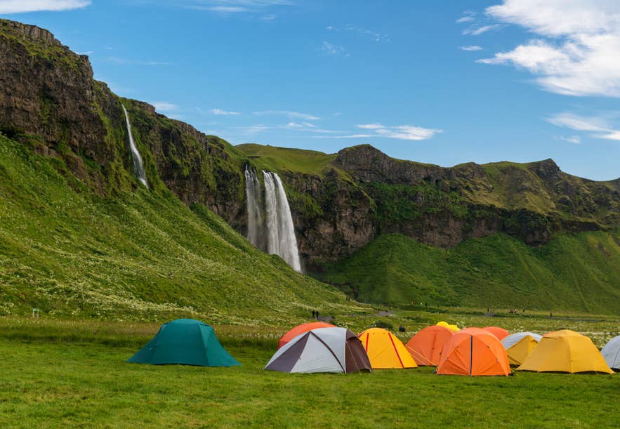
July and August are the only reliably mild months in Iceland, and the frost count shows why. July is the only month with no frost night anywhere in the study, and August comes within four nights of it, all at Grimsstadir. June still averages two frost nights in the Highlands, and September brings the frost back to Akureyri.
Nights stay near 49°F (9.3°C) in Reykjavik in July and 48°F (8.8°C) in August. That is the window for camping trips and for camper van rentals without a heater running all night. August keeps nearly all of July's warmth, at 52°F (11.3°C) against 53°F (11.7°C).
A Warm-Weather Trip Belongs in North Iceland
 A warm-weather trip to Iceland belongs in the north and the inland east, where the 59°F (15°C) afternoons are. Akureyri reaches that mark on about 52 days a year, and Egilsstadir reaches it on about 46. Reykjavik reaches it on about 26 days, and the South Coast near Vik reaches it on fewer than one.
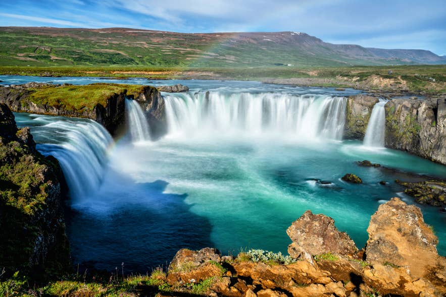
Whale watching from Akureyri puts those afternoons to use on the water of Eyjafjordur. Akureyri tours also reach Lake Myvatn and Godafoss Waterfall from the same base. A 10-day summer self-drive tour of the complete Ring Road reaches the north around its midpoint, so give that stretch the extra night.
The South Coast is still worth the drive, cool sea air included. Treat a 57°F (14°C) July afternoon at Reynisfjara Black Sand Beach as the price of the sights. Bring the windproof layer you would pack for Reykjavik.
Winter on Iceland's Coast Needs Layers Rather Than Arctic Gear
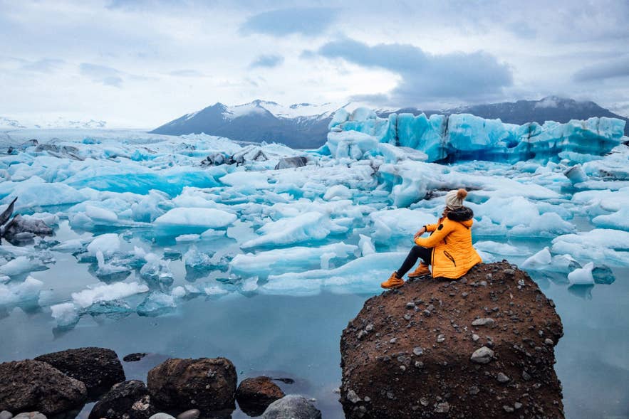
Winter on Iceland's coast needs layers and a windproof shell, since the coldest month averages above freezing in Reykjavik. The capital's coldest reading in 26 years was 5°F (-15.2°C), on December 31, 2022. Keflavik touched 8°F (-13.1°C) the same night, and an average January night is 29°F (-1.8°C).
Guided winter tours suit first-time visitors to Iceland and anyone new to icy roads. The driver handles the frost nights, and the operator reshapes the day when a road closes. Many of the winter departures are built around the northern lights, so the hunt is part of the itinerary.
Winter self-drive tours in Iceland work for travelers who prefer independence. A 4x4 and a buffer day for every four or five on the road cover the frost nights.
The frost nights are also the aurora nights. Northern lights hotels in Iceland sit away from town lights, and some offer a wake-up call when the aurora appears. That puts the coldest hours of the trip on a doorstep rather than a roadside.
Inland winter is the exception, and the Ring Road touches it. The Highland roads close for the season, but Route 1 crosses the plateau's northeastern edge at Grimsstadir, between Lake Myvatn and Egilsstadir. Anyone driving that stretch in winter should pack for days that average 25°F (-4°C) and nights near 18°F (-8°C), and Grimsstadir has gone as low as -20°F (-28.9°C).
What This Iceland Temperature Study Does Not Tell You
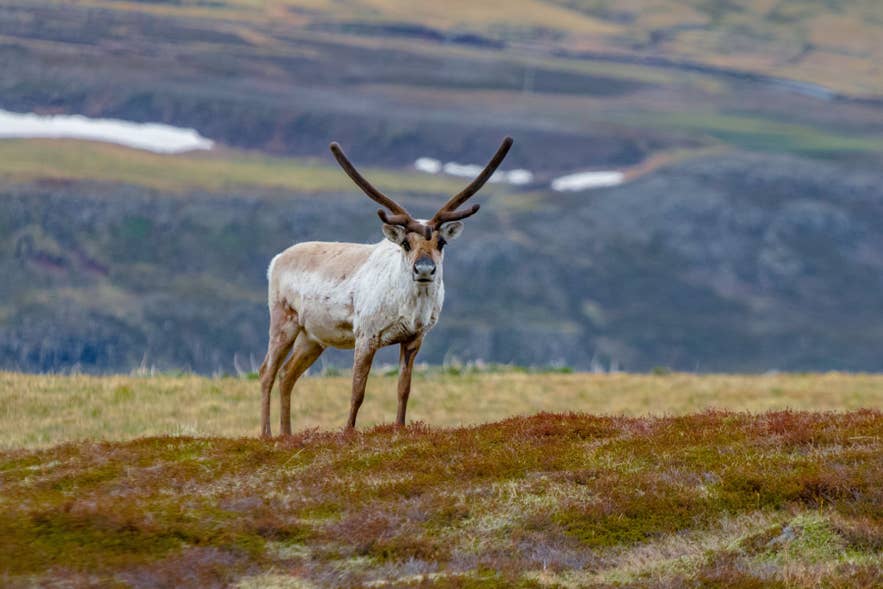 This temperature study ranks Iceland's months and places by how warm and how cold they run. Its limits matter as much as its findings.
-
A 26-year average is not a forecast for your week. Reykjavik's January averages 33°F (0.7°C), and on December 31, 2022, it fell to 5°F (-15.2°C). A cold snap or a warm spell can move a week far from the average. Use the study to choose a month and the forecast to pack for the week.
-
The frost and warm-day counts come from a weather model. The monthly temperatures are measured at Icelandic Met Office stations. The day counts come from ERA5, which estimates conditions across grid cells several miles wide and smooths out fjords, headlands, and city streets. It records fewer frost nights on the coast than a town thermometer would. The counts therefore compare months and places rather than stand as exact figures.
-
Three of the eleven locations have no station temperature behind them. Isafjordur, Egilsstadir, and Hofn appear only in the frost and warm-day counts. Every temperature in degrees in this study comes from one of the eight stations.
-
Storhofdi's record stops in 2013. The Westman Islands figures describe 2000 to 2013, and they are kept out of any comparison that needs all 26 years.
-
Temperature is not what the weather feels like. A 33°F (0.7°C) January afternoon in Reykjavik is a different day in still air and in a 30 mph (48 km/h) wind. This study does not measure wind chill. Our studies of the windiest and least windy months in Iceland and the rainiest and driest months in Iceland cover the wind and the wet.
-
The averages hide the daily swing. A July mean of 53°F (11.7°C) in Reykjavik comes from afternoons near 59°F (15°C) and nights near 49°F (9°C). The table in the July section gives the highs and lows for the capital only.
-
The study does not test for change over time. The averages describe 2000 to 2025 as a single block. We did not look for a warming or cooling trend, and nothing here should be read as a statement about climate change.
How We Built the Iceland Temperature Study
The temperature study has two parts. Monthly temperatures come from Icelandic Met Office weather stations. Frost and warm-day counts come from a daily weather model, because the published station tables give monthly figures rather than daily readings.
1. Monthly Temperatures From Eight Met Office Stations
We took the monthly mean temperature, the mean daily maximum, and the mean daily minimum from the Icelandic Met Office's published monthly tables. The window runs from January 2000 to December 2025, or 312 months per station, with no gaps at any of the seven main stations.
Reykjavik and Keflavik Airport represent the southwest. Stykkisholmur covers the Snaefellsnes Peninsula in the west, and Vatnsskardsholar covers the South Coast near Vik. Akureyri covers the north, Grimsstadir covers the Northeast Highlands, and Dalatangi covers the east coast.
Storhofdi in the Westman Islands is the eighth station. Its temperature record in the published tables ends in April 2013, so its figures cover January 2000 to April 2013 and sit outside any 26-year comparison. Isafjordur's Met Office station records precipitation only, so it has no place in this part of the study.
The monthly averages are plain 26-year means, rounded to the nearest whole degree in Fahrenheit and to one decimal in Celsius. The record highs and lows are the single highest and lowest readings at each station within the window, and they are not all-time national records.
2. What We Counted as a Frost Day and a Warm Day
A frost day is any day on which the lowest temperature reached 32°F (0°C) or below. It is the threshold at which wet roads ice over, and the one that matters to winter drivers.
A warm day is any day on which the highest temperature reached 59°F (15°C) or above. It is a mild afternoon by Icelandic standards and a rare one on the South Coast.
Both counts are averaged per calendar month across the 26 years. A figure such as "17 warm days in July" means an average July in Akureyri, not every July.
3. Where the Day Counts Come From
Daily maximum and minimum temperatures for 2000 to 2025 came from the Open-Meteo historical weather API. Open-Meteo serves the ERA5 family of reanalysis models, produced by the European Centre for Medium-Range Weather Forecasts.
ERA5 is a weather model run backward over past decades and corrected against the observations that exist. It fills in a daily record for any point on the map, including places with no thermometer.
We pulled the daily series for the coordinates of the eight stations above plus Isafjordur, Egilsstadir, and Hofn, eleven points in all. That set matches our rainfall and sunshine studies. The model smooths out fjords and headlands, and it runs slightly warm on winter nights at the coast. It therefore counts fewer frost nights in Reykjavik than the station would.
The day counts therefore compare months and places with each other. Every temperature in degrees comes from the station records.
4. Units and Rounding
Temperatures are given in Fahrenheit first, with Celsius in brackets, because those are the units most of our readers know. Icelandic forecasts and thermometers use Celsius.
Monthly averages are rounded to the nearest degree Fahrenheit and to one decimal in Celsius. Record readings keep one decimal in both. Day counts are rounded to the nearest whole day, and to one decimal where two places run close.
5. Sources
-
Icelandic Met Office, monthly climate tables by station (Manadargildi), accessed September 2026.
-
Copernicus Climate Change Service, ERA5 hourly data on single levels, accessed through the Open-Meteo historical weather API, September 2026.
-
Guide to Iceland, The Windiest and Least Windy Months in Iceland: A 26-Year Wind Study, 2026.
-
Guide to Iceland, What Is the Sunniest Month in Iceland? A 26-Year Sunshine Study, 2026.
-
Guide to Iceland, The Rainiest and Driest Months in Iceland: A 26-Year Rainfall Study, 2026.
Conclusion
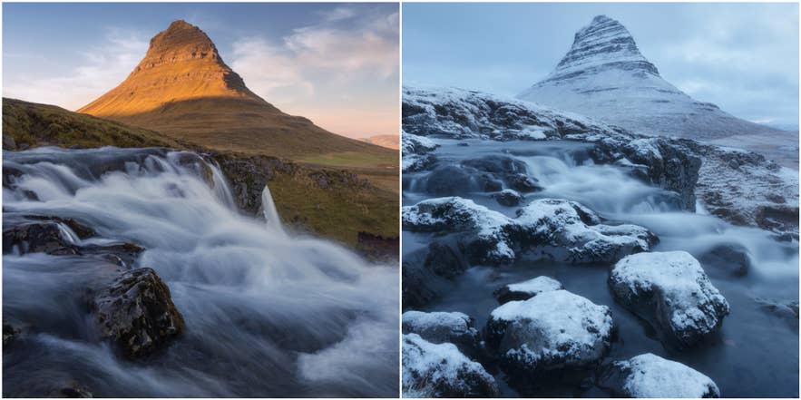
Iceland runs milder in winter and cooler in summer than its latitude suggests, and the exceptions are inland.
July is the warmest month in Iceland, at 53°F (11.7°C) in Reykjavik, and August follows at 52°F (11.3°C). January is the coldest month on the coast, at 33°F (0.7°C) in the capital, and December is the coldest inland.
Akureyri has the country's warmest summer afternoons. It reaches 59°F (15°C) on about 17 July days. Reykjavik reaches it on about 12 days, and the South Coast near Vik reaches it on fewer than one.
The northeast holds both records. Grimsstadir fell to -20°F (-28.9°C) in January 2002, and Akureyri climbed to 81.5°F (27.5°C) in July 2021.
Three points cover most trips.
-
Come in July or August for warmth, and stay in Akureyri for a few nights. The town's July afternoons average 60°F (15.5°C), and it reaches 59°F (15°C) on about 52 days a year.
-
Pack layers and a windproof shell for winter on the coast, where Reykjavik averages 33°F (0.7°C) in January. Guided small-group tours take the icy roads off your hands.
-
Treat the Highlands as a separate climate, and save Highland tours for July and August. Grimsstadir still averages two frost nights in June and five in September, and it runs about 11 degrees Fahrenheit (6°C) colder than the South Coast all winter.
A 26-year average describes a normal July or January, and only the Met Office forecast can describe yours. This study is the tool for choosing the month and the region. The forecast, checked in the week before you fly, is the tool for choosing the layers.
Related reading from Guide to Iceland:
This study is part of a series Guide to Iceland runs on original data. The companion weather studies cover the windiest and least windy months, the sunniest month, and the rainiest and driest months in Iceland. A fifth study combines rain, wind, temperature, and daylight to rank the best and worst months to visit Iceland.

Guide to Iceland Editorials is the shared byline for our content team. We use it on pieces several people worked on together, where no single writer owns the article, and on anything rewritten often enough that a personal byline would be misleading. We also publish our original data studies under this profile. Each study answers a question travelers ask about Iceland, using primary sources such as booking records, traveler reviews and public datasets, and every study is quality checked by human experts before it's published. Everything under this byline is researched and reviewed by people who live and work in Iceland. If you spot something out of date or want to suggest a correction, message us and it reaches the whole team.