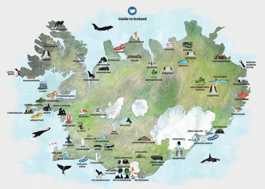
Find the map of Iceland you need with these 20 Icelandic attraction maps. We have created all the essential maps of Iceland's must-see attractions to help you plan the perfect Iceland vacation and easily navigate where to go.
Exploring Iceland starts with knowing where to go and how to get there. Whether you want to explore the Ring Road for a complete island loop, visit famous waterfalls in Iceland, or explore Reykjavik’s highlights, having a reliable Iceland map makes planning easy.
Why You Can Trust Our Content
Guide to Iceland is the most trusted travel platform in Iceland, helping millions of visitors each year. All our content is written and reviewed by local experts who are deeply familiar with Iceland. You can count on us for accurate, up-to-date, and trustworthy travel advice.
We’ve included maps of Iceland showing you which attractions are near each other so you can plan efficient routes, decide on accommodations in Iceland, and choose whether to take guided tours or enjoy self-drive adventures. From detailed regional maps to comprehensive Iceland sightseeing maps, you’ll find everything you need to organize your ideal trip.
If you'd like an even easier way to plan, our extensive selection of vacation packages to Iceland all include pre-mapped itineraries with must-see stops along the way.
Whether you’re interested in waterfalls, volcanoes, or fun things to do in the cities, use the Iceland maps in this guide to help you explore the country’s top attractions and hidden gems. Read on to find the perfect map of Iceland for your adventures!
-
Find out exactly How Many Days to Spend in Iceland
-
Discover the Best Attractions by the Ring Road of Iceland
Iceland Quick Facts
 Want to know more about Iceland before your trip? Let's look at a few useful facts to learn more about the country.
Where Is Iceland?
Before diving into the various maps of Iceland, firstly, let's answer where Iceland is on the world map. Iceland is a European island country in the North Atlantic Ocean, about halfway between Norway and Greenland. Most of Iceland is just south of the Arctic Circle, though the tiny island of Grimsey is within the limits of the Arctic Circle.
-
Read more: Where is Iceland?
-
See also: Iceland and Greenland - What's the Difference Between the Countries?
What Are the Regions of Iceland?
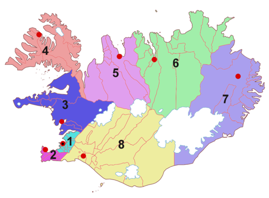
Iceland is divided into eight regions. Take a look at the map of Iceland's regions below.
Image by Bjarki S on Wikimedia Commons
The regions of Iceland are:
-
Capital Region
-
Southern Peninsula
-
West Iceland
-
Westfjords
-
Northwest Iceland
-
Northeast Iceland
-
East Iceland
-
South Iceland
There's a bit of overlap between Northwest Iceland and Northeast Iceland. Sometimes, they're collectively referred to as North Iceland. Sometimes, the Icelandic Highlands, located in central Iceland, are referred to as a region of their own.
What’s the Best Way To Get Around Iceland?
The best way to explore Iceland is by renting a car, which gives you the freedom to travel at your own pace. If you plan to drive, make sure to learn how to drive safely in Iceland before setting off.
For those who prefer not to drive, guided bus tours offer a convenient way to visit Iceland’s top sights. These tours provide expert insights while covering popular routes like the Golden Circle, South Coast, and beyond.
In the following sections, you’ll find detailed maps of Iceland’s most popular routes and attractions, along with details on the best ways to explore.
-
Learn more: The Ultimate Guide to Transportation in Iceland
Iceland Road Maps and Routes
Exploring Iceland’s diverse landscapes by car is easy with the right map. Whether you’re planning a drive around the Ring Road, a visit to the Snaefellsnes Peninsula, or a shorter trip near Reykjavik, these maps of Iceland will help you navigate key routes and must-see attractions.
While especially useful for anyone looking to embark on budget-friendly self-drive tours around Iceland, there are also alternative ways to explore the destinations marked on the maps.
Picking a base from Reykjavik's extensive selection of accommodations and embarking on day trips from the capital to explore other parts of Iceland is not only possible but also convenient.
Learn more and be inspired by all the possible routes pinpointed for you on the Iceland maps below!
Iceland Ring Road and Snaefellsnes Map With Attractions
This Iceland sightseeing map highlights all the main attractions along the Ring Road and Snaefellsnes Peninsula. The Ring Road (Route 1) is the most comprehensive road trip route in Iceland, as it circles the entire island.
You can use the detailed road map of Iceland above to plan your route and ensure you don’t miss key stops. Just zoom in to have a closer look!
This map of Iceland's attractions includes the most famous waterfalls, volcanoes, glaciers, and beaches along the route. It's also easy to stray a little off the Ring Road to include some of the lesser-known attractions in the beautiful Eastfjords.
If you want to visit Iceland's northern or eastern regions, you should aspire to drive the whole circle from Reykjavik. It's roughly the same distance to drive from Reykjavik to the town of Egilsstadir in East Iceland via the northern or southern routes. And the two routes show a vastly different side of the country.
It's possible to drive the Ring Road without the Snaefellsnes peninsula in six days, but the longer you take, the more sites you can see and the longer you can spend at them. For example, you can do a 10-day self-drive tour of Ring Road and the Snaefellsnes peninsula, which will allow you to see many of the major sights in Iceland.
Iceland Ring Road and Westfjords Map With Attractions
The Westfjords are Iceland's second most remote area, right after the uninhabited Highlands. It's not part of the Ring Road and requires a bit of a detour. But by adding it to the trip, along with the Snaefellsnes peninsula, you'll fully encircle Iceland, as seen on this second Iceland driving map.
Many of the roads in the Westfjords are gravel, and snowstorms on mountain passes are common, so you'll need to take your time as you drive from one scenic fjord to another.
The Westfjords are barely accessible during winter due to heavy snowfalls, closed roads, and even avalanche threats, but they are magical in summer. So think of this as the off-the-beaten-road Iceland attractions map.
You can take the ferry Baldur between Stykkisholmur and Brjanslaekur in the Westfjords to decrease driving time, with an optional stop at the tranquil Flatey island, one of the hidden gems in Iceland.
If you want to spend two weeks exploring the whole country at an affordable price, this 14-day budget self-drive tour of the Ring Road is a great option.
For those who prefer a bit more comfort during your stay, this 14-day self-drive around Iceland and Westfjords tour includes some fantastic Iceland hotels.
Westfjords Map With Attractions
You can also explore the beautiful Westfjords on your own. See the Westfjords map above for an overview of the top attractions.
The capital of the Westfjords region is the town of Isafjordur. With a population of just over 2,500, it makes an excellent base for exploring the sights of the remote Westfjords.
These sights include the Hornstrandir Nature Reserve, home to Arctic foxes and some of Iceland's most notable birds, like Arctic terns and black guillemots. If you want to go birdwatching, visit the Latrabjarg bird cliffs. The cliffs are 9 miles (14 kilometers) long and are the largest bird cliffs in Europe, so it's a great place to see the famous Iceland puffin.
While in the Westfjords, you can also visit the "Jewel of the Westfjords," the stunning Dynjandi waterfall with its cascading flow down dramatic cliffs. We also recommend seeing Raudisandur beach, which is unusual for Iceland as its sands are naturally reddish-pink rather than the typical volcanic black.
Try this two-day wildlife tour in the Westfjords to see what animals you can spot, or go on a 10-hour small group hiking tour through the Hornstrandir Nature Reserve. The Westfjords also have excellent opportunities for kayaking — you could even see whales or dolphins on this 2-hour kayaking tour departing from Isafjordur.
-
Check out the Ultimate Guide to the Westfjords of Iceland
-
Also, learn about Birds in Iceland
The Golden Circle & West Iceland Driving Map With Attractions
This map of Iceland attractions features the best locations in Southwest Iceland, including the Golden Circle sites and the many highlights of the Snaefellsnes peninsula.
The Golden Circle is the country's most popular sightseeing route and an excellent choice for those who find the Westfjords too remote or visit in the winter.
You can visit the Gullfoss waterfall, the Geysir geothermal area, and Thingvellir National Park. The map also includes sights like the Hraunfossar waterfall and attractions such as the world-famous Blue Lagoon.
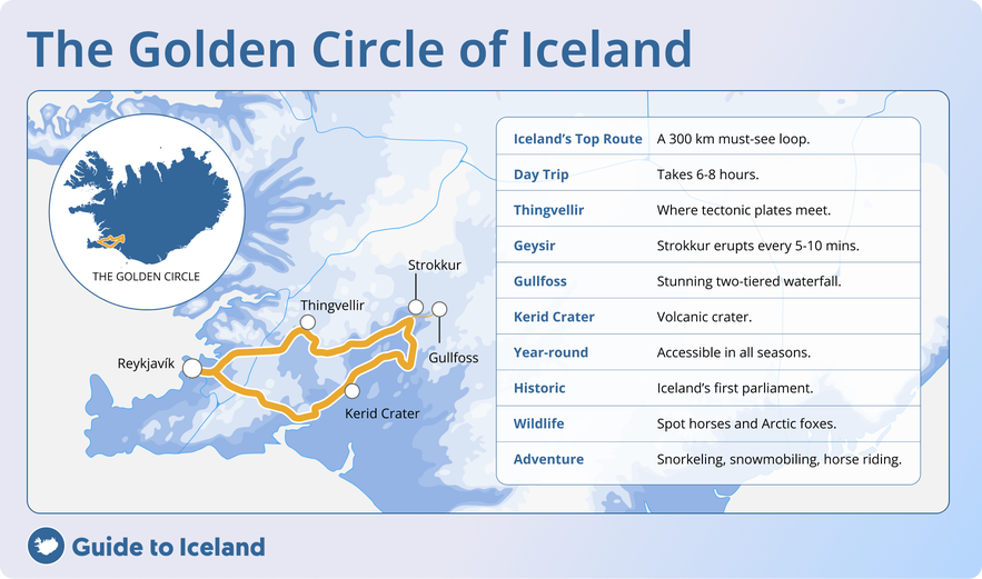
While traveling in West Iceland, you may want to spend more than a day exploring the Snaefellsnes peninsula. This two-day West Coast and Snaefellsnes peninsula winter tour is a great option to make the most of each location, whereas this six-day winter self-drive tour of the Golden Circle and Snaefellsnes peninsula is tailored towards northern lights hunting.
Iceland's South Coast and Snaefellsnes Peninsula Driving Map
The landscape of the South Coast of Iceland is known for its dramatic volcanic deserts and beautiful waterfalls. It has quickly become one of the most popular routes because it's close to Reykjavik and accessible. In one day, you can enjoy a round trip of visiting black sand beaches, taking glacier hike tours, and exploring waterfalls and volcanoes.
You can reach the magnificent Jokulsarlon glacier lagoon in two days, and if traveling between mid-October and March, you can explore the insides of ice caves.
If you only have a few days in Iceland and want to spend time on the South Coast, you can take a two-day small group summer South Coast tour or a two-day winter South Coast tour that will take you to all the highlights.
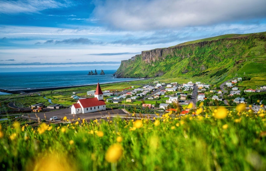
If you have more time to extend your adventure, the route shown on the Iceland map above continues west toward the stunning Snaefellsnes Peninsula in West Iceland.
Known as “Iceland in Miniature,” this area offers a mix of glaciers, lava fields, coastal cliffs, and small fishing villages. Highlights include Snaefellsjokull National Park, Kirkjufell mountain, and the black sand beaches near Djúpalónssandur.
Both the South Coast and the Snaefellsnes Peninsula are incredible routes that can be explored individually if you’re short on time. Each provides a compact yet unforgettable experience of Iceland's diverse landscapes, making them perfect for shorter trips or day excursions from Reykjavik.
If you have the flexibility, combining both routes, in addition to the famous Golden Circle, creates a seamless road trip showcasing the best of southern and western Iceland. If you want to enjoy all three of these routes on a budget, this seven-day budget self-drive tour of South Iceland is highly recommended.
If you're traveling to Iceland in the winter, the South Coast, the Snaefellsnes peninsula, and the Golden Circle are the three routes with good accessibility year-round.
-
Discover more: The Ultimate Guide to Iceland's South Coast
Map of Skaftafell Nature Reserve
Skaftafell Nature Reserve is located within Vatnajokull National Park in Southeast Iceland. You can see where the nature reserve is located on the map of Skaftafell below.
The nature reserve is a hiker's paradise with many hikes available, whether it be a day hike or a multi-day journey. It makes a suitable base camp for anyone who wants to climb Hvannadalshnukur, the highest peak in Iceland.
Other popular routes in the area include a walk up to Svartifoss waterfall with its iconic basalt columns and another to Svinafellsjokull glacier, an outlier glacier of Vatnajokull. You can also take a 3.5-hour easy glacier hike on the Fallsjokull glacier with a licensed guide.
Also nearby is the Jokulsarlon glacier lagoon, a large lake filled with enormous icebergs that break off from a glacial tongue and drift slowly out to sea. The lake is the deepest in Iceland and is also home to many seals that might say hi to visitors. The best way to experience this unique natural wonder is a boat tour of the Jokulsarlon lagoon to see the icebergs up close.
Map of Iceland's Natural Attractions
Iceland is home to breathtaking landscapes, from powerful waterfalls to volcanic marvels. This detailed map of Iceland's attractions highlights places of interest around the whole country, including hiking trails, geothermal areas, and iconic landmarks.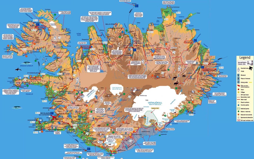 Explore more specific maps of Iceland’s natural highlights, including majestic waterfalls, soothing hot springs and swimming pools, and impressive volcanoes below. These guides will help you uncover Iceland’s most remarkable sights.
Map of Iceland's Waterfalls
Iceland's rugged landscape, with its wealth of glaciers and rivers, means there are more waterfalls than you can count all around the country. You don't even need to leave the city borders of Reykjavik since there's a waterfall found right in the valley of Ellidaardalur!
It would be impossible to try to count all the waterfalls that exist in Iceland. Many of them have no names, and new ones form each year from melting glaciers or changes in the ground due to earthquakes or volcanic eruptions. Check out our guide to Iceland's top 20 most beautiful waterfalls to discover the best ones to visit.
You can find a map of some of Iceland's most dramatic, powerful, and beautiful waterfalls above.
-
Learn more about Glaciers in Iceland
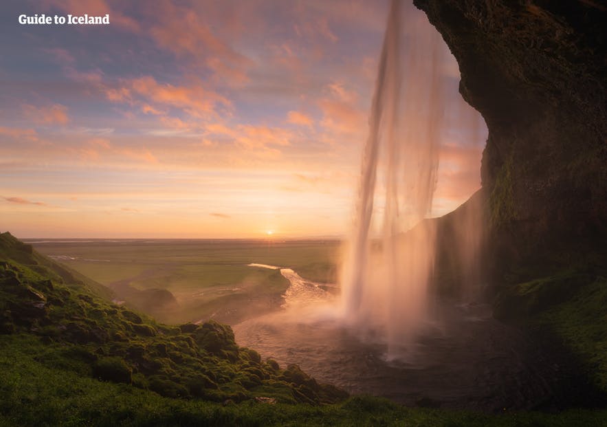
Gullfoss waterfall is Iceland's most famous waterfall. Its name, meaning "Golden Falls," is earned for its remarkable beauty and the rainbow crown that forms above it on sunny days. You can find it on the world-renowned Golden Circle route.
Seljalandsfoss waterfall and Skogafoss waterfall are a pair of popular and easily accessible waterfalls on the South Coast. They're 19 miles (30 kilometers) apart, connected by the Ring Road. Near them are other smaller waterfalls you can explore while there. Taking a small-group tour of the South Coast will not only bring you to both of these waterfalls, but you will also get to take part in an exciting glacier hike!
Only a short walk from Seljalandsfoss, you can find Gljufrabui waterfall. It is tucked between two cliffs, forming a hidden cave about 0.5 miles (800 meters) from Seljalandsfoss waterfall. Hiking up the trail at the top of Skogafoss waterfall will lead you to around 30 more waterfalls, one after the other.
Dettifoss waterfall, featured in the opening scene of the motion picture Prometheus, can be found in Northeast Iceland.
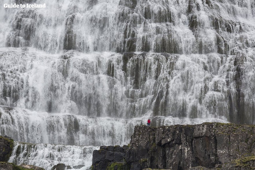
Glymur in the Westfjords is the tallest waterfall in the country that can be easily accessed. Another must-see waterfall in the Westfjords includes Dynjandi, pictured above, with its cascading water flowing down a tall cliff, making it a very dramatic sight.
Iceland is known for its hexagon-shaped basalt columns, which has even inspired some of the country's architecture. Svartifoss waterfall in the Skaftafell Nature Reserve has water flowing down a backdrop of black basalt columns, making it a very special waterfall.
-
See also: The Basalt Columns of Iceland
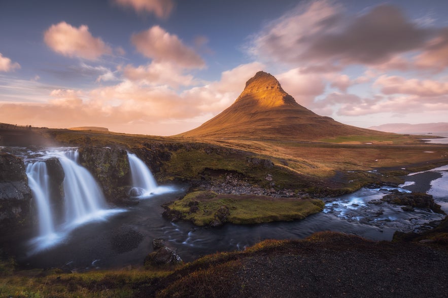
The smaller waterfalls are still impressive due to their picturesque nature or location, like Kirkjufellsfoss, which nestles close to the cone-shaped Kirkjufell mountain on the Snaefellsnes peninsula, or Hraunfossar falls, which trickles out of the lava in the western part of Iceland.
No matter which direction you decide to go, you'll surely find some impressive waterfalls.
While driving the Ring Road or through the Westfjords, you'll see more than you can count, providing countless photo opportunities and some magnificent sights.
-
See also: Waterfalls in Iceland
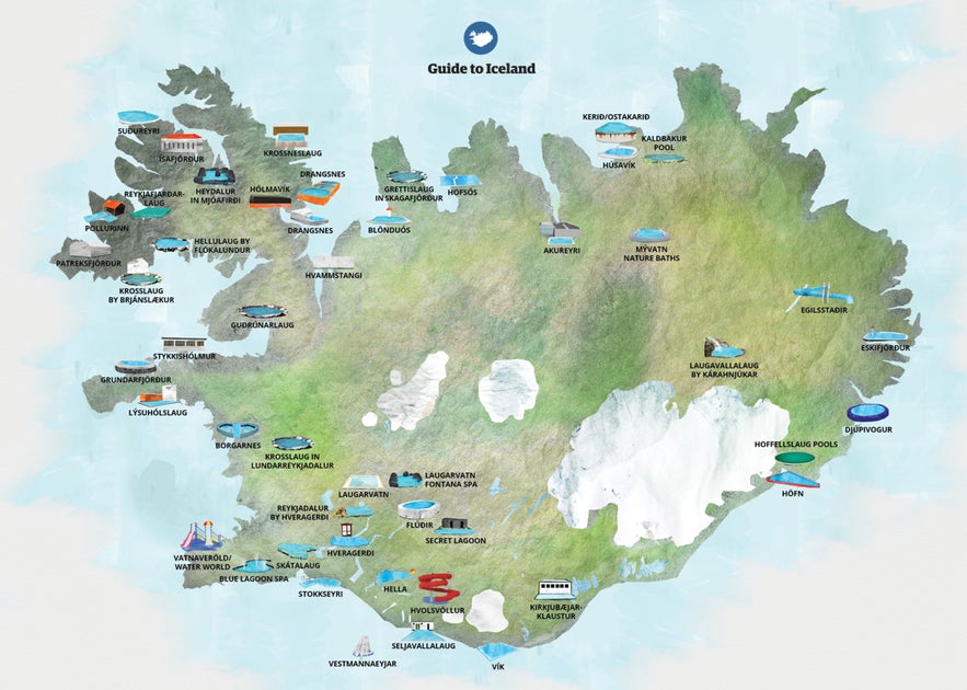
Map of Iceland's Hot Springs and Swimming Pools
One thing you'll notice while driving around Iceland is that every town and village, no matter how small, will have a swimming pool. This attraction map of Iceland highlights the country’s most popular pools and geothermal spas, perfect for unwinding on your trip.
The Greater Reykjavik area has a whopping 17 of them! In addition to the swimming pools in Reykjavik, there are also several hot springs and spas around the country you can bathe in, both human-made and natural.
You can easily find the swimming pools, as there will be a sign pointing the way to each one within each town, and since Iceland's towns and villages are small, finding them takes just minutes.
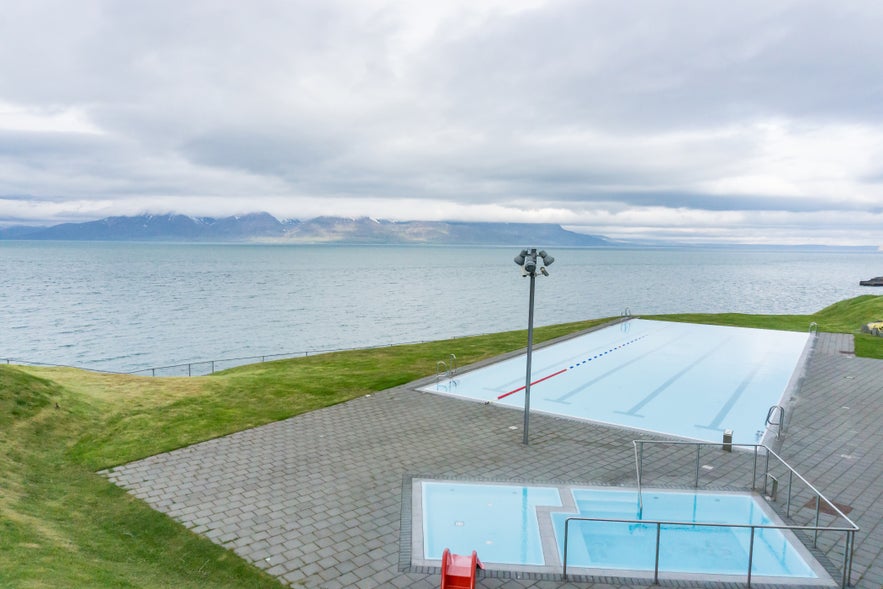
Arguably, the most stunning swimming pool in Iceland is the swimming pool in Hofsos, which boasts an undisturbed ocean view of Skagafjordur bay in North Iceland.
-
Discover the Best Swimming Pools in Iceland
The natural pools are harder to pin down as many do not appear on Google Maps. But it's such a treat that we've added the ones we can find to this map of Iceland with attractions. Some are in the middle of nowhere, with no roads near them. Others are unmarked, so it's best to ask the locals if there are any hot pools in the vicinity.
The pools also vary in look, size, and temperature. Some natural hot springs are forbidden to enter because of danger (high temperature or falling rocks) or to protect the pools and the delicate surrounding nature.
If the hot springs are on private land, you need to ask for permission before entering the pool.
The above map is for a two-week summer hot spring self-drive tour that lists many pools, spas, geothermal areas, natural hot springs, and notable attractions along the route.
Deciding which pools to seek out will depend on what you're looking for. If you want modern comforts like a changing room, showers, and bathrooms, you'll be looking for something quite different from a natural pool that requires you to disrobe outdoors in the sun, rain, wind, or snow.
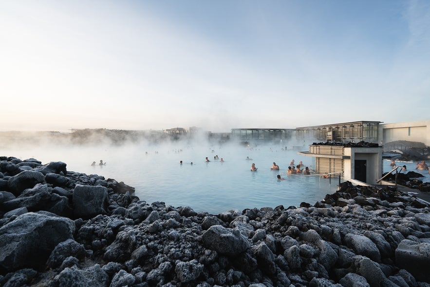
The Blue Lagoon is a world-famous geothermal water spa on the Reykjanes peninsula. It has showers, restrooms, changing facilities, on-site massages, a bar, a cafe, a restaurant, and even a hotel if you want to spend the night or have private access to the lagoon. Make sure to book your ticket to the Blue Lagoon early, as admission is limited and demand is high!
With a small geyser bubbling nearby, another hot pool is the historic Secret Lagoon by the town of Fludir in South Iceland. It is the oldest swimming pool in Iceland, built in 1891, but was transformed in the 21st century into a comfortable, warm geothermal pool. It has become more popular to combine a Golden Circle tour with the Secret Lagoon.
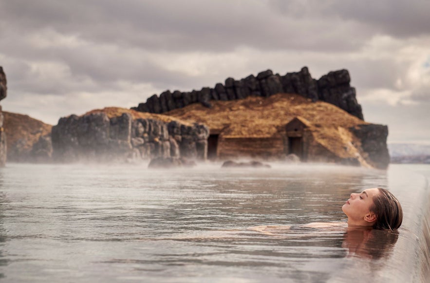 The Sky Lagoon is the perfect option if you'd prefer to stay in the capital region. Located in Kopavogur, it has a large geothermal pool with additional facilities, including a cold mist room, sauna and steam room, as well as a restaurant and an in-pool bar. It was opened in 2021 and has already gained a lot of popularity. If you're a Guide to Iceland customer, you also get a 15% discount off Sky Lagoon skincare products with the VIP Club.
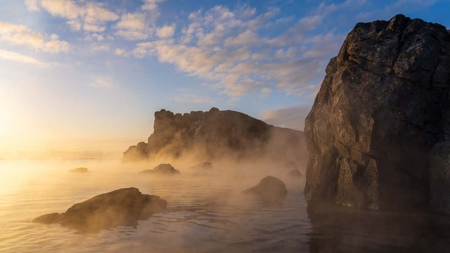
You can also head to Fontana Spa by Lake Laugavatn, where you can enjoy a sauna that's built right on top of a steaming geyser with a beautiful lake view. To lower the sauna's temperature, you simply open the door to let in some fresh air. The Earth Lagoon Myvatn in North Iceland offers a similar experience if you're exploring the region.
Krauma is one of the newest spa additions in Iceland, located right next to Deildartunguhver hot spring, the hot spring with the highest flow of water in the all of Europe. Getting a ticket to Krauma will grant you access to their sleek hot tubs and saunas, and don't forget to check out the stylish restaurant on-site.
Other new spas include the Geosea baths in North Iceland, fed with naturally heated saltwater, and the Vok Baths in the east.
Map of Iceland's Volcanoes
There are around 130 volcanoes in Iceland, although most are dormant.
The sheer amount of volcanoes means not all would fit on a map, but you can see the most notable ones above.
Some of them are very picturesque from afar, such as the Snaefellsjokull glacier volcano, which crowns the Snaefellsnes peninsula and, in clear weather, can be seen from the capital.
It's also famous for being the entry point to the Earth's core in Jules Verne's science fiction classic from 1864, Journey to the Center of the Earth.
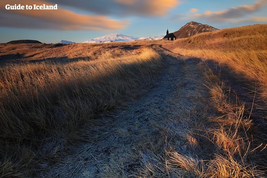
Other volcanoes require challenging but spectacular hikes to reach, such as Eyjafjallajokull, which is found right by the famous Fimmvorduhals trek. This volcano became world-famous in 2010 when its eruption grounded flights all over Europe for weeks, as well as puzzled news anchors and journalists attempting to pronounce its name.
You can also explore beautiful volcanic craters that are easy to hike up to and around, such as Hverfjall and Kerid. You can even enter the now dormant caldera of a volcano with the Inside the Volcano tour. It's the only caldera on Earth where you can descend into it and explore its vast and colorful magma chamber.
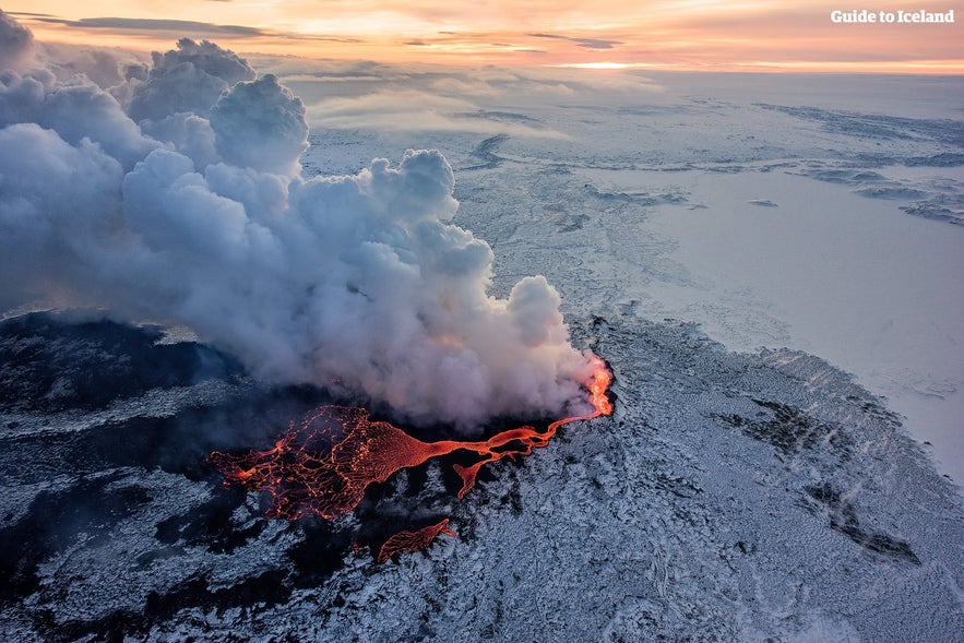
Other volcanoes are tucked away in the Highlands, such as Bardarbunga volcano or Holuhraun volcano, where their destructive powers can change the landscape but do no harm to towns or villages nestled on the country's shores. Even so, the effects of the ash on farmland and air travel can still be catastrophic.
-
Learn more: Iceland's Volcanoes: The Complete Guide
Reykjavik Maps
Almost all guests will spend at least one night of their holiday in Reykjavik, Iceland's capital. Naturally, we have more than one map of Reykjavik for you.
Map of Reykjavik's Main Attractions
If you're looking for a detailed map of Iceland, then you also need a dedicated map of Reykjavik. Iceland's capital is full of interesting attractions, including impressive architecture, art galleries, museums, parks, and markets. You can find all the top sights marked on the Reykjavik attractions map above.
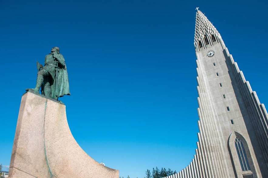
The most iconic landmark included on the sightseeing map is the 245-foot (74.5-meter) tall Hallgrimskirkja church, visible from almost every angle in Reykjavik and beyond the city limits. From its top, you have a great view of the city (although visitors must pay a small fee, around 7 USD, to take the lift up the tower). You can find another viewing platform at Perlan, which also houses the incredible Wonders of Iceland exhibition.
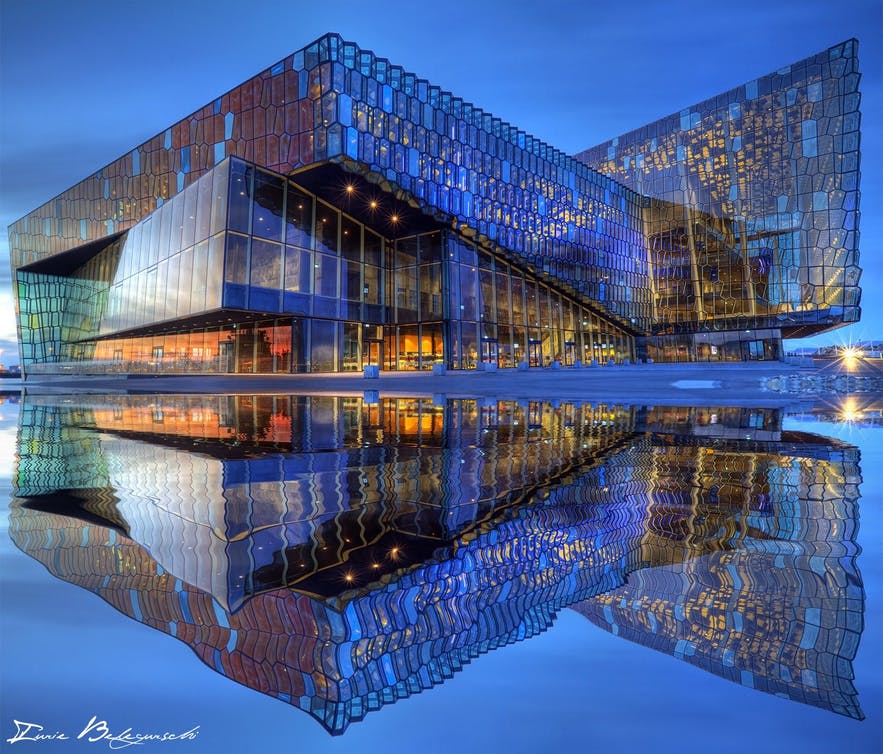
The Harpa Concert Hall and Conference Center is an attraction due to its impressive architecture, featuring a glass facade lit up with LED lights, and its many concerts, festivals, and exhibitions. Make sure you check the events calendar for Harpa before your visit.
-
See also: Sightseeing in Reykjavik
For a little natural beauty in the city, visitors can enjoy the views of the pond Tjornin, located right next to Reykjavik City Hall. The City Hall is open to all visitors, with many art showings and music events throughout the year.
If you're curious about the Icelandic art scene, then there are dozens of art galleries, museums, and street art exhibits from which to choose. The main art galleries have been included in the map above. Furthermore, you can find many smaller ones on the main shopping streets of Laugavegur, Skolavordustigur, Hverfisgata, and the surrounding streets.
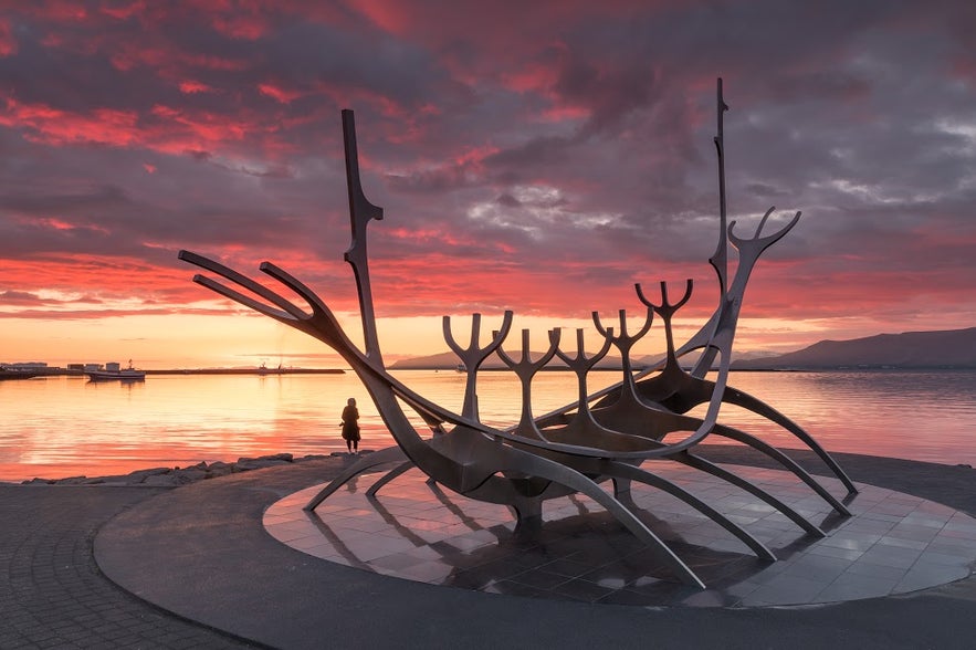
You can also find many sculptures throughout the city. The most famous one is most likely Solfarid, or The Sun Voyager, with its impressive seaside view of Faxafloi bay. We recommend a museum for Iceland's greatest sculptor, the Einar Jonsson Museum, located next to Hallgrimskirkja, with a beautiful sculpture garden with free entry behind it.
Laugardalur also has the Reykjavik Botanical Garden, the Reykjavik Family Park and Zoo, the popular Laugardalslaug swimming pool, a football stadium, a skating rink, and a campsite.
Outdoor markets are uncommon in Iceland, but you will find the fleamarket Kolaportid by the Old Harbor. In 2017, a food hall opened at Hlemmur, and another food hall, "Grandi Matholl," opened shortly after that near the harbor.
If you want to leave the city center for some beautiful sunset views or to see the northern lights in the winter, then head to the lighthouse at Grotta peninsula. Another unique place just outside the city is Videy island, which can be reached by ferry departing from the harbor, where you can see the historical Videyjarstofa and the Imagine Peace art installation by Yoko Ono. Alternatively, you can head to Ellidaardalur valley to enjoy a midnight picnic right next to a waterfall within the city's borders.
-
Check out the Top Food Halls in Reykjavik: The Ultimate Guide
-
See also: The Top 10 Things to do in Reykjavik
Map of Reykjavik's Nightlife
It's easy to navigate Reykjavik's nightlife on foot, especially if you're staying in the city center. There aren't many nightclubs, as most of Reykjavik's nightlife venues lead double or triple lives as cafes, restaurants, bars, hotels, music venues, and clubs.
You'll find almost all the bars you'll need on or by Reykjavik's main shopping street: Laugavegur. It can take as little as a few seconds to go from one bar to the next in this lively Nordic capital.
-
See also: Nightlife in Reykjavik
-
See also: Happy Hour - Reykjavik's Cheapest Bars
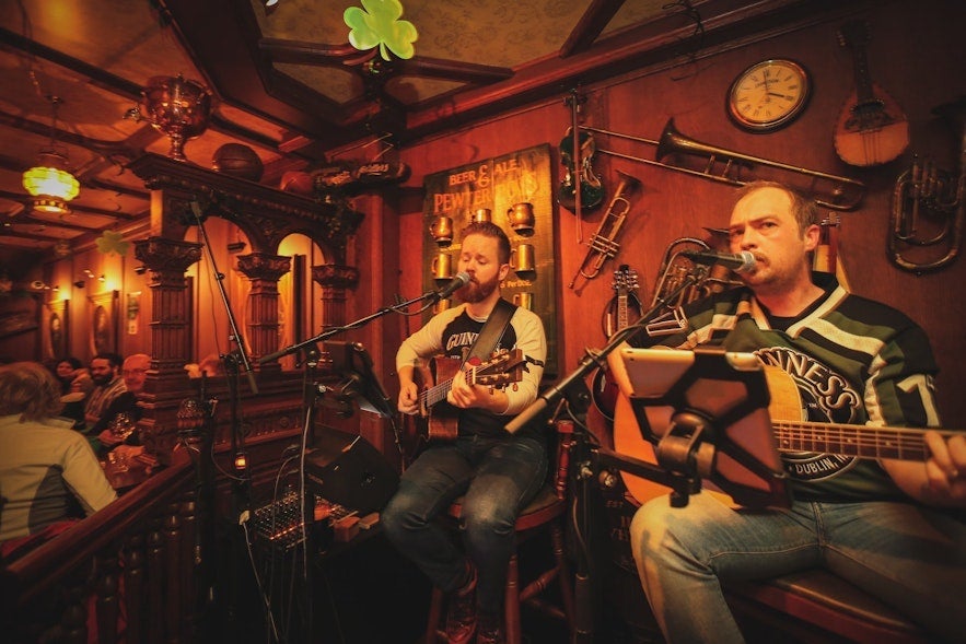
If you're planning on barhopping, you could start by sipping on a cocktail at your hotel. Many of the upscale hotels in Reykjavik double as popular hangout places for fancy cocktails with house restaurants where you can have a glass of wine or two with your meal.
If you're more into craft beers, there are a few locales where you can start your night instead. The best bars for craft beer in Reykjavik are Skuli Craft Bar and Bastard Brew & Food.
Following a drink at a hotel or a craft beer bar, you can go to one of the hostels, such as Loft Hostel or KEX Hostel, where there's usually live music or stand-up comedy.
Here, the crowds are more relaxed, and it's easier to mingle with strangers when you're both laughing or enjoying the same live jazz. To end the night, choose between many bars that double as nightclubs, with music playing long into the night.
-
Learn about Icelandic Music
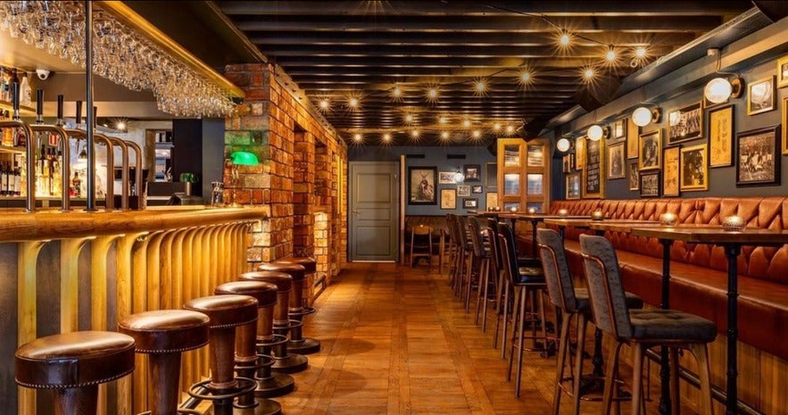
Tjarnarbio, Idno, and Thjodleikhusid host theater performances, live music, and improv comedy throughout the week and are great spots to check out.
Bio Paradis is not just a great spot to watch classic Icelandic films (with English subtitles) or international art-house films. It also serves beer and has a cozy sofa area surrounded by movie posters frequented by locals looking to relax or play games.
-
See also: Secret Spots & Hidden Gems in Reykjavík
Map of Reykjavik's Swimming Pools
You can find hundreds of swimming pools all over Iceland. Many Icelandic swimming pools would be considered spas in other countries but still have an unbeatable entry price.
The largest pool in Reykjavik and all of Iceland is the Laugardalslaug swimming pool, which sports both an indoor and outdoor pool, saunas, a massage room, seven hot tubs, and also a cold tub. If that wasn't enough, there's also a large gym next door called with the secluded spa for an additional cost.
The most central swimming pool in Reykjavik is the historical Sundholl Reykjavikur. It is the oldest swimming pool in Reykjavik but was renovated in 2017 with an additional outdoor pool, sauna, as well as hot and cold tubs. Two other swimming pools are relatively close to Reykjavik's city center, Vesturbaejarlaug and Seltjarnarneslaug. Both are outdoor (heated) pools with several hot tubs and saunas.
Map of North Iceland
North Iceland is known for its deep fjords, beautiful lakes, and interesting cultural sites. It takes about 6 hours of driving to reach the north when departing from Reykjavik.
The northern region is also home to the second-largest settlement outside the Capital Region, Akureyri. You can also visit Husavik, sometimes called the "whale-watching capital of Europe," the beautiful Lake Myvatn, and the stunning Asbyrgi canyon.
Many of the attractions are also covered in the Ring Road map, but down below, you can find more detailed maps of Lake Myvatn and Asbyrgi Canyon.
-
Learn more: The Best Guide to Whale Watching in Iceland
Map of Lake Myvatn Geothermal Area
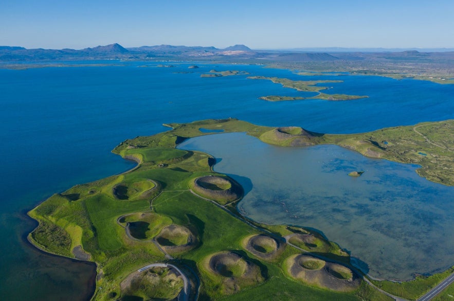
You can take a dip in the geothermal water at Earth Lagoon, which has large pools of warm mineral-rich water and steam baths. Booking admission to the Earth Lagoon is a great way to unwind after a day of exploring this beautiful area.
As you can see on the map of Myvatn lake above, the lake is also close to Krafla volcano and the Viti crater. The region is excellent for birdwatching and even the arctic fox can sometimes be spotted near nesting sites.
You can take a day tour of Lake Myvatn from Akureyri. Alternatively, if you're traveling in winter, you can go on this incredible dog-sledding tour pulled by adorable Siberian huskies.
-
See more: A Complete Guide to Lake Myvatn
Asbyrgi Canyon Map
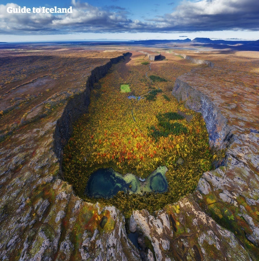
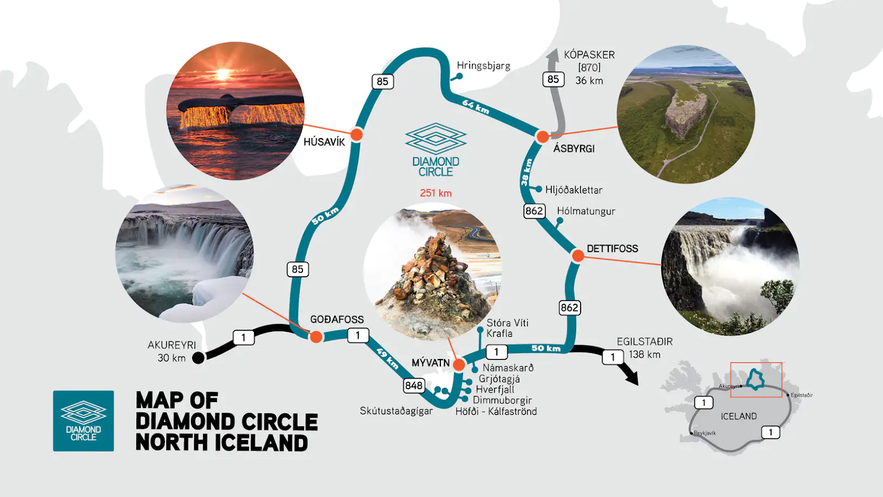
Asbyrgi Canyon in Northeast Iceland is best known for its horseshoe shape. There's a lot of interesting folklore surrounding the canyon — legend has it that it was formed by the footprint of Odin's eight-legged horse, Sleipnir.
The canyon is on the Diamond Circle route, about 50 miles (80 kilometers) east of Husavik. Take a look at the map of the Diamond Circle below.
Map of Iceland's Towns
Reykjavik is the only actual city in Iceland. The other settlements in the country are small by the global standard and considered towns or villages. Each one has its own distinct character and charm, with at least a few places of note that are worth a visit.
On the Iceland map below, you'll find some of the most famous or popular towns in Iceland to help plan your trip:
The largest town outside of the capital region is Akureyri, located on the north coast of the map of Iceland. With a population of about 20,00, Akureyri is sometimes called "the Capital of the North."
Other popular towns across Iceland are Selfoss in South Iceland, Egilsstadir, the largest settlement of East Iceland, and the secluded Isafjordur in the Westfjords. Selfoss has just under 7,000 people, while Egilsstadir and Isfjordur have roughly 2,500 people living there.
The largest towns in West Iceland are Borgarnes and Stykkisholmur, with fewer than 2,000 inhabitants.
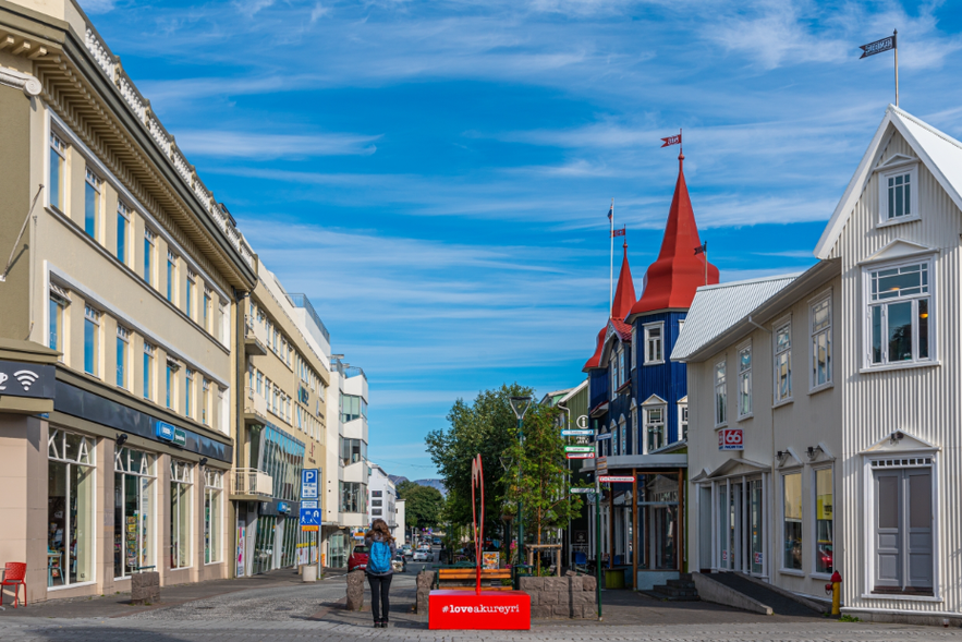
These smaller towns tend to have limited numbers of grocery stores, hotels, and restaurants compared to Reykjavik. However, you should be able to find the basic amenities you're looking for. Researching your destination before traveling is a good idea to ensure you have enough food and supplies for your stay.
-
Learn about Shopping for Groceries in Iceland
-
See also: Best Restaurants in Iceland
Driving Map of Iceland's Towns and Cities
If you're planning to tour the most popular towns, check out the suggested route on the map of Iceland below.
The route can be done in seven days, but you'll definitely want more time than this to explore all the sights and attractions you'll pass along the way. The route starts and ends at Reykjavik and passes through towns such as Vik, Selfoss, Hofn, Egilsstadir, Husavik, and Isafjordur. You can learn more about some of these towns below.
Map of Akureyri
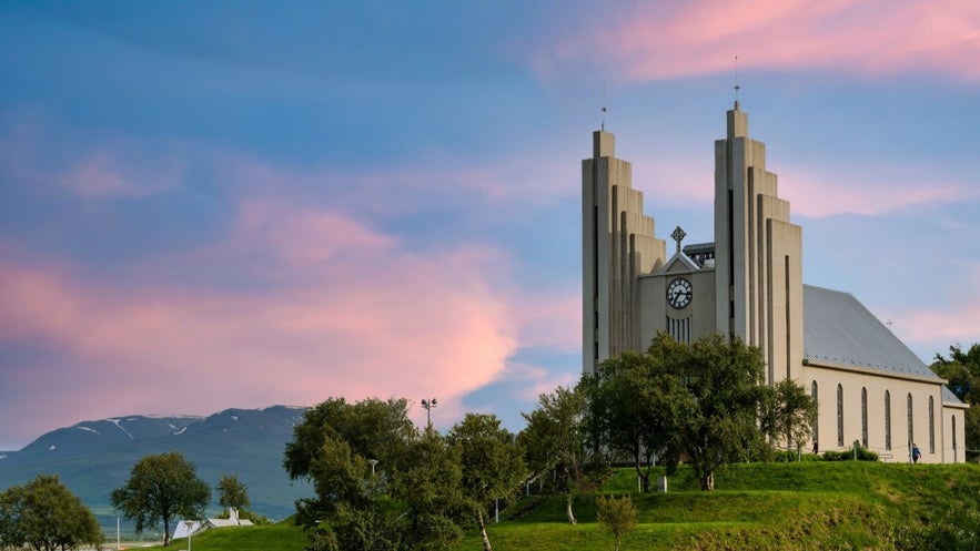 Akureyri is called the "Capital of the North" as it is the largest town in Iceland outside of the Greater Reykjavik Area. It's the cultural hub of North Iceland and has plenty to keep visitors occupied during their stay. The below map of Akureyri shows some of the best things to do in the area.
Attractions in Akureyri include the Laufas turf house, the incredible Akureyri Botanical Gardens, a swimming pool, and the Akureyrarkirkja church, with its iconic stairs leading up to the church door. In the winter, you can go skiing on Mount Hlidarfjall, one of the best ski resorts in the country. There's also a fun Christmas House, which celebrates Christmas year-round and sells all sorts of festive trinkets and treats.
You can also drive to Dalvik to take the ferry to Hrisey island, a beautiful and tranquil place with an interesting history.
-
Learn more: 13 Best Things to Do in Akureyri (and Nearby)
-
Check out the 11 Must-See Destinations in North Iceland
Husavik Map
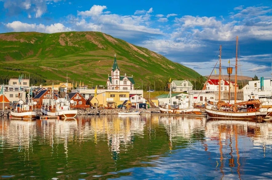 Husavik is a small town in North Iceland and one of the best places in the world to go whale watching. Most boat tour operators offer 100% sighting rates in the summer months. The water is home to baleen whales, dolphins and porpoises, and Arctic puffins are also often seen in the area. Browse a wide range of whale-watching tours and book before you travel.
Husavik was also featured in the 2020 film Eurovision Song Contest: The Story of Fire Saga. There's now a bar inspired by the film in the town, Jaja Ding Dong Husavik.
Beyond whales and films, it's a beautiful place to visit and has a fascinating history. Take a look at the map of Husavik above to see some of the best things to do while visiting there.
Map of Selfoss
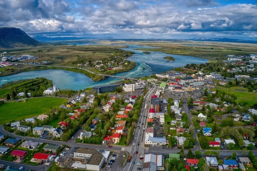 Selfoss is a town in South Iceland with a population of just under 10,000 people. It's about 30 miles (50 kilometers) east of Reykjavik. You can see a map of Selfoss and some of the best things to do here.
Selfoss is a good base if you want to explore the sights of the Golden Circle, but it's also close to the world-famous Geysir hot springs. From Selfoss, you can also reach Kerid crater, Ingolfsfjall mountain and the hot springs valley of Reykjadalur.
You'll find an interesting church and a museum dedicated to the chess player Bobby Fischer, who became an Icelandic citizen in his later years, in the town itself.
-
Discover the Top 8 Things to Do in Selfoss
Plan Your Trip to Iceland
Organizing a trip to a new country can be tricky. But with the maps of Iceland in this article, you'll be ready to go no matter what type of vacation you're planning. The only thing left to do now is to book your trip and start having fun!
Is there an Iceland travel map missing that you'd like to see on this list? Did these maps of Iceland with attractions help you plan your trip to Iceland? Have you visited Iceland before? Share your thoughts in the comment section below!

