The drive from Reykjavik to Diamond Beach runs about 235 miles (378 kilometers) one way along Iceland’s South Coast. This epic road trip along the paved Ring Road takes you past waterfalls, black sand beaches, glaciers, and a lagoon full of floating ice.
The route from Reykjavik to the Diamond Beach is one of the most popular self-drive tours in Iceland. South Iceland is also the most recommended region to visit by tourism professionals in Iceland.
The region works as a South Coast journey on its own or as the southern half of a Ring Road trip. Most people spread it over two or three days and base the first night in Vik, then take the drive back to visit the spots they missed.
The journey also gives you a close view of Iceland’s evolving glacial landscapes. Our study of glacier melting rates in Iceland traces 135 years of change, adding valuable context to the glaciers, lagoon, and ice fragments seen near Diamond Beach.
You will get the most out of it by using rental cars in Iceland, since the stops are far apart and public transport is limited. If you would rather have the logistics handled, a South Coast self-drive tour package bundles the car, route, and stays together.
This guide follows the route the way you drive it, one leg at a time, with the distances, parking, fuel, and services you need at each stage. Read on to learn how to prepare before driving in Iceland, what to see and do on each stretch, where to stop for food, and how to make the most of your journey.
Why You Can Trust Our Content
Guide to Iceland is the most trusted travel platform in Iceland, helping millions of visitors each year. All our content is written and reviewed by local experts who are deeply familiar with Iceland. You can count on us for accurate, up-to-date, and trustworthy travel advice.
Key Takeaways
-
The full drive from Reykjavik to Diamond Beach is about 235 miles (378 kilometers) one way and close to five hours without stops.
-
Vik sits roughly halfway and makes a good first-night base. A round trip with stops works best across two to three days.
-
Fuel and services thin out east of Kirkjubaejarklaustur, the quietest stretch of the route, so fill the tank there.
-
Parking at most attractions, including Skogafoss and Reynisfjara, costs around 7–8 USD (1,000–1,110 ISK) and is paid through the Parka app, so download it before you leave.
-
Jokulsarlon Glacier Lagoon and Diamond Beach are the usual turnaround point. Hofn and Vestrahorn are optional add-ons for anyone continuing east.
Plan the Route Before You Leave Reykjavik
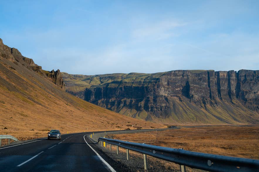
The route from Reykjavik to Diamond Beach follows one road the entire way, the Ring Road (Route 1), heading east along the South Coast. Navigation is simple, so the real planning is about timing, fuel, and where to eat.
The table below shows how far each stop sits from Reykjavik, the driving time to reach it, the distance and time from the previous stop, and what each leg offers, so you can shape the drive around your own pace.
| Stop | From Reykjavik | From the previous stop | Highlights and things to do |
|---|---|---|---|
| Selfoss | 35 mi (57 km) / ~50 min | 35 mi (57 km) / ~50 min |
|
| Seljalandsfoss | 75 mi (120 km) / ~2 hrs | 40 mi (63 km) / ~1 hr | Waterfall with a path behind the falling water |
| Skogafoss | 95 mi (150 km) / ~2 hrs 15 min | 19 mi (29 km) / ~25 min | 200-foot (60-meter) waterfall with stairs to a clifftop viewpoint |
| Reynisfjara | 113 mi (182 km) / ~2.5 hrs | 18 mi (29 km) / ~20 min | Black sand beach, basalt columns, and sea stacks |
| Vik | 116 mi (187 km) / ~2.5 hrs | 4 mi (6 km) / ~10 min | Fuel, groceries, dining, stays, and departures for ice cave and horse-riding tours |
| Kirkjubaejarklaustur | 160 mi (257 km) / ~3 hrs 15 min | 44 mi (70 km) / ~50 min |
|
| Skaftafell | 203 mi (327 km) / ~4 hrs | 43 mi (70 km) / ~50 min | Vatnajokull National Park, Svartifoss, hiking trails, and glacier tours |
| Jokulsarlon | 230 mi (370 km) / ~4.5 hrs | 27 mi (43 km) / ~35 min | Glacier lagoon with floating icebergs and seasonal activities |
| Diamond Beach | 235 mi (378 km) / ~5 hrs | Adjacent / ~5 min | Glacier ice scattered across black sand |
Most people split the drive over two or three days. A relaxed itinerary reaches Vik on day one, continues to Jokulsarlon and Diamond Beach on day two, and returns to Reykjavik on day three.
Plan your overnight stops before setting out and compare hotels in South Iceland along the route. Although you can drive each way in one long day, this leaves little time to explore the attractions.
Renting a Car and Prepping for the South Coast Drive
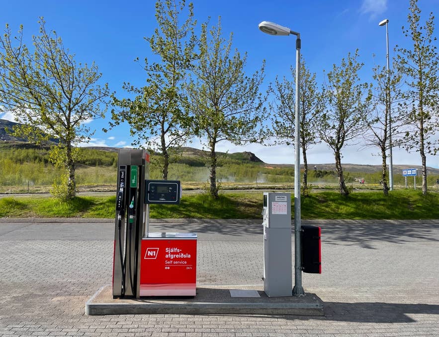
Before leaving the capital, arrange your car, supplies, and useful apps. You can start from Reykjavik or collect rental cars straight from Keflavik Airport after you land.
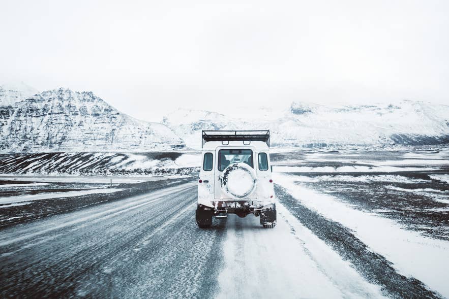
Standard two-wheel-drive cars are generally suitable for the paved Ring Road in summer. For winter self-drive trips, four-wheel-drive vehicles provide better traction, but always check conditions before driving. Summer offers long daylight hours, while winter brings limited daylight and possible road closures.
Stock up on food and water along the way. Kronan Supermarket has a branch in Selfoss for road-trip grocery shopping. Selfoss New Old Town also offers several dining options. The Golden Circle branches north near Selfoss and can be added if you have another day.
Fuel and services become less frequent east of Kirkjubaejarklaustur. Fuel remains available at Freysnes and Fagurholsmyri before Jokulsarlon, while Hofn is the next major service town for travelers continuing east. EV drivers should use a charging map to plan their stops.
Lastly, download these apps before leaving:
-
Parka: Pay for parking at many attractions along the route.
-
Vedur: View forecasts and weather warnings from the Icelandic Met Office.
-
SafeTravel: Check travel conditions and safety alerts. You can also submit a travel plan before setting off.
-
112 Iceland: Contact emergency services by text and share your location when calling is difficult.
For a full primer on road conditions and rules, see our guide to driving in Iceland.
Seljalandsfoss: The Waterfall You Can Walk Behind
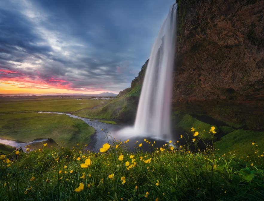
Seljalandsfoss Waterfall is the first major stop on the drive from Reykjavik to Diamond Beach, about 75 miles (120 kilometers) east of the capital and reached by a short turnoff from Route 1. The 200-foot (60-meter) waterfall is famous for the footpath that loops behind its curtain of water.
A large car park sits close to the waterfall. Parking costs about 6 USD (900 ISK) for the day and can be paid on-site or online through Check It. Bring waterproof footwear and a rain jacket for the wet path. In winter, obey closures because the path can become icy and falling ice is a danger.
A short walk north along the cliffs leads to Gljufrabui Waterfall, a 130-foot (40-meter) cascade partly concealed inside a narrow canyon. Reaching the inner chamber involves wading through the river, and visitors should also be aware of falling rocks.
Skogafoss: A Wide Curtain and a Clifftop View
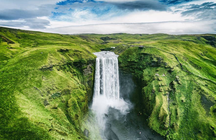
Skogafoss Waterfall is about 19 miles (29 kilometers) from Seljalandsfoss and roughly 95 miles (150 kilometers) from Reykjavik. The waterfall drops about 200 feet (60 meters), and a path beside it leads to the top and continues upstream.
Skogafoss has a large paved car park that sits near the foot of the falls, and a parking fee of about 7 USD (1,000 ISK) through Parka stays valid for eight hours.
Kvernufoss Waterfall lies in a gorge about 0.9 miles (1.5 kilometers) east of Skogafoss. The trail starts at the Skogar Museum car park and takes about 20 minutes. You can walk behind the waterfall, but the rocks there can be loose and slippery.
Reynisfjara: Black Sand and Basalt Columns
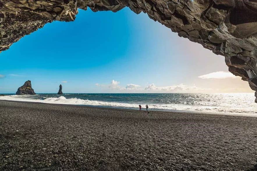
Reynisfjara Black Sand Beach lies about 113 miles (182 kilometers) from Reykjavik and roughly 18 miles (29 kilometers) past Skogafoss. Its black sand, basalt cliffs, and offshore Reynisdrangar Sea Stacks remain visible from the designated viewpoint.
As of July 2026, Reynisfjara is accessible only from the designated viewpoint because winter storms and a landslide from Reynisfjall Mountain reshaped the area. Follow the barriers and warning lights, keep well back from the sea, and never turn your back on the waves.
A car park sits at the end of Route 215, with Parka parking about 7 USD (1,000 ISK) for up to three hours. Just before the beach, Route 218 turns toward Dyrholaey, a 394-foot (120-meter) promontory with a lighthouse, sea arch, and wide coastal views sometimes called the Endless Black Beach.
Puffins generally nest at Dyrholaey from May to August, so the upper area can close overnight from mid-May to late June, and parking there is about 5 USD (750 ISK).
Vik: Your Overnight Stop on the South Coast
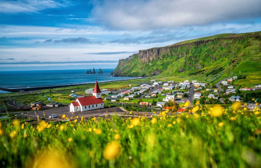
Vik, or Vik i Myrdal, is about 116 miles (187 kilometers) from Reykjavik and is a practical overnight base near the midpoint of the drive to Diamond Beach. The village has Vik accommodations, restaurants, fuel stations, and a Kronan supermarket.
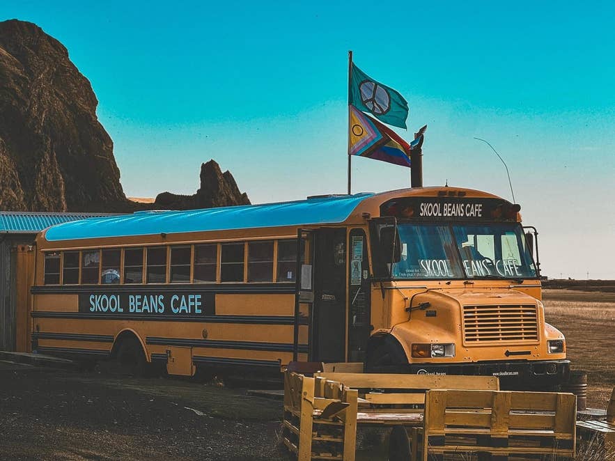
A few top places to eat sit in the village, including Skool Beans, serving coffee from a converted school bus, and Black Crust Pizzeria, baking on charcoal dough. Two popular tours start here too: a black beach riding tour on Icelandic horses and the year-round Katla ice cave tour.
On the hill above town stands Vikurkirkja, the Vik i Myrdal Church, a white chapel with a red roof and one of the most popular viewing spots in the village. A short drive or walk up reaches a small parking area and a sweeping view over the rooftops, the black coastline, and the Reynisdrangar Sea Stacks.
Kirkjubaejarklaustur: Last Services Before the Empty Leg
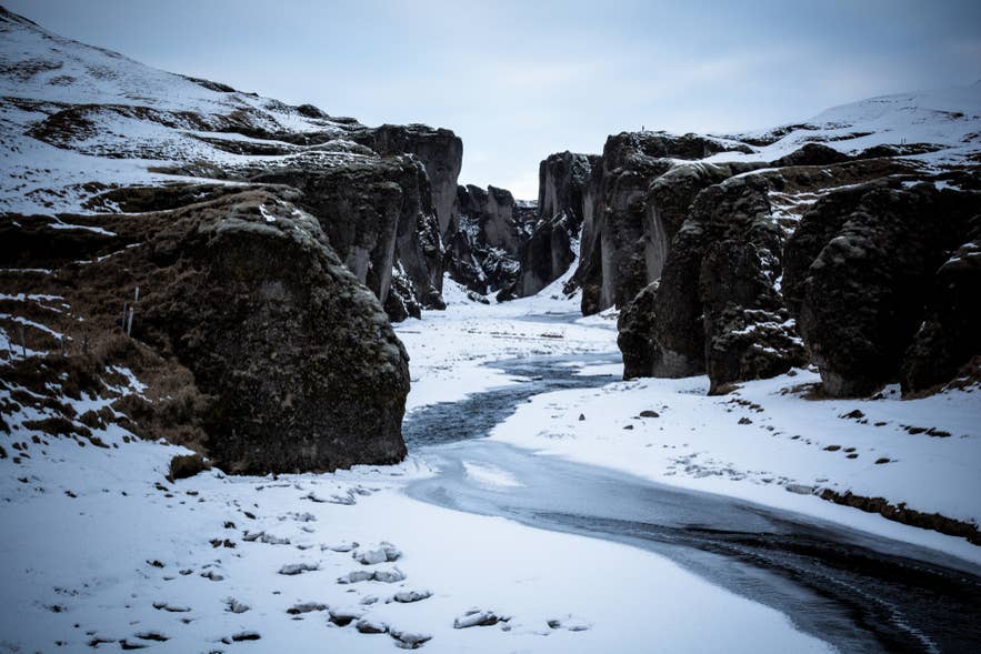
Kirkjubaejarklaustur, about 160 miles (257 kilometers) from Reykjavik, is the final village with a broad cluster of food, lodging, and fuel services before Skaftafell. Fuel is also available farther east at Freysnes and Fagurholsmyri.
Often shortened to Klaustur, the village sits beside the Eldhraun Lava Field, one of the largest lava flows in recorded history. Nearby, the gravel Route 206 leads to Fjadrargljufur, a deep, moss-lined river canyon with a rim path. Parking at the canyon is about 7 USD (1,000 ISK).
For a meal, Systrakaffi is a family-run cafe on the main street of Kirkjubaejarklaustur, and Klaustur Restaurant inside Hotel Klaustur serves local Icelandic dishes. Both are good places to break the drive before the quiet leg ahead.
Kirkjubaejarklaustur accommodations also make a good alternative first night if you want to be closer to the glaciers. Sitting about 44 miles (70 kilometers), or 50 minutes, east of Vik, the town shortens the day two drive, though Vik still wins for food options and tour offerings.
Skaftafell and Vatnajokull National Park: Glacier Hikes and Svartifoss
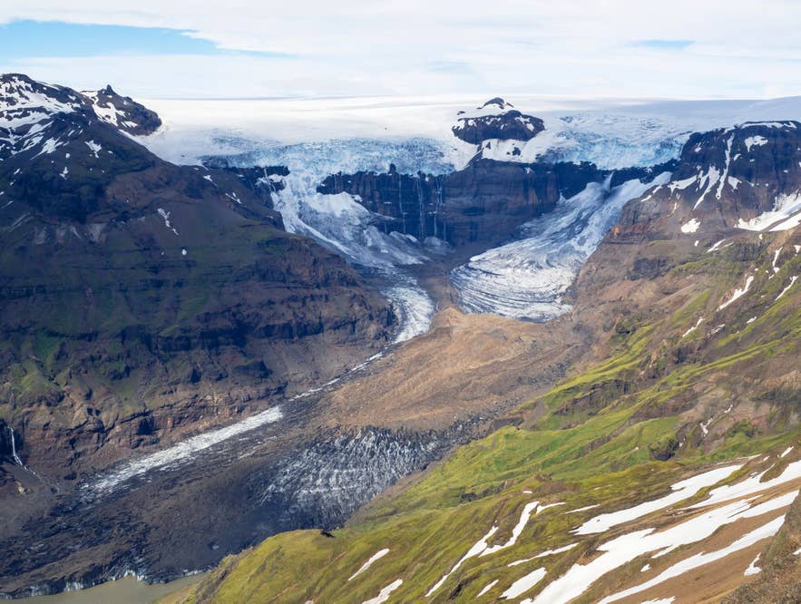
Skaftafell, about 203 miles (327 kilometers) from Reykjavik and roughly 44 miles (70 kilometers) past Kirkjubaejarklaustur, is a nature reserve within Vatnajokull National Park, home to Europe’s largest ice cap by volume. It is the main hub for glacier tours on the eastern South Coast.
Parking is about 8 USD (1,110 ISK) through Parka. Pay here, and you get 50 percent off parking elsewhere in Vatnajokull National Park the same day, including at Jokulsarlon Glacier Lagoon.
Trails from the Visitor Center lead to Svartifoss, a waterfall framed by dark basalt columns, and guided glacier hikes set out onto the nearby ice. Plan to spend at least two to four hours here for the Svartifoss hike and the viewpoint of Skaftafellsjokull, or a full day if you add a Skaftafell glacier hike.
The Skaftafellsstofa Visitor Center has a cafe with light meals and coffee and a shop with trail maps and supplies. The nearest fuel and a sit-down restaurant are at Freysnes, about 3 miles (5 kilometers) east.
Jokulsarlon Glacier Lagoon: Floating Icebergs and Boat Tours
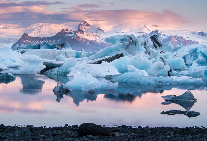
Jokulsarlon Glacier Lagoon is the deepest lake in Iceland and the highlight of the eastern South Coast, about 230 miles (370 kilometers) from Reykjavik. Its surface is dotted with house-sized icebergs that calve off the Breidamerkurjokull Glacier and drift slowly out to sea.
Like Skaftafell, it lies within Vatnajokull National Park, about 27 miles (43 kilometers) further east. On a calm day, the still water mirrors the floating ice. To get out among the icebergs, take an amphibian boat tour or a faster Zodiac cruise. Summer adds kayaking on the lagoon, while it is the starting point for the blue ice caving tour in winter.
If seeing plenty of floating ice is your priority, our study of the best time to visit Jokulsarlon and Diamond Beach points to February and March. April balances ice, longer daylight hours, and milder weather, while boat tours usually begin in May.
For drivers, parking is about 8 USD (1,110 ISK) through Parka, and one ticket also covers Diamond Beach, with 50 percent off if you paid at Skaftafell earlier. Privately operated food services are available at the lagoon, although some visitor services are seasonal.
About 6 miles (10 kilometers) before the lagoon, a turnoff leads to Fjallsarlon, a smaller, calmer glacier lagoon with its own boat trips. It is a good option if Jokulsarlon is crowded.
Diamond Beach: Icebergs on the Black Sand
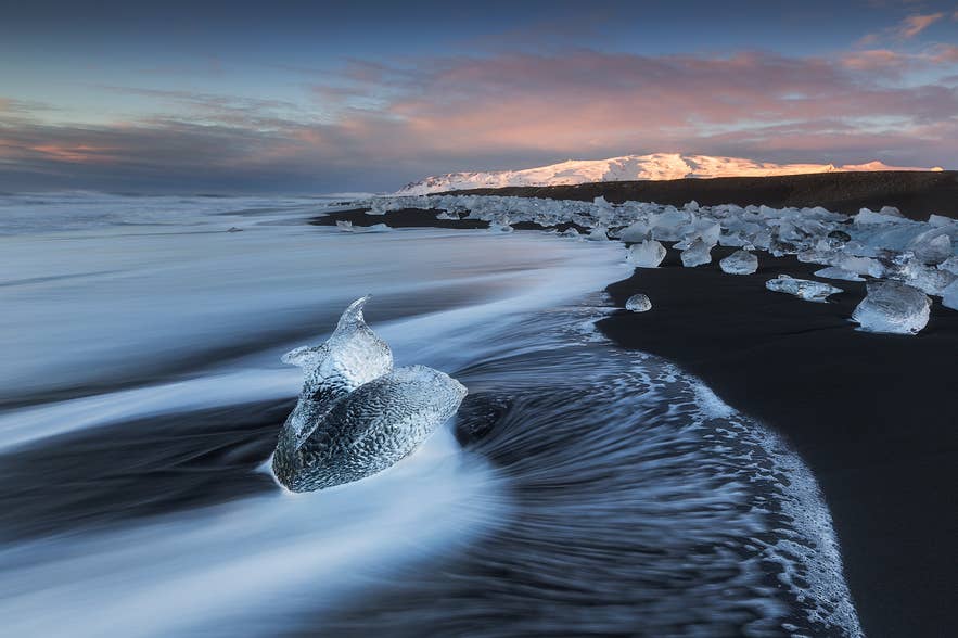
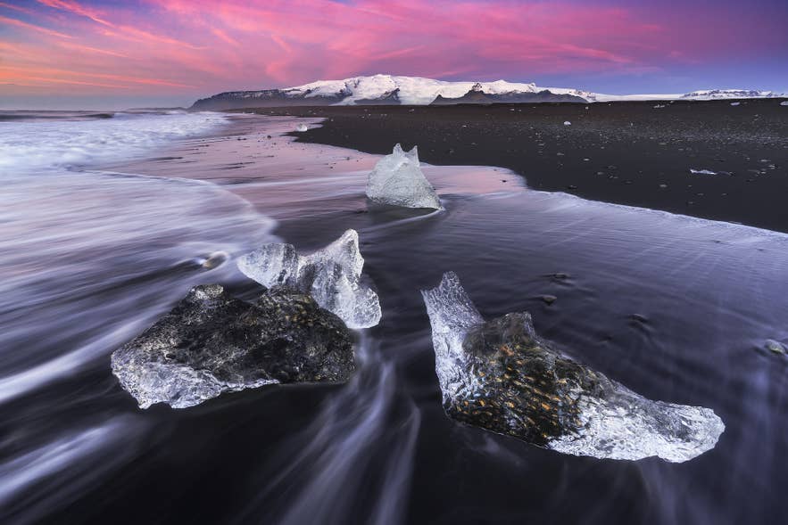
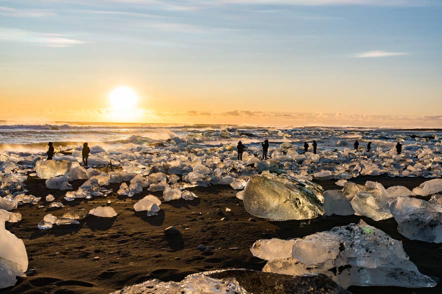
Diamond Beach sits just across Route 1 from Jokulsarlon, about 235 miles (378 kilometers) from Reykjavik, where chunks of glacier ice wash up and glitter on the black sand. Parking uses the same ticket as Jokulsarlon, so if you paid at the lagoon, you are already covered for both lots.
Icebergs wash up here in every season, ground by the waves into clear and blue shapes that stand out against the black sand. If you would rather not drive back the same day, there are hotels near Jokulsarlon, a few minutes away. Staying nearby lets you return for sunrise or sunset, when the low light makes the ice glow.
Beyond Diamond Beach: Turn Back or Continue to Hofn
From Diamond Beach, you have two choices. Turn back toward Reykjavik on the same Route 1, or continue east to the fishing town of Hofn and beyond. Most round-trip travelers turn around here, since the South Coast has no parallel road.
If you keep going, Hofn is about 50 miles (80 kilometers), or an hour, further east. It is the first proper service town after the long empty leg, with fuel, a supermarket, and plenty of Hofn accommodations. The town is known for langoustine, best sampled at Kaffi Hornid.
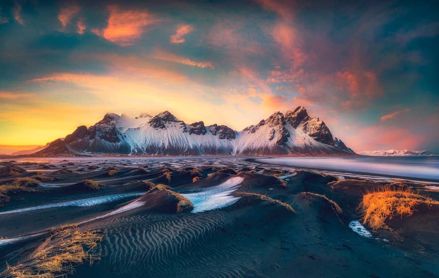
Roughly 4 miles (7 kilometers) past Hofn, a gravel road leads to Vestrahorn, a jagged mountain rising over the black sands of Stokksnes, with mirror reflections at low tide and a Viking Film Set nearby. Access is about 8 USD (1,100 ISK) per person at the Viking Cafe.
More South Coast Stops to Add on a Two-Day Drive
Several optional stops along the South Coast suit travelers driving the route over two days or wanting quieter alternatives on the way back. None fit into a single day with the main attractions, so treat this as a menu and pick one or two that match your time and the weather.
-
Reykjadalur Hot Spring Valley: A warm bathing river about 45 minutes from Reykjavik, reached by a hike of about 2.5 miles (4 kilometers) from a car park near Hveragerdi. Allow about an hour each way. Parking is about 7 USD (1,000 ISK) for five hours.
-
Seljavallalaug Pool: One of Iceland’s oldest pools, built in 1923 below the Eyjafjallajokull Volcano. Turn onto Route 242 after Seljalandsfoss, park at the road’s end, and walk about 20 minutes up a rocky valley. It is rustic and lukewarm with no staff.
-
Solheimajokull Glacier: An outlet glacier reached by the short gravel Route 221 between Skogafoss and Vik, with parking at the lot for about 5 USD (750 ISK). It is a popular base for guided glacier hikes and ice climbing excursions. Never walk on the ice without a guide.
-
Solheimasandur Plane Wreck: The remains of a US Navy plane that crash-landed on a black sand plain in 1973, with all aboard surviving. It is about a 2.5-mile (4-kilometer) walk each way from a marked car park on Route 1 west of Vik, or take the DC-3 Wreck shuttle. Parking is about 5 USD (750 ISK).
-
Svinafellsjokull Glacier: A glacier tongue of Vatnajokull about 3.3 miles (5.3 kilometers) from the Skaftafell Visitor Center, with free parking. A 9-minute walk reaches the viewpoint, where you can also see Hvannadalshnukur, Iceland’s tallest mountain at 6,921 feet (2,110 meters).
-
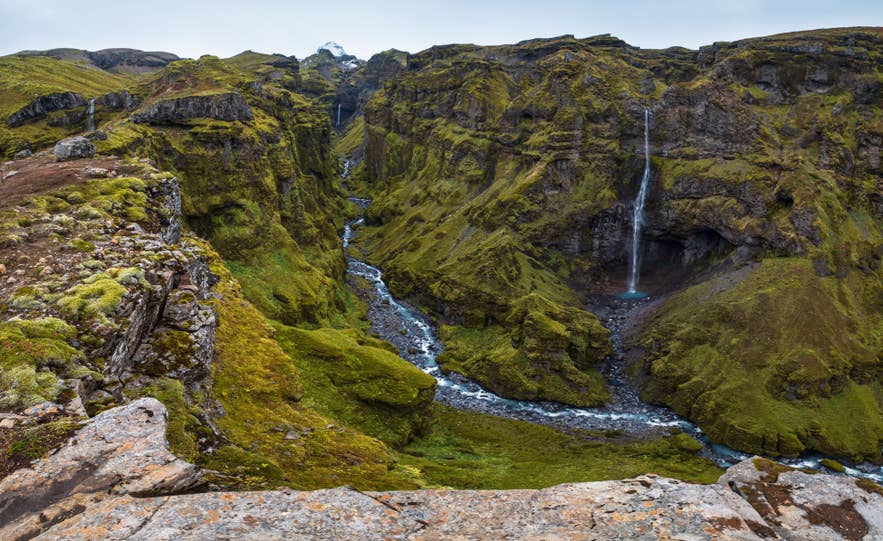
Mulagljufur Canyon: A moss-lined canyon between Skaftafell and Jokulsarlon, reached by an unmarked gravel turnoff off Route 1 with paid parking. The hike to the canyon and its Hangandifoss Waterfall is about 4.3 miles (7 kilometers) round trip and takes roughly 2.5 to 3 hours.
Activities Along the Drive to Diamond Beach
You can book self-driving activities at several stops between Reykjavik and Diamond Beach, making them easy to add to your itinerary. Meeting points are available in Hveragerdi, along the South Coast, in Vik and Skaftafell, and near the glacier lagoons.
-
Zipline in Hveragerdi: Fly over Svartagljufur Gorge on a 0.6-mile (1-kilometer) zipline, available May through October.
-
Horseback riding with views of Eyjafjallajokull: Ride through the countryside and enjoy volcano views in clear weather between June and April.
-
Glacier hiking on Solheimajokull: Explore crevasses and ice formations with a certified glacier guide.
-
Katla ice cave tour: Travel from Vik to explore an ice cave beneath Myrdalsjokull.
-
Horseback riding on a black sand beach: Ride an Icelandic horse along the black sand coast near Vik.
-
Buggy tour from Vik: Drive across black sand with views of the surrounding coastline.
-
Glacier hiking in Skaftafell: Walk across an outlet glacier of Vatnajokull with a guide from June through December.
-
Ice floating at Fjallsarlon: Float in the lagoon in a protective immersion suit, with departures offered June through March.
-
Boat tour on Jokulsarlon: Cruise among floating icebergs during the June-to-November season.
-
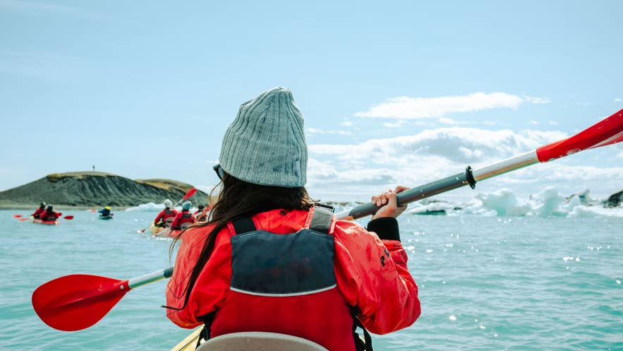
Kayaking on Jokulsarlon: Paddle between icebergs for a closer view of the lagoon from May through September.
-
Crystal blue ice cave tour: Depart from Jokulsarlon to explore a seasonal ice cave in Vatnajokull between October and April.
Best Food Stops From Reykjavik to Diamond Beach
Food stops between Reykjavik and Diamond Beach are concentrated in the main towns, which are also home to some of the best places to eat on the Ring Road. Choices become limited farther east, so check opening hours before traveling.
-
Kronan supermarkets: Stop at Kronan stores in Reykjavik, Selfoss, or Vik to stock up on road-trip snacks, drinks, and picnic supplies.
-
Old Dairy Food Hall: Visit the food hall in Selfoss New Old Town for several dining options in one convenient location.
-
Skool Beans: Order coffee, hot chocolate, bagels, or pastries from Skool Beans, a converted yellow school bus in Vik.
-
Black Crust Pizzeria: Try pizza made with distinctive charcoal-infused dough at Black Crust Pizzeria in Vik.
-
Systrakaffi: Choose from Icelandic dishes, pizzas, and desserts at Systrakaffi in Kirkjubaejarklaustur.
-
Skaftafell food outlet: Stop for food and drinks at the privately operated food outlet at Skaftafell, which opens during most of the year.
-
Jokulsarlon vendors: Pick up food or drinks from the seasonal vendors, but bring your own supplies outside summer when fewer options may be available.
Guided Tours From Reykjavik to Diamond Beach
If you do not want to drive, guided tours from Reykjavik can take you along the South Coast to Jokulsarlon and Diamond Beach. Options range from a long day trip to multi-day tours with accommodation and activities included.
-
One-day South Coast and Jokulsarlon tour: See Jokulsarlon, Diamond Beach, waterfalls, and other South Coast highlights on a 14- to 15-hour tour offered year-round.
-
Private Jokulsarlon and Diamond Beach tour: Travel with your own guide on a flexible 12-hour journey covering the main South Coast sights year-round.
-
Two-day summer South Coast tour: Visit Diamond Beach and Jokulsarlon, hike on Solheimajokull, and take a glacier lagoon boat tour between May and September.
-
Two-day winter South Coast tour: Visit the main South Coast sights and explore a Vatnajokull ice cave between October and April.
-
Three-day Golden Circle and South Coast tour: Combine the Golden Circle with a glacier hike, Jokulsarlon, and Diamond Beach from May to September.
Driving the South Coast at Your Own Pace
The drive from Reykjavik to Diamond Beach packs many of Iceland’s best-known sights into one stretch of road: waterfalls, black sand beaches, glaciers, and a lagoon full of ice. Take it slowly, fill up when you can, and let Vik break the journey so you are not rushing the best parts.
If you have a second day, treat the extra stops above as a menu and pick one or two favorites. For more route ideas, see our guide to the South Coast of Iceland or self-drive tour packages that bundle the car and stops together. Turn back at Diamond Beach or push on toward Hofn. Either way, the South Coast rewards an unhurried pace.
Is the road from Reykjavik to Diamond Beach paved?
How long does it take to drive from Reykjavik to Diamond Beach?
Where should I stop for fuel on the way to Diamond Beach?
Are there pharmacies and medical services along the Reykjavik to Diamond Beach drive?
Do I need to pay for parking at the stops between Reykjavik and Diamond Beach?
Can I drive an electric car from Reykjavik to Diamond Beach?
What is the best way to split the Reykjavik to Diamond Beach drive over a few days?
Have you driven the route from Reykjavik to Diamond Beach, or are you planning the trip? Share your favorite stops in the comments below.

I was born on the west side of Reykjavík and grew up downtown, so Iceland has been my back yard for most of my life. I'm a father of two, I've traveled on five continents, and I still haven't found a country that holds my attention the way this one does.
That's why I co-founded Guide to Iceland. We connect travelers directly with Icelandic operators, guides and hosts, so the advice and the services both come from people who actually live here.
I write about the practical side of a trip: what eating out in Reykjavík really costs, whether to pick Sky Lagoon or Hvammsvík, where to stop for food along the Ring Road, and which regions give you the best odds of clear skies for the northern lights. If you're planning a trip and something doesn't add up, message me.