参加人数には限りがあります
早めのお申し込みがお得です
最安値をお約束します
手数料なし
格安氷の洞窟ツアー|南海岸の名瀑、氷河湖の見学付き(ホステル泊)
ヴァトナヨークトル国立公園の天然の氷の洞窟を訪ねる1泊2日のお値打ちツアー。名瀑やブラックサンドビーチ、氷河湖など南海岸の見どころを巡り、最後は蒼い氷の洞窟を探検します。低予算で冬のアイスランドを満喫したい!という方におすすめしたいプランです。
このツアーでは、アイスランドでも人気が高いセリャントスフォスとスコガフォスの滝や、レイニスフィヤラのブラックサンドビーチ、ヨークルスアゥルロゥン氷河湖を訪ね、夜はヴァトナヨークトル国立公園内に宿泊します。町の光害から離れた場所にあり、オーロラが出現すればよりはっきりとキレイに見えます。
そして旅のハイライト、スーパーブルーのアイスケーブ。氷の洞窟は冬の間しか見られない珍しい自然現象です。天然の氷の彫像や光と氷が織りなす美しい色彩はまさに自然の神秘。一生の思い出になること間違いなしです。
ホステル(朝食込)・バス・経験豊富なガイドまで全て手配しますので、予約が完了したら後は宿で送迎を待つだけです!
アイスランドの冬の自然を楽しむのにお金はいりません。お得な2日間のアイスケーブ・ツアーのご予約はこちらから!日にちを選択すると、空き状況を確認できます。
ツアー概要
- ツアー時期: 11月. - 3月.
- 所要時間: 2 日間
- アクティビティ: スーパージープ, 観光, オーロラ, 氷の洞窟
- 難易度: ☆
- ツアーガイド言語: English
- ハイライト: レイキャヴィーク,
Reykjavík is the capital of Iceland and the northernmost capital of any sovereign state in the world.
Despite a small population (approximately 120,000, with just over 200,000 in the Greater Reykjavík area), it is a vibrant city that draws an ever increasing number of visitors every year. It is the financial, cultural and political centre of Iceland, and has a reputation of being one of the cleanest and safest cities in the world.
Geography
The city of Reykjavík is located in southwest Iceland by Faxaflói Bay. Throughout the ages, the landscape has been shaped by glaciers, earthquakes and volcanic eruptions and the area is geothermal; after all, its name translates to ‘Smoky Bay’.
Much of the current city area was subglacial during the Ice Age, with the glacier reaching as far as the Álftanes peninsula, while other areas lay under the sea. After the end of the Ice Age, the land rose as the glaciers drifted away, and it began to take on its present form.
The coastline of Reykjavík is set with peninsulas, coves, straits and islands, most notably the island of Viðey, and seabirds and whales frequent the shores. The mountain ring as seen from the shore is particularly beautiful.
Mount Esjan is the highest mountain in the vicinity of Reykjavík and the most distinctive feature of the coastline. This majestic summit is also highly popular amongst hikers and climbers. Other notable mountains that can be seen from the seaside are Akrafjall and Skarðsheiði.
On clear days, one may even see as far to the legendary Snæfellsjökull glacier, at the end of the Snæfellsnes peninsula.
The largest river to run through the city is Elliðaá in Elliðaárdalur valley, which is also one of Iceland’s best rivers for salmon fishing.
Transportation
There are no trains or trams in Iceland, but most people travel by car. The city also operates a bus system. There are two major harbours in town, the old harbour in the centre and Sundahöfn in the east.
The domestic Reykjavík Airport is located at Vatnsmýrin, not far from the city centre and close to the hill Öskjuhlíð and the restaurant, vantage point and exhibition centre Perlan. The international Keflavík Airport at Miðnesheiði heath then lies around 50 kilometres (31 miles) from the city.
Cars, jeeps and bicycles can be readily rented in the city and many organized tours are also being offered. It is, however, quite easy to walk between the major sites.
What to See & Do in Reykjavik
The local arts scene is strong in Iceland, with annual events and festivals, many of artists from which have hit the international stage.
Major events taking place in Reykjavík include Iceland Airwaves, Reykjavík Pride, RIFF (The Reykjavík International Film Festival), The Reykjavík Literature Festival, Culture Night, the Reykjavík Arts Festival, Food & Fun, the Reykjavík Fashion Festival and the Sónar music festival.
Amongst the famous people from Reykjavík are musicians like Björk Guðmundsdóttir and Sigur Rós, and writers Halldór Laxness (born on the main street, Laugavegur) and Arnaldur Indriðason.
Those eager to soak up the local culture should visit the city’s many museums, exhibitions and galleries, and check out live music at the cafés, bars, and concert venues dotted around. You could look at the programmes of what’s on at the Harpa music hall or the theatres, or else plan a few hours at the lighthouse at Grótta, the shopping street of Laugavegur, or the old harbour and the flea market.
You could even book a bird- and whale watching tour or a visit to Viðey island. There are a lot of things to do and the possibilities are endless.
Make sure to visit the public square of Austurvöllur, one of the city’s most popular gathering places, where you’ll also find the national parliament, the Alþingi, as well as the state church, a statue of independence hero Jón Sigurðsson, cafés, bars and restaurants.
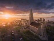
Austurvöllur was central in the protests following the banking collapse of 2008, along with Lækjargata, home to the House of Government. You are also not likely to miss the great church of Hallgrímskirkja that towers over the city from the hill of Skólavörðuholt, from which you’ll get a great view of the city.
Try a walk by the city pond, Tjörnin, to greet the many birds that frequent the area and to visit the city hall, stationed by its banks. A beautiful park lies by the pond, ideal for a nice walk, and sometimes concerts get held there.
Further off is the campus of the University of Iceland, the Nordic house and the Vatnsmýrin wetland, a particularly pleasant place, but be mindful to not disturb the wildlife there by keeping to the pathways.
For a nice swim on a warm day, we particularly recommend Nauthólsvík beach, which is heated with geothermal water. Those who love a dip should also visit the Laugardalur valley, home to one of the city’s best swimming pools, which sits a short walk away from Ásmundarsafn gallery, a beautiful botanical garden and a domestic zoo.
A walk by the Ægissíða beach, with its old fishing sheds, in the west part of Reykjavík also holds a particular charm. From there, you can see all the way to president’s house at Bessastaðir, which is also a historical site in its own right, having been the educational centre of Iceland for centuries.
Another place that offers one of the city’s best views is Perlan, up on Öskjuhlíð hill. The hill itself is a popular place to spend a few hours, with over 176,000 trees and great opportunities for walking and cycling. Perlan also has and observation deck with great views, a café and an exhibition centre.
Furthermore, the city is a short drive from many of Iceland’s major attractions, most famously the Golden Circle and the Blue Lagoon. In close vicinity you’ll also find the Heiðmörk preservation area, a favourite local site of the people of Reykjavík, as well as the Blue Mountains, one of Iceland’s best skiing venues.
Finally, we’d like to stress that these are only some suggestions of the many things you might check out in Reykjavík. Whatever you choose to do, we hope you’ll be able to make the most of your visit and we wish you a pleasant stay in our capital.
ヨークルスアゥルロゥン氷河湖,Jökulsárlón is Iceland’s most famous glacier lagoon. Conveniently located in the southeast by Route 1, about halfway between the Skaftafell Nature Reserve and Höfn, it is a popular stop for those travelling along the South Coast or around the Ring Road of the country.
Geography
As a glacier lagoon, Jökulsárlón is a lake that is filled with the meltwater from an outlet glacier. In this case, it is Breiðamerkurjökull, a tongue of Europe’s largest ice cap, Vatnajökull.
It stands out, however, due to the fact that it also fills with icebergs breaking from the glacier, some of which tower several stories high.
These icebergs, other than their scale, are notable for their colouration. Although they are, as expected, largely white, most are also dyed electric blue in part, with black streaks of ash from eruptions centuries past.
When the icebergs finally make it across the lagoon, they either drift out to sea or wash up on the nearby shore. Because of the way they glisten against the black sands of Breiðamerkursandur, this area has been nicknamed ‘the Diamond Beach’.
In spite of being a rather recent formation, Jökulsárlón is the deepest lake in the country, with depths of 248 metres (814 feet). With a surface area of 18 square kilometres (7 square miles), it is also growing to be one of the largest.
History
Jökulsárlón has not been around since Iceland’s settlement; it only formed around 1935. This was due to rapidly rising temperatures in the country from the turn of the twentieth century; since 1920, Breiðamerkurjökull has been shrinking at a dramatic rate, and the lagoon has begun to fill its space.
Today, the expansion of Jökulsárlón is accelerating. In 1975, it had less than half its current surface area.
In the relatively near future, it is expected that the lagoon will continue to grow until it becomes a large, deep fjord.
Though a dark omen for Iceland’s glaciers and ice caps in general, the retreat of Breiðamerkurjökull has resulted in an incredibly beautiful, if temporary, site. This has not been overlooked by Hollywood.
Jökulsárlón has been featured in the James Bond films A View to Kill in 1985 and Die Another Day in 2002, 2001’s Lara Croft: Tomb Raider, and 2005’s Batman Begins.
In 2017, Jökulsárlón was enveloped into the Vatnajökull National Park, thus it is now fully protected by Icelandic law.
Wildlife
Because of the wealth of herring and capelin that the tides bring into the lagoon, Jökulsárlón is somewhat of a hot-spot for Iceland’s wildlife.
In summer, it is a nesting site for Arctic Terns; stay well away from their nesting area, as these birds are notorious for the fierceness with which they protect their eggs, dive-bombing the heads of any they see as a threat. Skuas also nest on the lake’s shores in this season.
Seals can be reliably spotted here throughout the year, swimming amongst or else hauling out on the icebergs. Jökulsárlón provides them with a safe haven to rest and socialise, especially considering the waters of southeast Iceland are renowned for their population of orcas.
ヴァトナヨークトル,Vatnajökull glacier is the largest glacier in Europe, covering 8% of Iceland’s landmass.
It is the central feature of the Vatnajökull National park, found in the south west of Iceland, a popular spot for activities like glacier hiking from Skaftafell, boat tours in the Jökulsárlón glacier lagoon, and ice caving tours between November and March.
Facts about Vatnajokull
Vatnajökull has a surface area of approximately 8,100 square kilometres (3127 square miles); though it is rapidly shrinking due to climate change, its recession is not quite as advanced as at other glaciers, such as Langjökull and Mýrdalsjökull. In parts, it is a kilometre deep (over three thousand feet), and its average thickness is around half of that.
Vatnajökull also holds the tallest peak in Iceland beneath its ice; Hvannadalshnjúkur is 2,200 metres tall (7,218 feet). It also conceals some of the most active volcanoes in the country, the most notable being Grímsvötn, Öræfajökull and Bárðarbunga.
Volcanic activity in the region has occurred on and off throughout the centuries, and many geologists believe that several eruptions are overdue. If their calculations are correct, it would mean significant volcanic activity for Vatnajökull over the scope of the next half-century.
Depending on winds, this could result in worldwide consequences in terms of air-travel, agriculture and the general climate.
The glacier boasts over 30 outlet glaciers, which are channels of ice that flow out of ice caps but remain constrained on the sides of the valley. The major outlet glaciers of Vatnajökull include Dyngjujökull in the north, Breiðamerkurjökull, and Skeiðarárjökull to the south. To the west, one can find the outlet glaciers Síðujökull, Skaftárjökull and Tungnaárjökull.
Numerous rivers run out of Vatnajökull, making up some of the greatest glacial rivers in Iceland. The most notable are:
Tungnaá (west)
Köldukvísl (west)
Þjórsá (west)
Jökulsá á Fjöllum (north)
Skjálfandafljót (north)
Jökulsá á Brú (northeast)
Jökulsá í Fljótsdal (northeast)
Jökulsá í Lóni (south)
Hornafjarðarfljót (south)
Jökulsá á Breiðamerkursandi (south)
Skeiðará (south)
Núpsvötn (south)
Hverfisfljót (south)
Skaftá (south)
Vatnajokull National Park
Vatnajökull National Park was established in June 2008 and has slowly grown to include more and more areas. The park now covers an area of 14,141 square kilometres (5,460 square miles), 14% of the country. It is the second largest national park in Europe.
Rivers divide the highland plateau to the north of the park. The volcanic table mountain Herðubreið towers over this particular region, along with volcanoes Askja, Snæfell and Kverkfjöll.
The canyon Jökulsárgljúfur was carved out by glacial floods centuries ago. At the upper end of the canyon, you'll find Dettifoss, the most powerful waterfall in Europe. Further north, the horseshoe-shaped canyon Ásbyrgi is believed to have formed when Óðinn's eight-legged horse, Sleipnir, stepped his foot down from the heavens.
East around Snæfell, one can find wetlands and ranges, home to roaming herds of wild reindeer and abundant birdlife. Steep mountain ridges make up the south side of Vatnajökull, where outlet glaciers crawl onto the lowlands. The sandy plains of Skeiðarársandur also lie to the south, and the glacial river Skeiðará runs through this vast desert.
One of Iceland's most visited landmarks in the National Park is the Jökulsárlón glacier lagoon, which sits at the base of the outlet glacier Breiðamerkurjökull. Here, large icebergs that have broken off the glacier float across a vast lake before ending up in the Atlantic Ocean, or washed ashore on the nearby Diamond Beach.
This is one of the best seal-watching spots in the country.
The Future of Vatnajokull
The volume of Vatnajökull reached its peak around 1930 but has since been in a steady process of decline. Because of rising levels of global temperature, Vatnajökull has on average lost about a metre (three feet) of its thickness annually over the past 15 years.
If temperature levels continue to rise, the glacier could be all but gone nearing the end of the next century, leaving only small ice caps on top of the highest mountain summits.
Efforts are being made to prevent what some say is the inevitable, with reforestation projects going on all around the glacier, a proven method of cooling the area. Time will tell how successful they are.
Vatnajokull and Jokulsarlon in Popular Culture
The beauty of Vatnajökull National Park has not gone unnoticed by those in film or television. Many famous scenes have been shot here, starting with James Bond: A View to Kill in 1985. Other notable films with scenes here include Batman Begins, Lara Croft: Tomb Raider, and James Bond: Die Another Day.
Most famously, however, many places in Vatnajökull have been used in the HBO Series Game of Thrones, north of the Wall. The Wall itself is constructed with CGI using shots of the glacier.
スコゥガフォスの滝,Skógafoss is one of Iceland’s biggest and most beautiful waterfalls with an astounding width of 25 meters (82 feet) and a drop of 60 meters (197 feet).
Due to the amount of spray the cascade produces, at least one rainbow is present any time the sun emerges from behind the clouds.
Located on the Skógá river, this mighty cascade is clearly visible from Route 1 and is an excellent place to stop and stretch the legs while travelling Iceland’s South Coast. The river below Skógafoss holds a large char and salmon population and is thus a favourite spot for fishermen in the summer.
The land underneath the waterfall is very flat, allowing visitors to walk right up to the wall of water. This will get you drenched, although, on a summer’s day, it can be quite tempting.
Skógafoss can also be viewed from the top as a steep staircase leads to an observational platform above the cascade. Many nesting seabirds can be found on the route up.
Geography
Skógafoss is located near the small village of Skógar, south of the Eyjafjallajökull glacier volcano. There you’ll find the Skógasafn folk museum, an open-air museum with both old wooden houses and turf houses, as well as a regional museum with various artefacts from this area.
A part of the Skógasafn Regional Museum is the Museum of Transportation, which showcases the history and evolution of transportation, communication and technologies in Iceland. There, you can see how this nation evolved from the age of the working horse to the digital communications of the 21st century.
The Skógasafn museum also includes a café and a museum shop, and in the village of Skógar, you will find both a hotel and a restaurant.
At the eastern side of Skógafoss, you will find one of Iceland’s most famed hiking routes; the Fimmvörðuháls pass. The 22 kilometre (14 miles) trail takes you along Skógá river, between two glaciers, Mýrdalsjökull and Eyjafjallajökull, before ending in the beautiful Þórsmörk valley.
Skógafoss is often visited alongside the waterfall Seljalandsfoss, which is just a little further along the South Coast. Both fall from cliffs of the same height, and while Skógafoss is much more powerful, Seljalandsfoss has a cave behind it, which means it can be fully encircled. It is also next to a much lesser known but still awe-inspiring waterfall, Gljúfrabúi.
Folklore
A gold ring is on display at the Skógasafn museum. According to legend, the ring is from a chest that was owned by Þrasi Þórólfsson, one of the first Viking settlers in the area, who by some accounts was a giant. Folklore states that before his death in 900 AD, Þrasi buried a chest filled with gold in a cave behind Skógafoss waterfall.
Many attempts were made to retrieve the chest after Þrasi’s death, and years later, locals managed to grasp a ring on the side of the chest. As they pulled, the ring broke off, and the treasure was lost forever. The ring was then given to the local church before it made its way to the museum.
セリャラントスフォスの滝,Seljalandsfoss is a waterfall that can be fully encircled, situated on the South Coast of Iceland with a drop of 60 metres (200 feet).
Due to the waterfall’s close proximity to the Ring Road and impressive natural features, it is one the country's most famous and visited falls. Majestic and picturesque, it is one of the most photographed features in all of Iceland.
Geology and Surroundings
Seljalandsfoss waterfall, part of the river Seljalandsá, has its origins underneath the glacier Eyjafjallajökull. The volcano beneath this ice cap was the one that erupted in 2010 and caused havoc at airports across Europe.
The cascade of the falls is relatively narrow but falls from a tall cliff that once marked the country's coastline, the sea is now located across a stretch of lowlands and is visible from the site.
The most distinguishing feature of Seljalandsfoss is a pathway that stretches all the way around it. The cliffs behind the falls have a wide cavern, and rocks and paths allow guests to fully encircle it in summer.
Though a mesmerising opportunity, visitors should be prepared to get dampened due to the perpetual mist of the falls, which also tends to make the rocks of the pathway slippery.
Floodlights have been set up on both sides of the waterfall, which impressively illuminate the scene during the night when the midnight sun is not out. The lights were installed in 2001 due to the growing popularity of the falls as a tourist destination.
After visiting Seljalandsfoss, it is common for visitors to continue north to the waterfall Gljúfrabúi, which is found partially hidden behind a rock face. Because of Seljalandsfoss extreme popularity, Gljúfrabúi is widely considered the hidden gem of the scene, as it is too often overlooked.
Seljalandsfoss is also usually visited alongside the nearby Skógafoss. The waterfall falls from the same height, and while it cannot be encircled, it is much more powerful and steeped in the legend of a giant’s hidden treasure.
Visitor Centre Controversy
In 2017, it was announced that a visitor’s centre was to be constructed near the falls. The design of the building indicated that it would be seven metres (23 feet) high and 2,000 square metres (21,500 square feet) in size. Landowners in the area opposed to the idea, proclaiming that the centre would greatly alter the natural appearance of the waterfall’s renowned scenery.
The project has neither been fully approved nor wholly cancelled, with ideas surfacing of either significantly reducing the size of the construction, or moving the visitor centre’s location further away, for instance to the nearby farmstead Brekkuhorn.
Seljalandsfoss in Popular Culture
Along with a multitude of South Iceland’s most famous natural attractions, Seljalandsfoss can be seen in Justin Bieber’s music video for his song ‘I’ll Show You’. Please enjoy the video without emulating any antics that will endanger yourself or the environment.
The waterfall was also a featured waypoint during the first leg of the sixth season of The Amazing Race, an American reality TV series.
エイヤフィヤトラヨークトル氷河,The glacier volcano of Eyjafjallajökull is notorious the world over for causing havoc to air travel in 2010, and stumping television anchors everywhere as they tried to pronounce it. 1651 metres (5427 feet) tall, it is one of the most dominant features of the South Coast.
Geography
The glacier of Eyjafjallajökull is approximately 100 square kilometres (39 square miles), making it the country’s sixth largest. It sits close to the fourth greatest, Mýrdalsjökull, which also conceals another notorious volcano, this one called Katla.
While Eyjafjallajökull’s eruption was huge and disruptive, it pales in comparison to the potential of Katla. Far more explosive, and under much thicker ice, an eruption here in unfavourable wind conditions could have worldwide consequences.
The magma chambers between both of these mighty volcanoes are connected, and, unfortunately for us, an eruption at Eyjafjallajökull is usually followed by one at Katla within a decade.
Eyjafjallajökull has many glacial outlets, the most famous being Gígjökull. Many rivers flow from its meltwater, and one of these falls into the beautiful South Coast waterfall, Seljalandsfoss, which it is possible to fully encircle.
Eruptions
Eyjafjallajökull’s most recent eruption was no doubt the most famous in Iceland’s history (although the honour really should go to Laki, the 1783-4 eruption of which caused an ash cloud so great that Europe fell into a famine that many historians believe led to the French Revolution). On March 27th, 2010, magma began to bubble from beneath the surface, and by April 14th, ash was starting to billow from the peak.
800 people were evacuated, in fears not of magma, but of equally dangerous glacial floods, which have decimated Icelandic towns in the past. Animals were ordered to be kept inside, and those with respiratory problems told they should also stay indoors.
Air travel across Europe was halted, as, by the evening of April 15th, the ash was already over the UK, Scandinavia, and parts of Germany. Holidaymakers were trapped, waiting for news, and would end up stuck for eight days; in Scotland and Ireland, there were even flights delayed in May due to lingering effects.
Thankfully, no one was injured, although the ash is thought to have caused respiratory issues for some in the south of the country. Many farms were also destroyed by the ash and floods, with some farmers still struggling to recover today.
Since settlement in 874, Eyjafjallajökull has also erupted in 900, 1612, and from 1821 to 1823. The latter released a huge amount of fluoride which is believed to have affected the bone health of humans and animals alike at the time.
Eyjafjallajokull today
Eyjafjallajökull is now entirely safe to visit and is seen on most tours of the South Coast in clear weather. In the town of Hvolsvöllur, there is a visitor’s centre on the volcano, which focuses on the experience of one family whose farm, Þorvaldseyri, was one of the many destroyed by the floods, lava and ash.
It is very unlikely that Eyjafjallajökull will erupt again any time soon, with hundreds of years between each eruption, but as mentioned, its neighbour Katla might start rumbling...
ディルホゥラエイ,Dyrhólaey Peninsula is a 120-metre promenade famed for its staggering views of Iceland’s South Coast, as well as its historic lighthouse and wealth of birdlife. It is home to a rock arch of the same name.
Dyrhólaey, which translates to Door Hill Island, is of volcanic origin and was once an island before joining up to the Icelandic mainland. In ancient times, passing sailors used to refer to Dyrhólaey as ‘Cape Portland’.
It is also the southernmost part of the Icelandic mainland, making it a popular stop for sightseers travelling along the Ring Road, and can be found close by the coastal village of Vík í Mýrdal.
Other features along the South Coast en route to Dyrhólaey from Reykjavík include the waterfalls Seljalandsfoss and Skógafoss, and the glacier Eyjafjallajökull.
Dyrhólaey Arch
Dyrhólaey’s most instantly recognisable attraction is the promenade’s massive rock arch, a result of centuries of erosion. As a result, its name is in direct reference to this enormous arch. In fact, this natural feature is so large and dramatic that one daredevil pilot even flew through it, back in 1993. Boats can easily cruise through its opening.
Dyrhólaey Wildlife
Dyrhólaey has an abundance of birdlife, the most common year-round being Eider Ducks. Iceland’s favourite winged resident, the migratory Atlantic Puffin, can be found here from May to September.
It is one of the best places to reliably locate them, and one of the closest to Reykjavík after the islands in Faxaflói Bay which can be visited by boat from the Old Harbour.
While watching puffins, it is striking how little they seem to fear people, as they allow you to get very close. Be aware, however, they do not like to be touched, and if one flies off in a panic, the whole flock might follow it, so be respectful.
Features at and around Dyrhólaey
From your position atop the promenade of Dyrhólaey, you can enjoy staggering views over Iceland’s black sand beaches, complemented by the glittering waves of the Atlantic on one side, and distant mountainscapes to the other.
The most notable stretch of coast here is called Reynisfjara, renowned for its incredible geology, with the sea-stacks of Reynisdrangar jutting up out to sea. If you visit this beach while seeing Dyrhólaey as part of a South Coast adventure, be sure to follow the warning signs and stay away from the water as dangerous sneaker waves here are commonplace.
To the north, you will also able to see the creeping glacier, Mýrdalsjökull. This amazing ice cap conceals a secret; beneath its surface is one of the most explosive and notorious volcanoes in all of Iceland, Katla. Long overdue, experts say that it is a matter of when - not if - it will erupt over the coming years.
On top of Dyrhólaey stands Dyrhólaeyjarviti, a beautiful old lighthouse that consists of a white, square concrete tower. The first lighthouse in the area was built in 1919; the current construction was completed in 1927. Visitors here will be able to see the lighthouse flicking out beams of white light to sea every ten seconds.
ミールダルスヨークトル氷河,Mýrdalsjökull is a glacier in the south of the Icelandic highlands. It is the country's fourth largest ice cap, covering nearly 600 square kilometres (232 square miles), and its highest peak is almost 1500 meters tall. It is most well-known for sitting atop the notorious and explosive volcano, Katla.
Mýrdalsjökull is visible from Route 1 on the South Coast, sitting to the north of the village of Vík. It is visited on some snowmobiling, ice caving and helicopter tours, and one of its glacial outlets, Sólheimajökull, is the most popular place in the country for ice-climbing and glacier hiking.
Eruptions beneath Myrdalsjokull
Since 2010, the world has known of the volcano beneath Eyjafjallajökull; after all, it halted European air travel for over a week and stumped news readers everywhere. Few, however, are aware of the much larger volcano right beside it.
Mýrdalsjökull conceals Katla, one of the country’s most active volcanoes, having erupted, on average, once every fifty years since 930 AD. Because of the glacier above it, these eruptions tend to cause enormous ash clouds. It is these ash clouds that lead to flights being grounded, crops and livestock poisoned, and have the potential to change the world’s climate.
The last major eruption beneath Katla was in 1918, in which such huge lahar floods occurred that the southern coastline was extended five kilometres outwards. This area is also very susceptible to glacial floods, or 'jökulhlaup', during eruptions, even when the lava does not break through the surface of the ice. These are as dangerous as the lava itself, having wiped out whole Icelandic villages before.
Historically, the area was little settled for this reason.
Katla is connected to the same volcanic system as Eyjafjallajökull and usually erupts violently a few years after Eyjafjallajökull does. As the ex-president, Ólafur Ragnar Grímsson said in 2010:
‘The time for Katla to erupt is coming close… it is high time for European governments and airline authorities all over Europe and the world to start planning for the eventual Katla eruption’So it is currently several years overdue. Katla is monitored heavily, and roads around it closed when seismic activity increases. All road closures around Iceland can be found on Road and Coastal Administration's website.
Tours on Myrdalsjokull
While there are no eruptions immediately imminent, tours continue to run onMýrdalsjökull, allowing visitors to enjoy the glacier. It is, for example, possible to snowmobile across its surface throughout the year and take ice caving tours beneath it throughout the year, with departures from both Reykjavík and Vík.
Considering the ice caves under Vatnajökull glacier are usually only accessible from November to March, this provides a wider window of opportunity for travellers to Iceland outside of the depths of winter. It should be noted that the caves in Mýrdalsjökull do not have the same blue ice, however.
Tours around Myrdalsjokull
Mýrdalsjökull can be seen on all South Coast tours that reach Vík and beyond in clear weather. It can also be seen from above on helicopter tours that depart from Reykjavík.
The best perspectives of the glacier, however, can be found on the popular Fimmvörðuháls hiking trail, which goes between Eyjafjallajökull and Mýrdalsjökull. Part of this hike can be done in a day, or you can take the complete route from Þórsmörk to Skógar on a three-day trek
ソゥルヘイマサンドゥル,Sólheimasandur is a vast area of sand and gravel along the South Coast of Iceland, between the cliffs of the interior and the modern shoreline. It was built up by immense glacier bursts sweeping from the mountains to the shore.
Geography of Sólheimasandur
Sólheimasandur is a glacial outwash plain, meaning when that when eruptions happen under the nearby glacier, Mýrdalsjökull, the floodwater rushes across this land for the sea.
A glacial flood, otherwise called Jökulhlaup (one of two words taken from Icelandic in the English language, the other being geyser) is perhaps the most dangerous immediate element of an Icelandic eruption. While individuals have been killed by lava flows and bombs, many more have lost their lives to the water.
For this reason, Sólheimasandur has no significant settlements, all the way from the village of Vík í Mýrdal to Kirkjubæjarklaustur. The whole area is vulnerable to glacial floods, which are still notoriously unpredictable to modern science.
This is especially the case considering that the volcano beneath Mýrdalsjökull, Katla, is Iceland’s most active volcano, which carries a reputation for violently erupting, seemingly at random.
Even if these eruptions do not break the surface of the ice, they can still cause devastating floods. In fact, these can even be more dangerous, as these eruptions are often not detected..
If Katla is showing signs of waking, then the Ring Road going south across Sólheimasandur is often closed.
In spite of its dark reputation, Sólheimasandur is a place of ethereal and haunting beauty. Entirely flat, composed of black sands, it is often compared to a lunar landscape, or else some kind fantastical desert. The views of Mýrdalsjökull, Vatnajökull, the Highlands and the South Coast are also magnificent in clear weather.
Sólheimasandur is easy to reach, laying on the Ring Road that encircles the country.
The DC-3 Plane Wreckage
Wikimedia, Creative Commons, Photo Credit: Sekeri
One of the most impressive sights on Sólheimasandur is the DC-3 plane wreckage. Lying abandoned in the sand, a deteriorating skeleton, with nothing but endless black sand surrounding it, it makes an eerie destination even more ominous.
It is a US Navy plane, that was flying across the area in 1973; until recently the US had a NATO base at Keflavík, as Iceland has no armed forces of its own. It seemed to run out of fuel - although it was later discovered that the pilot had, in fact, switched to the wrong fuel tank - and had to make an emergency landing.
Thankfully, no one was killed or injured, although the plane was far too damaged to be repaired.
Because there were no deaths or injuries, there is nothing tasteless about taking photos with the plane. In fact, it a popular addition to many South Coast tours. Because the wreckage is not expected to remain there for long - considering the regular glacial floods that rush through the area - it is fine to touch it. It is not recommended that you climb on it, however, for safety reasons.
To reach the plane requires a short walk across Sólheimasandur.
ホプン,Höfn is an Icelandic fishing town of just over two thousand people in southeast Iceland. It is the most significant settlement on Route 1 between the village of Kirkjubæjarklaustur in the south and Egilsstaðir in the east.
Geography of Höfn
Höfn means ‘harbour,’ as the town is located in one of the few natural harbours of Iceland’s South Coast; unlike the rest of the country, this stretch is beachy and flat, and thus there are hardly any small coastal villages when compared to places such as the Snæfellsnes Peninsula.
The town is right at the tip of its own peninsula, which is easy to reach throughout the year. It sits at the base of Route 99, which detours off from Route 1. It is surrounded on three sides by the ocean, which has been known to freeze over in extreme conditions.
The town can also be reached by plane in good weather, as it is one of the few locations in the country with a domestic airport.
The largest glacier in Europe, Vatnajökull, which sits in a National Park of the same name, is within clear view of Höfn.
Nearby Locations to Höfn
Höfn is most often visited by those driving the full Ring Road of Iceland, as a place to stay just before or after visiting the South Coast or East Fjords.
It is also visited independently, however, by those seeking to spend enough time near the sites of southeast Iceland, most notably Vatnajökull National Park, the Jökulsárlón Glacier Lagoon, the Diamond Beach and Vestrahorn Mountain.
All of these sites are incredible. Vatnajökull, for example, is incredibly diverse, boasting a huge array of different sites to marvel over. In its southwestern corner, for example, it is home to the Skaftafell Nature Reserve, an oasis of unbelievable scenery, whereas to its west sits the mighty mountain Snæfell, renowned for its wildlife such as pink-footed geese and reindeer.
The Jökulsárlón Glacier Lagoon has recently been enveloped into the National Park, but warrants its own discussion. Out of all the sites listed, it is here where most visitors to Höfn want to spend the bulk of their time. This lagoon is, in fact, Iceland’s deepest lake, and renowned for being full of great icebergs throughout the year.
These bergs snap off of a tongue of Vatnajökull glacier, before slowly cruising through the waters towards the ocean. As they travel, they often become resting spots for some of the many seals who live in and around the lagoon.
The site is marvellous to behold, with a particular appeal for landscape photographers. Visitors, however, should not spend all their time in the lagoon. By following the channel from Jökulsárlón to the ocean, you will come onto the Diamond Beach, where these icebergs wash up on the shore and glisten against the black sands.
A final site in southeast Iceland, closer to Höfn than those previously listed, is Mount Vestrahorn. This jagged peak is ominous and dramatic, with two sharp peaks that have created the nickname ‘the Batman Mountain.’ Another favourite amongst photographers, it’s distinct silhouette and colouration make it the perfect subject regardless of the weather.
Culture at Höfn
Like many of Iceland’s small, coastal towns, Höfn has a surprising amount of culture. Its cuisine is particularly notable, with the celebration of it coming to a head at the annual Lobster Festival, held every July. This comes as little surprise, considering the town’s long history as an important fishing port.
Höfn also has several art museums where visitors can admire local handicrafts, although it should be noted, in spite of conflicting evidence on the internet, that the Höfn Glacier Museum is now closed.
レイニスフィヤラのブラックサンドビーチ,Reynisfjara is a world-famous black-sand beach found on the South Coast of Iceland, just beside the small fishing village of Vík í Mýrdal.
With its enormous basalt stacks, roaring Atlantic waves and stunning panoramas, Reynisfjara is widely considered to be the most beautiful example of Iceland’s black sand beaches. In 1991, National Geographic voted Reynisfjara as one of the Top 10 non-tropical beaches to visit on the planet.
Reynisfjara is found around 180 kilometers (112 miles) from Iceland’s capital city, Reykjavík, and is a popular stop-off for those taking a sightseeing tour along the popular South Coast.
Driving to the beach is particularly easy, taking an approximate two and a half hours from the capital, so can easily be done within half a day, or a full one combined with other features.
Folklore
Upon visiting the beach, travelers will immediately observe rocky sea stacks sitting off the shoreline, known as Reynisdrangar.
According to local Icelandic folklore, these large basalt columns were once trolls trying to pull ships from the ocean to shore. However, these trolls were dim and went out too late in the night; dawn broke on the horizon, turning the trolls into solid stone.
Another legend tells of a husband whose wife was kidnapped and killed by two trolls. The man followed the trolls down to Reynisfjara where he froze them, ensuring that they would never kill again.
So mesmerizing are these features that they featured in Season 7 of the HBO Series Game of Thrones; you can spot them in a few scenes shot ‘North of the Wall’.
The sea stacks themselves are home to thousands of nesting seabirds. Species that can be found here include puffins, fulmars and guillemots, making it a must-see location for all birdwatchers out there.
Surrounding Sites
Reynisfjara beach is located conveniently in the middle of the South Coast, adjacent to the village of Vík. This means that those taking the Ring Road around the country, or else those heading to the Jökulsárlón glacier lagoon, will pass it, and are encouraged to make a stop.
The closest major landmark is the Dyrhólaey rock arch and cliffs. While many seabirds are found at Reynisfjara, it is nothing compared to the numbers here. From May to August, it is one of the best places to see puffins from land.
En route to Reynisfjara from Reykjavík, you will discover waterfalls, such as Seljalandsfoss and Skógafoss, and glaciers, such as Eyjafjallajökull and Mýrdalsjökull. Further along the South Coast, you will reach the Vatnajökull National Park, with its many glacier tongues, glacier lagoons, black sand deserts, and the incredible Skaftafell Nature Reserve.
Potential Dangers
Visitors to Reynisfjara must be made well aware of the potential dangers present at the beach. First of all, the rolling, roaring waves of Reynisfjara are particularly violent, often pushing far further up the beach than many would expect.
These are called sneaker-waves, and they can appear when least expected, even on incredibly still days. There are no significant landmasses in between Antarctica and the shores of Reynisfjara, meaning waves have thousands of kilometers to build.
Visitors are advised to never turn their back on the waves, and keep a safe distance of at least 30 meters (98 feet).
Aside from these sudden and dramatic shifts in the tide, the rip currents offshore are infamous for their strength and ability to drag helpless people out into the freezing cold open ocean. A number of fatal accidents have occurred at Reynisfjara, the last of which occurred in January 2017.
ヴィークの町(ヴィーク・イ・ミールダル),Vík í Mýdral, or just Vík, is the southernmost village on the Icelandic mainland, located 186 kilometres (110 miles) from the capital Reykjavík.
Often visited by those travelling the popular sightseeing route along the South Coast, it is a wonderful place to stop, recharge, and if you are taking your time, rest for the night. Though it only has around 300 residents, the village is very popular amongst tourists for its convenience and beautiful surrounding landscapes.
Features near Vik
Reaching Vík from Reykjavík takes approximately two and a half hours, and en route, there are many marvellous features to admire. Two of the country’s most famous waterfalls, Skógafoss and Seljalandsfoss, lay between the two destinations; the former has awe-inspiring power, whereas the latter can be fully encircled.
The glaciers Eyjafjallajökull and Mýrdalsjökull can also be seen on clear days; both of these cover volcanoes which are particularly explosive, with Eyjafjallajökull famously disrupting European air travel in 2010. Out to sea in especially good weather, the Westman Islands can also be seen on the horizon.
Just before Vík are the popular birdwatching cliffs of Dyrhólaey, where you can also find an enormous rock arch curving out into the ocean. This is one of the best places for birdwatching in Iceland, with thousands of puffins nesting here from May to August.
The village itself sits opposite one of the country’s most famous features: Reynisfjara black sand beach. Considered one of the world’s most beautiful non-tropical beaches, it boasts incredible geology.
Particularly of note are the Reynisdrangar sea-stacks, said to be two trolls frozen in the light of the morning sun as they tried to pull a ship into shore.
Though this beach makes for a lovely walk, particularly for those staying in Vík overnight, as they can see it under the midnight sun or northern lights, it has its dangers. Sneaker waves can be notorious here, so visitors should stay far from the water’s edge, and never go for a swim. Lives have been lost here before.
The route to Vík from Reykjavík is beautiful and continues to be so as you travel further along the South Coast, through the Skeiðarásandur black-sand-plains into Vatnajökull National Park. This beautiful region is often the final destination of those passing through Vík, as it is home to the largest glacier in Europe, the Skaftafell Nature Reserve, and Jökulsárlón Glacier Lagoon.
Of course, ambitious travellers will carry on from here to encircle the full country.
Wildlife around Vik
Vík, due to its closeness to the Reynisfjall and Dyrhólaey cliffs, has a rich birdlife. Short walks from the village will take you to the nesting grounds of gulls, fulmar, guillemots, and in summer, puffins.
Due to its coastal location, visitors to Vík have a decent chance to see seals on the shore. There is also a slim chance to see whales or dolphins; the twenty or so species that live in Iceland’s waters can appear at any time.
Services in Vik
Vík has a wide variety of public services, due to its remoteness and its importance in connecting the east and west of Iceland. There are gas stations, shops and cafes, a swimming pool, a wool factory that can be visited, and a wide range of accommodation options for all budgets.
Please note, however, that as the village has such a small year-round population, those with special dietary requirements should purchase their food from Reykjavík before departing.
レイニスドランガル,Reynisdrangar are impressive rock formations situated near the shore of Reynisfjara beach by the coastal village Vík on the South Coast of Iceland.
The formations are the remains of large and imposing sea cliffs, made up of basalt, that serve as a vital part of the area’s allure; they shoot dramatically out of the ocean under the looming cliffs of Mt. Reynisfjall, making for a beautiful site, and have a folklore that is equally impressive.
More modern visitors will be excited to know that these pillars also feature in Season 7 of Game of Thrones, at Eastwatch by the Sea.
Dangerous Waves
Before getting into the wonders of Reynisdrangar, it is important for potential visitors to be aware of the dangers at the site.
These majestic rock pillars rise from the sea just off of Reynisfjara, a famous black sand beach on the South Coast, by the village of Vík. Though incredible due to its diverse and dramatic geology, Reynisfjara is gaining a notorious reputation for its sneaker waves.
There are no significant landmasses between Antarctica and Reynisfjara, giving waves the entire length of the Atlantic Ocean to build strength. This means that even on still, summer days, they can rise from seemingly nowhere and chase far further up the sand than would ever be expected.
It is absolutely imperative, therefore, that guests stay at least 30 metres (98 feet) from the water’s edge. Those who flout these rules put their lives and the lives of others at risk; people have died here before.
Folklore
As with almost all bizarre features in this country, there is an Icelandic folk tale that explains the origin of the Reynisdrangar pillars and their eerie appearance.
According to legend, a couple of trolls saw a ship out to sea by night, and waded out to reach it. They got hold of it, and began to drag it to shore, but as so often happens in troll stories, they got their timing wrong.
Before they were even close to getting to the shade, dawn broke. The trolls and ship were instantly frozen into stone, and they have remained immortalised since, as a warning to their kin.
This is not the only folk tale in this area. According to local legend, two other trolls murdered a woman, whose husband hunted them down, tricked them into coming out at night, and ensured they too were turned to stone. Their remains can be found inland.
Surroundings & Wildlife
Most visitors will only see the Reynisfjara sea-stacks from the shore of Reynisfjara, although there is an incredibly rewarding alternative view of them from above. Those with a reasonable level of fitness can venture up the bewitching cliffs of Mt. Reynisfjall, by a road to the west of Vík.
The mountain furthermore holds thousands of puffins every summer, from May to August. These adorable creatures have very little fear of people, and can be approached within metres (although you should never try to touch them). Other birds can be seen gliding around the cliffs such as Arctic terns, fulmars and seagulls.
The oceans of Iceland are pregnant with life, so lucky visitors may also see seals in the water, or even one of Iceland’s twenty species of whale and dolphin.
ブレイザメルクルヨークトル氷河,Breiðamerkurjökull is the glacial tongue that extends from southern Vatnajökull and into the glacier lagoon Jökulsárlón, creating the icebergs that define this beautiful landmark.
Breiðamerkurjökull is constantly retreating, breaking and melting, causing the Jökulsárlón glacier lagoon to increase in size; it is less than a century old, but already the deepest lake in Iceland.
This glacier tongue provides the lagoon with all of its enormous icebergs, which perpetually break from off its tip and tumble into the waters. Here they float for about five years until they are small enough to make their way towards sea. When they finally do escape the lagoon, most join the countless smaller ice chunks that adorn the nearby Diamond Beach.
Breiðamerkurjökull is beset with enormous cracks and crevices, and since it's virtually impossible to tell exactly when the next big block of ice will break from it, people should admire this enormous glacier tongue from a great distance.
南海岸,
The South Coast of Iceland is one of the most popular parts of the country for travellers. South Iceland is lined with countless natural wonders including cascading waterfalls, volcanoes, glaciers and black sand beaches.This incredible South Shore of Iceland stretches from the greater Reykjavík area in the west to the magnificent Jökulsárlón glacier lagoon in the east. It’s possible to incorporate a trip to The Golden Circle before heading South. This is another popular area with visitors to Iceland. Here you can see Þingvellir (or Thingvellir) National Park, the Geysir geothermal area, a volcanic crater called Kerið, and one of Iceland's biggest waterfalls; Gulfoss.
Highlights of the South Coast of Iceland
The South Coast offers an array of natural wonders that draw thousands of visitors each day.The whole area is geologically very young, formed during the last Ice Age by the lava flows from numerous volcanoes in the area. The lowlands are surrounded by volcanically active mountains, notably Eyjafjallajökull and Hekla. If you stop at Hveragerði, you can visit the Quake 2008 exhibition where you can witness the split in the North American and Eurasian tectonic plates.
In terms of culture in the South, it is rich and diverse. Most towns have amateur groups for theatre, poetry reading, and choir song. Community is a big part of an Icelander’s life and one of the key things that help them get through the winter months. The South was once home to the ancient bishop seat of Skálholt. Also, Iceland's most famous saga, Njal's Saga, takes place in the region.
When driving the South Coast route from Reykjavík city, the first major features are the two great waterfalls of Seljalandsfoss and Skógafoss. These falls which sit beneath the notorious subglacial volcano, Eyjafjallajökull. On clear days, the Westman Islands can be seen across the ocean from these beautiful cascades. Less than a kilometre from Seljalandsfoss is the hidden gem of Gljúfrabúi waterfall.
Skógar, which is home to Skogafoss waterfall, has a very interesting museum that discusses some of the nation’s history and culture. One of Iceland’s most famous hiking trails, Fímmvörðuháls, cuts through the area and is worth the walk if you have time.
A little further down the route is the glacier Mýrdalsjökull glacier, which covers one of Iceland’s most explosive volcanoes, Katla. Many glacier hikes are taken here upon the glacier tongue, Sólheimajökull.
This landscape has also been shaped by volcanic eruptions, although these were much more recent. Vast expanses of the black sand stretch from the Highlands to the sea, part of several glacial outwash plains that flood during a volcanic eruption. One such sandplain, Sólheimasandur, is home to a crashed DC-3 Plane Wreck.
The Dyrhólaey cliffs are next, home to many seabirds. Jutting out to sea is an enormous rock arch of the same name, which you can marvel at from many angles.
Adjacent to the village of Vík is the famous black-sand beach, Reynisfjara, which is home to basalt columns and the Reynisdrangar rock formations. These pillars are said to be two trolls frozen by the light of the sun.
Though beautiful, this area is notorious for its dangerous sneaker waves. Even on seemingly calm and still days, visitors should keep a distance from the shoreline. There are no landmasses between Reynisfjara beach and the continent of Antarctica, so you can imagine how the waves can build momentum.
After passing through Vík you will cross the glacial sandplain of Skeiðarársandur before entering Vatnajökull National Park. Here you can see Vatnajokull Glacier, Iceland’s largest glacier. Many ice cave tours take place in Vatnajokull in the winter months.
Move on to the dramatic Skaftafell Nature Reserve in the National Park. Here you can enjoy a diversity of landscapes and terrains. The area was considered a National Park in its own right because it was so beautiful.
Finally, you will approach the famous Jokulsarlon glacier lagoon, a deep lake that fills with icebergs as the Breiðamerkurjökull glacier slowly breaks down. Here there are plenty of options for boat tours that take you around the lagoon and up close to icebergs. A short distance from Jökulsárlón you will find the Diamond Beach, where blue icebergs wash on the black-sand beach, and another glacier lagoon called Fjallsárlón.
Geography, Nature & Wildlife
The South Coast is the most easily accessible part of the country’s southern region, found along the Ring Road (Route 1), which encircles Iceland. The area is made up of diverse landscapes; marshlands, bays, cultivated pastures, estuaries and black sand deserts.
Underneath the soil rests a vast lava field, known as Þjórsárhraun. Reaching several hundred metres offshore, it provides a protective factor to the lowland as ocean waves crash upon it. This results in the South Shore being unusually lacking in the deep fjords that so distinctly characterise the rest of Iceland's shoreline.
Unlike most early Icelandic settlements, few of the communities in the south were based on fishing. The only town with a significant harbour in the south is Þorlákshöfn, where the ferry to the Westman Islands leaves. Some agriculture is found here, with farms nestled in the mountains, but because of the glacial floods, they are few and far between.
There are, however, plenty of hot springs in the area. The most famous is the Blue Lagoon Spa which is close to Keflavik airport. The lagoon formed as a result of the overflow from a nearby power plant.
However, there are lots of natural geothermal hot springs in more remote locations, where you can avoid the crowds and have a more natural experience. Some of the spots travellers recommend are Seljavallalaug, which is close to Skogar, and Reykjadalur, the Valley of Steam, which is close to Hveragerði.
The South region boasts vibrant bird life during all seasons. Freshwater birds nest in the marshlands and around the estuaries, while seabirds flock around the cliffs of Reynisdrangar and Dyrhólaey.
You may be able to spot North Atlantic puffins nesting on the cliffs between May and August. In summer there are 2-3 times as many Arctic Tern as Icelanders so you are bound to spot some of them on your travels. Some species stay throughout the harsh Icelandic winter, including the northern diver, the loom and various species of gulls and ducks.
Seals are often found along the shore, particularly around the Jökulsárlón Glacier Lagoon and Diamond Beach. As with everywhere in Iceland, you should always keep an eye out to sea, as whales and dolphins reside all along its coastline.
In terms of sports; horse riding is popular, as is fishing, hiking, snorkelling, sightseeing and river rafting.
ダイヤモンドビーチThe Diamond Beach is a strip of black sand belonging to the greater Breiðamerkursandur glacial plain, located by Jökulsárlón glacier lagoon on the South Coast of Iceland.
Here, the icebergs which fill Jökulsárlón glacier lagoon wash up on shore, standing dazzling and defiant in stark contrast to the black sand beach. It is, therefore, a favourite amongst photographers, nature-lovers, and wildlife-enthusiasts. Many seals call this beach home, and it is one of the best places in the country to see orcas from the shore.
Breiðamerkursandur
Breiðamerkursandur is a glacial outwash plain located in the municipality of Hornafjörður. The sand stretches approximately 18 kilometres along Iceland’s South Coast, more specifically from the foot of Kvíárjökull Glacier to the famed glacier lagoon Jökulsárlón, that nests by the foot of Breiðamerkurjökull Glacier.
Both glaciers make up part of the 30 outlets of Vatnajökull, Europe’s largest ice cap and the central feature of the Vatnajökull National Park. Many of these are seen en route to the Diamond Beach as you travel along the South Coast.
The outwash plain was formed when three of Vatnajökull’s outlet glaciers, Breiðamerkurjökull, Hrútárjökull and Fjallsjökull, flowed forward due to volcanic activity and ground the rocks of the underlying surface, creating and pushing forward the glacial sediments.
Such sand plains are a common part of the Icelandic landscape, due to the island being volcanically active as well as boasting numerous ice caps. The terminus (the tip of a given glacier) also dug deep into the ground and left what is now the Jökulsárlón glacier lagoon. Although now the deepest lake in all of Iceland, it only began to form in 1935.
The glacier lagoon and Diamond Beach are fantastical sites, however, the rate of their expansion is, unfortunately, a consequence of climate change. With the rate that the glaciers are melting, there may be no ice left at either site within decades.
Jökulsárlón Icebergs
Jökulsárlón glacier lagoon is one of the most famed and visited attractions in Iceland. Floating on the lagoon are enumerable icebergs that have broken off the resident glacier, creating an ever-changing scenery of incredible allure.
The river Jökulsá connects the lagoon to the Atlantic Ocean, meaning that these icebergs eventually drift out to sea where they are polished by the waves before floating back to the black sands of Breiðamerkursandur. The name ‘Diamond Beach’ thus comes from the white ice on the black sand appearing like gemstones or diamonds, as they often glisten in the sun and sharply contrast their jet black surroundings.
Safety at the Diamond Beach
The Diamond Beach is a safe place for any responsible traveller; unlike at Reynisfjara, another South Coast black-sand-beach, sneaker waves and rip currents are not notorious for whisking unwitting tourists out to sea. However, there are still dangers to consider.
The main one of these is the icebergs themselves. Under no circumstance should you climb upon an iceberg, due to their slippery surfaces and sharp edges.
This is especially the case if the iceberg is at all in the water, as it could flip and trap you underneath, or else be pulled out to sea by a current with you on it.
The risk of injury and illness in the form of hypothermia is so great that extortionate fines exist to deter any ‘rebels’ looking for a thrill-seek. These have only come about due to serious incidents, to protect not only tourists at the lagoon but guides and staff who may feel obligated to embark on a dangerous rescue if they see someone at risk.
ピックアップ開始時刻 : 08:30.
ピックアップ時間になりましたら、バウチャーに記載されているピックアップ場所でバスをお待ちください。ホテルでピックアップとなる方は建物の外、バスが見える場所でお待ちください。バス停でのピックアップとなる方で場所が不明な場合、busstop.isで確認したり、ホテルのフロントまたはバウチャー記載のオペレーター会社にご連絡ください。ピックアップには30分ほど時間がかかることがございますが、20分過ぎてもバスが来ない場合やバスに乗り遅れてしまった場合には、バウチャーに記載のツアーオペレーター会社の電話番号へご連絡ください。必ず電話をかける・受けられる環境を整えてください。
ホテルのお部屋、ロビー、お客様の携帯電話へのお呼び出しはございませんのでご注意ください。
小型バスで行く南海岸の観光2日間
南海岸のホステルで1泊(ドミトーリーのベッド、朝食付き)
氷の洞窟探検
英語ガイド
消費税込み
昼食と夕食
必要なもの
雨風に耐えられる暖かい服
ハイキングブーツ
カメラ
備考
・ツアーのピックアップ場所はレイキャビク市内の指定された場所のみ選択できます。それ以外の場所やケプラビーク空港からの送迎は行っておりません。フライトの遅延等で間に合わない恐れがありますので、ツアー出発日または最終日にフライトを予定しないようにお願い致します。飛行機が遅延したためツアーのピックアップに間に合わない場合は返金対象外となります。また、南海岸からの到着時間が遅くなり、帰りのフライトや他のアクティビティを逃してしまった場合一切責任を負いませんのでご了承ください。
・オーロラについて:自然現象なので必ず見られるとは限りませんがツアー中はオーロラ鑑賞のチャンスがあります。特別なオーロラハンティング時間は予定しておりませんが、万が一ツアー中にオーロラが観察されましたらガイドからお知らせ致します。
・氷の洞窟について:氷の洞窟は氷河が作り出す自然現象です。気温が高かったり大雨となった場合、洞窟に立ち入るのが危険となることがあります。その場合には安全を考慮し氷の洞窟を中止する可能性もあります。
・スーツケースについて:マルチデーツアーであっても、機内持ち込みが可能なサイズのリュックや小さなカバンにまとめてください。スーツケースなどの荷物はレイキャビクのホテルに預けることができますのでお泊りのホテルにお尋ねください。ツアーに大きなスーツケースをご持参の場合、追加荷物料金が発生しますのでお申込み時にオプションとしてお選びください。
・靴について:足首が隠れる、丈夫で歩きやすい防水のハイキングブーツをご持参ください。ツアー中にレンタルできる靴は氷河ハイキング体験中に用意されます。
・食事はツアーに含まれませんが、休憩時に購入できます。
・ツアースケジュールは天候、交通状況等により事前の連絡なく変更となることがあります。
・冬のアイスランドでは積雪だけでなく、地面が凍結し滑りやすくなることがあります。靴底が滑りにくいように加工されている靴や、脱着式の滑り止め(スパイク)を準備しておくことをお勧めします。簡易スパイクはアイスランドまたは日本でも購入できます。
スケジュール
Day 1 - 南海岸の見所巡り

日の出前にピックアップ後、ミニバスで南海岸へ。畑も全て雪に覆われ、窓の外は一面の銀世界です。アイスランドの有名な氷河火山、エイヤフィヤトラヨークトル方面に向かいます。
まずは氷河のふもとにある二つの美しい滝を訪ねます。セリャントスフォスは、下がえぐれた崖の上から、谷川に向かって空を切るように水が流れ落ちていきます。冬季は夜のライトアップがあるので、夜明け前に着くと道路からも幻想的な姿を見ることができます。
ここからそう遠くない場所にスコゥガフォスがあります。落差約60メートルのスコゥガフォスの滝は形こそ典型的ですが水量が豊富で迫力満点の滝です。周りが平らなので滝つぼまで近づいて、轟く水で足元の大地が震動するのを感じてみてください。
次いで海岸沿いにさらに南下し、レイニスフィヤラのブラックサンドビーチへご案内します。柱状節理が古城のように海に聳え、漆黒の砂に次々と大西洋の荒波が打ち寄せる南海岸の名所です。
そして不気味な砂漠や黒い溶岩原を通り、欧州最大の氷河、ヴァトナヨークトル氷河のふもとにあるヨークルスアゥルロゥン氷河湖に向かいます。
ヨークルスアゥルロゥンは近くの氷舌から融け落ちた巨大な氷塊が漂っている深遠な湖。やがて海に辿り着いた流氷の一部は、満潮時に近くの黒い砂浜に打ち上げられ、小さく溶けて絹の絨毯に輝く宝石に姿を変えます。この場所はダイヤモンド・ビーチと言います。
南海岸の絶景を十分楽しんだら、ホステルへと進みます。
オーロラが見られるかもしれないので、夜空を見上げるのもお忘れなく。
Day 2 - 氷の洞窟へ

ヴァトナヨークトル大氷河の懐に抱かれて夜を過ごしたら、朝食後はいよいよアイスケーブを見に氷河探検に出発です。
一旦ガイドとともにヨークルスアゥルロゥン氷河湖まで戻りますが、ここからは氷河を走れるように改造された特別仕様車に乗り換えます。
スーパージープを降りたら、アイスケーブの入り口まで氷河の上を少し歩きます。冬の氷河は(当たり前ですが)寒いので、暖かく防水性のある服を着ましょう。
アイスケーブはヴァトナヨークトル氷河に毎年できる氷の洞窟で、春には溶けてなくなってしまう非常にレアな自然現象です。その年のアイスケーブをガイドが事前にチェックしているので、観光に最適なスポットにご案内します!
一歩踏み入れれば、中はファンタジー小説を現実に写し取ったようなまっ青な世界です。偶然が織りなす氷の彫刻、輝くような壁の色彩は思わず息をのむ美しさです。氷河の上で過ごす45分はガイドの説明を聞いたり、洞窟内を探検したりして氷の世界を堪能してください。
ヨークルスアゥルロゥン氷河湖に戻り、再びミニバスに乗ってレイキャビクまでお送りします。レイキャビクには 20:00~23:00 の到着を予定しています。天候によってはまたオーロラが見られるチャンスもあるので、車窓の景色もお楽しみに!
地図
動画
体験者の声